Eastern Mojave Vegetation
Tom Schweich
|
Eastern Mojave Vegetation
| California Highway 108 |
|
Tom Schweich |

|
California Highway 108 goes from Modesto through Oakdale and Sonora, and over Sonora Pass before ending at US Highway 395 on the eastern side of the Sierra Nevada near Bridgeport. | |
|
Other articles:
|
ModestoJunction: California Highway 99, north to Sacramento, and south to Fresno and Bakersfield. | |
|
|
Riverbank | |
|
Other articles:
|
OakdaleJunction: California Highway 120, north then west to Manteca, connection to US I-205 and US I-580 into the San Francisco Bay Area. | |
|
Other articles:
|
Yosemite JunctionJunction: CA Highway 120, east toward Yosemite, passing over Tioga Pass. | |
|
Other articles:
|
Junction: California Highway 49, south through Chinese Camp and Moccasin to Coulterville. | |
|
Other articles:
|
Junction: California Highway 49, north to Sonora, Angels Camp and other points in the California Gold Country. | |
|
Other articles:
Locations: Sonora. |
Junction: California Business 108, to California Highway 49, in Sonora. | |
|
Other articles:
|
Junction: Tuolumne Road to Wards Ferry Road. | |
|
Other articles:
Locations:
Pinecrest.
|
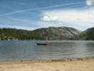
Pinecrest | |
|
Locations: Strawberry. |
Strawberry | |
|
Other articles:
|
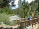
Bridge over the Middle Fork of the Stanislaus River, Columns of the Giants | |
|
Other articles:
Locations:
Columns of the Giants.
|
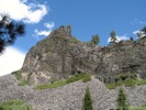
Columns of the Giants | |
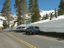
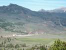
 West of Sonora Pass. West of Sonora Pass.
|
||
|
Other articles:
|
||
|
Other articles:
|
||
|
Other articles:
Locations:
Sonora Pass.
|
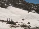
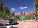
Sonora Pass | |
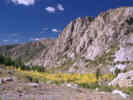
 Turning leaves on Sonora Pass. Turning leaves on Sonora Pass.
|
||
|
Other articles:
Locations:
Leavitt Falls.
|
||
|
Other articles:
Locations:
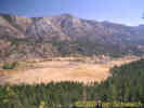
Leavitt Meadow.
|
Leavitt Meadows
| |
|
Other articles:
|
||
|
Locations: USMC Mountain Warfare Training Center. |
USMC Mountain Warfare Training Center | |
|
Other articles:
Locations: Pickel Meadow. |
Pickel Meadow | |
|
Other articles:
|
JunctionJunction: US Highway 395, north to Carson City and Reno; south to Bridgeport, Mono Lake and the Owens Valley. | |
| If you have a question or a comment you may write to me at: tomas@schweich.com I sometimes post interesting questions in my FAQ, but I never disclose your full name or address. |
Date and time this article was prepared: 4/21/2025 8:14:13 PM |