Eastern Mojave Vegetation
Tom Schweich
|
Eastern Mojave Vegetation
| Irwin Road - Central Mojave Desert |
|
Tom Schweich |
|
(No Preface) | |
|
Other articles:
|
Junction:
| |
|
Images:
|
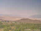
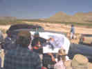
During a field trip stop between Cave Spring and Denning Spring, north of Fort Irwin, this group from the 1998 Desert Research Symposium has a discussion of east-west trending fault zones in the western Awawatz Mountains. The left-lateral Garlock fault zone is mapped along the base of the hills in the foreground. Telescope Peak in the Panamint Mountains can be seen in the distance. Southern Death Valley is in the right middle-ground. | |
|
Images:
|
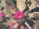
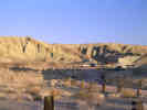
Beavertail cactus (Opuntia basilaris) near the northern boundary of Fort Irwin. | |
Fort Irwin National Training CenterNote: Travel by private citizens in Fort Irwin requires a military escort. | ||
|
Images:
|
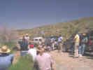
During a field trip stop and lunch break at Cave Spring, near Avawatz Pass, this group from the 1998 Desert Research Symposium has a discussion of the archeological resources of the Fort Irwin area. | |
|
Literature Cited:
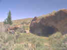
Locations: Cave Spring. |
| |
|
Literature Cited:
|
| |
Note: Travel by private citizens in Fort Irwin requires a military escort.
Fort Irwin National Training Center | ||
|
Other articles:
|
Junction: BLM Road, into northwestern Calico Mountains. | |
|
Other articles:
|
Junction: Fort Irwin Road | |
| Junction: Old Yermo Cutoff | ||
|
Other articles:
|
Junction:
| |
|
Other articles:
|
Several miles west is the BLM Rainbow Basin campground and the Barstow Syncline. | |
|
Other articles:
|
| |
|
Other articles:
|
Junction:
| |
| If you have a question or a comment you may write to me at: tomas@schweich.com I sometimes post interesting questions in my FAQ, but I never disclose your full name or address. |
Date and time this article was prepared: 10/2/2026 12:36:17 PM |