 Eastern Mojave Vegetation
 Eastern Mojave Vegetation
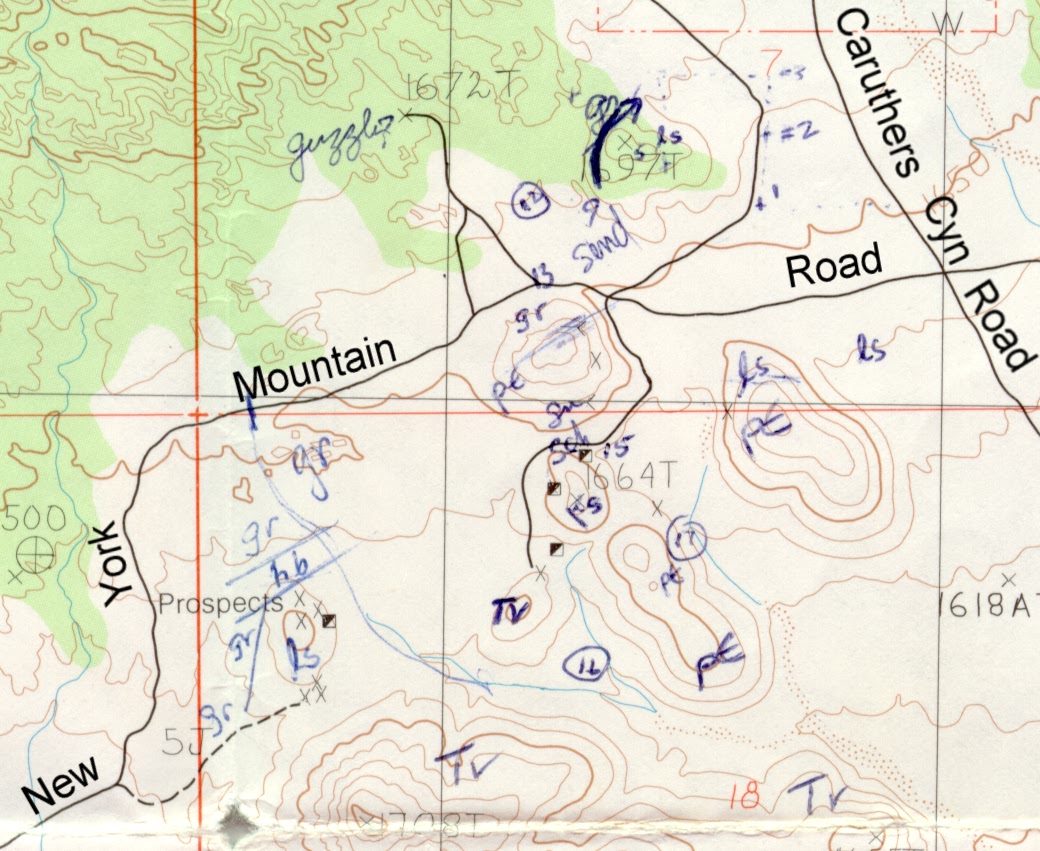
| Sketch map: 1987. |
|
|

If you have a question or a comment about this photograph you may write to me at: tomas@schweich.com I sometimes post interesting questions in my FAQ, but I never disclose your full name or address. |

This is my field sketch map of the surficial geology in the vicinity of the Golden Quail Mine. sch - schist. pE - metasandstone and metaconglomerate, possibly Precambrian and correlative with the Precambrian schist and gneiss found elsewhere in the Mid Hills, not mentioned by Hewett (1956). ls - limestone, probably Goodsprings dolomite. hb - highly sheared greenish rock, probably the Cedar Canyon fault zone. gr - granite. Tv - Tertiary volcanics, probably Peach Springs Tuff or Hole-in-the-Wall Tuff.
Article records that use this photograph:
Other photos about Economic Geology or Golden Quail Mine.
|
|
Date and time this page was prepared: 4/21/2025 8:32:33 PM |