Eastern Mojave Vegetation
Tom Schweich
|
Eastern Mojave Vegetation
| Nevada State Route 379 |
|
Tom Schweich |

|
From US Highway 50 in Little Smoky Valley through Duckwater to Currant on US Highway 6. |
|
Other articles:
|
Junction: US Highway 50 |
|
Other articles:
|
Junction: Windfall Mine Road |
|
Other articles:
Locations:
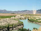
Fish Creek Valley.
|
Cross Fish Creek, multiple road junctions. |
|
Eureka County above
White Pine County below | |
|
Other articles:
|
|
|
Locations: Red Rock Summit. |
Red Rock Summit |
|
Other articles:
|
|
|
Other articles:
|
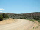
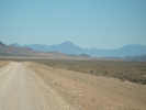
The road east to Duckwater and Currant from Red Rock Summit. |
|
White Pine County above
Nye County below | |
|
Other articles:
|
Looking south toward Duckwater. |
|
|
Duckwater |
|
Other articles:
|
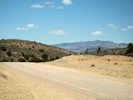
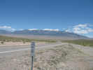
View of Currant Mountain of the White Pine Range. |
|
Other articles:
|
CurrantJunction: US Highway 6 |
| If you have a question or a comment you may write to me at: tomas@schweich.com I sometimes post interesting questions in my FAQ, but I never disclose your full name or address. |
Date and time this article was prepared: 9/22/2024 4:47:21 PM |