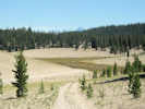
Eastern Mojave Vegetation
Tom Schweich
|
Eastern Mojave Vegetation
| "Taylor Canyon Road," Inyo Forest Road 1S17, Mono County, California |
|
Tom Schweich |

|
From California Highway 120 at Big Sand Flat to California Highway 120 in Adobe Valley by way of Crooked Meadows, Sentinel Meadow, Wet Meadow, and Taylor Canyon. | ||
|
Other articles:
|
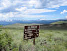
Junction: California Highway 120, in Adobe Valley. | ||
|
Other articles:
|
| ||
|
Other articles:
|
| ||
| Mouth of Taylor Canyon. | |||
| Campground | |||
|
Other articles:
Locations: Wet Meadow. |
Wet Meadow
| ||
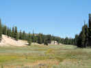
| Sentinel Meadow | |||
|
Other articles:
|
Junction: Forest Road 1S17G, stub road to viewpoint of Long Valley. | ||
|
Other articles:
|
Junction: Forest Road 1S04, "Pilot Springs Road | ||
|
Images:
|
|||
|
Other articles:
|
| ||
| Divide | |||
|
Other articles:
Locations: Crooked Meadows. |
| ||
|
Other articles:
|
| ||
| Crooked Meadow Campground | |||
|
Other articles:
|
| ||
|
Other articles:
|
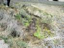
Spring at Crooked Meadows Campground | ||
|
Other articles:
|
| ||
|
Other articles:
|
| ||
|
Other articles:
Locations: Crooked Meadows. |
| ||
|
Locations: Crooked Meadows. |
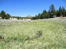
Crooked Meadows | ||
|
Other articles:
|
| ||
|
Other articles:
|
| ||
|
Other articles:
|
Junction: Forest Road 1S56, east to 1N02, "Sagehen Meadows Road." This road junction is on the divide between Dry Creek and Dexter Creek, and therefore is the divide between the Mono Lake basin and Adobe Valley, respectively. | ||
|
Other articles:
|
Junction: 1S55 | ||
|
Other articles:
|
Junction: "Pilot Springs Road," Forest Road 1S04 | ||
| Junction: 1S12 | |||
|
Other articles:
|
Junction: California Highway 120, in Big Sand Flat | ||
| If you have a question or a comment you may write to me at: tomas@schweich.com I sometimes post interesting questions in my FAQ, but I never disclose your full name or address. |
Date and time this article was prepared: 10/2/2026 12:35:57 PM |