Eastern Mojave Vegetation
Tom Schweich
|
Eastern Mojave Vegetation
| Colorado State Highway 133 |
|
Tom Schweich |

|
South from Carbondale to Hotchkiss | |
|
Other articles:
|
Junction: Colorado State Highway 82 | |
|
|
Carbondale | |
|
Garfield County above … Pitkin County below … | ||
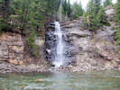
| Hayes Creek and Hayes Creek Fall enter the Crystal River. | ||
|
Other articles:
|
| |
|
Other articles:
Locations: Bears Gulch. |
| |
|
Other articles:
|
| |
| Colorado State Highway 133 makes a short foray into Gunnison County, then after a switchback, returns to Pitkin County, before crossing again into Gunnison County at McClure Pass. | ||
| Junction: Gunnison County Road 3, to Marble. | ||
|
Pitkin County above … McClure Pass, 8793 ft. Gunnison County below … | ||
|
Other articles:
|
Junction: County Road 265, north northwest in the direction of Clear Fork and Divide Highline Feeder Ditch. | |
|
Other articles:
|
Junction: County Road 12, to Crested Butte, by way of Kebler Pass. | |
|
|
HotchkissJunction: Colorado State Highway 92 | |
| If you have a question or a comment you may write to me at: tomas@schweich.com I sometimes post interesting questions in my FAQ, but I never disclose your full name or address. |
Date and time this article was prepared: 10/2/2026 12:41:23 PM |