Eastern Mojave Vegetation
Tom Schweich
|
Eastern Mojave Vegetation
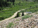
| County Road 260, Forest Road 214, “Peru Creek Road,” Summit County, Colorado |
|
Tom Schweich |

|
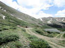
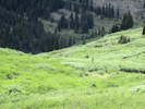
From Deadman Road (CR 86) south into the Nunn Creek Basin to the Nunn Creek Trail. | ||||||
| End of Road | |||||||
|
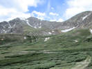
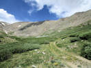
Locations: Horseshoe Basin. |
Horseshoe BasinThe Vidler collection system and diversion tunnel allows Golden to divert water from the Colorado River headwaters to Clear Creek for use at Fossil Trace and for other uses that require Non-tributary water. It is a vital part of Golden's water infrastructure. It consists of six collection points with six head gates that feed snowmelt into a pipeline. The pipeline is about 5000 feet long and carries the snowmelt across the Horseshoe basin. At the end of the pipeline is a flume that measures and controls the water before feeding it into the West Portal of a tunnel (Vidler Tunnel). The tunnel extends 1.4 miles through a mountain, under the Continental Divide, and discharges the water into the headwaters of Clear Creek several miles above Georgetown. | ||||||
|
Literature Cited:
Other articles:
Locations: Vidler Tunnel. |
Vidler Tunnel
| ||||||
|
Other articles:
|
| ||||||
| Road junction, right branch goes to Vidler Tunnel. | |||||||
|
Literature Cited:
Other articles:
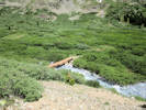
Locations: Peru Creek. |
| ||||||
|
Other articles:
Locations:
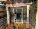
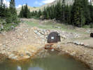
Anderson Tunnel Mine.
|
Shoe Basin Mine | ||||||
|
Other articles:
|
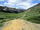
Argentine TrailheadThis is essentially the end of the road. | ||||||
|
Literature Cited:
Other articles:
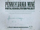
Locations: Pennsylvania Mine. |
The Pennsylvania Mine was initially developed in 1879, according to the EPA, and produced gold, silver, lead, copper and zinc. The mine is the largest anthropogenic contributor of heavy metals in the Snake River Watershed, which is the most impaired watershed in the state. Exposure to the metals can cause health problems in humans and wildlife. Brian Lorch, the county's Open Space and Trails Department director, said the Pennsylvania property is owned by a small company called TransPacific Tourism of Colorado, which was formed by a Colorado couple specifically to buy the 169-acre property in 1990 and then sell it to foreign investors. The investors walked away after the mine's environmental problems became apparent, leaving the couple stuck with the property ever since, Lorch said. The county then worked with the landowners to create a restrictive covenant in 2008 that transferred all development rights off the property, he said, and the county would like to buy the land to protect it as open space if the mine is ever cleaned up enough that liability isn't an issue (Langley, 2015). The EPA also plans to work with a private landowner who has owned the neighboring Jumbo Mine property for about 40 years. Because that property owner didn't cause the mine pollution, Paul Peronard EPA's on-scene coordinator said, the EPA will pay for the cleanup, which will likely cost less than a tenth of the Pennsylvania Mine reclamation (Langley, 2015). | ||||||
|
Other articles:
|
Junction: County Road 5 “Montezuma Road | ||||||
| If you have a question or a comment you may write to me at: tomas@schweich.com I sometimes post interesting questions in my FAQ, but I never disclose your full name or address. |
Date and time this article was prepared: 7/13/2024 8:06:18 AM |