|
The Vidler tunnel
which is being driven under Argentine Pass
through the main Continental Divide
by the Transcontinental Transportation & Mining Company,
is to serve a three-fold purpose, viz.,
(1) vein development at depth,
(2) cheap transportation of company ores,
and (3) a railroad thoroughfare whereby the ore tonnage of
Summit, Park and Lake, as well as Clear Creek,
counties may be more expeditiously and cheaply delivered
to custom smelting plants at Denver and Pueblo.
In its utilization for the latter purpose this bore
appears to offer the possibility of the establishment of a
most
important traffic route,
the distance from Leadville being thereby shortened
with present railroad connections by nearly 100 miles.
It is probable that the Argentine Central railroad line,
which now terminates at Waldorf
(a distance by rail about 9 miles from Silver Plume),
will utilize the Vidler transcontinental bore in tapping
the Argentine, Pennsylvania and Montezuma sections of
Summit county
and making connection with the South Park branch
of the Colorado & Southern railroad at or near Dillon.
The Vidler tunnel on completion will have a length of
nearly 7,500 feet
and a maximum depth of 2,400 feet.
It has already been driven 1,200 feet from the Clear Creek
county side,
and on the readiness of the enlarged power plant
under installation,
whereby air will be piped over Argentine Pass,
it is planned to prosecute rapid driving from the
Summit county side.
The tunnel has, in its progress,
intersected several veins of pay milling ore,
for the treatment of which the company has under erection
an experimental milling plant
on most improved metallurgical lines.
The Transcontinental Company owns a compact tract
of about 600 acres,
through the center of which the tunnel is coursing
(Anonymous, 1906).
|
|
Vidler
|
|
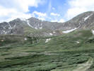
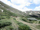
The Vidler tunnel is in Mount Edwards,
a short distance north of Argentine Pass
and about 5 miles east-northeast of Montezuma.
It was originally intended to be a railroad tunnel
and serve a proposed narrow-gage railroad
extending from Silver Plume to Dillon.
Work was started on the tunnel in 1901,
and for a time headings were driven from both the east
and west portals.
The west portal was abandoned after the face had been
carried about 700 feet,
but in spite of repeated changes in ownership
and reorganizations,
the eastern section of the tunnel was gradually
advanced until in
1911 it had a length of 5,118 feet.
No work is known to have been done since that time,
however, and the breasts of the east and west sections
are reported to be separated by about 1,700 feet.
The altitude of both portals is about 11,650 feet.
The east half of the tunnel trends S. 70� 47' W.,
and the west half N. 58� 17' E.
The tunnel was not accesible at any time
during the writer's visits,
but some information was found in reports
by G. W. Schneider,
J. W. Astley, and Herbert Strickland,
quoted in a prospectus of the Argentine Tunnel Railway Co.
The eastern section of the tunnel is reported to cut veins
at 227, 330, 380, 500, 885, 1956, and 2,175 feet
from the portal.
Most of the veins were small and
contained only quartz and pyrite,
but three carried lead-zinc ore.
Galena and sphalerite containing 12 ounces
or less of silver to the ton
and very little gold were found in the veins cut
at 227, 265, and 885 feet,
but only the last vein, known as the Flossie or Red Light,
was strong enough to encourage much development.
This vein strikes N. 33� E. and dips about 85� NW.
It carried galena and sphalerite in a quartz gangue,
and the ore-bearing part of the vein ranged from 1 to 18
inches in width,
averaging about 6 inches.
Some ore was stoped in this vein both north and south of
the main crosscut tunnel.
No production figures have been found,
but the property has never been an important producer
(Lovering, 1935).
|
The Vidler Tunnel is not mentioned by Lovering and Goddard (1950).
|
Rees Vidler bought the Horseshoe Tunnel
(a.k.a. Good Luck Tunnel) in 1902,
intending to extend the tunnel under the continental divide
to connect the railroads at Silver Plume and Keystone.
Financing to complete the tunnel was never found,
and the mining claims overlaying the Vidler tunnel
reverted to
Clear Creek and Summit counties due to unpaid taxes.
In 1952, Herbert Young began buying the claims in the
Vidler Claims Group,
all but one of which were purchased for back taxes.
In 1956 the Vidler Tunnel was presented
as an alternative for a highway tunnel
under the continental divide,
but was rejected because the grade was too great for
automobile traffic.
Young then purchased an option on water rights located
above the confluence of
Soda Creek and the Snake River.
In 1967 financing was found and
in 1968 the 1.4 mile long tunnel was completed.
The first water flowed through the tunnel in 1969,
and the collection system,
which diverts water above an elevation of 11,000 feet,
was completed in 1970.
The tunnel is decreed for 31.5 cubic feet per second
(Winchester, 2001).
|
The Vidler Tunnel and collection system was purchased by the City of Golden in 2000 for $1,000,000.00 (Golden, City of, 2000).
Elevation: 11763ft, 0m.
Articles that refer to this location:
Literature Referring To This Location:
-
Anonymous. 1906.
Development and Transportation Tunnel Enterprises in the Argentine District, Colorado.
Mining Reporter.
LIV(23):570-573.
-
City of Golden. 2000.
A Resolution of the Golden City Council Approving a Water Purchase Agreement with Vidler Water Company.
Resolution No. 1136.
{TAS-pdf}
Date retrieved: 1 July 2018: http://ordinances.cityofgolden.net/media/W1siZiIsIjIwMTQvMDUvMDUvMTQvNTIvNDYvMjMzLzExMzZyZXNfd2F0ZXJfcHVyY2guX2Fncm1udF93X1ZpZGxlci5wZGYiXV0/1c10d00c/1136res%20water%20purch.%20agrmnt%20w_Vidler.pdf
-
Lovering, T. S. 1935.
Geology and Ore Deposits of the Montezume Quadrangle, Colorado.
Professional Paper 178.
Washington, D. C.: United States Geological Survey, 1935.
{TAS-pdf}
Date retrieved: 1 July 2016: https://pubs.usgs.gov/pp/0178/report.pdf
-
Lovering, T. S., and E. N. Goddard. 1950.
Geology and ore deposits of the Front Range.
Professional Paper 223.
Washington, D. C.: United States Geological Survey, 1950.
{TAS-pdf}
Date retrieved: 1 July 2018: https://pubs.er.usgs.gov/publication/pp223
-
Stambaugh, Will. 2007.
2007 Vidler Tunnel Repairs: Flossie Vein Collapse Area and East Portal Rebuild.
(http://www.cityofgolden.net/media/2007%20Vidler%20Tunnel%20Repairs.pdf, accessed 13 November 2014.)
-
Winchester, John N., P.E. 2001.
A Historical View: Transmountain Diversion Development in Colorado.
Proceedings 2001 USCID Water Management.
|
|
If you have a question or a comment you may write to me at:
tomas@schweich.com
I sometimes post interesting questions in my FAQ, but I never disclose your full name or address.
|
A, B, C,
D, E, F,
G, H, I,
J, K, L,
M,
N, O,
P, Q, R,
S, T, U,
V, W, X,
Y, Z
[Home Page] [Site Map]
Date and time this article was prepared:8:32:18 PM, 4/21/2025.
|
 Eastern Mojave Vegetation