Eastern Mojave Vegetation
|
Eastern Mojave Vegetation
| Mesquite Valley, San Bernardino County, California. |
|
Gazetteer Query: G.N.I.S. See also: Sandy. See also: Spring Mountains. Pahrump. |
||
|
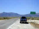
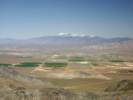
Mesquite Valley is a small structural basin bounded by the southern Spring Range on the east, the Clark Mountain Range on the south, and the Mesquite Mountains on the west. The lowest elevation is about 774 m. Pahrump Valley to the north is about three times larger than Mesquite Valley. Black Butte appears to be a natural structural divide between the two valleys.
Articles that refer to this location:
Literature Referring To This Location:
| ||
| No collections made at this location. | ||
| If you have a question or a comment you may write to me at: tomas@schweich.com I sometimes post interesting questions in my FAQ, but I never disclose your full name or address. |
A, B, C,
D, E, F,
G, H, I,
J, K, L,
M, Date and time this article was prepared:12:56:34 PM, 10/2/2026. | |