Eastern Mojave Vegetation
Tom Schweich
|
Eastern Mojave Vegetation
| Field Notes (Continued) |
|
Tom Schweich |

Topics in this Article: 1800s 1900s 1910s 1920s 1930s 1940s 1950s 1960s 1970s 1980s 1990 1991 1992 1993 1995 1996 1997 1998 1999 2000 2001 2002 2003 2004 2005 2006 2007 2008 2008 Tour de Swertia albomarginata Mono Lake, August 2008 2009 2010 2011 2012 2013 2014 2015 2016 2017 2018 2019 2020 2021 2022 2023 2024 2025 Contents Literature Cited |
When I first read the field notes of Annie Alexander and Louise Kellogg, I was fascinated by the descriptions they wrote about the places they went and the plants and animals they found there. By publishing my field notes on the Internet I hope to follow a little bit in their tradition. | ||||||||||||||||||||||||||||||||||||||||||||||||||||||||||||||||||||||||||||||||||||||||||||||||||||||||||||||||||||||||||||||||||||||||||||||||||||||||||||||||||||||||||||||||||||||||||||||||||||||||||||||||||||||||||||||||||||||||||||||||||||||||||||||||||||||||||||||||||||||||||||||||||||||||||||||||||||||||||||||||||||||||||||||||||||||||||||||||||||||||||||||||||||||||||||||||||||||||||||||||||||||||||||||||||||||||||||||||||||||||||||||||||||||||||||||||||||||||||||||||||||||||||||||||||||||||||||||||||||||||||||||||||||||||||||||||||||||||||||||||||||||||||||||||||||||||||||||||||||||||||||||||||||||||||||||||||||||||||||||||||||||||||||||||||||||||||||||||||||||||||||||||||||||||||||||||||||||||||||||||||||||||||||||||||||||||||||||||||||||||||||||||||||||||||||||||||||||||||||||||||||||||||||||||||||||||||||||||||||||||||||||||||||||||||||||||||||||||||||||||||||||||||||||||||||||||||||||||||||||||||||||||||||||||||||||||||||||||||||||||||||||||||||||||||||||||||||||||||||||
|
|
2005 | ||||||||||||||||||||||||||||||||||||||||||||||||||||||||||||||||||||||||||||||||||||||||||||||||||||||||||||||||||||||||||||||||||||||||||||||||||||||||||||||||||||||||||||||||||||||||||||||||||||||||||||||||||||||||||||||||||||||||||||||||||||||||||||||||||||||||||||||||||||||||||||||||||||||||||||||||||||||||||||||||||||||||||||||||||||||||||||||||||||||||||||||||||||||||||||||||||||||||||||||||||||||||||||||||||||||||||||||||||||||||||||||||||||||||||||||||||||||||||||||||||||||||||||||||||||||||||||||||||||||||||||||||||||||||||||||||||||||||||||||||||||||||||||||||||||||||||||||||||||||||||||||||||||||||||||||||||||||||||||||||||||||||||||||||||||||||||||||||||||||||||||||||||||||||||||||||||||||||||||||||||||||||||||||||||||||||||||||||||||||||||||||||||||||||||||||||||||||||||||||||||||||||||||||||||||||||||||||||||||||||||||||||||||||||||||||||||||||||||||||||||||||||||||||||||||||||||||||||||||||||||||||||||||||||||||||||||||||||||||||||||||||||||||||||||||||||||||||||||||||
| |||||||||||||||||||||||||||||||||||||||||||||||||||||||||||||||||||||||||||||||||||||||||||||||||||||||||||||||||||||||||||||||||||||||||||||||||||||||||||||||||||||||||||||||||||||||||||||||||||||||||||||||||||||||||||||||||||||||||||||||||||||||||||||||||||||||||||||||||||||||||||||||||||||||||||||||||||||||||||||||||||||||||||||||||||||||||||||||||||||||||||||||||||||||||||||||||||||||||||||||||||||||||||||||||||||||||||||||||||||||||||||||||||||||||||||||||||||||||||||||||||||||||||||||||||||||||||||||||||||||||||||||||||||||||||||||||||||||||||||||||||||||||||||||||||||||||||||||||||||||||||||||||||||||||||||||||||||||||||||||||||||||||||||||||||||||||||||||||||||||||||||||||||||||||||||||||||||||||||||||||||||||||||||||||||||||||||||||||||||||||||||||||||||||||||||||||||||||||||||||||||||||||||||||||||||||||||||||||||||||||||||||||||||||||||||||||||||||||||||||||||||||||||||||||||||||||||||||||||||||||||||||||||||||||||||||||||||||||||||||||||||||||||||||||||||||||||||||||||||||
|
Literature Cited:
Other articles:
|
Searching the Web for Phacelia crenulata found the following: 1: Contact Dermatitis. 1980 Jun;6(4):272-4. Related Articles, Links A potent contact allergen of Phacelia (Hydrophyllaceae). The major contact allergen of Phacelia crenulata (Hydrophyllaceae) has been identified as geranylhydroquinone. A maximization test of geranylhydroquinone showed this to be a potent sensitizer comparable in degree to poison oak/ivy urushiol. Comparative patch testing on humans with urushiol established that the phacelia allergen does not cross-react with poison oak or ivy. PMID: 7398286 [PubMed - indexed for MEDLINE]
|
|
| Death of Jacob Schweich.
|
|
| Thursday, 24 March 2005.
|
|
|
|
|
| Sunday, 17-Apr-05
|
|
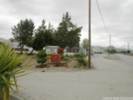
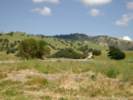
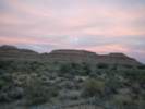
Today we drove to Atascadero from Alameda
|
|
Other articles:
|
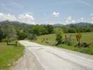
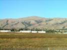
At Monterey Road in Gilroy, we left Highway 101, and followed Monterey Road to its junction with Highway 25. On Highway 25 we passed through Hollister and Tres Pinos. We drove through Barado County Historical Park, but saw nothing to make us stop. After re-entering Highway 25, we passed by the San Benito County Fair Grounds.
|
|
Other articles:
|
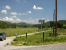
At Paicines we looked at the winery building footings to see if we could see some that were being shifted by the San Andreas Fault. We didnt. Later, I learned that this was the wrong winery. We should have stopped at the Almaden Cienega Winery near Hollister.
|
|
Other articles:
|
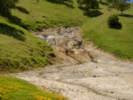
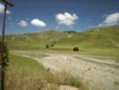
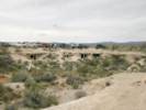
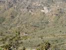
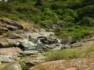
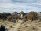
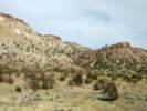
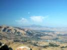
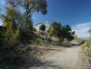
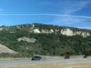
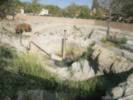
I stopped to take this photo as a good example of hummocky terrain resulting from repeated landslides. It is likely that the sliding occurred during frequent earthquakes along the San Andreas Fault.
|
|
Other articles:
|
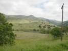
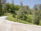
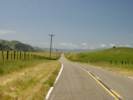
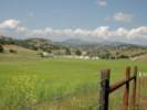
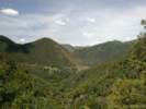
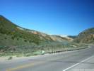
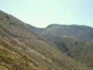
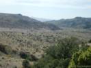
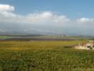
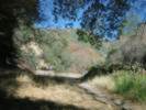
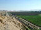
Between Willow Creek and Pinnacles the road climbs westerly out of the San Benito River canyon and away from the trace of the San Andreas fault. However, this little valley is itself very linear and aligned with the San Andreas Fault. It passes the Bear Valley Fire Control Station, and then descends gently past Schmidt Ranch to Pinnacles.
|
|
Other articles:
|
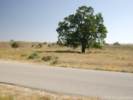
Looking the other way, down the valley, and to the southeast.
|
|
Other articles:
|
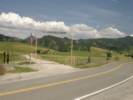
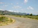
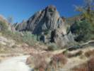
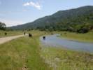
We started to drive into Pinnacles National Monument, but when we learned that you have to park outside the park and take a shuttle bus in, we decided to skip to monument for this trip. Instead a few miles south we stopped along the road for lunch. Here we had a good view of some shutter ridges and a sag pond along the fault.
|
|
Other articles:
|
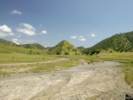
A little further on, we saw a road to the east signed San Benito Lateral. We took it and soon came to a fork with Old Hernandez Road and __________ Road. We took Old Hernandez Road as it led south, the general direction of our travel.
|
|
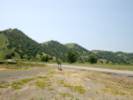
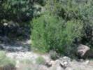
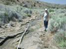
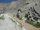
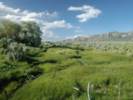
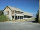
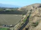
 Looking downstream (north) on the San Benito River, just south of the former townsite of San Benito, Old Hernandez Road. Looking downstream (north) on the San Benito River, just south of the former townsite of San Benito, Old Hernandez Road.
|
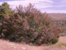
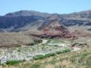
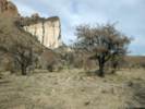
About 1.6 miles (2.0 km) east of the San Benito townsite, Old Hernandez Road climbs up onto a small bluff. From this vantage point we can look back toward the townsite. This photograph is looking down river. The pinkish trees along the river are tamarisk.
|
|
Other articles:
|
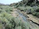
We saw this spring along side the road. Thinking it might be hot or warm, I walked up to check the water. However, the water was cold, even though it smelled moderately of sulfur.
|
|
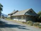
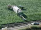
 Cows by the San Benito River on Old Hernandez Road. Cows by the San Benito River on Old Hernandez Road.
|
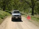
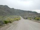
At first it was paved, but soon it became dirt, and at one point we had to ford the San Benito River. This ford was a bit deeper than we thought, and we were surprised when the nose of the 4 Runner dipped into the water. Regardless, we made it through, and up the bank on the other side.
|
|
Other articles:
|
When we reached the pavement at the other end, there was a Road Closed sign. But it must have been intended for people traveling in the opposite direction.
|
|
Other articles:
|
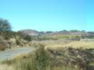
At Coalinga Road, we looked east
|
|
Other articles:
|
and west.
|
|
|
From Old Hernandez Road and Coalinga Road, we back tracked a few miles to Highway 25, and then continued south through Bitterwater.
|
|
Other articles:
Locations:
Bitterwater Lake.
La Laguna Vieja Rancho.
|
Just south of Bitterwater, in Bitterwater Valley, is Bitterwater Lake. I'm guessing someone thought the water was bitter. Gudde (1969) notes at least fifty locations, lakes, and streams in California with a reference to bitterness of the water. "Amargosa" also refers to bitterness of the water, although modern Spanish uses "amargo" or "amargado" for the adjective "bitter." The location of Bitterwater Lake is also occupied by La Laguna Vieja Rancho.
|
|
|
At the end of Highway 25, where it dead ends into Highway 198, we jogged over to Peach Tree Valley road and continued south on that one.
|
|
Other articles:
Locations:
Lewis Creek.
|
|
|
Other articles:
Locations:
Peachtree Valley.
|
We returned to Highway 25, where it swings west of the fault through Lonoak.
|
|
Other articles:
Locations:
Peachtree Valley.
|
|
|
Other articles:
|
The stopped for this photo at the intersection of Peach Tree Road and Indian Valley Road.
|
|
|
The fish is still hanging in the oak tree on Indian Valley Road, although weathering a bit now.
|
|
Other articles:
|
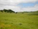
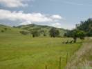
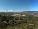
In Indian Valley the hills were still a lush green, compared to last year when they were beginning to turn brown.
|
|
|
Across the Salinas River from San Miguel, we thought to take River Road all the way into Paso Robles. Unfortunately, it is closed, or so the sign says, so we had to detour via Estrella Road and Airport Road.
|
|
|
| Monday, 18-Apr-05
|
|
Today we stayed around the Atascadero Paso Robles area.
|
|
|
| Tuesday, 19-Apr-05
|
|
Today, we drove to Zzyzx from Atascadero.
|
|
 The hot spring on 19 April 2004. The hot spring on 19 April 2004.
|
Got coffee at Jacks, took a photo of the hot spring.
|
|
|
In Paso Robles, we crossed the river on 13th Street that becomes Creston Road. We followed Creston Road until it becomes La Panza Road, where it crosses Highway 41. From La Panza Road, we joined Highway 58, and continued on to Shell Creek.
|
|
Other articles:
Locations:
Shell Creek.
|
|
|
Other articles:
Locations:
San Joaquin Valley.
|
|
|
Locations:
Desert Tortoise Natural Area.
|
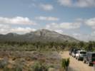
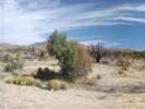
We proceeded to California City, where we got gas (for the car), and then continued to the Desert Tortoise Natural Area. It was cool and quite windy there and, while we took several trails, we saw no tortoises. From the desert tortoise Natural Area, we took back roads to Twenty Mule Team Parkway, which eventually led us to US Highway 395. Between the golf ball and the prison, we stopped once to look at flowers, which were nice, but not spectacular. At California Highway 58 in Kramer Junction, we turned left and continued through Barstow on US I-15.
|
|
Literature Cited:
Other articles:
|
|
|
|
We had dinner at the Mad Greek in Baker, and then returned to the Desert Studies Center at Zzyzx.
|
|
|
| Wednesday, 20-Apr-05
|
|
Today we collected in the Mesquite Mountains.
|
|
|
It is 5 miles to I-15 from Zzyzx, 7 miles on I-15 to Baker, and 44 miles on I-15 and Kingston Road to Winters Pass.
|
|
Other articles:
|
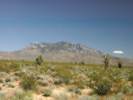
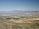
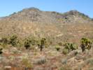
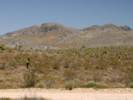
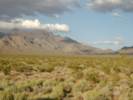
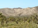
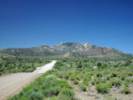
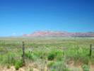
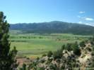
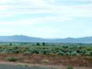
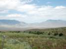
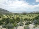
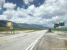
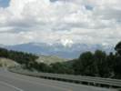
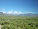
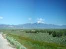
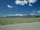
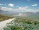
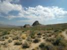
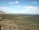
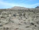
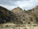
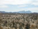
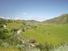
As we came over a rise on Kingston Road, we were treated to an excellent view of Shadow Valley, the Mesquite Mountains, and Mt. Charleston in the distance.
|
|
Other articles:
Locations:
Goldhammer Mine.
|
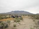
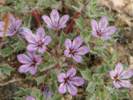
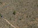
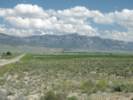
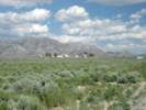
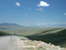
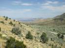
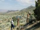
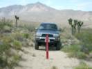
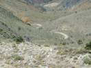
We stopped on Kingston Road, opposite the Winters Pass Hills, and walked over to south slopes of Winters Pass Hills, elevation 990 m (3500 ft) looking for Lilac Sunbonnet (Langloisia setosissima ssp. punctata). I had collected some here last year. However, there were none to be found. Here and there, I found some tiny bristly plants that I assumed were emerging L. setosissima. I'm thinking that the 20th of April 2004 was just about perfect in terms of a full bloom of the species. However, this year, the 20th of April 2005 was much too early, because the early Spring was cool and cloudy. As a comparison, on 24 April 2005 we found Lilac Sunbonnet in full bloom at the Goldhammer Mine, which is 100 km (62 mi) south, at elevation 675 m (2280 ft), which is 215 m (1220 ft) lower in elevation.
|
|
Locations: Winters Pass.
|
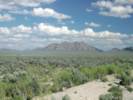
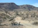
From Winters Pass we walked about 1 ½ miles south along a ridge, climbing to 1250 m from 1175 m in the process. We stopped at the base of the limestone hills. Collections 440 through 450 were made along this ridge.
|
|
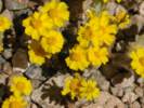
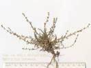
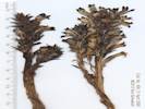
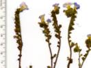
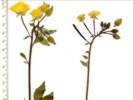
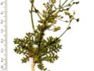
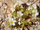 Desert Snow (Linanthus demissus) in the Mesquite Mountains. Desert Snow (Linanthus demissus) in the Mesquite Mountains.
 Collection No. 440 from the Mesquite Mountains. Collection No. 440 from the Mesquite Mountains.
440
|
Linanthus demissus (A. Gray) E. Greene, growing in open areas, common.
|
|
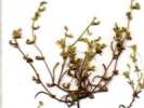
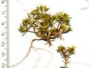
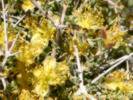
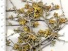
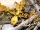
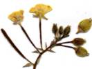
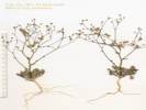
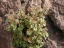
 Spiny Desert Olive (Menodora spinescens) in the Mesquite Mountains. Spiny Desert Olive (Menodora spinescens) in the Mesquite Mountains.
 Collection No. 441 from the Mesquite Mountains. Collection No. 441 from the Mesquite Mountains.
441
|
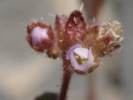
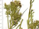
Menodora spinescens. This plant was in bloom and fruit, so it was a good find for collecting. 3
|
|
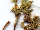
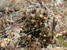
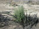
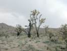
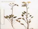
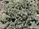
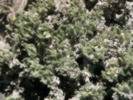
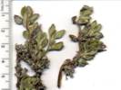
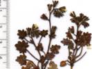
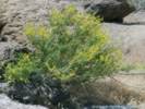
 Blackbrush (Coleogyne ramosissima) in the Mesquite Mountains, California Blackbrush (Coleogyne ramosissima) in the Mesquite Mountains, California
 Collection No. 442 from the Mesquite Mountains. Collection No. 442 from the Mesquite Mountains.
 Collection No. 442 from the Mesquite Mountains. Collection No. 442 from the Mesquite Mountains.
442
|
Coleogyne ramosissima. One bush, many flowers, Common. 3 labels.
|
|
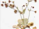
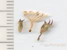
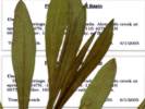
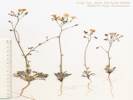
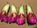
 Collection No. 443 Phacelia fremontii from the Mesquite Mountains Collection No. 443 Phacelia fremontii from the Mesquite Mountains
443
|
Phacelia fremontii Torr. Growing around and under a Joshua tree.
|
|
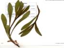
 Collection No. 444, Gilia cana, from the Mesquite Mountains Collection No. 444, Gilia cana, from the Mesquite Mountains
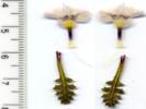 Collection No. 444, Gilia cana, from the Mesquite Mountains Collection No. 444, Gilia cana, from the Mesquite Mountains
 Coll. No. 444, Gilia cana Coll. No. 444, Gilia cana
444
|
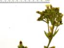
| G. cana (M.E. Jones) A. Heller Desert Gilia, Showy Gilia Mesquite Mountains, San Bernardino County, California. On the ridge east of Winters Pass, approximately 500 m from Kingston Road. 35.6916°N, 115.6984°W. WGS1984 Elev. 1182 m. Growing in gravel on southeast facing slope. Coll. No. 444, keyed 11 Jan 2013, characters observed: Annual from stout tap root, green, photosynthetic; Leaves alternate, largest 1 cm. wide, oblanceolate, pinnate-divided; Inflorescence open, not coiled, not unrolling, parts in 5s; Pedicels 1-3 mm., axillary pedicels > calyx; Calyx lobes 5, 3 mm., tips pointed but not bristly, lobes fused by thin translucent membrane; Corolla tube (purple) 6 mm., + throat (yellow, wider near mouth) 3 mm. + lobes (5, equal, truncate acuminate) 5 mm = 14 mm.; Ovary 1, entire, style clearly attached to top; Stigmas 3; Stamens 5, alternate, = corolla lobes, all fertile; Filaments free, fused to corolla at base of lobes; Seeds not gelatinous when wet (per Aliciella). The seeds must have been gelatinous when wet, and I did not recognize it, as I have been advised this is a Gilia and not an Aliciella.
|
Other articles:
445
|
Pectocarya platycarpa (Munz & I.M. Johnst.) Munz & I.M. Johnst. Broad-Fruited Combseed
|
|
Other articles:
445.1
|
Pectocarya heterocarpa (I.M. Johnst.) I.M. Johnst. Mixed-Nut Combseed.
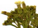
| Mesquite Mountains, San Bernardino County, California. On a ridge east of Winters Pass, approximately 600 m from Kingston Road. 35.692°N, 115.6972°W. WGS 1984. Elev. 1183 m. Found in Coll. No. 445, of P. platycarpa. Coll. No. 445.1, 20 April 2005, characters observed while keying: Annual, to 10 cm., densely branched at base; Pedicel, in fruit, partly fused to one nutlet; Calyx bilateral; Sepals unequal, upper 2 > others; Style 1, simple, attached to receptacle; Stigma 1; Nutlets 4, mature spreading widely, margins, basal nutlet margins less ornamented than cauline,
|
Other articles:
446
|
Eriogonum, growing in loosened soil adjacent to a large shrub, perhaps dug up previously by animals.
| Eriogonum maculatum A. Heller. Spotted Buckwheat. Mesquite Mountains, San Bernardino County, California. On the ridge east of Winters Pass, approximately 700 m from Kingston Road. 35.6926°N, 115.6963°W. WGS 1984. Elev. 1190 m. Growing in gravel on southeast facing slope. Coll. No. 446, 29 Mar 2012, characters observed while keying: Annual herb; Leaves basal and cauline, bracts present, but not as obviously dark as some collections; Involucle peduncled, smooth (not ribbed or angled), puberulent, lightly glandular; Stipe 0; Perianth lobes not alike, basal lobes inflated; Stamens included.
|
 Coll. No. 447, Chylismia claviformis x brevipes, from the Mesquite Mountains Coll. No. 447, Chylismia claviformis x brevipes, from the Mesquite Mountains
 Coll. No. 447, Chylismia claviformis x brevipes, from the Mesquite Mountains Coll. No. 447, Chylismia claviformis x brevipes, from the Mesquite Mountains
 Coll. No. 447, Chylismia claviformis Coll. No. 447, Chylismia claviformis
447
|
Chylismia claviformis × brevipes (Torr. & Frém.) A. A. Heller. Browneyes.
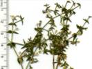
| Mesquite Mountains, San Bernardino County, California. On the ridge east of Winters Pass, approximately 800 m from Kingston Road. 35.693°N, 115.6954°W. WGS1984 Elev. 1192 m. Growing in gravel on limestone ridge in, and adjacent to, small shrubs. Coll. No. 447, keyed 11 Dec 2012, characters observed: Annual, to 40-45 cm, day blooming; Stem 5 mm diameter, not wand-like, spreading hairs and few glandular hairs proximally, to glabrous distally; Stipules absent; Leaves mainly basal, pinnately lobed with large terminal lobe; Inflorescence from distal lobes; Sepals 11 mm, tips free in bud, remaining fused in pairs when flower opens, deciduous after flowering; Hypanthium 6.5 mm.; Petals 11 mm x 16 mm wide, yellow; Anthers 8; Ovary tip projection 0; Style 13 mm, exceeding anthers; Stigma 2 mm, ball-shaped, exserted; Fruit to 50 mm x 3.0-3.5 mm wide, wider toward the tip, 4-chambered, ? Row(s) per chamber; Seeds 2 mm x 1.2 mm wide, glabrous, not hair-tufted, ovate, flattened. Keys easily to Chylismia claviformis, but not to subspecies. 11 Oct 2013: Per Andy Sanders, this collection is a hybrid between C. brevipes and claviformis -- the large yellow fls. and very elongate frt. are brevipes characters.
|
 Sun Cup (Camissonia sp.) in the Mesquite Mountains. Sun Cup (Camissonia sp.) in the Mesquite Mountains.
|
These flower buds on the Camissonia were extremely hairy.
|
|
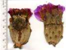
 Collection No. 448 from the Mesquite Mountains Collection No. 448 from the Mesquite Mountains
 Collection No. 448 from the Mesquite Mountains Collection No. 448 from the Mesquite Mountains
 Coll. No. 448, Oxytheca perfoliata Coll. No. 448, Oxytheca perfoliata
448
|
Oxytheca perfoliata Torr. & A. Gray. Very small, red, growing in open areas.
|
|
 Beavertail Cactus (Opuntia basilaris) near Winters Pass in the Mesquite Mountains. Beavertail Cactus (Opuntia basilaris) near Winters Pass in the Mesquite Mountains.
 Collection No. 449 from the Mesquite Mountains. Collection No. 449 from the Mesquite Mountains.
449
|
Opuntia basilaris, flowers. Occasional, not common.
|
|
 Collection No. 450, Tiquilia canescens var. canescens, woody crinklemat, Mesquite Mountains. Collection No. 450, Tiquilia canescens var. canescens, woody crinklemat, Mesquite Mountains.
 Collection No. 450, Tiquilia canescens var. canescens, woody crinklemat, Mesquite Mountains. Collection No. 450, Tiquilia canescens var. canescens, woody crinklemat, Mesquite Mountains.
 Collection No. 450, Tiquilia canescens var. canescens, woody crinklemat, Mesquite Mountains. Collection No. 450, Tiquilia canescens var. canescens, woody crinklemat, Mesquite Mountains.
450
|
Tiquilia canescens (DC.) A. T. Richardson var. canescens, Woody Crinklemat, found growing out of flat-lying limestone outcrops, at the highest point of our walk
|
|
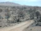
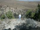
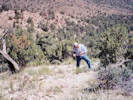
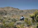 Cheryl relaxes amongst the Blackbrush in the Mesquite Mountains. Cheryl relaxes amongst the Blackbrush in the Mesquite Mountains.
|
We went to the top of the first hill at the end of the ridge. Here we took a short break, and then headed back to the car.
|
|
|
Also observed: |
|
Other articles:
Locations:
Clark Mountain.
|
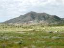
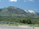
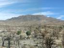
Our way back to Zzyzx the afternoon sun lit up the Kingston Range and Clark Mountain.
|
|
Locations:
Soda Springs Desert Studies Center.
|
Back at the Soda Springs Desert Studies Center at Zzyzx, we cleaned up a bit and then relaxed on the lanai of our luxury hotel
|
|
Locations:
Soda Springs Desert Studies Center.
|
Back at Soda Springs Desert Studies Center, we cleaned up a bit and relaxed. Then, being basically lazy, drove into Baker to have dinner at the Mad Greek.
|
|
Locations:
Soda Springs Desert Studies Center.
|
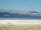
while watching the sun set over Soda Lake
|
|
Locations:
Soda Springs Desert Studies Center.
|
then we dressed for dinner at the Mad Greek in Baker.
|
|
|
| Thursday, 21-Apr-05
|
Other articles:
Locations:
Mesquite Valley.
Sandy.
Spring Mountains.
|
|
|
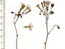
 Collection No. 451, Gilia aliquanta ssp. aliquanta, from the Mesquite Mountains Collection No. 451, Gilia aliquanta ssp. aliquanta, from the Mesquite Mountains
 Coll. No. 451, Gilia aliquanta ssp. aliquanta Coll. No. 451, Gilia aliquanta ssp. aliquanta
451
|
Small white Gilia, in the saddle on buff-colored platy limestone.
| Gilia aliquanta A. D. Grant & V. E. Grant ssp. aliquanta. Puff Calyx Gilia. Mesquite Mountains, San Bernardino County, California. In saddle, 2.75 km east of Winters Pass. 35.6901°N, 115.6723°W. WGS 1984. Elev. 1304 m. Growing in a buff-colored limestone gravel. Coll. No. 451, keyed 11 Jan 2013, characters observed: Annual, from stout taproot, to 15 cm.; Leaves basal and cauline, Basal leaves, pinnate lobed, sharp pointed, hairs non-glandular; Cauline leaves, different, terminal leaflet > lateral leaflet; Pedicel 1-8 mm. (with open flowers); Calyx 2.5 mm., nearly glabrous, some purple color (faded), fused membraneous, puffed (hard to see on pressed surfaces, look on unpressed sides of calices); Stamens = corolla lobes; Seeds >1 per chamber, light brown (greenish), gelatinous when wet.
|
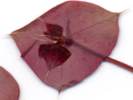
 Undetermined species found in limestone outcrop on east side of Mesquite Mountains. Undetermined species found in limestone outcrop on east side of Mesquite Mountains.
 Collection No. 452, Phacelia perityloides var. jaegeri from the Mesquite Mountains. Collection No. 452, Phacelia perityloides var. jaegeri from the Mesquite Mountains.
452
|
Small Phacelia, in the saddle on buff-colored platy limestone.
|
|
Other articles:
453
|
Nicotiana, on steep southeast-facing slope, among large dark-colored limestone boulders.
| Nicotiana obtusifolia Martens & Galeotti. Desert Tobacco. Mesquite Mountains, San Bernardino County, California. In dark limestone boulders, on a steep, southeast-facing slope, near top of Mesquite Mountains, 2.9 km eastnortheast of Winters Pass. 35.6957°N, 115.6719°W. WGS1984 Elev. 1397 m. Coll. No. 453, 21 Apr 2013, characters observed while keying: Perennial herb to 50 cm; Leaves, ±clasping (on the verge of sessile), definitely none petioled; Calyx, bell-shaped, sepals fused 8 mm + 5 lobes 6 mm × 8 mm dia., lobes equal; Corolla, 18-20 mm, limb 12 mm, open during day.
|
Other articles:
454
|
|
Galium stellatum Kellogg. Starry Bedstraw. Mesquite Mountains, San Bernardino County, California. Among boulders in dark limestone, west-facing slope, near top of Mesquite Mountains. 35.6965°N, 115.6721°W. WGS1984 Elev. 1409 m. Coll. No. 454, 21 April 2005, characters observed while keying: Perennial, to 30 cm.; Stem, woody, 10 cm. or more; Leaves, whorls of 4, widest below middle, sharp at tip; Inflorescence, crowded; Corolla, 4-lobed; Fruit, 3.0-4.0 mm., incl. hairs, hairs dense, straight, white.
|
Other articles:
455
|
|
So much for field guesses, this one turned out to be: Hedeoma nana (Torr.) Briq. ssp. californica W. S. Stewart. California Mock Pennyroyal. Mesquite Mountains, San Bernardino County, California. Among boulders in dark limestone, west-facing slope, near top of Mesquite Mountains. 35.6947°N, 115.6721°W. WGS1984 Elev. 1409 m. Coll. No. 455, 21 April 2013, characters observed while keying: Perennial herb, woody at base, to 13 cm., (subshrub); Stem 4-angled, recurved short hairy throughout; Leaves opposite, petiole 1 mm. + blade 4.5 mm. × 2.5 mm. wide, ovate, short hairy, margin entire, abaxially glandular; Inflorescence axillary; Bract, 1 mm., hairy (not spiny); Pedicels 2 mm.; Calyx 4.5 mm., tubular, 3 lobes > other 2, in fruit, lobes variously curved but not converging, throat ±open; Corolla, 2-lipped, 7 mm.; (Style, should be unequally 2-lobed, but unable to see); Stamens 2, staminodes 0; Anthers, fertile sacs 2.
|
Other articles:
456
|
|
Orobanche cooperi (A. Gray) A. Heller. Burro Weed Strangler. Mesquite Mountains, San Bernardino County, California. Among boulders in dark limestone, west-facing slope, near top of Mesquite Mountains. 35.6965°N, 115.6721°W. WGS1984 Elev. 1409 m. Coll. No. 456, 21 April 2005, characters observed while keying: Non-photosynthetic parasitic herb to 12 cm.; Root attachment unknown; Inflorescence dense, 2.0-3.5 cm. wide; Pedicel 5 mm.; Bractlets, 2, 8 mm., narrow; Calyx, fused 5 mm. + free 6 mm. = 11 mm., divided ±equally; Corolla, 20 mm., constricted at middle, lacking a ring of hairs at base of filaments; Anthers, sparsely hairy; Stigma lobes 2, thin, recurved.
|
Other articles:
|
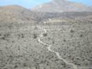
From the top of the mountain, I returned to the south, passing by the east side of the ridge. When I reached the saddle, I turned west along the old road to Winters Pass, where I left the car. From this valley I could see the buff-colored limestone where there were so many different species of plants.
|
|
Other articles:
Locations:
Mesquite Mountains.
|
Back at the car, I put my collections into the press and then, after looking back at the peak where I had been, I drove back to Zzyzx.
|
|
|
| Friday, 22-Apr-05
|
|
Papers in the Research Center
|
|
|
| Saturday, 23-Apr-05
|
|
Saturday was cool and windy.
|
|
|
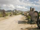
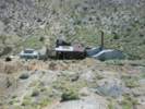
After the papers were presented, we went on a short field trip. The original plan was a field trip to Salt Springs to see Emmet Harders mine. However, there was some sort of desert run event that left Baker and traveled north on the same highway we needed to use, CA Hwy 127. As an alternative, we shifted some of Mondays stops to Saturday, i.e, the Valley Wells smelter, and the arrastres near Halloran Spring.
|
|
|
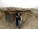
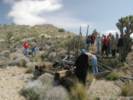
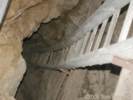
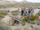
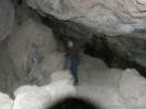
At the Valley Wells smelter, we looked at the foundations and tried to guess how they processed the ore. We also noticed the dug-out shelters that were dug by the smelter workers under the caliche layer. Some rooms were as large 12 feet across, and carefully squared. The opening was covered by wood, and some had holes in the roof for a stove pipe.
|
|
Locations:
Valley Wells Copper Smelter.
|
|
|
Locations:
Valley Wells.
|
|
|
Locations:
Valley Wells.
|
|
|
|
At Halloran Springs we parked and walked up to the arrastres. There were two. One still had an iron post in the center. There was little evidence or ore to be processed, nor did we know from where the ore was brought.
|
|
Other articles:
Locations:
Halloran Springs.
|
|
|
Other articles:
Locations:
Halloran Springs.
|
|
|
|
| Sunday, 24-Apr-05
|
Locations:
Mountain Pass.
|
|
|
Literature Cited:
Other articles:
Locations: Mollusk Mine.
|
|
|
Other articles:
Locations:
Striped Mountain.
|
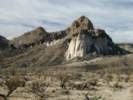
Striped Mountain to the south.
|
|
Literature Cited:
Other articles:
Locations: Silverado-Tungstite Claims.
|
|
|
Literature Cited:
Other articles:
Locations: Silverado-Tungstite Claims.
|
|
|
Literature Cited:
Other articles:
Locations: Standard No. 1 Mine.
|
|
|
Literature Cited:
Other articles:
Locations: Evening Star Mine.
|
|
|
Locations:
Death Valley Mine.
|
|
|
Other articles:
Locations:
Death Valley Mine.
|
|
|
Locations:
Death Valley Mine.
|
|
|
Locations:
Death Valley Mine.
|
|
|
Locations:
Goffs.
|
|
|
Locations:
Goffs.
|
|
|
Locations:
Goffs.
|
|
|
Locations:
Goldhammer Mine.
|
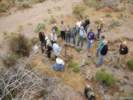
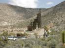
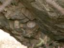
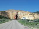
The field strip stopped at the Goldhammer Mine, to attempt to learn how the ore was processed and what the remnants of the equipment was used for. Unfortunately, I got distracted by the bird eggs in one of the mine shafts
|
|
Other articles:
Locations:
Goldhammer Mine.
|
and by the abundant Lilac Sunbonnet (Langloisia setosissima ssp. punctata) growing in the gravel around the mine. This was as good of display for this species as I have seen anywhere, and the mine would be a good stop for wildflowers in any good year.
|
|
Other articles:
Locations:
Vulcan Iron Mine.
|
|
|
|
| April 25, 2005
|
Other articles:
|
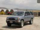
As I was descending into Bakersfield on California Highway 58 on April 25, 2005, the 4Runner turned over 100,000 miles at General Beale Road. We got off to buy some produce and to take this photo.
|
|
|
| May 1, 2005
|
Locations:
Mount Diablo.
|
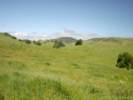
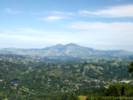
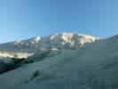
We hiked up the Big Springs Trail, nearly to Vollmer Peak, then took a shortcut to the ridge for this view.
|
|
Locations:
Bear Valley Reservoir.
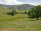
|
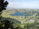
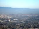
Looking a little farther to the left (north), we could see Bear Valley Reservoir.
|
|
|
| Friday, May 13, 2005
|
Other articles:
|
|
|
Other articles:
Locations:
Bear Creek.
|
|
|
Other articles:
Locations:
Bear Creek.
|
|
|
Other articles:
|
|
|
Other articles:
|
|
|
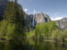
Other articles:
Locations:
Yosemite National Park.
|
|
|
Locations:
Yosemite National Park.
|
|
|
Locations:
Yosemite National Park.
|
|
|
Locations:
Yosemite National Park.
|
|
|
|
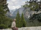
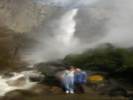
| Saturday, May 14,2005
|
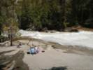
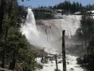
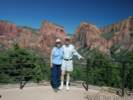
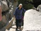 Cheryl makes it to the top of Vernal Fall. Cheryl makes it to the top of Vernal Fall.
|
|
|
Locations:
Yosemite National Park.
|
|
|
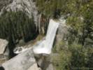
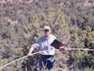
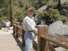 Tom on the bridge above Vernal Fall. Tom on the bridge above Vernal Fall.
|
|
|
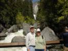
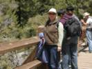 Cheryl on the bridge above Vernal Fall. Cheryl on the bridge above Vernal Fall.
|
|
|
Locations:
Yosemite National Park.
|
|
|
Locations:
Vernal Fall.
Yosemite National Park.
|
|
|
Locations:
Vernal Fall.
Yosemite National Park.
|
|
|
|
| Friday, 27-May-05
|
|
We left home on Friday in the early morning, making good time until we left Barstow.
|
|
|
Then there was an accident on I-15 between Barstow and Baker that had the highway jammed up for about 10 miles and about an hour. However, we still got to Baker in time to get a placard for the car.
|
|
|
We had an early dinner at the Mad Greek Restaurant in Baker.
I had a chicken giro while Cheryl had the more authentic lamb giro.
|
|
|
From Baker we continued up the I-15 to Cima (Kessler Springs) Road. This is the road that goes from Valley Wells in Interstate 15, past Kessler Springs and the Kessler Springs Ranch, to Cima, where it joins Morningstar Mine Road and Kelso-Cima Road. Other sources refer to this as Cima Road, as does CALTRANS.
|
|
Literature Cited:
Other articles:
Locations: Evening Star Mine.
|
|
|
|
We drove in to the Mid Hills Campground arriving at about 630 PM -- plenty of time to set up the tent before dark. We got our favorite camp site (#24) up near the top of the campground, and behind a small hill that gives shelter from the wind. The weather was very nice, about 80-85 in the daytime, and 55 at night.
|
|
|
| Saturday, 28-May-05
|
|
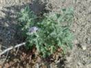
Saturday, I measured my plot in Salvia dorrii.
|
|
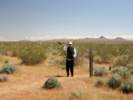
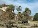
 Tag showing location in Salvia dorrii plot. Tag showing location in Salvia dorrii plot.
|
At the Salvia dorrii plot, we stretched the measuring tape and then added plastic tags to the centerline stakes where I have found S. dorrii. This should help me measure faster and more accurately in the future. Confusion about my position in the plot has caused data problems in the past.
|
|
Other articles:
|
After putting down the tags, I left the tape in place and climbed the mesa rim to the south to take photos. Cheryl went out and stood in the plot for the photo to provide scale.
|
|
Other articles:
|
This photo is large-sized (1.2 MB).
|
|
|
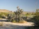
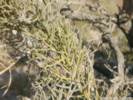
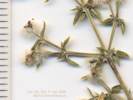
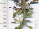
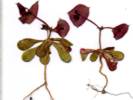
While on the rim, I collected a little Phacelia that I think is P. perityloides. There were five or six specimens of this plant, and several of them were growing out of cracks in the rocks where there was no soil.
|
|
 Phacelia perityloides var. jaegeri at Lobo Point. Phacelia perityloides var. jaegeri at Lobo Point.
 Collection No. 458, Phacelia perityloides var. jaegeri Collection No. 458, Phacelia perityloides var. jaegeri
458
|
458 Phacelia perityloides
|
|
|
Then came measuring the plot. This went a lot slower than I thought it would. Replacing the numbers on the stakes was the main thing that slowed me down.
|
|
Other articles:
|
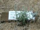
Stakes that had been recycled previously were given new numbers. For example, for the stake that is recorded as xW036, the x tells me that I have used the stake before, probably in another plot. So I renumbered this one to be W136.
|
|
|
This year I also started using clear acrylic stakes, instead of the fiberglass stakes. After several years in the field, the fiberglass stakes begin to shred glass fibers. They are difficult to handle without getting the fibers in my hands. Probably its better not to introduce the glass fibers into the environment where they might cause similar irritation to some of the small animals.
|
|
|
There were just 13 live Salvia dorrii, down from almost 100 maximum from before. All live S. dorrii were in bloom except for one small plant. No seedlings survived the recent years drought.
|
|
|
Later, relaxing in the tent before going to sleep, I found myself wondering why we hava a noun drought to describe the lack of rainfall, but no simple word for the opposite condition, a period of plentiful rainfall.
|
|
|
While there were no new seedlings, every live plant, except one, had flowers. The flowers should produce seed that should produce seedlings next year, if we get one more year of good rain. This leads me to believe that Salvia dorrii does not store reproductive capacity in a soil seed bank as does Frasera albomarginata. Instead, reproductive capacity is stored in mature, live plants through periods of drought.
|
|
|
Some of the very mature Salvia dorrii have split stems, and only one small branch of the large plant is still alive.
|
|
|
After measurement, I took photos of the live plants, then coiled up the tape and finished.
|
|
|
For lunch we drive into Lobo Point, where we had a leisurely lunch. I think Cheryl has hummus and pita bread and I have ham and cheese on crackers, while we shared some pistachios and carrots. We also read our books and relaxed a bit.
|
|
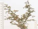
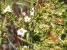
 Keckiella antirrhinoides var. microphylla at Lobo Point. Keckiella antirrhinoides var. microphylla at Lobo Point.
|
I walked up the hillside to find the Keckiella. It was in bloom. Then I walked across to a specimen of Horsebush to see if it was blooming. It wasnt yet. The Symphoricarpus was in bloom, and the Apache Plume (Fallugia paradoxa) was just beginning to set seed. Wrights buckwheat was beginning to grow flower stalks but not flowering yet, just like at at home.
|
|
Other articles:
|
From Lobo Point we went to Pinto Mountain to see one of the plots of Frasera albomarginata. There were many Frasera albomarginata in bloom at Pinto Mountain. In my plot, there was one plant in bloom, two plants still alive from last year, and one new plant this year. I measured and photographed my plots, and then we walked back down to the car. The Cliff Rose was setting seed while still flowering.
|
|
|
We returned to camp, and cleaned up a bit. After attitude adjustment hour, we had a fine dinner of Frito-Pie: Chili over a bed of Fritos (corn chips), with grated cheese on top. It felt good to lay down when it got dark and a little cool. Tonight, I finished The Dive from Clausens Pier.
|
|
|
| Sunday, 29-May-05
|
|
Then Sunday, we went to Wild Horse Mesa and measured the Frasera albomarginata plot there.
|
|
Other articles:
|
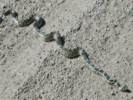
On our way south on Wild Horse Canyon Road, we came upon this Gopher snake sunning itself.
|
|
Other articles:
|
|
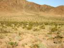
We walked up the old road. Since vehicles cannot drive on the road, it is becoming more faint every year. At some point it will just disappear completely. I just wonder whether other people will be able to find the old roads and trails, and follow them up to the rim of the mesa. Or, perhaps, now that we have a national park, no one does that any more, and it doesnt matter. I could not see any water in the Guzzler. Perhaps it has sprung a leak. On the way up to the experimental plots, we passed a Juniper that had nearly died. This year, all the outside of the large shrub is still brown, but it is growing from the inside, and live green foliage can be seen inside the brown dead foliage. The Single-Leaf Ash (Fraxinus anomala) was in bloom this year.
|
 Measuring Frasera albomarginata on the north face of Wild Horse Mesa. Measuring Frasera albomarginata on the north face of Wild Horse Mesa.
 Measuring Frasera albomarginata on the north face of Wild Horse Mesa. Measuring Frasera albomarginata on the north face of Wild Horse Mesa.
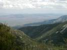
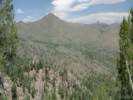 View from the north face of Wild Horse Mesa. View from the north face of Wild Horse Mesa.
|
|
The experimental plot had 41 new seedlings this year, with 48 plants surviving from last year, plus three plants from prior years. Outside the plot, many Frasera albomarginata were blooming, but none were blooming inside. I'm not sure why this might be: except perhaps my repeated visits have affected the growth of the plants. Also seen in bloom were: Atriplex canescens, Calochortus kennedyi, Dalea searlesiae, Fraxinus anomala, Galium cf. parishii, Linanthus (blue), and Penstemon eatonii.
|
|
After we came down off the mountain, we decided to return to Lobo Point for lunch. I took a few photographs around the area, then we drove to Hole in the Wall.
|
|
|
At Hole-in-the-Wall, we talked to a couple from England, who were visiting for the day. They were on a combined business-pleasure trip that started in San Diego, and would end in Las Vegas the next day. There were quite a few more people at Hole-in-the-Wall, and I am reminded of a previous observation: since the area became a national park, there are more people on the roads and in the campgrounds, but fewer people in the back country.
|
|
Other articles:
|
|
There were also a larvae of some sort clinging to the rocks in the water. Perhaps, these are mosquito larvae, or perhaps the larvae of the little biting flies.
|
|
So far we havent decided about tomorrow. Im thinking of exiting through Macedonia Canyon, and then trying to enter Mormon Canyon before going on to Saint George.
|
|
|
Tonight, I started The Shadow of the Wind.
|
|
|
| Monday, 30-May-05
|
|
Monday morning after breakfast we packed the car and attempted to leave the Mid Hills area by way of Macedonia Canyon.
|
|
Other articles:
Locations:
Macedonia Canyon.
|
|
|
Other articles:
Locations:
New York Mountains.
|
|
|
Other articles:
Locations:
Castle Peaks.
|
|
|
Other articles:
Locations:
New York Mountains.
|
Stopped again at Barnwell (Manvel) for a photo when the area is green. Formerly, my only other photo of Barnwell was taken in the depths of serious drought.
|
|
|
We bypassed Las Vegas, keeping both hands on the wheel, and looking neither to the right nor left, and headed up the Interstate to St. George.
|
|
Other articles:
Locations:
Virgin River.
|
|
Stopped for lunch at a picnic area in the Virgin River Gorge Recreation Area.
|
|
Then we drove the remainder of the way into Saint George, and then came on in to town. We made the mistake again of getting off at Bluff Street and having to drive up through the town to Saint George Blvd, where the main part of town is. We're staying at a Best Western where we've stayed before.
|
|
|
We had dinner at a good restaurant in Ancestor Square, about two blocks away, called the Painted Pony. Then we went to the supermarket to buy supplies for the next few days. Before returning to the motel, we drove out to a housing development west of St. George called Kayenta. There the houses have large lots, they are all single story painted in earth tones, and the landscaping is as natural as possible. It's very pretty, but also probably very expensive.
|
|
|
| Tuesday, 31-May-05
|
|
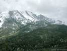
Our plan for Tuesday was to Toroweap on the north rim of Grand Canyon -- 90 miles of dirt roads -- not to mention stalking the wild Frasera albomarginata on Mt. Trumbull.
|
|
|
Well, we didn't make it to Toroweap. After a fine breakfast at the Bear Paw Cafe in Saint George, we went to the local BLM office for information. The lady told us not to try the road we were thinking of, but to try a different one that entailed 40 miles of highway, followed by only 61 miles of dirt road. She also warned us about flat tires, and all manner of pestilence.
|
|
Other articles:
|
So we headed out that way, got gas at Pipe Spring, then turned south. At 14 miles of the 61 miles total, I felt a heavy vibration in the back. When I stopped --- we had a flat tire on the right rear. Oh bother! Well, we jacked it up and changed the tire, but what to do now? Deciding a second flat tire in the absence of a second spare would put a crimp on our day, we returned to Saint George.
|
|
Other articles:
Locations:
Hurricane.
La Verkin.
|
|
|
|
We went to Big O and got four new tires. While we waited for the tires, we went next door to Jimmy Johns Worlds Greatest Gourmet Sandwich Shop, where we shared a turkey sub.
|
|
|
But now it was 300 PM. Did we want to try the 3-4 hours of driving to Toroweap? Well, we decided no. Instead we headed north, up the I-15.
|
|
Other articles:
Locations:
Kolob Canyons, Zion National Park.
|
|
|
|
So we're at the BestWestern Cedar City. The motel doesn't have high speed Internet, but I'm picking up a signal from somewhere. My laptop says it's a good signal, and it's running at 54Mbps. Who knows where it's coming from.
|
|
|
In keeping with the theme of the day, we had a lousy dinner. After finding the first two of our choices closed, one permanently, and one not open for dinner, we cruised another and decided it looked a little weird, and then settled for the restaurant attached to the motel. This was called the Cedar Creek Restaurant and it seems to be run by a very serious young man named Cody. The waitresses were pretty perky, and we had lots of free refills of iced tea and water, but the lettuce at the salad bar was pretty bad. We had soup instead, a creamy chicken with wild rice and sodium, which tasted good but probably near toxic levels, and the rest of the meal was nothing to write home about, so I won't. We lied, we asked for a box to put our leftover food in, then left the food in the motel parking lot garbage can.
|
|
|
Well, as for Wednesday, we're headed north and west to US Hwy 50 near Great Basin National Park, settling there, in Ely, Nevada, or maybe Eureka, Nevada. We are expecting improvement in both experience and attitude.
|
|
|
| Wednesday, 1-Jun-05
|
|
This morning we went to the Mountain Grill for breakfast. The pancakes were pretty good, but the coffee was watery. This set the theme for the day for both of were a bit foggy-brained for the day.
|
|
|
Heading north on Interstate 15, we came under increasing cloud cover. We had read about floods caused by heavy rains in the Salt Lake City area, and wondered if we would encounter rain as well.
|
|
Other articles:
Locations:
Pine Valley Mountains.
San Francisco Mountains.
|
|
|
Other articles:
Locations:
Frisco.
San Francisco Mountains.
|
|
|
Literature Cited:
Other articles:
Locations: Wah Wah Mountains.
|
|
|
|
After crossing the Wah Wah Valley, the highway climbs into the Wah Wah Mountains. I had read about these mountains in the GSA Bulletin, but could not remember the topic at the time.
|
|
Literature Cited:
Other articles:
Locations: Wah Wah Mountains. Wah Wah Summit.
|
|
|
Other articles:
Locations:
Snake Range.
|
Utah Highway 21 drops off the west side of the Wah Wah Mountains, and turns northwest through Pine Valley to Garrison, Utah, and the Utah-Nevada border.
|
|
Other articles:
Locations:
Snake Valley.
Snake Valley.
|
|
|
Other articles:
Locations:
Snake Valley.
Wheeler Peak.
|
|
|
Other articles:
Locations:
Great Basin National Park.
Wheeler Peak.
|
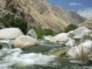
Deciding it was too cold for lunch at 10,000 feet, we returned to Upper Lehman Creek Campground, where we had lunch beside a small rushing branch of Lehman Creek.
|
|
|
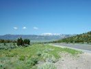
Leaving Great Basin National Park, US Highway 50 climbs over Sacramento Pass, then crosses Spring Valley.
|
|
Other articles:
Locations:
Snake Range.
|
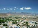
Climbing through the Schell Creek Range to Connors Pass (elevation 7,723 ft, 2353 m), we could look back and see Wheeler Peak in Great Basin National Park. After descending the west side of the Schell Creek Range, the road heads northwest to Ely, Nevada. At Ely, we got a motel room at the Best Western Main motel.
|
|
|
Knowing we had a place to stay the night, we left town by Highway 6 south bound for the White River Valley.
|
|
Other articles:
Locations:
Egan Range.
White River Valley.
|
I wanted to visit some places in the White River Valley because Douglas Post collected several species of Frasera here. Twenty-four miles south of Ely, we turned south on Nevada Highway 318. In 1998, we briefly visited Hiko at the southern end of this highway. However, this trip we would not get so far south. At its north end, Highway 318 passes by Preston. There is a motel and coffee shop here that look decent.
|
|
Other articles:
Locations:
White River Valley.
|
We continued through Lund to Gap Mountain. Here we turned west to Gap Camp. I had seen this camp on the map and wanted to know if it was a real camp ground. The camp looks to be a former hunters camp of little cabins and trailers. However, there is a BLM sign stating the camp is closed due to lack of maintenance funds. Perhaps, the BLM owns the camp and could lease the cabins if they were maintained.
|
|
|
We drive across the dam of the Adams-McGill Reservoir, watching the baby coots and the yellow-headed blackbirds. Of course, I was so busy trying not to drive off the dam while looking around, I failed to take a photograph of the dam or the lake. It turns out the largest of four reservoirs in the Kirch Wildlife Management Area. The other three are Dacey Reservoir, Hay Meadow Reservoir, and Tule Field Reservoir.
|
|
Other articles:
Locations:
Gap Mountain.
|
Looking back east we could see Gap Mountain without a large cloud shadow on it. Also to the north (left), Gap Mountain Camp could be seen.
|
|
|
We did a drive-by of the Hot Creek Campground. It looks livable, there are a few large cottonwood trees, that give some shade to the lucky camps. I think you would really want to fish or hunt here, to justify camping as well.
|
|
|
While most maps and brochures refer to this campground at the Hot Creek Campground, it also has a sign referring to itself as the Dave Deacon Campground. Dave Deacon is the new and preferred name.
|
|
Other articles:
Locations:
Hot Creek Springs.
|
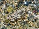
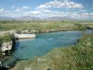
|
Endangered Fish Sanctuary This spring is inhabited by the rare White River Springfish, one of the few native fishes of this area. This sanctuary will help to insure its contunued unmolested existence. Unlawful to remove any fish from this water or to introduce any species Nevada Dept. of Wildlife.
|
|
I tired to take some photos of the fish, but all I got were some very nice art-sy shots of ripples in pretty aqua-colored water.
|
|
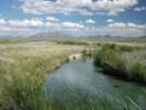
|
From Hot Creek Springs, we drove past the settlement of Sunnyside, back to Highway 318. We were looking for White Horse Pasture, where Douglas Post recorded collecting Frasera gypsicola.
|
|
Other articles:
Locations:
Egan Range.
White Horse Pasture.
|
North about 10-12 miles, we passed an apparently abandoned settlement that I would guess to be at the site of Emigrant Springs. While the DeLorme Atlas suggested that one should turn west here, we saw no open gates that we felt comfortable driving through. Instead we continued north another half-mile to a road signed for Wells Station Summit and Currant.
|
|
Other articles:
Locations:
White River.
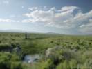
|
We drove out just past the main channel of the White River, then turned around and drive back, getting out several times looking for anything that might be a kind of Frasera. At this location, there was no flowing water in the White River, only a stagnant puddle that was associated by the excavation made to install the culvert. There was also a stream depth gauge with a satellite uplink, stranded in the dry section of the river bed. There was no sign of any plant remotely resembling a Frasera.
|
|
Other articles:
Locations:
White Horse Pasture.
|
From this location in White Horse Pasture, I could see the trees of the abandoned station at Emigrant Springs, with the Egan Range, in the vicinity of Shingle Pass, well lighted by the afternoon sun.
|
|
|
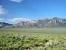
To the northwest the resistant cliff-forming limestone of the Egan Range were also well-lit by the late afternoon sun.
|
|
Other articles:
Locations:
Hardy Springs.
|
|
|
|
From Hardy Springs, we got back on Nevada Highway 318, and then US Highway 6, for our drive back to Ely, Nevada. Our next door neighbors at the motel turned out to be a couple of bikers, with big Harley hogs. When we pulled they were cleaning their bikes from the days run. They told us they had come from Modesto. One of them was stopping to visit relatives at Glenwood Springs, Colorado, and the other was continuing on to Greely, Colorado. Then he would return to Glenwood Springs, and they would ride together back to Modesto. They were a little concerned about the weather and likelihood of rain while crossing Utah. We didnt do anything to help allay their fears, noting the floods in Toole, Utah, the previous day.
|
|
|
For dinner, we went to the Silver State Restaurant, across the street from the motel. I had a grilled chicken sandwich, with a salad substituting for the standard French fries. The sandwich was very tasty, but I did not realize it would come with some sort of cheese. I should have pressed the waitress for a hamburger with a chicken breast instead of following her suggestion that I get the grilled chicken sandwich. At least the iceberg lettuce that came with three carrot shreds as the salad was edible here. Cheryl had the hamburger, which she said was very good. For dessert, we each had an ice cream cone. Oh
if they only had a Starbucks in Ely
..
|
|
|
After dinner, I fired up my laptop and looked for a wireless Internet connection. I found two, one of which had a nice strong signal, but neither would let me connect, so I shut off my laptop and read my book, The Shadow of the Wind, (La Sombra del Viento) instead.
|
|
|
| Thursday, 2-Jun-05
|
|
This morning, we got up fairly early (6:30 AM) dressed, and went over to the Silver State Restaurant for breakfast. I had my now-usual stack of pancakes with an egg on the side, with a strip of bacon donated by Cheryl from her breakfast. Unfortunately, we had to suffer though another watery cup of coffee this morning. Oh please, someone teach these people how to make a real cup of coffee! We heard one of the morning waitresses say that she had worked in this restaurant for 32 years. Maybe its time to change the grounds in the coffee maker.
|
|
Other articles:
Locations:
Gleason Creek.
Robinson Canyon.
|
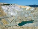
After breakfast we talked with the bikers for a few minutes, and wished each other good luck and safe journey. Then we got in the car and headed west on US Highway 50. A few miles west of town is the mining town of Ruth, where we pulled off the highway. On the road to Ruth, I noticed a sign directing us to the Overlook of the Liberty Pit.
|
|
Other articles:
Locations:
Robinson Mining District.
|
|
|
|
We returned to the road and drove into Ruth. Its a cute little down, with many houses built just the same, like a company town. The Mackay School of Mines from University of Nevada at Reno has a field station here, and three van loads of students were forming up for a day in the field.
|
|
Other articles:
Locations:
Jakey Valley.
|
Returning to the highway, we went northwest over Robinson Summit and crossed Jakey Valley, where we could see the White Pine Range.
|
|
Other articles:
|
Crossing the White Pine Range through Little Antelope Summit, and down the other side we could see Diamond Peak and the Diamond Mountains.
|
|
|
We stopped in Eureka for gas, and a Bio-Break, then continued on, as I have previously explored much of Eureka, and Cheryl did not have anything she wanted to see here.
|
|
Other articles:
Locations:
Ruby Hill.
|
I stopped along the highway for a look back at the Eureka Mining District at the north end of the Fish Creek Range.
|
|
Other articles:
Locations:
Big Smoky Valley.
Toiyabe Range.
|
|
|
|
and then crosses the Toiyabe Range. Its just one mountain range after another
after another.
|
|
|
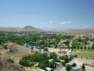
I tried to take a couple of interesting photos of Austin from above, but from that vantage point the town is mostly trailers and junkyards. Of the three towns on US Highway 50, Ely, Eureka, and Austin, the latter is most up in the mountains, and constrained by the canyon slopes, and the highway. The canyon at Eureka is a little wider and more open, while Ely is situated at the mouth of the canyon.
|
|
Other articles:
|
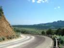
On our way from Austin to the Earthquake Faults, we used Highway 50, instead of dropping down to Nevada 722, as we have done the last few times. We did stop at the Shoe Tree for a photo, then continued on to the Earthquake Faults.
|
|
|
There are hundreds of shoes in this tree, and it looks like people climb up into the tree, and hand large bunches of shoes from it.
|
|
Other articles:
Locations:
Fairview Peak.
|
Just west of Fairview Peak, we turned south on the earthquake road. There were several earthquakes in this area in 1954. I had read about this place in a couple of geology books, and field trip guides.
|
|
Other articles:
Locations:
Fairview Peak.
|
|
|
|
The scarp is still very visible, and I took a photo from the top showing Cheryl at the bottom.
|
|
Other articles:
Locations:
Fairview Peak.
|
From here we drove a little further south, looked at some scarps, then back north a little way to have lunch.
|
|
|
After lunch, we headed back to US Highway 50, and then west through Fallon. We stopped at Verdi for gas, just as the rain began falling. It rained pretty good from Verdi to Truckee, but by the time we passed over Donner Summit, the sun was out.
|
|
|
Dinner was a cheeseburger at In n Out Burger in Auburn. We drove by our former property in Lincoln to see what the new owners have done with it. They have finished a garage, and leveled a pad to build a house. However, for the time being they are living in a trailer.
|
|
|
From Lincoln, we drive home to Alameda.
|
|
|
My Trip To Cerro Gordo. Mi Viaje A Cerro Gordo
|
|
|
| Friday, July 15, 2005
|
|
Steve Keire, a friend from work, and I left Friday morning. Driving south on the Interstate 5 highway, we stopped for lunch supplies in Bakersfield.
|
|
Other articles:
Locations:
Kern River.
|
We stopped briefly for lunch in the lower Kern River canyon. It was still very hot here, and strewn with garbage, so we did not stay long. We continued up the canyon, and past Lake Isabella, which was quite full and then over Walker Pass.
|
|
Literature Cited:
Other articles:
Locations: Walker Pass.
|
|
|
Other articles:
Locations:
Walker Pass.
|
We reviewed the trail signs on the north side of the highway, and looked at the vegetation and the view, mostly, I think, thankful that we had passed into the region of our destination.
|
|
Other articles:
|
There is also remote weather station on the south side of the highway. It has a radio-frequency antenna, and not a satellite communications antenna. So, I dont think it is connected into the ROMAN (Real-time Observation Monitor and Analysis Network). There is a Walker Pass RAWS, but it is about two miles west of Walker Pass, near a mountain top.
|
|
Other articles:
Locations:
Robber's Roost.
|
Robbers Roost was on our right-hand side as we drive down the east slope of Walker Pass. We turned off on a little dirt road, at what I now think was Soldier Wells, through an unlocked gate and across the slope toward Robber's Roost.
|
|
Locations:
Robber's Roost.
|
Robber's Roost was used by the robber Tiburcio Vasquez from about 1850 to 1874. He and his gang robbed stages and freight wagons carrying gold ores and bullion from the mines of the Eastern Sierra to Los Angeles and Bakersfield. As a defense against his robbery the Cerro Gordo mines made 300 pound silver balls that couldn't be carried on horseback.
|
|
Locations:
Robber's Roost.
|
It was a good little road, but there were no recent tire tracks. The reason why there were no tire tracks on the little road became obvious when we arrived at Robbers Roost. In the middle of the road was a red stick. On our side it said nothing. But the other side, "Route Closed." After taking the photograph, we drive around the sign. There was no way I was going to drive all the way back to Highway 178, and then try to find a route that was not closed.
|
|
|
Steve and I climbed to the top of Robber's Roost. The rock is granite and it is highly faulted.
|
|
Locations:
Robber's Roost.
|
There are good views from the top of the rock, but spotting a stage down at the location of present day Highway 14 would be difficult unless one had a good telescope, or unless the stage was raising a cloud of dust.
|
|
|
We drove back to the highway, being careful to travel only on open routes.
|
|
Other articles:
Locations:
Bartlett.
Cerro Gordo.
Owens Lake.
|
|
|
|
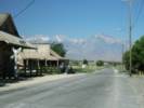
At Lone Pine, we got the last rooms in the Lone Pine Hotel, and then went out for dinner. The Lone Pine Hotel was used by many movie stars in the 1930's and 1940's when westerns were made nearby in the Alabama Hills. It was very hot when we arrived in Lone Pine, but cooled off rapidly when the sun went down, as the elevation is over 4000 feet.
|
|
|
| Saturday, July 16, 2005
|
Other articles:
Locations:
Sierra Nevada.
|
|
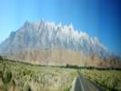
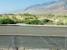
Our first stop was the location where the former Southern Pacific railroad tracks crossed California Highway 136. I had intended to stop at a wide spot in the road to take a photograph of Mount Whitney in the strong early morning light. This was also a good place for a panorama showing the eastern Sierra Nevada mountain front towering over the Alabama Hills. The wide spot in the highway turned out to be the former crossing of the standard gauge Jawbone Branch of the Southern Pacific. The railroad is gone now, but it used to go from Mojave through Inyokern to Owenyo, where it connected with the Southern Pacific Narrow Gauge railroad. The Southern Pacific Narrow Gauge was formerly called the Carson & Colorado, as it started near the silver mines of Virginia City and was originally intended to go all the way to the Colorado River. Since Steve and I both worked for the railroad, we said a little prayer for this abandoned branch railroad line, and moved on.
|
Locations: Swansea.
|
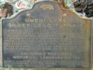
Our next stop was in the little town of Swansea. This historical plaque at Swansea reads:
|
|
Other articles:
|
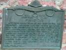
Owens Lake Silver-Lead Furnace
The Owens Lake Silver-Lead furnace and mill was built here by Col. Sherman Stevens in 1869 and used until March 1874. James Brady assumed its operation in 1870 for the Silver-Lead Company and built the town of Swansea. During the next five years the output of this furnace and another at Cerro Gordo was around 150 bars of silver every 24 hours, each weighing 83 pounds.
California Registered Historical Landmark No. 752 |
|
|
At one time boats took the ores from the mines across the lake from Swansea. A steamboat named the Bessie Brady was built in 1872 to carry Cerro Gordo silver from Swansea across Owens Lake to Cartago, and on her return she towed barges of charcoal back to Swansea. This charcoal was hauled up the grade to Cerro Gordo for use in the silver smelters. Eventually the small community of Swansea was virtually destroyed by a catastrophic storm that delivered rocks and water down the mountainside.
|
|
Other articles:
|
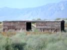
There were the remains of a section house, still painted in Southern Pacific orange.
|
|
Other articles:
|
And a narrow gauge stock car.
|
|
Other articles:
|
From Swansea we could just barely see the remains of two towers of the salt tramway to Swansea from the Saline Valley.
|
|
|
The next stop was Keeler on the shores of the Owens Lake. Now the lake is completely dry, as the water from the Owens River is all sent to Los Angeles.
|
|
Other articles:
Locations:
Keeler.
|
|
|
|
Keeler
End of the Line
From Mound House, Nevada, narrow gauge rails of the Carson & Colorado Railroad reached this site in 1883. Cerro Gordo and other mines faltered. The rail line fell on hard times, so plans to extend the line to Mojave were abandoned, leaving Keeler as "end of the line."
Dedicated May 12, 1973.
Slim Princess Chapter
E Clampus Vitus
Inyo County
Board of Supervisors
|
|
Other articles:
Locations:
Keeler.
|
After a brief visit to the Sierra Talc mill, we crossed the highway to Cerro Gordo Road.
|
|
|
Cerro Gordo | Cerro Gordo discovered by Mexicans in 1865 was at $17,000,000 Inyo's wealthiest mineral producer. Silver, lead, zinc, water, and supplies all went by mule train, tram, the "Bessie Brady" boat across Owens Lake, and Remi Nadeau's mule teams to build the pueblo of Los Angeles. Dedicated June 14, 1980. Slim Princess Chapter No. 395. E Clampus Vitus
|
|
At the Cerro Gordo Road, there is also another sign here reading:
|
|
|
Private Property
Visit Cerro Gordo by reservation only.
760-876-5030
|
|
Other articles:
|
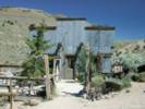
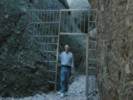
We called the owner of the town of Cerro Gordo to make sure we would be welcome. Visiting the town is by reservation only, as it is privately owned. Steve had made several attempts to call and write to get permission, but did not receive a response. Anyway, when we called, the owner said to come on up to the town. The road is dirt, narrow, and quite steep. It took about a half hour to travel the 8 miles, and having the low range gears in the 4Runner made pulling the hills much easier.
|
|
Locations:
Cerro Gordo (Town).
|
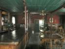
The owner met us when we arrived in the town, gave us a little orientation, telling us where we could go and where we could not. He also unlocked the buildings so we could look inside.
|
|
|
Steve and I started pretty much up the hill to the hoist room and the main shaft.
|
|
Other articles:
|
In the pass between the Owens and Saline Valleys, we looked at the remains of a furnace.
|
|
Locations:
Cerro Gordo Mine.
|
We then walked over to the main shaft hoist, or "head frame." I tried to look down into the shaft, but the owner (wisely) had a very heavy, locked gate around the shaft. When we talked to him, he said that he got his water from the 700 foot level, i.e., 700 feet down into the mine, and he had been to the 900 foot level. I think the deepest shaft is 1100 feet.
|
|
Locations:
Cerro Gordo (Town).
|
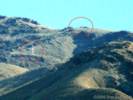
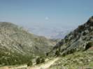
From the head frame we started slowly walking up the road to the top of Cerro Gordo. It was about another 1,000 feet of climbing to the top, and took us about an hour. Following the road, we came to a peak with a lot of telecommunications equipment. This peak was about 9125 ft elevation, but it was not Cerro Gordo Peak, which is just to the north at elevation 9188 ft.
|
|
Locations:
Keeler.
Nelson Range.
|
From the top we had good views of the Owens Valley, Keeler, Owens Lake, and the Sierra Nevada, but we could not pick out which peak was Mt. Whitney.
|
|
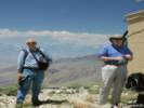 Two guys on top of the hill. Two guys on top of the hill.
|
Looking the other way we could see the Nelson Range, a little bit of the Saline Valley, and the Racetrack in Death Valley National Park.
|
|
Locations:
Racetrack.
|
The Racetrack (http://www.schweich.com/geoidxR.html#CARacetrack) is the dry lake where the big rocks move mysteriously, leaving furrows behind, except that no one has ever seen them move.
|
|
Other articles:
Locations:
Cerro Gordo (Town).
|
|
|
Other articles:
Locations:
Independence.
|
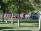
We drove to Bishop for the night, stopping a few minutes in Independence to look at the steam locomotive on display. This was the #18 from the SP narrow gauge. The sign said that the locomotive was being restored, and would soon be moved to three miles of re-constructed track a little bit east of the town.
|
|
|
We had dinner at a nice restaurant in Bishop, called Whiskey Creek, where Cheryl and I have eaten several times before, and then walked back to the hotel for the night.
|
|
|
| Sunday, July 17, 2005.
|
Other articles:
|
Sunday morning we had breakfast at Jack's Cafe, an old cafe in Bishop, and then drove to the Laws Museum.
|
|
Other articles:
|
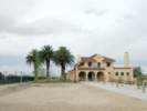
We walked from our motel to downtown for breakfast. Along the way, I noticed this older house set back from the main street of Bishop. It still looks pretty good, though at one time it must have been someone's beautiful Owens Valley mansion.
|
|
Literature Cited:
Other articles:
|
|
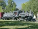
The town of Laws was also a stop on the Southern Pacific Narrow Gauge, and the museum grounds were donated by the railroad to the county when the railroad stopped operating. They have the #9 locomotive and six railroad cars on display here, plus a lot of old railroad stuff on display. As you might expect, talking with the caretaker, it came up that both Steve and I had worked for the Southern Pacific. We got the secret behind-the-scenes tour that took four hours, and included looking at every bolt, nut, and spike in the entire yard.
|
Other articles:
Locations:
White Mountains.
|
From Laws, we drove north on US Highway 6 through the Chalfant Valley. The July 1986, magnitude 6.3 Chalfant, California, earthquake was the largest of a recent series (1978present) of moderate-sized earthquakes near the Long Valley volcanic region of east-central California
|
|
Other articles:
Locations:
Benton Hot Springs.
|
|
|
Other articles:
Locations:
Tuolumne Meadows.
Yosemite National Park.
|
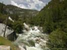
The highway passes by the south shore of Mono Lake and joins US Highway 395 south of Lee Vining. We got gas in Lee Vining and then started up to Tioga Pass on Highway 120. We stopped for lunch east of Tioga Pass, and then drove home the usual route through Yosemite, Oakdale, Escalon, Manteca, etc.
|
|
|
| Thursday September 15th
|
|
We had a little bit of trepidation this morning because Delta airlines declared bankruptcy yesterday. However, when we got to the airport, there was no sign of any financial problems. Our ride to the airport was waiting out front of the house before the requested time, and we were ready a few minutes early, so we left the house just before 7:00 AM and arrived at the airport at about 730 AM. After waiting in the wrong line for a half-hour, we were directed to the correct line. The wait was quite short, and we were at the gate an hour and a half before flight time. We went to the cafe at the end of the concourse for coffee and a roll. We also got a couple of bananas and another roll because the ticket agent said there would be no food on our flight to Atlanta. As we were getting on the flight, it already seemed as through it had been a long trip, but we were only 3 hours into an 18-hour trip.
|
|
|
The flight to Atlanta was uneventful and smooth. They did serve some food, a little box of cheese, crackers, and some drink, so it turned out that our extra food might not have been necessary. The flight arrived at Atlanta a few minutes late, and our flight to Madrid left from the farthest concourse from our arrival concourse, so by the time we rode the shuttle train and walked to the gate for the Madrid flight, the airplane was almost loaded.
|
|
|
From Atlanta, we pushed away from the gate on time, and left Atlanta, flying essentially parallel to the North America coast line, until we passed Labrador. We must have flown directly above Hurricane Ophelia. However, the flight deck did not announce it, nor did we notice any particular turbulence as we passed over North Carolina.
|
|
|
The flight was nearly full, and the gentleman behind me was so large that I could not recline my seat. This made sleeping difficult, while sitting bolt upright. Maybe I slept about an hour, during the movie, but otherwise, was awake the entire 8 hour flight.
|
|
|
| Friday September 16th
|
|
Friday morning we arrived in Madrid on a pleasant but hazy morning. For some reason, passport control and baggage was really fast, no delays, and we were out of the airport and into a taxi quickly. Took a taxi to Atocha, and bought AVE tickets for the 1100 AM AVE to Sevilla. Cheryl got a little confused and asked for "ida y revuelta" meaning going and scrambled, instead of "ida y vuelta" going and returning. The ticket clerk paused a second, but figured out quickly what we wanted.
|
|
|
Having the tickets in hand, we wanted to call Rachel and tell her which train we would be on. I bought a telephone card in the news stand. First, you scratch off the stuff hiding the secret code on that card. At the telephone, you have to call a 900-number, the Spanish equivalent of an 800-number, then put in the secret code, like a PIN, then the phone system asks you for the number you want. By the time we called Rachel, it was time to get on the train.
|
|
|
Security to get on the train is a little tighter, with all baggage x-rayed, and a separate ticket check. You have to load your own baggage on the AVE, and we were a little late, so there was little room for our baggage. I put mine on top of someone else's baggage, and we had to leave Cheryl's bag hanging out into the aisle a little bit. Then we found our seats. The trip passes quickly, especially if you're tired and keep passing out (going to sleep actually). But at Cordoba, per Cheryl's request, I checked our bags, and found that some space had opened up sice people had gotten off the train there. So I was able to re-arrange the baggage more neatly, and not on top of, or in front of, anyone else's bags.
|
|
|
At Sevilla, Rachel was waiting for us in front of the station, and she drove us home. She had just picked Ian up at school, so he and Cheryl rode in the back seat.
|
|
|
Shortly after we got home, Nacho arrived home from work. We had some bean soup that Rachel had made, then took a siesta. I set the alarm clock, because I did not want to oversleep and then not be able to sleep later. We took a little walk in the neighborhood. Rachel and Nacho put Ian to bed, then we had a snack and went to bed ourselves.
|
|
|
| Saturday, September 17th
|
|
This morning we had breakfast and went into Sevilla. Rachel was mostly looking for a birthday present for the little girl of a friend. We went to a toy store near Plaza Burgos. Nacho and I also looked at routers for their home network. However, their DSL has a USB modem, and I'm just not sure that anyone makes a router with a USB WAN connection. We may look somewhere else later in the week.
|
|
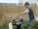 Rafa salts the sardines while they cook. Rafa salts the sardines while they cook.
|
This afternoon we joined Rachel and Nacho's neighbors for an afternoon barbeque. They had gotten some sardines at the local supermarket and were barbequing them. The sardines were a little bigger than we think of sardines. They were about 8 inches long. The cook dipped then in olive oil and then scattered salt on them while they cooked. They were really good. Nacho also made a tomato salad. And Rachel made some dipping sauce for the barbequed chicken, using a recipe from the Canary Islands: cumin, garlic, paprika, tomato and vinegar.
|
|
|
For a while I played soccer with "Ale," short for Alejandro, the three-year-old neighbor boy, and took my turn supervising Ian push things around the neighbor's back yard.
|
|
|
Today's weather was cloudy in the morning. It was comfortable walking around in Sevilla, with a little breeze. This afternoon, when the sun came out, the sun was quite strong and hot. Later in the afternoon, though, the angle of the sun, and the natural haze in the air softened the impact of the sun.
|
|
|
After a brief attempt at a siesta, we got up, then took a walk around the neighborhood. Rachel took us down to see the new school. It's about four blocks away, on the other side of the Mas Supermarket.
|
|
|
Now, Rachel and Nacho have put Ian down for the night, and I think I'll download the pictures from the camera and see what I've got.
|
|
|
| Sunday September 18th
|
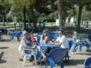 Coffee in the Parque del Alamillo Coffee in the Parque del Alamillo
 Outdoor caf e in Parque del Alamillo. Outdoor caf e in Parque del Alamillo.
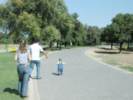 Ian heads down the path. Ian heads down the path.
|
|
|
 Poetry reading in the park. Poetry reading in the park.
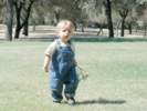 Ian plays in the park. Ian plays in the park.
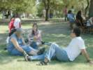 Relaxing in the park during the poetry reading. Relaxing in the park during the poetry reading.
|
On weekends there are many activities in this park. In one area, an arts school for children was decorating tiles to be fired later. In another, there was a poetry recital. Sponsored by the Junta of Andalucia, the work of several local poets was published in a small book that was handed out free, and then the poets were reciting their work to a small gathering under the trees. We sat on the grass and let Ian play for a while while listening, and then moved on.
|
|
|
It still seems a little strange that a "junta" could be a good thing. When I was in high school, maybe when your ideas of the world are being formed, there was a lot of talk about "military juntas" in Latin America. They were bad things, and often referred to simply as the "junta." "The Junta of Peru today did ..." this and that, in a voice to tell you it was a bad thing. So you begin to associate "junta" with something that is not a good thing. However, in Spain the governments of states, such as Andalucia, Extremedura, etc., are referred to as "Juntas." So the government of Andalucia is known as the Junta de Andalucia. But it's a good thing, and they seem to do lots of things to improve people's lives, whether it is to sponsor a small poetry reading, build housing, or provide social services.
|
|
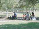 Little train in Parque del Alamillo. Little train in Parque del Alamillo.
|
In another area, there is a little train, like the Golden Gate Live Steamers in Tilden Park. They have a pretty good oval of track, and one little live steam engine, with two diesel engines. People were getting rides around the oval, while others were working on some of the facilities. It looked like a club of railroad enthusiasts who had this location in a small corner of the park.
|
|
|
We came home, and I watched Ian play outside while Nacho cooked lunch. He prepared Salmorejo and Fish. The Salmorejo is a little like gazpacho, but with maybe a little more garlic, and it's pureed. The fish is called "merluza" that we would call "hake." It is a very mild white fish.
|
|
|
After siesta, Rachel and Nacho and Ian went to a first birthday party for another child. The child's mother is in Rachel's yoga class.
|
|
Locations:
Bormujos.
|
Cheryl and I took a walk around Bormujos. We headed west through the old town, past Ian's school and the Bormujos library. Then up toward the main street. There must have been an important soccer game going on because most of the bars were full with people crowded around watching the television. We stopped at a small bar and had a cafe con leche, sitting out on the sidewalk, enjoying the shade. It was a little warm in the sun, even for being very late afternoon. From there we walked over to the hospital, and checked the view west toward Huelva. But the sun was low in the west, and very bright. This would be a good view point for a clear early morning.
|
|
|
Now we are at home, Rachel and Nacho and Ian have come home, and Ian is having his cereal.
|
|
|
| Monday the 19th
|
|
This morning after breakfast, Rachel dropped Ian off at his school went on to her yoga class. It was quite cool this morning, 15°C or about 59°F, with a pretty good breeze from the east to west. The high temperature today was forecast for 30°C, 87°F, in Sevilla.
|
|
Locations:
Bormujos.
|
Cheryl and I wanted to go out for coffee. We were the only people wearing a sweater. Everyone else was out in their shirt sleeves. I think they must have known that the sun was quite warm, and that doing anything, even walking to to coffee place, was sufficient to keep one warm. Needless to say we arrived at the coffee place, called "La Rana" or "The Frog" quite overheated. We ordered cafe con leche, and the waiter stood there for a few moments, as though he expected use to order something else. We were a little slow on the uptake, Cheryl could see some pastries, but didn't want those. We didn't see a menu, so we did not know what to order. Later we knew the thing to do was to ask if they had "toast" as in "¿Hay tostada?" We think the answer would have yes, and then we could have asked for tomato, or ham, or maybe something else on the toast. So maybe next time, we'll get it right.
|
|
|
On the way back from the coffee place, we stopped at the local bank, BBVA, to get some money. But the ATM rejected my ATM card, saying that the card was defective. This made me a little bit nervous, as the card could be defective, or the ATM unable to read it, or perhaps it was rejected by our bank, under some sort of anti-fraud measure. Just to be sure, I walked to downtown Bormujos. There, I tried another bank's ATM. I think it was the Bank of Andalucia. It had no trouble with my ATM card, and it had no trouble dispening money. So perhaps only BBVA was having trouble with their network, or perhaps only that ATM had trouble with my card. Maybe we'll give it another test in a day or so.
|
|
|
After Rachel came home from her yoga class, we went to the market. We loaded up on groceries. There is a MAS Supermarket near her house, and a larger market called Mercadona in the center of the town. We went to Mercadona. They have a fish market, and will custom cut meats like a Deli counter, but nearly everything else is pre-packaged, including the chicken and the beef. Many of the brands we are familiar with are available, such as Lays potato chips, and Post cereals, but the varieties are fewer, and there are many local products. At checkout you have to unload your cart and then bag your own groceries.
|
|
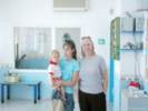 Ian, Rachel and Cheryl at Ian's School. Ian, Rachel and Cheryl at Ian's School.
|
From Mercadona, we went to Ian's school to pick him up. He was just coming out of his classroom to play in the outside area. We picked him up, looked in his classroom a few minutes, and then came home.
|
|
|
Cheryl and Rachel collaborated on lunch. They made Merluza "Hake," steaks this time, breaded and browned with onions, and then simmered with green beans.
|
|
|
After lunch, Nacho had a quick siesta, and then Rachel and Nacho went to a movie in Sevilla while we watched Ian. We played in the house, played in the yard, got good and dirty, then had a snack, and went for a little walk. Ian fell asleep on the walk, and we had to wake him up so that he would be able to go to sleep later. Rachel and Nacho had coffee after the movie, and then came home. They, all three, are upstairs now, giving Ian a bath and getting him ready for bed.
|
|
|
For our bed time snack, we had an empanada that Rachel made. It was bacon, dates, and bleu cheese between a kind of flaky crust. Rachel got this recipe from someone in her yoga class. It was very good.
|
|
|
| Tuesday September 20th
|
Locations:
Sevilla.
|
This morning we went into Seville. Rachel has a cold, so she decided not to go with us for the day. When it was time to take Ian to school, we dropped him off at his school, and then Rachel drove us into the city center. We walked past Plaza Nueva, and then onto the main shopping street, called "Sierpes." We bought a few souvenirs, and then had a coffee at a cafe. We tried for the toast with tomato puree here. Ordered "tostada con aciete y tomate." But when they brought the toast, it had thin slices of fried green tomatoes, instead of the tomato puree. That has a little disappointing.
|
|
Locations:
Sevilla.
|
|
|
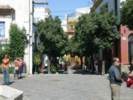 Plaza in Barrio Santa Cruz Plaza in Barrio Santa Cruz
|
In a plaza we rested and had a coke (and also used the bathroom), and then we made our way to the bus station at Plaza de Armas. When we arrived at the bus station, there was a bus just leaving for Bormujos, but the driver would not take our money, and we had to get a ticket. So we had to go back to the ticket counter and get a ticket. We missed that bus, but caught another just a few minutes later. Busses run every 20 minutes, and the bus ride from Sevilla to a corner near to Rachel and Nacho's house takes about 20 minutes.
|
|
|
Back at the house, we had some Peruvian Chicken that Cheryl had made, and then a siesta. This afternoon, we tried to find a place to stay for the weekend, but the places we called were full, or wanted a minumum three-day stay. We can stay at Julio and Pamen's house in Santa Maria. Julio is Nacho's brother. But we thought we maybe wanted to stay a couple of nights at the beach. Maybe we can still find something.
|
|
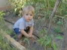 Ian plays in the garden. Ian plays in the garden.
|
When it cools off everyone comes outside. Ian likes to play in his back yard, especially in the dirt in the vegetable garden.
|
|
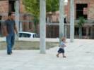 Taking a walk in the neighborhood. Taking a walk in the neighborhood.
|
This evening we took at walk. It is pretty comfortable as the sun is going down. Ian insisted on getting out of his stroller and walking with us. It slows us down, but he likes to look and touch stuff.
|
|
|
I think this is all for tonite. May not be able to e-mail for the next few days, but I'll try to keep my journal up to date.
|
|
|
For dinner (after I wrote the above), we had Tortilla Espanola and "melon." The common melon here is called Piel de Sapo, or "toad skin" melon. I really like it. It has the internal appearance of honeydew, but a little stronger flavor, getting close to a cantelope. For the Tortilla Espanola, which is made with egg and potato, I had mine a la Americana, meaning with catsup. I believe this may be near to a sacrilege, putting catsup on a spanish tortilla. However, as Utah Philips said, "It's good, though."
|
|
|
| Wednesday September 21st
|
|
After last night's journal entry, we decided that going to the beach was maybe not a good idea because so many of us have colds. This is OK, as our visit is primarily a family visit. Also we are having a little trouble finding a place to stay on the beach south of Cadiz. So today we stayed home.
|
|
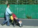 Ian goes to school. Ian goes to school.
|
This morning after breakfast we took Ian to school. We met his teacher again, and the director of the school. Afterwards we walked another block into Bormujos and had a cafe con leche. Rachel and Cheryl had orange juice.
|
|
|
There is a central market in Bormujos, but only a few stalls have vendors. There was a fish market and a vegetable market. We looked at some salmon, but it did not look too fresh, so did not buy any.
|
|
|
Cheryl also stopped at a millinery store in the town but I don't think she bought anything. Back at home, Rachel and Cheryl did a couple of sewing projects, while I cleaned out some old IBM e-mail. I guess it is ... .... well, not nice or fun ... but satisfying in a way to look over things I should have read when I received them a few months ago, give them due consideration (often very little), and then finish up with an empty e-mail in-box. It will also be nice to go back to work, with all my e-mail and not have a huge in-box that has to be read right off the bat.
|
|
|
Anyway, we went to get Ian at school at about 130 pm, then had some lunch when Nacho came home from work about 300 pm. We finished off the Peruvian chicken that Cheryl made yesterday.
|
|
 Ian plays in the Bormujos City Park Ian plays in the Bormujos City Park
|
After siesta, to which I am becoming very accustomed, in the afternoon we played with Ian, and then walked to a park nearby in downtown Bormujos. Ian played in the sand, and rolled down the grassy slope with help from his daddy.
|
|
 Ian rolls down the hill in the park. Ian rolls down the hill in the park.
|
After we got home, I changed into shorts t-shirt and went out to get my exercise. By now, it was 830, the sun was going down, and the temperature maybe about 80 degrees. This was the first time I felt like exercising since I got sick before our trip. I started by running over to the hospital, then down to the university, over to the restaurant, and then back up the hill to Nacho and Rachel's house. Took me about 25 minutes, and felt pretty good, so I must be about healed from whatever that was I had.
|
|
|
Ian has now had his bath, and Rachel is putting him down, I think Nacho and Cheryl are cleaning out the dishwasher. In a few minutes, we'll have our late meal, usually around 1000 pm, and then go to bed.
|
|
|
More later.
|
|
|
| Thursday September 22nd
|
Locations:
Bormujos.
|
This morning dawned a little cloudy, but no rain is forecast. We were awakened by the nearby construction. They seem to start working seriously as soon as it gets light. This is now about 800 am. At the end of Rachel and Nacho's street they are digging out the dirt for the foundation of a new building. This started last week, and the area is now almost completely dug out. That building will be some apartments (or flats). On the other side of it is a partially built building. They are pouring the third floor now, and working pretty fast. Construction seems to start, as I said, as soon as it gets light, and continues at a pretty good pace until about 200 pm. Then they must take a long lunch until about 400 pm and work until 700 pm. Rachel says that in the summer, they stop work for the day at 200 pm, as it is just too hot to work in the afternoon in the summer.
|
|
 El Corte Ingles in San Juan de Aznalfarache. El Corte Ingles in San Juan de Aznalfarache.
 Inside El Corte Ingles. Inside El Corte Ingles.
|
After breakfast, we took Ian to school, and then went to the El Corte Ingles in San Juan de Aznalfarache, near Maireina. Maireina is the next town to the south. Then San Juan de Aznalfarache is to the east, between Maireina and Sevilla. This is a huge department store with a lot on inside, as well as outside, covered parking. Also inside the building was a Hipercor. This is more of a discount department store, more on the order of a K-Mart. The stores are open to each other, but if you go from one to the other, it is expected you will seal your purchases in large plastic bags to prevent the merchandise from getting mixed.
|
|
 Inside El Corte Ingles. Inside El Corte Ingles.
 Inside Hipercor. Inside Hipercor.
 Inside Hipercor. Inside Hipercor.
|
Cheryl and Rachel bought some thread, which was the main reason why we came here. We also got a coffee in one of the two cafeterias. And Cheryl bought a grocery cart so that she can carry a few groceries when she walks to the market. She has looked for this kind of cart in the US, but can't find the features and quality she has admired in the Spanish carts. This particular cart folds up very small, so Cheryl thinks she can get it into her suit case.
|
|
|
We came home, and Rachel and Cheryl talked while I did a little IBM e-mail, then they got lunch.
|
|
Locations:
Triana.
|
After siesta, we went to Triana, on the opposite side of the river from Seville. One purpose was to visit a district of tile shops. We went into maybe six to eight shops. About half of the shops also painted and fired their own tiles. And I would guess, at a less busy time of day, one would be able to watch the shop owners painting their tiles.
|
|
Locations:
Triana.
|
|
|
Locations:
Rio Guadalquivir.
Triana.
|
We had a quick rest, with a coke, on the river in Triana. It was about as quick as Ian would let us have it, as it's pretty hard for him to sit still. On the way to the car, we had an idea to buy falafel sandwiches for dinner. The wait was a little long, long enough to make jokes about growing the chick peas, but when we got to eat them back at home, they were pretty good.
|
|
|
Rachel has lost her voice, but is feeling much better today. Right now our plan is for Nacho to go to work for a while in the morning, then leave in the early afternoon for Santa Maria. If all the plans hold together, we'll go into Cadiz on Saturday. This is a city that has been on our list to visit for a few years.
|
|
|
All for now, will probably send this on Friday morning.
|
|
|
| Friday September 23rd
|
|
Well, it's actually Sunday afternoon, and it's been pointed out to me that I have some serious journaling to do. Typically, this would be the time that Rachel calls us, Sunday afternoon for her, and Sunday morning for us. Now we have an idea of what it is like for her to come home from a weekend trip, and then call us, and try to talk while Nacho and Ian, and all the neighbors are outside having the neighborhood chat.
|
|
|
As for Friday morning, we got most of our things ready to go away for the weekend, and then went over to the local cafeteria called La Rana, for coffee. Nacho came home from work about noon, and we got on the highway south for Cadiz. From Seville the road crosses a low plain, with low rolling hills. Being Fall now, the country side is quite dry. The only remaining crop that we saw in the fields was cotton. There were many fields of cotton the entire way from Seville to Cadiz. I only saw one or two irrigated fields. Those seem to be alfalfa, or other grasses. There are some olive orchards south, but not so many as we saw on the highway east to Granada.
|
|
|
The highway we used was an Autovia, or a toll road. The toll was 5.15 euros for about 60 km of distance, and there was only one toll booth in the entire length.
|
|
|
We were going to stay in Julio and Pamen's flat in El Puerto de Santa Maria. Julio and Pamen and family are staying in Argentina for a year while Julio takes a naval course. To get to their house, we turned off the highway just before arriving at Cadiz and turned a little bit west. Julio and Pamen's flat is in a housing development for Spanish military personnel stationed at Rota. Rota is both a Spanish, and an American navy base. Apparently, all the American servicemen live inside the base.
|
|
|
When we arrived, Nacho had to turn on the electricity and the water. The water heater and the stove operate on butane gas. You have to go buy the gas in cylinders. So after a quick lunch of sandwiches that we had brought from Sevilla, Nacho, Ian, Cheryl and I set off to the market for food and to buy some butane gas.
|
|
|
The market was pretty easy. Nacho knew where it was, and it had pretty much everything. There was a butcher, and Nacho had the butcher slice some chicken breast filet very thin for frying.
|
|
|
For the butane gas, we went to the gasoline station (Repsol, I think) where Nacho had purchased butane before. However, there was no one there selling butane. They did tell Nacho about another gas station nearby that sold butane, so we went there. I think it was about 9 euros for about 12 1/2 kg of butane. I'm not sure how long that lasts, but maybe about a week for a family of four.
|
|
Locations:
Rota.
|
|
|
|
At the house, Rachel fed Ian and got him ready for bed, while Nacho prepared dinner with a little assistance from me. We had Tuna Surprise Pasta, the surprise of course being the tuna in the tomato sauce on the pasta.
|
|
|
| Saturday September 24th
|
 Coffee in the Cathedral Plaza of Cadiz. Coffee in the Cathedral Plaza of Cadiz.
|
This morning was our visit to Cadiz. The city is on a promontory of rock, probably relatively recent marine terrace deposits if you ask me, and connected to the mainland by a narrow spit of sand.
|
|
Locations:
Cadiz.
|
Our first stop was the tourist office, where Nacho and Rachel got a tourist map, and a flyer describing today as the World Day of the Tourist. There was also a cruise ship in port, and there wer many, many people in the main plaza of town.
|
|
Locations:
Cadiz.
|
|
|
Locations:
Cadiz.
|
We walked down the shopping streets and through the public market to the car. Then drive to the restaurant for lunch. When Rachel's friend Mary had come to visit, they made the mistake of walking, and learned it was really a long way. After a brief wait, we got into the restaurant. No gazpacho today
a something of a disappointment, so we had salad, and ordered two paellas, one with salsa verde (and garlic), and one with tomato sauce called El Senorito, because the clams were already removed from their shells, i.e., the work was already done. It was very good. I think I preferrred the salsa verde paella. Rachel had formerly preferred the salsa verde, but this time I think she preferred the El Senorito.
|
|
Locations:
Cadiz.
|
After lunch, we went back to the old part of the town -- el casco antiguo. Rachel nursed Ian. Nacho and I walked out a narrow causeway to a fort. The fort must be built upon the farthest outcrop of the uplifted marine sediments. There were several reefs along the causeway, and there were fishermen as well as divers with snorkels. I did not seen any catch, but there were enough people that there must be some fish to catch.
|
|
 Ian plays on the beach. Ian plays on the beach.
|
When we came back, Rachel and Ian were ready so we let Ian play on the beach for a while. The water was pretty warm, maybe 75 degrees, but since it was the Atlantic Ocean, the water was not as warm as the Mediterranean.
|
|
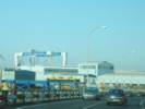 Shipyards "Astillero Puerto Real" near Cadiz Shipyards "Astillero Puerto Real" near Cadiz
|
|
|
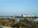 Natural park along an estuary. Natural park along an estuary.
|
|
|
|
For dinner, Nacho prepared some chicken in the style he and Rachel had eaten in the Czech Republic. It was grilled, with a slice of cheese, and a canned peach on top. Unfortunately, we forgot to buy the canned peaches. We did however had some canned pineapple. So we had chicken with cheese and pineapple. It was pretty good, and with only a little bit of brown sugar could have been Czech/Hawaiian chicken. I contributed the sliced tomatos, but the chicken made the meal. For dessert, Nacho and I had flan and Rachel and Cheryl had Arroz con leche (rice pudding). By this time, it was the usual Spanish 1000 or 1030 pm, and after some prodding from Cheryl, gave up the idea of being sociable, took a shower and went to bed.
|
|
|
| Sunday September 25th
|
|
This morning, Cheryl and I walked down to the beach in El Puerto de Santa Maria. We had a nice view of Cadiz on the left (south) and the navy base at Rota to the right (north). We walked back up the hill and bought the newspaper for Nacho (El Pais, the country), and churros. This is dough fried in oil. We did not know how much to order, so we ordered "Uno" (one) because the lady in front of my ordered "Uno." Turned out that was probably enough. The "uno" refers to one euro's worth of churros, rather than Churros for one, one kilogram, etc.
|
|
Locations:
El Puerto de Santa Maria.
Rota Naval Station.
|
Back at the flat, we determined to walk back down to the beach and let Ian play. Ian enjoyed this very much, but I got pretty overheated, so I went back up and sat in the shade on a park bench where there was a nice cool breeze. While I know that this area of Spain is at the same latitude as San Francisco, and the sun is not high in the sky because the equinox is past, the sun seems hotter here than at the beaches in the Bay Area. Perhaps also that is because the summer fog is more thicker and more persistent on the California coast than here.
|
|
|
Turns out I wasn't the only one wilting in the heat, as everyone came up off the beach. We let Ian play in the playground for a while, and then walked back up the hill to the flat.
|
|
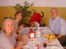 Lunch in El Puerto de Santa Maria Lunch in El Puerto de Santa Maria
|
We cleaned the flat and closed it down, disconnected the butane bottle, turned off the electricity, etc., and then went to a restaurant for lunch. I would not have thought this was the place, beacuse the parking was a very sandy and rough dirt road. But off the road, and inside the building was a very nice open air restaurant. There were awnings and shades, so inside was very pleasant. No gazpacho here either, I think the season for gazpacho has passed. I had the Pollo al Ajillo, this would be the Garlic Chicken. Turns out it was marinated in sherry (a local flavor) and deep fried in garlic. Very very tasty, but definitely not heart healthy. Cheryl had a swordfish filet. It also was tasty and moist, not dry like the swordfish steaks we sometimes get in the states. Rachel had a fish-kebob, with a kind of whitefish. Nacho had a steak that looked pretty good, also.
|
|
|
The drive back to Sevilla took a little more than an hour, through most of which Ian slept. At this age (14 months), he really does not like riding in the car. Nacho has a pretty good song that put Ian to sleep this time called "Maya." Haven't a clue what it's about. Old MacDonald Had A Farm is also pretty entertaining for its chorus of E-I-E-I-O that Ian like to sing along. Nacho and I sometimes get mixed up as to what sounds the animals make as the animal sounds are a little different in Spanish than in English.
|
|
|
On getting home, we unloaded the car, and then joined the neighbors. Nacho and Ian went over the the next door neighbor's to watch a car race, and play. There were lots of people visiting, and the neighbors and relatives who visit send their kids to the same school, so the kids know each other.
|
|
|
Well, now Ian is upstairs having a bath. I'm trying to stay awake until dinner time. I think I'll stop writing, select a few photos, and send this off.
|
|
|
| Monday September 26th
|
|
This morning Rachel has to go into Sevilla for the first day of training for her teaching job. The school has about eight locations around Sevilla, including one branch in Bormujos, where Rachel will teach. However, at the beginning of the year, all the teachers get together at the main location in Sevilla.
|
|
|
We dropped Ian off about 900 am at his school and began the drive into Sevilla. This is still the Spanish rush hour at 930 am where the highways enter the city. Once in the city, traffic moved pretty well. We parked under the Nervion shopping center. Rachel went to her school, and Cheryl walked up and down the street trying to remember the restaurant where she had the perfect tostada con tomate. After checking the whole block we stopped at one and ordered coffee and tostada. Well, I just don't think this will be the trip for tomate in Sevilla, as they had no tomate (pureed tomato) this morning. We settled for orange juice, cafe con leche, and plain toast.
|
|
|
Then we shopped a bit. This shopping center has lots of stores we recognize, such as Pizza Hut, Macdonalds, and Starbucks. There are also lots of clothes shops, etc. We bought some window locks that Rachel and Nacho need for Ian's window, so that he cannot fall out. And we went to El Corte Ingles. We looked through the gourmet shop for marzipan and things to bring home, but cthis particular store has a pretty small section of that kind of stuff.
|
|
|
Along the street Schwepes was giving away small cans of free lemon tonic water. We each took one and sat on a bench for our represhment. But the tonic outweighed the lemon and it was pretty sour. Strangely refreshing after the shock of the quinine, but still acutally quite refreshing. It was interesting to watch people's faces when they took the first sip. Kids just took one drink and handed the can to their parents.
|
|
|
There were some school kids in the park, who space we intruded on a little bit, but several of them started to talk to us. They were mostly 14, we couldn't tell if they were cutting school or on a break. We told them that we lived near San Francisco, and that we were visiting our daughter and family who lived in Bormujos.
|
|
|
We thought we would go to Parque de Buhaira, which is listed as a pretty park in the moorish style. Crossing the street we got behind some construction for the Sevilla metro, and discovered that once over there, there was no way to get to the park. So we had to back track, up to the main street, across and back down. The park was very nice, and the book says there is a place for tapas there. However, our time was getting for meeting Rachel was getting short, so we went back to the Nervion shopping center to meet her.
|
|
|
Back at the house, we picked up Ian, and started lunch. Rachel determined to make falafel. My task was to go over to the MAS supermarket and get the cucumbers (Pepinos) and pita bread (pan de pita). I successfully met this challenge, and we had lunch when Nacho came home.
|
|
|
After siesta, Rachel and Nacho went to a movie, while Cheryl and I babysat Ian. We played a little inside and a little outside, trying to keep Ian out of the mud in the vegetable garden, and from grabbing the little eggplants growing there.
|
|
|
When Rachel and Nacho came back I went out for a little exercise, running for about a half hour. It was still pretty warm, at least 80 and maybe 85 degrees, and my route went over to the hospital, down to the university, across to the restaurant, part way back up the hill, up the hill past the hospital, and across the slope to the house. You have to pick your route carefully, as there is much construction in this area. Especially at the end of the block, they have just begun excavating the basement for a new building, and the dust is drifting out of the lot and into the street. So, at one intersection, there is at least an inch, and maybe two inches of very fine, powdery dust. You don't want to drive, walk, or run through it.
|
|
|
Nacho made sandwiches for dinner, some turkey and cheese, and some tuna and tomato, grilling them in their sandwich maker.
|
|
|
At that point, I was ready for bed, and did so.
|
|
|
| Tuesday September 27th
|
|
This morning we got up and had a slightly more leisurely morning, taking Ian to school about 1000 am. Rachel, Cheryl and I went to Ikea. We started first with a coffee at House of India coffee shop, and then went into the store. Maybe everyone else knows about Ikea, but it is a huge store with a lot of stuff, some set up in rooms, and some things separate.
|
|
|
Rachel is interested in some bookcases for her upstairs room, and some nightstands for their bedside.
|
|
|
It was also time to go to the market again. Conveniently, there is a Mercadona in the same complex, so we went there. Among other things we looked at the fish for dinner. While I'm not sure I could tell the difference, Rachel did not like the looks of their fish. I guess maybe you have to watch things like that a little more carefully here.
|
|
|
Back at the house, Rachel started then lentil soup for lunch, and then we went to get Ian. Nacho was working a little bit late today to make up for leaving early last Friday, so we went ahead and ate, before Nacho came home.
|
|
|
This afternoon, Nacho and I installed a Logitech camera and the MSN Messenger software on their laptop, so that we can try video across the Atlantic when we get home.
|
|
|
This evening, Rachel has gone into Sevilla for part of her new teacher orientation. We took turns playing with Ian, and then took Ian to the park to play. Going to the park, or going for a walk in the neoghborhood is something that is done in the early evening, just before or as the sun is going down. It is much cooler then, and actually quite pleasant, maybe 80 degrees, without the direct rays of the sun.
|
|
|
| Wednesday September 28th.
|
|
This morning we took Ian to school and went into Sevilla with Rachel. She dropped us off near the Parque Maria Luisa. First we went to have our coffee at a coffee bar that Cheryl frequented last summer. The auto driving school is just across the street, so while Rachel was taking her driving lessons, Cheryl would care for Ian, first having a coffee, and then walking him up and down the streets, while they waited for Rachel.
|
|
Locations:
Sevilla.
|
Then we walked into the park and went to the Museum of Arts and Popular Customs, or "Museo de Artes y Costumbres Populares de Sevila," in Spanish. I'm not exactly why we decided to go there, but on retrospect, I think we are very happy that we did. The center piece is a collection of embroidery and related needle arts that were given to the museum by a family that dealt in those things in the late 19th and early 20th century. There are two large rooms with examples of that kind of work, which according to the brochure is just 10% of the holdings. Another two rooms contain the furniture owned by the same family during that time, showing both their living space and working space.
|
|
|
There are other exhibits as well in the museum, including one showing over 50 years of photographs of Spanish people by a single ethnographic photographer. Other floors have exhibits of tile from the 16th to the 20th century, and lots of everyday things, such as tools for working with olives, leather, etc.
|
|
|
We were in the museum for about two hours, and left in time to walk to Nervion to meet Rachel. Along the way, we stopped in a technical bookstore that I had seen on previous trips. I looked at a few books. Two that interested me were titled, "Architecture of the Spanish Countryside" and Andalucia, Culture and Diversity." However, they are so heavy, that I am reluctant to buy them and then try to fit them into my suitcase.
|
|
|
From there we walked through the Parque La Buhaira again, and met Rachel at the Starbucks at the Nervion Shopping Center.
|
|
|
We picked up Ian, and after he went down for a nap, Rachel and I walked over to the Mas supermarket to buy some fish for dinner. It was called Lengua in spanish, which I think is halibut for us. Cheryl made a salad and then cooked the fish, which together with bread became our lunch.
|
|
|
After a siesta, staged this time, as Ian was awake, Rachel and Nacho worked out which bookcases they wanted to buy for their upstairs bedroom. Then we took a neighborhood walk.
|
|
|
Now it's time for dinner, or at least to start thinking about it.
|
|
|
| Thursday September 29th
|
|
Today, we went into Sevilla with Rachel, again. After we parked the car near Reachels school, Cheryl and I took the #23 bus from Nervion to the edge of the Barrio Santa Cruz. The streets are very narrow, and often change names every block, so it is difficult to navigate anywhere successfully. We headed for Plaza Alfalfa, a less-tourist area in the on the edge of the city center.
|
|
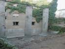 Three Roman columns on Calle Marmoles. Three Roman columns on Calle Marmoles.
|
Navigating in the general direction we came upon these three columns standing up in a pit about 10 feet deep. The pit was fenced off to keep people out. The columns looked old, like they could be Roman columns. I checked around for some kind of sign, explaining the columns, but was unable to find one. So, we noted the location was on Calle Marmoles, and continued on our way toward Plaza Alfalfa. Later, after we returned home, I was able to find a web site that explained these were indeed Roman columns.
|
|
 Coffee break in Plaza Alfalfa. Coffee break in Plaza Alfalfa.
|
We continued on toward Plaza Alfalfa, where we had our now-traditional mid-morning coffee. Taking a chance, we ordered tostada con tomate and finally got what we expected, i.e., toast with pureed tomato.
|
|
Locations:
Sevilla.
|
From Plaza Alfalfa, we wandered through the small streets looking for the house where Cheryl remembered taking Rachel to the dentist. We came out at Plaza Burgos, where Cheryl showed me a house that was under reconstruction last summer, and now was finished. Next door was another house that once was very attractive, but now needed some reconstruction itself. We walked past the toy store, and back into the Alfalfa neighborhood. We tried to do a little shopping; looking for a lace shop that Cheryl remembered seeing. I also remembered seeing a lace shop when we were first nearing Plaza Alfalfa, but Cheryl could not find the shop she remembered, and I could not find the lace shop that I thought I had seen. We went around and around, up and down, through and back, until we came out at Plaza Burgos again.
|
|
|
We plunged back into the city streets coming out this time at Plaza Magdalena, where we found an El Corte Ingles. This one had housewares, curtains, and things, that Cheryl wanted to look at. We did a little looking here, and then walked over to Plaza Nueva, where we caught the #23 bus from Plaza Nueva back to Nervion to meet Rachel.
|
|
|
| Friday September 30th
|
Locations:
Madrid.
|
This morning we left Sevilla on the 1100 AM AVE for Madrid. We stayed at the Tryp Atocha hotel. This was on Calle Atocha, about half way between the train station and Plaza Sol. After checking in, we went for lunch at a sidewalk café near Plaza Sol. After lunch, we walked to Parque Retiro. It was a very nice day, and I enjoyed just sitting on the bench, watching the day and the people. Back at the hotel, we rested a while, and then set out to find a little dinner.
|
|
|
| Saturday October 1st
|
|
Saturday morning we checked out and took a taxi to the airport. Our flight to Atlanta, and Atlanta to San Francisco all left and arrived on time.
|
|
|
| Friday October 14th
|
|
We left Alameda shortly after 7:00 AM, stopping at Starbucks for coffee on our way out of town, and pretty much drove straight through to Hole-in-the-Wall.
|
|
|
When we went by Wild Horse Canyon Road, I noticed that the Park Service had a pretty good chain across the road. I guess they are pretty serious about the road being closed.
|
|
|
Among the back-country drivers, there a folk lore built up about the various kinds of road closed signs and what they really mean. Im convinced that some counties, notably Inyo County leaves Road Closed signs out all the time, whether the road is closed or not. In this way, they cannot be held responsible if you damage yourself or your vehicle at some minor rut or washout. So the general advice is to drive right by county Road Closed signs. However, if the sign is a Park Service sign, then the advice is to obey it, as the Park Service is likely to be watching and will cite you for driving on a closed Park Service road.
|
|
|
The problem with Wild Horse Canyon Road being closed is that it is the primary access route to my plots at Lobo Point and the north face of Wild Horse Mesa. Typically, I would drive up Wild Horse Canyon to a small road junction and turn east toward Lobo Point to visit my plot in Salvia dorrii, or turn west toward Winklers Cabin to visit my plot in Frasera albomarginata. But if the road is closed, it could mean about a four mile walk into Wild Horse Mesa, which might be difficult, if I have to carry in equipment and supplies to work in the plots.
|
|
|
However, years ago, when Merritt College first started using the camp site at Lobo Point, we used a small road from Black Canyon Road just north of Hole-in-the-Wall to access the camp site. We knew that there was a road that also went out to Wild Horse Canyon Road from Lobo Point, but did not use it. However, over the years the road across the north face of Barber Mountain began to deteriorate, and the Merritt College group began to use the road out to Wild Horse Canyon instead of Black Canyon. So, it just might be possible tomorrow to drive from Black Canyon Road, east across the north face of Barber Mountain to Lobo Point, and then continue from Lobo Point to Wild Horse Canyon, then carefully tiptoe across Wild Horse Canyon Road, and take the road to Winklers into the north face of Wild Horse Mesa. That is: if I can find the road, if it is still usable, and if the Park Service hasnt closed that road also. I guess tomorrow, well find out.
|
|
|
We set up camp at Hole-in-the Wall. I think there must be about 30 campsites, and there were maybe ten available when we got there.
|
|
|
Walking around the camp, we saw places that the fire had burned right into the campground. Yet, on the slopes of Barber Mountain to the west, there were many large patches of vegetation that were not burned.
|
|
|
A lot of the campsites appeared to have hunters in them. When we asked the camp host about hunting season, she told us that tomorrow morning was the first day of quail hunting season, and that deer season had opened the previous weekend.
|
|
|
| Saturday October 15th
|
|
This morning, the hunters started rising about 5:00AM, and by 5:30 AM, they started pulling out of the campsite. The first gunshot echoed over Hole-in-the-Wall before 6:00 AM, just as the sky began to show a little light.
|
|
|
We started crawling out of bed around Seven, had a fine breakfast and set out for our day about 8:00 AM. We drove north on Black Canyon Road, and turned off north west on the road that led to the Gold Valley Mine, and Gold Valley Spring. So far so good. Along this road there were several hunters with shotguns at the ready. One gave us the evil eye. I wonder if they are like fishermen, who dont like people coming by and scaring the fish. We did see a few quail, to whom we shouted, Run little quail, Run!
|
|
Other articles:
Locations:
Lobo Point.
|
|
|
Other articles:
|
We got out to look at plants. The first plants that we noticed were the Verbenas (Verbena gooddingii Briq. ). There were many small plants, and quite a few of them were in bloom.
|
|
Other articles:
|
We also saw the first of many Blue Yucca (Yucca baccata Torrey) that were sprouting from the roots.
|
|
Other articles:
Locations:
Lobo Point.
|
|
|
Other articles:
|
We drove into the Lobo Point campsite and walked around a little bit. The venerable old Juniper in the center of camp was singed in the lower branches, but did not completely burn.
|
|
Other articles:
Locations:
Lobo Point.
|
Most of the pinyons and Junipers in the valley did burn.
|
|
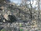 Former thicket of Fragrant Snowberry burned by the Hackberry Complex Fire. Former thicket of Fragrant Snowberry burned by the Hackberry Complex Fire.
|
The little thicket of Fragrant Snowberry (Symphoricarpos longiflorus A. Gray) burned
|
|
 Fragrant Snowberry (Symphoricarpos longiflorus) resprouting from its roots. Fragrant Snowberry (Symphoricarpos longiflorus) resprouting from its roots.
|
but the plant is starting to grow from the roots.
|
|
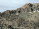 Small unburned patch. Small unburned patch.
|
There was one pretty good-sized patch of vegetation under a cliff that did not burn.
|
|
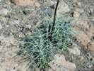 Mexican Bladder Sage (Salazaria mexicana) resprouting from the roots. Mexican Bladder Sage (Salazaria mexicana) resprouting from the roots.
|
Numerous Mexican Bladder Sage (Salazaria mexicana Torrey) were sprouting.
|
|
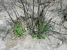 Yellow Bush Penstemon (Keckiella antirrhinoides) resprouting after the Hackberry Complex fire. Yellow Bush Penstemon (Keckiella antirrhinoides) resprouting after the Hackberry Complex fire.
|
We walked a short way up the hill to see if the Yellow Bush Penstemon (Keckiella antirrhinoides (Benth.) Straw ssp. microphylla (A. Gray) N. Holmgren) would survive, and were pleasantly surprised to see that about half of the bushes had resprouted.
|
|
Other articles:
|
Looking northeast from the slopes of Lobo Point toward Gold Valley Mine, one could see numerous Junipers and a few Pinyons that did not burn, especially in the low places along washes.
|
|
|
Also there were two Junipers and some Snakeweed (Gutierezzia microcephala) that survived. These were in the former parking lot used by Merritt College when they camped here many years ago.
|
|
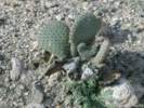 Beavertail (Opunita basilaris) sprouting after a fire. Beavertail (Opunita basilaris) sprouting after a fire.
|
We also saw a few Beavertail Cactus (Opuntia basilaris Engelm. & J. Bigelow) that were sprouting, and the pads were very full, i.e., the plant looked well-watered. However, we also saw many Beavertail that were not sprouting. This suggests that Beavertail may or may not resprout depending upon the damage caused to its root crown.
|
|
Other articles:
Locations:
Lobo Point.
|
Unfortunately, it looks like the large Juniper near the Medicine Wheel was too badly burned to survive.
|
|
Other articles:
Locations:
Lobo Point.
|
In the Lobo Point campground there was one Pinyon that was perhaps 3-4 feet tall when I first camped there in 1980. Over the years, it grew to more than 12 feet tall. However, it looks too badly burned to survive. This would be in the extreme right of the photograph linked at left. Panning to the left, though, one can see a Juniper that is scorched and brown on one side, but not burned. Then an Antelope Bitterbrush (Purshia tridentata (Pursh) DC ssp. glandulosa (Curran) M. E. Jones), a Box Thorn (Lycium cooperi A. Gray), and finally a large Pinyon (Pinus monophylla Torrey & Fremont) that did not burn. These plants should provide seed to re-establish the vegetation in this little valley.
|
|
Other articles:
|
From Lobo Point, we drove out to my (former) plot in Purple Sage (Salvia dorrii (Kellogg) Abrams ssp. pilosa (A. Gray) J. L. Strachan & Rev.).
|
|
Other articles:
|
The plot itself is almost completely wiped out. There are no surviving Salvia dorrii, and none were found to be sprouting from the roots. The Blackbrush (Coleogyne ramosissima Torrey) is likewise completely gone, and not resprouting.
|
|
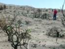 Former plot in Salvia dorrii Former plot in Salvia dorrii
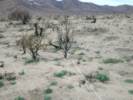 Former plot in Salvia dorrii Former plot in Salvia dorrii
|
Siting down the centerline of the plot, there were only a few annuals, mostly Senecio, and tap-rooted perennials, such as Verbena gooddingii, and Mirabilis multiflora that survived.
|
|
 Fiberglas stakes burned by the fire. Fiberglas stakes burned by the fire.
|
None of my fiberglas stakes, making the locations of Salvia dorrii survived the fire. The plastic resin in the stakes burned out, leaving the glass fibers behind. We were somewhat concerned that the glass fibers could be dangerous to the animals, so we pulled out all stakes, cleaned up as much glass fiber as we could, and disposed of them back at home.
|
|
 Location marker burned so that number cannot be read. Location marker burned so that number cannot be read.
|
The location markers in the plot also suffered in the fire. The heat bubbled the plastic, and none of the upper sides of the tags were readable.
|
|
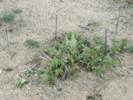 Mirabilis bigelovii in my Salvia dorrii plot. Mirabilis bigelovii in my Salvia dorrii plot.
|
There is one Mirabilis multiflora that I have been following for a few years. This plant survived, as it is a perennial growing every year from the roots. I noticed, though, that all of the M. multiflora in this area were very much chewed upon. Im thinking that perhaps the rabbits, or other small mammals, must be very hungry and are forced to eat this plant, even though it may not be very palatable to them.
|
|
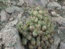 Fire-singed Claret Cup Cactus (Echinocereus triglochidiatus) making a comeback after the Hackberry Complex fire. Fire-singed Claret Cup Cactus (Echinocereus triglochidiatus) making a comeback after the Hackberry Complex fire.
|
Nearby, I found a fire-singed Claret Cup Cactus (Echinocereus triglochidiatus) making a comeback after the Hackberry Complex fire.
|
|
Other articles:
|
We got back into the car, and headed for the north slope of Wild Horse Mesa. When we got to Wild Horse Canyon Road, it looked to be in excellent condition. Im not sure why the Park Service is keeping the road closed. However, as the day wore on, and we saw more and more of the road, all in very good condition, I doubt the road is closed because of road conditions. I think perhaps the Park Service is more interested in keeping tourists out of the back country. Perhaps they are afraid of trees falling over on tourists. Or, maybe, they are concerned about archeological sites exposed by the fire.
|
|
|
Regardless, we carefully tiptoe-ed across Wild Horse Canyon Road, and headed up the road to (the former site of) Winklers Cabin.
|
|
Other articles:
|
The landscape has a kind of eerie feeling; formerly there were shrubs scratching both sides of the car on this road, now its all just wide open, with mostly ground visible. In fact, along Black Canyon Road, we noticed several large dumps of tin cans along the road. I think before the fire, these were hidden by the bushes. Now, with the bushes gone, you can see all the places that people dumped their tin cans years ago.
|
|
Other articles:
|
I also found the patterns of light and dark interesting, each dark place marking the former location of a shrub.
|
|
|
We could not drive all the way into Winklers Cabin in the 4Runner. Well, maybe I could have, but the road got pretty rough at a spot where two washes joined and then the road climbed out of the wash. So we parked the car and walked to my plot in Frasera albomarginata on the north face of Wild Horse Canyon.
|
|
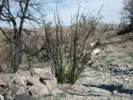 Single-Leaf Ash (Fraxinus anomala Wats) resprouting from roots after Hackberry Complex Fire. Single-Leaf Ash (Fraxinus anomala Wats) resprouting from roots after Hackberry Complex Fire.
|
Along the way, we saw many plants sprouting. In addition to plants already mentioned, the Dalea searlsiae (A. Gray) Barneby was out in force, and I was very pleasantly surprised to see the Single-Leaf Ash (Fraxinus anomala S. Watson) sprouting.
|
|
|
The big oak in the canyon burned, but was sprouting from its roots.
|
|
Other articles:
|
My plot did not burn. All the plants were OK, and the stakes in place. The fire came very close, though. On the bottom edge of my plot, there was one Juniper about 15 feet away from the plot that was scorched on one side. To the east, the fire approached, and burned the Pinyons within 30 feet of my plot.
|
|
Locations:
Wild Horse Mesa.
|
After looking at the plot, we walked up to the little saddle to the west, and had a good view of the patchiness of the burned areas on the north face of the mesa.
|
|
|
The other thing we noticed over here was the absence of nearby gunshots. This confirms an observation from several years ago. With the conversion to a national park, there are more people, but they tend to stay around the main roads, and few people get into the back country.
|
|
Other articles:
|
Driving back out to Wild Horse Canyon Road, we noticed this Pancake Cactus (Opuntia chlorotica Engelm. & J. Bigelow) that was sprouting from the roots. However, in this same area, we could several other plants that were not sprouting, probably depending upon the amount of damage to the plant from the fire.
|
|
Other articles:
|
Well, Cheryl wanted to go have lunch at the Mid Hills Campground. I was a little nervous about driving on the closed Wild Horse Canyon Road, and into the closed campground, given the Park Service propensity to cite visitors for going into closed areas.
|
|
Other articles:
|
We drove slowly up Wild Horse Canyon Road, stopping to take photos in several places.
|
|
Other articles:
|
|
|
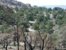 An area in the Mid Hills after the Hackberry Complex Fire. An area in the Mid Hills after the Hackberry Complex Fire.
|
There was a small unburned area to the north of the road, so we drove into there for lunch. I climbed a small hill to take these photos and peer toward the campground. I looked like the only thing moving was the windmill.
|
|
|
|
|
|
|
|
|
We took our time driving back down Wild Horse Canyon Road across the north side of Lobo Point and Barber Mountain to Black Canyon Road.
|
|
|
At Black Canyon Road, we turned left, heading north to Pinto Mountain. Along the way we noticed water running in the canyon. That seems odd. I wonder if burning of the vegetation reduces water uptake and transpiration, and leaves more ground water for the creeks and springs?
|
|
Other articles:
|
In Cedar Canyon, we stopped to look at the location of my plot on Pinto Mountain. Again we were surprised by the patchy distribution of burned areas.
|
|
Other articles:
Locations:
Cedar Canyon.
|
|
|
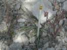 Yellow 116 in my plot at Pinto Mountains. Yellow 116 in my plot at Pinto Mountains.
|
I photographed the living Frasera albomarginata in my plot, and walked back to the car.
|
|
|
Back at Hole-in-the-Wall, we read a bit, had a small rehydration and attitude adjustment hour
|
|
Other articles:
Locations:
Woods Mountains.
|
watched the moon rise over the Woods Mounains
|
|
|
enjoyed a fine Frito Pie dinner, and went to bed.
|
|
|
| Sunday October 16th
|
|
This morning was cool and cloudy. After breakfast we packed up, and headed out.
|
|
Other articles:
Locations:
Cedar Canyon.
|
|
|
Other articles:
Locations:
Kelso.
|
Stopped at Kelso to use the bathroom.
|
|
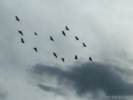 Egrets in Kelso. Egrets in Kelso.
|
Saw these egrets in the trees at Kelso. After a while they circled around and then headed southwest.
|
|
|
Stopped at Granite Pass to collect a few rocks.
|
|
|
Then got on the great Concrete Ribbon of Happiness and headed for home.
|
|
Locations:
Mount Diablo.
|
|
|
Other articles:
Locations:
Mission Peak.
|
|
|
|
| November 11, 2005
|
Other articles:
Locations:
Soledad.
|
|
|
Other articles:
Locations:
Salinas Valley.
|
|
|
Other articles:
Locations:
Salinas Valley.
|
|
|
Other articles:
Locations:
Gabilan Range.
Stonewall Canyon.
|
|
|
Other articles:
Locations:
Gabilan Range.
Stonewall Canyon.
|
|
|
Locations:
Pinnacles National Monument.
|
|
|
Locations:
Chalone Creek.
Pinnacles National Monument.
|
|
|
Locations:
Chalone Creek.
Pinnacles National Monument.
|
|
|
Locations:
Pinnacles National Monument.
|
|
|
Locations:
Pinnacles National Monument.
|
|
|
Other articles:
Locations:
Pinnacles National Monument.
|
|
|
Other articles:
Locations:
Salinas Valley.
|
|
|
Other articles:
Locations:
Salinas Valley.
|
|
|
Other articles:
Locations:
Salinas River.
|
|
|
Other articles:
Locations:
Salinas River.
|
|
|
Other articles:
Locations:
Salinas Valley.
|
|
|
Other articles:
Locations:
Salinas Valley.
|
|
|
Other articles:
Locations:
Salinas Valley.
|
|
|
Other articles:
Locations:
San Juan Bautista.
|
|
|
|
| November 19, 2005
|
Locations:
Mission Peak.
|
|
|
Locations:
Coyote Hills.
San Francisco Bay.
|
|
|
|
| December 4, 2005
|
Locations:
Emeryville.
San Francisco Bay.
|
We got up in the very early morning for a photo of the San Francisco Bay just after dawn.Tall buildings in the right foreground are in Emeryville, the port of Oakland at the left, and San Francisco in the right middleground.
|
|
|
| December 24, 2005
|
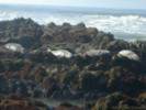 Seals resting on rocks near Cambria. Seals resting on rocks near Cambria.
|
|
|
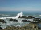 Waves breaking on rocks near Cambria. Waves breaking on rocks near Cambria.
|
|
|
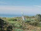 Great Blue Heron on the cliffs near Cambria. Great Blue Heron on the cliffs near Cambria.
|
|
|
Other articles:
|
We stopped along California Highway 46 for a view of Morro Rock and Morro Bay. But the winter sun was against us, and the photo very difficult. On the opposite side of the highway, the winter sun was lighting up this fault scarp that places Franciscan Formation above some Miocene sediments.
|
|
|
| December 26, 2005
|
Locations:
San Miguel.
|
At Mission San Miguel, an outdoor chapel has been constructed since the church is unusable.
|
|
Locations:
San Miguel.
|
|
|
|
[Previous Page]
[Next Page]
| Go to page: [1800s] [1900s] [1910s] [1920s] [1930s] [1940s] [1950s] [1960s] [1970s] [1980s] [1990] [1991] [1992] [1993] [1994] [1995] [1996] [1997] [1998] [1999] [2000] [2001] [2002] [2003] [2004] [2005] [2006] [2007] [2008] [2009] [2010] [2011] [2012] [2013] [2014] [2015] [2016] [2017] [2018] [2019] [2020] [2021] [2022] [2023] [2024] [2025] [A]
If you have a question or a comment you may write to me at:
tomas@schweich.com
I sometimes post interesting questions in my FAQ, but I never disclose your full name or address.
|
|
Date and time this article was prepared: 4/21/2025 8:23:00 PM |