Eastern Mojave Vegetation
Tom Schweich
|
Eastern Mojave Vegetation
| Kelbaker Road - Mojave National Preserve |
|
Tom Schweich |

|
(No Preface) | ||||||
|
Literature Cited:
Other articles:
Locations: Baker. |
BakerJunctions:
| ||||||
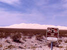
 Signs on Kelbaker Road, leaving Baker. Signs on Kelbaker Road, leaving Baker.
|
Signs on Kelbaker Road, as you are leaving Baker. This picture was taken on a rainy Saturday afternoon. It is 35 miles to Kelso, where there are no services, and 78 miles to the nearest services. | ||||||
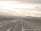 Kelbaker Road near Baker in an El Nino Spring rain. Kelbaker Road near Baker in an El Nino Spring rain.
|
Kelbaker Road near Baker in an El Niño-sponsored spring rain. From Baker, the road climbs 1100 ft up a broad bajada on the northwest slope of Cima Dome into the Cima Volcanic Field. | ||||||
|
Other articles:
|
|||||||
| Junction: Black Tank Wash Road | |||||||
|
Locations: Cima Volcanic Field. |
Cima Volcanic Field | ||||||
|
Other articles:
|
Junction:
| ||||||
|
Other articles:
|
| ||||||
|
Other articles:
|
Junction: Power Line Road | ||||||
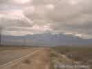 Providence Mountains from Kelbaker Road. Providence Mountains from Kelbaker Road.
|
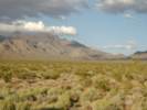
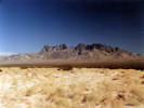
The Providence Mountains as seen from Kelbaker Road where the road begins to descend toward Kelso. The Providence Mountains are very rugged on the northwest face shown here, and easier to visit from the southeast side. The Mid Hills are the northeast extension of the Providence Mountains ridge line as seen at left. | ||||||
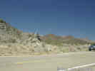 Outcrop of fossiliferous Paleozoic limestone along Kelbaker Road. Outcrop of fossiliferous Paleozoic limestone along Kelbaker Road.
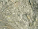 Close-up of fossiliferous limestone on Kelbaker Road. Close-up of fossiliferous limestone on Kelbaker Road.
|
|||||||
|
Locations:
Kelso Dunes.
|
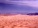
Kelso Dunes as seen from Kelbaker Road north of Kelso. | ||||||
|
Other articles:
Locations:
Kelso.
|
KelsoJunctions: Kelso Cima Road | ||||||
|
Other articles:
|
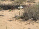
Sand crosses the road, making a preferred habitat for the Desert Lily. | ||||||
| Junctions: Vulcan Mine Road | |||||||
|
Other articles:
Locations:
Vulcan Iron Mine.
|
View of the Vulcan Iron Mine from Kelbaker Road. | ||||||
|
Literature Cited:
Other articles:
Locations: Kelso Dunes. |
Kelso Dunes
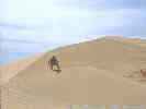
Matt near the top of the Kelso Dunes | ||||||
|
Other articles:
|
Junction: Power Line Road | ||||||
|
Other articles:
|
| ||||||
Jack & Marilyn Sweeney Granite Mountains Desert Research CenterAlso known as: Granite Mountains Reserve. | |||||||
|
Locations: Granite Pass. |
Granite PassThis pass separates the Bristol Basin on the south from the Devils Playground and Soda Lake on the north. | ||||||
|
Other articles:
|
|||||||
|
Other articles:
|
Junction: U. S. Interstate 40, west to Barstow or east to Needles. | ||||||
|
Literature Cited:
Other articles:
|
Omya (California) operates the Amboy Limestone quarry located 6 miles east of Amboy, California, in the southern Bristol Mountains. The Amboy Limestone deposit, a very high purity, high brightness (white) crystalline limestone deposit is of such high purity it is suitable for pharmaceutical and food grade limestone applications, and can be utilized in products for human consumption. The limstone is mined from an extensive dip slope of Mississippian age Monte Cristo Limestone, Bullion Member, up to 300 feet thick, and 1500 feet long. Current mine life is 55 years, plus reclamation phases for a total operation life of 70 years. The current Phase 1 quarry development occurs in an area of about 10 acres. The ultimate quary will cover approximately 50 acres. | ||||||
|
Other articles:
|
Junction: Route 66, or National Old Trails Highway, east to Chambless, west to Amboy. | ||||||
| If you have a question or a comment you may write to me at: tomas@schweich.com I sometimes post interesting questions in my FAQ, but I never disclose your full name or address. |
Date and time this article was prepared: 9/22/2024 4:37:41 PM |