Eastern Mojave Vegetation
Tom Schweich
|
Eastern Mojave Vegetation
| Field Notes (Continued) |
|
Tom Schweich |

Topics in this Article: 1800s 1900s 1910s 1920s 1930s 1940s 1950s 1960s 1970s 1980s 1990 1991 1992 1993 1995 1996 1997 1998 1999 2000 2001 2002 2003 2004 2005 2006 2007 2008 2008 Tour de Swertia albomarginata Mono Lake, August 2008 2009 2010 2011 2012 2013 2014 2015 2016 2017 2018 2019 2020 2021 2022 2023 2024 2025 Contents Literature Cited |
When I first read the field notes of Annie Alexander and Louise Kellogg, I was fascinated by the descriptions they wrote about the places they went and the plants and animals they found there. By publishing my field notes on the Internet I hope to follow a little bit in their tradition. | ||
|
|
2001 | ||
My 2001 Trip To Spain | |||
|
|
Saturday, February 3rdI left Saturday, February 3rd from San Francisco. The flight from San Francisco to New York was uneventful. After a 1-hour layover in New York, I got on the plane for Madrid. | ||
|
|
Sunday, February 4thThe flight from New York landed at 6:30 AM, about a half-hour early. It was still dark. The flight was fairly smooth with only a little turbulence. I slept probably an hour, but no more. Because I was too close to the video screen, light would flash through my closed eyelids, making sleep difficult. Also the full flight was quite noisy with people moving up and down the aisles. | ||
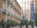
| I had breakfast at Valpan, a local café, then determined to visit the Rastro. This is the Sunday market. "Rastro" means "the stain" after the cow blood that ran down the streets when the cattle were slaughtered. There were handcrafts, manufactured goods, junk, and new things to buy, including several open-air hardware stores. | |||
| Did a little shopping, I looked for a wallet, but I didnt find anything that would hold both airline tickets, and passport. | |||
 Hostal La Naval Hostal La Naval
|
Back up at La Latina Metro station, I had coffee at Jamaica, and then went to get my luggage, trooping the 10 or so blocks to Hostal La Nava. After checking in, I overloaded the elevator. It is quite old, with a closed car, but open grillwork around the elevator shaft. The capacity was 3 people, but when we crammed 4 people and our luggage into it, it refused to move. So I had to walk up 2 more floors to the 3rd floor. | ||
| For lunch I ate at an upstairs restaurant across the street. I had ensalada mixta (green salad) and chuletas de cordero (lamb chops) with French fires. Had a nap. I think I slept about an hour. I walked up to Rachel and Nacho's where they fixed breaded chicken, asparagus, and mushrooms (setas a la plancha) for dinner. We walked back to the hostal. I asked and received a second pillow for the bed. My room had a cama de matrimonio (marriage bed), which is midway in size between a double bed and a queen bed. It's OK for size, but it has only one pillow that is the full width of the bed. I knew I would never make it through the night because I like to wad up the pillow, etc. So I asked for and got a second pillow. The bed felt really good and I crashed. | |||
|
|
Monday, February 5thToday is my first full day in Madrid. I slept in far longer that I would have thought, until 10:30 AM. I thought the hostal was very noisy early in the morning, until I checked my watch. | ||
| I awoke at 3:30 AM wide-awake after a recurring dream of trying to think of a collective verb in Spanish that I could apply to the European locations of a Chiron project. I finally drugged myself back to sleep at about 4:30 AM with some benadryl. | |||
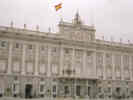 Royal Palace Royal Palace
|
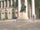
Woke up at 10:22 AM when the maid tried to enter our room. It was probably 11:30 AM when I got to the street. I got some coffee and a croissant. Took the Metro to Opera and walked through the Plaza de Oriente to the Royal Palace. We also saw an archeological dig between the Palace and the Cathedral. Later I learned that they were planning to build a parking garage between the Cathedral and the Royal Palace, but found some ruins immediately upon digging. So now they are doing an archeological dig. I guess that it's that way a lot in Madrid, or probably any old city. | ||
| Had to give up my Swiss Army Knife at the door to the Royal Palace. I had forgotten that it was in my backpack. They X-Ray every purse and backpack at the entrance to the Royal Palace, and the guard said, "Señor, pocket knife?" They checked my passport and kept the knife until I were ready to leave. From the palace I took the Metro back to Sol. Had lunch at a small restaurant called Haiti, right under Tio Pepe. Tried to shop for a bufanda (scarf) at El Corte Ingles, but they were all wool, and very expensive so I didn't buy one. | |||
| Couldn't think of anything else to buy, so I took the Metro to Plaza Manuel Becerra, transferred to the Circular, and rode one more station to Diego de Leon. Exited at Calle Azcona ( remembered that from the previous night), walked to Rachel and Nacho's apartment. Visited with Rachel until Nacho came home from work. I went with Rachel to the market, to buy things for dinner, then had home-made Tortilla Española for dinner. | |||
|
|
Tuesday, February 6thFor Tuesday, I did the Thyssen-Bornemisza Museum. Got up a little earlier, about 9:00 AM, and walked down Calle Alcala to near Goya where I had breakfast at Café Lucky. Took the Metro to Banco de España and walked down Paseo de Prado to the museum. The building looks fairly traditional from the outside, but has been entirely reconstructed from the inside. Three floors of art, starting with the oldest at the top and becoming more recent as you come down stairs. Ate lunch in the cafeteria at the Museum. I had a sandwich, but asked the waitress whether it was OK to eat a sandwich with my hands or with a knife and fork. She said I could do whatever I liked. So, I cut it in half with the knife and fork, and then ate it with my hands. I noticed a Spanish couple at the next table also got sandwiches, and they did the same thing. Although, they were kind of watching me like I was watching them. | ||
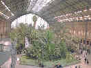 Atocha Railroad Station Atocha Railroad Station
|
After lunch I walked down to the Atocha train station, reserved a car from Hertz with my Hertz #1 club card from work, and bought tickets for Segovia the next day. | ||
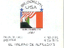 Business Card from Brooklyn USA Restaurant, Madrid Business Card from Brooklyn USA Restaurant, Madrid
|
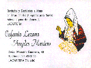
I seem to be pretty good at stretching very little out to a full day's activities. Rode the Metro back to Rachel and Nacho's apartment. For dinner we went to Brooklyn USA. We shared a good salad, and then I had a small pizza for dinner. They also make really good vegetarian lasagna that I had when I visited last November. | ||
|
|
Wednesday Morning, February 7th | ||
| On Wednesday morning, my alarm failed me and I got up too late to make the 8:00 AM train for Segovia. I had set the alarm for 6:00, but it was 6:00 PM instead of 6:00 AM. I got this fancy new travel clock and it didn't occur to me that it could keep track of AM vs. PM for the alarm. So I got up, dawdled a bit and got to Atocha at 9:15 AM, so as to take the 10:00 AM train. | |||
| The tickets I so cleverly bought the day before did not work, so I had to buy new tickets. They were 2900 pesetas, or $16.00. Armed with a second set of tickets, these valid, I got the Cercanias train to Segovia. On the way there were rain and snow flurries in the mountains. | |||
|
Locations:
Segovia.
|
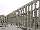
It was very windy and cold in Segovia. From the train station, I took the bus to the city center. We got off the bus at the Aqueduct. It just happened that this is where the tourist office is. So I got a map and started walking up the hill. | ||
|
Locations:
Segovia.
|
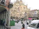
Stopped for café con leche and a croissant, which of course also buys admission to the bathroom, and then pushed on up the hill to Plaza Mayor. Still very windy and cold. | ||
| I detoured through the cathedral to get out of the wind, but it was still very cold inside, and you could hear the wind whistling through the towers of the cathedral. | |||
|
Locations:
Segovia.
|
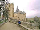
Then I pressed on to the alcazar (fort), which was more interesting. After touring the main floor, I climbed to the tower, 242 steps up a narrow spiral staircase, and took a few pictures. Still very windy. At one point I got down on my hands and knees to avoid being blown off the top of the tower. | ||
|
Locations:
Segovia.
|
So at this point, it was almost 2:00 PM and I had a decision to make about whether to try and catch the 3:00 PM train back to Madrid, or wait for the 5:00 PM train. I got a taxi at Plaza Mayor back to the train station. I hurriedly walked up the street to a bar to see if I cold get something to eat. He had some little slices of bread with ham, a different kind of ham, and some cheese. So I ordered two of each of those and some Cokes. The guy running the bar was very nice. He also went down the bar and cut some slices of tortilla española for us. | ||
| I ate my little snack and then walked down to the train station for the train ride back to the Atocha station in Madrid. After a short rest at Rachel and Nacho's, we went to the SuperMarket with them. | |||
|
|
Thursday. February 8th | ||
| I wanted to see the Museum of Natural Sciences. We took the Metro to Nuevas Ministerios, because that was where the guidebook said to go. It would have been better to go to Rios Rosas I got a bit turned around but eventually found the museum. The museum was mostly zoology represented by stuffed mounted small mammals and birds, and some ecology. There was a separate geology section, where the primary topics were paleontology and mineralogy. There was really no geologic or tectonic history. There was one nice interpretative display about "La Cuenca de Madrid," which was one of three Neogene-age (17 million years ago) closed basins in Spain. | |||
| Took a taxi to Plaza Manuel Becerra. I had lunch in a local restaurant, sitting at the bar. Then I had a nap, and walked up to Rachel and Nacho's for dinner. It turns out that no one was very hungry so it was "Every Man For Himself" for dinner. Then I walked back to the hostal and went to bed. | |||
|
|
Friday February 9thTonight we are in Cuenca. We drove here from Madrid, leaving about 4:30 PM and arriving about 6:30 PM. Our rental car was a Ford Focus station wagon, with a diesel engine and stick shift. It moved right along, with some really good torque in the low RPMs, but like most diesels, it had no horsepower above about 3000 rpm. It was pretty easy getting from Atocha, where we rented the car, to the freeway out of town. Traffic moved right along and I was at about the mid-point of speed at 120 Kph (about 75 mph). When we got to Cuenca, I made a wrong turn or two in the new town, but eventually we found our way to the old town or "casco antiguo." Our car is parked in the area above the old town and we walked back down to our hostal. We are in rooms 41 and 42. The rooms have a low doorway and high ceiling. There is an armoire with a curtain on one side, a window and a radiator on the other. The beds sag in the middle. A toilet and shower, with bidet, are across the hall. We have to share two bathrooms with nine rooms. | ||
| We had dinner in the café of the hostal. Tapas: a salad, a pisto (reminded me of the sauce my mother would make to put over Spanish rice), boquerones (fish), tortilla con queso manchuga, and croquetas. For desert I had a lemon mouse that was very good. The view out the window was of the Parador and the statue of the virgin up on the hill. | |||
| After dinner, Rachel, Nacho, and I walked down to Plaza Mayor. "Ave por Cuenca" signs are everywhere. Then we walked down past Meson Casa Colgadas and across the footbridge to the Parador. | |||
| Otherwise, today we didnt do too much. It took us a long time to get up and get packed this morning. We went to Rachel's and had some banana bread for breakfast. Then Rachel and I went to the Super Market to buy some turkey and cheese for lunch. The good smoked turkey breast was 2475 pts / kg, about $6.50 /lb. The cheaper turkey loaf was about half that. The good Swiss cheese was about $4.00/lb. The local Manchego sheep's milk cheese was about $3.00/lb. | |||
| Rachel made us sandwiches in her sandwich maker and about that time Nacho came home. We got ready and left for Atocha to pick up our car. | |||
|
|
Saturday, February 10thSaturday morning was a little rainy, not heavy rain, just a very fine mist. After breakfast we walked down to the tourist office and got a map. We must have walked down to the bridge again because I have some pictures from there. | ||
| We visited the Museum of Abstract Art. They had a special exhibition of an artist named Sempere. One of his techniques was to paint several layers of color, and then scratch off the top layer of color in a pattern that reveals a picture. The artist did mostly landscapes in this manner. | |||
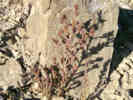
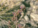
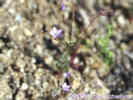
 Scroph growing from wall. Scroph growing from wall.
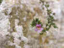 Scroph growing from wall. Scroph growing from wall.
|
From the Museum of Abstract Art, we walked up to a plaza near the Science Museum. Since the museum was about to close, we didnt go in. But, walking around the plaza nearly I found a small scroph (snapdragon family) growing out of a wall, with a single flower. We walked back to the Posada de San Jose where Nacho made a 3:00 PM reservation for dinner at Meson Casas Colgadas. I had a roast shoulder of lamb -- very good -- after ensalada mixta. | ||
|
Locations:
Cuenca.
|
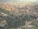
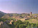
After dinner Rachel, Nacho, and I walked up the hill. We bushwhacked a bit and then found a trail leading to the top. Got a very nice view of Cuenca in the late afternoon sun. Bushwhacked straight down the hill back to town. | ||
|
Locations:
Cuenca.
|
Back in town we toured a couple of the small plazas in town, including this one, the Plaza de San Nicolas, which was very pretty in the twilight. | ||
| Took a little rest again and then had tapas for dinner followed by lemon mousse for desert. | |||
|
|
Sunday, February 11thTonight we are back in Madrid. We left Villalba de la Sierra about 5:30 PM and got to Atocha about 7:30 PM. The Autovia wasn't too bad. The traffic stopped only once or twice on the outskirts of Madrid, but otherwise we came right into town, whipped around the Repsol station and right into the parking lot at Atocha. | ||
| We had lunch in Meson Nelia in Villalba de la Sierra. This was along the Rio Jucar in the valley below Ciudad Encantada. I had Lomas de Cerdo. Was a roast piece of lamb loin, topped with a parsley/garlic/salt covering. It also came with roast garlic, some asparagus, and a seta (grilled mushroom) that was very good. For desert I had "Las Turbas," which was a cookie covered by a layer of aluja, (almonds and honey), a coffee flavored ice cream, and covered by white chocolate. A very nice meal well-worth repeating. | |||
| Before then we tried to eat at Ciudad Encantada, but the waiters were much too harried and not responding well to people attempting to be customers. So we left. | |||
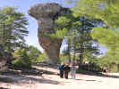 The standard photo at the entrance to La Ciudad Encantada. The standard photo at the entrance to La Ciudad Encantada.
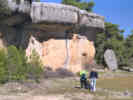 Photograph in La Ciudad Encantada. Photograph in La Ciudad Encantada.
|
The Ciudad Encantada was interesting. There was a layer of resistant limestone on dip slope of 5-6° above a layer of softer rock. All was jointed in approximately the dip slope direction and eroded into interesting shapes. The top surface of the limestone was pitted and many of the small pools of water held algae with bryophytes around the edges. Lots of lichens also. I looked carefully at several locations but did not see any hornworts or liverworts. | ||
| We got to Ciudad Encantada by going north from Cuenca over progressively smaller roads until we reached the road between Uña and Nacimiento de Jucar. Uña was very pretty, lit by the sun, but I couldn't find a good place to stop for a photograph. | |||
|
Locations:
Cuenca.
|
This morning we had breakfast in Posada de San Jose and walked around a bit. One place we visited again was the bridge across to the Parador for a nice sunny view of the hanging houses. | ||
| Tomorrow we are going to Almaden. | |||
|
|
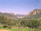
Monday, February 12, 2001Today I drove to Almaden. Unlike the highway to Valencia, the highway south to Cordoba, also know as N IV, had very heavy traffic and is lined with industry nearly all the way to Aranjuez. I drove south about 1½ hour, turning off of N IV at Puerto Lapice. We got gas, diesel really, just down the road. It cost 3800 pts for 35.53 liters having gone 555.9 kilometers. Translated to English measurements, we got 36.8 miles per gallon, and paid $2.25 per gallon for diesel. | ||
| I almost missed a turn in Ciudad Real, but after going around the circle a couple of times, I found the right direction. From Ciudad Real, the road headed into the hills. I thought about getting lunch in Luciana near the Guadiana River, but it was only 1:30 PM. I got a small snack from our food supply and then continued on the highway to Teja Chueca, where I crossed the river heading southwest on CM 415. | |||
|
Locations:
Almaden.
|
I arrived at Almaden before 3:00 PM, driving from Madrid in 4½ hours. We had lunch at the Alcor Hotel which is just outside of town. Then I tried to get a room at Hotel El Cordobes, but they were full. Went back to Hotel Alcor, which had many rooms available. | ||
|
Locations:
Almaden.
|
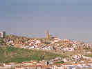
First I drove up to the "casco antiguo", literally "ancient crown," which means the old, high part of the town. At the very top is a church -- closed. I walked down around the mine and took some pictures. Then I saw the old castle and went up there. Both the old church and castle had storks nesting on top. | ||
|
Locations:
Almaden.
|
I could see a park across the valley to the west, so I drove over there to get a good view of the town in the strong afternoon light. | ||
|
Locations:
Almaden.
|
Then I drove to the polytechnic university and asked to see the museum. They got a student to show me in the museum. He was eager to help, but spoke no English. Still haven't verified that "cuarcitas" is chert. | ||
My route Monday to Almaden from Madrid was:
| |||
|
|
Tuesday, February 13thOn Tuesday morning I had breakfast at Hotel Alcor. Nothing special. The guy who served lunch on Monday afternoon, also served breakfast on Tuesday morning, and took my money when I paid the hotel bill. | ||
| I drove to the Super Market in a crowd of parents taking their children to school. Bought some snacks making a few mistakes. Apparently I should have known that yogurt was sold in packs of four even though packaged in twos. Also I should have gotten the produce lady to weigh and label our 2 oranges and each of the two different kinds of apples we had selected. The register clerk was pretty nice though, and took care of my little stupid mistakes. Then I drove to the old city center. Got out to look at the storks, etc. | |||
|
Locations:
Almaden.
|
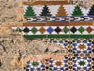
I also noticed an old house across the street with a little but of the original tile showing. I took a picture of the tile. | ||
| Finally I drove to the Mineral Museum that was still closed, then, out of town to the north looking for places to stop and buy stuff. | |||
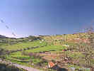
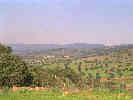 Countryside between Almaden and Guadalupe. Countryside between Almaden and Guadalupe.
|
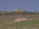
The road to Siruela from Chillon was quite pretty. Went through a small pass and the followed a valley with several very large ranches. The road passed into the province of Extremadura from Castilla - La Mancha. The road climbed over another pass and then dropped down the slope into Siruella. As we approached Siruella we saw two men with donkeys loaded up with burden baskets. | ||
 Embalse de Garcia de Sola Embalse de Garcia de Sola
|
The road to Embalse de Garcia de Sola from Talarrubias was little used but very nice. The narrow rock canyon that was dammed up was visible from quite a distance. Below the dam was a very neat little town that looked like a combination of dam worker's residences and vacation homes. | ||
| To the west of Talarrubias was another town with a huge castle on the hill. Unfortunately, an industry in the town was putting out so much smoke or water vapor that the valley was very hazy, and we didnt take a picture. | |||
My route Tuesday from Almaden to Oropesa was:
| |||
| The road from Embalse de Garcia de Sola to Valdecaballeros was scenic and a major road. The road northwest from there, though, was very small; only slightly more than one lane wide with a white stripe down each side. Back on a major highway, EX 116, we climbed up a long ridge, and through a pass before dropping down in to a valley below Guadalupe. | |||
| Guadalupe itself is on the side of a hill. I drove into town and parked. I was just a block away from the Plaza Mayor and the Cathedral. I had lunch outside in the plaza, walked around a bit, and then decided to drive on to Oropesa. | |||
| The road first traversed the side of a mountain and the dropped down through a canyon before climbing to Puerto de San Vincente. From there the road dropped down a gentle slope into the valley of the Rio Tajo. | |||
| I got to Oropesa about 5:00 PM. After a few false starts, I found my way to the Parador of Oropesa, which fortunately had a room. I think me and a busload of Japanese tourists were the only guests. | |||
|
|
Wednesday February 14thThis morning I had breakfast at the Parador. I checked out, and headed south to El Puente de Arzobispo to buy pottery. I found one pretty nice place and bought some pottery. | ||
|
Locations:
Lagartera.
|
Then I tried to get to Lagartera. Missed a road somewhere and ended up driving the long way around. Finally got there, found a shop and did some shopping. Bought many pieces of beautiful hand embroidery. | ||
| I now drove to Talavera looking for pottery. Found one shop and bought some. | |||
| Then I started looking for a place for lunch. Found one on the northeast end of town. While I was eating, an episode of "The Simpsons" came on the television. It was an episode where Homer becomes impotent, and all the hijinks that ensue. Undoubtedly, the best American culture has to offer Spain. | |||
| I drove from Talavera to Madrid, along my carefully planned route to minimize the amount of city street driving I did, turning in our car at about 4:30 PM. | |||
|
|
Thursday, February 15thToday I shopped. After breakfast at Jamaica, I took the Metro to Sol and walked up to Gran Via. There I bought some Lladro for a neighbor. Walked down to Plaza de España and took a picture of the statue of Miguel Cervantes with Don Quixote and Sancho. Walked back up Gran Via against a cold brisk wind. | ||
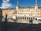 Plaza Mayor. Plaza Mayor.
|
Had café con leche and a croissant at Rodillo, then moved on to buy a car at a toy store. At El Corte Ingles, I tried and failed to find some sewing stuff for Rachel. Back down on Sol I went into a knitting crafts store looking for the seam gauge, but were directed to a merceria. After much pantomime and a little bit of Spanish, I bought a seam gauge. It was a little different from what we call a seam gauge here in the States. Left there and found another merceria at the next corner. Here I bought a seam ripper, a pincushion and some thread. There were maybe four mercerias in this one little area a block from Sol; the only mercerias I ever saw. From there I took a spin around the Plaza Mayor to buy Rachel and Nacho a good kitchen knife. | ||
| Thinking about a birthday cake I walked down Calle Mayor looking in bakery windows, down to La Plaza de la Villa, then up past Plaza del Oriente past the Opera House to the Opera Metro station. Came back to the hotel to rest a few minutes and then to Rachel's. Went to the Serrano Metro station to buy Rachel some shoes for her birthday. Had dinner at the special Paella restaurant. Shared the Paella de la Casa, mostly seafood, i.e., prawns, shrimp, and a few other unidentified parts, but no tentacles, and a vegetarian paella. | |||
| I checked into the hostal, and then walked up to Rachel and Nacho's apartment. We wanted to fix chicken with rosemary and garlic for dinner. Having bought the chicken at the market, we ended up in an herb store to buy the rosemary. In Spanish, it's called "romero." After dinner, I traipsed back down to the hostal with my suitcase in tow. | |||
|
|
Friday, February 16thToday I went to the Museo de Geominero. At C/ Rios Rosas 23, it was in a restored building. I had to show my passport and sign in. The room was open to a glass ceiling. The ground floor had fossils arranged by age with a mineral display around the walls. Then there were 3 mezzanines, around the walls. The first mezzanine had collections over the industry with a few additional cases relating to human and dinosaur evolution. The second mezzanine had displays of minerals from each province. The entrance hallways were lined with fossils arranged taxonomically. There was, however, no interpretation of the fossils or minerals. | ||
| Headed back to the museum of natural sciences. Paid for both exhibits and walked through the same as before. A little bit of interpretative ecology, and a lot of mounted birds and animals. Went through the volcanoes exhibit and then found some other parts. One was an exhibit of photographs taken in 13 national parks around the world by a variety of different photographers. | |||
| We all met at Moncloa, and then went to a falafel place for lunch. Very good, just like we are used to, here in the Bay Area. | |||
| In the afternoon, I organized my stuff a bit for packing Saturday morning. | |||
 El Estragon -- an excellent vegetarian restaurant near Opera in Madrid. El Estragon -- an excellent vegetarian restaurant near Opera in Madrid.
|
For dinner we met more extended family at a vegetarian restaurant. I had something like a garnish plate with carrot, celery, cauliflower, etc., with three kinds of dressing. Then I had Canelone a la Rosinni, which was canelone with two cheeses and a tomato sauce. | ||
|
|
Saturday, February 17thDrove us to the airport. After checking in, we had breakfast. Then said good-bye as only ticketed passengers can enter the secure area of the airport. The flight took off on time from Madrid, arriving in New York a few minutes late. The Delta customs facility was fairly efficient, getting through Passport Control, getting our baggage, passing customs and rechecking our luggage and getting back up to our next flight in about 50 minutes. I wasn't the last passenger on our flight to San Francisco, but pretty close. I think we left New York about 15 minutes late. We arrived into San Francisco about thirty minutes late, which was not too bad given that it was raining at the time. | ||
|
Locations: Zzyzx. |
April 20, 2001April 20-23, 2001 was the Desert Research Symposium and Field Trip, held at the Soda Springs Desert Studies Center at Zzyzx. | ||
| I left the Chiron offices at about 11:30 AM after a couple of meetings, making it to Westly before being forced by hunger into McDonalds for some Scotch food. It was raining hard there, and the rain continued off and on until about Panoche Creek. I stopped for groceries at the Albertson's in Bakersfield, and pressed on, arriving at Zzyzx about 8:00 PM. | |||
| I gave my talk about "The eastern Mojave plant collections of Annie Alexander and Louise Kellogg" in the morning. | |||
|
|
April 21, 2001 | ||
|
Other articles:
Locations:
Kokoweef Peak.
Mescal Range.
|
Saturday afternoon we took an abbreviated field trip to the Dinosaur Trackway in the Mescal Range. These tracks are in the Jurassic Aztec Sandstone, and seem to be the only dinosaur tracks in California. There are several different species represented here, both bipeds and quadripeds. Casts of dinosaur tracks are available from the San Bernardino County Museum. | ||
|
Locations:
Mescal Range.
|
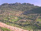
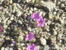
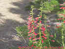
268 | Menodora spinescens, on the south side of the Mescal Range, near dinosaur trackway, with Yucca brevifolia, Thamnosma montana, Coleogyne ramosissima, Sphaeralcea ambigua, Ferocactus cylindraceus, seen only on volcanics below the sandstone, not seen on the sandstone. Agave utahensis is found on the sandstone. | |
|
Locations: Mountain Pass. |
April 22, 2001 | ||
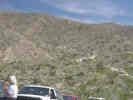
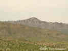
| Yesterday, we left Soda Springs and drove to Mountain Pass. After reforming the group, we drove south around the Mescal Range several miles in, we turned right, to the north, went up a hill and parked at the wrecked car and collapsed cabin. | |||
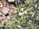
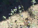
| Walked up to dinosaur trackway. Saw several Menodora spinescens in bloom. Also Verbena gooddingii and Apricot Mallow just beginning. A few Joshua trees were beginning to bloom. Saw a couple of small crucifers, and a small phacelia. | |||
| Saturday morning we had a bit of rain, maybe a millimeter, and Saturday was cool with lots of big puffy clouds. | |||
| Sunday morning, today, is a bright cloudless still morning, with a bit of haze at ground level. | |||
|
Locations: Radar Ridge. |
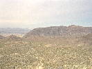
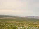
Field trip stop at Radar Ridge, the microwave site. Here is a plant looking a lot like Gilia tricolor, an unknown Brassica, a Pectocarya, Yucca brevifolia (jaegeriana), and Yucca mohavensis. | ||
|
Other articles:
Locations:
Rocky Ridge.
|
| ||
|
Literature Cited:
Other articles:
Locations: Jackass Canyon. Old Dad Mountain. |
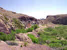
We drove further down Jackass Canyon and stopped just short of the railroad tie fence. The geologists had come here to see the Monte Cristo Limestone of Old Dad Mountain sitting on reddish granitic rocks. The granitic rocks have leisingang weathering rings indicating they were deeply weathered. The contact between the limestone and granite has been mapped as a thrust fault. We were here to review the possibility that Old Dad Mountain is a gravity slide block from the Soda or the Avawatz Mountains area (Reynolds, 2001). While at this field trip stop, I found Malvastrum oops, Eremalche rotundifolia, a small poppy, and Mirabilis bigelovii [= M. laevis var. villosa] TAS 19-Feb-05. | ||
|
Other articles:
|
Stopped several times along Kelbaker Road. Found one Desert Lily growing alongside the road about 3 miles southeast of Baker. | ||
|
Other articles:
Locations: Halloran Springs. |
Lunch at Halloran Spring, Loeseliastrum matthewsii, Larrrea tridentata, Ambrosia dumosa, Grayia spinosa, Krameria erecta, Mentzelia undetermined, Yucca schidigera, Opuntia basilaris, a Chicory, Isomeris arborea, Nama undetermined (Purple Mat). | ||
|
Other articles:
|
269 |
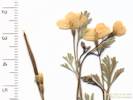
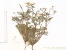
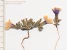
Eschscholzia minutiflora S. Watson. Small-Flowered California Poppy. Halloran Hills, San Bernardino County, California. Halloran Hills, just southwest of Halloran Springs Road, 2 miles north of U. S. Interstate 15, accessed from Halloran Springs Exit. 35.3949°N, 115.9174°W. WGS 1984. Elev. 1589 m. Coll. No. 269, 22 April 2001, characters observed: Annual, to 20 cm.; Leaves, basal and cauline, basal, 70-80 mm., some leaf segments widen to tip, tip obtuse, not notched, petiole, small glands, not hairs; Peduncle, 60-70 mm., < basal leaves; Flower bud, glabrous, ±nodding; Receptacle, 3.2 mm. × 1.7 mm. wide, tapered at base, parallel sides distally (leads away from E. minutiflora in TJM2 key); Petals, 6 mm. × 5 mm. wide, near round, yellow; Seed, 1 mm., oblong, dark brown, net-ridged. | |
| Eremalche rotundifolia on the power line road, 11S 0589872 3921866 726 m. | |||
| Back to Highway 127, then north to Silurian Lake, across it, and then up into the Silurian Hills. First "islands" are slide blocks on granitic surface. Sand blows up and ponds in eddies. Saw Abronia villosa in fine-grained sediments ponded above the T&T roadbed. | |||
| Followed T&T roadbed to Valjean, saw ponded sediments. Found Desert lily on stable sandy surface, not in anastomosing watercourses. | |||
| Had dinner in Shoshone, slept at Castles of Clay. | |||
|
|
April 23, 2001 -- Shoshone to Mid Hills | ||
| After a fine breakfast we received a fine talk from Bennie Troxel giving an overview of the rock units in the Death Valley, using a display he is putting together for the Shoshone Museum. | |||
| Greg Wilkerson told us about the Franklin Wells Hectorite deposit. | |||
| We walked up to the Shoshone Zoo. | |||
|
Locations:
Amargosa River.
|
At the Amargosa Natural Area, we saw the "Hanging Gardens." | ||
|
Locations:
China Ranch.
|
Janet and I went to China Ranch for a Date Shake. | ||
| I drove Janet to Zzyzx, and then left for Mid Hills. | |||
|
|
April 24, 2001 - Mid Hills | ||
|
Other articles:
|
At the Wild Horse Mesa plot, 32 plants remain in the plots. There are no new rosettes since last fall. Of the 32 plants, 3 were budding and will attempt to bloom, Also, of the 32 plants, seven are dead, or possible dead. One additional plant was observed to be possibly dead this trip. The Blackbrush (Coleogyne ramosissima) has already bloomed, and a few have set seed. Some Antelope Bitterbrush (Purshia glandulosa) is beginning to bloom, but others have not developed buds yet. Many of the Senecio are beginning to bloom. Some Cryptantha is blooming, but not as much as previous years. Arenaria is growing vigourously, but not blooming. | ||
|
Other articles:
|
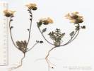
270 |
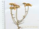
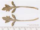
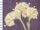
Crucifer on Winkler Formation below Frasera albomarginata plot.
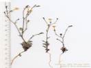
Boechera perennans (S. Watson) W. A. Weber. Perennial Rockcress. Wild Horse Mesa, San Bernardino County, California. North face of Wild Horse Mesa, on Winkler Formation below Swertia albomarginata experimental plot, 5.49 km west of the current (2015) Hole-in-the-Wall Visitor Center, 12.67 KM north northeast of Mitchell Caverns. 35.0476°N, 115.4583°W. WGS 1984. Elev. 1539 m. Coll. No. 270, 24 Apr 2001, characters observed: Perennial herb, to 60 cm., not scapose; Stem, proximal, hairy, nearly all stalked much-branched hairs; Leaves, mostly cauline, 31 mm. × 4 mm. wide, sessile, base sagittate, hairs branched, 5-6 branches, tree-like (stalked, stellate); Inflorescence, not 1-sided; Bracts, 0; Sepals, hairy; Petals, 9 mm. × 2.3 mm. wide, purple-tipped; Fruit, a silique, linear, 44 mm. × 1.9 mm. wide, length 23× width, ascending to horizontal to descending, glabrous, pedicel, glabrous, base straight to ascending. | |
| Following plant collected on an east facing slope of Precambrian gneiss and schist with Pinus monophylla, Juniperus osteosperma, and Coleogyne ramosissima; 11S 0640750 3879791 1493 m. | |||
|
Other articles:
|
271 |
Amsinckia tessellata A. Gray var. tessellata. Bristly Fiddleneck.
Wild Horse Mesa, San Bernardino County, California. Lower slopes of north face of Wild Horse Mesa, about 1.1 miles by road and trail west of Wild Horse Canyon Road, and 8.2 miles north northeast of Mitchell Caverns. 37.051°N, 115.4567°W. WGS 1984. Elev. 1493 m. East facing slope on Precambrian gneiss and schist with Pinus monophylla, Juniperus osteosperma, and Coleogyne ramosissima. Coll. No. 271, 24 April 2001, characters observed: Annual, tap-rooted, to 25 cm., green, non-parasitic, inland; Stem, erect, straight hairy; Leaf, alternate, 50 mm. × 6 mm. wide, somewhat reduced above, entire, bulbous hairy, not glaucus; Inflorescence, coiled, spike-like cyme; Calyx, 3 lobes separate + 2 lobes fused = 4 lobes, notched at tip; Receptacle conic; Corolla, yellow/orange, ±tubular, 8 mm. × limb 1.5 mm.; Ovary, deeply lobed, style base hidden within lobes; Nutlets, erect, 3 mm., scar lateral, flat, without thick rim, margin prickles 0. | |
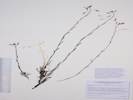
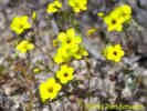
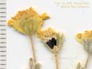
| 272 | White or very light yellow, 5 petals. Gilia ophthalmoides Brand | ||
 Tiny Gilia found at Wild Horse Mesa. Tiny Gilia found at Wild Horse Mesa.
|
273 | Gilia | |
|
Other articles:
|
273.1 |
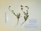
Phacelia fremontii Torr. Fremont's Phacelia.
Wild Horse Mesa, San Bernardino County, California. Lower slopes of north face of Wild Horse Mesa, about 1.1 miles by road and trail west of Wild Horse Canyon Road, and 8.2 miles north northeast of Mitchell Caverns. 35.051°N, 115.4567°W. WGS 1984. East facing slope on Precambrian gneiss and schist with Pinus monophylla, Juniperus osteosperma, and Coleogyne ramosissima. Coll. No. 273.1, 24 Apr 2001, characters observed: Annual, tap-rooted, to 12 cm., green; Stem, branched at base; Leaves, mostly basal, few cauline, alternate, deeply lobed; Inflorescence coiled; Calyx, sinus appendages 0; Sepals 5, none cordate; Flowers open, bisexual; Perianth in 2 or more whorls, parts 5; Corolla radial, deciduous in fruit; Petals fused 9 mm. + free 2 mm. = 11 mm., lobes blue; Stamens, #=corolla lobes, inserted, alternate, 5 mm.; Filaments, free, glabrous; Ovary superior, entire, hairy distally; Pistil 1; Style 1, 3 mm., hairy proximally; Stigma, 2-lobed; Seeds, # unknown (s/b 10-18), surface unknown (s/b furrowed). | |
|
Other articles:
|
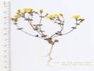
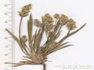
274 |
Layia glandulosa (Hook.) Hook. & Arn. White Daisy Tidy Tips. Wild Horse Mesa, San Bernardino County, California. 3.4 miles west northwest of Hole-in-the-Wall, 8 miles north northeast of Mitchell Caverns. 35.051°N, 115.4567°W. WGS 1984. Elev. 1493 m. Annual composite with white ray flowers, and yellow disk flowers. East facing slope on Precambrian gneiss and schist with Pinus monophylla, Juniperus osteosperma, and Coleogyne ramosissima. Coll. No. 274, 24 Apr 2001, characters observed: Annual, tap-rooted, to 15 cm.; Stem, leaves, and phyllaries with round black stalked glands and white hairs; Inflorescence, some flowers of head have ligulate flowers, head composed of 2 kinds of flowers, head radiate; Phyllaries in 1 series, each subtending a ray flower, margins folded, enclosing a ray flower; Receptacle, paleate, flat; Ray flowers, #8, white; Disk flowers, #±20; Pappus awl-shaped and fine bristles; Fruit, mature ray compressed front to back, adaxial face covered by papery phyllary margins. | |
 Coll. No. 275, Cryptantha pterocarya var. pterocarya Coll. No. 275, Cryptantha pterocarya var. pterocarya
 Coll. No. 275, Cryptantha pterocarya var. pterocarya Coll. No. 275, Cryptantha pterocarya var. pterocarya
|
Cryptantha pterocarya (Torr.) Greene Wingnut Cryptantha. Wild Horse Mesa, San Bernardino County, California. North face of Wild Horse Mesa, near an old quarry road, 3.3 miles by air west northwest of Hole-in-the-Wall. 35.051°N, 115.4567°W. WGS 1984. Elev. 1493 m. East facing slope on Precambrian gneiss and schist with Pinus monophylla, Juniperus osteosperma, and Coleogyne ramosissima. | ||
| Drove into Lobo Point for lunch and to see what was in bloom. | |||
|
Other articles:
|
276 |
Leptosiphon aureus (Nutt.) Benth. ex E. Vilm. ssp. aureus.
Lobo Point, San Bernardino County, California. In a small valley 1.5 miles west northwest of Hole-in-the-Wall. 35.0513°N, 115.4231°W. WGS 1984. Elev. 1383 m. Coll. No. 276, 24 Apr 2001, characters observed: Annual, to 10 cm.; Leaves, opposite, palmate compound; Flowers in small clusters; Pedicels, 6 mm.; Calyx, 5 mm., lobes 5, ±equal, 4 mm., membrane width ±equal lobe width; Corolla, mostly yellow, tube 2 mm. + purple/yellow throat 3 mm. + yellow lobes 6 mm. = 11 mm., no hairy ring; Filaments glabrous. | |
|
Literature Cited:
Other articles:
|
277 |
Plagiobothrys arizonicus (A. Gray) A. Gray. Arizona Popcornflower.
Lobo Point, San Bernardino County, California. Alluvial terrace west of informal camp site, 1.5 miles west northwest of Hole-in-the-Wall. 35.0513°N, 115.4231°W. Elev. 1383 m. | |
|
Other articles:
|
278 |
Eriophyllum wallaceii (A. Gray) A. Gray. Woolly easterbonnets.
Lobo Point, San Bernardino County, California. Alluvial flats and washes, 1½ miles west northwest of Hole-in-the-Wall, and 9 miles north northeast of Mitchell Caverns. 35.0513°N, 115.4231°W. WGS 1984. Elev. 1383 m. Coll. No. 278, 24 Apr 2001, characters observed: Annual, to 3 cm., cobwebby, not gland-dotted; Leaves, basal and cauline, alternate, to 9 mm., obovate, entire; Peduncle, 8-15 mm.; Inflorescence, composed of two kinds of flowers, some with strap-shaped corollas; Phyllaries, in 1-series, (ஃequal); Receptacle, epaleate, conical, slightly pitted; Ray flowers, 5 mm., yellow, corolla not papery, deciduous; Anther tip awl-like; Pappus of well-developed scales, 0.5 mm., on both ray and disk flowers; Fruit, 2 mm., black, some appressed hairy. | |
| 279 | Prunus fasciculata | ||
|
Other articles:
|
280 | Phacelia 11S 0643447 3879841 1457 m. | |
|
Other articles:
|
281 |
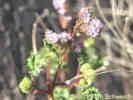
Plantago patagonica, on the landslide below the Phacelia.
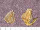
Plantago patagonica Jacq. Woolly Plantain. Lobo Point, San Bernardino County, California. Near the top of the landslide on the east side of Lobo Point, 1.7 miles west northwest of Hole-in-the-Wall, and 9 miles north northeast of Mitchell Caverns. 35.0511°N, 115.4271°W. WGS 1984. Elev. 1457 m. Coll. No. 281, 24 April 2001, characters observed: Annual, herb, to 10 cm., drying light green; Leaves, basal rosette, 55 mm. × 2.5 mm., narrowly oblanceolate, entire; Peduncle, 55 mm., not grooved, hairs ascending (not spreading), diameter >> than leaf hairs, Inflorescence, scapose, 10-12, in single terminal spikes, axis not visible between flowers; Bract, linear, 1-2 × calyx, exserted; Flower, bisexual, Corolla, lobes 1.8 mm., 1 erect, 3 spreading, tube glabrous (should be hairy); Stamens, 4, inserted; Style 1.2 mm.; Fruit, 2.5 mm Seeds 2, 1.4 mm., inner side deep concave (much easier to dissect fruit and examine seeds when dry, rather than when wetted with Pohl's solution). | |
| At the Pinto Mountain plot, I am following ten plants total. Two of the ten plants are most likely dead. Three are beginning their second year of growth. Two other plants are among the original group growing in the plot when it was established. Standing inside my plot, and looking outside, I can see five Frasera albomarginata that are budding. | |||
|
Other articles:
|
282 |
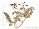
Astragalus undetermined from Pinto Mountain experimental plot.
Astragalus cimae M. E. Jones var. cimae. Cima milkvetch. Pinto Mountain, San Bernardino County, California. Experimental plots in Frasera albomarginata, southwest slopes of Pinto Mountain, in Winkler Formation, a lacustrine limestone. 35.1755°N, 115.3867°W. WHS 1984. Elev. 1668 m. | |
|
Other articles:
|
283 |
Gilia ophthalmoides Brand. Pinyon Gilia.
Pinto Mountain, San Bernardino County, California. South side of Pinto Mountain, north of Cedar Canyon Road, and the abandoned telephone cable road. 35.1701°N, 115.3869°W. WGS 1984. Elev. 1587 m. Coll. No. 283, 24 April 2001, characters observed: Annual, to 10 cm.; Leaves, mostly basal, much reduced above, basal deeply pinnately lobed, cobwebby hairs, lobes bristle-tipped, cauline alternate, not clasping or expanded at base; Pedicel slightly glandular, adjacent pedicels unequal; Calyx membraneous between lobes, few glands and hairs, lobes not bristle-tipped; Corolla, tube 7 mm. + yellow throat 2 mm. + lobes 3 mm. = 12 mm.; Stamens, slightly exserted, not exceeding lobes; Fruit, ovoid, 4.5 mm. | |
 Coll. No. 283.1, Ipomopsis polycladon Coll. No. 283.1, Ipomopsis polycladon
|
283.1 |
Probably a duplicate of #283, accidently split into two parts.
Ipomopsis polycladon (Torr.) V. E. Grant. Sprawling Skyrocket. Cedar Canyon, San Bernardino County, California. 250 meters south of Cedar Canyon Road, opposite Pinto Mountain, 7.6 miles by Cedar Canyon Road east of Kelso-Cima Road. 35.1656°N, 115.3884°W. WGS 1984 Elev. 1584 m. Coll. No. 283.1, keyed 5 Jan 2013, characters observed: Annual to 7 cm.; Stem branched from base, decumbent to ascending; Leaves basal and cauline, alternate, 20 mm, 1-pinnately lobed, tips sharp pointed, not bristle tipped; Inflorescence crowded at branch tips, flowers sessile or nearly so; Calyx lobes equal, 4 mm., > tube (but not >> tube); Corolla tube 3 mm + lobes 1 mm = 4 mm, funnel-shaped, lobes radial, throat not well developed; Seeds 2 mm., 6, paired in 3 chambers, gelatinous when wet. | |
| Left by way of Macedonia Canyon, saw one tortoise in the lower part of the canyon. | |||
|
Other articles:
|
284 |
Nama, granite sand wash, Macedonia canyon below narrows.
Nama demissum A. Gray var. demissum. Desert Purple Mat. Macedonia Canyon, San Bernardino County, California. In Macedonia Canyon, about 5 miles east of Kelso-Cima Road, and 1.25 miles west of Wild Horse Canyon, both by way of Macedonia Canyon Road. 35.0746°N, 115.4765°W. WGS 1984. Elev. 1381 m. Coll. No. 284, 24 April 2001, characters observed: Annual, sprawling, to 4 cm., green; Leaves, basal and cauline, sessile, oblanceolate, 11 mm. × 1.8 mm. wide; Calyx, lobes 5, equal, not cordate, sinus appendages 0, free from ovary; Corolla, 14 mm., limb 11 mm.; Ovary, entire; Styles, 2. | |
|
|
May 25, 2001 | ||
|
Other articles:
|
Today I drove to Mid Hills from Alameda, stopping for gas and groceries in Bakersfield. Arrived at Mid Hills about 3:00 PM, occupied a campsite, since this was Memorial Day, and then went to Pinto Mountain to check my plot. | ||
|
Other articles:
|
285 |
Eriastrum eremicum (Jeps.) H. Mason var. eremicum. Desert Woollystar.
Pinto Mountain, San Bernardino County, California. Along the old telephone cable road on the south side of Pinto Mountain. 35.1694°N, 115.3872°W. WGS 1984. Elev. 1584 m. . on flats, southside of Pinto Mountain, more common on soils developed from pyroclastics, not on limestone. | |
 Coll. No. 285.1, Eriogonum inflatum Coll. No. 285.1, Eriogonum inflatum
|
285.1 |
Eriogonum inflatum Torr. & Frem. Desert Trumpet. Coll. No. 285.1, 12 Oct 2012, characters observed while keying: Annual or perennial flowering in first year, not glandular; Leaves basal only, round to obovate, to 20 mm, straight hairy both surfaces; Involucre peduncled, smooth, > 1.0 mm.; Flowers yellow, 1.5 mm., hairy. | |
| At the Pinto Mountain plot, there were no births and no deaths. Six plants could be seen in bloom above the plot. Arennaria macradenia in bloom. Looks relatively green up here. | |||
|
|
May 26, 2001 -- Wild Horse Mesa and Lobo Point | ||
 Fragrant Snowberry at Lobo Point. Fragrant Snowberry at Lobo Point.
|
286 | Symphoricarpos longiflorus, one location near Lobo Point, north-facing, steep rocky slope that comes down to wash; inferior ovary, sweet smelling, style hairy on upper half, stigma inserted, stamens 5 alternate. | |
| Tetradymia not blooming yet. Same true in lower reaches of Macedonia Canyon. | |||
| 287 | Menodora scoparia, on rocky dry exposed flats, uncommon, leaves ± opposite, yellow flowers on ascending branches, ovary superior, 2 chambers in ovary, 2 stamens. | ||
| 288 | Frasera albomarginata, north face of Wild Horse Mesa. | ||
|
Other articles:
|
289 |
Unknown composite, thread-like leaves.
Hymenoxys cooperi (A. Gray) Cockerell. Cooper's Rubberweed. Wild Horse Mesa, San Bernardino County, California. Mid-slope on the north slopes of Wild Horse Mesa, 3.4 miles west northwest of Hole-in-the-Wall, and 8.2 miles north northeast of Mitchell Caverns. 35.0485°N, 115.458°W. WGS 1984. Elev. 1514 m. Thread-like leaves. Coll. No. 289, 26 May 2001, characters observed: Annual, tap-rooted, to 40 cm.; Leaves, basal and cauline, alternate, dissected into linear lobes, glandular punctate; Inflorescence, composed of 2 kinds of flowers; Phyllaries, in 2 equal series (appearing as though outer < inner), outer basally fused, without large glands; Receptacle epaleate; Pappus of well-developed scales on ray and disk flowers. | |
| 290 | Penstemon eatonii, on disturbed soil (former road) on Winkler Formation. | ||
|
Other articles:
|
291 |
Baileya multiradiata or pleniradiata, at the campsite on the road to Winkler's Cabin. Common.
Baileya multiradiata Harv. & A. Gray ex Torr. Desert Marigold. Wild Horse Mesa, San Bernardino County, California. Lower slopes of the north face of Wild Horse Mesa, 3.3 miles west northwest of Hole-in-the-Wall, and 8.3 miles north northeast of Mitchell Caverns. 35.0536°N, 115.4553°W. WGS 1984. Elev. 1446 m. Coll. No. 291, 26 May 2001, characters observed: Perennial, to 50 cm., gray tomentose; Leaves, alternate, petiole 40 mm. + blade 25 mm., ovate, pinnate-lobed; Inflorescence, composed of 2 kinds of flowers, Head, hemispheric, radiate; Phyllaries, in 2 series, ±equal, erect, overlapping, long spreading hairs; Receptacle epaleate; Ray, #32+, corolla, 13 mm., yellow, prominently 3-lobed, persistent when dry, papery, reflexed; Pappus, 0; Fruit, achene, ±smooth (minutely papillate on ribs). | |
| Also observed Langloisia setosissima at Lobo Point and north face of Wild Horse Mesa. | |||
|
|
May 27, 2001 -- Mid Hills to Atascadero | ||
|
Other articles:
|
Drove today down Macedonia Canyon, where I saw and photographed a nice specimen of Penstemon eatonii in bloom. | ||
| From Kelso I drove to the power line. Turned right (east) on the power line road. A bit of a rough ride in spots, until I turned right down an road not shown on the AAA San Bernardino County map to Marl Spring. | |||
|
Locations:
Marl Spring.
|
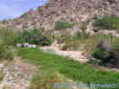
At Marl Spring, I found several locations with water, until I found the main spring at the corral. | ||
|
Other articles:
Locations:
Kelso Mountains.
|
| ||
| I drove down the switchbacks to view the Dudleya saxosa ssp. aloides. Driving back up the canyon, I returned to Kelbaker Road and then to Baker. | |||
|
Other articles:
|
Stopped briefly at Kramer Station to take photographs for the Annie Alexander web site. | ||
| Raced a train to the Tehachapi Loop, but lost the race, it got down the loop before I could get there. It surprised me how many people seemed to be camping at the loop, mostly in RVs. | |||
| Took this photograph in the Buttonwillow highway junction. | |||
| Cotton is King in the southern San Joaquin Valley. | |||
| The best photograph in Buttonwillow needs to be taken earlier in the day, so I only got this one. | |||
| McKittrick owes its sole existence to oil. | |||
| Oil well west of McKittrick. | |||
| View of the southern San Joaquin Valley from CA Highway 58. | |||
| The summit of Highway 58 looks to be an uplifted landscape. | |||
| The highway descent into California Valley. | |||
| The San Andreas fault passes through the hummocky terrain in the middleground. | |||
| California Valley | |||
| Shell Creek is one of many creeks that cross CA Highway 58. | |||
| Santa Margarita is the end of CA Highway 58, at its junction with US highway 101. The best photographs of Santa Margarita will be in the morning. I took this photo in the late afternoon. | |||
|
|
Saturday, September 15, 2001I left early Saturday morning and got to Mojave for lunch of Scotch food. Pressed on to Baker, stopping for gas, and to tell the NPS I was in the park. Set up my tent at Mid Hills. | ||
|
Other articles:
|
Drove to Pinto Mountain to check my plot there. No signs of burros, eagles, or rattlesnakes. In my plot only three of ten remaining plants have leaves showing. Those leaves that do show are dark grey-green. It must have been a dry summer. One of the plants was stepped on. The hoof print looks to be burro-sized. Too small for a cow. Too large for deer. | ||
|
Other articles:
Locations:
Pinto Mountain.
|
292 |
| |
| I return to camp, and armed with the Jepson Manual and Sierra Nevada Pale Ale, I determine the mystery plant to be Cordylanthus parviflorus. Had a small dinner, and retired to my tent with a good mystery novel. | |||
|
|
Sunday, September 16, 2001Sunday morning dawned beautiful, bright and warm. I need my sweatshirt on, just until the sun comes over the ridge at Mid Hills. | ||
| Decide to tackle the Salvia dorrii at Lobo Point first. This is at minimum two hours of work. While I had no unusual findings, in general, the leaves are small, and some of the weaker plants are completely dried up. Only next springs observation will tell how many are dead, and how many still live. | |||
| Drive into Lobo Point and check things out. Then over to North Wild Horse Mesa. There is a Honda Accord parked at the trailhead. Someone is pretty brave to drive it into here. Walking up to my experimental plot, I hear voices and spot two people on the hill west of Winklers Cabin. It's quite unusual to spot someone in the back country. | |||
| At North Wild Horse Mesa, three plants have successfully set good amounts of seed. They have died now, and the numbers of live plants will be lower in the Spring, unless some new rosettes appear. Of the other plants, fourteen are clearly still alive, but the remaining fourteen are dormant and maybe dead. | |||
| There are many Cordylanthus parviflorus on the Winkler Formation at North Wild Horse Mesa. I'm beginning to suspect that the plant should be identified as a limestone endemic. | |||
| I walk down to the trailhead and have lunch. There is not much in bloom now, and if I drive home tonight, I can start working in the front yard tomorrow, as I have a week of vacation planned. Unfortunately, it is also Sunday afternoon, and anyone getting on I-15 at Baker would have to be nuts. Stop and go traffic climbing the hill west out of Baker is too bizarre for words. After packing up my tent, I head down Macedonia Canyon, then south through Granite Pass to Interstate 40. At Barstow, I drive though town, and out Old Highway 58. On the way, I hear on the radio that there is an accident at the intersection of I-15 and CA-58. | |||
|
[Previous Page]
[Next Page]
Go to page: [1800s] [1900s] [1910s] [1920s] [1930s] [1940s] [1950s] [1960s] [1970s] [1980s] [1990] [1991] [1992] [1993] [1994] [1995] [1996] [1997] [1998] [1999] [2000] [2001] [2002] [2003] [2004] [2005] [2006] [2007] [2008] [2009] [2010] [2011] [2012] [2013] [2014] [2015] [2016] [2017] [2018] [2019] [2020] [2021] [2022] [2023] [2024] [2025] [A] | |||
| If you have a question or a comment you may write to me at: tomas@schweich.com I sometimes post interesting questions in my FAQ, but I never disclose your full name or address. |
Date and time this article was prepared: 4/21/2025 8:22:04 PM |
||