Eastern Mojave Vegetation
Tom Schweich
|
Eastern Mojave Vegetation
| Field Notes (Continued) |
|
Tom Schweich |

Topics in this Article: 1800s 1900s 1910s 1920s 1930s 1940s 1950s 1960s 1970s 1980s 1990 1991 1992 1993 1995 1996 1997 1998 1999 2000 2001 2002 2003 2004 2005 2006 2007 2008 2008 Tour de Swertia albomarginata Mono Lake, August 2008 2009 2010 2011 2012 2013 2014 2015 2016 2017 2018 2019 2020 2021 2022 2023 2024 2025 Contents Literature Cited |
When I first read the field notes of Annie Alexander and Louise Kellogg, I was fascinated by the descriptions they wrote about the places they went and the plants and animals they found there. By publishing my field notes on the Internet I hope to follow a little bit in their tradition. | |||||||||||||||||||||
|
|
2014 | |||||||||||||||||||||
|
|
Thursday, March 6th | |||||||||||||||||||||
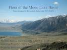 Title slide of my Mono Lake presentation Title slide of my Mono Lake presentation
|
Gave Flora of Mono Lake basin talk to Nevada Native Plant Society.
Slides in PDF format are available here: Flora of the Mono Lake basin. | |||||||||||||||||||||
|
|
Friday, March 7th | |||||||||||||||||||||
|
Other articles:
Locations:
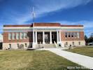
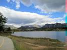
Gardnerville.
|
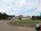
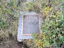
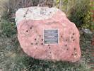
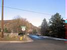
Stopped by the Carson Valley Museum and Cultural Center to ask about William M. Maule. | |||||||||||||||||||||
|
Other articles:
Locations:
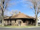
Minden.
|
The Maule house in Minden. | |||||||||||||||||||||
|
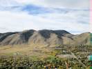
Locations:
Green Mountain.
South Table Mountain.
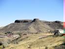
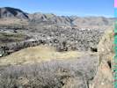
|
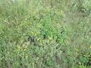
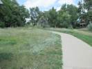
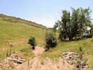
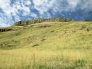
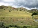
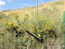
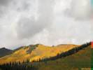
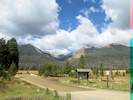
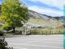
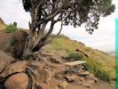
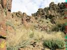
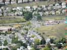
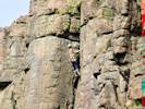
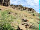
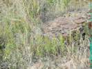
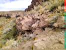
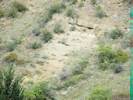
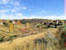
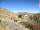
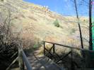
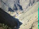
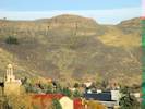
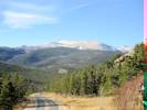
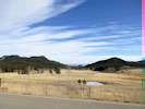
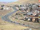
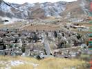
Today we took a walk on South Table Mountain. Leaving from the trailhead on Golden Hills Road, we walked generally north climbing two rims before reaching the top of the mesa near an ephemeral pond. | |||||||||||||||||||||
|
|
Saturday, 2 August 2014 | |||||||||||||||||||||
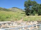
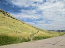
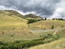
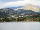
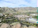
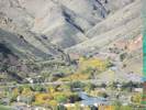
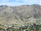
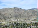
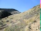
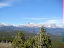
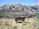
| Joined the Metro-Denver Chapter of the Colorado Native Plant Society for a field trip on Grasses of Green Mountain. | ||||||||||||||||||||||
|
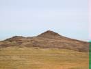
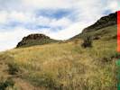
Locations:
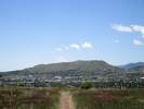
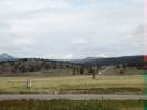
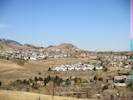
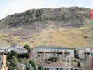
Lookout Mountain.
|
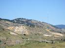
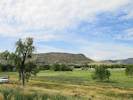
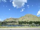
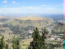
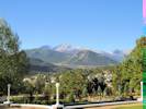
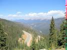
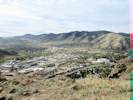
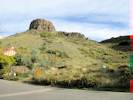
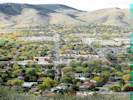
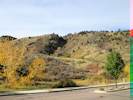
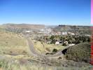
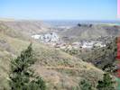
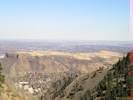
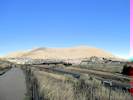
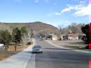
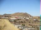
View of Lookout Mountain from the west slope of Green Mountain. Interstate 70 crosses the lower part of the photograph. | |||||||||||||||||||||
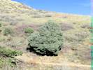
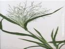
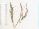
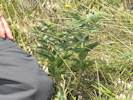 Lithospermum occidentale on the west side of Green Mountain Lithospermum occidentale on the west side of Green Mountain
|
Some of the taxa seen on Green Mountain. | |||||||||||||||||||||
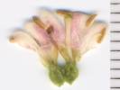 Flower of Symphoricarpos occidentalis as found on Green Mountain. Flower of Symphoricarpos occidentalis as found on Green Mountain.
 Symphoricarpos occidentalis as found on Green Mountain. Symphoricarpos occidentalis as found on Green Mountain.
|
1054 |
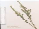
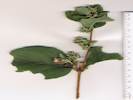
Symphoricarpos occidentalis Hook. Western Snowberry.
Green Mountain, Jefferson County, Colorado. Rooney Valley Trail, west side of Green Mountain. 39.6917°N, 105.176°W. WGS 1984. Elev. 1912 m. Small patch beside swale. Woody perennial to 50 cm., forming dense colonies in moist open swales, [spreading by long sparsely-branched rhizomes,] Twigs without lenticels, minutely hairy when young; Leaves opposite, ovate, to 7 cm. × 5 cm. wide, reduced above, thick, approaching leathery, pinnately veined, upper surface glabrous, lower few short white hairs, margin slightly wavy, slightly rolled under, sparsely curved hairy; Petioles to 7 mm.; Inflorescence axillary (and terminal?); Floral bracts triangular, 3 mm.; Flowers in dense axillary clusters, bisexual, ±radial, possibly slightly bilateral, 2 or more whorls; Corolla fused at base, tube 2 mm., throat with recurved hairs, lobes 5, 2-3 mm, slightly longer than tube, white with magenta mottling; Stamens 5, alternate, exserted; Anthers versatile; Ovary inferior; Pistil 1; Style exserted; Stigma entire; Fruit a berry, green when young, mature color and size unknown (Described from specimen seen on Green Mountain, 2 August 2014). | ||||||||||||||||||||
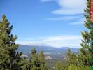
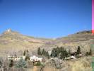
|
Other articles:
Locations:
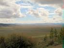
Green Mountain.
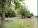
|
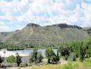
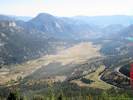
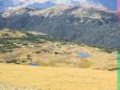
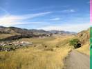
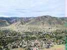
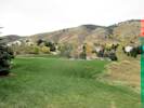
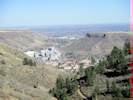
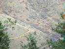
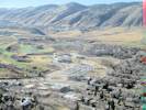
View from Green Mountain to Forsberg / Iron Spring Park and the South Platte Valley beyond. | |||||||||||||||||||||
|
Other articles:
Locations: Ackmen. Letters: Monday, August 4, 2014. |
Received letter today from Diana N. Wilson about Ackmen Colorado. | |||||||||||||||||||||
|
|
Sunday, August 10th | |||||||||||||||||||||
|
Other articles:
Locations:
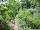
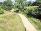
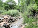
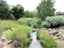
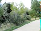
Tucker Gulch (lower).
|
| |||||||||||||||||||||
|
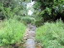
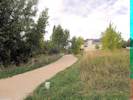
Other articles:
Locations:
Tucker Gulch (lower).
|
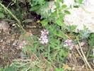
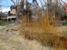
1055 |
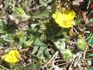
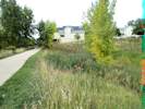
Tucker Gulch (lower), Jefferson County, Colorado. Common within the city limits of Golden, along the creek of Tucker Gulch and the Tucker Gulch Trail, about 250 m. north of the First Street Bridge, and 350 m. south southwest of Ford Street. 39.7687°N, 105.2283°W. WGS 1984. Elev. 1777 m. Common, low-growing subshrub with yellow flowers. Perennial herb, to 50 cm.; Stem, moderately strigose, proximally eglandular, distally hairy and glandular, but generally hairs exceed glands, Leaves, cauline alternate, well-distributed along stem, 16 mm. × 7 mm. wide, elliptic to obovate, entire, some margins contorted after drying, 1-veined, distal perpendicular to stems, not densely canescent, generally hairs > glands; Inflorescence heads 1-8 per stem, terminating leafy stems, not subtended by leafy bracts; Heads solitary, with both ray and disk flowers; Phyllaries in 2+ series, unequal, to 7 mm.; Rays, 9 mm.; Pappus double, outer narrow scales ≤ 1 mm. (easier to see on mature fruit), inner bristles, 6.5 mm., white; Fruit, disk 3 mm., hairy. | ||||||||||||||||||||
|
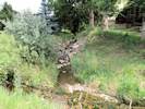
Other articles:
Locations:
Tucker Gulch (lower).
|
1056 |
Tucker Gulch (lower), Jefferson County, Colorado. 39.7687°N, 105.2283°W. WGS 1984. Elev. 1777 m. Common, white-flowered plant in mowed and unmowed sunny areas all along the trail. Annual terrestrial herb, to 50 cm.; Leaves, cauline, elliptical, 20 mm. × 5 mm.; Flowers, not bracteate; Petals, 4, white, deeply bilobed; Style, 1.4 mm. in young fruit; Fruit, elliptical, 7 mm. × 4 mm. wide × 2 mm. thick, flattened parallel to papery internal partition. | ||||||||||||||||||||
|
|
Monday, August 11th | |||||||||||||||||||||
|
Other articles:
Locations:
Cressmans Gulch (lower).
|
| |||||||||||||||||||||
|
|
Wednesday, August 13th | |||||||||||||||||||||
|
Other articles:
Locations:
North Table Mountain.
|
| |||||||||||||||||||||
|
|
Friday, August 15th | |||||||||||||||||||||
|
Other articles:
Locations:
North Table Mountain.
South Table Mountain.
|
| |||||||||||||||||||||
|
|
Sunday, August 17th | |||||||||||||||||||||
|
Literature Cited:
Other articles:
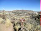
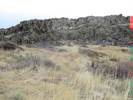
Locations: Golden. North Table Mountain. |
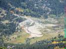
Field Trip Stop 15 North Table Mountain Rockfall Area of Noe, et al. (1999) forms in the parking lot of the Hillside Community Church at 103 N. Ford Street.
| |||||||||||||||||||||
|
Literature Cited:
Other articles:
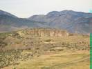
Locations: Magpie Gulch. |
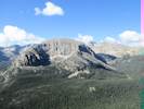
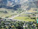
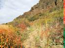
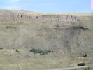
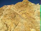
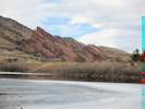
Looking to the north and south, we can see the distinctive hogback of the Dakota Sandstone at both ends of the valley. But why is this hogback missing at the valley center? The answer is that the Golden Fault, a large, Laramide thrust fault, weaves along the valley just to the east of the mountain front. Here, the fault has displaced nearly 8,000 feet of the Paleozoic and Mesozoic, sedimentary section (Van Horn, 1976). The trace of the fault can be seen as it cuts up the side of the first large alluvial terrace to the south of Clear Creek. There is a distinct break in the vegetation between the Fountain Formation to the west (covered with mountain mahogany shrubs) and the Pierre Shale to the east (covered with grasses). | |||||||||||||||||||||
| 1057 |
Campanula rapunculoides L. Rampion Bellflower.
Golden, Jefferson County, Colorado. Waste places, alley between Arapahoe Street and Cheyenne St, north of 5th Street. 36.7611°N, 105.2291°W. WGS 1984. Elev. 1759 m. Small colony between fence and pavement. Coll. No. 1057, 18 Aug 2014: Terrestrial green perennial herb, to 60 cm.; Stem ascending, little branched; Sap milky; Leaves, cauline, alternate, ovate, 7 cm. × 4 cm.; Petioles 10 mm.; Inflorescence, flowers 1-2 in axils; Pedicels to 12 mm.; Perianth in 2+ whorls; Corolla, radial, bell-shaped, regular; Petals united; Ovary inferior; Seeds (unknown). | |||||||||||||||||||||
 Coll. No. 1058, Sporobolus airoides Coll. No. 1058, Sporobolus airoides
|
1058 |
Sporobolus airoides (Torr.) Torr. Alkali Sacaton.
Golden, Jefferson County, Colorado. Arapahoe Street, between 4th and 5th. 39.7612°N, 105.2285°W. WGS 1984. Elev. 1758 m. Occasional weed of landscaped areas. Coll. No. 1058, 18 Aug 2014: Annual/perennial unknown, probably perennial in 1st year; Culm, lacking short rhizome; Sheath, conspicuous tufts of hairs at proximal end, Ackerfield (2015) says &lqquo;... tufts of hair at the tips ...&rdquo, sparsely hairy at summit (distal end); Leaf, elongate, erect, blade rolled in bud; Panicle, large, 17 cm., open, lower nodes few branches, not appearing whorled, branches spreading at maturity, branches 2-7 cm.; Pedicels 2.0-4.5 mm.; Spikelets, not crowded, 2.8 mm., Glumes 1.5 & 2.5 mm. Discarded. Pretty much destroyed while looking at arrangement of panicle branches at base of inflorescence. | ||||||||||||||||||||
|
Other articles:
|
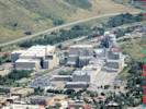
Lookout Mountain Nature Center and Buffalo Bill Museum. | |||||||||||||||||||||
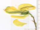
| 1059 |
Mentzelia nuda (Pursh) Torr. & A. Gray. Bractless Blazing Star.
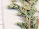
Golden, Jefferson County, Colorado. South side of Magpie Gulch east of CO Highway 93. 39.7639°N, 105.2347°W. WGS 1984. Elev. 1768 m. Coll. No. 1059, 28 Aug 2014: Perennial herb, of eastern slope, to 50 cm.; Leaves alternate, to 12 cm. × 2 cm. wide; margin shallowly toothed; Bracts, 15 mm., pinnately toothed, some basal and some clearly arising from the capsule; Petals, 10+, 40 mm. × 7 mm. wide; Stamens many; Filaments broad, narrowing at distal end; Anthers basifixed; Capsule, 30 mm. × 10 mm. diameter, erect, not curved at base, thick cylindric; Calyx (in fruit), lobes 9-12 mm.; Seeds, horizontal in capsule and winged, 3.8 mm. × 2.5 mm. wide, wing width 0.5-0.8 mm. Typically, M. nuda is described as having “1 or 2 bracts usually at base” of capsule (Harrington, 1954), or “bracts not fused to ovary wall” (Weber & Wittmann, 2012), or “bracts free from capsule” (Ackerfield, 2015). However, this collection clearly has 15 mm. pinnatifid bracts arising from the capsule. Such character would lead to M. decapetala. Regardless, the small size of those bracts, and small size of other characters support placing this in M. nuda rather than M. decapetala. | |||||||||||||||||||||
| Beckmannia? | ||||||||||||||||||||||
|
Other articles:
|
1060 |
Andropogon gerardii Vitman. Big Bluestem. Golden, Jefferson County, Colorado. Transition between high plains and Front Range, 1.8 km northwest of the GNIS location of Golden, on the Nightbird Gulch trail, 290 m. from the trailhead on Canyon Point Circle. 39.7638°N, 105.2392°W. WGS 1984. Elev. 1849 m Coll. No. 1060, 28 Aug 2014, characters observed: Perennial, to 85 cm., clumped, rhizomes unknown; Leaves, blade and sheath differentiated; Sheath, 11 cm., open; Ligule, membraneous (though surrounded by hairs), 3 mm., auricles 0; Blade, soft, flat, 27 cm., hairy near ligule; Inflorescence, 80 mm., > leaves, 1-2 per stem, in 5-6 digitate branches, spikelets many; Rachis, soft bristles on margins and at nodes; Disarticulation at nodes of rachis; Spikelets in pairs, Sterile spikelet, 7 mm., pedicel 4.5 mm.; Fertile spikelet, Florets #1, Glumes, awns 0, ±equal, lower keeled, upper flattened and grooved; Lemma, 6 mm., membraneous, rolled, glabrous, tip 2-forked, awn, #1, 13 mm., bent, twisted, attached on back; Stamens, 3; Anthers, yellow; Ovary, glabrous; Stigma, feathery. | ||||||||||||||||||||
|
Other articles:
|
1061 |
| ||||||||||||||||||||
| 1062 | Iva ? | |||||||||||||||||||||
|
Other articles:
|
1063 |
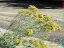
Ericameria nauseosa (Pall. ex Pursh) G.L.Nesom & G.I.Baird var. graveolens (Nutt.) Reveal & Schuyler.
Golden, Jefferson County, Colorado. Illinois Street at alley between 4th and 5th Streets. 39.7602°N, 105.2308°W. WGS 1984 Elev. 1763 m. Collection No. 1063, 17 September 2014, characters observed: Perennial shrub, woody at base, to 1 m., sprawling to erect; Stem covered with felt-like tomentum (long hairs infiltrated with resin, must scrape with knife to expose); Leaves, alternate, lance-linear, 70 mm. × 3 mm., not twisted in the manner of some related species, upper surface tomentose, margin entire; Heads discoid (with only disk flowers), cymose at ends of branches, narrowly tubular; Involucre 8 mm., not spiny; Phyllaries in 3 vertical ranks, outer << inner, keeled, some with few short hairs; Receptacles not chaffy, but have some short (<0.5 mm.) appendages between flowers; Flowers #5; Corolla tube (i.e., petals united at base) 7.5 mm. + lobes #5, 1 mm., glabrous throughout; Ovary inferior; Pappus of bristles, 6-7 mm., white; Stamens 5; Anthers connate (united), 2 mm., acute at base; Style 11 mm., branches half-round in cross-section, stigmatic 1 mm. + appendage 2 mm., glabrous inside, uniformly short hairy on outside, tips rounded; cypselae, all similar in shape, 5 mm., short hairy; Not known from California. In Ackerfield (2012), Asteraceae, Key 2, 15a-b, a question of how tomentose the stems and leaves are made keying tricky. | ||||||||||||||||||||
|
Other articles:
|
1064 |
Ericameria nauseosa (Pall. ex Pursh) G.L.Nesom & G.I.Baird var. graveolens (Nutt.) Reveal & Schuyler.
Golden, Jefferson County, Colorado. Waste place at 4th and Illinois Streets, against the school yard fence. 39.7607°N, 105.2312°W. WGS 1984. Elev. 1773 m. Collection No. 1063, 17 September 2014, characters observed: Perennial shrub, woody at base, to 1 m., sprawling to erect; Stem covered with felt-like tomentum (long hairs infiltrated with resin, must scrape with knife to expose); Leaves, alternate, lance-linear, 70 mm. × 3 mm., not twisted in the manner of some related species, upper surface tomentose, margin entire; Heads discoid (with only disk flowers), cymose at ends of branches, narrowly tubular; Involucre 8 mm., not spiny; Phyllaries in 3 vertical ranks, outer << inner, keeled, some with few short hairs; Receptacles not chaffy, but have some short (<0.5 mm.) appendages between flowers; Flowers #5; Corolla tube (i.e., petals united at base) 7.5 mm. + lobes #5, 1 mm., glabrous throughout; Ovary inferior; Pappus of bristles, 6-7 mm., white; Stamens 5; Anthers connate (united), 2 mm., acute at base; Style 11 mm., branches half-round in cross-section, stigmatic 1 mm. + appendage 2 mm., glabrous inside, uniformly short hairy on outside, tips rounded; cypselae, all similar in shape, 5 mm., short hairy; Not known from California. In Ackerfield (2012), Asteraceae, Key 2, 15a-b, a question of how tomentose the stems and leaves are made keying tricky. | ||||||||||||||||||||
|
Other articles:
Locations:
Florissant Fossil Beds National Monument.
Kenosha Pass.
South Park.
|
Sunday, 21 September
| |||||||||||||||||||||
|
Other articles:
Locations:
Bear Lake.
Lake Estes.
Moraine Park.
Sprague Lake.
|
Tuesday, 23 September
| |||||||||||||||||||||
|
Other articles:
Locations:
Berthoud Pass.
Colorado River.
Forest Canyon Overlook.
Forest Canyon Pass.
Horseshoe Park.
Longs Peak.
Roaring River.
Terra Tomah Mountain.
|
Wednesday, 24 September
| |||||||||||||||||||||
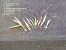
 Blepharoneuron tricholepis (Torr.) Nash Blepharoneuron tricholepis (Torr.) Nash
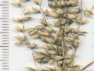 Blepharoneuron tricholepis (Torr.) Nash Blepharoneuron tricholepis (Torr.) Nash
 Blepharoneuron tricholepis (Torr.) Nash Blepharoneuron tricholepis (Torr.) Nash
|
1065 |
This specimen was given to me by my son, Matt.
Blepharoneuron tricholepis (Torr.) Nash. Pine Dropseed. Unknown, Douglas County, Colorado. Lower montane ponderosa pine, gravely soil derived from Pikes Peak granite. Coll. No. 1065, 18 Sep 2014, characters observed: Perennial bunchgrass to 35 cm.; Sheath open; Ligule membraneous; Inflorescence 1-2, loose panicle, 15 cm. long × 1.5 cm. wide, >leaves; Axis scabrous; Spikelets, many, similar, >2 per node, 1-flowered, 2 mm.; Florets, 1 per spikelet, bisexual; Glumes, lower 2.0 mm., upper 2.5 mm., awns 0; Lemma, 2.5 mm., keeled, veins 3, densely hairy, awns 0; Palea, <lemma, keel hairy, margin glabrous. | ||||||||||||||||||||
|
Other articles:
Locations:
North Table Mountain.
|
Friday, 3 October
| |||||||||||||||||||||
|
Other articles:
|
Monday, October 6th | |||||||||||||||||||||
|
Literature Cited:
Other articles:
Locations: Cressmans Gulch (lower). |
1066 |
Cressmans Gulch (lower), Jefferson County, Colorado. Many plants in and around the surge basin north of Wyoming Street at Ridge Road. 39.7753°N, 105.2303°W. Elev. 1810 m. Upright shrub with yellow flowers and large reddish seed pods. Collection No. 1066, 6 October 2014, characters observed: Perennial shrub, to 2 m., woody below; Stem erect, unarmed; Leaves compound, odd-pinnate (with terminal leaflet); Leaflets, 11, 16 mm. × 12 mm. wide, notched at tip, glabrous above, sparsely appressed hairy below; Inflorescence a raceme, axillary, 9± flowers; Calyx, 5-merous, 5 mm. × 6 mm. dia., appressed hairy; Flowers, 19 mm., yellow, with dark markings; Banner, 10 mm.; Wings, 10 mm. × 4 mm., reduced in comparison to Lupinus; Keel, fully enclosing stamens and pistil, glabrous; Stamens, 10; Filaments, 9 fused, 1 free; Style, recurved; Fruit, inflated, bladder-like, 50 mm. × 22 mm., walls papery, color reddish fading to brown, base stalk-like; Seeds, reniform, flattened, 6 mm. × 4 mm. × 2 mm., brown, surface smooth; native to southern Europe. Weber & Wittmann (2012) note “ introduced about 1913 around houses in Sunshine Canyon northwest of Boulder, now spreading and becoming estabished in the foothill canyons ” | ||||||||||||||||||||
|
Other articles:
Locations:
Golden.
Lichen Peak.
North Table Mountain.
|
Wednesday, 8 October
| |||||||||||||||||||||
|
Other articles:
Locations:
North Table Mountain.
|
1067 |
North Table Mountain, Jefferson County, Colorado. Near the south rim. 39.7753°N, 105.2303°W. Elev. 1950 m. Rocky slope with little soil development near rim of mesa, growing with Brickellia californica(?). Coll. No. 1067, 8 Oct 2014, characters observed while keying: Perennial herb, to 30 cm., woody at base; Stems many; Leaves alternate, 9 mm., pinnately dissected into 7 parts, silvery hairy; Inflorescence raceme-like, indeterminate, heads 1-3 in axils; Heads have only disk flowers, all alike; Involucre of hairy phyllaries; Phyllaries in 2 series, hairy, not gummy or with tips recurved; Receptacle hairy, not chaffy or bristly; Flowers fertile; Pappus absent; growing with Brickellia californica(?). | ||||||||||||||||||||
|
Other articles:
Locations:
North Table Mountain.
|
1068 |
Ambrosia psilostachya DC. Western Ragweed.
North Table Mountain, Jefferson County, Colorado. Near the south rim. 39.7687°N, 105.2156°W. Elev. 1950 m. Rocky slope with little soil development near rim of mesa. Coll. No. 1068, 8 Oct 2014, characters observed while keying: Perennial herb, to 40 cm., woody at base; Leaves opposite below, alternate above, 50 mm. × 22 mm., ovate, pinnately divided; Inflorescence indeterminate, appearing raceme-like, 2 kinds of flowers, pistillate heads many, distal, carpellate heads few, clustered in distal leafy axils; Phyllaries fused into a cup; Receptacle not chaffy; Pappus absent. | ||||||||||||||||||||
|
Other articles:
Locations:
Castle Rock.
Clear Creek Canyon.
Golden.
Lookout Mountain.
Magpie Gulch.
Nightbird Gulch.
|
Wednesday, October 15th
| |||||||||||||||||||||
|
Other articles:
|
1069 |
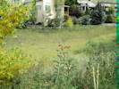
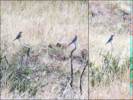
South Table Mountain, Jefferson County, Colorado. West side of South Table Mountain, along south loop of Lubahn Trail. 39.7523°N, 105.2081°W. Elev. 1835 m. Good example of carpellate flowers. | ||||||||||||||||||||
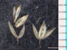
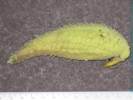 Seed pod of Asclepias speciosa Seed pod of Asclepias speciosa
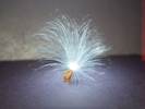 Seed of Asclepias speciosa Seed of Asclepias speciosa
|
Seed pod of Asclepias speciosa Torr., the Showy Milkweed. | |||||||||||||||||||||
|
Other articles:
Locations:
Deadman Gulch.
|
| |||||||||||||||||||||
|
Other articles:
|
Friday October 24th.
| |||||||||||||||||||||
|
Other articles:
Locations:
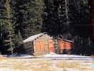
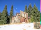
White Ash Mine.
|
Saturday, 25 October
| |||||||||||||||||||||
|
Other articles:
Locations:
Castle Rock.
Chimney Gulch.
Clear Creek Canyon.
South Table Mountain.
Windy Saddle.
|
Thursday, October 30th
| |||||||||||||||||||||
|
Other articles:
Locations:
Chimney Gulch.
|
Saturday, November 1st
| |||||||||||||||||||||
|
Other articles:
Locations:
Panorama Point.
|
Sunday, November 9th
| |||||||||||||||||||||
|
|
Saturday, November 22nd | |||||||||||||||||||||
|
Other articles:
Locations:
North Table Mountain.
South Table Mountain.
|
Wednesday, November 26th
| |||||||||||||||||||||
|
Other articles:
Locations:
Apex.
Coal Creek Canyon Fire Department Station 4.
|
Saturday, November 29th
| |||||||||||||||||||||
|
Other articles:
Locations:
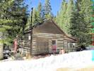
White Ash Mine Park.
|
Monday, December 7th
| |||||||||||||||||||||
|
Other articles:
|
Thursday, December 11th
| |||||||||||||||||||||
|
Other articles:
Locations:
Tucker Gulch (lower).
|
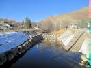
Monday, December 15th | |||||||||||||||||||||
|
Other articles:
Locations:
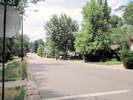
Golden.
|
Saturday, December 20th
| |||||||||||||||||||||
|
Literature Cited:
Other articles:
Locations: Nightbird Gulch. North Table Mountain. Tucker Gulch (lower). |
Sunday, December 21st
| |||||||||||||||||||||
|
[Previous Page]
[Next Page]
Go to page: [1800s] [1900s] [1910s] [1920s] [1930s] [1940s] [1950s] [1960s] [1970s] [1980s] [1990] [1991] [1992] [1993] [1994] [1995] [1996] [1997] [1998] [1999] [2000] [2001] [2002] [2003] [2004] [2005] [2006] [2007] [2008] [2009] [2010] [2011] [2012] [2013] [2014] [2015] [2016] [2017] [2018] [2019] [2020] [2021] [2022] [2023] [2024] [2025] [A] | ||||||||||||||||||||||
| If you have a question or a comment you may write to me at: tomas@schweich.com I sometimes post interesting questions in my FAQ, but I never disclose your full name or address. |
Date and time this article was prepared: 4/21/2025 8:24:42 PM |
|||||||||||||||||||||