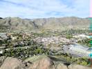
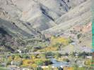
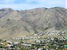
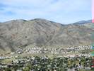
Eastern Mojave Vegetation Lubahn Trail (southern segment of loop), Golden, Jefferson County, Colorado  
 

Tom Schweich  

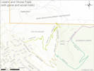
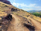
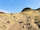
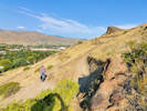
Home Page  Southern segment of trail from 19th and Belvedere to top of South Table Mountain. This segment has also been called the Golden Summit Trail. GoogleEarth shows this as the Golden Summit Trail.

Other articles:
• Lubahn Trail (north loop):   map;
• Olivine Trail:   map;

Locations: South Table Mountain.  

Full Size Image
Lubahn and Olivine Trails.


Other articles:
• Field Notes:  Wednesday, October 15th;  19 Oct 2019;  7 Jul 2023;

Locations: Castle Rock.  

Castle Rock

Full Size Image
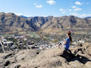
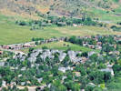
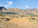
View from the top of Castle Rock.
Full Size Image
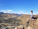
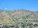
View from the top of Castle Rock.
Full Size Image
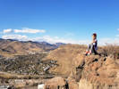
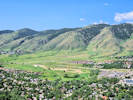
View from the top of Castle Rock.
Full Size Image
Schweich Hill from Castle Rock on South Table Mountain.
Full Size Image
Magpie Gulch (left) and Nightbird Gulch (right) seen from Castle Rock on South Table Mountain.
Full Size Image
Survey Field and Lookout Mountain from Castle Rock on South Table Mountain.
Full Size Image
Golden Cliffs Trail on south face of North Table Mountain
Full Size Image
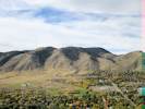
Central Golden as seen from Castle Rock
Full Size Image
Mouth of Clear Creek Canyon
Full Size Image
Magpie Gulch
Full Size Image
Nightbird Gulch
Top of Castle Rock.

Other articles:
• Field Notes:  19 Oct 2019;  

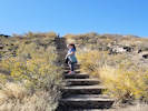
Stairs

Full Size Image
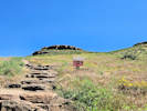
Climbing the stairs to Castle Rock.

Other articles:
• Lubahn Trail (north loop):   at STM;  

Junction: Lubahn Trail (northern segment of loop), South Table Mountain Trail.
 

Junction: spur, (use trail?) to highpoint above the “G” at south. This is also the end of the Old Quarry Trail.

Other articles:
• Golden Checklist Flora:  Lookout Mountain;
• Field Notes:  Wednesday, October 15th;  

Full Size Image
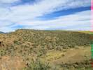
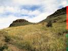
Mountain Mahogany (Cercocarpus montanus) on South Table Mountain.
Full Size Image
Lookout Mountain
Scrubland of Alder-Leaf Mountain Mahogany (Cercarpus montanus).

Other articles:
• Old Quarry Trail:   at w. end;
• Field Notes:  22 Sep 2020;  

Full Size Image
West end of Old Quarry Trail.
Rim of South Table Mountain.

Other articles:
• Field Notes:  22 Sep 2020;  


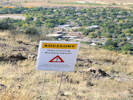
The intent is to close the trail just below the rim and revegetate the trail.
Full Size Image
Closed for Restoration.

Images: Full Size Image
Upcoming restoration.


Other articles:
• Field Notes:  22 Sep 2020;  

The trail above this point is on Jefferson County Open Space land. It looks like the trail above will be closed and the vegetation restored.


Other articles:
• Lubahn Spur:   at Lubahn S;
• Field Notes:  Wednesday, October 15th;  

Junction: Lubahn Trail Spur, across the bottom of an interesting outcrop of Denver Formation and, eventually, to the north half of the Lubahn Trail.

Full Size Image
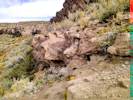
Cross-bedded fluvial facies of the Denver Formation.

Other articles:
• Field Notes:  Wednesday, October 15th;  

Full Size Image
Hikers on Castle Rock
Hikers on Castle Rock.

Other articles:
• Olivine Trail:   at Lubahn Trl;
• Field Notes:  22 Sep 2020;  

Switchback #6 Junction: Olivine Trail

Full Size Image
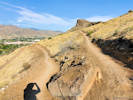
Switchback #6: view southeast.
Full Size Image
The old Lubahn Trail, eventually goes through the gap at right.
Full Size Image
Junction of Lubahn Trail with Olivine Trail.
 

Other articles:
• Field Notes:  22 Sep 2020;  

Switchback #5

Full Size Image
Switchback #5: view northwest.
 

Other articles:
• Field Notes:   at Coll. No. 1069;  

Full Size Image
Coll. No. 1069, Ambrosia psilostachya
 

Other articles:
• Field Notes:  22 Sep 2020;  

Switchback #4

Full Size Image
Switchback #4: view southeast, into the sun.
 

Other articles:
• Field Notes:  22 Sep 2020;  

Switchback #3

Full Size Image
Switchback #3: view to northwest.
 

Images: Full Size Image
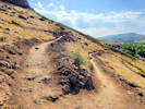
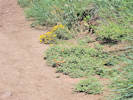
Sphaeralcea coccinea and Heterotheca villosa re-colonize the edge of the Lubahn Trail.
 

Between switchback 2 and 3 is an example of native vegetation retaking the edge of the trail.

Other articles:
• Field Notes:  22 Sep 2020;  

Switchback #2

Full Size Image
Switchback #2: view to southeast directly into the sun.
 

Other articles:
• Field Notes:  22 Sep 2020;  

Switchback #1

Full Size Image
Switchback #1: The view is looking northwest.
Switchback, southern most point of trail

Other articles:
• Belvedere Street:   at end;
• Field Notes:  22 Sep 2020;  

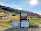
Trailhead: Belvedere Street, near 19th Street.

Full Size Image
Trailhead at south end of Belvedere Street.
If you have a question or a comment you may write to me at: tomas@schweich.com I sometimes post interesting questions in my FAQ, but I never disclose your full name or address.  


[Home Page] [Site Map]

Date and time this article was prepared: 4/24/2026 5:02:00 PM