
Topics in this Article:
1800s
1900s
1910s
1920s
1930s
1940s
1950s
1960s
1970s
1980s
1990
1991
1992
1993
1995
1996
1997
1998
1999
2000
2001
2002
2003
2004
2005
2006
2007
2008
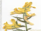
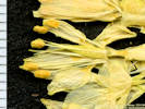
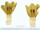
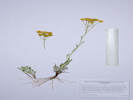
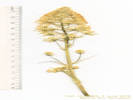
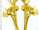
2008 Tour de Swertia albomarginata
Mono Lake, August 2008
2009
2010
2011
2012
2013
2014
2015
2016
2017
2018
2019
2020
2021
2022
2023
2024
Contents
Literature Cited
|
|
When I first read the field notes of Annie Alexander and Louise Kellogg, I was fascinated by the descriptions they wrote about the places they went and the plants and animals they found there. By publishing my field notes on the Internet I hope to follow a little bit in their tradition.
|
|
|
|
2019
|
|
|
|
January, 2019
|
|
Other articles:
• Iowa Street:
near Ford St;
near Ford St;
• Washington Avenue:
near Iowa;
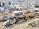
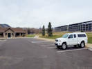
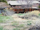
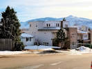 Recent construction on Iowa Street Recent construction on Iowa Street
 Recent construction on Iowa Street Recent construction on Iowa Street
|
|
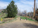
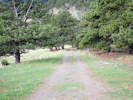
January 20, 2019. Walk around the neighborhood.
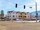
Recent construction at Washington and Iowa |
|
|
Other articles:
• Washington Avenue:
near 6th;
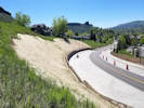
 Progress on Washington Avenue complete street project. Progress on Washington Avenue complete street project.
|
|
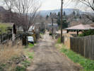
January 21, 2019
Neighborhood walk, progress on Washington Avenue complete streets project.
|
|
|
|
February, 2019
|
|
Other articles:
• Washington Avenue:
bet. 2nd & 5th;
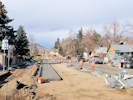
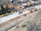
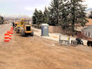
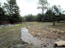
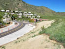
 Grading on the Washngton Avenue complete streets project. Grading on the Washngton Avenue complete streets project.
|
|
February 4, 2019. Neighborhood walk. Granding on Washington Avenue.
|
|
Other articles:
• 5th Street:
near Arapahoe;
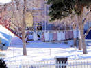 Laundry day in Colorado. Laundry day in Colorado.
|
|
February 20, 2019.
|
|
Other articles:
• Arapahoe Street:
near 2nd;
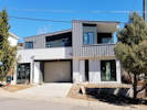
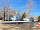 124 Arapahoe Street 124 Arapahoe Street
 124 Arapahoe Street 124 Arapahoe Street
|
|
February 24, 2019. This house was listed as for sale in Zillow for less than a day before the status was changed to pending.
|
|
|
|
March, 2019
|
|
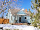
Other articles:
• Cheyenne Street:
near 4th;
near alley;
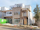
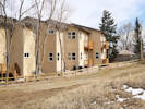
 Duplex at the former 409 Cheyenne St. Duplex at the former 409 Cheyenne St.
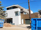 Duplex under construction. Duplex under construction.
|
|
March 9, 2019. Current state of construction.
|
|
Other articles:
• Golden Checklist Flora:
Euphorbia myrsinites;
• Gregory Drive:
30290;
• Washington Avenue:
bet. 2nd & 5th;
near 5th;
near 5th;
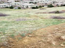
 Infestation of Myrtle Spurge between Gregory Drive and Goldco Circle. Infestation of Myrtle Spurge between Gregory Drive and Goldco Circle.
 Progress on Washington Avenue Complete Street project. Progress on Washington Avenue Complete Street project.
|
|
Neighborhood walk, large infestation of Myrtle Spurge.
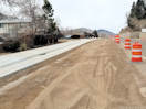
Washington Avenue north of 5th. |
Washington Avenue looking south. |
|
|
Other articles:
• Rubey Drive:
at path;
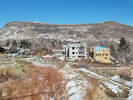 Continued construction at 148 Washington Continued construction at 148 Washington
|
|
March 16, 2019
|
|
Other articles:
• Field Notes:
Coll. No. 2090, 26 Jun 2019;
Locations:
Schweich Hill.
 Post-construction miitigation. Post-construction miitigation.
|
|
Post construction, area cleaned and jute mat emplaced.
|
|
Other articles:
• Golden Cliffs Trail:
at highpoint;
along trail;
near the rim of Golden Ravine.;
• Climbing Access Trail:
below rim;
below rim;
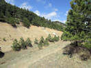
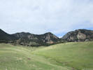
 Grrrr, Someone rode their mountain bike off trail in the mud. Grrrr, Someone rode their mountain bike off trail in the mud.
 North Table Loop climbs out of Golden Ravine. North Table Loop climbs out of Golden Ravine.
|
|
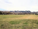
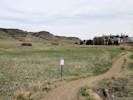
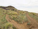
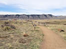
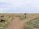
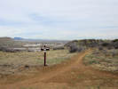
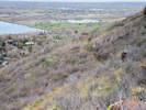
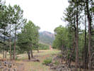
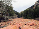
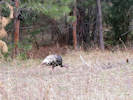
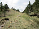
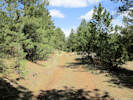
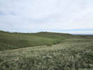
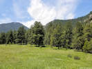
Spring morning ramble on North Table Mountain.
Mouth of Golden Ravine. |
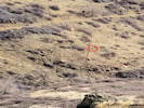
Coyote in Golden Ravine. |
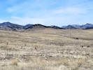
Small herd of deer on North Table Mountain. |
Two golf balls on top of the mesa. |
Where I previously found Munroa squarrosa. |
I don't think closing the trail has worked. |
Does every rock need a steel anchor? |
Property boundaries lined up on a section line. |
Survey Pin |
|
|
Other articles:
• CO Hwy 93:
above CO 93;
Locations:
Ralston Dike.
Ranson/Edwards Homestead Open Space Park.
 Yellow Indian Grass (Sorghastrum nutans) in winter. Yellow Indian Grass (Sorghastrum nutans) in winter.
|
|
Little sojourn to Ranson/Edwards.
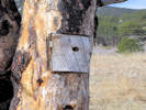
Creative bird box, carved in the trunk of a burned ponderosa pine. |
The Ralston Dike, or what is left of it. |
|
|
Other articles:
• Climbing Access Trail:
below rim;
• North Table Mountain:
Other Vertebrates;
 Western Fence Lizard in the grotto. Western Fence Lizard in the grotto.
 Climbers hiking along the base of the cliffs. Climbers hiking along the base of the cliffs.
|
|
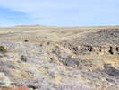
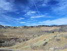
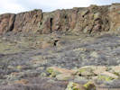
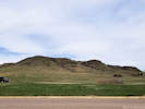
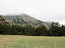
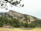
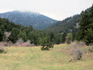
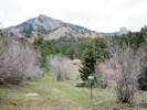
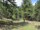
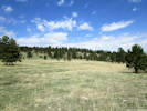
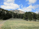
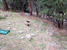
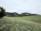
Saturday, April 6, 2019
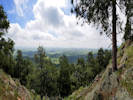
North Table Mountain. My objective on this trip was to visit the slot or grotto that is visible on the southwest side of North Table Mountain. I was hoping I would find a damp place with ferns or bryophytes. The grotto was shallow and dry.
Slot or grotto below the cliffs. |
|
 Dakota Ridge at the north end of Golden Dakota Ridge at the north end of Golden
|
|
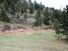
Sunday, April 7, 2019.
Survey Field.
|
|
|
2012
|
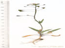
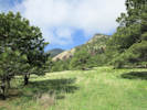
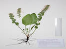
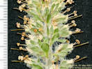
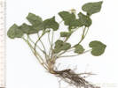
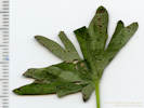
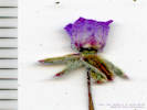
Berberis repens, south-facing slope of a ravine, near power line, few patches of snow still around, Lomatium orientale also blooming here.
|
Native and Naturalized Flora of the Golden Area, Jefferson County, Colorado
Berberidaceae
Berberis repens Lindl.
Creeping Barberry.
Colorado School of Mines Survey Field, Jefferson County, Colorado.
West edge of Survey Field, 3.2 km. south southwest of the GNIS location of Golden.
39.7345°N, 105.2296°W.
WGS 1984
Elev. 6324 ft.
South-facing steep slope of a ravine.
Lomatium orientale also blooming here.
Collected by permit: Colorado School of Mines, 2018, issued: Apr 1, 2018, to: Tom Schweich.
|
Tom Schweich
2012. |
7-Apr-2019 |
|
|
|
Other articles:
• Ancient Palms Trail:
at Basalt Top Loop;
• Basalt Cap Loop:
at Ancient Palms Trl;
near Ancient Palms Trail;
near social trail;
near overlook;
50000;
• Cretaceous Trail:
at Basalt Top Loop;
at Tertiary Trl;
near Denver West Pkwy;
along Denver West Pkwy;
at Denver West Pkwy west;
at Denver West Pkwy west;
60000;
• Tertiary Trail:
at property line;
near property line;
30000;
 Recently paved parking lot at Camp George West Park. Recently paved parking lot at Camp George West Park.
 Sports field at Camp George West Park. Sports field at Camp George West Park.
|
|
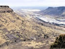
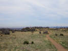
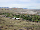
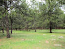
Tuesday, April 9, 2019
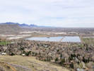
South Table Mountain. I walked from the officially designated parking lot at Camp George West Park. Learned that I would be the only person doing that, because the walk to the base of South Table Mountain is nearly a mile.

Entrance to the National Renewable Energy Laboratory |
Cretaceous Trail north of Denver West Parkway to South Table Mountain. |
Junction of the Tertiary Trail with the Cretaceous Trail. |
Social trail up to the Tertiary Trail from the Montrachet Denver West Apartments below. |
View north from South Table Mountain. |
Top end of the Cretaceous Trail. |
End of the Cretaceous Trail at the Basalt Cap Loop. |
South Table Mountain as seen from Denver West Parkway. |

Sun-loving Sedge beside the Tertiary Trail. |

Social trail users on a trail from W. 20th Avenue. |

Hikers on the Ancient Palms Trail. |
Basalt Top Loop Trail looking east. |
Mt. Morrison and I-70 west. |
Junction of Basalt Top Loop and Ancient Palms Trails. |
The start of the Ancient Palms Trail. |
View northwest. |
Ancient Palms Trail nears the north rim of South Table Mountain. |
|
|
Other articles:
• Cheyenne Street:
at 708 Cheyenne;
 708 Cheyenne, Architects Rendering 708 Cheyenne, Architects Rendering
|
|
Public hearing for 708 Cheyenne Street.
|
|
Other articles:
• Alley:
at end;
• Social Trail (N. Ford to Jackson):
at trl jct;
at alley;
• Social Trail (N. Wash. OS):
at trl jct;
Locations:
Schweich Hill.
 What happened here? Cactus dug up and soil scraped. What happened here? Cactus dug up and soil scraped.
|
|
Tuesday, April 16, 2019
North Washington Open Space Schweich Hill.
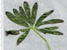
Leaves of Campanula glomerata “Dane's Blood” |
Yard waste disposal in the open space. |
Yard waste disposal in the open space. |
Buffalo grass (Buchloe dactyloides) at the intersection of social trails. |
Social trail at the end of the alley. |
Columbine/Ford St alley from north end. |
Three Missouri Foxtail Cactus together. |
[Coll. No. 1817] Packera plattensis fendleri leaves just beginning to grow in mid-April. |
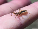
Assassin bug in North Washington Open Space |
|
|
|
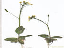
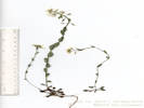
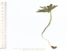
2013
|
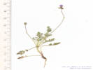
Taraxacum officinale
|
Native and Naturalized Flora of the Golden Area, Jefferson County, Colorado
Asteraceae
Taraxacum officinale F. H. Wigg.
Common Dandelion.
North Washington Open Space, Jefferson County, Colorado.
Small (4 acre) fallow city-owned parcel in northern Golden, near the intersection of Colorado Highway 93 and Washington Avenue. 2.3 km. northwest of GNIS location of Golden. Top of hill, sunny slope south of social trail.
39.7686°N, 105.2331°W.
WGS 1984
Elev. 1825 m.
Collected by permit: City of Golden, 2019, issued: Jan 29, 2019, to: Tom Schweich.
|
Tom Schweich
2013. |
16-Apr-2019 |
|
|
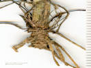
 Coll. No. 2014, Bryophyte Coll. No. 2014, Bryophyte
|
2014
|
Bryophyte
|
Native and Naturalized Flora of the Golden Area, Jefferson County, Colorado
Bryophyta
Bryophyte.
North Washington Open Space, Jefferson County, Colorado.
Small (4 acre) fallow city-owned parcel in northern Golden, near the intersection of Colorado Highway 93 and Washington Avenue. 2.3 km. northwest of GNIS location of Golden. Upper slope of cut bank, north side of open space.
39.7688°N, 105.2335°W.
WGS 1984
Elev. 1825 m.
Collected by permit: City of Golden, 2019, issued: Jan 29, 2019, to: Tom Schweich.
|
Tom Schweich
2014. |
16-Apr-2019 |
|
|
|
Other articles:
• Lou's Loop:
28340;
• Recreational Trail (Pine Ridge Estates):
near Pine Ridge;
near Pine Ridge;
at spur;
at game trl;
• Private Path (Canyon View III HOA):
at Lous Lp;
near Lous Lp;
Locations:
Dakota Ridge.
 South end of Dakota Ridge, Golden open space. South end of Dakota Ridge, Golden open space.
|
|
Pine Ridge Estates and Dakota Ridge.
South end of Dakota Ridge, Golden open space. |
Private spur trail connecting Lou's Loop to the City of Golden recreational trail. |
Slope of Dakota Ridge |
Spur trail from Lou's Loop towards Dakota Ridge. |

The southernmost end of Dakota Ridge |
|
|
Other articles:
• Lippincott Road:
at Bull Gl;
near Bull Gulch;
near s gate;
near s gate;
at washout;
mid-quarry;
near quarry;
near jct quarry rd;
near jct quarry rd;
near gate;
80000;
Locations:
Bull Gulch.
Lippincott Ranch.
 Gate, usually locked, closed to public access. Gate, usually locked, closed to public access.
|
|
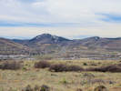
Thursday, April 18, 2019
Lippincott Property
The road continues north-ish in the direction of Bull Gulch. |
The way out, south-ish. |
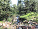
Stream and springy ground at top of quarry. |
The linear opening in the forest accomodates a power line. |
The summit meadow. |
Tilted rocks above middle meadow. |
Bull Gulch, looking upstream. |
Turkey, one of a pair, many more seens. |
Where the old ranch road crosses Bull Gulch. |
Path southwest to middle meadow. |
Ranch road approaches Bull Gulch. |
North gate, to City of Boulder property. |
South gate, City of Boulder side. |
South gate, from Lippincott property. |

Stream crossing. |
View up the quarry from the ranch road crossing. |

Quarry |
Quarry |
Ranch road, generally north-ish. |
View across springy ground. |
Entrance to Lippincott Property. |
Lippincott property on 1906 base map. |
Lippincott property on 1942 base map. |
Lippincott property on 1965, 1967 ed. base map. |
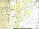
Lippincott property on 1965 rev. 1994 base map. |
|
 My first collection on the Lippincott Property, Taraxacum officinale My first collection on the Lippincott Property, Taraxacum officinale
|
2015
|
Taraxacum officinale
Plants of Jefferson County Open Space
Jefferson County, Colorado
Asteraceae
Taraxacum officinale F. H. Wigg.
Common Dandelion.
Lippincott Property, Jefferson County, Colorado.
Jointly owned by City of Boulder OSMP and Jefferson County Open Space, approximate center of property. 21.8 km. north northwest of the GNIS location of Golden.
39.9013°N, 105.2741°W.
WGS 1984
Elev. 1983 m.
Gentle slope at edge of ponderosa pine forest.
Collected by permit: Jefferson County Open Space, 2019, issued: Mar 1, 2019, to: Tom Schweich.
|
Tom Schweich
2015. |
18-Apr-2019 |
|
|
|
Literature Cited:
- Baldwin, Bruce G., Susan Kalisz, and W. Scott Armbruster, 2011.
Other articles:
• Lippincott Road:
60000;
 Location of three collections of tiny annuals. Location of three collections of tiny annuals.
|
2016
|
Collinsia parviflora
Plants of Jefferson County Open Space
Jefferson County, Colorado
Plantaginaceae
Collinsia parviflora Lindl.
Maiden Blue-eyed Mary.
Lippincott Property, Jefferson County, Colorado.
Jointly owned by City of Boulder OSMP and Jefferson County Open Space, approximate center of property. 21.8 km. north northwest of the GNIS location of Golden.
39.9019°N, 105.274°W.
WGS 1984
Elev. 2005 m.
Forming carpets under trees in ponderosa pine woodland.
Collected by permit: Jefferson County Open Space, 2019, issued: Mar 1, 2019, to: Tom Schweich.
|
Tom Schweich
2016. |
18-Apr-2019 |
|
|
|
Other articles:
• Lippincott Road:
60000;
 Coll. No. 2017, Capsella bursa-pastoris Coll. No. 2017, Capsella bursa-pastoris
|
2017
|
Capsella bursa-pastoris
Plants of Jefferson County Open Space
Jefferson County, Colorado
Brassicaceae
Capsella bursa-pastoris (L.) Medik.
Shepherd's Purse.
Lippincott Property, Jefferson County, Colorado.
Jointly owned by City of Boulder OSMP and Jefferson County Open Space, approximate center of property. 21.8 km. north northwest of the GNIS location of Golden.
39.9019°N, 105.2739°W.
WGS 1984
Elev. 2003 m.
Disturbed places, in this case an old road, along with other early annuals, such as Collinsia parviflora and Draba reptans.
Collected by permit: Jefferson County Open Space, 2019, issued: Mar 1, 2019, to: Tom Schweich.
|
Tom Schweich
2017. |
18-Apr-2019 |
|
|
|
Other articles:
• Lippincott Road:
60000;
 Coll. No. 2018, Draba nemorosa Coll. No. 2018, Draba nemorosa
|
2018
|
Draba reptans
Plants of Jefferson County Open Space
Jefferson County, Colorado
Brassicaceae
Draba nemorosa L.
Woodland Whitlow Grass.
Lippincott Property, Jefferson County, Colorado.
Jointly owned by City of Boulder OSMP and Jefferson County Open Space, approximate center of property. 21.8 km. north northwest of the GNIS location of Golden.
39.9019°N, 105.2739°W.
WGS 1984
Elev. 2002 m.
Disturbed places, in this case an old road, along with other early annuals, such as Collinsia parviflora and Capsella bursa-pastoris.
Collected by permit: Jefferson County Open Space, 2019, issued: Mar 1, 2019, to: Tom Schweich.
|
Tom Schweich
2018. |
18-Apr-2019 |
|
|
 Coll No. 2019, Woodsia ? Coll No. 2019, Woodsia ?
 Coll No. 2019, Woodsia ? Coll No. 2019, Woodsia ?
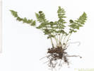 Coll. No. 2019, Fern. Coll. No. 2019, Fern.
|
2019
|
Woodsia ?
Plants of Jefferson County Open Space
Jefferson County, Colorado
Dryopteridaceae
Woodsia oregana D.C. Eaton ssp. cathcartiana (B.L. Rob.) Windham.
Rocky Mountain Woodsia.
Lippincott Property, Jefferson County, Colorado.
Jointly owned by City of Boulder OSMP and Jefferson County Open Space, south bank of Bull Gulch, 23.0 km. north northwest of the GNIS location of Golden.
39.9081°N, 105.279°W.
WGS 1984
Elev. 1987 m.
Deep shade.
Determined by comparison to Coll. No. 2069, which was made from the same plants.
Collected by permit: Jefferson County Open Space, 2019, issued: Mar 1, 2019, to: Tom Schweich.
|
Tom Schweich
2019. |
18-Apr-2019 |
|
|
|
Locations:
Lippincott Ranch.
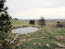 One of several small ponds on the stream. One of several small ponds on the stream.
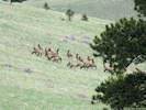 The elk were keeping a close eye on us. The elk were keeping a close eye on us.
|
|
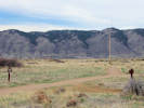
Wednesday, April 24, 2019
Lippincott Property, with Irene Weber.
Also seen,
Clematis hirsutissima,
Anemone patens,
Nothocalais cuspidata, and
Carduus nutans.
Sugar Bowls, Clematis hirsutissima, Irene's knee for scale. |
Southeast parcel, general view to northwest. |
Southeast parcel, general view to northeast. |
View of Lippincott property from southeast corner. |
Carpet of Spring Beauty (Claytonia rosea) under the Ponderosa Pines. |
|
 Flower of Coll. No. 2020, Claytonia rosea Flower of Coll. No. 2020, Claytonia rosea
|
2020
|
Claytonia rosea
Plants of Jefferson County Open Space
Jefferson County, Colorado
Montiaceae
Claytonia rosea Rydb.
Rocky Mountain Springbeauty.
Lippincott Property, Jefferson County, Colorado.
Jointly owned by City of Boulder OSMP and Jefferson County Open Space, south parcel, grassland with a few ponderosa pines, 21.8 km. north northwest of the GNIS location of Golden.
39.9008°N, 105.2722°W.
WGS 1984
Elev. 1960 m.
Collected by permit: Jefferson County Open Space, 2019, issued: Mar 1, 2019, to: Tom Schweich.
|
Tom Schweich, with Irene Weber
2020. |
24-Apr-2019 |
|
|
|
|
2021
|
Cerastium arvense ssp. strictum
Plants of Jefferson County Open Space
Jefferson County, Colorado
Caryophyllaceae
Cerastium arvense L. ssp. strictum Gaudin.
Field Chickweed.
Lippincott Property, Jefferson County, Colorado.
Jointly owned by City of Boulder OSMP and Jefferson County Open Space, south parcel, high prairie above Rocky Flats, 21.8 km. north northwest of the GNIS location of Golden.
39.9008°N, 105.2673°W.
WGS 1984
Elev. 1936 m.
Collected by permit: Jefferson County Open Space, 2019, issued: Mar 1, 2019, to: Tom Schweich.
|
Tom Schweich, with Irene Weber
2021. |
24-Apr-2019 |
|
|
|
|
2022
|
Chorispora tenella
Plants of Jefferson County Open Space
Jefferson County, Colorado
Brassicaceae
Chorispora tenella (Pall.) DC.
Crossflower.
Lippincott Property, Jefferson County, Colorado.
Jointly owned by City of Boulder OSMP and Jefferson County Open Space, south parcel, high prairie above Rocky Flats, 21.5 km. north northwest of the GNIS location of Golden.
39.9001°N, 105.2626°W.
WGS 1984
Elev. 1908 m.
Coordinates estimated by GoogleEarth.
Collected by permit: Jefferson County Open Space, 2019, issued: Mar 1, 2019, to: Tom Schweich.
|
Tom Schweich, with Irene Weber
2022. |
24-Apr-2019 |
|
|
 Cymopterus? Lomatium? Cymopterus? Lomatium?
 Coll. No. 2023, Musineon divaricatum Coll. No. 2023, Musineon divaricatum
|
2023
|
Cymopterus ?
p>
Plants of Jefferson County Open Space
Jefferson County, Colorado
Apiaceae
Musineon divaricatum (Pursh) Raf.
Leafy Wildparsley.
Lippincott Property, Jefferson County, Colorado.
Jointly owned by City of Boulder OSMP and Jefferson County Open Space, south parcel, high prairie above Rocky Flats, 21.7 km. north northwest of the GNIS location of Golden.
39.9021°N, 105.2608°W.
WGS 1984
Elev. 1903 m.
Heavy clay soil.
Collected by permit: Jefferson County Open Space, 2019, issued: Mar 1, 2019, to: Tom Schweich.
|
Tom Schweich, with Irene Weber
2023. |
24-Apr-2019 |
|
|
|
|
2024
|
Leucocrinum montanum
Plants of Jefferson County Open Space
Jefferson County, Colorado
Anthericeae
Leucocrinum montanum Nutt. ex A. Gray.
Star Lily.
Lippincott Property, Jefferson County, Colorado.
Jointly owned by City of Boulder OSMP and Jefferson County Open Space, south parcel, high prairie above Rocky Flats, 21.7 km. north northwest of the GNIS location of Golden.
39.9016°N, 105.2676°W.
WGS 1984
Elev. 1950 m.
Grassy, open, southeast-facing slope.
Collected by permit: Jefferson County Open Space, 2019, issued: Mar 1, 2019, to: Tom Schweich.
|
Tom Schweich, with Irene Weber
2024. |
24-Apr-2019 |
|
|
|
|
2025
|
Viola nuttallii
Plants of Jefferson County Open Space
Jefferson County, Colorado
Violaceae
Viola nuttallii Pursh.
Nuttall's Violet.
Lippincott Property, Jefferson County, Colorado.
Jointly owned by City of Boulder OSMP and Jefferson County Open Space, south parcel, high prairie above Rocky Flats, 21.7 km. north northwest of the GNIS location of Golden.
39.9016°N, 105.2687°W.
WGS 1984
Elev. 1960 m.
Grassy, open, southeast-facing slope.
Collected by permit: Jefferson County Open Space, 2019, issued: Mar 1, 2019, to: Tom Schweich.
|
Tom Schweich, with Irene Weber
2025. |
24-Apr-2019 |
|
|
|
Locations:
North Table Mountain.
|
|
Thursday, April 25, 2019.
North Table Mountain, parking lot for Golden Cliffs Trail
|
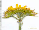
 Habitat of Coll. No. 2026, Corydalis aurea. Habitat of Coll. No. 2026, Corydalis aurea.
 Coll. No. 2026, Corydalis aurea with fruit. Coll. No. 2026, Corydalis aurea with fruit.
|
2026
|
Corydalis aurea
|
Native and Naturalized Flora of the Golden Area, Jefferson County, Colorado
Fumariaceae
Corydalis aurea Willd.
Scrambled Eggs.
North Table Mountain, Jefferson County, Colorado.
City of Golden open space, lower south slope of North Table Mountain, just above the overflow parking lot, 1.6 km. north northeast of the GNIS location of Golden.
39.7663°N, 105.2164°W.
WGS 1984
Elev. 1797 m.
Small colony growing amongst rocks and shrubs, primarily Ribes cereum at this location.
Collected by permit: City of Golden, 2019, issued: Jan 29, 2019, to: Tom Schweich.
|
Tom Schweich
2026. |
25-Apr-2019 |
|
|
|
Locations:
Kenneys Creek.
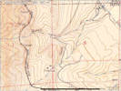
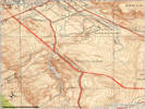 Kenneys Creek shown on the Morrison, CO 1938 quadrangle. Kenneys Creek shown on the Morrison, CO 1938 quadrangle.
|
|
Saturday, April 27, 2019
Found “Kenneys Creek” on the Morrison quad of 1938.
|
|
|
|
|
Aimee Genevieve (Arbios) Chick
Paradise Valley - Born November 9, 1922, in Stockton, CA. Passed away peacefully on April 28, 2019 in Phoenix, AZ
First child to Sodie and Helen (Burubeltz) Arbios. Joining sisters Marie Boyle and Helen Sobczak in heaven. Brother James B. Arbios (Lorene) resides in St. Helena, CA. Attended St. Agnes Grammar School, St. Mary's High School and College of Pacific (student body president in 1943-44) in Stockton. Married USAAF Lt. Henry Chick III (RIP 2007), of Kansas City, MO in 1944. Lived in Baton Rouge, LA, Greenville, MS, Marianna, FL, Maryvale, Casa Grande, Tempe, Scottsdale, and Paradise Valley, AZ. Loving mother to sons Russell Paul (Suzy) of Laguna, CA, William Shaw (Suzanne-RIP 2016) of Scottsdale, and James Philip (Penny) of Lake Elsinore, CA. Devoted Grandmother to Shelby, Donald, Tyler, Chris, Billy, Melissa, Kimberly, David, Genevieve, and Caroline. Great-grandmother to Sutton, Chase, Zelda, Sage, and Twyla. Inspired many pupils for 24 years as a beloved teacher at Ingleside Elementary (Phoenix) and Pueblo Elementary (Scottsdale). Earned a Master's Degree in Education from Arizona State in 1965. Long-time resident of Paradise Valley. Enjoyed traveling to areas of the world she taught about, exploring the Arizona desert, and listening to cherished family friend Dolan Ellis. Fifty-five year breast cancer survivor. Enjoyed many summer vacations in Seabright, CA with extended family and life-long friends. Proud of her Basque heritage. Devout Roman Catholic. Celebration of life mass to be said in her honor on July 18, 2019 at the Oblates of Saint Joseph church in Santa Cruz, CA. Placed in the columbarium next to Henry at the National Memorial Cemetery of Arizona. A glorious lady with a sharp wit and a kind word for everyone. To know her was to love her. May she rest in eternal peace and joy.
|
Published in The Arizona Republic on May 29, 2019. (URL: https://www.legacy.com/obituaries/azcentral/obituary.aspx?n=aimee-genevieve-chick-arbios&pid=192998599)
|
|
Other articles:
• Washington Avenue:
above Rubey;
near Rubey;
Locations:
Schweich Hill.
 Deer in the open space. Deer in the open space.
|
|
Upper Washington Open Space.
Packera plattensis fendleri |
The Washington Avenue Complete Street Project nears completion. |
The Washington Avenue Complete Street Project nears completion. |
|
|
Other articles:
• Lippincott Road:
53000;
Locations:
Lippincott Ranch.
 Woodland Pinedrops seen in the northern parcel. Woodland Pinedrops seen in the northern parcel.
|
|
Sunday, May 26th
Sunday, 26 May 2019
View east from the Lippincott property. |
Meadow in the southwest corner. |
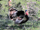
Turkey |
Former watercourse (?), view upstream |
Former watercourse (?), view downstream. |
Meadow and Ponderosa pine woodland in the northernmost part of the property. |

Turkey, maybe the same one. |
|
|
|
2027
|
Field identification: Claytonia rosea
Plants of Jefferson County Open Space
Jefferson County, Colorado
Montiaceae
Claytonia rosea Rydb.
Rocky Mountain Springbeauty.
Lippincott Property, Jefferson County, Colorado.
Jointly owned by City of Boulder OSMP and Jefferson County Open Space, near the northern edge of the property and the Boulder County boundary, grassland in a ponderosa pines woodland, 23.7 km. north northwest of the GNIS location of Golden.
39.9127°N, 105.2787°W.
WGS 1984
Elev. 2066 m.
Collected by permit: Jefferson County Open Space, 2019, issued: Mar 1, 2019, to: Tom Schweich.
|
Tom Schweich
2027. |
26-May-2019 |
|
|
|
|
2028
|
Field identification: Cerastium arvense ssp. strictum
Plants of Jefferson County Open Space
Jefferson County, Colorado
Caryophyllaceae
Cerastium arvense L. ssp. strictum Gaudin.
Field Chickweed.
Lippincott Property, Jefferson County, Colorado.
Jointly owned by City of Boulder OSMP and Jefferson County Open Space, near the northern edge of the property and the Boulder County boundary, grassland in a ponderosa pines woodland, 23.7 km. north northwest of the GNIS location of Golden.
39.9129°N, 105.2785°W.
wgs 1984
Elev. 2055 M.
Common early spring forb, growing with Mertensia lanceolata, Thermopsis, Prunus virginiana, and Pinus ponderosa.
Collected by permit: Jefferson County Open Space, 2019, issued: Mar 1, 2019, to: Tom Schweich.
|
Tom Schweich
2028. |
26-May-2019 |
|
|
|
|
2029
|
Field identification: Senecio integerrimus
Plants of Jefferson County Open Space
Jefferson County, Colorado
Asteraceae
Senecio integerrimus Nutt.
Columbia Ragwort.
Lippincott Property, Jefferson County, Colorado.
Jointly owned by City of Boulder OSMP and Jefferson County Open Space, near the northern edge of the property and the Boulder County boundary, east side of ridge, 25.6 km. north northwest of the GNIS location of Golden.
39.9125°N, 105.2764°W.
WGS 1984
Elev. 2087 m.
Deep forest litter in cracks of ridge bedrock.
Collected by permit: Jefferson County Open Space, 2019, issued: Mar 1, 2019, to: Tom Schweich.
|
Tom Schweich
2029. |
26-May-2019 |
|
|
|
|
2030
|
Field identification: Delphinium, probably D. nuttallii.
Plants of Jefferson County Open Space
Jefferson County, Colorado
Ranunculaceae
Delphinium nuttallianum Pritz.
Twolobe Larkspur.
Lippincott Property, Jefferson County, Colorado.
Jointly owned by City of Boulder OSMP and Jefferson County Open Space, near the northern edge of the property and the Boulder County boundary, east side of ridge, 25.6 km. north northwest of the GNIS location of Golden.
39.9124°N, 105.2765°W.
WGS 1984
Elev. 2089 m.
Perennial plant from a thickened tuber-like root; flowers blue.
In thick soil and forest duff on the exposed east side of a ridge.
Collected by permit: Jefferson County Open Space, 2019, issued: Mar 1, 2019, to: Tom Schweich.
|
Tom Schweich
2030. |
26-May-2019 |
|
|
 Fruit of Coll. No. 2031, Lomatium orientale Fruit of Coll. No. 2031, Lomatium orientale
 Leaf of Coll. No. 2031, Lomatium orientale Leaf of Coll. No. 2031, Lomatium orientale
 Coll. No. 2031, Lomatium orientale Coll. No. 2031, Lomatium orientale
|
2031
|
Field identification: Lomatium orientale.
Plants of Jefferson County Open Space
Jefferson County, Colorado
Apiaceae
Lomatium orientale J.M. Coult. & Rose.
Northern Idaho Biscuitroot.
Lippincott Property, Jefferson County, Colorado.
Jointly owned by City of Boulder OSMP and Jefferson County Open Space, near the northern edge of the property and the Boulder County boundary, east side of ridge, 25.6 km. north northwest of the GNIS location of Golden.
39.9125°N, 105.2765°W.
WGS 1984
Elev. 2088 m.
In thick soil and forest duff on the exposed east side of a ridge.
Collected by permit: Jefferson County Open Space, 2019, issued: Mar 1, 2019, to: Tom Schweich.
|
Tom Schweich
2031. |
26-May-2019 |
|
|
 Flower of Coll. No. 2032, Toxicoscordion paniculatum. Flower of Coll. No. 2032, Toxicoscordion paniculatum.
|
2032
|
Field identification: Zigadenus sp.
Plants of Jefferson County Open Space
Jefferson County, Colorado
Melanthiaceae
Zigadenus paniculatus (Nutt.) S. Watson var. gramineus (Rydb.) Ackerfield.
Grassy Death Camas.
Lippincott Property, Jefferson County, Colorado.
Jointly owned by City of Boulder OSMP and Jefferson County Open Space, near the northern edge of the property and the Boulder County boundary, east side of ridge, 25.6 km. north northwest of the GNIS location of Golden.
39.9126°N, 105.2765°W.
WGS 1984
Elev. 2087 m.
In thick soil and forest duff on the exposed east side of a ridge.
Collected by permit: Jefferson County Open Space, 2019, issued: Mar 1, 2019, to: Tom Schweich.
|
Tom Schweich
2032. |
26-May-2019 |
|
Inflorescence, a raceme, no panicle branches seen;
Flowers, 9-11 mm. dia.;
Tepals, (4)5.4(6) mm., gland indistinct;
Stamens, = tepals;
Ovary, superior.
|
|
|
2033
|
Field identification: Viola nuttallii
Plants of Jefferson County Open Space
Jefferson County, Colorado
Violaceae
Viola nuttallii Pursh.
Nuttall's Violet.
Lippincott Property, Jefferson County, Colorado.
Jointly owned by City of Boulder OSMP and Jefferson County Open Space, near the northern edge of the property and the Boulder County boundary, west side of ridge, 23.6 km. north northwest of the GNIS location of Golden.
39.9123°N, 105.2769°W.
WGS 1984
Elev. 2080 m.
Large plants.
In deep ponderosa pine forest duff near top of forested west southwest-facing slope.
Collected by permit: Jefferson County Open Space, 2019, issued: Mar 1, 2019, to: Tom Schweich.
|
Tom Schweich
2033. |
26-May-2019 |
|
|
|
|
2034
|
Field identification: Leucocrinum montanum
Plants of Jefferson County Open Space
Jefferson County, Colorado
Anthericeae
Leucocrinum montanum Nutt. ex A. Gray.
Star Lily.
Lippincott Property, Jefferson County, Colorado.
Jointly owned by City of Boulder OSMP and Jefferson County Open Space, near the northern edge of the property and the Boulder County boundary, west side of ridge, 23.6 km. north northwest of the GNIS location of Golden.
39.9123°N, 105.2774°W.
WGS 1984
Elev. 2076 m.
Deep ponderosa pine forest duff.
Collected by permit: Jefferson County Open Space, 2019, issued: Mar 1, 2019, to: Tom Schweich.
|
Tom Schweich
2034. |
26-May-2019 |
|
|
|
Literature Cited:
- Nazaire, Mare, and Larry Hufford, 2012.
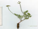
 Corolla of Coll. No. 2035, Mertensia lanceolata Corolla of Coll. No. 2035, Mertensia lanceolata
|
2035
|
Field identification: Mertensia lanceolata
Plants of Jefferson County Open Space
Jefferson County, Colorado
Boraginaceae
Mertensia lanceolata (Pursh) DC.
Prairie Bluebells.
Lippincott Property, Jefferson County, Colorado.
Jointly owned by City of Boulder OSMP and Jefferson County Open Space, north of Bull Gulch about half way to north boundary, west side of ridge, 23.3 km. north northwest of the GNIS location of Golden.
39.9104°N, 105.2778°W.
WGS 1984
Elev. 2030 m.
Deep ponderosa pine forest duff.
Collected by permit: Jefferson County Open Space, 2019, issued: Mar 1, 2019, to: Tom Schweich.
|
Tom Schweich
2035. |
26-May-2019 |
|
Coll. No. 2035, 26 May 2019, characters observed:
Perennial,
relatively short (<40 cm.);
Leaves,
cauline,
adaxial surface slightly pustular strigose directed toward apex;
Calyx,
not divided to base;
Corolla,
tube 6.5 mm. + lobes 7.5 mm., fused 5.5 mm.,
ring of white hairs near (2.2 mm.) base;
Filaments,
3.5 mm.,
attached below (0.5 mm.) fornices,
filaments > anthers;
Anthers,
#6 (!),
1.8-1.9 mm.,
versatile.
|
|
|
2035.1
|
Field identification: Galium aparine.
Plants of Jefferson County Open Space
Jefferson County, Colorado
Rubiaceae
Galium aparine L.
Sticky Willy, Cleavers.
Lippincott Property, Jefferson County, Colorado.
Jointly owned by City of Boulder OSMP and Jefferson County Open Space, north of Bull Gulch about half way to north boundary, west side of ridge, 23.3 km. north northwest of the GNIS location of Golden.
39.9104°N, 105.2778°W.
WGS 1984
Elev. 2030 m.
Annual.
Deep ponderosa pine forest duff.
Collected by permit: Jefferson County Open Space, 2019, issued: Mar 1, 2019, to: Tom Schweich.
|
Tom Schweich
2035.1 |
26-May-2019 |
|
|
|
Literature Cited:
- Hufford, Larry, and Michelle McMahon, 2004.
- James, Edwin, 1825.
 Coll. No. 2036, Besseya plantaginea Coll. No. 2036, Besseya plantaginea
|
2036
|
Field identification: Plantaginaceae, office: Besseya plantaginea
Plants of Jefferson County Open Space
Jefferson County, Colorado
Plantaginaceae
Besseya plantaginea (James) Rydb.
White River Kittentails.
Lippincott Property, Jefferson County, Colorado.
Jointly owned by City of Boulder OSMP and Jefferson County Open Space, south of Bull Gulch approximate centroid of parcel, 22.6 km. north northwest of the GNIS location of Golden.
39.9051°N, 105.2791°W.
WGS 1984
Elev. 2021 m.
Northwest facing forested slope.
Collected by permit: Jefferson County Open Space, 2019, issued: Mar 1, 2019, to: Tom Schweich.
|
Tom Schweich
2036. |
26-May-2019 |
|
Inflorescence of Coll. No. 2036, Besseya plantaginea |
Described by James (1825) in his Catalogue of Plants, collected between Palmer Lake and Fountain.
V[eronica] plantaginea. N. S.? Flowers spiked, unibracteate.
Capsule nearly orbicular, dehiscent at the margin.
Radical leaves numerous and large, oval-lanceolate, stiped.
Margin crenate.
Those of the scape few, sessile, and alternate,
Spike long, dense-flowered.
This plant, so unlike in habit and appearance to the
American Species of Veronica, seems referable to no other Genus
among the Pediculariæ of Jussieu,
to which it is manifestly nearly allied.
Habitat on open plains within the Rocky Mountains;
flowering in June and July.
|
Hufford and McMahon (2004) make a strong argument for submerging Besseya back into Synthyris.
A central concern is the paraphyly of Synthyris in the face of continued recognition of Besseya as a coordinate group.
We advocate a classification that reflects our knowledge of evolutionary relationships,
especially monophyletic groups.
Thus, we consider it important that Besseya be classified as part of Synthyris
(Hufford and McMahon, 2004).
|
 Coll. No. 2037, Viola canadensis Coll. No. 2037, Viola canadensis
|
2037
|
Field indentification: Viola sp.
Plants of Jefferson County Open Space
Jefferson County, Colorado
Violaceae
Viola canadensis L.
Canadian White Violet.
Lippincott Property, Jefferson County, Colorado.
Jointly owned by City of Boulder OSMP and Jefferson County Open Space, south of Bull Gulch approximate centroid of parcel, 22.6 km. north northwest of the GNIS location of Golden.
39.9044°N, 105.2797°W.
WGS 1984
Elev. 2034 m.
Northwest facing forested slope.
Collected by permit: Jefferson County Open Space, 2019, issued: Mar 1, 2019, to: Tom Schweich.
|
Tom Schweich
2037. |
26-May-2019 |
|
|
 Coll. No. 2037.1, Noccaea fendleri var. glauca Coll. No. 2037.1, Noccaea fendleri var. glauca
|
2037.1
|
Field identification: Noccaea fendleri.
Plants of Jefferson County Open Space
Jefferson County, Colorado
Brassicaceae
Noccaea fendleri (A. Gray) Holub.
Lippincott Property, Jefferson County, Colorado.
Jointly owned by City of Boulder OSMP and Jefferson County Open Space, south of Bull Gulch approximate centroid of parcel, 22.6 km. north northwest of the GNIS location of Golden.
39.9044°N, 105.2797°W.
WGS 1984
Elev. 2034 m.
Northwest facing forested slope.
Collected with Besseya plantaginea and Viola canadensis.
Collected by permit: Jefferson County Open Space, 2019, issued: Mar 1, 2019, to: Tom Schweich.
|
Tom Schweich
2037.1 |
26-May-2019 |
|
|
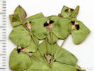
 Leaves of Coll. No. 2037.2 Leaves of Coll. No. 2037.2
 Coll. No. 2037.2 Coll. No. 2037.2
 Tuber (?) of Coll. No. 2037.2 Tuber (?) of Coll. No. 2037.2
|
2037.2
|
Accidental collection, probably Delphinium nuttallianum, per the fusiform or tuberous roots, and the ternately compound leaves with spinulose tips.
Rehydrated Leaves of Coll. No. 2037.2 |
|
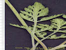
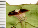
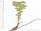
 Woolly hairs in axils of basal leaves of Coll. No. 2038, Arnica fulgens Woolly hairs in axils of basal leaves of Coll. No. 2038, Arnica fulgens
|
2038
|
Field identification: Arnica fulgens
Plants of Jefferson County Open Space
Jefferson County, Colorado
Asteraceae
Arnica fulgens Pursh.
Shining Leopardbane.
Lippincott Property, Jefferson County, Colorado.
Jointly owned by City of Boulder OSMP and Jefferson County Open Space, south of Bull Gulch approximate centroid of parcel, 22.4 km. north northwest of the GNIS location of Golden.
39.9038°N, 105.2788°W.
WGS 1984
Elev. 2053 m.
Open prairie in small saddle.
Collected by permit: Jefferson County Open Space, 2019, issued: Mar 1, 2019, to: Tom Schweich.
|
Tom Schweich
2038. |
26-May-2019 |
|
Coll. No. 2038, 26 May 2019, characters observed:
Perennial herb,
25 cm.,
fibrous roots;
Stem,
glandular to densely glandular distally;
Leaves,
basal and cauline,
basal,
petiole 40 mm. + blade 46 mm. × 12 mm. wide,
long brown woolly hairs in the axils,
3-5± subparallel veins,
cauline,
opposite,
2-3 pairs,
sessile,
reduced distally,
elliptical,
glandular adaxial and margin,
margin, sinuate to entire,
tips, round;
Inflorescence,
head,
1 per stem,
showy,
>leaves;
Involucre,
hemispheric,
11 mm. × 25 mm. wide;
Phyllaries,
in 2 series (not strongly overlapping),
±equal,
13 mm. × 2.8 mm. wide,
green,
margin of inner series chartaceous,
tips, purplish-red,
glandular,
margins, ±flat;
Receptacle,
epaleate,
short bristles;
Flowers,
2 kinds;
Ray flowers,
#12-14,
tube 4 mm. + blade 11 mm. × 5 mm. wide,
yellow,
fertile;
Disk flowers,
many,
tube 6 mm. + lobes 1 mm.,
expanding gradually,
yellow,
open,
bisexual;
Pappus,
well-developed bristles, barbellate,
7.5 mm.;
Cypsela,
4 mm. × 1.3 mm wide,
compressed front to back,
hairy on angles.
|
 Coll. No. 2039, Iris missouriensis Coll. No. 2039, Iris missouriensis
|
2039
|
Field identification: Iris missouriensis.
Plants of Jefferson County Open Space
Jefferson County, Colorado
Iridaceae
Iris missouriensis Nutt.
Western Blue Flag.
Lippincott Property, Jefferson County, Colorado.
Jointly owned by City of Boulder OSMP and Jefferson County Open Space, south of Bull Gulch approximate centroid of parcel, 22.3 km. north northwest of the GNIS location of Golden.
39.9028°N, 105.278°W.
WGS 1984
Elev. 2041 m.
Open prairie in small saddle.
Collected by permit: Jefferson County Open Space, 2019, issued: Mar 1, 2019, to: Tom Schweich.
|
Tom Schweich
2039. |
26-May-2019 |
|
|
|
Locations:
Colorado School of Mines Survey Field.
Deadman Gulch.
Kinney Run.
|
|
Sunday, June 2, 2019
Illinois Avenue, Deadman Gulch, Kinney Run, and Survey Field
|
|
|
2040
|
Field identification: Prunus virginiana
|
Native and Naturalized Flora of the Golden Area, Jefferson County, Colorado
Rosaceae
Prunus virginiana L.
Chokecherry.
Deadman Gulch, Jefferson County, Colorado.
Slightly above the watercourse locally named “Kinney Run,” between US Highway 6 and Eagle Ridge Drive, 3.2 km. south of the GNIS location of Golden
39.7339°N, 105.216°W.
WGS 1984
Elev. 1790 m.
Collected by permit: City of Golden, 2019, issued: Jan 29, 2019, to: Tom Schweich.
|
Tom Schweich
2040. |
2-Jun-2019 |
|
|
|
|
2041
|
Field identification: Rhus trilobata
|
Native and Naturalized Flora of the Golden Area, Jefferson County, Colorado
Anacardiaceae
Rhus trilobata Torrey & A. Gray.
Squawbush.
Deadman Gulch, Jefferson County, Colorado.
Slightly above the watercourse locally named “Kinney Run,” between US Highway 6 and Eagle Ridge Drive, 3.2 km. south of the GNIS location of Golden
39.7339°N, 105.216°W.
WGS 1984
Elev. 1791 m.
Variety trilobata if infraspecific names are to be applied.
Collected by permit: City of Golden, 2019, issued: Jan 29, 2019, to: Tom Schweich.
|
Tom Schweich
2041. |
2-Jun-2019 |
|
|
|
|
2042
|
Field identification: Scutellaria brittonii.
|
Native and Naturalized Flora of the Golden Area, Jefferson County, Colorado
Lamiaceae
Scutellaria brittonii Porter.
Britton's Skullcap.
Deadman Gulch, Jefferson County, Colorado.
Slightly above the watercourse locally named “Kinney Run,” between US Highway 6 and Eagle Ridge Drive, 50 m. northwest of Kinney Run Trail, 3.17 km. south of the GNIS location of Golden.
39.734°N, 105.2163°W.
WGS 1984
Elev. 1798 m.
Southeast-facing slope, most dense in and around Rhus trilobata shrubs.
Collected by permit: City of Golden, 2019, issued: Jan 29, 2019, to: Tom Schweich.
|
Tom Schweich
2042. |
2-Jun-2019 |
|
|
 Seed of Coll. No. 2042.1, Musineon divaricatum Seed of Coll. No. 2042.1, Musineon divaricatum
 Inflorescence of Coll. No. 2042.1, Musineon divaricatum Inflorescence of Coll. No. 2042.1, Musineon divaricatum
|
2042.1
|
Field identification: Musineon divaricatum.
|
Native and Naturalized Flora of the Golden Area, Jefferson County, Colorado
Apiaceae
Musineon divaricatum (Pursh) Raf.
Leafy Wildparsley.
Deadman Gulch, Jefferson County, Colorado.
Slightly above the watercourse locally named “Kinney Run,” between US Highway 6 and Eagle Ridge Drive, 50 m. northwest of Kinney Run Trail, 3.17 km. south of the GNIS location of Golden.
39.734°N, 105.2163°W.
WGS 1984
Elev. 1798 m.
In fruit.
Collected by permit: City of Golden, 2019, issued: Jan 29, 2019, to: Tom Schweich.
|
Tom Schweich
2042.1 |
2-Jun-2019 |
|
|
 Calyx and corolla of Coll. No. 2043, Orobanche fasciculata Calyx and corolla of Coll. No. 2043, Orobanche fasciculata
 Coll. No. 2043, Orobanche fasciculata Coll. No. 2043, Orobanche fasciculata
|
2043
|
Field identification: Orobanche fasciculata.
|
Native and Naturalized Flora of the Golden Area, Jefferson County, Colorado
Orobanchaceae
Orobanche fasciculata Nutt.
Clustered Broomrape.
Deadman Gulch, Jefferson County, Colorado.
Slightly above the watercourse locally named “Kinney Run,” between US Highway 6 and Eagle Ridge Drive, 90 m. northwest of Kinney Run Trail, 3.17 km. south of the GNIS location of Golden.
39.734°N, 105.2166°W.
Elev. 1806 m.
With Artemisia frigida and Lithospermum incisum
Collected by permit: City of Golden, 2019, issued: Jan 29, 2019, to: Tom Schweich.
|
Tom Schweich
2043. |
2-Jun-2019 |
|
stem leaves, #8, glandular-hairy;
calyx tube 4.5 mm. + lobes 5 mm.;
flowers, #6.
|
 Coll. No. 2044, Packera Coll. No. 2044, Packera plattensis fendleri
|
2044
|
Field identification: Packera plattensis.
|
Native and Naturalized Flora of the Golden Area, Jefferson County, Colorado
Asteraceae
Packera plattensis (Nuttall) W. A. Weber & Á. Löve.
Prairie Groundsel.
Deadman Gulch, Jefferson County, Colorado.
Above the watercourse locally named “Kinney Run,” between US Highway 6 and Eagle Ridge Drive, 110 m. northwest of Kinney Run Trail, 3.17 km. south of the GNIS location of Golden.
39.7339°N, 105.2169°W.
WGS 1984
Elev. 1817 m.
Northeast-facing slope, more open stoney ground, on what appears to be a southeast to northwest trend approximating the trend of Eagle Ridge to the southeast.
Collected by permit: City of Golden, 2019, issued: Jan 29, 2019, to: Tom Schweich.
|
Tom Schweich
2044. |
2-Jun-2019 |
|
|
|
|
2044.1
|
Field identification: something weird, later: Ipomopsis spicata.
|
Native and Naturalized Flora of the Golden Area, Jefferson County, Colorado
Polemoniaceae
Ipomopsis spicata (Nutt.) V.E. Grant.
Spiked Ipomopsis.
Deadman Gulch, Jefferson County, Colorado.
Above the watercourse locally named “Kinney Run,” between US Highway 6 and Eagle Ridge Drive, 110 m. northwest of Kinney Run Trail, 3.17 km. south of the GNIS location of Golden.
39.7339°N, 105.2169°W.
WGS 1984
Elev. 1817 m.
Northeast-facing slope, more open stoney ground, on what appears to be a southeast to northwest trend approximating the trend of Eagle Ridge to the southeast.
Collected by permit: City of Golden, 2019, issued: Jan 29, 2019, to: Tom Schweich.
|
Tom Schweich
2044.1 |
2-Jun-2019 |
|
|
 Cyathium of Coll. No. 2044.2, Euphorbia brachycera Cyathium of Coll. No. 2044.2, Euphorbia brachycera
 Inflorescence of Coll. No. 2044.2, Euphorbia brachycera Inflorescence of Coll. No. 2044.2, Euphorbia brachycera
 Coll. No. 2044.2, Euphorbia brachycera Coll. No. 2044.2, Euphorbia brachycera
|
2044.2
|
Field identification: Euphorbiaceae, Office: Euphorbia brachycera.
|
Native and Naturalized Flora of the Golden Area, Jefferson County, Colorado
Euphorbiaceae
Euphorbia brachycera Engelm.
Horned Spurge.
Deadman Gulch, Jefferson County, Colorado.
Above the watercourse locally named “Kinney Run,” between US Highway 6 and Eagle Ridge Drive, 110 m. northwest of Kinney Run Trail, 3.17 km. south of the GNIS location of Golden.
39.7339°N, 105.2169°W.
WGS 1984
Elev. 1817 m.
Northeast-facing slope, more open stoney ground, on what appears to be a southeast to northwest trend approximating the trend of Eagle Ridge to the southeast.
Collected by permit: City of Golden, 2019, issued: Jan 29, 2019, to: Tom Schweich.
|
Tom Schweich
2044.2 |
2-Jun-2019 |
|
|
|
|
2045
|
Field identification: Ipomopsis spicata.
|
Native and Naturalized Flora of the Golden Area, Jefferson County, Colorado
Polemoniaceae
Ipomopsis spicata (Nutt.) V.E. Grant.
Spiked Ipomopsis.
Deadman Gulch, Jefferson County, Colorado.
Above the watercourse locally named "Kinney Run," between US Highway 6 and Eagle Ridge Drive, 140 m. northwest of Kinney Run Trail, 3.17 km. south of the GNIS location of Golden. Very near the boundary of the Colorado School of Mines Survey Field.
39.7341°N, 105.2171°W.
WGS 1984
Elev. 1815 m.
Northeast-facing slope, more open stoney ground, on what appears to be a southeast to northwest trend approximating the trend of Eagle Ridge to the southeast.
Same as Coll. No. 2044.1. A little beaten down by recent hail.
Collected by permit: City of Golden, 2019, issued: Jan 29, 2019, to: Tom Schweich.
|
Tom Schweich
2045. |
2-Jun-2019 |
|
|
|
|
2046
|
Field identification: Oxytropis lambertii.
|
Native and Naturalized Flora of the Golden Area, Jefferson County, Colorado
Fabaceae
Oxytropis lambertii Pursh.
Purple Locoweed.
Colorado School of Mines Survey Field, Jefferson County, Colorado.
Above the watercourse locally named "Kinney Run," between US Highway 6 and Eagle Ridge Drive, 190 m. northwest of Kinney Run Trail, 3.17 km. south of the GNIS location of Golden. Very near the boundary of the Colorado School of Mines Survey Field.
39.7341°N, 105.2175°W.
WGS 1984
Elev. 1810 m.
A collection of O. lambertii by Edward L. Greene on May 1, 1870 is the first known plant collection from Golden (PBRU35080).
Collected by permit: Colorado School of Mines, 2019, issued: Apr 1, 2019, to: Tom Schweich.
|
Tom Schweich
2046. |
2-Jun-2019 |
|
|
|
|
2047
|
Field identification: Cercocarpus montanus.
|
Native and Naturalized Flora of the Golden Area, Jefferson County, Colorado
Rosaceae
Cercocarpus montanus Raf.
Alder-Leaf Mountain Mahogany.
Colorado School of Mines Survey Field, Jefferson County, Colorado.
Southeast portion of the Survey Field, overlooking an unnamed creek, on the lip of an northwest-facing alluvial terrace, 3.09 km. south of the GNIS location of Golden.
39.7342°N, 105.2191°W.
WGS 1984
Elev. 1825 m.
Mixed-grass prairie and shrubland.
Collected by permit: Colorado School of Mines, 2019, issued: Apr 1, 2019, to: Tom Schweich.
|
Tom Schweich
2047. |
2-Jun-2019 |
|
|
|
|
2048
|
Field identification: Physocarpus monogynus Crataegus succulenta
|
Native and Naturalized Flora of the Golden Area, Jefferson County, Colorado
Rosaceae
Crataegus succulenta Schrad. ex Link.
Fleshy Hawthorn.
Colorado School of Mines Survey Field, Jefferson County, Colorado.
Highest Great Plains at the Rocky Mountain Front Range, southeast portion of Survey Field, beside a small unnamed stream tributary to Deadman Gulch (Kinney Run), 2.9 km. south of the GNIS location of Golden
39.7357°N, 105.219°W.
WGS 1984
Elev. 1800 m.
Thorns 4.3-4.8 mm.
Collected by permit: Colorado School of Mines, 2019, issued: Apr 1, 2019, to: Tom Schweich.
|
Tom Schweich
2048. |
2-Jun-2019 |
|
|
|
|
2049
|
Field identification: Antennaria parvifolia.
|
Native and Naturalized Flora of the Golden Area, Jefferson County, Colorado
Asteraceae
Antennaria parvifolia Nutt.
Small-Leaf Pussytoes.
Colorado School of Mines Survey Field, Jefferson County, Colorado.
Highest Great Plains at the Rocky Mountain Front Range, southeast portion of Survey Field, on a terrace above a small unnamed stream tributary to Deadman Gulch (Kinney Run), 2.9 km. south of the GNIS location of Golden
39.7357°N, 105.2176°W.
WGS 1984
Elev. 1808 m.
Collected by permit: Colorado School of Mines, 2019, issued: Apr 1, 2019, to: Tom Schweich.
|
Tom Schweich
2049. |
2-Jun-2019 |
|
|
|
Locations:
North Table Mountain.
|
|
Tuesday, June 4, 2019
|
|
|
2050
|
Field identification: Aegilops cylindrica.
|
Native and Naturalized Flora of the Golden Area, Jefferson County, Colorado
Poaceae
Aegilops cylindrica Host.
Jointed Goat Grass.
North Table Mountain, Jefferson County, Colorado.
Lower southwest slopes of North Table Mountain, along the lower portion of the City of Golden North Table Mountain trail, 1.9 km. north of the GNIS location of Golden.
39.7687°N, 105.2231°W.
WGS 1984
Elev. 1806 m.
Highest prairie mixed with foothill shrubs, also collected nearby Sphaeralcea coccinea, Linaria dalmatica, and Thinopyrum intermedium.
Collected by permit: City of Golden, 2019, issued: Jan 29, 2019, to: Tom Schweich.
|
Tom Schweich
2050. |
4-Jun-2019 |
|
|
|
|
2051
|
Field identification: Hesperostipa comata.
|
Native and Naturalized Flora of the Golden Area, Jefferson County, Colorado
Poaceae
Hesperostipa comata (Trin. & Rupr.) Barkworth.
Needle and Thread.
North Table Mountain, Jefferson County, Colorado.
Lower southwest slopes of North Table Mountain, along the lower portion of the City of Golden North Table Mountain trail, 1.9 km. north of the GNIS location of Golden.
39.7687°N, 105.223°W.
WGS 1984
Elev. 1828 m.
Highest prairie mixed with foothill shrubs, also collected nearby: Aegilops cylindrica, Sphaeralcea coccinea, Linaria dalmatica, and Thinopyrum intermedium.
Collected by permit: City of Golden, 2019, issued: Jan 29, 2019, to: Tom Schweich.
|
Tom Schweich
2051. |
4-Jun-2019 |
|
|
|
|
2052
|
Field identification: Lithospermum occidentale.
|
Native and Naturalized Flora of the Golden Area, Jefferson County, Colorado
Boraginaceae
Lithospermum occidentale (Mack.) Weakley, Witsell & D. Estes.
Western Gromwell nee Marbleseed.
North Table Mountain, Jefferson County, Colorado.
Lower southwest slopes of North Table Mountain, along the lower portion of the City of Golden North Table Mountain trail, 1.9 km. north of the GNIS location of Golden.
39.7687°N, 105.223°W.
WGS 1984
Elev. 1836 m.
Highest prairie mixed with foothill shrubs, also collected nearby: Aegilops cylindrica, Hesperostipa comata, Sphaeralcea coccinea, Linaria dalmatica, and Thinopyrum intermedium.
Collected by permit: City of Golden, 2019, issued: Jan 29, 2019, to: Tom Schweich.
|
Tom Schweich
2052. |
4-Jun-2019 |
|
|
|
|
2053
|
Field identification: Sphaeralcea coccinea.
|
Native and Naturalized Flora of the Golden Area, Jefferson County, Colorado
Malvaceae
Sphaeralcea coccinea (Nutt.) Rydb.
Scarlet Globemallow.
North Table Mountain, Jefferson County, Colorado.
Lower southwest slopes of North Table Mountain, along the lower portion of the City of Golden North Table Mountain trail, 1.95 km. north of the GNIS location of Golden.
39.7689°N, 105.2233°W.
WGS 1984
Elev. 1837 m.
Most dense along disturbed trail sides, the roots of this one extended under the trail.
Highest prairie mixed with foothill shrubs, also collected nearby: Aegilops cylindrica, Hesperostipa comata, Lithospermum occidentale, Linaria dalmatica, and Thinopyrum intermedium.
Collected by permit: City of Golden, 2019, issued: Jan 29, 2019, to: Tom Schweich.
|
Tom Schweich
2053. |
4-Jun-2019 |
|
|
|
|
2054
|
Field identification: Linaria dalmatica.
|
Native and Naturalized Flora of the Golden Area, Jefferson County, Colorado
Plantaginaceae
Linaria dalmatica (L.) Mill.
Dalmatian ToadFlax.
North Table Mountain, Jefferson County, Colorado.
Lower southwest slopes of North Table Mountain, on the section line between Sections 21 and 28 which for unknown reason has been plowed or otherwise disturbed, 1.95 km. north of the GNIS location of Golden.
39.769°N, 105.2228°W.
WGS 1984
Elev. 1848 m.
Highest prairie mixed with foothill shrubs, also collected nearby: Aegilops cylindrica, Hesperostipa comata, Lithospermum occidentale, Sphaeralcea coccinea, and Thinopyrum intermedium.
Collected by permit: City of Golden, 2019, issued: Jan 29, 2019, to: Tom Schweich.
|
Tom Schweich
2054. |
4-Jun-2019 |
|
|
 Inflorescence of Coll. No. 2055, Toxicoscordion paniculatum Inflorescence of Coll. No. 2055, Toxicoscordion paniculatum
 Panicle at base of inflorescence of Coll. No. 2055, Toxicoscordion paniculatum. Panicle at base of inflorescence of Coll. No. 2055, Toxicoscordion paniculatum.
|
2055
|
Field identification: Zigadene lily.
Plants of Jefferson County Open Space
Jefferson County, Colorado
Melanthiaceae
Zigadenus paniculatus (Nutt.) S. Watson var. gramineus (Rydb.) Ackerfield.
Grassy Death Camas.
North Table Mountain Park, Jefferson County, Colorado.
Small grassy areas on the upper southwest slope of North Table Mountain, hummocky terrain, probably in the head of one or more landslides, 1.95 km. north of the GNIS location of Golden.
39.769°N, 105.2211°W.
WGS 1984
Elev. 1907 m.
One of three plants collected is paniculate and then only at the base of the inflorescence.
In a small wedge of Jefferson County lands, between two City of Golden-owned parcels.
Collected by permit: Jefferson County Open Space, 2019, issued: Mar 1, 2019, to: Tom Schweich.
|
Tom Schweich
2055. |
4-Jun-2019 |
|
|
|
|
2056
|
Field identification: Carex sp.
|
Native and Naturalized Flora of the Golden Area, Jefferson County, Colorado
Cyperaceae
Carex occidentalis L. H. Bailey.
Western Sedge.
North Table Mountain, Jefferson County, Colorado.
Small grassy areas on the upper southwest slope of North Table Mountain, hummocky terrain, probably in the head of one or more landslides, 1.98 km. north of the GNIS location of Golden.
39.7692°N, 105.2209°W.
WGS 1984
Elev. 1905 m.
Collected by permit: City of Golden, 2019, issued: Jan 29, 2019, to: Tom Schweich.
|
Tom Schweich
2056. |
4-Jun-2019 |
|
Coll. No. 2056, 4 Jun 2019, characters observed:
Perennial sedge;
Habit,
caespitose;
Culms,
to 50 cm.,
slightly scabrous especially below the inflorescence;
Leaves,
1.7 mm. wide,
green,
sheaths,
white-hyaline,
ventrally smooth;
Inflorescence,
29 mm. × 10 mm. wide,
loosely clustered;
Spikes,
identical appearing,
6 mm. × 5 mm. wide,
terminal and lateral androgynous
(there are no anthers, but the flowers at the top of each spike contain white filaments);
Bracts,
5 mm.,
proximal, 10 mm.,
<inflorescence,
leaf-like;
Pistillate scales,
3.5 mm.,
<perigynia,
mid-vein green,
brown laterally,
hyaline margin;
Perigynia,
#12 per spike,
4 mm. × 1.6-1.8(2) mm. wide,
weakly winged,
±veinless,
glabrous,
beak,
1 mm.,
flattish,
dorsally bulged and the margin is displaced but not onto the ventral face;
Achene,
2.3 mm. × 1.5 mm. wide,
biconvex,
short oblong;
Stigmas,
#2;
Anthers,
n/a;
|
|
Other articles:
• Golden Checklist Flora:
Poa pratensis;
 Coll. No. 2057, Poa pratensis Coll. No. 2057, Poa pratensis
|
2057
|
Field identification: Poa sp.
|
Native and Naturalized Flora of the Golden Area, Jefferson County, Colorado
Poaceae
Poa pratensis L.
Kentucky Bluegrass.
North Table Mountain, Jefferson County, Colorado.
Small grassy areas on the upper southwest slope of North Table Mountain, hummocky terrain, probably in the head of one or more landslides, 1.96 km. north of the GNIS location of Golden.
39.7691°N, 105.2211°W.
WGS 1984
Elev. 1905 m.
Collected by permit: City of Golden, 2019, issued: Jan 29, 2019, to: Tom Schweich.
|
Tom Schweich
2057. |
4-Jun-2019 |
|
|
|
|
2058
|
Field identification: Physocarpus monogynus.
Plants of Jefferson County Open Space
Jefferson County, Colorado
Rosaceae
Physocarpus monogynus (Torr.) J.M. Coult.
Mountain Ninebark.
North Table Mountain Park, Jefferson County, Colorado.
Small grassy areas on the upper southwest slope of North Table Mountain, hummocky terrain, probably in the head of one or more landslides, 1.94 km. north of the GNIS location of Golden.
39.7689°N, 105.2209°W.
WGS 1984
Elev. 1912 m.
In a small wedge of Jefferson County Open Space lands between two City of Golden parcels.
Collected by permit: Jefferson County Open Space, 2019, issued: Mar 1, 2019, to: Tom Schweich.
|
Tom Schweich
2058. |
4-Jun-2019 |
|
|
|
Locations:
Lippincott Ranch.
|
|
Thursday, June 6, 2019
Lippincott property with Anthony Massaro, Tanner Marshall, Megan Bowes, and Chris Wanner.
|
|
|
2059
|
Field identification: Senecio integerrimus.
Plants of Jefferson County Open Space
Jefferson County, Colorado
Asteraceae
Senecio integerrimus Nutt.
Columbia Ragwort.
Lippincott Property, Jefferson County, Colorado.
Northernmost Jefferson County, parcel jointly owned by City of Boulder and Jefferson County Open Space, approximate centroid of parcel, 22 km. north northwest of the GNIS location of Golden.
39.9019°N, 105.2741°W.
WGS 1984
Elev. 2027 m.
Ponderosa pine woodland where the highest Great Plains meets the Rocky Mountain Front Range, parcel disturbed by cattle grazing and clay mining.
Collected by permit: Jefferson County Open Space, 2019, issued: Mar 1, 2019, to: Tom Schweich.
|
Tom Schweich
2059. |
6-Jun-2019 |
|
|
|
|
2060
|
Field identification: Potentilla fissa.
Plants of Jefferson County Open Space
Jefferson County, Colorado
Rosaceae
Potentilla fissa Nutt. ex Torr. & A.Gray.
Bigflower Cinquefoil.
Lippincott Property, Jefferson County, Colorado.
Northernmost Jefferson County, parcel jointly owned by City of Boulder and Jefferson County Open Space, approximate centroid of parcel, 22.2 km. north northwest of the GNIS location of Golden.
39.9021°N, 105.2769°W.
WGS 1984
Elev. 2019 m.
Growing with Potentilla recta which was not yet in bloom.
GPS coordinates were doubtful and revised using GoogleEarth.
Collected by permit: Jefferson County Open Space, 2019, issued: Mar 1, 2019, to: Tom Schweich.
|
Tom Schweich, with Anthony Massaro and Tanner Marshall
2060. |
6-Jun-2019 |
|
The coordinates reported by my GPS receiver were (39.902637117,-105.275957342), but when mapped in ArcMap they were up on the side of the hogback. I'm sure the collection was made below the hogback fairly close to the stream. I used GoogleEarth to estimate different coordinates of (39.902078,-105.276874) which are about 125 m. to the southwest.
|
 Coll. No. 2061, Crataegus succulenta Coll. No. 2061, Crataegus succulenta
|
2061
|
Field identification: Crataegus succulenta.
Plants of Jefferson County Open Space
Jefferson County, Colorado
Rosaceae
Crataegus succulenta Schrad. ex Link.
Fleshy Hawthorn.
Lippincott Property, Jefferson County, Colorado.
Northernmost Jefferson County, parcel jointly owned by City of Boulder and Jefferson County Open Space, approximate centroid of parcel, 22.2 km. north northwest of the GNIS location of Golden.
39.902°N, 105.2771°W.
WGS 1984
Elev. 2025 m.
Highest Great Plains meets the Rocky Mountain Front Range, bottomland between two hogbacks, parcel disturbed by cattle grazing and clay mining.
Collected by permit: Jefferson County Open Space, 2019, issued: Mar 1, 2019, to: Tom Schweich.
|
Tom Schweich
2061. |
6-Jun-2019 |
|
|
|
|
2062
|
Field identification: Penstemon virens.
Plants of Jefferson County Open Space
Jefferson County, Colorado
Plantaginaceae
Penstemon virens Pennell ex Rydb.
Front Range Beardtongue.
Lippincott Property, Jefferson County, Colorado.
Northernmost Jefferson County, parcel jointly owned by City of Boulder and Jefferson County Open Space, approximate centroid of parcel, 22.2 km. north northwest of the GNIS location of Golden.
39.9026°N, 105.278°W.
WGS 1984
Elev. 2040 m.
Highest Great Plains meets the Rocky Mountain Front Range, southern edge of a small meadow in a saddle, parcel disturbed by cattle grazing and clay mining.
Collected by permit: Jefferson County Open Space, 2019, issued: Mar 1, 2019, to: Tom Schweich.
|
Tom Schweich
2062. |
6-Jun-2019 |
|
|
|
|
2063
|
Field identification: Veronica, maybe V. arvensis.
Plants of Jefferson County Open Space
Jefferson County, Colorado
Plantaginaceae
Veronica arvensis L.
Corn Speedwell.
Lippincott Property, Jefferson County, Colorado.
Northernmost Jefferson County, parcel jointly owned by City of Boulder and Jefferson County Open Space, approximate centroid of parcel, 22.3 km. north northwest of the GNIS location of Golden.
39.9035°N, 105.2782°W.
WGS 1984
Elev. 2044 m.
Annual, inflorescence terminal, pedicel short, corolla blue.
Margin of a small meadow in saddle between hogback and flatiron. Very wet.
Collected by permit: Jefferson County Open Space, 2019, issued: Mar 1, 2019, to: Tom Schweich.
|
Tom Schweich
2063. |
6-Jun-2019 |
|
|
 Fruit of Coll. No. 2063.1, Veronica biloba Fruit of Coll. No. 2063.1, Veronica biloba
 Coll. No. 2063.1, Veronica biloba Coll. No. 2063.1, Veronica biloba
|
2063.1
|
Accidental collection, some kind of Veronica.
Plants of Jefferson County Open Space
Jefferson County, Colorado
Plantaginaceae
Veronica biloba L.
Twolobe Speedwell.
Lippincott Property, Jefferson County, Colorado.
Northernmost Jefferson County, parcel jointly owned by City of Boulder and Jefferson County Open Space, approximate centroid of parcel, 22.3 km. north northwest of the GNIS location of Golden.
39.9035°N, 105.2782°W.
WGS 1984
Elev. 2044 m.
Annual, petiole short, flowers in terminal raceme, pedicels long, style short, fruit notch deep.
Margin of a small meadow in saddle between hogback and flatiron. Very wet. Collected with V. arvensis.
Collected by permit: Jefferson County Open Space, 2019, issued: Mar 1, 2019, to: Tom Schweich.
|
Tom Schweich
2063.1 |
6-Jun-2019 |
|
|
|
Other articles:
• Golden Checklist Flora:
Alyssum alyssoides;
 Coll. No. 2063.2, Alyssum alyssoides Coll. No. 2063.2, Alyssum alyssoides
|
2063.2
|
Accidental collection: Alyssum alyssoides
Plants of Jefferson County Open Space
Jefferson County, Colorado
Brassicaceae
Alyssum alyssoides (L.) L.
Lippincott Property, Jefferson County, Colorado.
Northernmost Jefferson County, parcel jointly owned by City of Boulder and Jefferson County Open Space, approximate centroid of parcel, 22.3 km. north northwest of the GNIS location of Golden.
39.9035°N, 105.2782°W.
WGS 1984
Elev. 2044 m.
Margin of a small meadow in saddle between hogback and flatiron. Very wet. Collected with Veronica arvensis and V. biloba.
Collected by permit: Jefferson County Open Space, 2019, issued: Mar 1, 2019, to: Tom Schweich.
|
Tom Schweich
2063.2 |
6-Jun-2019 |
|
|
 Coll. No. 2063.3, Erodium cicutarium Coll. No. 2063.3, Erodium cicutarium
 Coll. No. 2063.3, Erodium cicutarium Coll. No. 2063.3, Erodium cicutarium
 Coll. No. 2063.3, Erodium cicutarium Coll. No. 2063.3, Erodium cicutarium
|
2063.3
|
Accidental collection: unknown.
Plants of Jefferson County Open Space
Jefferson County, Colorado
Geraniaceae
Erodium cicutarium (L.) L'Her. ex Aiton.
Redstem Stork's Bill.
Lippincott Property, Jefferson County, Colorado.
Northernmost Jefferson County, parcel jointly owned by City of Boulder and Jefferson County Open Space, approximate centroid of parcel, 22.3 km. north northwest of the GNIS location of Golden.
39.9035°N, 105.2782°W.
WGS 1984
Elev. 2044 m.
Margin of a small meadow in saddle between hogback and flatiron. Very wet. Collected with Veronica arvensis and V. biloba.
Collected by permit: Jefferson County Open Space, 2019, issued: Mar 1, 2019, to: Tom Schweich.
|
Tom Schweich
2063.3 |
6-Jun-2019 |
|
|
|
Other articles:
• Field Notes:
Coll. No. 2085, 17 Jun 2019;
• Glossary:
calyculus;
 Stout and erect caudex of Coll. No. 2064, Packera plattensis. Stout and erect caudex of Coll. No. 2064, Packera plattensis.
 Inconspicuous calyculi in the head of Coll. No. 2064, Packera plattensis Inconspicuous calyculi in the head of Coll. No. 2064, Packera plattensis
|
2064
|
Field identification: Packera streptanthifolia, possibly the same as Coll. No. 2085, office identification: P. plattensis.
Plants of Jefferson County Open Space
Jefferson County, Colorado
Asteraceae
Packera plattensis (Nuttall) W. A. Weber & Á. Löve.
Prairie Groundsel.
Lippincott Property, Jefferson County, Colorado.
Northernmost Jefferson County, parcel jointly owned by City of Boulder and Jefferson County Open Space, approximate centroid of parcel, 22.4 km. north northwest of the GNIS location of Golden.
39.9027°N, 105.2782°W.
WGS 1984
Elev. 2038 m.
South margin of a small meadow in saddle between hogback and flatiron, quite wet from runoff of the meadow.
Collected by permit: Jefferson County Open Space, 2019, issued: Mar 1, 2019, to: Tom Schweich.
|
Tom Schweich
2064. |
6-Jun-2019 |
|
Coll. No. 2064, 6 June 2019, characters observed:
Perennial herb,
25-35 cm.,
caudex, some, perhaps the older ones, are stout and erect;
Stem,
tomentose,
especially in axils,
thinning distally;
Leaves,
basal and cauline,
basal,
petiole,
35-40 mm,
long, thin not winged, tomentose,
blade 20-24 mm. × 7-9 mm. wide,
ovate,
some (7 of 23 = 30%) lyrate,
2-7-2.8 × longer than wide,
mid-vein tomentose thinning distally,
tips,
mostly entire, few 3-toothed,
cauline,
reduced distally,
sessile,
base not auriculate,
increasingly pinnatisect distally;
Inflorescence
heads #3-5 per stem,
>leaves;
Peduncles,
8-12 mm.;
Involucre,
5 mm. × 9 mm. wide,
ovoid,
thinly tomentose;
Phyllaries,
in 2 equal series,
5.5 mm. × 1.0-1.3 mm. wide,
green,
thinly tomentose,
margins, flat, scarious,
tip, reddish brown;
Receptacle,
epaleate;
Flowers,
of 2 kinds;
Ray flowers,
#10-12,
tube 3 mm. + blade 6.5-7.5 mm. × 2.7 mm. wide,
color yellow,
fertile;
Disk flowers
many,
tube 4 mm. + lobes 0.5 mm.,
throat expanding gradually,
yellow,
open,
bisexual;
Pappus,
many,
well-developed.
Bristles,
4.5 mm.,
±equal;
Fruit,
1.2 mm. × 0.5 mm. wide,
compressed front-to-back,
color brown,
margin, thinly pubescent or fringed(?).
The following was abstracted from FNANM (2019):
| Packera streptanthifolia (Greene) W. A. Weber & Á. Löve, Phytologia. 49: 48. 1981.
| Packera pseudaurea (Rydberg) W. A. Weber & Á. Löve, Phytologia. 49: 48. 1981.
| Packera plattensis (Nuttall) W. A. Weber & Á. Löve, Phytologia. 49: 48. 1981.
| Coll. No. 2064
|
| Rocky Mountain groundsel
| False-gold groundsel
| Prairie groundsel
|
|
| Perennials, 1050+ cm; fibrous-rooted (caudices weak to stout, horizontal to suberect).
| Perennials, 2070+ cm; fibrous-rooted (bases simple or branched, horizontal to erect).
| Biennials or perennials, 2060+ cm; rhizomatous and/or fibrous-rooted (bases erect to suberect), sometimes stoloniferous (mostly eastern populations).
| Perennial herb, 25-35 cm., caudex , some, perhaps older ones, are stout and erect;
|
| Stems 1 or 25, clustered, usually glabrous, sometimes sparsely floccose-tomentose proximally and in leaf axils.
| Stems usually 1, sometimes 24, clustered, glabrous or sparsely tomentose proximally.
| Stems 1 or 23, clustered, floccose-tomentose proximally and in leaf axils, otherwise sparsely tomentose or glabrescent.
| Stem, tomentose, especially in axils, thinning distally;
|
| Basal leaves (and proximal cauline, relatively thick and turgid) petiolate; blades spatulate to oblanceolate, or ovate to orbiculate, 2040+ × 1030+ mm, bases tapering to abruptly contracted or subcordate, margins entire, crenate, dentate, or weakly lobulate (faces usually glabrous, sometimes hairy).
| Basal leaves petiolate; blades usually broadly lanceolate to ovate, sometimes subhastate, 2050+ × 2040+ mm, bases truncate to subcordate or obtuse, margins crenate, denticulate, bluntly dentate, or sharply dentate (proximal cauline leaves petiolate; margins usually pinnately lobed to laciniate, sometimes subentire).
| Basal leaves (and proximal cauline) petiolate; blades narrowly elliptic to elliptic-ovate or oblanceolate to suborbiculate or sublyrate, 2070+ × 1030+ mm, bases tapering to rounded or abruptly contracted, margins subentire to crenate, serrate-dentate, or pinnately lobed (abaxial faces floccose-tomentose, especially along midribs, ± glabrescent).
| Basal leaves, petiole, 35-40 mm, long, thin not winged, tomentose, blade 20-24 mm. × 7-9 mm. wide, ovate, some (7 of 23 = 30%) lyrate, 2-7-2.8 × longer than wide, mid-vein tomentose thinning distally, tips, mostly entire, some 3-toothed;
|
| Cauline leaves gradually to abruptly reduced (± petiolate or sessile; entire or subentire).
| Cauline leaves gradually reduced (becoming sessile, sometimes clasping).
| Cauline leaves gradually reduced (petiolate, sublyrate or pinnatisect, abaxial faces sparsely hairy; distals sessile, subentire to irregularly dissected).
| Cauline leaves, reduced distally, sessile, base not auriculate, inreasingly pinnatisect distally;
|
| Heads 220+ in loose, corymbiform or subumbelliform arrays. Peduncles bracteate, glabrous or sparsely tomentose.
| Heads 520+ in open or congested, subumbelliform arrays.
| Heads 620+ in open or congested, corymbiform arrays. Peduncles conspicuously bracteate, sparsely to densely tomentose.
| Inflorescence, heads #3-5 per stem, >leaves;
|
|
| Peduncles bracteate, glabrous.
|
| Peduncles, 8-12 mm.;
|
| Calyculi conspicuous. [However, looking at images of vouchers, I don't see conspicuous calyculi.]
| Calyculi inconspicuous.
| Calyculi inconspicuous.
| (Calyculi inconspicuous)
|
|
|
|
| Involucre, 5 mm. × 9 mm. wide, ovoid, thinly tomentose;
|
| Phyllaries (8)13 or 21, green (tips sometimes cyanic), 47+ mm, glabrous.
| Phyllaries (13)21(30+), light green, 38 mm, glabrous.
| Phyllaries 13 or 21, green (tips sometimes cyanic), 56+ mm, densely tomentose proximally, glabrescent distally.
| Phyllaries, in 2 equal series, 5.5 mm. × 1.0-1.3 mm. wide, green, thinly tomentose, margins, flat, scarious, tip, reddish brown;
|
|
|
|
| Receptacle, epaleate;
|
|
|
|
| Flowers, of 2 kinds;
|
| Ray florets 8 or 13; corolla laminae 510 mm.
| Ray florets 0, 8, or 13; corolla laminae 610+ mm
| Ray florets 810; corolla laminae 910 mm.
| Ray flowers, #10-12, tube 3 mm. + blade 6.5-7.5 mm. × 2.7 mm. wide, color yellow, fertile;
|
| Disc florets 3560+; corolla tubes 24 mm, limbs 2.54 mm.
| Disc florets 7080+; corolla tubes 2.53.5 mm, limbs 23 mm.
| Disc florets 6070+; corolla tubes 2.53.5 mm, limbs 3.54.5 mm.
| Disk flowers many, tube 4 mm. + lobes 0.5 mm., throat expanding gradually, yellow, open, bisexual;
|
|
|
|
| Pappus, many, well-developed. Bristles, 4.5 mm., ±equal;
|
| Cypselae 12.5 mm, glabrous; pappi 36 mm.
| Cypselae 11.5 mm, glabrous; pappi 4.55.5 mm.
| Cypselae 1.52.5 mm, usually hirtellous, sometimes glabrous; pappi 6.57.5 mm.
| Fruit, 1.2 mm. × 0.5 mm. wide, compressed front-to-back, color brown, margin, thinly pubescent;
|
Filename: 280Packera_plattensis_streptanthifolia.html
|
|
|
2065
|
Field identification: Allium geyeri.
Plants of Jefferson County Open Space
Jefferson County, Colorado
Alliaceae
Allium geyeri S. Watson.
Geyer's Onion.
Lippincott Property, Jefferson County, Colorado.
Northernmost Jefferson County, parcel jointly owned by City of Boulder and Jefferson County Open Space, approximate centroid of parcel, 22.4 km. north northwest of the GNIS location of Golden.
39.9028°N, 105.2781°W.
WGS 1984
Elev. 2039 m.
South margin of a small meadow in saddle between hogback and flatiron, quite wet from runoff of the meadow.
Collected by permit: Jefferson County Open Space, 2019, issued: Mar 1, 2019, to: Tom Schweich.
|
Tom Schweich
2065. |
6-Jun-2019 |
|
|
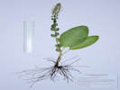 Coll. No. 2066, 6 June 2019 Coll. No. 2066, 6 June 2019
|
2066
|
Field identification: Besseya plantaginea.
Plants of Jefferson County Open Space
Jefferson County, Colorado
Plantaginaceae
Besseya plantaginea (James) Rydb.
White River Kittentails.
(=Synthyris plantaginea (James) Benth.)
Lippincott Property, Jefferson County, Colorado.
Northernmost Jefferson County, parcel jointly owned by City of Boulder and Jefferson County Open Space, approximate centroid of parcel, 22.5 km. north northwest of the GNIS location of Golden.
39.904°N, 105.2801°W.
WGS 1984
Elev. 2038 m.
Northwest slope, deep shade.
Collected by permit: Jefferson County Open Space, 2019, issued: Mar 1, 2019, to: Tom Schweich.
|
Tom Schweich
2066. |
6-Jun-2019 |
|
|
|
|
2067
|
Field identification: Lithospermum incisum.
Plants of Jefferson County Open Space
Jefferson County, Colorado
Boraginaceae
Lithospermum incisum Lehm.
Narrowleaf Stoneseed.
Lippincott Property, Jefferson County, Colorado.
Northernmost Jefferson County, parcel jointly owned by City of Boulder and Jefferson County Open Space, north-central area of parcel, 22.7 km. north northwest of the GNIS location of Golden.
39.9055°N, 105.28°W.
WGS 1984
Elev. 2022 m.
Edge of ponderosa pine woodland exposed to prairie to the south.
Collected by permit: Jefferson County Open Space, 2019, issued: Mar 1, 2019, to: Tom Schweich.
|
Tom Schweich
2067. |
6-Jun-2019 |
|
|
|
|
2068
|
Field identification: Oreobatus deliciosus.
Plants of Jefferson County Open Space
Jefferson County, Colorado
Rosaceae
Rubus deliciosus Torr.
Delicious raspberry.
Lippincott Property, Jefferson County, Colorado.
Northernmost Jefferson County, parcel jointly owned by City of Boulder and Jefferson County Open Space, north-central area of parcel, 23.0 km. north northwest of the GNIS location of Golden.
39.9073°N, 105.2805°W.
WGS 1984
Elev. 2020 m.
Highest prairie at edge of ponderosa pine woodland.
Collected by permit: Jefferson County Open Space, 2019, issued: Mar 1, 2019, to: Tom Schweich.
|
Tom Schweich
2068. |
6-Jun-2019 |
|
|
|
|
2069
|
Field identification: Woodsia sp.
Plants of Jefferson County Open Space
Jefferson County, Colorado
Dryopteridaceae
Woodsia oregana D.C. Eaton ssp. cathcartiana (B.L. Rob.) Windham.
Rocky Mountain Woodsia.
Lippincott Property, Jefferson County, Colorado.
Jointly owned by City of Boulder OSMP and Jefferson County Open Space, south bank of Bull Gulch, 23.0 km. north northwest of the GNIS location of Golden.
39.908°N, 105.2784°W.
WGS 1984
Elev. 1997 m.
Deep shade.
Same as Coll. No. 2019, 18 Apr 2019.
Collected by permit: Jefferson County Open Space, 2019, issued: Mar 1, 2019, to: Tom Schweich.
|
Tom Schweich
2069. |
6-Jun-2019 |
|
|
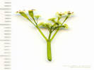 Coll. No. 2069.1, Osmorhiza, cf. O. depauperata Coll. No. 2069.1, Osmorhiza, cf. O. depauperata
|
2069.1
|
Field identification: Sweet-Cicely.
Plants of Jefferson County Open Space
Jefferson County, Colorado
Apiaceae
Osmorhiza depauperata Phil.
Blunt-Fruit Sweet-Cicely.
Lippincott Property, Jefferson County, Colorado.
Jointly owned by City of Boulder OSMP and Jefferson County Open Space, south bank of Bull Gulch, 23.0 km. north northwest of the GNIS location of Golden.
39.908°N, 105.2784°W.
WGS 1984
Elev. 1997 m.
Immature.
Collected by permit: Jefferson County Open Space, 2019, issued: Mar 1, 2019, to: Tom Schweich.
|
Tom Schweich
2069.1 |
6-Jun-2019 |
|
|
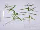 Coll. No. 2069.2, Pseudostellaria jamesiana Coll. No. 2069.2, Pseudostellaria jamesiana
|
2069.2
|
Field identification: Pseudostellaria sp.
Plants of Jefferson County Open Space
Jefferson County, Colorado
Caryophyllaceae
Pseudostellaria jamesiana (Torr.) W. A. Weber & R. L. Hartm.
Tuber Starwort.
Lippincott Property, Jefferson County, Colorado.
Jointly owned by City of Boulder OSMP and Jefferson County Open Space, south bank of Bull Gulch, 23.0 km. north northwest of the GNIS location of Golden.
39.908°N, 105.2784°W.
WGS 1984
Elev. 1997 m.
Also collected here: Osmorhiza depauperata and Woodsia oregana.
Collected by permit: Jefferson County Open Space, 2019, issued: Mar 1, 2019, to: Tom Schweich.
|
Tom Schweich
2069.2 |
6-Jun-2019 |
|
|
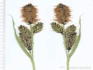 Inflorescence of Coll. No. 2070, Carex nebrascensis Inflorescence of Coll. No. 2070, Carex nebrascensis
|
2070
|
Field identification: Carex nebrascensis.
Plants of Jefferson County Open Space
Jefferson County, Colorado
Cyperaceae
Carex nebrascensis Dewey.
Nebraska Sedge.
Lippincott Property, Jefferson County, Colorado.
Jointly owned by City of Boulder OSMP and Jefferson County Open Space, northern portion of property, sunny site on the south bank of Bull Gulch, 22.9 km. north northwest of the GNIS location of Golden.
39.9079°N, 105.277°W.
WGS 1984
Elev. 1957 m.
Collected by permit: Jefferson County Open Space, 2019, issued: Mar 1, 2019, to: Tom Schweich.
|
Tom Schweich
2070. |
6-Jun-2019 |
|
Coll. No. 2070, 6 June 2019, Characters observed:
Perennial sedge,
rhizomatous;
Culms,
to 30 cm.,
lightly scabrous below head;
Leaves,
5.5 mm. wide,
green,
glabrous,
sheaths, white-hyaline, ventrally smooth;
Inflorescence,
75 mm. × 16 mm. wide,
#4 spikes,
loosely clustered;
Spikes,
differentiated,
terminal staminate,
lateral pistillate,
erect,
proximal pistillate,
18-29 mm. × 6-7 mm. wide;
Bracts,
12 mm., short,
proximal,
76 mm.,
< inflorescence,
bristle=like;
Pistillate scales,
3.5 mm.,
≤ perigynia,
green mid-vein, black laterally,
awn, short;
Perigynia,
many per spike,
3 mm. × 1.6 mm. wide,
wingless,
faces veined,
glabrous,
beak, 0.4 mm. flattish;
Achene,
unknown;
Stigma, #2;
Anthers,
3.5-3.7 mm.;
Habitat,
streamside.
|
|
Other articles:
• Glossary:
spathe;
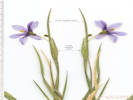 Inflorescence of Coll. No. 2071, Sisyrinchium montanum Inflorescence of Coll. No. 2071, Sisyrinchium montanum
|
2071
|
Field identification: Sisyrinchium sp.
Plants of Jefferson County Open Space
Jefferson County, Colorado
Iridaceae
Sisyrinchium montanum Greene.
Rocky Mountain Blue-Eyed Grass.
Lippincott Property, Jefferson County, Colorado.
Jointly owned by City of Boulder OSMP and Jefferson County Open Space, northern portion of property, sunny site on the south bank of Bull Gulch, 22.9 km. north northwest of the GNIS location of Golden.
39.9079°N, 105.277°W.
WGS 1984
Elev. 1957 m.
Outer spathe bract avg. 2.17× inner, corolla blue-violet.
Collected by permit: Jefferson County Open Space, 2019, issued: Mar 1, 2019, to: Tom Schweich.
|
Tom Schweich
2071. |
6-Jun-2019 |
|
|
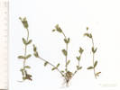 Coll. No. 2072, Cerastium fontanum ssp. vulgare Coll. No. 2072, Cerastium fontanum ssp. vulgare
|
2072
|
Field identification: Cerastium sp., something different that we usually see.
Plants of Jefferson County Open Space
Jefferson County, Colorado
Caryophyllaceae
Cerastium fontanum Baumgarten ssp. vulgare (Hartman) Greuter & Burdet.
Common Mouse-Ear.
Lippincott Property, Jefferson County, Colorado.
Jointly owned by City of Boulder OSMP and Jefferson County Open Space, northern portion of property, sunny site on the south bank of Bull Gulch, 22.9 km. north northwest of the GNIS location of Golden.
39.9079°N, 105.277°W.
WGS 1984
Elev. 1963 m.
Collected by permit: Jefferson County Open Space, 2019, issued: Mar 1, 2019, to: Tom Schweich.
|
Tom Schweich
2072. |
6-Jun-2019 |
|
|
|
|
2073
|
Field identification: Liverwort
Deferred to match with Coll. No. 2171.
|
|
|
2074
|
Field identification: Clematis hirsutissima.
Plants of Jefferson County Open Space
Jefferson County, Colorado
Ranunculaceae
Clematis hirsutissima Pursh.
Hairy Clematis, Sugar Bowls.
Lindsay/JEFFCO, Jefferson County, Colorado.
On the City of Boulder OSMP parcel just west across the fence from the Lippincott Parcel, south side of Bull Gulch, 22.8 km. north northwest of the GNIS location of Golden.
39.9074°N, 105.2759°W.
WGS 1984
Elev. 1970 m.
Collected by permit: City of Boulder OSMP, issued: May 18, 2019, to: Tom Schweich.
|
Tom Schweich
2074. |
6-Jun-2019 |
|
|
|
|
|
Sunday, June 9, 2019
North Table Mountain field trip for Colorado Native Plant Society.
|
|
Locations:
Ranson/Edwards Homestead Open Space Park.
|
|
Monday, June 10, 2019
Ranson/Edwards
|
 Fruit of Coll. No. 2075, Lomatium orientale Fruit of Coll. No. 2075, Lomatium orientale
 Inflorescence with fruit of Coll. No. 2075, Lomatium orientale Inflorescence with fruit of Coll. No. 2075, Lomatium orientale
|
2075
|
Field identification: Lomatium orientale in fruit.
Plants of Jefferson County Open Space
Jefferson County, Colorado
Apiaceae
Lomatium orientale J.M. Coult. & Rose.
Northern Idaho Biscuitroot.
Ranson/Edwards Homestead Open Space Park, Jefferson County, Colorado.
High plains above Rocky Flats, 1.7 mi. west on CO 72 from CO 93, 1.2 mi. generally north on Plainview Road, then approx. 300 m. northeast on an old road in the direction of the original homestead. Open prairie, lightly grazed in some recent years.
39.8919°N, 105.2603°W.
WGS 1984
Elev. 1941 m.
In fruit.
Geographic coordinates estimated with GoogleEarth.
Collected by permit: Jefferson County Open Space, 2019, issued: Mar 1, 2019, to: Tom Schweich.
|
Tom Schweich
2075. |
10-Jun-2019 |
|
|
|
|
2076
|
Field identification: Scutellaria brittonii.
Plants of Jefferson County Open Space
Jefferson County, Colorado
Lamiaceae
Scutellaria brittonii Porter.
Britton's Skullcap.
Ranson/Edwards Homestead Open Space Park, Jefferson County, Colorado.
High plains above Rocky Flats, 1.7 mi. west on CO 72 from CO 93, 1.1 mi. generally north on Plainview Road, then approx. 75 m. east.
39.8893°N, 105.261°W.
WGS 1984
Elev. 1936 m.
Relatively dry terrace on south side of small creek, in open prairie, lightly grazed in some recent years.
Collected by permit: Jefferson County Open Space, 2019, issued: Mar 1, 2019, to: Tom Schweich.
|
Tom Schweich
2076. |
10-Jun-2019 |
|
|
|
|
|
Friday, June 14, 2019
North Washington Open Space, Cressman Gulch, and Dakota Ridge.
|
|
Locations:
Schweich Hill.
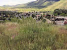 Partially weeded patch os smooth brome at the top of the hill. Partially weeded patch os smooth brome at the top of the hill.
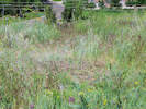 Post-weeding photo, not terribly enlightening. Post-weeding photo, not terribly enlightening.
|
|
Weeded a patch of smooth brome on top of the hill.
There was an isolated patch of smooth brome mixed into the remnant mixed-grass prairie on top of the hill. I estimate it to be 1 to 1.5 square meters in size.
Over the course of two days, with about 1 ½ hours of work, I pulled all of it. This resulted in 2 shopping bags of grass to dispose of. Probably weighed about 5 pounds. This material was removed to my residence and disposed of in the yard waste bin.
Generally, the culms snapped off at the ground surface. Though, in about ¼ to 1/3 of the stems I removed at least some root material. Occasionally I would get a rhizome to 6-8 cm in length.
I pulled mostly smooth brome, although occasionally I would also pull cheatgrass and alyssum.
I occasionally accidently pulled a native, such as mistaking a stem of scurf pea for a culm of smooth brome. However, overall, I suspect I did more damage to natives with my knees and shoes that by accidently pulling them.
Access to the patch without damaging the native vegetation was difficult. The plants are sometimes hidden in the litter, and sometimes too dense to step anywhere without stepping on a native. I noticed this with the cacti and with Eriogonum effusum.
The remaining native plant vegetation is shown in the list below.
Within the patch of smooth brome there were many small Echinocereus viridiflorus.
It is not clear to me whether the small cacti were new seedlings and the smooth brome was acting like a nurse plant, or whether the cacti were small because of competition with the smooth brome.
Will removal of smooth brome simply prepare more habitat for cheatgrass and alyssum?
How quickly will the smooth brome re-assert its dominance in the patch?
How many years of weeding are necessary to completely remove the smooth brome?
Without post-weeding water, will the remaining natives suffer from root disturbance and from sudden exposure?
Should cheatgrass and alyssum be removed at the same time?
When weeding smooth brome around natives, should we be pulling the culms, or digging out the crowns and rhizomes?
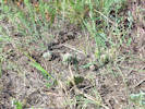
Cacti exposed by weeding the smooth brome. |
After weeding, I observed the following native plants in the weeded plot.
- Artemisia dracunculus L. Tarragon, Dragon Wort
- Artemisia frigida Willd. Prairie Sagewort
- Artemisia ludoviciana Nutt. Silver Wormwood
- Erigeron divergens Torr. & A. Gray. Spreading Fleabane
- Heterotheca villosa (Pursh) Shinners. Hairy False Goldenaster
- Hymenopappus filifolius Hook. Polycephalus (Osterh.) B.L. Turner. Many-Headed Fine-Leaved Wooly-White
- Escobaria missouriensis (Sweet) Britton & Rose. Missouri Foxtail Cactus
- Echinocereus viridiflorus Engelm. Nylon Hedgehog Cactus
- Opuntia macrorhiza Engelm. Western Pricklypear
- Oxytropis lambertii Pursh. Purple Locoweed
- Eriogonum effusum Nutt. Spreading Buckwheat
- Leucocrinum montanum Nutt. Ex A. Gray. Star Lily
- Hesperostipa comata (Trin. & Rupr.) Barkworth. Needle and Thread
|
|
Literature Cited:
- Friends of Bidwell Park, 2019.
- Martine, Christopher T., Stacey Leicht-Young, Patrick Herron, and Andrew Latimer, 2008.
Other articles:
• Wyoming Street:
at N trail;
at Ridge;
|
|
Looked for Colutea arborescens along Cressman Gulch.
C. arborescens is native to Europe and North Africa,
but it is known on other continents where it is grown as an ornamental and used in landscaping for erosion control.
It is also known in the wild as an occasionally weedy escapee from cultivation.
C. arborescens is on the monitor list of noxious weeds for Washington state, but has no special status in Colorado.
Friends of Bidwell Park (Chico, California) lists it under the heading of
"Plants ranked #1 on park priority list: Highly invasive. Should have immediate management," with the following comments,
Came from 1 plant in 1890s. Control attempted in past, focused eradication program started by FOBP in May, 2003 with about 1M plants removed so far. People spread seeds by "popping" pods as they walk through the park.
C. arborescens has potential to become invasive in New England (Martine, et al., 2008)
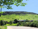
View of City of Golden open space from Wyoming Street. |
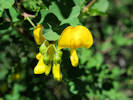
Flower of Colutea arborescens |
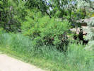
Colutea arborescens along Cressman Gulch trail near Wyoming St. |
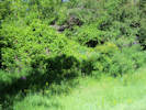
Virginia creeper (Parthenocissus quinquefolia) out-competing bladder senna (Colutea arborescens) in Cressman Gulch. |
|
|
Other articles:
• Catamount Drive:
near city shops;
• Recreational Trail (Pine Ridge Estates):
near spur;
Locations:
Dakota Ridge.
North Table Mountain.
 Yucca glauca “Soapweed Yucca” on Dakota Ridge. Yucca glauca “Soapweed Yucca” on Dakota Ridge.
|
|
South end of Dakota Ridge. Walked diagonally up the ridge, noting plants as I went. Observed 44 natives and 17 exotic plants, for a total of 61 taxa.
I also collected nine golf balls. Collected geographic coordinates for the gold balls, so we can plot their location and estimate the source of them.
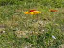
Gaillardia aristata on Dakota Ridge. |
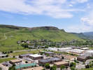
North Table Mountain from Dakota Ridge |
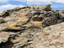
Slickensides on Dakota Ridge. |
Golf balls collected on Dakota Ridge. |
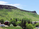
Southwest slope of North Table Mountain, City of Golden open space. |
|
|
Literature Cited:
- Fernandez-Mazuecos, Mario, Jose Luis Blanco-Pastor, and Pablo Vargas, 2013.
- Sutton, D. A., 1988.
Other articles:
• Golden Checklist Flora:
Dakota Ridge;
Linaria canadensis texana;
• Field Notes:
22 March 2020;
Locations:
Dakota Ridge.
|
2077
|
Field identification: Scroph s.l. (?), office: Nuttallanthus texana.
|
Native and Naturalized Flora of the Golden Area, Jefferson County, Colorado
Plantaginaceae
Nuttallanthus texanus (Scheele) D. A. Sutton.
Blue Toadflax, Texas Toadflax.
Dakota Ridge, Jefferson County, Colorado.
Western slope, southernmost end of Dakota Ridge, 4.3 km. north northwest of the GNIS location of Golden
39.7821°N, 105.2375°W.
WGS 1984
Elev. 1899 m.
In sedimentary rocks with Rhus trilobata and Heterotheca villosa.
Name of ridge is taken from Van Horn (1972) Geology of Golden quadrangle, but is otherwise not accepted by the USGS.
Collected by permit: City of Golden, 2019, issued: Jan 29, 2019, to: Tom Schweich.
|
Tom Schweich
2077. |
14-Jun-2019 |
|

Coll. No. 2077, Linaria canadensis var. texana |
Sutton (1988) separated the North American Linaria into their own genus.
However, Fernandez-Mazuecos, et al. (2013) show that acceptance of Nuttallanthus renders Linaria paraphyletic.
|
|
Locations:
Lippincott Ranch.
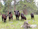 My assistants for a day of collecting. My assistants for a day of collecting.
|
|
Monday, June 17, 2019
Lippincott Property.
|
|
|
2078
|
Field identification: Penstemon virens.
Plants of Jefferson County Open Space
Jefferson County, Colorado
Plantaginaceae
Penstemon virens Pennell ex Rydb.
Front Range Beardtongue.
Lippincott Property, Jefferson County, Colorado.
Narrows of the parcel between central and southeast portions, 22 km. north northwest of the GNIS location of Golden.
39.902°N, 105.2731°W.
WGS 1984
Elev. 1995 m.
With mixed grasses and forbs in a gently sloped ponderosa pine woodland.
Collected by permit: Jefferson County Open Space, 2019, issued: Mar 1, 2019, to: Tom Schweich.
|
Tom Schweich
2078. |
17-Jun-2019 |
|
|
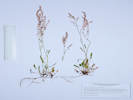 Coll. No. 2079, Rumex acetosella Coll. No. 2079, Rumex acetosella
|
2079
|
Field identification: Sorrel.
Plants of Jefferson County Open Space
Jefferson County, Colorado
Polygonaceae
Rumex acetosella L.
Sheep Sorrel.
Lippincott Property, Jefferson County, Colorado.
Narrows of the parcel between central and southeast portions, 22 km. north northwest of the GNIS location of Golden.
39.9021°N, 105.2726°W.
WGS 1984
Elev. 1995 m.
With mixed grasses and forbs in a gently sloped ponderosa pine woodland.
Collected by permit: Jefferson County Open Space, 2019, issued: Mar 1, 2019, to: Tom Schweich.
|
Tom Schweich
2079. |
17-Jun-2019 |
|
|
|
|
2080
|
Field identification: Arnica fulgens.
Plants of Jefferson County Open Space
Jefferson County, Colorado
Asteraceae
Arnica fulgens Pursh.
Shining Leopardbane.
Lippincott Property, Jefferson County, Colorado.
Narrows of the parcel between central and southeast portions, 22 km. north northwest of the GNIS location of Golden.
39.9022°N, 105.2721°W.
WGS 1984
Elev. 1992 m.
With mixed grasses and forbs in a gently sloped, open ponderosa pine woodland.
Collected by permit: Jefferson County Open Space, 2019, issued: Mar 1, 2019, to: Tom Schweich.
|
Tom Schweich
2080. |
17-Jun-2019 |
|
|
|
Literature Cited:
- Pursh, Frederick, 1814.
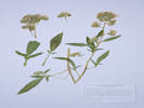 Coll. No. 2081, Phacelia heterophylla Coll. No. 2081, Phacelia heterophylla
|
2081
|
Field identification: Phacelia heterophylla.
Plants of Jefferson County Open Space
Jefferson County, Colorado
Boraginaceae
Phacelia heterophylla Pursh.
Varileaf Phacelia.
Lippincott Property, Jefferson County, Colorado.
Northernmost Jefferson County, parcel jointly owned by Jefferson County Open Space and City of Boulder OSMP, narrows of the parcel between central and southeast portions, 22 km. north northwest of the GNIS location of Golden.
39.9023°N, 105.2717°W.
WGS 1984
Elev. 1992 m.
Open ponderosa pine woodland with a lot of cheatgrass.
Subspecies heterophylla if infraspecific names are to be applied, as this is not the subspecies virgata found in northern California and Oregon.
Collected by permit: Jefferson County Open Space, 2019, issued: Mar 1, 2019, to: Tom Schweich.
|
Tom Schweich
2081. |
17-Jun-2019 |
|
Described by Pursh (1814) from a collection by M. Lewis Jun-Jul, 1806 on the banks of the Kooskooskie (Clearwater) River.
|
|
|
2081.1
|
Field identification: Camelina microcarpa.
Plants of Jefferson County Open Space
Jefferson County, Colorado
Brassicaceae
Camelina microcarpa Andrz. ex DC.
Little-Podded False Flax.
Lippincott Property, Jefferson County, Colorado.
Northernmost Jefferson County, parcel jointly owned by Jefferson County Open Space and City of Boulder OSMP, narrows of the parcel between central and southeast portions, 22 km. north northwest of the GNIS location of Golden.
39.9023°N, 105.2717°W.
WGS 1984
Elev. 1992 m.
Open ponderosa pine woodland with a lot of cheatgrass.
Collected by permit: Jefferson County Open Space, 2019, issued: Mar 1, 2019, to: Tom Schweich.
|
Tom Schweich
2081.1 |
17-Jun-2019 |
|
|
|
|
2081.2
|
Field identification: Descurainia sofia.
Plants of Jefferson County Open Space
Jefferson County, Colorado
Poaceae
Hesperostipa comata (Trin. & Rupr.) Barkworth.
Needle and Thread.
Lippincott Property, Jefferson County, Colorado.
Northernmost Jefferson County, parcel jointly owned by Jefferson County Open Space and City of Boulder OSMP, narrows of the parcel between central and southeast portions, 22 km. north northwest of the GNIS location of Golden.
39.9024°N, 105.2697°W.
WGS 1984
Elev. 1972 m.
Edge of open ponderosa pine woodland at break in slope.
Collected by permit: Jefferson County Open Space, 2019, issued: Mar 1, 2019, to: Tom Schweich.
|
Tom Schweich
2082.1 |
17-Jun-2019 |
|
|
|
|
2082
|
Field identification: Koeleria macrantha.
Plants of Jefferson County Open Space
Jefferson County, Colorado
Poaceae
Koeleria macrantha (Ledeb.) Schult.
Prairie Junegrass.
Lippincott Property, Jefferson County, Colorado.
Northernmost Jefferson County, parcel jointly owned by Jefferson County Open Space and City of Boulder OSMP, narrows of the parcel between central and southeast portions, 22 km. north northwest of the GNIS location of Golden.
39.9024°N, 105.2697°W.
WGS 1984
Elev. 1972 m.
Edge of open ponderosa pine woodland at break in slope.
Collected by permit: Jefferson County Open Space, 2019, issued: Mar 1, 2019, to: Tom Schweich.
|
Tom Schweich
2082. |
17-Jun-2019 |
|
|
|
|
2082.1
|
Field identification: Hesperostipa comata.
Plants of Jefferson County Open Space
Jefferson County, Colorado
Poaceae
Hesperostipa comata (Trin. & Rupr.) Barkworth.
Needle and Thread.
Lippincott Property, Jefferson County, Colorado.
Northernmost Jefferson County, parcel jointly owned by Jefferson County Open Space and City of Boulder OSMP, narrows of the parcel between central and southeast portions, 22 km. north northwest of the GNIS location of Golden.
39.9024°N, 105.2697°W.
WGS 1984
Elev. 1972 m.
Edge of open ponderosa pine woodland at break in slope.
Collected by permit: Jefferson County Open Space, 2019, issued: Mar 1, 2019, to: Tom Schweich.
|
Tom Schweich
2082.1 |
17-Jun-2019 |
|
|
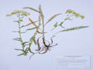 Coll. No. 2083, Achillea millifolium Coll. No. 2083, Achillea millifolium
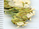 Inflorescence of Coll. No. 2083, Achillea millifolium Inflorescence of Coll. No. 2083, Achillea millifolium
|
2083
|
Field identification: Achillea millifolium.
Plants of Jefferson County Open Space
Jefferson County, Colorado
Asteraceae
Achillea millefolium L.
Common Yarrow.
Lippincott Property, Jefferson County, Colorado.
Northernmost Jefferson County, parcel jointly owned by Jefferson County Open Space and City of Boulder OSMP, narrows of the parcel between central and southeast portions, 22 km. north northwest of the GNIS location of Golden.
39.9024°N, 105.2697°W.
WGS 1984
Elev. 1976 m.
Edge of open ponderosa pine woodland at break in slope.
Collected by permit: Jefferson County Open Space, 2019, issued: Mar 1, 2019, to: Tom Schweich.
|
Tom Schweich
2083. |
17-Jun-2019 |
|
|
|
|
2084
|
Field identification: Vicia americana.
Plants of Jefferson County Open Space
Jefferson County, Colorado
Fabaceae
Vicia americana Willd.
American Vetch.
Lippincott Property, Jefferson County, Colorado.
Northernmost Jefferson County, parcel jointly owned by Jefferson County Open Space and City of Boulder OSMP, narrows of the parcel between central and southeast portions, 22 km. north northwest of the GNIS location of Golden.
39.9023°N, 105.2696°W.
WGS 1984
Elev. 1973 m.
Flowers magenta to purple, fading light blue.
Edge of open ponderosa pine woodland at break in slope.
Variety minor if infraspecific names are to be applied.
Collected by permit: Jefferson County Open Space, 2019, issued: Mar 1, 2019, to: Tom Schweich.
|
Tom Schweich
2084. |
17-Jun-2019 |
|
|
|
Other articles:
• Field Notes:
Coll. No. 2064, 6 Jun 2019;
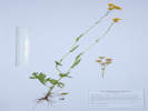 Coll. No. 2085, Packera plattensis Coll. No. 2085, Packera plattensis
|
2085
|
Field identification: Packera? Senecio?
Possibly the same as Coll. No. 2064
Plants of Jefferson County Open Space
Jefferson County, Colorado
Asteraceae
Packera plattensis (Nuttall) W. A. Weber & Á. Löve.
Prairie Groundsel.
Lippincott Property, Jefferson County, Colorado.
Northernmost Jefferson County, parcel jointly owned by Jefferson County Open Space and City of Boulder OSMP, narrows of the parcel between central and southeast portions, 21.8 km. north northwest of the GNIS location of Golden.
39.9019°N, 105.2694°W.
WGS 1984
Elev. 1965 m.
South-facing slope with grasses and forbs.
Collected by permit: Jefferson County Open Space, 2019, issued: Mar 1, 2019, to: Tom Schweich.
|
Tom Schweich
2085. |
17-Jun-2019 |
|
|
|
|
2086
|
Field identification: Allium geyeri.
Plants of Jefferson County Open Space
Jefferson County, Colorado
Alliaceae
Allium geyeri S. Watson.
Geyer's Onion.
Lippincott Property, Jefferson County, Colorado.
Northernmost Jefferson County, parcel jointly owned by Jefferson County Open Space and City of Boulder OSMP, narrows of the parcel between central and southeast portions, 22 km. north northwest of the GNIS location of Golden.
39.9023°N, 105.2722°W.
WGS 1984
Elev. 1987 m.
Nearly flat, open ponderosa pine woodland with grasses and forbs.
Collected by permit: Jefferson County Open Space, 2019, issued: Mar 1, 2019, to: Tom Schweich.
|
Tom Schweich
2086. |
17-Jun-2019 |
|
|
|
Other articles:
• Golden Checklist Flora:
Hordeum murinum;
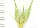 Ciliate glumes of Coll. No. 2087, Hordeum murinum Ciliate glumes of Coll. No. 2087, Hordeum murinum
|
2087
|
Field identification: Hordeum sp., probably H. jubatum.
Plants of Jefferson County Open Space
Jefferson County, Colorado
Poaceae
Hordeum murinum L.
Mouse Barley.
Lippincott Property, Jefferson County, Colorado.
Northernmost Jefferson County, parcel jointly owned by Jefferson County Open Space and City of Boulder OSMP, narrows of the parcel between central and southeast portions, 22 km. north northwest of the GNIS location of Golden.
39.9019°N, 105.2737°W.
WGS 1984
Elev. 1997 m.
Disturbed site at junction of two ranch roads on the edge of a flat, open ponderosa pine woodland.
Collected by permit: Jefferson County Open Space, 2019, issued: Mar 1, 2019, to: Tom Schweich.
|
Tom Schweich
2087. |
17-Jun-2019 |
|
Auricles, to 3 mm., glumes ciliate.
|
|
|
|
Wednesday, June 19, 2019
Golden to Steamboat Springs.
|
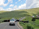 Herding cows to summer pasture. Herding cows to summer pasture.
|
|
Herding cows across the road.
|
|
Other articles:
• CO Hwy 131:
in Toponas;
Locations:
The Flat Tops.
Toponas.
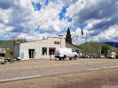 Downtown Toponas Downtown Toponas
|
|
Toponas
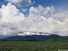
The Flat Tops, as seen from Toponas. |
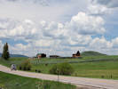
North side of Toponas. |
Toponas consists of a large general store with gas pumps, and a few ranch houses and attendant outbuildings.
Despite the small size of the town, this is a strategic location,
lying in a broad mountain pass on the divide between the Yampa River to the north and the Colorado River to the south.
As a result, the town is traversed by not only State Highway 131,
but also the former Craig branch of the Denver and Rio Grande Western Railroad.
|
|
Other articles:
• County Route 5:
along route;
Locations:
Egeria Park.
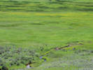 Bald Eagle on a post in Egeria Park. Bald Eagle on a post in Egeria Park.
|
|
Egeria Park
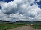
County Route 5 east through Egeria Park. |
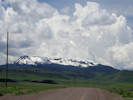
County Route 5 west toward the Flat Tops |
West ot Toponas and south of Five Pine Mesa.
|
|
Other articles:
• County Route 3:
at edge of mesa;
at ditch;
at gulch;
• Colorado Trans-Basin Water Transfer:
Stillwater Ditch;
Locations:
Five Pine Mesa.
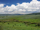 Unnamed gulch on Five Pine Mesa. Unnamed gulch on Five Pine Mesa.
|
|
Five Pine Mesa
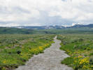
Stillwater Ditch (Five Pine Mesa Ditch) coming down from Stillwater Reservoir. |
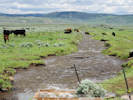
Stillwater Ditch (Five Pine Mesa Ditch) coming down to Toponas and eventually the Colorado River. |
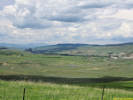
Yampa and the uppermost Yampa River valley. |
Across the top of Five Pine Mesa on County Route 3.
|
|
Other articles:
• County Road 7:
at Main St;
Locations:
Yampa.
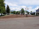 Moffatt Avenue in Yampa Moffatt Avenue in Yampa
|
|
Yampa
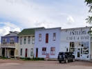
Business at the center of Yampa. |
|
|
|
|
Thursday, June 20 2019
Steamboat Springs north to Steamboat Lake State Park.
|
|
Other articles:
• Forest Road 60:
near forest boundary;
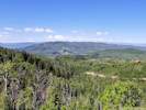 Area of Steamboat Springs from Forest Road 60 Area of Steamboat Springs from Forest Road 60
|
|
Buffalo Pass
Road closed!
|
|
Other articles:
• County Route 129:
at Steamboat Lk;
Locations:
Hahns Peak.
Sand Mountain.
Steamboat Lake State Park.
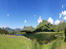 Panorama at Steamboat Lake State Park. Panorama at Steamboat Lake State Park.
|
|
Steamboat Lake State Park
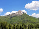
Hahn's Peak from the valley below. |
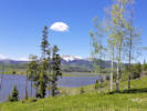
Sand Mountain seen from Steamboat Lake State Park. |
|
|
Other articles:
• County Route 129:
at FR 486;
Locations:
Hahns Peak Lake.
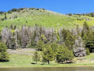 Vegetation zones above Hahns Peak Lake. Vegetation zones above Hahns Peak Lake.
|
|
Hahns Peak Lake
Vegetation zones at Hahn's Peak Lake, grasses and Douglas fir near shore, Lodgepole pines, willows on lower slope with aspen in the draw, sagebrush near the top, with junipers on the dry summit.
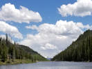
Hahns Peak Lake. |
|
|
|
|
Friday, June 21, 2019
Snow day, around Steamboat Springs.
|
|
Other articles:
• US Hwy 40:
Steamboat Springs;
Locations:
Steamboat Springs.
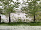 Snow on the first day of Summer in Steamboat Springs. Snow on the first day of Summer in Steamboat Springs.
|
|
Snowy morning in Steamboat Springs.
Steamboat Springs depot, now an art center. |
Rio Grande caboose at former Steamboat Springs depot. |
|
|
|
|
Saturday, June 22, 2019
Steamboat Springs to Golden.
|
|
Other articles:
• US Hwy 40:
on US Hwy 40;
Locations:
Lake CataMount.
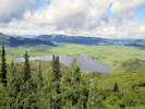 Lake Catamount on the Yampa River. Lake Catamount on the Yampa River.
|
|
View from US Hwy 40 south of Steamboat Springs.
|
|
Other articles:
• US Hwy 40:
along Muddy Ck;
Locations:
Baker Mountain.
 Baker Mountain on a snowy second day of summer. Baker Mountain on a snowy second day of summer.
|
|
Upper portion of the valley of Muddy Creek.

Whiteley Peak in the valley of Muddy Creek. |
|
|
Other articles:
• Township Route 132:
near H. Mill;
Locations:
Henderson Mill.
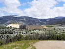 Henderson Mill Henderson Mill
|
|
Henderson Mill and Ute Pass
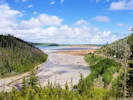
Tailings Pond. |
|
|
Locations:
Schweich Hill.
|
|
Tuesday, 25 June 2019
Field trip to North Washington Open Space for Stewards of Golden Open Space.
|
|
Locations:
Schweich Hill.
|
|
Wednesday, 26 June 2019
North Washington Open Space
|
|
|
2088
|
Field identification: Melilotus officinalis.
|
Native and Naturalized Flora of the Golden Area, Jefferson County, Colorado
Fabaceae
Melilotus officinalis (L.) Lam.
Yellow Sweet Clover.
North Washington Open Space, Jefferson County, Colorado.
Small (4 acre) fallow city-owned parcel in northern Golden, near the intersection of Colorado Highway 93 and Washington Avenue, 2.20 km. northwest of the GNIS location of Golden.
39.7686°N, 105.2313°W.
WGS 1984
Elev. 1803 m.
Extreme southeastern corner, approx. 5 m. in the parcel owned by Villas at Canyon Point, LLC.
Collected by permit: City of Golden, 2019, issued: Jan 29, 2019, to: Tom Schweich.
|
Tom Schweich
2088. |
26-Jun-2019 |
|
|
|
Other articles:
• Golden Checklist Flora:
Triticum aestivum;
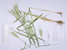 Coll. No. 2089, Triticum aestivum Coll. No. 2089, Triticum aestivum
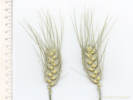 Inflorescence of Coll. No. 2089, Triticum aestivum Inflorescence of Coll. No. 2089, Triticum aestivum
|
2089
|
Field identification: Wheat
|
Native and Naturalized Flora of the Golden Area, Jefferson County, Colorado
Poaceae
Triticum aestivum L.
Wheat.
North Washington Open Space, Jefferson County, Colorado.
Small (4 acre) fallow city-owned parcel in northern Golden, near the intersection of Colorado Highway 93 and Washington Avenue, 2.20 km. northwest of the GNIS location of Golden.
39.7686°N, 105.2312°W.
WGS 1984
Elev. 1803 m.
Extreme southeastern corner of open space, probably a contaminant in grass seed used for revegetation following construction of condominiums at 410-416 N. Ford St.
Collected by permit: City of Golden, 2019, issued: Jan 29, 2019, to: Tom Schweich.
|
Tom Schweich
2089. |
26-Jun-2019 |
|
|
|
Literature Cited:
- Ackerfield, Jennifer, 2015.
- Baldwin, Bruce G., Douglas H. Goldman, David J. Keil, Robert Patterson, and Thomas J. Rosatti, 2012.
- SEINet, 2019+.
- Shaw, Robert B., 2008.
- Weber, William A., and Ronald C. Wittmann, 2012.
Other articles:
• Field Notes:
28 Apr 2018;
18 Mar 2019;
Coll. No. 2090, 26 Jun 2019;
|
2090
|
Field identification: Bromus sp.
|
Native and Naturalized Flora of the Golden Area, Jefferson County, Colorado
Poaceae
Bromus carinatus Hook. & Arn.
North Washington Open Space, Jefferson County, Colorado.
Small (4 acre) fallow city-owned parcel in northern Golden, near the intersection of Colorado Highway 93 and Washington Avenue, 2.20 km. northwest of the GNIS location of Golden.
39.7686°N, 105.2312°W.
WGS 1984
Elev. 1803 m.
Extreme southeastern corner of open space, probably planted as revegetation following construction of condominiums at 410-416 N. Ford St.
Probably var. carinatus if infraspecific names are to be applied.
Collected by permit: City of Golden, 2019, issued: Jan 29, 2019, to: Tom Schweich.
|
Tom Schweich
2090. |
26-Jun-2019 |
|
Coll. No. 2090, 26 June 2019, characters observed:
Annual/Perennial unknown (planted Spring 2019),
height 60-90 cm.,
clumped;
Leaves,
sheath and blade differentiated,
soft;
Sheath,
80 mm.,
closed,
generally glabrous,
except collar somewhat hairy;
Ligule,
membraneous,
2 mm.;
Auricles,
absent;
Blade,
140 mm. × 7 mm. wide,
flat,
scabrous,
mid-rib prominent;
Inflorescence,
1 per culm,
>leaves,
panicle,
180-200 mm. × 40-90 mm. wide;
Rachis,
not extended,
minutely scabrous on abaxial side;
Spikelets,
many (#22-26),
36 mm. × 11 mm. wide,
similar,
1 per node;
Compression,
lateral;
Disarticulation,
between the florets;
Glumes,
lower,
9.5 mm.,
veins,
#5,
distinct,
upper,
12 mm.,
<lowest floret,
veins,
#7,
distinct
keeled,
membraneous,
awns, 0,
margins short ciliate;
Florets,
6 per spikelet;
Rachilla,
exposed,
scabrous on abaxial side,
not extended;
Lemma,
13 mm.,
broad, 2.5 mm. midvein to margin,
>glumes,ovate,
keeled distally,
finely short hairy throughout,
veins, #9, glabrous,
margins, scarious,
tip, entire,
awns, #1, 8 mm., straight,
attached near tip;
Palea,
7 mm.,
<lemma,
keel, ciliate,
veins, green,
margin, glabrous,
tip, entire;
Anthers, 3.6 mm., yellow;
Ovary, hairy.
Keys poorly in most Colorado floras, but quite nicely to B. carinatus var. carinatus in the Jepson Manual (Baldwin, et al., 2012),
in good part by the length of the lemma awn.
Regardless, I think this is very likely a commercial cultivar used in revegetation.

Coll. No. 2090, Bromus carinatus |
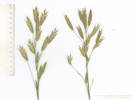
Inflorescence of Coll. No. 2090, Bromus carinatus |
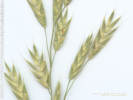
Spikelets of Coll. No. 2090, Bromus carinatus |
The construction of the condominiums at 410-416 North Ford Street bled over into Schweich Hill.
The soil was disturbed, construction debris was dumped, and construction equipment was stored on the city-owned parcel.
At completion of construction the construction debris and equipment was removed.
The disturbed area was covered with a jute mat, and the area seeded.
Unfortunately, the primary species seeded was Bromus carinatus Hook. & Arn. California brome.
Colorado flora authors disagree whether California brome is native to the state (Shaw, 2008, and Ackerfield, 2015)
or whether it is an alien grass (Weber & Wittmann, 2012).
Regardless, there are no historic or recent collections of this grass made in Golden s.l. (SEINet, 2019).
The closest old collection is an early 20th century collection from Mount Morrison (Bethel & Clokey #3998, 3 Jun 1921: CM234168, IND27631, RM88139 & UTC22795).
There were no collections of B. carinatus when the Magic Mountain area was extensively collected E. H. Brunquist in 1959-1960,
nor were there any collections from South Table Mountain when that mesa was collected by Loraine Yeatts in 1983-1984.
Therefore, I think it is fair to say that the planting of the grass as construction remediation represents introduction of an alien grass to Golden s.l. if not to Colorado.
In addition, the seed was contaminated by Triticum aestivum L. Wheat as several specimens of that taxon were collected with the California brome.
None of this was necessary,
as there are numerous native grasses already growing on Schweich Hill that are easy to obtain and grow from seed.
|
|
|
2091
|
Field identification: Nasella viridula.
|
Native and Naturalized Flora of the Golden Area, Jefferson County, Colorado
Poaceae
Nassella viridula (Trin.) Barkworth.
Green Needlegrass.
North Washington Open Space, Jefferson County, Colorado.
Small (4 acre) fallow city-owned parcel in northern Golden, near the intersection of Colorado Highway 93 and Washington Avenue, 2.27 km. northwest of the GNIS location of Golden.
39.7685°N, 105.2325°W.
WGS 1984
Elev. 1806 m.
East-central portion of the parcel where native vegetation begins to give way to smooth brome.
Collected by permit: City of Golden, 2019, issued: Jan 29, 2019, to: Tom Schweich.
|
Tom Schweich
2091. |
26-Jun-2019 |
|
|
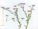 Coll. No. 2092, Erigeron divergens Coll. No. 2092, Erigeron divergens
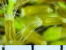 Pappi of Coll. No. 2092, Erigeron divergens Pappi of Coll. No. 2092, Erigeron divergens
|
2092
|
Field identification: Erigeron sp.
|
Native and Naturalized Flora of the Golden Area, Jefferson County, Colorado
Asteraceae
Erigeron divergens Torr. & A. Gray.
Spreading Fleabane.
North Washington Open Space, Jefferson County, Colorado.
Small (4 acre) fallow city-owned parcel in northern Golden, near the intersection of Colorado Highway 93 and Washington Avenue, 2.27 km. northwest of the GNIS location of Golden.
39.7686°N, 105.2333°W.
WGS 1984
Elev. 1821 m.
A very blue Erigeron with pappi of alternating scales and bristles, rather than outer scales and inner bristles.
Collected by permit: City of Golden, 2019, issued: Jan 29, 2019, to: Tom Schweich.
|
Tom Schweich
2092. |
26-Jun-2019 |
|
Coll. No. 2092, 26 June 2019, characters observed:
Perennial
herb
20 cm.;
Stem ascending,
short spreading white hairs;
Leaves,
cauline,
alternate,
sessile,
not clasping,
blade 23 mm. × 4.5 mm. wide, 5× long/wide,
reduced distally,
oblanceolate,
entire,
eglandular,
white curved hairs but not appressed (FNANM: strigoso-hirsute),
margins,
entire;
Inflorescence,
heads enclosed by involucre,
heads #3+ per stem,
not overtopped by leaves;
Peduncles,
24-50 mm.;
Involucre,
10-11 mm. wide × 5.5 mm. high,
ellipsoid;
Phyllaries,
±equal,
3± series,
4 mm. × 0.6 mm. wide,
green,
minutely glandular,
margins flat,
tips acute;
Receptacle,
epaleate;
Flowers,
2 kinds,
Ray flowers,
many,
tube 2 mm. + blade 5-6 mm. × 0.5 mm. wide,
lavender,
fertile,
pappus, very short scales with a few barbellate bristles;
Disk flowers,
many,
tube 2 mm. + lobes 0.4 mm.,
tube white, lobes yellow,
pappus, alternating very short scales and barbellate bristles, 1.5 mm.;
Fruit,
0.8 mm.,
slightly compressed front to back,
light brown,
sparsely hairy.
|
|
Locations:
Tin Cup Ridge.
|
|
Sunday, June 30, 2019
Tin Cup Ridge
|
|
|
2093
|
Field identification: Melilotus officinalis.
Plants of Jefferson County Open Space
Jefferson County, Colorado
Fabaceae
Melilotus officinalis (L.) Lam.
Yellow Sweet Clover.
Tin Cup Ridge, Jefferson County, Colorado.
East base of the hogback locally called Tin Cup Rudge, the northward extension of Dinosaur Rudge into Golden, 6.4 km. south southeast of the GNIS location of Golden.
39.7137°N, 105.2037°W.
WGS 1984
Elev. 1880 m.
Mixed grasses and forbs. Collected with Aegilops cylindrica, Erigeron tracyi, Nassella viridula, and Poa compressa.
Collected by permit: Jefferson County Open Space, 2019, issued: Mar 1, 2019, to: Tom Schweich.
|
Tom Schweich
2093. |
30-Jun-2019 |
|
|
|
|
2094
|
Field identification: Aegilops cylindrica.
Plants of Jefferson County Open Space
Jefferson County, Colorado
Poaceae
Aegilops cylindrica Host.
Jointed Goat Grass.
Tin Cup Ridge, Jefferson County, Colorado.
East base of the hogback locally called Tin Cup Rudge, the northward extension of Dinosaur Rudge into Golden, 6.4 km. south southeast of the GNIS location of Golden.
39.7137°N, 105.2038°W.
WGS 1984
Elev. 1884 m.
Mixed grasses and forbs. Collected with Erigeron tracyi, Melilotus officinalis, Nassella viridula, and Poa compressa.
Collected by permit: Jefferson County Open Space, 2019, issued: Mar 1, 2019, to: Tom Schweich.
|
Tom Schweich
2094. |
30-Jun-2019 |
|
|
|
|
2095
|
Field identification: Nassella viridula.
Plants of Jefferson County Open Space
Jefferson County, Colorado
Poaceae
Nassella viridula (Trin.) Barkworth.
Green Needlegrass.
Tin Cup Ridge, Jefferson County, Colorado.
East base of the hogback locally called Tin Cup Rudge, the northward extension of Dinosaur Ridge into Golden, 6.4 km. south southeast of the GNIS location of Golden.
39.7137°N, 105.2038°W.
WGS 1984
Elev. 1887 m.
Mixed grasses and forbs. Collected with Aegilops cylindrica, Erigeron tracyi, Melilotus officinalis, and Poa compressa.
Collected by permit: Jefferson County Open Space, 2019, issued: Mar 1, 2019, to: Tom Schweich.
|
Tom Schweich
2095. |
30-Jun-2019 |
|
|
|
|
2096
|
Field identification: Poa compressa.
Plants of Jefferson County Open Space
Jefferson County, Colorado
Poaceae
Poa compressa L.
Canada Bluegrass.
Tin Cup Ridge, Jefferson County, Colorado.
East base of the hogback locally called Tin Cup Rudge, the northward extension of Dinosaur Ridge into Golden, 6.4 km. south southeast of the GNIS location of Golden.
39.7137°N, 105.2038°W.
WGS 1984
Elev. 1886 m.
Mixed grasses and forbs. Collected with Aegilops cylindrica, Erigeron tracyi, Melilotus officinalis, and Nassella viridula.
Collected by permit: Jefferson County Open Space, 2019, issued: Mar 1, 2019, to: Tom Schweich.
|
Tom Schweich
2096. |
30-Jun-2019 |
|
|
|
|
2097
|
Field identification: Heterotheca villosa.
Plants of Jefferson County Open Space
Jefferson County, Colorado
Asteraceae
Heterotheca villosa (Pursh) Shinners.
Hairy False Goldenaster.
Tin Cup Ridge, Jefferson County, Colorado.
East base of the hogback locally called Tin Cup Ridge, the northward extension of Dinosaur Ridge into Golden, 6.4 km. south southeast of the GNIS location of Golden.
39.7137°N, 105.2039°W.
WGS 1984
Elev. 1889 m.
Mixed grasses and forbs. Collected with Aegilops cylindrica, Erigeron tracyi, Melilotus officinalis, Nassella viridula, and Poa compressa.
Probably var. minor if infraspecific names are to be applied.
Collected by permit: Jefferson County Open Space, 2019, issued: Mar 1, 2019, to: Tom Schweich.
|
Tom Schweich
2097. |
30-Jun-2019 |
|
|
|
|
2098
|
Field identification: Achillea millefolium.
Plants of Jefferson County Open Space
Jefferson County, Colorado
Asteraceae
Achillea millefolium L.
Common Yarrow.
Tin Cup Ridge, Jefferson County, Colorado.
East base of the hogback locally called Tin Cup Ridge, the northward extension of Dinosaur Ridge into Golden, 6.4 km. south southeast of the GNIS location of Golden.
39.7136°N, 105.2038°W.
WGS 1984
Elev. 1889 m.
Mixed grasses and forbs. Collected with Erigeron tracyi, Heterotheca villosa, Medicago lupulina, and Poa compressa.
Collected by permit: Jefferson County Open Space, 2019, issued: Mar 1, 2019, to: Tom Schweich.
|
Tom Schweich
2098. |
30-Jun-2019 |
|
|
|
|
2099
|
Field identification: Medicago lupulina.
Plants of Jefferson County Open Space
Jefferson County, Colorado
Fabaceae
Medicago lupulina L.
Black Medick.
Tin Cup Ridge, Jefferson County, Colorado.
East base of the hogback locally called Tin Cup Ridge, the northward extension of Dinosaur Ridge into Golden, 6.4 km. south southeast of the GNIS location of Golden.
39.7136°N, 105.2038°W.
WGS 1984
Elev. 1889 m.
Mixed grasses and forbs. Collected with Achillea millefolium, Erigeron tracyi, Heterotheca villosa, and Poa compressa.
Collected by permit: Jefferson County Open Space, 2019, issued: Mar 1, 2019, to: Tom Schweich.
|
Tom Schweich
2099. |
30-Jun-2019 |
|
|
|
|
2100
|
Field identification: Erigeron tracyi.
Plants of Jefferson County Open Space
Jefferson County, Colorado
Asteraceae
Erigeron tracyi Greene.
Running Fleabane.
Tin Cup Ridge, Jefferson County, Colorado.
East base of the hogback locally called Tin Cup Ridge, the northward extension of Dinosaur Ridge into Golden, 6.4 km. south southeast of the GNIS location of Golden.
39.7136°N, 105.2038°W.
WGS 1984
Elev. 1889 m.
Mixed grasses and forbs. Collected with Achillea millefolium, Erigeron tracyi, Heterotheca villosa, and Medicago lupulina.
Collected by permit: Jefferson County Open Space, 2019, issued: Mar 1, 2019, to: Tom Schweich.
|
Tom Schweich
2100. |
30-Jun-2019 |
|
|
|
|
2101
|
Field identification: Asclepias speciosa.
Plants of Jefferson County Open Space
Jefferson County, Colorado
Asclepiadaceae
Asclepias speciosa Torr.
Showy Milkweed.
Tin Cup Ridge, Jefferson County, Colorado.
East base of the hogback locally called Tin Cup Ridge, the northward extension of Dinosaur Ridge into Golden, 6.4 km. south southeast of the GNIS location of Golden.
39.7134°N, 105.2037°W.
WGS 1984
Elev. 1891 m.
Mixed grasses and forbs. Collected with Achillea millefolium, Erigeron tracyi, Glycyrrhiza lepidota, and Medicago lupulina.
Collected by permit: Jefferson County Open Space, 2019, issued: Mar 1, 2019, to: Tom Schweich.
|
Tom Schweich
2101. |
30-Jun-2019 |
|
|
|
|
2102
|
Field identification: Glycirhiza lepidota.
Plants of Jefferson County Open Space
Jefferson County, Colorado
Fabaceae
Glycyrrhiza lepidota Pursh.
American Licorice.
Tin Cup Ridge, Jefferson County, Colorado.
East base of the hogback locally called Tin Cup Ridge, the northward extension of Dinosaur Ridge into Golden, 6.42 km. south southeast of the GNIS location of Golden.
39.7132°N, 105.2039°W.
WGS 1984
Elev. 1897 m.
Mixed grasses and forbs. Collected with Achillea millefolium, Astragalus flexuosus, Asclepias speciosa, and Medicago lupiulina.
Collected by permit: Jefferson County Open Space, 2019, issued: Mar 1, 2019, to: Tom Schweich.
|
Tom Schweich
2102. |
30-Jun-2019 |
|
|
|
|
2103
|
Field identification: Astragalus flexuousus.
Plants of Jefferson County Open Space
Jefferson County, Colorado
Fabaceae
Astragalus flexuosus G. Don.
Flexible Milkvetch.
Tin Cup Ridge, Jefferson County, Colorado.
East base of the hogback locally called Tin Cup Ridge, the northward extension of Dinosaur Ridge into Golden, 6.44 km. south southeast of the GNIS location of Golden.
39.7131°N, 105.2039°W.
WGS 1984
Elev. 1900 m.
Among Poa compressa, Pediomelum tenuiflorum, and Artemisia campestris in what appears to be an old quarry road.
Collected by permit: Jefferson County Open Space, 2019, issued: Mar 1, 2019, to: Tom Schweich.
|
Tom Schweich
2103. |
30-Jun-2019 |
|
|
|
|
2104
|
Field identification: Eriogonum umbellatum.
Plants of Jefferson County Open Space
Jefferson County, Colorado
Polygonaceae
Eriogonum umbellatum Torr. var. umbellatum.
Sulphur-Flower Buckwheat.
Tin Cup Ridge, Jefferson County, Colorado.
Lower east slopes of the hogback locally called Tin Cup Ridge, the northward extension of Dinosaur Ridge into Golden, 6.44 km. south southeast of the GNIS location of Golden.
39.7129°N, 105.2043°W.
WGS 1984
Elev. 1909 m.
Growing around base of Rhus trilobata on east-facing moderate slope. Collected with Elymus lanceolatus.
Collected by permit: Jefferson County Open Space, 2019, issued: Mar 1, 2019, to: Tom Schweich.
|
Tom Schweich
2104. |
30-Jun-2019 |
|
|
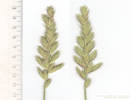 Inflorescence of Coll. No. 2105, Elymus lanceolatus Inflorescence of Coll. No. 2105, Elymus lanceolatus
|
2105
|
Field identification: Pascopyrum smithii.
Plants of Jefferson County Open Space
Jefferson County, Colorado
Poaceae
Elymus lanceolatus (Scribn. & J. G. Sm.) Gould.
Thickspike Wheatgrass.
Tin Cup Ridge, Jefferson County, Colorado.
Lower east slopes of the hogback locally called Tin Cup Ridge, the northward extension of Dinosaur Ridge into Golden, 6.44 km. south southeast of the GNIS location of Golden.
39.7129°N, 105.2043°W.
WGS 1984
Elev. 1910 m.
Growing near Rhus trilobata on east-facing moderate slope. Collected with Eriogonum umbellatum var. umbellatum.
1 of 4 clumps dug up has a clearly-defined rhizome
Collected by permit: Jefferson County Open Space, 2019, issued: Mar 1, 2019, to: Tom Schweich.
|
Tom Schweich
2105. |
30-Jun-2019 |
|
Coll. No. 2105, 30 June 2019, characters observed:
Perennial,
to 65 cm.,
rhizomatous;
Leaves,
blade and sheath differentiated;
Sheath,
95 mm.,
open,
pilose distally;
Ligule,
membraneous,
0.5 mm.,
auricles, 2 mm.;
Blade,
190 mm. × 3 mm. wide,
involute,
veins prominent and pilose adaxially;
Inflorescence,
1 per culm,
bilateral spike
rachis internodes 5.0-5.5(8.0) mm.;
Spikelets,
many,
19 mm. × 6 mm. wide,
3.5-3.8(2.4) × internode,
closely spaced, reaching midlength of that above,
similar,
1(2) per node,
stalked,
pedicels, 1 mm.;
Compression,
lateral;
Disarticulation,
between the florets;
Glumes,
lower,
11 mm.,
narrowly lanceolate (not subulate),
veins, #5,
upper,
11.5 mm.,
≤lowest floret,
widest at middle,
veins, #7-9,
keeled,
sparsely hairy throughout,
awn-tipped;
Florets,
7 per spikelet,
bisexual;
Lemma,
9.5 mm.,
>glumes,
lanceolate,
rolled,
pilose,
veins, #7,
tip,
entire,
awns, #1, 2 mm.,
or possible merely awn-tipped;
Palea,
8.5 mm.,
<lemma,
membraneous,
keel, ciliate,
veins, green,
margin, glabrous,
tip, bifid;
Anthers,
#3,
4.7 mm.,
yellow;
Stigma,
feathery;
Achene,
unknown.
|
|
|
2106
|
Field identification: Helianthus pumilis.
Plants of Jefferson County Open Space
Jefferson County, Colorado
Asteraceae
Helianthus pumilus Nutt.
Little Sunflower.
Tin Cup Ridge, Jefferson County, Colorado.
Top of the hogback locally called Tin Cup Ridge, the northward extension of Dinosaur Ridge into Golden, 6.42 km. south southeast of the GNIS location of Golden.
39.713°N, 105.205°W.
WGS 1984
Elev. 1932 m.
Among shrubs and grasses typical of Front Range foothills.
Collected by permit: Jefferson County Open Space, 2019, issued: Mar 1, 2019, to: Tom Schweich.
|
Tom Schweich
2106. |
30-Jun-2019 |
|
|
|
Locations:
Lippincott Ranch.
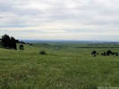 View east to Rocky Flats. View east to Rocky Flats.
|
|
Monday, July 1, 2019
Lippincott Property
|
|
Locations:
Lippincott Ranch.
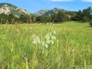 Coll. No. 2107, Lithospermum occidentale Coll. No. 2107, Lithospermum occidentale
|
2107
|
Field identification: Lithospermum occidentale.
Plants of Jefferson County Open Space
Jefferson County, Colorado
Boraginaceae
Lithospermum occidentale (Mack.) Weakley, Witsell & D. Estes.
Western Gromwell nee Marbleseed.
Lippincott Property, Jefferson County, Colorado.
Northernmost Jefferson County, parcel jointly owned by Jefferson County Open Space and City of Boulder OSMP, open prairie in southeast portion, 21.8 km. north northwest of the GNIS location of Golden.
39.9009°N, 105.2724°W.
WGS 1984
Elev. 1977 m.
East-facing swale; also collected here: Calochortus gunnisonii and Claytonia rosea.
Collected by permit: Jefferson County Open Space, 2019, issued: Mar 1, 2019, to: Tom Schweich.
|
Tom Schweich
2107. |
1-Jul-2019 |
|
|
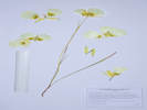 Coll. No. 2108, Calochortus gunnisonii. Coll. No. 2108, Calochortus gunnisonii.
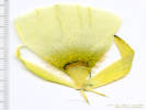 Petal of Coll. No. 2108, Calochortus gunnisonii Petal of Coll. No. 2108, Calochortus gunnisonii
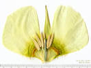 Flower interior of Coll. No. 2108, Calochortus gunnisonii Flower interior of Coll. No. 2108, Calochortus gunnisonii
|
2108
|
Field identification: Calochortus gunnisonii.
Plants of Jefferson County Open Space
Jefferson County, Colorado
Liliaceae
Calochortus gunnisonii S. Watson.
Gunnison's Mariposa Lily.
Lippincott Property, Jefferson County, Colorado.
Northernmost Jefferson County, parcel jointly owned by Jefferson County Open Space and City of Boulder OSMP, open prairie in southeast portion, 21.8 km. north northwest of the GNIS location of Golden.
39.9008°N, 105.2722°W.
WGS 1984
Elev. 1977 m.
Northeast slope, small swale; also collected here: Lithospermum occidentale and Claytonia rosea.
Collected by permit: Jefferson County Open Space, 2019, issued: Mar 1, 2019, to: Tom Schweich.
|
Tom Schweich
2108. |
1-Jul-2019 |
|

Flower interior of Coll. No. 2108, Calochortus gunnisonii being scanned. |
|
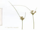 Inflorescence of Coll. No. 2109, Juncus interior Inflorescence of Coll. No. 2109, Juncus interior
|
2109
|
Field identification: Juncus sp.
Plants of Jefferson County Open Space
Jefferson County, Colorado
Juncaceae
Juncus interior Wiegand.
Inland Rush.
Lippincott Property, Jefferson County, Colorado.
Northernmost Jefferson County, parcel jointly owned by Jefferson County Open Space and City of Boulder OSMP, open prairie in southeast portion, 21.8 km. north northwest of the GNIS location of Golden.
39.9005°N, 105.272°W.
WGS 1984
Elev. 1978 m.
In small ravine, open below. Smut infested.
Collected by permit: Jefferson County Open Space, 2019, issued: Mar 1, 2019, to: Tom Schweich.
|
Tom Schweich
2109. |
1-Jul-2019 |
|
Coll. No. 2109, 1 July 2019, characters observed:
Perennial rush, to 50 cm.,
densely caespitose;
Leaves,
sheaths,
±40 mm. exposed,
ligule,
auricles,
absent and very short,
blades,
to 250 mm. × 1.5 mm. wide,
margins inrolled somewhat but not folded along the mid-rib;
Inflorescence,
42-47 mm. × 13-17 mm. wide,
appearing terminal,
bracts,
upper, 130 mm.,
lower, 70 mm.;
Flowers,
#30-40,
subtended by a pair of bracteoles;
Tepals,
5 mm.,
lanceolate,
tip, acuminate or short bristle(?),
green center, light brown stripe, scarious margin;
Capsule,
3.5 mm.,
rounded at summit,
greenish-brown.
|
|
Literature Cited:
- Grant, William F., and Ernest Small, 1996.
|
2110
|
Field identification: Lotus, maybe L. tenuis per few-flowered umbels.
Plants of Jefferson County Open Space
Jefferson County, Colorado
Fabaceae
Lotus tenuis Waldst. & Kit. ex Willd.
Narrowleaf Birds Foot Trefoil.
Lippincott Property, Jefferson County, Colorado.
Northernmost Jefferson County, parcel jointly owned by Jefferson County Open Space and City of Boulder OSMP, open wet prairie in southeast portion, 21.8 km. north northwest of the GNIS location of Golden.
39.9005°N, 105.2717°W.
WGS 1984
Elev. 1971 m.
Also collected here: Juncus interior, Veronica anagallis-aquatica and Dianthus armeria.
Collected by permit: Jefferson County Open Space, 2019, issued: Mar 1, 2019, to: Tom Schweich.
|
Tom Schweich
2110. |
1-Jul-2019 |
|
Coll. No. 2110, 1 July 2019, characters observed:
Perennial herb,
decumbent to ascending,
to 45 cm.;
Stem,
sparsely hairy;
Leaves,
apparently ternately compound with free foliaceous stipules,
but described as
“... leaves pinnately compound with 5 leaflets sessile on the stem such that the lowest
pair of leaflets resemble foliaceous stipules ... Ackerfield (2015)”,
leaflet,
11-12 mm. × (2.5)3.2-3.6(5) mm. wide;
Inflorescence,
umbel;
Flowers,
#(2)4-6,
yellow;
Stamens, united.
Width of leaves and flowers per umbel within range of both L. corniculatus and L. tenuis.
Determined as L. tenuis because the range of characters occasionally equals the lower limit of the smaller L. tenuis,
but never the upper limit of the larger L. corniculatus.
Lotus corniculatus, birdsfoot trefoil, is a Eurasian perennial legume,
popular in temperate climates for pasture or hay and silage production.
Its ancestry is controversial.
While innumerable studies of L. corniculatus and allied species have been published,
comprehensive morphological, geographical, and genetic studies are still needed.
Nevertheless, there is sufficient information for a provisional analysis of the origin and relationships
of this important economical species.
Although sometimes defined to have diploid populations, L. corniculatus essentially appears to be tetraploid.
Biochemical and genetic evidence indicates that this species is an allotetraploid.
Although about a dozen diploid species have been proposed as ancestral to L. corniculatus,
the evidence points strongly to four of these species.
Lotus uliginosus uniquely shares a rhizomatous habit, an acyanogenic factor, and a tannin characteristic with L. corniculatus,
clearly showing an especially close relationship, and reflecting the possibility that it is one of two direct parental species.
Principal candidates for a second parent include Lotus alpinus, Lotus japonicus, and Lotus tenuis.
...
An evolutionary sequence is suggested in which L. uliginosus hybridized with L. tenuis
followed by introgression from L. alpinus and L. japonicus (Grant and Small, 1996).
|
|
|
2110.1
|
Field identification: Dianthus armeria.
Plants of Jefferson County Open Space
Jefferson County, Colorado
Caryophyllaceae
Dianthus armeria L.
Deptford Pink.
Lippincott Property, Jefferson County, Colorado.
Northernmost Jefferson County, parcel jointly owned by Jefferson County Open Space and City of Boulder OSMP, open wet prairie in southeast portion, 21.7 km. north northwest of the GNIS location of Golden.
39.9002°N, 105.2715°W.
WGS 1984
Elev. 1969 m.
Also collected here: Heterotheca villosa, Potentilla recta, Prunella vulgaris, and Veronica anagallis-aquatica
Found at this location and numerous places downslope, and in the adjacent northwest corner of Ranson/Edwards.
Collected by permit: Jefferson County Open Space, 2019, issued: Mar 1, 2019, to: Tom Schweich.
|
Tom Schweich
2110.1 |
1-Jul-2019 |
|
|
|
|
2111
|
Field identification: Veronica, probably V. anagallis-aquatica.
Plants of Jefferson County Open Space
Jefferson County, Colorado
Plantaginaceae
Veronica anagallis-aquatica L.
Water Speedwell.
Lippincott Property, Jefferson County, Colorado.
Northernmost Jefferson County, parcel jointly owned by Jefferson County Open Space and City of Boulder OSMP, open wet prairie in southeast portion, 21.7 km. north northwest of the GNIS location of Golden.
39.9002°N, 105.2715°W.
WGS 1984
Elev. 1969 m.
Also collected here: Dianthus armeria, Heterotheca villosa, Potentilla recta, and Prunella vulgaris.
Collected by permit: Jefferson County Open Space, 2019, issued: Mar 1, 2019, to: Tom Schweich.
|
Tom Schweich
2111. |
1-Jul-2019 |
|
|
|
|
2112
|
Field identification: Prunella vulgaris.
Plants of Jefferson County Open Space
Jefferson County, Colorado
Lamiaceae
Prunella vulgaris L.
Common Selfheal.
Lippincott Property, Jefferson County, Colorado.
Northernmost Jefferson County, parcel jointly owned by Jefferson County Open Space and City of Boulder OSMP, open wet prairie in southeast portion, 21.7 km. north northwest of the GNIS location of Golden.
39.9001°N, 105.2716°W.
WGS 1984
Elev. 1969 m.
At edge of small creek; also collected here: Dianthus armeria, Heterotheca villosa, Potentilla recta, and Veronica anagallis-aquatica.
Also Coll. No. 2144, about 550 m. northwest where the creek is diverted through the former clay pit.
Collected by permit: Jefferson County Open Space, 2019, issued: Mar 1, 2019, to: Tom Schweich.
|
Tom Schweich
2112. |
1-Jul-2019 |
|
|
|
|
2113
|
Field identification: Heterotheca villosa.
Plants of Jefferson County Open Space
Jefferson County, Colorado
Asteraceae
Heterotheca villosa (Pursh) Shinners.
Hairy False Goldenaster.
Lippincott Property, Jefferson County, Colorado.
Northernmost Jefferson County, parcel jointly owned by Jefferson County Open Space and City of Boulder OSMP, open wet prairie in southeast portion, 21.7 km. north northwest of the GNIS location of Golden.
39.9002°N, 105.2714°W.
WGS 1984
Elev. 1966 m.
At edge of small creek; also collected here: Dianthus armeria, Prunella vulgaris, Potentilla recta, and Veronica anagallis-aquatica.
Variety minor if infraspecific names are to be applied.
Collected by permit: Jefferson County Open Space, 2019, issued: Mar 1, 2019, to: Tom Schweich.
|
Tom Schweich
2113. |
1-Jul-2019 |
|
|
|
|
2114
|
Field identification: Potentilla recta.
Plants of Jefferson County Open Space
Jefferson County, Colorado
Rosaceae
Potentilla recta L.
Sulphur Cinquefoil.
Lippincott Property, Jefferson County, Colorado.
Northernmost Jefferson County, parcel jointly owned by Jefferson County Open Space and City of Boulder OSMP, open wet prairie in southeast portion, 21.7 km. north northwest of the GNIS location of Golden.
39.9002°N, 105.2712°W.
WGS 1984
Elev. 1966 m.
At edge of small creek; also collected here: Dianthus armeria, Heterotheca villosa, Prunella vulgaris, and Veronica anagallis-aquatica.
Colorado Noxious Weed List B.
Collected by permit: Jefferson County Open Space, 2019, issued: Mar 1, 2019, to: Tom Schweich.
|
Tom Schweich
2114. |
1-Jul-2019 |
|
|
|
|
2115
|
Field identification: Bromus japonicus.
Plants of Jefferson County Open Space
Jefferson County, Colorado
Poaceae
Bromus japonicus Thunb.
Japanese Cheat Grass.
Lippincott Property, Jefferson County, Colorado.
Northernmost Jefferson County, parcel jointly owned by Jefferson County Open Space and City of Boulder OSMP, open wet prairie in southeast portion, 21.7 km. north northwest of the GNIS location of Golden.
39.9002°N, 105.2712°W.
WGS 1984
Elev. 1967 m.
Also collected here: Dianthus armeria, Heterotheca villosa, Potentilla recta, Prunella vulgaris, and Veronica anagallis-aquatica.
Collected by permit: Jefferson County Open Space, 2019, issued: Mar 1, 2019, to: Tom Schweich.
|
Tom Schweich
2115. |
1-Jul-2019 |
|
While B. japonicus and B. tectorum are superficially similar and often found growing together,
they are probably not that closely related, as B. japonicus is placed in section Bromus,
and B. tectorum in section Genea.
|
|
|
2116
|
Field identification: Gaillardia aristata.
Plants of Jefferson County Open Space
Jefferson County, Colorado
Asteraceae
Gaillardia aristata Pursh.
Blanketflower.
Lippincott Property, Jefferson County, Colorado.
Northernmost Jefferson County, parcel jointly owned by Jefferson County Open Space and City of Boulder OSMP, open wet prairie in southeast portion, 21.7 km. north northwest of the GNIS location of Golden.
39.9002°N, 105.2708°W.
WGS 1984
Elev. 1964 m.
Also collected here: Bromus japonicus, Dianthus armeria, Heterotheca villosa, Potentilla recta, and Veronica anagallis-aquatica.
Collected by permit: Jefferson County Open Space, 2019, issued: Mar 1, 2019, to: Tom Schweich.
|
Tom Schweich
2116. |
1-Jul-2019 |
|
|
|
|
2117
|
Field identification: Gaillardia aristata.
Plants of Jefferson County Open Space
Jefferson County, Colorado
Asteraceae
Gaillardia aristata Pursh.
Blanketflower.
Lippincott Property, Jefferson County, Colorado.
Northernmost Jefferson County, parcel jointly owned by Jefferson County Open Space and City of Boulder OSMP, open wet prairie in southeast portion, 21.8 km. north northwest of the GNIS location of Golden.
39.9008°N, 105.2708°W.
WGS 1984
Elev. 1963 m.
Collected by permit: Jefferson County Open Space, 2019, issued: Mar 1, 2019, to: Tom Schweich.
|
Tom Schweich
2117. |
1-Jul-2019 |
|
|
|
|
2118
|
Field identification: grass, Agrostis?
Plants of Jefferson County Open Space
Jefferson County, Colorado
Poaceae
Poa secunda J. Presl.
Sandberg Bluegrass..
Lippincott Property, Jefferson County, Colorado.
Northernmost Jefferson County, parcel jointly owned by Jefferson County Open Space and City of Boulder OSMP, open wet prairie in southeast portion, 21.8 km. north northwest of the GNIS location of Golden.
39.901°N, 105.2708°W.
WGS 1984
Elev. 1960 m.
In the bottom of a swale with timothy grass.
Collected by permit: Jefferson County Open Space, 2019, issued: Mar 1, 2019, to: Tom Schweich.
|
Tom Schweich
2118. |
1-Jul-2019 |
|
Coll. No. 2118, 1 July 2019, characters observed;
Perennial grass,
to 85 cm.,
may have one small rhizome;
Leaves,
Sheath,
120 mm.,
open,
glabrous,
Ligule,
absent to minimal to 0.5 mm.,
membraneous when present,
Blade,
140 mm. × 4 mm.,
flat to involute to ±prow-tipped;
Inflorescence,
1 per culm,
>leaves,
panicle,
150 mm. × 15-20 mm. wide,
2-3 branches, 5-8 mm.;
Rachis,
not extended;
Spikelets,
many,
10-10.5 mm. × 3-3.5 mm. wide,
similar,
borne singly,
pedicels, 0.5, 1, 4 mm.;
Compression,
lateral;
Disarticulation,
above the glumes,
between the florets;
Glumes,
lower,
4 mm.,
veins, #1,
upper,
5.5 mm.,
<lowest floret,
veins,
#5;
Florets,
4 per spikelet,
mostly bisexual;
Lemma,
6.5 mm.,
>glumes;
lanceolate,
membraneous,
rolled,
a bit scabrous on the midvein best seen when viewed laterally,
veins,
≥5,
±convergent,
margins, scarious,
tip, acute,
awns, none;
Palea,
6.5 mm.,
±=lemma,
membraneous,
keel ciliate,
veins, green,
tip, entire.
Anthers,
2.2-2.5 mm.
|
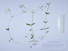 Coll. No. 2118.1, Cerastium brachypodum Coll. No. 2118.1, Cerastium brachypodum
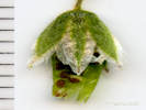 Flower/Fruit of Coll. No. 2118.1, Cerastium brachypodum Flower/Fruit of Coll. No. 2118.1, Cerastium brachypodum
|
2118.1
|
Field identification: Cerastium sp.
Plants of Jefferson County Open Space
Jefferson County, Colorado
Caryophyllaceae
Cerastium brachypodum (Engelmann ex A. Gray) B. L. Robinson.
Short-stalked mouse-ear chickweed.
Lippincott Property, Jefferson County, Colorado.
Northernmost Jefferson County, parcel jointly owned by Jefferson County Open Space and City of Boulder OSMP, open wet prairie in southeast portion, 21.8 km. north northwest of the GNIS location of Golden.
39.901°N, 105.2708°W.
WGS 1984
Elev. 1960 m.
Sepals glandular hairy, >petals.
Collected with Phleum pratense and Poa secunda.
Collected by permit: Jefferson County Open Space, 2019, issued: Mar 1, 2019, to: Tom Schweich.
|
Tom Schweich
2118.1 |
1-Jul-2019 |
|
|
|
|
2119
|
Plants of Jefferson County Open Space
Jefferson County, Colorado
Poaceae
Phleum pratense L.
Timothy.
Lippincott Property, Jefferson County, Colorado.
Northernmost Jefferson County, parcel jointly owned by Jefferson County Open Space and City of Boulder OSMP, open wet prairie in southeast portion, 21.8 km. north northwest of the GNIS location of Golden.
39.901°N, 105.2708°W.
WGS 1984
Elev. 1963 m.
Collected with Poa secunda and Cerastium brachypodum.
Collected by permit: Jefferson County Open Space, 2019, issued: Mar 1, 2019, to: Tom Schweich.
|
Tom Schweich
2119. |
1-Jul-2019 |
|
|
|
Locations:
Ranson/Edwards Homestead Open Space Park.
|
|
Saturday, July 6, 2019
Ranson/Edwards, primarily an attempt to relocation Crassula aquatica, which failed after crawling in the mud for an hour.
|
|
|
2120
|
Field identification: Calochortus gunnisonii.
Plants of Jefferson County Open Space
Jefferson County, Colorado
Liliaceae
Calochortus gunnisonii S. Watson.
Gunnison's Mariposa Lily.
Ranson/Edwards Homestead Open Space Park, Jefferson County, Colorado.
High plains above Rocky Flats, west 1.7 mi. on CO Hwy 72 from CO Hwy 93, generally north 1.0 mi. on Plainview Road, then 50 m. east into open prairie, 19.6 km. north northeast of the GNIS location of Golden.
39.8872°N, 105.2607°W.
WGS 1984
Elev. 1920 m.
Gentle slope, southeast aspect, collected with Helianthus pumilis, Artemisia ludoviciana, and Hesperostipa comata.
Collected by permit: Jefferson County Open Space, 2019, issued: Mar 1, 2019, to: Tom Schweich.
|
Tom Schweish
2120. |
6-Jul-2019 |
|
|
|
|
2121
|
Field identification: undetermined aquatic.
Plants of Jefferson County Open Space
Jefferson County, Colorado
Plantaginaceae
Callitriche palustris L.
Vernal Star Wort.
Ranson/Edwards Homestead Open Space Park, Jefferson County, Colorado.
High plains above Rocky Flats, west 1.7 mi. on CO Hwy 72 from CO Hwy 93, generally north 1.0 mi. on Plainview Road, then 225 m. east to a small stream, 19.4 km. north northeast of the GNIS location of Golden.
39.8863°N, 105.2595°W.
WGS 1984
Elev. 1918 m.
Aquatic.
Also collected nearby: Lithospermum occidentale, Sisyrinchium montanum, and Amorpha fruticosa.
Collected by permit: Jefferson County Open Space, 2019, issued: Mar 1, 2019, to: Tom Schweich.
|
Tom Schweich
2121. |
6-Jul-2019 |
|
|
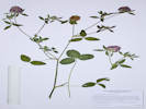 Coll. No. 2122, Trifolium pratense Coll. No. 2122, Trifolium pratense
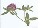 Inflorescence of Coll. No. 2122, Trifolium pratense Inflorescence of Coll. No. 2122, Trifolium pratense
|
2122
|
Field identification: Trifolium, perhaps T. pratense.
Plants of Jefferson County Open Space
Jefferson County, Colorado
Fabaceae
Trifolium pratense L.
Red Clover.
Ranson/Edwards Homestead Open Space Park, Jefferson County, Colorado.
High plains above Rocky Flats, west 1.7 mi. on CO Hwy 72 from CO Hwy 93, generally north 1.0 mi. on Plainview Road, then 360 m. east to a small stream, 19.4 km. north northeast of the GNIS location of Golden.
39.8866°N, 105.2582°W.
WGS 1984
Elev. 1925 m.
On the bank of a small stream that has been diverted to water a terrace above Coal Creek.
Collected by permit: Jefferson County Open Space, 2019, issued: Mar 1, 2019, to: Tom Schweich.
|
Tom Schweich
2122. |
6-Jul-2019 |
|
When collected, the flowers were more red than purple. The stipules are large, ovate-acuminate, scarious with several green nerves, heads solitary at the ends of each stem.
|
|
|
2123
|
Field identification: Juncus bufonius.
Plants of Jefferson County Open Space
Jefferson County, Colorado
Juncaceae
Juncus bufonius L.
Toad Rush.
Ranson/Edwards Homestead Open Space Park, Jefferson County, Colorado.
High plains above Rocky Flats, west 1.7 mi. on CO Hwy 72 from CO Hwy 93, generally north 1.1 mi. on Plainview Road, then 500 m. east to a muddy terrace above Coal Creek, 19.6 km. north northeast of the GNIS location of Golden.
39.888°N, 105.2566°W.
WGS 1984
Elev. 1920 m.
Muddy terrace created by diversion of a small stream.
Also collected here: Alopecurus carolinianus, Limosella aquatica, Crassula aquatica, Veronica peregrina, Erythranthe floribunda, and Plagiobothrys scouleri var. hispidulus.
Collected by permit: Jefferson County Open Space, 2019, issued: Mar 1, 2019, to: Tom Schweich.
|
Tom Schweich
2123. |
6-Jul-2019 |
|
|
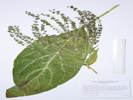 Coll. No. 2124, Cynoglossum officinale Coll. No. 2124, Cynoglossum officinale
|
2124
|
Field identification: Cynoglossum officinale.
Plants of Jefferson County Open Space
Jefferson County, Colorado
Boraginaceae
Cynoglossum officinale L.
Gypsyflower.
Ranson/Edwards Homestead Open Space Park, Jefferson County, Colorado.
High plains above Rocky Flats, west 1.7 mi. on CO Hwy 72 from CO Hwy 93, generally north 1.0 mi. on Plainview Road, then 365 m. east into a thicket, primarily of Prunus virginiana, 19.6 km. north northeast of the GNIS location of Golden.
39.8872°N, 105.258°W.
Also collected nearby: Lithospermum occidentale, Toxicodendron rydbergii, and Thinopyrum intermedium.
Colorado Noxious Weed List B.
|
Tom Schweich
2124. |
6-Jul-2019 |
|
|
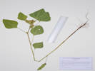 Coll. No. 2425, Arctium minus. Coll. No. 2425, Arctium minus.
|
2124.1
|
Plants of Jefferson County Open Space
Jefferson County, Colorado
Asteraceae
Arctium minus Bernh.
Lesser Burdock.
Ranson/Edwards Homestead Open Space Park, Jefferson County, Colorado.
High plains above Rocky Flats, west 1.7 mi. on CO Hwy 72 from CO Hwy 93, generally north 1.0 mi. on Plainview Road, then 365 m. east into a thicket, primarily of Prunus virginiana, 19.6 km. north northeast of the GNIS location of Golden.
39.8872°N, 105.258°W.
WGS 1984
Elev. 1921 m.
Collected with Cynoglossum officinale.
Vegetative parts only, collections with flower or fruit typically made in August through October. Colorado Noxious Weed List C.
Collected by permit: Jefferson County Open Space, 2019, issued: Mar 1, 2019, to: Tom Schweich.
|
Tom Schweich
2124.1 |
6-Jul-2019 |
|
|
|
Literature Cited:
- Weakley, Alan S., Richard J. LeBlond, Bruce A. Sorrie, C. Theo Witsell, L. Dwayne Estes, Janchi Gandhi, Katherine Gould Mathews, and Atsushi Ebihara, 2011.
- Weigend, M., M. Gottschlinf, F. Selvi, and H. H. Hilger, 2009.
|
2125
|
Field identification: Lithospermum occidentale.
Plants of Jefferson County Open Space
Jefferson County, Colorado
Boraginaceae
Lithospermum occidentale (Mack.) Weakley, Witsell & D. Estes.
Western Gromwell nee Marbleseed.
Ranson/Edwards Homestead Open Space Park, Jefferson County, Colorado.
High plains above Rocky Flats, west 1.7 mi. on CO Hwy 72 from CO Hwy 93, generally north 1.0 mi. on Plainview Road, then 400 m. east to a small break in slope, 19.6 km. north northeast of the GNIS location of Golden.
39.8875°N, 105.2578°W.
WGS 1984
Elev. 1922 m.
Between two thickets of Prunus virginiana on the same break in slope.
Collected nearby: Thinopyrum intermedium; observed nearby: Toxicodendron rydbergii.
Collected by permit: Jefferson County Open Space, 2019, issued: Mar 1, 2019, to: Tom Schweich.
|
Tom Schweich
2125. |
6-Jul-2019 |
|
|
|
|
2126
|
Field identification: Thinopyrum intermedium.
Plants of Jefferson County Open Space
Jefferson County, Colorado
Poaceae
Thinopyrum intermedium (Host) Barkworth & D.R. Dewey.
Intermediate Wheatgrass.
Ranson/Edwards Homestead Open Space Park, Jefferson County, Colorado.
High plains above Rocky Flats, west 1.7 mi. on CO Hwy 72 from CO Hwy 93, generally north 1.0 mi. on Plainview Road, then 400 m. east to a small break in slope, 19.6 km. north northeast of the GNIS location of Golden.
39.8875°N, 105.258°W.
WGS 1984
Elev. 1928 m.
Few rhizomes, glume with offset mucro.
Between two thickets of Prunus virginiana on the same break in slope.
Collected nearby: Lithospermum occidentale; observed nearby: Toxicodendron rydbergii.
Collected by permit: Jefferson County Open Space, 2019, issued: Mar 1, 2019, to: Tom Schweich.
|
Tom Schweich
2126. |
6-Jul-2019 |
|
|
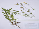 Coll. No. 2127, Silene latifolia Coll. No. 2127, Silene latifolia
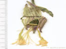 Flower of Coll. No. 2127, Silene latifolia Flower of Coll. No. 2127, Silene latifolia
|
2127
|
Field identification: Silene sp.
Plants of Jefferson County Open Space
Jefferson County, Colorado
Caryophyllaceae
Silene latifolia Poir.
Bladder Campion.
Ranson/Edwards Homestead Open Space Park, Jefferson County, Colorado.
High plains above Rocky Flats, west 1.7 mi. on CO Hwy 72 from CO Hwy 93, generally north 1.0 mi. on Plainview Road, then 400 m. east to a small break in slope, 19.6 km. north northeast of the GNIS location of Golden.
39.888°N, 105.2573°W.
WGS 1984
Elev. 1926 m.
In a thicket, primarily of Prunus virginiana, along a break in slope.
Also collected in these thickets: Polygonum douglasii, Cynoglossum officinale, and Arctium minus.
Collected by permit: Jefferson County Open Space, 2019, issued: Mar 1, 2019, to: Tom Schweich.
|
Tom Schweich
2127. |
6-Jul-2019 |
|
Calyx with long multicellular hairs and short glandular hairs; flowers imperfect, pistillate flowers with 5 styles.
|
|
|
2127.1
|
Field identification: Polygonum douglasii.
Plants of Jefferson County Open Space
Jefferson County, Colorado
Polygonaceae
Polygonum douglasii Greene.
Douglas Knotweed.
Ranson/Edwards Homestead Open Space Park, Jefferson County, Colorado.
High plains above Rocky Flats, west 1.7 mi. on CO Hwy 72 from CO Hwy 93, generally north 1.0 mi. on Plainview Road, then 400 m. east to a small break in slope, 19.6 km. north northeast of the GNIS location of Golden.
39.888°N, 105.2573°W.
WGS 1984
Elev. 1926 m.
In a thicket, primarily of Prunus virginiana, along a break in slope.
Also collected in these thickets: Silene latifolia, Cynoglossum officinale, and Arctium minus.
Collected by permit: Jefferson County Open Space, 2019, issued: Mar 1, 2019, to: Tom Schweich.
|
Tom Schweich
2127.1 |
6-Jul-2019 |
|
|
|
|
|
Sunday, July 7, 2019
Weed collecting in the Heritage Dells area.
|
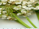 Flowers of Aegopodium podagraria Flowers of Aegopodium podagraria
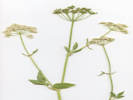 Inflorescence of Aegopodium podograria Inflorescence of Aegopodium podograria
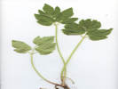 Basal leaves of Aegopodium podograria Basal leaves of Aegopodium podograria
|
2128
|
Field identification: Aegopodium podagraria.
|
Native and Naturalized Flora of the Golden Area, Jefferson County, Colorado
Apiaceae
Aegopodium podagraria L.
Bishops Goutweed.
Heritage Dells, Jefferson County, Colorado.
Backyard of 209 Berthoud Way, Golden. 5.58 km. south of the GNIS location of Golden.
39.7182°N, 105.2091°W.
WGS 1984
Elev. 1874 m.
Non-varigated form.
Escaping through side fence where watered, but apparently not through the back fence into unwatered open space. Not seen in Apex Gulch, City of Golden open space, 100 m. south.
Collected by permit: Jefferson County Open Space, 2019, issued: Mar 1, 2019, to: Tom Schweich.
|
Tom Schweich
2128. |
7-Jul-2019 |
|
Coll. No. 2128, 7 Jul 2019, characters observed:
Perennial herb, to 90 cm.,
erect,
branched,
rhizomatous;
Leaves,
basal,
petiole 150 mm.,
irregular to biternate,
120 mm. × 100 mm. wide,
leaflet,
ovate,
55 mm. × 35 mm. wide,
margin serrate,
cauline,
reduced,
sometimes opposite,
ternate,
leaflets,
lanceolate,
53 mm. × 18 mm. wide;
Inflorescence,
compound umbel,
45 mm. × 75 mm. wide;
Flowers,
white;
Ovary,
glabrous,
stylopodium, present;
Style,
#1, 1.2 mm.;
Fruit,
glabrous,
1.5 mm. × 1 mm. wide.
Native of Eurasia, cult. in old-fashioned gardens and often escaped in ne. U.S., especially in moist, partly shaded places.
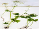
Overview of Aegopodium podograria |
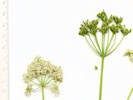
Compound umbels of Aegopodium podograria |
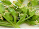
Fruit of Aegopodium podograria |
|
|
Locations:
Apex Gulch.
|
|
Monday, July 8, 2019
Headed for Kinney Run, got stuck in Apex Gulch.
|
|
|
2129
|
Field identification: "White top."
|
Native and Naturalized Flora of the Golden Area, Jefferson County, Colorado
Brassicaceae
Berteroa incana (L.) DC.
Hoary Alyssum.
Apex Gulch, Jefferson County, Colorado.
Terrace on the north bank of Apex Gulch, between Fire Station 4 and the Kinney Run Trail bridge, 5.72 km. south of the GNIS location of Golden.
39.717°N, 105.2095°W.
WGS 1984
Elev. 1877 m.
Also collected here: Potentilla recta, Verbascum thapsus, and Vicia americana.
This area was extensively collected by E. H. Brunquist in 1959-1960 during the Peabody Museum excavation at Magic Mountain. B. incana was not collected at that time.
Collected by permit: City of Golden, 2019, issued: Jan 29, 2019, to: Tom Schweich.
|
Tom Schweich
2129. |
8-Jul-2019 |
|
|
|
|
2130
|
Field identification: Vetch.
|
Native and Naturalized Flora of the Golden Area, Jefferson County, Colorado
Fabaceae
Vicia villosa Roth.
Hairy Vetch.
Apex Gulch, Jefferson County, Colorado.
Terrace on the north bank of Apex Gulch, between Fire Station 4 and the Kinney Run Trail bridge, 5.73 km. south of the GNIS location of Golden.
39.717°N, 105.2095°W.
WGS 1984
Elev. 1879 m.
Lax, twining on smooth brome.
Also collected here: Berteroa incana, Potentilla recta, and Verbascum thapsus.
This area was extensively collected by E. H. Brunquist in 1959-1960 during the Peabody Museum excavation at Magic Mountain.
Collected by permit: City of Golden, 2019, issued: Jan 29, 2019, to: Tom Schweich.
|
Tom Schweich
2130. |
8-Jul-2019 |
|
|
|
|
2131
|
Field identification: Potentilla recta.
|
Native and Naturalized Flora of the Golden Area, Jefferson County, Colorado
Rosaceae
Potentilla recta L.
Sulphur Cinquefoil.
Apex Gulch, Jefferson County, Colorado.
Terrace on the north bank of Apex Gulch, between Fire Station 4 and the Kinney Run Trail bridge, 5.73 km. south of the GNIS location of Golden.
39.7169°N, 105.2095°W.
WGS 1984
Elev. 1879 m.
Also collected here: Berteroa incana, Vicia villosa, and Verbascum thapsus.
This area was extensively collected by E. H. Brunquist in 1959-1960 during the Peabody Museum excavation at Magic Mountain. P. recta was not collected at that time. Colorado Noxious Weed List B.
Collected by permit: City of Golden, 2019, issued: Jan 29, 2019, to: Tom Schweich.
|
Tom Schweich
2131. |
8-Jul-2019 |
|
|
|
|
2132
|
Field identification: Verbascum thapsus.
|
Native and Naturalized Flora of the Golden Area, Jefferson County, Colorado
Scrophulariaceae
Verbascum thapsus L.
Common Mullein.
Apex Gulch, Jefferson County, Colorado.
Terrace on the north bank of Apex Gulch, between Fire Station 4 and the Kinney Run Trail bridge, 5.73 km. south of the GNIS location of Golden.
39.717°N, 105.2095°W.
WGS 1984
Elev. 1879 m.
Also collected here: Berteroa incana, Vicia villosa, and Potentilla recta.
This area was extensively collected by E. H. Brunquist in 1959-1960 during the Peabody Museum excavation at Magic Mountain. V. thapsus was collected at that time. Colorado Noxious Weed List C.
Collected by permit: City of Golden, 2019, issued: Jan 29, 2019, to: Tom Schweich.
|
Tom Schweich
2132. |
8-Jul-2019 |
|
|
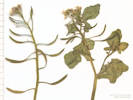 Inflorescence of Coll. No. 2133, Nasturtium officinale Inflorescence of Coll. No. 2133, Nasturtium officinale
 Inflorescence of Coll. No. 2133, Nasturtium officinale Inflorescence of Coll. No. 2133, Nasturtium officinale
|
2133
|
Field identification: Noccaea fendleri. --- Egads!
|
Native and Naturalized Flora of the Golden Area, Jefferson County, Colorado
Brassicaceae
Nasturtium officinale R. Br.
Watercress.
Apex Gulch, Jefferson County, Colorado.
Terrace on the north bank of Apex Gulch, between Fire Station 4 and the Kinney Run Trail bridge, 5.73 km. south of the GNIS location of Golden.
39.7169°N, 105.21°W.
WGS 1984
Elev. 1873 m.
Flowing water below a well or casing-enhanced spring.
This area was extensively collected by E. H. Brunquist in 1959-1960 during the Peabody Museum excavation at Magic Mountain. N. officinale was not collected at that time.
Collected by permit: City of Golden, 2019, issued: Jan 29, 2019, to: Tom Schweich.
|
Tom Schweich
2133. |
8-Jul-2019 |
|
|
|
|
2134
|
Field identification: Monarda fistulosa.
|
Native and Naturalized Flora of the Golden Area, Jefferson County, Colorado
Lamiaceae
Monarda fistulosa L.
Wild Bergamot.
Apex Gulch, Jefferson County, Colorado.
Terrace on the north bank of Apex Gulch, between Fire Station 4 and the Kinney Run Trail bridge, 5.74 km. south of the GNIS location of Golden.
39.7168°N, 105.2103°W.
WGS 1984
Elev. 1891 m.
This area was extensively collected by E. H. Brunquist in 1959-1960 during the Peabody Museum excavation at Magic Mountain. M. fistulosa was also collected at that time.
Collected by permit: City of Golden, 2019, issued: Jan 29, 2019, to: Tom Schweich.
|
Tom Schweich
2134. |
8-Jul-2019 |
|
|
 Coll. No. 2135, Ligustrum vulgare Coll. No. 2135, Ligustrum vulgare
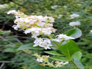 Coll. No. 2135, Ligustrum vulgare Coll. No. 2135, Ligustrum vulgare
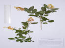 Coll. No. 2135, Ligustrum vulgare Coll. No. 2135, Ligustrum vulgare
|
2135
|
Field identification: fragrant shrub.
|
Native and Naturalized Flora of the Golden Area, Jefferson County, Colorado
Oleaceae
Ligustrum vulgare L.
Privet.
Apex Gulch, Jefferson County, Colorado.
Terrace on the north bank of Apex Gulch, between Fire Station 4 and the Kinney Run Trail bridge, 5.74 km. south of the GNIS location of Golden.
39.7168°N, 105.2102°W.
WGS 1984
Elev. 1886 m.
Naturalized.
Shaded, equable habitat.
This area was extensively collected by E. H. Brunquist in 1959-1960 during the Peabody Museum excavation at Magic Mountain. L. vulgare was not collected at that time.
Collected by permit: City of Golden, 2019, issued: Jan 29, 2019, to: Tom Schweich.
|
Tom Schweich
2135. |
8-Jul-2019 |
|
|
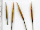 Fresh seed of Hesperostipa spartea Fresh seed of Hesperostipa spartea
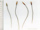 Fresh seed of Hesperostipa spartea Fresh seed of Hesperostipa spartea
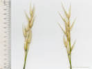 Glumes of Hesperostipa spartea Glumes of Hesperostipa spartea
|
|
Wednesday, July 10, 2019
Collected seed and scanned them. This is Hesperostipa spartea, for which the original seed was purchased from Minnesota.
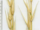
Glumes of Hesperostipa spartea |
|
|
Locations:
North Table Mountain.
|
|
Thursday, July 11, 2019
Collecting on the north side of North Table Mountain.
|
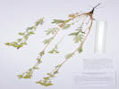 Coll. No. 2136, Potentilla pensylvanica Coll. No. 2136, Potentilla pensylvanica
|
2136
|
Field identification: Potentilla, probably P. pensylvanica.
Plants of Jefferson County Open Space
Jefferson County, Colorado
Rosaceae
Potentilla pensylvanica L.
Prairie Cinquefoil.
North Table Mountain Park, Jefferson County, Colorado.
Near the north boundary of the park, lower north slopes of North Table Mountain, in what appears to be the hummocky terrain of an ancient landslide, 6.26 km. north northeast of the GNIS location of Golden.
39.7977°N, 105.209°W.
WGS 1984
Elev. 1813 m.
Leaflet margins revolute.
Also collected here: Boechera fendleri, Delphinium carolinianum ssp. virescens, Senecio integerrimus, and Viola nuttallii.
Collected by permit: Jefferson County Open Space, 2019, issued: Mar 1, 2019, to: Tom Schweich.
|
Tom Schweich
2136. |
11-Jul-2019 |
|
Coll. No. 2136, 11 July 2019, characters observed:
Perennial herb,
to 40 cm.,
erect;
Leaves,
basal and cauline,
basal,
130 mm. × 25 mm. wide,
compound, pinnate,
leaflets,
#11,
margins, revolute;
cauline,
#7-10 per stem,
alternate,
reduced in size,
compound, pinnately-lobed,
stipules,
large, to 25 mm.,
deeply cleft,
petiole,
25 mm.,
blade,
70 mm. × 32 mm. wide,
leaflets,
#10,
30 mm. × 11 mm. wide,
lobed ≥½,
margin, revolute;
Inflorescence,
clusters of #5-7 flowers;
Pedicels,
2-10 mm.;
Sepals,
#5, 5 mm.,
green,
hairy,
glands, abundant,
epicalyx bractlets, 4.5 mm. × 1.8 mm. wide;
Petals,
#5,
5.3 mm. × 4.5 mm. wide,
yellow;
Receptacle,
hairy,
3 mm.;
Stamens,
±16;
Anthers,
0.7 mm. × 0.6 mm. wide;
Ovary,
many;
Styles,
1 per ovary,
thickest near base,
tapered throughout;
Achenes,
1.3 mm. × 0.8 mm. wide,
attachment, lateral,
rugose.
|
|
|
2137
|
Field identification: Dephinium carolinum var. virescens.
Plants of Jefferson County Open Space
Jefferson County, Colorado
Ranunculaceae
Delphinium carolinianum Walter ssp. virescens (Nutt.) R.E. Brooks.
Carolina Laskspur.
North Table Mountain Park, Jefferson County, Colorado.
Near the north boundary of the park, lower north slopes of North Table Mountain, in what appears to be the hummocky terrain of an ancient landslide, 6.26 km. north northeast of the GNIS location of Golden.
39.7976°N, 105.2094°W.
WGS 1984
Elev. 1815 m.
Also collected here: Boechera fendleri, Potentilla pensylvanica, Senecio integerrimus, and Viola nuttallii.
Inflorescence stunted in one specimen, virus infection (?).
Collected by permit: Jefferson County Open Space, 2019, issued: Mar 1, 2019, to: Tom Schweich.
|
Tom Schweich
2137. |
11-Jul-2019 |
|
|
|
|
2138
|
Field identification: Chenopodium, probably C. album.
Plants of Jefferson County Open Space
Jefferson County, Colorado
Chenopodiaceae
Chenopodium album L.
Lambsquarters.
North Table Mountain Park, Jefferson County, Colorado.
Near the north boundary of the park, lower north slopes of North Table Mountain, in what appears to be the hummocky terrain of an ancient landslide, 6.16 km. north northeast of the GNIS location of Golden.
39.7969°N, 105.2101°W.
WGS 1984
Elev. 1815 m.
Also collected nearby: Opuntia macrorhiza, Potentilla pensylvanica, and Opuntia macrorhiza.
Collected by permit: Jefferson County Open Space, 2019, issued: Mar 1, 2019, to: Tom Schweich.
|
Tom Schweich
2138. |
11-Jul-2019 |
|
|
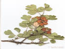 Coll. No. 2139, Rhus trilobata. Coll. No. 2139, Rhus trilobata.
|
2139
|
Field identification: Rhus trilobata, in fruit.
Plants of Jefferson County Open Space
Jefferson County, Colorado
Anacardiaceae
Rhus trilobata Torrey & A. Gray.
Squawbush.
North Table Mountain Park, Jefferson County, Colorado.
Near the north boundary of the park, lower north slopes of North Table Mountain, in what appears to be the hummocky terrain of an ancient landslide, 6.06 km. north northeast of the GNIS location of Golden.
39.7965°N, 105.21°W.
WGS 1984
Elev. 1822 m.
Fruit, no flower.
Near top of small mound, also collected here: Opuntia macrorhiza and Thelesperma megapotamicum.
Collected by permit: Jefferson County Open Space, 2019, issued: Mar 1, 2019, to: Tom Schweich.
|
Tom Schweich
2139. |
11-Jul-2019 |
|
|
|
|
2140
|
Field identification: Thelesperma megapotamicum.
Plants of Jefferson County Open Space
Jefferson County, Colorado
Asteraceae
Thelesperma megapotamicum (Spreng.) Kuntze.
Hopi Tea Greenthread.
North Table Mountain Park, Jefferson County, Colorado.
Near the north boundary of the park, lower north slopes of North Table Mountain, in what appears to be the hummocky terrain of an ancient landslide, 6.06 km. north northeast of the GNIS location of Golden.
39.7965°N, 105.21°W.
WGS 1984
Elev. 1822 m.
Near top of small mound, also collected here: Opuntia macrorhiza and Rhus trilobata.
Collected by permit: Jefferson County Open Space, 2019, issued: Mar 1, 2019, to: Tom Schweich.
|
Tom Schweich
2140. |
11-Jul-2019 |
|
|
|
|
2141
|
Field identification: Opuntia, later in the office: O. macrorhiza.
Plants of Jefferson County Open Space
Jefferson County, Colorado
Cactaceae
Opuntia macrorhiza Engelm.
Western Pricklypear.
North Table Mountain Park, Jefferson County, Colorado.
Near the north boundary of the park, lower north slopes of North Table Mountain, in what appears to be the hummocky terrain of an ancient landslide, 6.06 km. north northeast of the GNIS location of Golden.
39.7966°N, 105.21°W.
WGS 1984
Elev. 1814 m.
Near top of small mound, also collected here: Thelesperma megapotamicum and Rhus trilobata.
Collected by permit: Jefferson County Open Space, 2019, issued: Mar 1, 2019, to: Tom Schweich.
|
Tom Schweich
2141. |
11-Jul-2019 |
|
|
|
Locations:
Lippincott Ranch.
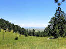 View southeast from “Saddle Meadow” View southeast from “Saddle Meadow”
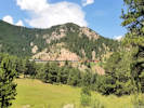 BNSF train on the Moffatt Route. BNSF train on the Moffatt Route.
|
|
Saturday, July 13, 2019
Lippincott
|
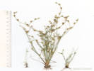 Coll. No. 2142, Juncus bufonius Coll. No. 2142, Juncus bufonius
|
2142
|
Field identification: Juncus bufonius.
Plants of Jefferson County Open Space
Jefferson County, Colorado
Juncaceae
Juncus bufonius L.
Toad Rush.
Lippincott Property, Jefferson County, Colorado.
Northernmost Jefferson County, parcel jointly owned by Jefferson County Open Space and City of Boulder OSMP, in flowing water diverted through former clay pit, 22.0 km. north northwest of the GNIS location of Golden.
39.9028°N, 105.2749°W.
WGS 1984
Elev. 2005 m.
Also collected here: Aloperucus carolinianus, Prunella vulgaris, and Trifolium repens.
Collected by permit: Jefferson County Open Space, 2019, issued: Mar 1, 2019, to: Tom Schweich.
|
Tom Schweich
2142. |
13-Jul-2019 |
|
|
|
|
2142.1
|
Field identification: Alopecurus carolinianus.
Plants of Jefferson County Open Space
Jefferson County, Colorado
Poaceae
Alopecurus carolinianus Walter.
Carolina Foxtail.
Lippincott Property, Jefferson County, Colorado.
Northernmost Jefferson County, parcel jointly owned by Jefferson County Open Space and City of Boulder OSMP, in flowing water diverted through former clay pit, 22.0 km. north northwest of the GNIS location of Golden.
39.9028°N, 105.2749°W.
WGS 1984
Elev. 2005 m.
Also collected here: Juncus bufonius, Prunella vulgaris, and Trifolium repens.
Collected by permit: Jefferson County Open Space, 2019, issued: Mar 1, 2019, to: Tom Schweich.
|
Tom Schweich
2142.1 |
13-Jul-2019 |
|
|
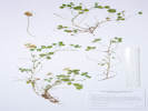 Coll. No. 2143, Trifolium repens Coll. No. 2143, Trifolium repens
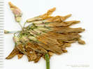 Head of Coll. No. 2143, Trifolium repens Head of Coll. No. 2143, Trifolium repens
|
2143
|
Field identification: “White Clover”
Plants of Jefferson County Open Space
Jefferson County, Colorado
Fabaceae
Trifolium repens L.
White Clover.
Lippincott Property, Jefferson County, Colorado.
Northernmost Jefferson County, parcel jointly owned by Jefferson County Open Space and City of Boulder OSMP, muddy places beside flowing water diverted through former clay pit, 22.0 km. north northwest of the GNIS location of Golden.
39.903°N, 105.2748°W.
WGS 1984
Elev. 2005 m.
Also collected here: Juncus bufonius, Prunella vulgaris, and Alopecurus carolinianus.
Collected by permit: Jefferson County Open Space, 2019, issued: Mar 1, 2019, to: Tom Schweich.
|
Tom Schweich
2143. |
13-Jul-2019 |
|
As described in Ackerfield (2015), the thing to see here is the “
calyx with a whitish-green tube with a purple spot below each sinus, and green teeth
”
|
|
|
2144
|
Field identification: Prunella vulgaris.
Plants of Jefferson County Open Space
Jefferson County, Colorado
Lamiaceae
Prunella vulgaris L.
Common Selfheal.
Lippincott Property, Jefferson County, Colorado.
Northernmost Jefferson County, parcel jointly owned by Jefferson County Open Space and City of Boulder OSMP, muddy places beside flowing water diverted through former clay pit, 22.0 km. north northwest of the GNIS location of Golden.
39.9029°N, 105.275°W.
WGS 1984
Elev. 2005 m.
Also collected here: Juncus bufonius, Trifolium repens, and Alopecurus carolinianus.
Also Coll. No. 2112 about 550 m. southeast along a small natural stream.
Collected by permit: Jefferson County Open Space, 2019, issued: Mar 1, 2019, to: Tom Schweich.
|
Tom Schweich
2144. |
13-Jul-2019 |
|
|
|
|
2145
|
Field identification: Monarda fistulosa.
|
|
|
2146
|
Field identification: Ceanothus fendlerii.
Plants of Jefferson County Open Space
Jefferson County, Colorado
Rhamnaceae
Ceanothus fendleri A. Gray.
Fendler's Ceanothus.
Lippincott Property, Jefferson County, Colorado.
Northernmost Jefferson County, parcel jointly owned by Jefferson County Open Space and City of Boulder OSMP, a little southwest of the clay pit and adit, 22.1 km. north northwest of the GNIS location of Golden.
39.9024°N, 105.2758°W.
WGS 1984
Elev. 2015 m.
Openings in ponderosa pine woodland. Also collected nearby: Monarda fistulosa, Plantago lanceolata, Nassella viridula, and Crataegus succulenta.
Collected by permit: Jefferson County Open Space, 2019, issued: Mar 1, 2019, to: Tom Schweich.
|
Tom Schweich
2146. |
13-Jul-2019 |
|
|
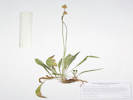 Coll. No. 2147, Plantago lanceolata Coll. No. 2147, Plantago lanceolata
|
2147
|
Field identification: Plantago lanceolata.
Plants of Jefferson County Open Space
Jefferson County, Colorado
Plantaginaceae
Plantago lanceolata L.
Narrowleaf Plantain.
Lippincott Property, Jefferson County, Colorado.
Northernmost Jefferson County, parcel jointly owned by Jefferson County Open Space and City of Boulder OSMP, west of the clay pit and adit, 22.1 km. north northwest of the GNIS location of Golden.
39.9023°N, 105.2769°W.
WGS 1984
Elev. 2018 m.
Lowest slopes of hogback, among ponderosa pines, also collected here: Crataegus succulenta, Nassella viridula, and Potentilla fissa.
Collected by permit: Jefferson County Open Space, 2019, issued: Mar 1, 2019, to: Tom Schweich.
|
Tom Schweich
2147. |
13-Jul-2019 |
|
|
|
|
2148
|
Field identification: Nassella viridula.
Plants of Jefferson County Open Space
Jefferson County, Colorado
Poaceae
Nassella viridula (Trin.) Barkworth.
Green Needlegrass.
Lippincott Property, Jefferson County, Colorado.
Northernmost Jefferson County, parcel jointly owned by Jefferson County Open Space and City of Boulder OSMP, west of the clay pit and adit, 22.2 km. north northwest of the GNIS location of Golden.
39.9021°N, 105.2772°W.
WGS 1984
Elev. 2031 m.
South end of the hogback, at the edge of a small group of Ponderosa pines. Also collected nearby: Crataegus succulenta and Potentilla fissa.
Collected by permit: Jefferson County Open Space, 2019, issued: Mar 1, 2019, to: Tom Schweich.
|
Tom Schweich
2148. |
13-Jul-2019 |
|
|
|
|
2149
|
Field identification: Acer glabrum.
Plants of Jefferson County Open Space
Jefferson County, Colorado
Sapindaceae
Acer glabrum Torr.
Rocky Mountain Maple.
Lippincott Property, Jefferson County, Colorado.
Northernmost Jefferson County, parcel jointly owned by Jefferson County Open Space and City of Boulder OSMP, edge of forest at extreme southwest corner near the railroad tracks, 22.3 km. north northwest of the GNIS location of Golden.
39.9016°N, 105.2825°W.
WGS 1984
Elev. 2104 m.
Also collected nearby: Juniperus communis and J. scopulorum, Berberis repens, and Hieracium albiflorum.
One of several quintessential Jefferson County taxa, as the type was collected in Platte Canyon by Dr. Edwin James of the Major Stephen H. Long expedition of 1820.
Collected by permit: Jefferson County Open Space, 2019, issued: Mar 1, 2019, to: Tom Schweich.
|
Tom Schweich
2149. |
13-Jul-2019 |
|
|
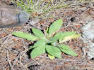 Rosette of Coll. No. 2150, Hieracium albiflorum Rosette of Coll. No. 2150, Hieracium albiflorum
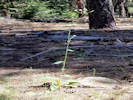 Coll. No. 2150, Hieracium albiflorum Coll. No. 2150, Hieracium albiflorum
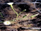 Inflorescence of Coll. No. 2150, Hieracium albiflorum Inflorescence of Coll. No. 2150, Hieracium albiflorum
|
2150
|
Field identification: Chicorieae, office: Hieracium albiflorum, thanks to Cindy.
Plants of Jefferson County Open Space
Jefferson County, Colorado
Asteraceae
Hieracium albiflorum Hook.
White-Flower Hawkweed.
Lippincott Property, Jefferson County, Colorado.
Northernmost Jefferson County, parcel jointly owned by Jefferson County Open Space and City of Boulder OSMP, southwest corner near the railroad tracks, 22.3 km. north northwest of the GNIS location of Golden.
39.9019°N, 105.2813°W.
WGS 1984
Elev. 2095 m.
Non-rhizomatous, fibrous roots, leaves mostly rosette, hairy, nearly scapose, flowers ligulate, white.
In ponderosa pine woodland, thick forest duff, with Juniperus communis and J. scopulorum, and Berberis repens.
Most plants show some evidence of herbivory.
Collected by permit: Jefferson County Open Space, 2019, issued: Mar 1, 2019, to: Tom Schweich.
|
Tom Schweich
2150. |
13-Jul-2019 |
|
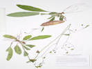
Coll. No. 2150, Hieracium albiflorum |
|
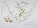 Coll. No. 2151, Campanula rotundifolia Coll. No. 2151, Campanula rotundifolia
|
2151
|
Field identification: Campanula rotundifolia.
Plants of Jefferson County Open Space
Jefferson County, Colorado
Campanulaceae
Campanula rotundifolia L.
Harebell.
Lippincott Property, Jefferson County, Colorado.
Northernmost Jefferson County, parcel jointly owned by Jefferson County Open Space and City of Boulder OSMP, southwest corner near the railroad tracks, 22.3 km. north northwest of the GNIS location of Golden.
39.9025°N, 105.2802°W.
WGS 1984
Elev. 2079 m.
More sprawling than erect, deep forest duff in ponderosa pine woodland, with Collomia linearis, Eriogonum umbellatum, Lappula occidentalis, and Sedum lanceolatum.
Collected by permit: Jefferson County Open Space, 2019, issued: Mar 1, 2019, to: Tom Schweich.
|
Tom Schweich
2151. |
13-Jul-2019 |
|
|
|
|
2152
|
Field identification: Sedum lanceolatum.
Plants of Jefferson County Open Space
Jefferson County, Colorado
Crassulaceae
Sedum lanceolatum Torr.
Spearleaf Stonecrop.
Lippincott Property, Jefferson County, Colorado.
Northernmost Jefferson County, parcel jointly owned by Jefferson County Open Space and City of Boulder OSMP, southwest corner near the railroad tracks, 22.3 km. north northwest of the GNIS location of Golden.
39.9024°N, 105.2802°W.
WGS 1984
Elev. 2090 m.
Deep forest duff in ponderosa pine woodland, with Collomia linearis, Eriogonum umbellatum, Lappula occidentalis, and Campanula rotundifolia.
Collected by permit: Jefferson County Open Space, 2019, issued: Mar 1, 2019, to: Tom Schweich.
|
Tom Schweich
2152. |
13-Jul-2019 |
|
|
|
|
2153
|
Field identification: Hypericum perforatum.
Plants of Jefferson County Open Space
Jefferson County, Colorado
Hypericaceae
Hypericum perforatum L.
Common St. John's Wort.
Lippincott Property, Jefferson County, Colorado.
Northernmost Jefferson County, parcel jointly owned by Jefferson County Open Space and City of Boulder OSMP, southwest corner near the railroad tracks, 22.3 km. north northwest of the GNIS location of Golden.
39.9025°N, 105.2801°W.
WGS 1984
Elev. 2077 m.
Deep forest duff in ponderosa pine woodland, with Collomia linearis, Eriogonum umbellatum, Lappula occidentalis, and Campanula rotundifolia.
Collected by permit: Jefferson County Open Space, 2019, issued: Mar 1, 2019, to: Tom Schweich.
|
Tom Schweich
2153. |
13-Jul-2019 |
|
|
 Georeferenced collections of selected Myosotis near Colorado. Georeferenced collections of selected Myosotis near Colorado.
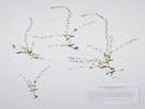 Coll. No. 2154, Myosotis micrantha Coll. No. 2154, Myosotis micrantha
|
2154
|
Field identification: some sort of stickseed
Plants of Jefferson County Open Space
Jefferson County, Colorado
Boraginaceae
Myosotis micrantha Pall. Ex Lehm.
Small-Flowered Forget-Me-Not.
Lippincott Property, Jefferson County, Colorado.
Northernmost Jefferson County, parcel jointly owned by Jefferson County Open Space and City of Boulder OSMP, southwest corner near the railroad tracks, 22.3 km. north northwest of the GNIS location of Golden.
39.9024°N, 105.2801°W.
WGS 1984
Elev. 2067 m.
Deep forest duff in ponderosa pine woodland, with Collomia linearis, Eriogonum umbellatum, Hypericum perforatum, and Campanula rotundifolia.
Collected by permit: Jefferson County Open Space, 2019, issued: Mar 1, 2019, to: Tom Schweich.
|
Tom Schweich
2154. |
13-Jul-2019 |
|
Coll. No. 2154, 13 Jul 2019, characters observed;
Annual,
12-20 cm.;
Stems,
erect,
branched at and above the base;
Leaves,
alternate,
sessile,
oblanceolate,
14 mm. × 5.5 mm. wide,
strigose,
few hooked hairs on abaxial mid-rib;
Inflorescence,
scorpioid,
greatly exceeding leaves, although there are flowers throughout the plant;
Pedicel,
in fruit << calyx;
Calyx,
in flower,
2.5 mm., fused ±½,
lobes ±equal,
strigose, some hairs hooked,
in fruit 4 mm.;
Corolla,
white, lobes, blue;
Nutlets,
1.2 mm.,
>>style,
brown,
smooth,
shiny,
margin sharp raised.
I applied M. micrantha because the inflorescence greatly exceeds the leaves
and the plant is floriferous nearly to the base.
Also hairs are hooked on the abaxial mid-rib of the leaves,
a character only described for M. micrantha
(see the Jepson Manual of California, 2nd ed.).
This will key to M. arvensis in Ackerfield (2015).
However, M. micrantha is not a possibility there.
Distribution of collections of the two taxa (SEINet, 8 Dec 2019)
show collections of M. micrantha in northeast Utah and southeast Wyoming,
whereas collections of M. arvensis are much farther from Colorado.
Myosotis arvensis.
Biennial or sometimes annual, 1-4 dm, often branched above, strigose to hirsute-puberulent throughout;
lvs 1-6 cm ?3-16 mm, the lower mostly oblanceolate, the upper often more oblong or lanceolate;
infl slightly if at all longer than the leafy part of the plant;
mature pedicels ascending or spreading, equaling or generally surpassing the 3-5 mm cal;
cal hirsute-puberulent and shortly uncinate-hispid;
cor blue or occasionally white, the limb 2-4 mm wide;
nutlets distinctly surpassing the style;
2n=50-54.
Native of Eurasia, established in fields and roadsides from Nf. to Minn., s. sometimes to N.H. and W.Va. Summer.
(Gleason, Henry A. & Cronquist, Arthur J. 1991. Manual of vascular plants of northeastern United States and adjacent Canada. lxxv + 910 pp.)
Myosotis micrantha.
Annual or winter-annual to 2 dm, often branched from the base, ±hirsute-puberulent throughout;
lvs seldom over 2 cm ?7 mm;
plants floriferous nearly to the base, the lower fls scattered among the lvs;
fruiting pedicels ascending or somewhat spreading, under 2 mm, shorter than the 3-5 mm cal;
cal strigose at least above, the tube also shortly uncinate- hispid;
cor blue, the limb 1-2 mm wide, not flat;
nutlets surpassing the style;
2n=36-40.
Native of Eurasia, locally intr. in dry waste places; Que. to Va., Mich., and Io. Apr.-July. (M. stricta)
(Gleason, Henry A. & Cronquist, Arthur J. 1991. Manual of vascular plants of northeastern United States and adjacent Canada. lxxv + 910 pp.)
|
|
|
2154.1
|
Field identification: Collomia linearis
|
|
|
2155
|
Field identification: Eriogonum umbellatum.
Plants of Jefferson County Open Space
Jefferson County, Colorado
Polygonaceae
Eriogonum umbellatum Torr. var. umbellatum.
Sulphur-Flower Buckwheat.
Lippincott Property, Jefferson County, Colorado.
Northernmost Jefferson County, parcel jointly owned by Jefferson County Open Space and City of Boulder OSMP, southwest corner near the railroad tracks, 22.3 km. north northwest of the GNIS location of Golden.
39.9025°N, 105.28°W.
WGS 1984
Elev. 2062 m.
Deep forest duff in ponderosa pine woodland, with Sedum lanceolatum, Hypericum perforatum, and Campanula rotundifolia.
Collected by permit: Jefferson County Open Space, 2019, issued: Mar 1, 2019, to: Tom Schweich.
|
Tom Schweich
2155. |
13-Jul-2019 |
|
|
|
|
2156
|
Field identification: Opuntia macrorhiza.
Plants of Jefferson County Open Space
Jefferson County, Colorado
Boraginaceae
Cryptantha virgata (Porter) Payson.
Miner"s Candle.
Lippincott Property, Jefferson County, Colorado.
Northernmost Jefferson County, parcel jointly owned by Jefferson County Open Space and City of Boulder OSMP, southwest base of hogback in center of parcel, 22.4 km. north northwest of the GNIS location of Golden.
39.9034°N, 105.2776°W.
WGS 1984
Elev. 2056 m.
Gentle rocky southwest-facing slope with forest duff near edge of ponderosa pine woodland.
Collected by permit: Jefferson County Open Space, 2019, issued: Mar 1, 2019, to: Tom Schweich.
|
Tom Schweich
2157. |
13-Jul-2019 |
|
|
|
|
2157
|
Field identification: Cryptantha virgata.
Plants of Jefferson County Open Space
Jefferson County, Colorado
Boraginaceae
Cryptantha virgata (Porter) Payson.
Miner"s Candle.
Lippincott Property, Jefferson County, Colorado.
Northernmost Jefferson County, parcel jointly owned by Jefferson County Open Space and City of Boulder OSMP, southwest base of hogback in center of parcel, 22.4 km. north northwest of the GNIS location of Golden.
39.9034°N, 105.2776°W.
WGS 1984
Elev. 2056 m.
Gentle rocky southwest-facing slope with forest duff near edge of ponderosa pine woodland.
Collected by permit: Jefferson County Open Space, 2019, issued: Mar 1, 2019, to: Tom Schweich.
|
Tom Schweich
2157. |
13-Jul-2019 |
|
|
|
|
2157.1
|
Plants of Jefferson County Open Space
Jefferson County, Colorado
Alliaceae
Allium geyeri S. Watson.
Geyer's Onion.
Lippincott Property, Jefferson County, Colorado.
Northernmost Jefferson County, parcel jointly owned by Jefferson County Open Space and City of Boulder OSMP, southwest base of hogback in center of parcel, 22.4 km. north northwest of the GNIS location of Golden
39.9034°N, 105.2776°W.
WGS 1984
Elev. 2056 m.
Gentle rocky southwest-facing slope with forest duff near edge of ponderosa pine woodland.
Collected by permit: Jefferson County Open Space, 2019, issued: Mar 1, 2019, to: Tom Schweich.
|
Tom Schweich
2157.1 |
13-Jul-2019 |
|
|
|
|
2158
|
Field identification: Briza maxima Bromus briziformis.
Plants of Jefferson County Open Space
Jefferson County, Colorado
Poaceae
Bromus briziformis Fisch. & C. A. Mey.
Rattlesnake Brome.
Lippincott Property, Jefferson County, Colorado.
Northernmost Jefferson County, parcel jointly owned by Jefferson County Open Space and City of Boulder OSMP, southwest base of hogback in center of parcel, 22.3 km. north northwest of the GNIS location of Golden.
39.9032°N, 105.2771°W.
WGS 1984
Elev. 2065 m.
Gentle rocky southwest-facing slope with forest duff near edge of ponderosa pine woodland.
Collected by permit: Jefferson County Open Space, 2019, issued: Mar 1, 2019, to: Tom Schweich.
|
Tom Schweich
2158. |
13-Jul-2019 |
|
|
|
Other articles:
• Rubey Drive:
at school;
 South Table Mountain from Mitchell School. South Table Mountain from Mitchell School.
 North Table Mountain from Mitchell School. North Table Mountain from Mitchell School.
|
|
Northwest flank of Mount Zion above Clear Creek Canyon |
|
|
Locations:
Ranson/Edwards Homestead Open Space Park.
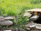 Geum macrophyllum growing beside a spring. Geum macrophyllum growing beside a spring.
|
|
Tuesday, July 16, 2019
Ranson/Edwards, mostly as a pre-walk for tomorrow.
|
|
|
2159
|
Field identification: Elymus, maybe E. virginicus E. canadensis that may be just a little immature.
Plants of Jefferson County Open Space
Jefferson County, Colorado
Poaceae
Elymus canadensis L.
Canadian Wildrye.
Ranson/Edwards Homestead Open Space Park, Jefferson County, Colorado.
Approx. centroid of park, 1.7 mi. west on CO Highway 72 from CO Highway 93, 1.2 mi. generally north on Plainview Road, in the ditch on the west side of Plainview Road.
39.8902°N, 105.262°W.
WGS 1984
Elev. 1914 m.
Collected by permit: Jefferson County Open Space, 2019, issued: Mar 1, 2019, to: Tom Schweich.
|
Tom Schweich
2159. |
17-Jul-2019 |
|
Coll. No. 2159, 16 Jul 2019, characters observed:
Perennial grass,
to 1 m.,
clumped, not rhizomatous;
Roots,
fibrous;
Stem,
herbaceous,
nodes mostly concealed by sheaths;
Leaves,
blade and sheath differentiated;
Sheath, open;
Ligule, membraneous, auricles, 1 mm., thim,
Blade, 180 mm., folded;
Inflorescence,
1 per culm,
bi-lateral spike,
75 mm. × 9 mm. wide;
Rachis,
not disarticulating;
Spikelets,
many,
2 per node,
7-9 mm. × 2-5 mm wide (exclusive of awns);
Compression,
unremarkable;
Disarticulation, below the glumes;
Glumes,
#2,
side-by-side,
body 7 mm. + awn 21 mm. = 28.5 mm,
body < adjacent lemma,
veins, (2+)3,
more flat than rounded (terete);
Florets,
3+ per spikelet,
pistillate, bisexual, staminate;
Lemma,
9 mm,
body > glume body,
rolled,
scabrous,
veins, #5, glabrous,
tip, 2-forked,
awns, #1, 25 mm., curving,
attached end;
Palea,
8.5 mm,
≤lemma,
color, tan, except veins,
veins, green, scabrous,
margin, scarious,
tip, bifid;
Stamens,
#3,
2.4 mm.,
yellow.
|
|
|
2160
|
Field identification: aquatic.
Plants of Jefferson County Open Space
Jefferson County, Colorado
Araceae
Lemna minor L.
Common Duckweed.
Ranson/Edwards Homestead Open Space Park, Jefferson County, Colorado.
Northwest corner of park, 1.7 mi. west on CO highway 72 from CO Highway 93, 2.2 mi. generally north on Plainview Road, then 300 m. west to a small spring and pond, 21.4 km. north northeast of the GNIS location of Golden,
39.8976°N, 105.2746°W.
WGS 1984
Elev. 2020 m.
Aquatic.
Collected by permit: Jefferson County Open Space, 2019, issued: Mar 1, 2019, to: Tom Schweich.
|
Tom Schweich
2160. |
16-Jul-2019 |
|
|
|
|
2161
|
Field identification: tree.
Plants of Jefferson County Open Space
Jefferson County, Colorado
Salicaceae
Populus alba L.
White Cottonwood.
Ranson/Edwards Homestead Open Space Park, Jefferson County, Colorado.
Northwest corner of park, 1.7 mi. west on CO highway 72 from CO Highway 93, 2.2 mi. generally north on Plainview Road, then 445 m. west to the base of a east limb of a small hogback, 21.4 km. north northeast of the GNIS location of Golden,
39.8977°N, 105.2759°W.
WGS 1984
Elev. 2030 m.
Small tree.
This has also been collected in the nearby City of Boulder Lindsay-Jeffco property.
Collected by permit: Jefferson County Open Space, 2019, issued: Mar 1, 2019, to: Tom Schweich.
|
Tom Schweich
2161. |
16-Jul-2019 |
|
|
|
|
2161.1
|
Field identification: Dianthus armeria.
Plants of Jefferson County Open Space
Jefferson County, Colorado
Caryophyllaceae
Dianthus armeria L.
Deptford Pink.
Ranson/Edwards Homestead Open Space Park, Jefferson County, Colorado.
Northwest corner of park, 1.7 mi. west on CO highway 72 from CO Highway 93, 2.2 mi. generally north on Plainview Road, then 445 m. west to the base of a east limb of a small hogback, 21.4 km. north northeast of the GNIS location of Golden,
39.8977°N, 105.2759°W.
WGS 1984
Elev. 2030 m.
Collected by permit: Jefferson County Open Space, 2019, issued: Mar 1, 2019, to: Tom Schweich.
|
Tom Schweich
2161.1 |
16-Jul-2019 |
|
|
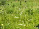 Coll. No. 2162, Danthonia spicata Coll. No. 2162, Danthonia spicata
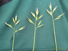 Open inflorescence of Coll. No. 2162, Danthonia spicata Open inflorescence of Coll. No. 2162, Danthonia spicata
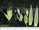 Dissected spikelet of Coll. No. 2162, Danthonia spicata Dissected spikelet of Coll. No. 2162, Danthonia spicata
|
2162
|
Field identification: Danthonia, maybe D. californica because of the open panicle.
Plants of Jefferson County Open Space
Jefferson County, Colorado
Poaceae
Danthonia spicata (L.) P. Beauv. ex Roem. & Schult.
Poverty Oatgrass.
Ranson/Edwards Homestead Open Space Park, Jefferson County, Colorado.
Northwest corner of park, 1.7 mi. west on CO highway 72 from CO Highway 93, 2.2 mi. generally north on Plainview Road, then 445 m. west to the base of the east limb of a small hogback, 21.4 km. north northeast of the GNIS location of Golden,
39.8978°N, 105.276°W.
WGS 1984
Elev. 2030 m.
Previously collected nearby: Amorpha nana, Dianthus armeria, Muhlenbergia wrightii, and Sorghastrum nutans.
Collected by permit: Jefferson County Open Space, 2019, issued: Mar 1, 2019, to: Tom Schweich.
|
Tom Schweich
2162. |
16-Jul-2019 |
|
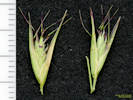
Spikelets of Coll. No. 2162, Danthonia spicata |
Coll. No. 2162, 16 Jul 2019, characters observed:
Perennial,
60-65 cm.,
clumped, non-rhizomatous;
Roots,
fibrous;
Stem,
herbaceous;
Leaf,
blade and sheath differentiated,
soft;
Sheath, open;
Ligule, 0.2-0.3 mm., ciliate;
Blade, 120 mm., mostly flat, margin, scabrous;
Inflorescence,
1 per culm,
>leaves,
panicle,
55 mm. × 40 mm. wide,
2 branches
[in the specimen examined, the florets appear paired, one on a short pedicel, and one on a longer pedicel];
Rachis,
not extended,
short soft hairy an all sides;
Spikelets,
#10-11,
14 mm. × 3.0-4.5 mm. wide,
similar,
borne singly,
pedicels, 1 mm. and 2.7 mm.;
Compression,
lateral;
Disarticulation, between the florets;
Glumes,
lower,
13.0-15.5 mm.,
veins, #5, ±obscure,
upper,
12.5-14.0 mm.,
>lowest floret,
rounded,
awns,
#0;
Florets,
7+ per spikelet,
bisexual;
Axis,
extended beyond upper floret;
Callus,
tuft of white hairs;
Lemma,
6 mm.,
<glumes,
ovate,
rounded,
green,
back, sparse straight hairs,
veins, ≥5,
margins,
proximal hairy,
distal scarious,
tip,
2-forked,
1.5 mm.,
awns,
#1,
attached end,
8 mm.,
brown and flattened proximally,
twisted;
Palea,
4.5 mm.,
<lemma,
body, single cell thick,
margin, green and ciliate;
Anthers,
#2,
2 mm.,
purple;
Achene,
2 mm.,
green.
|
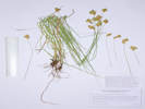 Coll. No. 2163, Carex scoparia. Coll. No. 2163, Carex scoparia.
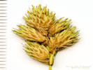 Inflorescence of Coll. No. 2163, Carex scoparia. Inflorescence of Coll. No. 2163, Carex scoparia.
|
2163
|
Field identification: Carex brevior.
Plants of Jefferson County Open Space
Jefferson County, Colorado
Cyperaceae
Carex scoparia Schkuhr ex Willd.
Pointed Broom Sedge.
Ranson/Edwards Homestead Open Space Park, Jefferson County, Colorado.
Northwest corner of park, 1.7 mi. west on CO highway 72 from CO Highway 93, 2.0 mi. generally north on Plainview Road to private road, then 550 m west northwest, near northern fence line, 21.6 km. north northeast of the GNIS location of Golden,
39.8991°N, 105.2743°W.
WGS 1984
Elev. 2002 m.
Collected by permit: Jefferson County Open Space, 2019, issued: Mar 1, 2019, to: Tom Schweich.
|
Tom Schweich
2163. |
16-Jul-2019 |
|
Coll. No. 2163, 16 July 2019, characters observed:
Perennial sedge,
caespitose,
to 60 cm.,
lightly scabrous below head;
Leaves,
2 mm. wide,
green
sheaths, white-hyaline,
centrally smooth;
Inflorescence,
22 mm. × 15 mm. wide,
spikes, #6,
closely clustered;
Spikes,
identical appearing,
gynecandrous,
10 mm. × 5 mm. wide,
terminal spike clavate;
Bracts,
9 mm. long,
proximal,
20 mm.,
=inflorescence,
bristle-like;
Pistillate scales,
<perigynia,
mid-vein, green,
margin, hyaline,
awn, absent;
Perigynia,
many per spike,
5 mm. × 2 mm. wide,
winged,
faces, veined,
adaxial veins, #7-9,
glabrous,
beak,
1.5 mm.,
±sloping to tip,
achene to beak tip, 2.5-2.8 mm.;
Achene,
1.3 mm. × 0.7 mm. wide,
oval,
biconvex;
Stigma,
#2.
|
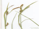 Inflorescence of Carex conoidea. Inflorescence of Carex conoidea.
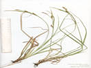 Overview of Carex conoidea. Overview of Carex conoidea.
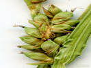 Pistillate Spikelet of Carex conoidea. Pistillate Spikelet of Carex conoidea.
|
|
Thursday, July 18, 2019
Field identification: Carex conoidea.
Plants of Jefferson County Open Space
Jefferson County, Colorado
Cyperaceae
Carex conoidea Willd.
Open Field Sedge.
Meyer Ranch Park, Jefferson County, Colorado.
Wetland immediately south of the parking lot.
39.5458°N, 105.272°W.
WGS 1984
Elev. 2401 m.
|
Anthony Massaro, with Irene Weber and Tanner Marshall
|
18-Jul-2019 |
|
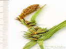
Spikelets of Carex conoidea. |
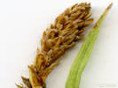
Staminate Spikelet of Carex conoidea. |
|
|
Locations:
Lippincott Ranch.
|
|
Sunday, July 21, 2019
Lippincott.
|
|
|
2164
|
Field identification: some sort of dandelion or viper grass-like thing.
Plants of Jefferson County Open Space
Jefferson County, Colorado
Asteraceae
Scorzonera laciniata L.
Cutleaf Vipergrass.
Lippincott Property, Jefferson County, Colorado.
Northernmost Jefferson County, jointly owned by City of Boulder OSMP and Jefferson County Open Space, approximate centroid of parcel, in the junction of the ranch road and quarry road, 22.0 km. north northwest of the GNIS location of Golden.
39.9019°N, 105.2738°W.
WGS 1984
Elev. 1997 m.
Trampled by vehicles and eaten by cows. Also collected in this junction: Capsella bursa-pastoris, Collinsia parviflora, and Draba nemorosa, with Taraxacum officinale nearby.
Collected by permit: Jefferson County Open Space, 2019, issued: Mar 1, 2019, to: Tom Schweich.
|
Tom Schweich
2164. |
21-Jul-2019 |
|
|
|
|
2165
|
Field identification: Elymus elymoides.
Plants of Jefferson County Open Space
Jefferson County, Colorado
Poaceae
Elymus elymoides (Raf.) Swezey.
Squirreltail Grass.
Lippincott Property, Jefferson County, Colorado.
Northernmost Jefferson County, jointly owned by City of Boulder OSMP and Jefferson County Open Space, on the spoils pile east side of the clay pit, 22.3 km. north northwest of the GNIS location of Golden.
39.9041°N, 105.2741°W.
WGS 1984
Elev. 1972 m.
With ponderosa pines, grasses and forbs.
Collected by permit: Jefferson County Open Space, 2019, issued: Mar 1, 2019, to: Tom Schweich.
|
Tom Schweich
2165. |
21-Jul-2019 |
|
|
|
Other articles:
• Lippincott Road:
near n gate;
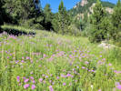 Sea of Monarda fistulosa Sea of Monarda fistulosa
|
2166
|
Field identification: Monarda fistulosa.
Plants of Jefferson County Open Space
Jefferson County, Colorado
Lamiaceae
Monarda fistulosa L.
Wild Bergamot.
Lindsay/JEFFCO, Jefferson County, Colorado.
On the City of Boulder OSMP parcel just west across the fence from the Lippincott Parcel, south side of Bull Gulch, 22.8 km. north northwest of the GNIS location of Golden.
39.9073°N, 105.2759°W.
WGS 1984
Elev. 1970 m.
In an opening among ponderosa pines, with Erigeron speciosus.
Collected by permit: City of Boulder OSMP, issued: May 18, 2019, to: Tom Schweich.
|
Tom Schweich
2166. |
21-Jul-2019 |
|
|
|
|
2166.1
|
Field identification: Erigeron, maybe E. speciosus.
Plants of Jefferson County Open Space
Jefferson County, Colorado
Asteraceae
Erigeron speciosus (Lindl.) DC.
Aspen Fleabane.
Lindsay/JEFFCO, Jefferson County, Colorado.
On the City of Boulder OSMP parcel just west across the fence from the Lippincott Parcel, south side of Bull Gulch, 22.8 km. north northwest of the GNIS location of Golden.
39.9073°N, 105.2758°W.
WGS 1984
Elev. 1970 m.
With Monarda fistulosa, Castilleja integra, Phleum pratense, openings in Pinus ponderosa forest.
Collected by permit: City of Boulder OSMP, issued: May 18, 2019, to: Tom Schweich.
|
Tom Schweich
2166.1 |
21-Jul-2019 |
|
|
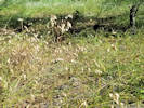 Habit of Coll. No. 2167, Bromus briziformis Habit of Coll. No. 2167, Bromus briziformis
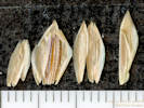 Dissected spikelet of Coll. No. 2167, Bromus briziformis Dissected spikelet of Coll. No. 2167, Bromus briziformis
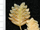 Spikelet of Coll. No. 2167, Bromus briziformis Spikelet of Coll. No. 2167, Bromus briziformis
|
2167
|
Field identification: Briza maxima Bromus briziformis.
Plants of Jefferson County Open Space
Jefferson County, Colorado
Poaceae
Bromus briziformis Fisch. & C. A. Mey.
Rattlesnake Brome.
Lippincott Property, Jefferson County, Colorado.
Northernmost Jefferson County, jointly owned by City of Boulder OSMP and Jefferson County Open Space, moderate slope above and on the north side of Bull Gulch, 23. km. north northwest of the GNIS location of Golden.
39.9089°N, 105.2777°W.
WGS 1984
Elev. 1987 m.
Other grasses collected nearby: Bromus lanatipes and Danthonia spicata.
Collected by permit: Jefferson County Open Space, 2019, issued: Mar 1, 2019, to: Tom Schweich.
|
Tom Schweich
2167. |
21-Jul-2019 |
|
Coll. No. 2167, 21 July 2019, characters observed:
Annual grass,
30-40 cm.,
clumped;
Roots,
fibrous;
Stem,
herbaceous;
Leaves,
blade and sheath differentiated,
soft;
Sheath,
closed;
Ligule,
membraneous,
ciliate;
Blade,
120 mm. × 4 mm. wide,
flat,
hairy;
Inflorescence,
1 per culm,
nodding,
raceme or few-branched panicle,
>leaves;
Rachis,
not extended,
scabrous;
Spikelets,
many,
16-20 mm. × 8-10 mm. wide,
similar,
borne singly,
pedicels,
18-22 mm.;
Compression,
lateral;
Disarticulation,
unknown, rachilla seems pretty tough;
Glumes,
spreading at 45° to rachilla,
lower,
5.5 mm.,
veins, #5,
terete,
upper,
7.0 mm.,
<lowest floret,
veins, #9,
±parallel,
membraneous,
tough,
awns, #0;
Florets,
10-12 per spikelet,
spreading at 45° to rachilla;
Lemma,
8 mm.,
>glumes,
ovate,
membraneous,
rolled,
glabrous,
tan,
veins, #9, not uniformly spaced, ±parallel,
margins, scarious,
tip acute,
awns, #0;
Palea,
6 mm.,
membraneous,
ciliate,
tip, unknown,
color, tan;
Stamens,
none seen;
Achene,
5 mm.,
brown,
fused to lemma and palea.
|
|
|
2168
|
Field identification: Danthonia spicata.
Plants of Jefferson County Open Space
Jefferson County, Colorado
Poaceae
Danthonia spicata (L.) P. Beauv. ex Roem. & Schult.
Poverty Oatgrass.
Lippincott Property, Jefferson County, Colorado.
Northernmost Jefferson County, jointly owned by City of Boulder OSMP and Jefferson County Open Space, moderate slope above and on the north side of Bull Gulch, 23.3 km. north northwest of the GNIS location of Golden.
39.9097°N, 105.2789°W.
WGS 1984
Elev. 2040 m.
Ponderosa pine woodland; a little immature compared to the same grass collected at Ranson/Edwards in full sun a week earlier.
Collected by permit: Jefferson County Open Space, 2019, issued: Mar 1, 2019, to: Tom Schweich.
|
Tom Schweich
2168. |
21-Jul-2019 |
|
|
|
|
2169
|
Field identification: Lupinus sp.
Plants of Jefferson County Open Space
Jefferson County, Colorado
Fabaceae
Lupinus caudatus Kellogg var. argophyllus (A. Gray) S.L. Welsh.
Kellogg's Spurred Lupine.
Lippincott Property, Jefferson County, Colorado.
Northernmost Jefferson County, jointly owned by City of Boulder OSMP and Jefferson County Open Space, moderate slope above and on the north side of Bull Gulch, 23.4 km. north northwest of the GNIS location of Golden
39.9105°N, 105.2791°W.
WGS 1984
Elev. 2040 m.
Openings in ponderosa pine woodland.
The collector was competing with the cows to collect these before the cows ate them all.
Collected by permit: Jefferson County Open Space, 2019, issued: Mar 1, 2019, to: Tom Schweich.
|
Tom Schweich
2169. |
21-Jul-2019 |
|
Coll. No. 2169, 21 Jul 2019, characters observed:
Perennial herb to 50 cm.;
Stems, erect, hairs appressed;
Leaves,
basal, unknown,
cauline,
petiole,
to 40 mm.,
compound,
palmate,
leaflets,
#6,
47-50 mm. × 7-8 mm. wide,
lanceolate,
flat,
adaxial glabrous,
abaxial hairy,
tips, pointed;
Inflorescence,
loose raceme;
Flowers,
10-12 mm.,
purple,
calyx 5-7 mm.,
hairy,
spur ≤1 mm.;
banner,
9 mm.,
recurved 3.2-3.5 mm. from tip,
flowers open in profile,
hairy on back (easier to see if not rehydrated),
wings,
10 mm.,
keel,
blue tipped,
glabrous (except a few occasional hairs);
Style, >stamens, barely exserted.
|
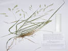 Coll. No. 2170, Bromus lanatipes Coll. No. 2170, Bromus lanatipes
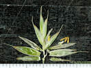 Dissected spikelet of Coll. No. 2170, Bromus lanatipes Dissected spikelet of Coll. No. 2170, Bromus lanatipes
|
2170
|
Field identification: Bromus sp., office: Bromus lanatipes, based in part on shaggy hairy leaf sheath, and hairy lemmas that are mostly glabrous on the proximal back with increasing hairiness distally.
Plants of Jefferson County Open Space
Jefferson County, Colorado
Poaceae
Bromus lanatipes (Shear) Rydb.
Wooly Brome.
Lippincott Property, Jefferson County, Colorado.
Northernmost Jefferson County, jointly owned by City of Boulder OSMP and Jefferson County Open Space, moderate slope above and on the north side of Bull Gulch, 23.2 km. north northwest of the GNIS location of Golden
39.9097°N, 105.2771°W.
WGS 1984
Elev. 2019 m.
Deep forest duff in ponderosa pine woodland.
Collected by permit: Jefferson County Open Space, 2019, issued: Mar 1, 2019, to: Tom Schweich.
|
Tom Schweich
2170. |
21-Jul-2019 |
|
Coll. No. 2170, 21 July 2019, characters observed:
Perennial grass (short-lived?),
50 cm.,
clumped;
Roots,
fibrous;
Stem,
herbaceous;
Internodes,
glabrous;
Leaves,
blade and sheath differentiated,
soft;
Sheath,
60-70 mm.,
closed,
long shaggy hair;
Ligule,
1.5 mm.,
membraneous,
auricles, absent;
Blade,
160 mm. × 5 mm. wide,
adaxial scaberulous,
tip, acute;
Inflorescence,
1 per culm,
>leaves,
panicle,
130 mm. × 60 mm. wide,
2+ branches;
Rachis,
not extended,
scabrous;
Spikelets,
#12-13,
23 mm. × 5 mm. wide,
similar,
borne singly;
Compression,
lateral;
Disarticulation,
unknown,
should be above the glumes;
Glumes,
lower,
5 mm.,
veins, #1,
keeled,
keel scabrous,
upper,
6 mm.,
<lowest floret,
veins, #5,
keeled;
Lemma,
7.5 mm.,
>glumes,
hairy laterally becoming more broadly hairy distally,
veins, #5, convergent,
awns, #1, 3 mm., straight, barbellate, attached near end;
Palea,
9 mm.,
±=lemma,
membraneous,
keel ciliate,
veins, lt. green,
margin, glabrous,
tip, entire;
Anthers,
#3,
2.3 mm.,
yellow;
Achene,
immature.
|
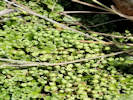 Liverwort in Bull Gulch. Liverwort in Bull Gulch.
|
2171
|
Field identification: Liverwort
|
|
Locations:
Little Scraggy Peak.
Long Scraggy Peak.
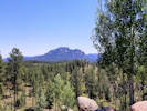 Long Scraggy Peak Long Scraggy Peak
|
|
Tuesday, July 23, 2019
Buffalo Creek recreation area, east flank of Little Scraggy Peak.
|
|
Literature Cited:
- Grant, Verne, 1992.
- Grant, Verne, and Dieter H. Wilken, 1986.
- Greene, Edward Lee, 1905a.
|
2172
|
Field identification: Ipomopsis, assumed to be I. aggregata.
|
Plants of Colorado
Polemoniaceae
Ipomopsis aggregata (Pursh) V.E. Grant ssp. collina (Greene) Wilken & Allard.
Scarlet Gilia.
Little Scraggy Peak, Jefferson County, Colorado.
Buffalo Creek Recreation Area, northeast slopes of Little Scraggy Peak, fairly close to Little Scraggy trailhead, 60 km. south of the GNIS location of Golden
39.3408°N, 105.2607°W.
WGS 1984
Elev. 2410 m.
Area generally disturbed by minerals prospecting, fuels reduction, and mountain biking recreation.
Collected by permit: Pike-Isabel National Forest, 2019, issued: Mar 8, 2019, to: Tom Schweich.
|
Tom Schweich
2172. |
23-Jul-2019 |
|
Coll. No. 2172, 23 Jul 2019, characters observed:
Perennial herb, 50-60 cm.;
Stem,
glandular,
few long white hairs;
Leaves,
basal and cauline similar,
37 mm. × 24 mm. wide,
pinnatifid with narrow segments,
reduced above;
Inflorescence,
narrow thyrse;
Pedicels,
1-2.5 mm.;
Calyx,
tube 5 mm. + lobes 1.5 mm.,
glandular,
hyaline sinuses,
tips spinulose;
Corolla,
salverform,
tube 25 mm. × 1.8 mm. gradually expanding to 5 mm. wide,
+ lobes 5 mm.,
spreading;
Stamens,
some barely exserted.
Nearby (10 km.) collections of Ipomopsis aggregata are all subsp. collina
and all by Dieter Wilkin (his #13548, #13600, and #14502).
Vouchers are at CS and RM.
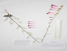
Coll. No. 2172, Ipomopsis aggregata ssp. collina |
The basionym for I. aggregata ssp. collina is Callisteris collina
proposed by Greene in 1905.
|
C. collina.
Calyx-teeth not half as long as the almost cylindric tubes,
very obtuse, abruptly aristate-pointed, the point straight, rigidly erect:
corolla only pinkish, its oblong-lanceolate very acute lobes reflexed, and irregularly so.
Bluffs of Clear Creek on the plains not far from Denver,
collected by myself, July 1870.
Type in my own herbarium.
|
|
|
|
2173
|
Field identification: Geranium, perhaps G. viscosissimum.
|
Plants of Colorado
Geraniaceae
Geranium caespitosum James.
Pineywoods Geranium.
Little Scraggy Peak, Jefferson County, Colorado.
Buffalo Creek Recreation Area, northeast slopes of Little Scraggy Peak, fairly close to Little Scraggy trailhead, 60 km. south of the GNIS location of Golden.
39.3406°N, 105.2607°W.
WGS 1984
Elev. 2410 m.
Also collected here: Ipomopsis aggregata ssp. collina.
Area generally disturbed by minerals prospecting, fuels reduction, and mountain biking recreation.
Collected by permit: Pike-Isabel National Forest, 2019, issued: Mar 8, 2019, to: Tom Schweich.
|
Tom Schweich
2173. |
23-Jul-2019 |
|
Coll. No. 2173, 23 Jul 2019, characters observed:
Perennial herb, to 35 cm.;
Stems,
simple,
erect,
glandular,
glands yellow-tipped;
Leaves,
basal and cauline,
50 mm. wide,
palmately lobed,
lobes, #5,
obtuse and shortly acuminate;
Inflorescence,
cyme,
cymules 2-flowered (see Aedo, 2001);
Corolla,
blue-purple;
Petals,
13 mm. × 8 mm. wide,
hairy on proximal ↷.
Will key to G. viscosissimum in Weber & Wittman (2012) using the simple and erect stems.
However, in Ackerfield (2015), Aedo (2001), and Welsh, et al. (1993), keys to
G. caespitosum mainly on leaf characters.
|
|
|
2174
|
Field identification: Koeleria macrantha.
|
Plants of Colorado
Poaceae
Koeleria macrantha (Ledeb.) Schult.
Prairie Junegrass.
Little Scraggy Peak, Jefferson County, Colorado.
Buffalo Creek Recreation Area, northeast slopes of Little Scraggy Peak, fairly close to Little Scraggy trailhead, 60 km. south of the GNIS location of Golden.
39.3407°N, 105.2607°W.
WGS 1984
Elev. 2407 m.
In bloom.
Also collected here: Ipomopsis aggregata ssp. collina and Geranium caespitosum.
Area generally disturbed by minerals prospecting, fuels reduction, and mountain biking recreation.
Collected by permit: Pike-Isabel National Forest, 2019, issued: Mar 8, 2019, to: Tom Schweich.
|
Tom Schweich
2174. |
23-Jul-2019 |
|
|
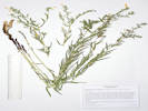 Coll. No. 2175, Lithospermum multiflorum Coll. No. 2175, Lithospermum multiflorum
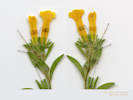 Coll. No. 2175, Lithospermum multiflorum Coll. No. 2175, Lithospermum multiflorum
|
2175
|
Field identification: Lithospermum, probably L. multiflorum.
|
Plants of Colorado
Boraginaceae
Lithospermum multiflorum Torrey ex A. Gray.
Many Flowered Stoneseed.
Little Scraggy Peak, Jefferson County, Colorado.
Buffalo Creek Recreation Area, northeast slopes of Little Scraggy Peak, fairly close to Little Scraggy trailhead, 4 mi. generally south of town of Buffalo Creek on County Road 126, 60 km. south of the GNIS location of Golden.
39.3407°N, 105.2607°W.
WGS 1984
Elev. 2405 m.
Also collected here: Ipomopsis aggregata ssp. collina, Geranium caespitosum, and Koeleria macrantha.
Area generally disturbed by minerals prospecting, fuels reduction, and mountain biking recreation.
Collected by permit: Pike-Isabel National Forest, 2019, issued: Mar 8, 2019, to: Tom Schweich.
|
Tom Schweich
2175. |
23-Jul-2019 |
|
|
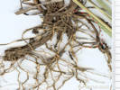 Obscure rhizome on Coll. No. 2176, Bromus pumpellianus Obscure rhizome on Coll. No. 2176, Bromus pumpellianus
|
2176
|
Field identification: Bromus ciliata.
|
Plants of Colorado
Poaceae
Bromus pumpellianus Scribn.
Pumpelly's Brome.
Little Scraggy Peak, Jefferson County, Colorado.
Buffalo Creek Recreation Area, northeast slopes of Little Scraggy Peak, fairly close to Little Scraggy trailhead, about 4 mi. south of town of Buffalo Creek by Cty Rd 126, 60 km. south of the GNIS location of Golden.
39.3406°N, 105.2609°W.
WGS 1984
Elev. 2411 m.
Also collected here: Lithospermum multiflorum, Geranium caespitosum, Ipomopsis aggregata ssp. collina, and Koeleria macrantha.
Area generally disturbed by minerals prospecting, fuels reduction, and mountain biking recreation.
Collected by permit: Pike-Isabel National Forest, 2019, issued: Mar 8, 2019, to: Tom Schweich.
|
Tom Schweich
2176. |
23-Jul-2019 |
|
Coll. No. 2176, 23 Jul 2019, characters observed:
Perennial grass, to 70-80 cm.,
occasionally obscurely rhizomatous;
Roots, fibrous;
Stem, herbaceous;
Leaves,
blade and sheath differentiated,
soft,
sheath,
90 mm.,
closed,
ligule,
membraneous,
1 mm.,
auricles,
minimal,
blade,
90 mm. × 3 mm. wide,
flat,
scabrous,
margins, scabrous;
Inflorescence,
1 per culm,
>leaves,
panicle,
130 mm. × 30 mm. wide;
Rachis,
not extended,
scabrous;
Spikelet,
many,
26 mm. × 5 mm. wide,
similar,
1 per node,
pedicels 16-30 mm.;
Compression,
lateral;
Disarticulation,
above the glumes,
between florets;
Glumes,
lower,
6 mm.,
veins, ≥3,
back hairy,
upper,
8.5 mm.,
<lowest floret,
veins, ≥3,
rounded,
membraneous,
awns, 0,
back hairy,
somewhat more dense distally;
Florets,
6 per spikelet,
bisexual;
Lemma,
10 mm.,
>glumes,
lanceolate,
rolled,
uniformly hairy on back,
green,
veins, #7,
convergent,
tip, rounded,
awns,
#1,
1.5 mm.,
straight,
attached back of lemma, near tip;
Palea,
8 mm.,
<lemma,
membraneous,
back hairy,
keel ciliate,
veins, green,
margin, glabrous,
tip, entire;
Anthers,
2.3 mm.;
Ovary,
glabrous;
Stigma,
feathery;
Achene,
3 mm.,
green.
|
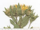 Inflorescence of Coll. No. 2177, Heterotheca foliosa Inflorescence of Coll. No. 2177, Heterotheca foliosa
|
2177
|
Field identification: Heterotheca, towards H. foliosa.
|
Plants of Colorado
Asteraceae
Heterotheca foliosa (Nutt.) Shinners.
Hairy False Goldenaster.
Little Scraggy Peak, Jefferson County, Colorado.
Buffalo Creek Recreation Area, northeast slopes of Little Scraggy Peak, fairly close to Little Scraggy trailhead, about 4 mi. south of town of Buffalo Creek by Cty Rd 126, 60 km. south of the GNIS location of Golden.
39.3407°N, 105.261°W.
WGS 1984
Elev. 2412 m.
Scent a kind of foetid lemon-pine.
Also collected here: Lithospermum multiflorum, Geranium caespitosum, Ipomopsis aggregata ssp. collina, Bromus pumpellianus, and Koeleria macrantha.
Area generally disturbed by minerals prospecting, fuels reduction, and mountain biking recreation.
Collected by permit: Pike-Isabel National Forest, 2019, issued: Mar 8, 2019, to: Tom Schweich.
|
Tom Schweich
2177. |
23-Jul-2019 |
| Coll. No. 2177, 23 July 2019, characters observed:
Perennial herb, to 40 cm.;
Stem,
hispid,
glandular;
Leaves,
proximal mostly withered, but they appear to have been oblanceolate;
distal,
35 mm. × 9 mm. wide,
sessile,
oblanceolate,
glandular,
hispid,
hairs are curved, but not really appressed, so not strigose,
Bracts,
#1-4,
surpassing heads;
Phyllaries,
2+ graduated series;
Flowers of 2 kinds;
Ray flowers,
tube 4 mm. + blade 17 mm. ×1 mm. wide,
yellow;
Disk flowers,
tube 6 mm. + lobes 1.5 mm = 7.5 mm.,
yellow;
Pappus,
capillary bristles
2 kinds,
short, 1 mm.,
long, 7 mm.
Cypsela,
2 mm.,
shaggy hairy;
In Harrington (1954): Crysopsis fulcrata Greene [=Heterotheca fulcrata (Greene) Shinners],
and not Chrysopsis foliosa Nutt. because the involucres are definitely glandular.
In Weber & Wittman (2012): Heterotheca villosa (Pursh) Shinners.
H. fulcrata requires foliage very densely appressed pubescent, the plant gray in aspect, glands hardly visible.
H. foliosa (Nutt.) Shinners is not recognized.
In Ackerfield (2015): Heterotheca foliosa (Nutt.) Shinners [H. fulcrata (Greene) Shinners misapplied].
|
|
|
2178
|
Field identification: yellow owl's clover.
|
Plants of Colorado
Orobanchaceae
Orthocarpus luteus Nutt.
Yellow Owls Clover.
Little Scraggy Peak, Jefferson County, Colorado.
Buffalo Creek Recreation Area, northeast slopes of Little Scraggy Peak, fairly close to Little Scraggy trailhead, about 4 mi. south of town of Buffalo Creek by Cty Rd 126, 60 km. south of the GNIS location of Golden.
39.3405°N, 105.2608°W.
WGS 1984
Elev. 2409 m.
Also collected here: Lithospermum multiflorum, Geranium caespitosum, Ipomopsis aggregata ssp. collina, Bromus pumpellianus, and Koeleria macrantha.
Area generally disturbed by minerals prospecting, fuels reduction, and mountain biking recreation.
Collected by permit: Pike-Isabel National Forest, 2019, issued: Mar 8, 2019, to: Tom Schweich.
|
Tom Schweich
2178. |
23-Jul-2019 |
|
|
|
|
2179
|
Field identification: Sedum lanceolatum.
|
Plants of Colorado
Crassulaceae
Sedum lanceolatum Torr.
Spearleaf Stonecrop.
Little Scraggy Peak, Jefferson County, Colorado.
Buffalo Creek Recreation Area, northeast slopes of Little Scraggy Peak, fairly close to Little Scraggy trailhead, about 4 mi. south of town of Buffalo Creek by Cty Rd 126, 60.3 km. south of the GNIS location of Golden.
39.3394°N, 105.2618°W.
WGS 1984
Elev. 2430 m.
On a berm left by prospecting a quartz vein, area generally disturbed by minerals prospecting, fuels reduction, and mountain biking recreation.
Collected by permit: Pike-Isabel National Forest, 2019, issued: Mar 8, 2019, to: Tom Schweich.
|
Tom Schweich
2179. |
23-Jul-2019 |
|
|
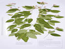 Coll. No. 2180, Apocynum x-floribundum Coll. No. 2180, Apocynum x-floribundum
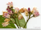 Inflorescence of Coll. No. 2180, Apocynum x-floribundum Inflorescence of Coll. No. 2180, Apocynum x-floribundum
|
2180
|
Field identification: Apocynum sp.
|
Plants of Colorado
Apocynaceae
Apocynum ×floribundum Greene.
Dogbane.
Little Scraggy Peak, Jefferson County, Colorado.
Buffalo Creek Recreation Area, northeast slopes of Little Scraggy Peak, fairly close to Little Scraggy trailhead, about 4 mi. south of town of Buffalo Creek by Cty Rd 126, 60.3 km. south of the GNIS location of Golden.
39.3393°N, 105.2616°W.
WGS 1984
Elev. 2438 m.
Openings in ponderosa pine, also seen/collected here; Achillea millefolium, Sedum lanceolatum, Oxytropis lambertii, Verbascum thapsus, and Elymus elymoides.
Area generally disturbed by minerals prospecting, fuels reduction, and mountain biking recreation.
Collected by permit: Pike-Isabel National Forest, 2019, issued: Mar 8, 2019, to: Tom Schweich.
|
Tom Schweich
2180. |
23-Jul-2019 |
| Coll. No. 2180, 23 Jul 2019:
Nearby collections (15 km., SEINet, 29 Jan 2020) are of
Apocynum cannabinum L. and A. androsaemifolium L.
I applied the hybrid name (A. ×floribundum Greene) to this
collection because the leaves are spreading to
ascending, not drooping, and the corolla lobes are
more spreading, not reflexed.
Also of note, the corolla is more than twice the calyx.
|
|
|
2181
|
Field identification: Achillea millefolium.
|
Plants of Colorado
Asteraceae
Achillea millefolium L.
Common Yarrow.
Little Scraggy Peak, Jefferson County, Colorado.
Buffalo Creek Recreation Area, northeast slopes of Little Scraggy Peak, fairly close to Little Scraggy trailhead, about 4 mi. south of town of Buffalo Creek by Cty Rd 126, 60.3 km. south of the GNIS location of Golden.
39.3393°N, 105.2615°W.
WGS 1984
Elev. 2429 m.
Openings in ponderosa pine, also seen/collected here; Apocynum ×floribundum, Sedum lanceolatum, Oxytropis lambertii, Verbascum thapsus, and Elymus elymoides.
Area generally disturbed by minerals prospecting, fuels reduction, and mountain biking recreation.
Collected by permit: Pike-Isabel National Forest, 2019, issued: Mar 8, 2019, to: Tom Schweich.
|
Tom Schweich
2181. |
23-Jul-2019 |
|
|
|
|
2182
|
Field identification: Wooly Potentilla.
|
Plants of Colorado
Rosaceae
Potentilla hippiana Lehm. var. hippiana.
Wooly Cinquefoil.
Little Scraggy Peak, Jefferson County, Colorado.
Buffalo Creek Recreation Area, northeast slopes of Little Scraggy Peak, fairly close to Little Scraggy trailhead, about 4 mi. south of town of Buffalo Creek by Cty Rd 126, 60.3 km. south of the GNIS location of Golden.
39.3393°N, 105.2617°W.
WGS 1984
Elev. 2423 m.
Openings in ponderosa pine, also seen/collected here; Apocynum ×floribundum, Sedum lanceolatum, Oxytropis lambertii, Verbascum thapsus, and Elymus elymoides.
Area generally disturbed by minerals prospecting, fuels reduction, and mountain biking recreation.
Collected by permit: Pike-Isabel National Forest, 2019, issued: Mar 8, 2019, to: Tom Schweich.
|
Tom Schweich
2182. |
23-Jul-2019 |
|
Coll. No. 2182, 23 July 2019, characters observed:
Perennial herb, to 35 cm.,
woody caudex;
Stem,
unbranched, pilose;
Leaves,
basal and cauline,
basal,
70 mm. × 24 mm. wide,
pinnately compound,
sericeous,
less dense adaxially,
but not distinctly bicolored,
leaflets,
#9,
cauline,
reduced,
stipules,
11 mm. × 3 mm. wide,
lanceolate,
entire,
leaflets, #5,
24 mm. × 6 mm. wide,
without decurrent bases,
toothed along length;
Inflorescence,
cyme;
Bractlets,
±same color as sepals;
Petals,
5 mm. × 4.5 mm. wide,
yellow;
Styles,
2.7 mm.,
tapered from base,
smooth.
|
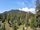 Little Scraggy Peak from the location of my Coll. Nos. 2183-2185. Little Scraggy Peak from the location of my Coll. Nos. 2183-2185.
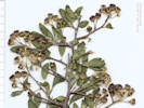 Fruit of Coll. No. 2183, Ceanothus fendleri Fruit of Coll. No. 2183, Ceanothus fendleri
|
2183
|
Field identification: Ceanothus fendleri.
|
Plants of Colorado
Rhamnaceae
Ceanothus fendleri A. Gray.
Fendler's Ceanothus.
Little Scraggy Peak, Jefferson County, Colorado.
Buffalo Creek Recreation Area, northeast slopes of Little Scraggy Peak, fairly close to Little Scraggy trailhead, about 4 mi. south of town of Buffalo Creek by Cty Rd 126, 60.4 km. south of the GNIS location of Golden.
39.3385°N, 105.2612°W.
WGS 1984
Elev. 2426 m.
Also collected here: Cercocarpus montanus and Potentilla fissa.
Among rock outcrops in an area generally disturbed by minerals prospecting, fuels reduction, and mountain biking recreation.
Collected by permit: Pike-Isabel National Forest, 2019, issued: Mar 8, 2019, to: Tom Schweich.
|
Tom Schweich
2183. |
23-Jul-2019 |
|
|
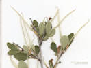 Coll. No. 2184, Cercocarpus montanus in fruit. Coll. No. 2184, Cercocarpus montanus in fruit.
|
2184
|
Field identification: Cercocarpus montanus.
|
Plants of Colorado
Rosaceae
Cercocarpus montanus Raf.
Alder-Leaf Mountain Mahogany.
Little Scraggy Peak, Jefferson County, Colorado.
Buffalo Creek Recreation Area, northeast slopes of Little Scraggy Peak, fairly close to Little Scraggy trailhead, about 4 mi. south of town of Buffalo Creek by Cty Rd 126, 60.4 km. south of the GNIS location of Golden.
39.3384°N, 105.2613°W.
WGS 1984
Elev. 2426 m.
Also collected here: Ceanothus fendleri and Potentilla fissa.
Among rock outcrops in an area generally disturbed by minerals prospecting, fuels reduction, and mountain biking recreation.
Collected by permit: Pike-Isabel National Forest, 2019, issued: Mar 8, 2019, to: Tom Schweich.
|
Tom Schweich
2184. |
23-Jul-2019 |
|
|
|
|
2185
|
Field identification: another Potentilla, maybe P. fissa.
|
Plants of Colorado
Rosaceae
Potentilla fissa Nutt. ex Torr. & A.Gray.
Bigflower Cinquefoil.
Little Scraggy Peak, Jefferson County, Colorado.
Buffalo Creek Recreation Area, northeast slopes of Little Scraggy Peak, fairly close to Little Scraggy trailhead, about 4 mi. south of town of Buffalo Creek by Cty Rd 126, 60.4 km. south of the GNIS location of Golden.
39.3385°N, 105.2612°W.
WGS 1984
Elev. 2425 m.
Also collected here: Ceanothus fendleri and Cercocarpus montanus.
Among rock outcrops in an area generally disturbed by minerals prospecting, fuels reduction, and mountain biking recreation.
Collected by permit: Pike-Isabel National Forest, 2019, issued: Mar 8, 2019, to: Tom Schweich.
|
Tom Schweich
2185. |
23-Jul-2019 |
|
|
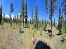 Panorama at the location of Coll. Nos. 2186-2188. Panorama at the location of Coll. Nos. 2186-2188.
|
2186
|
Field identification: Hesperostipa comata.
|
Plants of Colorado
Poaceae
Hesperostipa comata (Trin. & Rupr.) Barkworth.
Needle and Thread.
Little Scraggy Peak, Jefferson County, Colorado.
Buffalo Creek Recreation Area, northeast slopes of Little Scraggy Peak, fairly close to Little Scraggy trailhead, about 4 mi. south of town of Buffalo Creek by Cty Rd 126, 60.4 km. south of the GNIS location of Golden.
39.3378°N, 105.2621°W.
WGS 1984
Elev. 2427 m.
Open ponderosa pine woodland. Area generally disturbed by minerals prospecting, fuels reduction, and mountain biking recreation.
Subsp. intermedia per Shaw (2008), infraspecific names not recognized by Weber & Wittmann (2012) or Ackerfield (2015).
Collected by permit: Pike-Isabel National Forest, 2019, issued: Mar 8, 2019, to: Tom Schweich.
|
Tom Schweich
2186. |
23-Jul-2019 |
|
|
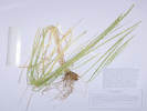 Coll. No. 2187, Elymus trachycaulus Coll. No. 2187, Elymus trachycaulus
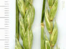 Spikelets of Coll. No. 2187, Elymus trachycaulus Spikelets of Coll. No. 2187, Elymus trachycaulus
|
2187
|
Field identification: a non-blue Thinopyrum, maybe T. ponticum
|
Plants of Colorado
Poaceae
Elymus trachycaulus (Link) Shinners.
Slender Wheatgrass.
Little Scraggy Peak, Jefferson County, Colorado.
Buffalo Creek Recreation Area, northeast slopes of Little Scraggy Peak, fairly close to Little Scraggy trailhead, about 4 mi. south of town of Buffalo Creek by Cty Rd 126, 60.4 km. south of the GNIS location of Golden.
39.3379°N, 105.2622°W.
WGS 1984
Elev. 2420 m.
Open ponderosa pine woodland, with Hesperostipa comata and Nassella viridula. Area generally disturbed by minerals prospecting, fuels reduction, and mountain biking recreation.
Collected by permit: Pike-Isabel National Forest, 2019, issued: Mar 8, 2019, to: Tom Schweich.
|
Tom Schweich
2187. |
23-Jul-2019 |
|
Coll. No. 2187, 23 July 2019, characters observed:
Perennial grass, to 80 cm.,
not rhizomatous;
Roots,
fibrous;
Stem,
herbaceous;
Leaves,
blade and sheath differentiated,
soft;
Sheath,
16 cm.,
open,
glabrous;
Ligule,
membraneous,
1 mm.,
auricles, minimal;
Blade,
20 cm.,
rolled,
scabrous;
Inflorescence,
1 per culm,
>leaves,
bi-lateral spike,
140 mm. × 5 mm. wide;
Rachis,
not extended,
scabrous on margins;
Spikelets,
many, #20-24,
14 mm. × 2.2 mm. wide,
similar,
borne singly,
sessile;
Disarticulation,
above the glumes,
between florets;
Glumes,
lower,
11 mm.,
veins, #5,
rounded,
some veins scabrous,
upper,
11.5 mm.,
=lowest floret,
veins, #5,
rounded,
membraneous,
some veins scabrous,
awns, #0,
margins chartaceous,
if the lemma awn is excluded, glumes > adjacent lemma, nearly as long as spikelet;
Florets,
4+ per spikelet,
fertile florets, #4,
bisexual;
Axis,
not extended,
green;
Lemma,
9.5 mm., <glumes,
lanceolate,
membraneous,
rolled,
proximal glabrous,
distal scabrous,
color, green,
veins, ≥5,
margins scarious,
tip bifid,
awns, #1, 1.5 mm., straight,
attached, end;
Palea,
8 mm., <lemma,
membraneous,
keel, ciliate,
margin glabrous,
tip, laciniate;
Anthers,
1.8 mm.,
tan;
Ovary,
glabrous;
Stigma,
feathery;
Achene,
3.7 mm.,
green.
|
|
Literature Cited:
- Romaschenki, Konstantin, Paul M. Peterson, Robert J. Soreng, nuria Garcia-Jacas, and Alfonso Susanna, 2010.
|
2188
|
Field identification: Nassella viridula.
|
Plants of Colorado
Poaceae
Achnatherum robustum (Vasey) Barkworth.
Sleepygrass.
Little Scraggy Peak, Jefferson County, Colorado.
Buffalo Creek Recreation Area, northeast slopes of Little Scraggy Peak, fairly close to Little Scraggy trailhead, about 4 mi. south of town of Buffalo Creek by Cty Rd 126, 60.4 km. south of the GNIS location of Golden.
39.3378°N, 105.262°W.
WGS 1984
Elev. 2423 m.
Palea 3.5 mm., oblong, hairy.
Open ponderosa pine woodland, with Hesperostipa comata and Elymus trachycaulus. Area generally disturbed by minerals prospecting, fuels reduction, and mountain biking recreation.
Collected by permit: Pike-Isabel National Forest, 2019, issued: Mar 8, 2019, to: Tom Schweich.
|
Tom Schweich
2188. |
23-Jul-2019 |
|
|
|
Other articles:
• Forest Road 311:
near US Hwy 285;
• Colorado Trans-Basin Water Transfer:
Otero Pump Station and Pipeline;
• US Highway 285:
near Trout Creek Pass;
at Trout Creek Pass;
near Trout Creek Pass;
Locations:
Trout Creek Pass.
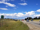 Northeast on US Highway 285. Northeast on US Highway 285.
|
|
Monday, August 5, 2019
Short stop at Trout Creek Pass.
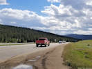
Southwest on US Highway 285. |
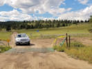
East end of County Road 311. |
|
|
Other articles:
• Hymenoxis richardsonii:
Coll. No. 2189, 5 Aug 2019;
• Forest Road 311:
collecting locality;
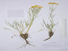 Coll. No. 2189, Hymenoxys richardsonii var. floridunda Coll. No. 2189, Hymenoxys richardsonii var. floridunda
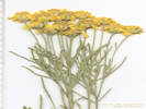 Distal leaves and inflorescence of Coll. No. 2189, Hymenoxys richardsonii var. floridunda Distal leaves and inflorescence of Coll. No. 2189, Hymenoxys richardsonii var. floridunda
|
2189
|
Field identification: Packera?
|
Plants of Colorado
Asteraceae
Hymenoxys richardsonii (Hook.) Cockerell var. floribunda (A. Gray) Parker.
Colorado Rubberweed.
Trout Creek Pass, Chaffee County, Colorado.
Along Chaffee County Road 311, about 0.8 mi. west of its intersection with US Highway 285 at Trout Creek Pass, 149 km. southwest of the GNIS location of Golden.
38.9082°N, 105.9888°W.
WGS 1984
Elev. 2883 m.
Collected by permit: Pike-Isabel National Forest, 2019, issued: Mar 8, 2019, to: Tom Schweich.
|
Tom Schweich
2189. |
5-Aug-2019 |
|
Coll. No. 2189, 5 August 2019, characters observed:
Perennial, sub-shrub, 20 cm.,
caudex, branched, woody;
Stem,
clusters of tomentum,
glandular;
Leaves,
basal and cauline,
25-60 mm. × 15-15 mm. wide,
reduced distally,
pinnately lobed into 3 linear segments,
0.8-1.8 mm. wide,
glandular punctate,
little bits of tomentum here and there,
margins,
entire;
Inflorescence,
head enclosed by an involucre,
1 per stem,
showy,
flat-topped,
not overtopped by leaves;
Peduncles,
40 mm.,
inconspicuously glandular;
Involucre,
5 mm. × 10 mm. wide,
hemispheric,
glandular,
scattered tomentose;
Phyllaries,
2 series,
series 1, 4.5 mm. × 2 mm. wide, fused ½, lanceolate,
series 2, 4 mm. × 1.5 mm. wide, widest above middle;
Receptacle,
conic,
epaleate;
Flowers,
2 kinds;
Ray flowers,
#8-10,
tube 1.9 mm. + blade 5.5 mm. × 4.8 mm. wide,
obovate,
yellow,
fertile;
Disk flowers,
many,
tube 3.5 mm. + lobes 0.4 mm.,
throat expanding,
yellow;
Pappus,
few,
well-developed scales,
1.8 mm.,
±equal;
Fruit (cypsela),
2.5 mm.,
hairy.
|
|
Other articles:
• Forest Road 311:
collecting locality;
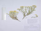 Coll. No. 2190, Tetradymia canescens Coll. No. 2190, Tetradymia canescens
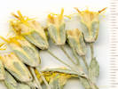 Inflorescence of Coll. No. 2190, Tetradymia canescens Inflorescence of Coll. No. 2190, Tetradymia canescens
|
2190
|
Field identification: Asteraceae.
|
Plants of Colorado
Asteraceae
Tetradymia canescens DC.
Spineless Horsebush.
Trout Creek Pass, Chaffee County, Colorado.
Along Chaffee County Road 311, about 0.8 mi. west of its intersection with US Highway 285 at Trout Creek Pass, 149 km. southwest of the GNIS location of Golden.
38.908°N, 105.9888°W.
WGS 1984
Elev. 2883 m.
Collected with Hymenoxys richardsonii var. floribunda.
A Western Cordilleran plant, also collected at Mono Lake, California.
Collected by permit: Pike-Isabel National Forest, 2019, issued: Mar 8, 2019, to: Tom Schweich.
|
Tom Schweich
2190. |
5-Aug-2019 |
|
Coll. No. 2190, 5 August 2019, characters observed:
Perennial, woody shrub, 15 cm.;
Stem,
tomentose,
thinning in age;
Leaves,
cauline,
alternate,
10 mm. × 2.6 mm. wide,
tomentose,
margin, entire,
tip, acute;
Inflorescence,
head enclosed by an involucre,
not overtopped by leaves;
Peduncles,
10-12 mm.;
Involucre,
8 mm. × 4 mm. wide,
cylindric,
tomentose,
Phyllaries,
#4 in 1 series
(altho' it really looks to me like they are paired in vertical ranks),
±equal,
8 mm. × 2.7 mm. wide,
tomentose,
margins, flat, scarious;
Receptacle,
epaleate;
Flowers,
1 kind;
Disk flowers,
#4,
tube 7.5 mm. + lobes 3 mm.,
throat expanding above tube,
yellow,
glabrous;
Pappus,
well-developed bristles,
2 unequal series,
1 mm., 6.5 mm.,
plumose;
Anthers,
3 mm.,
tailed;
Style,
2-branched,
tips,
0.2 mm. ±brush-like appendages;
Stigma,
1 mm.,
> style appendages;
Fruit (cypsela),
2 mm,
hairy.
|
|
|
2191
|
Field identification: Achnatherum hymenoides.
|
Plants of Colorado
Poaceae
Achnatherum hymenoides (Roem. & Schult.) Barkworth.
Indian Rice Grass.
Trout Creek Pass, Chaffee County, Colorado.
Along Chaffee County Road 311, about 0.8 mi. west of its intersection with US Highway 285 at Trout Creek Pass, 149 km. southwest of the GNIS location of Golden.
38.9079°N, 105.9889°W.
WGS 1984
Elev. 2883 m.
Collected with Hymenoxys richardsonii var. floribunda and Tetradymia canescens.
Collected by permit: Pike-Isabel National Forest, 2019, issued: Mar 8, 2019, to: Tom Schweich.
|
Tom Schweich
2191. |
5-Aug-2019 |
|
|
|
|
2192
|
Field identification: Geranium caespitosum.
|
Plants of Colorado
Geraniaceae
Geranium caespitosum James.
Pineywoods Geranium.
Trout Creek Pass, Chaffee County, Colorado.
Along Chaffee County Road 311, about 0.8 mi. west of its intersection with US Highway 285 at Trout Creek Pass, 149 km. southwest of the GNIS location of Golden.
38.9081°N, 105.9888°W.
WGS 1984
Elev. 2884 m.
Collected with Hymenoxys richardsonii var. floribunda, Tetradymia canescens, and Achnatherum hymenoides.
Collected by permit: Pike-Isabel National Forest, 2019, issued: Mar 8, 2019, to: Tom Schweich.
|
Tom Schweich
2192. |
5-Aug-2019 |
|
|
|
Other articles:
• Forest Road 311:
collecting locality;
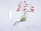 Coll. No. 2193, Penstemon barbatus Coll. No. 2193, Penstemon barbatus
|
2193
|
Field identification: Penstemon sp.
|
Plants of Colorado
Plantaginaceae
Penstemon barbatus (Cav.) Roth.
Beard-Lip Beardtongue.
Trout Creek Pass, Chaffee County, Colorado.
Along Chaffee County Road 311, about 0.8 mi. west of its intersection with US Highway 285 at Trout Creek Pass, 149 km. southwest of the GNIS location of Golden.
38.9083°N, 105.9889°W.
WGS 1984
Elev. 2891 m.
Collected with Hymenoxys richardsonii var. floribunda, Tetradymia canescens, Geranium caespitosum, and Achnatherum hymenoides.
Collected by permit: Pike-Isabel National Forest, 2019, issued: Mar 8, 2019, to: Tom Schweich.
|
Tom Schweich
2193. |
5-Aug-2019 |
|
|
|
Other articles:
• Forest Road 311:
collecting locality;
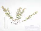 Coll. No. 2194, Galium boreale Coll. No. 2194, Galium boreale
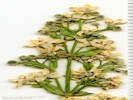 Inflorescence of Coll. No. 2194, Galium boreale Inflorescence of Coll. No. 2194, Galium boreale
|
2194
|
Field identification: Galium sp.
|
Plants of Colorado
Rubiaceae
Galium boreale S. Watson.
Bedstraw.
Trout Creek Pass, Chaffee County, Colorado.
Along Chaffee County Road 311, about 0.8 mi. west of its intersection with US Highway 285 at Trout Creek Pass, 149 km. southwest of the GNIS location of Golden.
38.9082°N, 105.989°W.
WGS 1984
Elev. 2890 m.
Collected with Hymenoxys richardsonii var. floribunda, Tetradymia canescens, Geranium caespitosum, Penstemon barbatus, and Achnatherum hymenoides.
Collected by permit: Pike-Isabel National Forest, 2019, issued: Mar 8, 2019, to: Tom Schweich.
|
Tom Schweich
2194. |
5-Aug-2019 |
|
|
|
Other articles:
• Forest Road 311:
collecting locality;
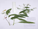 Coll. No. 2194.1 Mertensia ciliata Coll. No. 2194.1 Mertensia ciliata
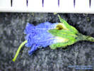 Flower of Coll. No. 2194.1 Mertensia ciliata Flower of Coll. No. 2194.1 Mertensia ciliata
|
2194.1
|
Field identification: Solanaceae.
|
Plants of Colorado
Boraginaceae
Mertensia ciliata (Torr.) G. Don.
Tall Fringed Bluebells.
Trout Creek Pass, Chaffee County, Colorado.
Along Chaffee County Road 311, about 0.8 mi. west of its intersection with US Highway 285 at Trout Creek Pass, 149 km. southwest of the GNIS location of Golden.
38.9082°N, 105.9889°W.
WGS 1984
Elev. 2883 m.
Collected with Hymenoxys richardsonii var. floribunda, Tetradymia canescens, Geranium caespitosum, Penstemon barbatus, Galium boreale, and Achnatherum hymenoides.
Collected by permit: Pike-Isabel National Forest, 2019, issued: Mar 8, 2019, to: Tom Schweich.
|
Tom Schweich
2194.1 |
5-Aug-2019 |
|
Coll. No. 2194.1, 5 August 2019, characters observed:
Perennial herb, to 40-45 cm.;
Stem,
herbaceous,
green,
glabrous;
Leaves,
basal, withered,
cauline,
alternate,
petiole 50 mm. + blade 125 mm. × 27 mm. wide,
reduced above,
lanceolate,
mid-rib prominent,
lateral veins evident,
pustular foveate adaxially,
margins strigulose (ciliate?);
Inflorescence,
cymose;
Pedicel,
1-2 mm.,
elongating to 5 mm. in fruit;
Calyx,
lobes, #5,
2 mm.,
fused 0.5 mm.,
interior strigose;
Corolla,
3-4 mm., fused,
white to blue,
ring of hairs near base (0.5 mm.),
Stamens,
#5,
in throat;
Filaments,
attached ≤fornices,
≤anthers;
Anthers,
1.2 mm.;
Style,
#1,
4 mm.,
elongating to 6 mm. in fruit;
Fruit,
nutlet,
nominally #4, but sometimes only #2 develop;
2 mm. × 1.3 mm. wide,
attachment lateral,
adaxially keeled above scar,
margin without bristles or prickles.
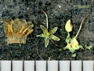
Flower details of Coll. No. 2194.1 Mertensia ciliata |
|
|
Other articles:
• US Highway 24:
near Jumpin' Good Goat Dairy;
Locations:
Elephant Rock.
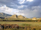 Elephant Rock across from Jumpin' Good Goat Dairy. Elephant Rock across from Jumpin' Good Goat Dairy.
|
|
|
|
Locations:
Arkansas River.
 Rafting on the Arkansas River Rafting on the Arkansas River
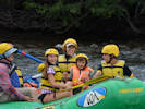 Rafting on the Arkansas River Rafting on the Arkansas River
|
|
Tuesday, August 6, 2019
Rafting on the Arkansas River.
|
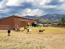 Goats at the dairy. Goats at the dairy.
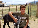 Ian and a goat. Ian and a goat.
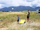 Ian and Nico playing corn hole. Ian and Nico playing corn hole.
|
|
Wednesday, August 7, 2019
|
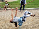 Sofia figures out how to do the crossed ropes. Sofia figures out how to do the crossed ropes.
|
|
|
|
Other articles:
• US Highway 24:
in Leadville;
Locations:
Leadville.
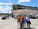 A visit to Leadville's legendary Silver Dollar Saloon. A visit to Leadville's legendary Silver Dollar Saloon.
|
|
Thursday, August 8, 2019
A visit to Leadville.

Inside Leadville's legengary Silver Dollar Saloon. |

Inside Leadville's legengary Silver Dollar Saloon. |

Inside Leadville's legengary Silver Dollar Saloon. |
|
|
|
|
Saturday, August 10, 2019
|
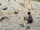 Nico with a dinosaur track. Nico with a dinosaur track.
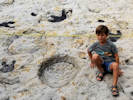 Nico with a dinosaur track. Nico with a dinosaur track.
|
|
|
|
Other articles:
• Alameda Avenue:
at other site;
 Nico with a dinosaur track. Nico with a dinosaur track.
 Nico touches a dinosaur bone. Nico touches a dinosaur bone.
|
|
|
|
Locations:
Schweich Hill.
 Eleven seeds that may be viable found in 3 fruits of Astragalus crassicarpus. Eleven seeds that may be viable found in 3 fruits of Astragalus crassicarpus.
|
|
Sunday, August 11, 2019
North Washington Open Space
|
|
|
2195
|
Field identification: Campanula glomerata.
|
Native and Naturalized Flora of the Golden Area, Jefferson County, Colorado
Campanulaceae
Campanula glomerata L.
Dane's Blood.
North Washington Open Space, Jefferson County, Colorado.
Small (4 acre) fallow city-owned parcel in northern Golden, near the intersection of Colorado Highway 93 and Washington Avenue, 1.73 km. north northeast of the GNIS location of Golden. Along the north fence.
39.7688°N, 105.2328°W.
WGS 1984
Elev. 1810 m.
Garden escapee from the front yard of 633 Alaska Street, where this plant was cultivated in the front yard.
Collected by permit: City of Golden, 2019, issued: Jan 29, 2019, to: Tom Schweich.
|
Tom Schweich
2195. |
5-Aug-2019 |
|
|
|
|
2196
|
Field identification: Solidago, maybe S. nana.
|
Native and Naturalized Flora of the Golden Area, Jefferson County, Colorado
Asteraceae
Solidago missouriensis Nutt.
Missouri Goldenrod.
North Washington Open Space, Jefferson County, Colorado.
Small (4 acre) fallow city-owned parcel in northern Golden, near the intersection of Colorado Highway 93 and Washington Avenue, 1.73 km. north northeast of the GNIS location of Golden. Along the north fence.
39.7688°N, 105.2328°W.
WGS 1984
Elev. 1813 m.
Collected by permit: City of Golden, 2019, issued: Jan 29, 2019, to: Tom Schweich.
|
Tom Schweich
2196. |
11-Aug-2019 |
|
|
|
|
2197
|
Field identification: Pediomelum tenuiflorum.
|
Native and Naturalized Flora of the Golden Area, Jefferson County, Colorado
Fabaceae
Psoralidium tenuiflorum (Pursh) Rydb.
Slimflower Scurfpea.
North Washington Open Space, Jefferson County, Colorado.
Small (4 acre) fallow city-owned parcel in northern Golden, near the intersection of Colorado Highway 93 and Washington Avenue, 1.73 km. north northeast of the GNIS location of Golden. Along the north fence.
39.7688°N, 105.2329°W.
WGS 1984
Elev. 1816 m.
Collected by permit: City of Golden, 2019, issued: Jan 29, 2019, to: Tom Schweich.
|
Tom Schweich
2197. |
11-Aug-2019 |
|
|
|
Literature Cited:
- Smith, Jerd, 2019.
Other articles:
• Colorado Trans-Basin Water Transfer:
Berthoud Pass Ditch;
|
|
Vandals damage Northglenn Ditch.
|
|
|
|
Thursday, August 15, 2019
|
|
Other articles:
• C-8:
Morrison Natural History Museum;
 Nico tries using an air chisel. Nico tries using an air chisel.
|
|
Visit to the Morrison Natural History Museum.
|
|
|
|
Tuesday, August 20, 2019
|
|
Other articles:
• Lookout Mountain Road:
at the M;
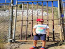 Nico at the gate to the M. Nico at the gate to the M.
 Nico and Ian on the trail to the M. Nico and Ian on the trail to the M.
|
|
A visit to the M.
|
|
Other articles:
• Colorow Road:
at nature center;
 Matching animal tracks at the Lookout Mountain Nature Center. Matching animal tracks at the Lookout Mountain Nature Center.
|
|
Lookout Mountain Nature Center
|
|
Locations:
Ranson/Edwards Homestead Open Space Park.
|
|
Tuesday, August 27, 2019
Ranson/Edwards
|
|
|
2198
|
Field Identification: Solidago, for sure, a big one.
Plants of Jefferson County Open Space
Jefferson County, Colorado
Asteraceae
Solidago rigida L. var. humilis Porter.
Stiff Goldenrod.
Ranson/Edwards Homestead Open Space Park, Jefferson County, Colorado.
High plains above Rocky Flats, 19.4 km. north northwest of the GNIS location of Golden, 1.6 mi. west on CO Hwy 72 from CO Hwy 93, 0.9 mi. north on Plainview Road, then 130 m. west into open prairie.
39.8852°N, 105.2635°W.
WGS 1984
Elev. 1954 m.
Low, wet area. Also collected here: Helianthus pauciflorus ssp. subrhomboideus, nearby: Lactuca serriola, Sonchus asper, and Sporobolus heterolepis.
Collected by permit: Jefferson County Open Space, 2019, issued: Mar 1, 2019, to: Tom Schweich.
|
Tom Schweich
2198. |
27-Aug-2019 |
|
|
|
|
2199
|
Field identification: Helianthus pauciflorus ssp. subrhomboideus.
Plants of Jefferson County Open Space
Jefferson County, Colorado
Asteraceae
Helianthus pauciflorus Nutt. ssp. subrhomboideus (Rydb.) O. Spring & E. Schilling.
Stiff Sunflower.
Ranson/Edwards Homestead Open Space Park, Jefferson County, Colorado.
High plains above Rocky Flats, 19.4 km. north northwest of the GNIS location of Golden, 1.6 mi. west on CO Hwy 72 from CO Hwy 93, 0.9 mi. north on Plainview Road, then 125 m. west into open prairie.
39.8851°N, 105.2634°W.
WGS 1984
Elev. 1959 m.
A small colony of short stature.
Low, wet area. Also collected here: Solidago rigida var. humilis, nearby: Lactuca serriola, Sonchus asper, and Sporobolus heterolepis.
Collected by permit: Jefferson County Open Space, 2019, issued: Mar 1, 2019, to: Tom Schweich.
|
Tom Schweich
2199. |
27-Aug-2019 |
|
|
|
|
2200
|
Field identification: Lactuca serriola.
Plants of Jefferson County Open Space
Jefferson County, Colorado
Asteraceae
Lactuca serriola L.
Prickly Lettuce.
Ranson/Edwards Homestead Open Space Park, Jefferson County, Colorado.
High plains above Rocky Flats, 19.4 km. north northwest of the GNIS location of Golden, 1.6 mi. west on CO Hwy 72 from CO Hwy 93, 0.9 mi. north on Plainview Road, then 150 m. west into open prairie.
39.8855°N, 105.2635°W.
WGS 1984
Elev. 1958 m.
Stem prickly below, achenes with multiple nerves.
Dense colony of small plants in dried wetland, with Iris missouriensis and Epilobium sp..
Collected by permit: Jefferson County Open Space, 2019, issued: Mar 1, 2019, to: Tom Schweich.
|
Tom Schweich
2200. |
27-Aug-2019 |
|
|
|
|
2201
|
Field identification: some kind of thistle, later maybe Sonchus asper.
Plants of Jefferson County Open Space
Jefferson County, Colorado
Asteraceae
Sonchus asper (L.) Hill.
Spiny Sowthistle.
Ranson/Edwards Homestead Open Space Park, Jefferson County, Colorado.
High plains above Rocky Flats, 19.4 km. north northwest of the GNIS location of Golden, 1.6 mi. west on CO Hwy 72 from CO Hwy 93, 0.9 mi. north on Plainview Road, then 150 m. west into open prairie.
39.8857°N, 105.2636°W.
WGS 1984
Elev. 1957 m.
Leaf-base auricles rounded. Achenes 3(5)-ribbed, not transverse rugose. Many rosettes present.
Collected by permit: Jefferson County Open Space, 2019, issued: Mar 1, 2019, to: Tom Schweich.
|
Tom Schweich
2201. |
27-Aug-2019 |
|
|
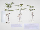 Coll. No. 2202, Bidens frondosa Coll. No. 2202, Bidens frondosa
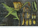 Various flower parts of Coll. No. 2202, Bidens frondosa Various flower parts of Coll. No. 2202, Bidens frondosa
|
2202
|
Field identification: Discoid comp., later: Bidens tripartita.
Plants of Jefferson County Open Space
Jefferson County, Colorado
Asteraceae
Bidens frondosa L.
Devil's Beggartick.
Ranson/Edwards Homestead Open Space Park, Jefferson County, Colorado.
High plains above Rocky Flats, 19.4 km. north northwest of the GNIS location of Golden, 1.6 mi. west on CO Hwy 72 from CO Hwy 93, 0.9 mi. north on Plainview Road, then 290 m. west to a small reservoir.
39.8865°N, 105.2644°W.
WGS 1984
Elev. 1956 m.
Discoid composite; in delta gravel of small reservoir.
Collected by permit: Jefferson County Open Space, 2019, issued: Mar 1, 2019, to: Tom Schweich.
|
Tom Schweich
2202. |
27-Aug-2019 |
|
Coll. No. 2202, 27 August 2019, characters observed:
Herbs, 18-28 cm.;
Leaves,
basal,
unknown,
cauline,
opposite,
50 mm. × 40 mm. wide,
pinnately compound,
leaflets,
#3,
25 mm. × 12 mm. wide,
margin,
serrate;
Inflorescence,
head enclosed in an involucre,
5-6 mm. wide;
Phyllaries,
outer, #5, 12 mm. × 2 mm. wide, green,
inner, many, 5.5 mm. × 2.5 mm. wide,
brown,
margin, scarious
(similar to the paleae);
Receptacle,
paleate;
Paleae,
5 mm. × 1.7 mm. wide,
margin, scarious;
Corolla,
1.5 mm., orange-yellow;
Pappus,
#2,
barbed awns,
1.5 mm.;
Achene,
2-5-2.8 mm. × 1.5 mm. wide,
very flat,
hairy.
|
|
|
2203
|
Field identification: Echinochloa sp.
Plants of Jefferson County Open Space
Jefferson County, Colorado
Poaceae
Echinochloa muricata (P. Beauv.) Fernald var. microstachya Wiegand.
Rough Barnyardgrass.
Ranson/Edwards Homestead Open Space Park, Jefferson County, Colorado.
High plains above Rocky Flats, 19.4 km. north northwest of the GNIS location of Golden, 1.6 mi. west on CO Hwy 72 from CO Hwy 93, 0.9 mi. north on Plainview Road, then 290 m. west to a small reservoir.
39.8866°N, 105.2644°W.
WGS 1984
Elev. 1954 m.
Sterile lemma with pustular-based bristles.
In gravel of small stream delta. Also collected here: Bidens frondosa.
Collected by permit: Jefferson County Open Space, 2019, issued: Mar 1, 2019, to: Tom Schweich.
|
Tom Schweich
2203. |
27-Aug-2019 |
|
|
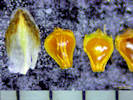 Scale and achenes of Coll. No. 2204, Eleocharis, c.f. E. obtusa Scale and achenes of Coll. No. 2204, Eleocharis, c.f. E. obtusa
|
2204
|
Field identification: Eleocharis sp.
Plants of Jefferson County Open Space
Jefferson County, Colorado
Cyperaceae
Eleocharis R. Br.
c.f. E. obtusa (Willd.) Schult.
Spikerush.
Ranson/Edwards Homestead Open Space Park, Jefferson County, Colorado.
High plains above Rocky Flats, 19.4 km. north northwest of the GNIS location of Golden, 1.6 mi. west on CO Hwy 72 from CO Hwy 93, 0.9 mi. north on Plainview Road, then 290 m. west to a small reservoir.
39.8866°N, 105.2644°W.
WGS 1984
Elev. 1955 m.
No rhizomes seen, achenes biconvex, 1 mm., with a broad flattened cap, stigmas, #2.
E. palustris was previously collected here, other plants collected nearby: Bidens frondosa, Gratiola neglecta, Alisma trivale, and Echinochloa muricata.
Collected by permit: Jefferson County Open Space, 2019, issued: Mar 1, 2019, to: Tom Schweich.
|
Tom Schweich
2204. |
27-Aug-2019 |
|
|
|
|
2205
|
Field identification: Solidago, maybe S. nemoralis.
Plants of Jefferson County Open Space
Jefferson County, Colorado
Asteraceae
Solidago nana Nutt.
Baby Goldenrod.
Ranson/Edwards Homestead Open Space Park, Jefferson County, Colorado.
High plains above Rocky Flats, 1.6 mi. west on CO Hwy 72 from CO Hwy 93, 1.1 mi. north on Plainview Road, then 480 m. on a small ridge, 19.4 km. north northwest of the GNIS location of Golden.
39.8879°N, 105.266°W.
WGS 1984
Elev. 1979 m.
Also observed/collected nearby: Toxicodendron rydbergii and Artemisia campestris.
Collected by permit: Jefferson County Open Space, 2019, issued: Mar 1, 2019, to: Tom Schweich.
|
Tom Schweich
2205. |
27-Aug-2019 |
|
Coll. No. 2205, 27 August 2019, characters observed:
Perennial herb, to 35 cm.,
short-hairy throughout;
Stem,
ascending from a creeping rootstock;
Leaves,
mostly cauline,
alternate,
petiole, 25 mm.,
blade 40 mm. × 9 mm. wide,
reduced distally,
oblanceolate,
margin, entire,
tip, round,
veins (nerves), #1,
eglandular,
short hairy;
Inflorescence,
head enclosed by involucre,
many heads per stem,
not showy,
70 mm. × 26 mm. wide,
elongated,
not overtopped by leaves;
Peduncles,
3 mm.;
Involucre,
5 mm. × 2.5 mm. wide,
cylindric-conic;
Phyllaries,
in 5± series,
lower << rest of involucre,
unequal,
4 mm. × 1.2 mm. wide,
chartaceous with green tips,
veins, #1,
eglandular,
margins, flat,
tip, ciliate;
Receptacle,
epaleate;
Flowers,
2 kinds;
Ray flowers,
#4,
tube 2.5 mm. + blade 2 mm. × 0.7 mm. wide = 4.5 mm.;
yellow;
Disk flowers,
#8,
tube 3.5 mm. + lobes 0.5 mm. = 4.0 mm.,
yellow;
Pappus,
many well-developed bristles,
3 mm.,
±equal;
Fruit (cypsela),
1 mm. × 0.4 mm. wide,
brown,
hairy.
Keys to S. nemoralis in Weber & Wittmann (2012) and FNANM per the form of the inflorescence, yet the description in FNANM better describes this as S. nana especially in the number of phyllary series, and relative number of ray and disk flowers.
Based on the key in Ackerfield (2015), would key to S. nana based upon the relative number of ray and disk flowers in the heads.
Based upon the description in Ackerfield (2015), very similar to S. nana but S. nemoralis is a better fit because the ray flowers, disk flowers, and the cypselae are shorter.
|
|
|
2206
|
Field identification: Artemisia campestris.
Plants of Jefferson County Open Space
Jefferson County, Colorado
Asteraceae
Artemisia campestris L. ssp. pacifica (Nutt.) Peck.
Field Sagewort.
Ranson/Edwards Homestead Open Space Park, Jefferson County, Colorado.
High plains above Rocky Flats, 1.6 mi. west on CO Hwy 72 from CO Hwy 93, 1.1 mi. north on Plainview Road, then 500 m. west on a small ridge, 19.4 km. north northwest of the GNIS location of Golden.
39.8884°N, 105.2663°W.
WGS 1984
Elev. 1978 m.
Fairly dry, exposed prairie on small ridge between watercourses. Also observed/collected nearby: Toxicodendron rydbergii and Solidago nana.
Same as Coll. No. 2207.
Collected by permit: Jefferson County Open Space, 2019, issued: Mar 1, 2019, to: Tom Schweich.
|
Tom Schweich
2206. |
27-Aug-2019 |
|
|
|
|
2207
|
Field identification: Artemisia campestris.
Plants of Jefferson County Open Space
Jefferson County, Colorado
Asteraceae
Artemisia campestris L. ssp. pacifica (Nutt.) Peck.
Field Sagewort.
Ranson/Edwards Homestead Open Space Park, Jefferson County, Colorado.
High plains above Rocky Flats, 1.6 mi. west on CO Hwy 72 from CO Hwy 93, 1.1 mi. north on Plainview Road, then 620 m. west on a small ridge, 19.4 km. north northwest of the GNIS location of Golden.
39.8877°N, 105.2672°W.
WGS 1984
Elev. 1988 m.
Fairly dry, exposed prairie on small ridge between watercourses. Also observed/collected nearby: Toxicodendron rydbergii and Solidago nana.
Same as Coll. No. 2206.
Collected by permit: Jefferson County Open Space, 2019, issued: Mar 1, 2019, to: Tom Schweich.
|
Tom Schweich
2207. |
27-Aug-2019 |
|
|
|
|
2208
|
Field identification: Allium cernuum.
Plants of Jefferson County Open Space
Jefferson County, Colorado
Alliaceae
Allium cernuum Roth.
Nodding Onion.
Ranson/Edwards Homestead Open Space Park, Jefferson County, Colorado.
High plains above Rocky Flats, 1.6 mi. west on CO Hwy 72 from CO Hwy 93, 1.1 mi. north on Plainview Road, then 870 m. west on a small ridge, 20.0 km. north northwest of the GNIS location of Golden.
39.8884°N, 105.2696°W.
WGS 1984
Elev. 2010 m.
Northwest-facing slope above ephemeral stream.
Collected by permit: Jefferson County Open Space, 2019, issued: Mar 1, 2019, to: Tom Schweich.
|
Tom Schweich
2208. |
27-Aug-2019 |
|
|
|
|
2209
|
Field identification: Senecio spartioides.
Plants of Jefferson County Open Space
Jefferson County, Colorado
Asteraceae
Senecio spartioides Torr. & A. Gray.
Broomlike Ragwort.
Ranson/Edwards Homestead Open Space Park, Jefferson County, Colorado.
High plains above Rocky Flats, 1.6 mi. west on CO Hwy 72 from CO Hwy 93, 1.1 mi. north on Plainview Road, then 925 m. west on a small ridge, 19.9 km. north northwest of the GNIS location of Golden.
39.8875°N, 105.2699°W.
WGS 1984
Elev. 2017 m.
Collected by permit: Jefferson County Open Space, 2019, issued: Mar 1, 2019, to: Tom Schweich.
|
Tom Schweich
2209. |
27-Aug-2019 |
|
|
|
|
2210
|
Field identification: another Bidens, maybe B. cernua or B. laevis.
Plants of Jefferson County Open Space
Jefferson County, Colorado
Asteraceae
Heliomeris multiflora Nutt. var. multiflora.
Showy Golden Eye.
Ranson/Edwards Homestead Open Space Park, Jefferson County, Colorado.
High plains above Rocky Flats, 1.6 mi. west on CO Hwy 72 from CO Hwy 93, 1.1 mi. north on Plainview Road, then 725 m. west to an ephemeral stream, 19.7 km. north northwest of the GNIS location of Golden.
39.8867°N, 105.2686°W.
WGS 1984
Elev. 1994 m.
Edge of an emphemeral stream, with Lsyimachia ciliata, Mentha arvensis, and Lycopus americanus.
Collected by permit: Jefferson County Open Space, 2019, issued: Mar 1, 2019, to: Tom Schweich.
|
Tom Schweich
2210. |
27-Aug-2019 |
|
|
|
|
|
Plants of Jefferson County Open Space
Jefferson County, Colorado
Asteraceae
Bidens frondosa L.
Devil's Beggartick.
Ranson/Edwards Homestead Open Space Park, Jefferson County, Colorado.
High plains above Rocky Flats, 1.6 mi. west on CO Hwy 72 from CO Hwy 93, 1.1 mi. north on Plainview Road, then 725 m. west to an ephemeral stream, 19.7 km. north northwest of the GNIS location of Golden.
39.8867°N, 105.2737°W.
WGS 84
Elev. 1994 m.
Edge of an ephemeral stream, with Heliomeris multiflora, Lsyimachia ciliata, Mentha arvensis, and Lycopus americanus.
Collected by permit: Jefferson County Open Space, 2019, issued: Mar 1, 2019, to: Tom Schweich.
|
Tom Schweich
2210.1 |
27-Aug-2019 |
|
|
|
Locations:
Lippincott Ranch.
|
|
Thursday, August 29, 2019
Lippincott Property.
|
|
|
2211
|
Field identification: Gutierrezia sarothrae.
Plants of Jefferson County Open Space
Jefferson County, Colorado
Asteraceae
Gutierrezia sarothrae (Pursh) Britton & Rusby.
Broom Snakeweed.
Lippincott Property, Jefferson County, Colorado.
Northernmost Jefferson County, parcel jointly owned by Jefferson County Open Space and City of Boulder OSMP, approx. centroid of parcel, atop spoils pile of clay pit, 22.5 km. north northwest of the GNIS location of Golden.
39.9054°N, 105.2737°W.
WGS 1984
Elev. 1977 m.
Open recent growth ponderosa pine woodland, also seen/collected here: Achnatherum nelsonii, and Elymus elymoides.
Collected by permit: Jefferson County Open Space, 2019, issued: Mar 1, 2019, to: Tom Schweich.
|
Tom Schweich
2211. |
29-Aug-2019 |
|
|
|
Other articles:
• Lippincott Road:
at Bull Gl;
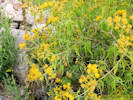 Coll. No. 2216, Pericome caudata Coll. No. 2216, Pericome caudata
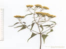 Coll. No. 2212, Pericome caudata Coll. No. 2212, Pericome caudata
|
2212
|
Field identification: Senecio ???, definitely a shrub, with a Senecio-like involucre.
Plants of Jefferson County Open Space
Jefferson County, Colorado
Asteraceae
Pericome caudata A. Gray.
Mountain Tail-Leaf.
Lippincott Property, Jefferson County, Colorado.
Northernmost Jefferson County, parcel jointly owned by Jefferson County Open Space and City of Boulder OSMP, among boulders on the south side of Bull Gulch, 22.9 km. north northwest of the GNIS location of Golden.
39.908°N, 105.2764°W.
WGS 1984
Elev. 1960 m.
Shrub, to 1 meter.
Collected by permit: Jefferson County Open Space, 2019, issued: Mar 1, 2019, to: Tom Schweich.
|
Tom Schweich
2212. |
29-Aug-2019 |
|
|
|
|
2213
|
Field identification: Grindelia hirsutula.
Plants of Jefferson County Open Space
Jefferson County, Colorado
Asteraceae
Grindelia squarrosa (Pursh) Dunal.
Curlycup Gumweed.
Lippincott Property, Jefferson County, Colorado.
Northernmost Jefferson County, parcel jointly owned by Jefferson County Open Space and City of Boulder OSMP, among boulders on the south side of Bull Gulch, 22.9 km. north northwest of the GNIS location of Golden.
39.9078°N, 105.2764°W.
WGS 1984
Elev. 1965 m.
Also collected here: Heterotheca foliosa, Pericome caudata, Senecio spartioides, and Urtica dioica.
Variety squarrosa per leaf proportions in Ackerfield (2015) if infraspecific names are to be applied.
Collected by permit: Jefferson County Open Space, 2019, issued: Mar 1, 2019, to: Tom Schweich.
|
Tom Schweich
2213. |
29-Aug-2019 |
|
|
|
|
2214
|
Field identification: Mentha sp.
Plants of Jefferson County Open Space
Jefferson County, Colorado
Lamiaceae
Nepeta cataria L.
Catnip.
Lippincott Property, Jefferson County, Colorado.
Northernmost Jefferson County, parcel jointly owned by Jefferson County Open Space and City of Boulder OSMP, among boulders on the south side of Bull Gulch, 22.9 km. north northwest of the GNIS location of Golden.
39.908°N, 105.2765°W.
WGS 1984
Elev. 1965 m.
Also collected here: Grindelia squarrosa, Heterotheca foliosa, Pericome caudata, Senecio spartioides, and Urtica dioica.
Collected by permit: Jefferson County Open Space, 2019, issued: Mar 1, 2019, to: Tom Schweich.
|
Tom Schweich
2214. |
29-Aug-2019 |
|
Coll. No. 2214, 29 August 2019, characters observed:
Perennial herb, to 40 cm.;
Stem,
square,
hispid;
Leaves,
opposite,
petiole, 8 mm.,
blade, 40 mm. × 19 mm. wide, reduced above,
deltoid-chordate,
margin, crenate,
abaxial densely hispid, rather than tomentose per Ackerfield (2015),
tip, acute;
Inflorescence,
flower clusters arising from axils,
flowers pedicillate;
Calyx,
lobes sharply acute but lacking spines or bristles;
Corolla,
2-lipped,
white.
|
|
|
2215
|
Field identification: Heterotheca foliolosa.
Plants of Jefferson County Open Space
Jefferson County, Colorado
Asteraceae
Heterotheca foliosa (Nutt.) Shinners.
Hairy False Goldenaster.
Lippincott Property, Jefferson County, Colorado.
Northernmost Jefferson County, parcel jointly owned by Jefferson County Open Space and City of Boulder OSMP, among boulders on the south side of Bull Gulch, 22.9 km. north northwest of the GNIS location of Golden.
39.9079°N, 105.2766°W.
WGS 1984
Elev. 1961 m.
Also collected here: Grindelia squarrosa, Pericome caudata, Senecio spartioides, Nepeta cataria, and Urtica dioica.
Collected by permit: Jefferson County Open Space, 2019, issued: Mar 1, 2019, to: Tom Schweich.
|
Tom Schweich
2215. |
27-Aug-2019 |
|
|
|
|
2216
|
Field identification: Senecio spartioides.
Plants of Jefferson County Open Space
Jefferson County, Colorado
Asteraceae
Senecio spartioides Torr. & A. Gray.
Broomlike Ragwort.
Lippincott Property, Jefferson County, Colorado.
Northernmost Jefferson County, parcel jointly owned by Jefferson County Open Space and City of Boulder OSMP, among boulders on the south side of Bull Gulch, 22.9 km. north northwest of the GNIS location of Golden.
39.908°N, 105.2765°W.
WGS 1984
Elev. 1961 m.
Also collected here: Grindelia squarrosa, Heterotheca foliosa, Pericome caudata, Nepeta cataria, and Urtica dioica.
Collected by permit: Jefferson County Open Space, 2019, issued: Mar 1, 2019, to: Tom Schweich.
|
Tom Schweich
2216. |
29-Aug-2019 |
|
|
|
|
2217
|
Field identification: Nettles.
Plants of Jefferson County Open Space
Jefferson County, Colorado
Urticaceae
Urtica dioica L. ssp. gracilis (Aiton) Seland.
Stinging Nettle.
Lippincott Property, Jefferson County, Colorado.
Northernmost Jefferson County, parcel jointly owned by Jefferson County Open Space and City of Boulder OSMP, among boulders on the south side of Bull Gulch, 22.9 km. north northwest of the GNIS location of Golden.
39.9078°N, 105.2764°W.
WGS 1984
Elev. 1958 m.
Also collected here: Grindelia squarrosa, Heterotheca foliosa, Pericome caudata, Senecio spartioides, and Nepeta cataria.
Collected by permit: Jefferson County Open Space, 2019, issued: Mar 1, 2019, to: Tom Schweich.
|
Tom Schweich
2217. |
29-Aug-2019 |
|
|
|
|
2218
|
Field identification: Epilobium, maybe E. brachycarpum.
Plants of Jefferson County Open Space
Jefferson County, Colorado
Onagraceae
Epilobium brachycarpum C. Presl.
Autumn Willow Herb.
Lippincott Property, Jefferson County, Colorado.
Northernmost Jefferson County, parcel jointly owned by Jefferson County Open Space and City of Boulder OSMP, among boulders on the south side of Bull Gulch, 22.9 km. north northwest of the GNIS location of Golden.
39.9079°N, 105.2764°W.
WGS 1984
Elev. 1960 m.
Also collected here: Grindelia squarrosa, Heterotheca foliosa, Pericome caudata, Senecio spartioides, and Nepeta cataria.
Collected by permit: Jefferson County Open Space, 2019, issued: Mar 1, 2019, to: Tom Schweich.
|
Tom Schweich
2218. |
29-Aug-2019 |
|
|
|
|
2219
|
Field identification: Erigeron porteri, or is it?
Plants of Jefferson County Open Space
Jefferson County, Colorado
Asteraceae
Symphyotrichum porteri (A. Gray) G.L. Nesom.
Smooth White Aster.
Lippincott Property, Jefferson County, Colorado.
Northernmost Jefferson County, parcel jointly owned by Jefferson County Open Space and City of Boulder OSMP, among boulders on the south side of Bull Gulch, 22.9 km. north northwest of the GNIS location of Golden.
39.9078°N, 105.2766°W.
WGS 1984
Elev. 1960 m.
Basal rosette present, fibrous roots.
Also collected here: Grindelia squarrosa, Heterotheca foliosa, Pericome caudata, Senecio spartioides, and Nepeta cataria.
Collected by permit: Jefferson County Open Space, 2019, issued: Mar 1, 2019, to: Tom Schweich.
|
Tom Schweich
2219. |
29-Aug-2019 |
|
|
|
|
2220
|
Field identification: Liatris punctata.
Plants of Jefferson County Open Space
Jefferson County, Colorado
Asteraceae
Liatris punctata Hook.
Dotted Blazing Star.
Lippincott Property, Jefferson County, Colorado.
Northernmost Jefferson County, parcel jointly owned by Jefferson County Open Space and City of Boulder OSMP, north segment of parcel, south side of Bull Gulch, 22.9 km. north northwest of the GNIS location of Golden.
39.9071°N, 105.2793°W.
WGS 1984
Elev. 2022 m.
Drier rocky knoll at edge of ponderosa pine woodland.
Collected by permit: Jefferson County Open Space, 2019, issued: Mar 1, 2019, to: Tom Schweich.
|
Tom Schweich
2220. |
29-Aug-2019 |
|
|
|
|
2221
|
Field identification: Hypericum perforatum.
Plants of Jefferson County Open Space
Jefferson County, Colorado
Hypericaceae
Hypericum perforatum L.
Common St. John's Wort.
Lippincott Property, Jefferson County, Colorado.
Northernmost Jefferson County, parcel jointly owned by Jefferson County Open Space and City of Boulder OSMP, north segment of parcel, south side of Bull Gulch, 22.9 km. north northwest of the GNIS location of Golden.
39.9064°N, 105.2802°W.
WGS 1984
Elev. 2025 m.
Highest prairie at edge of ponderosa pine woodland. Heavily grazed by cattle. Also collected here: Symphyotrichum laeve.
Colorado Noxious Weed List C.
Collected by permit: Jefferson County Open Space, 2019, issued: Mar 1, 2019, to: Tom Schweich.
|
Tom Schweich
2221. |
29-Aug-2019 |
|
|
|
|
2222
|
Field identification: Symphyotrichum laeve.
Plants of Jefferson County Open Space
Jefferson County, Colorado
Asteraceae
Symphyotrichum laeve (L.) Á. Löve & D. Löve.
Smooth Blue Aster.
Lippincott Property, Jefferson County, Colorado.
Northernmost Jefferson County, parcel jointly owned by Jefferson County Open Space and City of Boulder OSMP, north segment of parcel, south side of Bull Gulch, 22.8 km. north northwest of the GNIS location of Golden.
39.9062°N, 105.2804°W.
WGS 1984
Elev. 2015 m.
Highest prairie at edge of ponderosa pine woodland. Heavily grazed by cattle. Also collected here: Hypericum perforatum, a Colorado Noxious Weed List C plant.
Collected by permit: Jefferson County Open Space, 2019, issued: Mar 1, 2019, to: Tom Schweich.
|
Tom Schweich
2222. |
29-Aug-2019 |
|
|
|
|
2223
|
Field identification: Helianthus pauciflorus ssp. subrhombioides.
Plants of Jefferson County Open Space
Jefferson County, Colorado
Asteraceae
Helianthus pauciflorus Nutt. ssp. subrhomboideus (Rydb.) O. Spring & E. Schilling.
Stiff Sunflower.
Lippincott Property, Jefferson County, Colorado.
Northernmost Jefferson County, parcel jointly owned by Jefferson County Open Space and City of Boulder OSMP, southwest segment of parcel, nearly up to the railroad tracks, 22.6 km. north northwest of the GNIS location of Golden.
39.9043°N, 105.2813°W.
WGS 1984
Elev. 2040 m.
Steep east-facing grassy slope. Also collected here: Heliomeris multiflora var. multiflora.
Collected by permit: Jefferson County Open Space, 2019, issued: Mar 1, 2019, to: Tom Schweich.
|
Tom Schweich
2223. |
29-Aug-2019 |
|
|
|
|
2224
|
Field identification: the Bidens thing ???
Plants of Jefferson County Open Space
Jefferson County, Colorado
Asteraceae
Heliomeris multiflora Nutt. var. multiflora.
Showy Golden Eye.
Lippincott Property, Jefferson County, Colorado.
Northernmost Jefferson County, parcel jointly owned by Jefferson County Open Space and City of Boulder OSMP, southwest segment of parcel, nearly up to the railroad tracks, 22.6 km. north northwest of the GNIS location of Golden.
39.9042°N, 105.2812°W.
WGS 1984
Elev. 2054 m.
Perennial from creeping rootstock.
Steep east-facing grassy slope. Also collected here: Helianthus pauciflorus ssp. subrhomboideus.
Collected by permit: Jefferson County Open Space, 2019, issued: Mar 1, 2019, to: Tom Schweich.
|
Tom Schweich
2224. |
29-Aug-2019 |
|
|
|
Other articles:
• Tolland Road:
East Portal;
near RR Xing;
near Rollinsville;
• Plainview Road:
at bend;
• CO Highway 119:
at CO 72W;
Locations:
Nederland.
 BNSF manifest freight westbound near Tolland, Colorado BNSF manifest freight westbound near Tolland, Colorado
|
|
Sunday, September 1, 2019
Hiking on South Boulder Creek, from the east portal of the Moffat Tunnel.
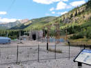
East portal of the Moffat Tunnel. |
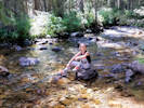
Sofia on South Boulder Creek. |
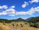
The station of Rollins, Rollinsville in the middle distance. |
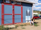
The shed of the frozen dead guy. |
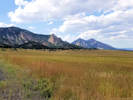
Looking north across Ranson/Edwards Homestead Open Space. |
|
|
Locations:
Ranson/Edwards Homestead Open Space Park.
|
|
Tuesday, September 10, 2019
Ranson/Edwards Homestead Open Space with Cindy Trujillo.
|
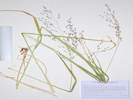 Coll. No. 2225, Panicum virgatum Coll. No. 2225, Panicum virgatum
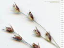 Coll. No. 2225, Panicum virgatum Coll. No. 2225, Panicum virgatum
|
2225
|
Field identification: Panicum virgatum.
Plants of Jefferson County Open Space
Jefferson County, Colorado
Poaceae
Panicum virgatum L.
Switchgrass.
Ranson/Edwards Homestead Open Space Park, Jefferson County, Colorado.
High Plains above Rocky Flats, near northwest corner of Ranson/Edwards, 1.7 mi. west on CO Hwy 72 from CO Hwy 93, 1.9 mi. generally north to a private road, then 200 m. west along the northern boundary fence, 21.7 km. north northwest of Golden.
39.8991°N, 105.2751°W.
WGS 1984
Elev. 2009 m.
Rhizomatous, sheaths glabrous, glumes with long acuminate tips.
Growing in the former access road to a clay pit.
Collected by permit: Jefferson County Open Space, 2019, issued: Mar 1, 2019, to: Tom Schweich.
|
Tom Schweich, with Cindy Trujillo
2225. |
10-Sep-2019 |
|
|
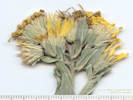 Coll. No. 2226, Heterotheca foliosa Coll. No. 2226, Heterotheca foliosa
|
2226
|
Field identification: Heterotheca, maybe H. foliosa.
Plants of Jefferson County Open Space
Jefferson County, Colorado
Asteraceae
Heterotheca foliosa (Nutt.) Shinners.
Hairy False Goldenaster.
Ranson/Edwards Homestead Open Space Park, Jefferson County, Colorado.
High plains above Rocky Flats, northwest corner of Ranson/Edwards, 1.7 mi. west on CO Hwy 72 from CO Hwy 93, 2.1 mi generally north on Plainview Road, then 350 m. west.
39.8974°N, 105.2751°W.
WGS 1984
Elev. 2036 m.
Area with down, burned ponderosa pines, also collected here: Ceanothus fendleri, nearby Amorpha nana, Danthonia spicata, and Sorghastrum nutans.
Collected by permit: Jefferson County Open Space, 2019, issued: Mar 1, 2019, to: Tom Schweich.
|
Tom Schweich, with Cindy Trujillo
2226. |
10-Sep-2019 |
|
|
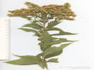 Coll. No. 2227, Solidago gigantea Coll. No. 2227, Solidago gigantea
|
2227
|
Field identification: Solidago, tall, possibly S. gigantea.
Plants of Jefferson County Open Space
Jefferson County, Colorado
Asteraceae
Solidago gigantea Aiton.
Giant Goldenrod.
Ranson/Edwards Homestead Open Space Park, Jefferson County, Colorado.
High plains above Rocky Flats, northwest corner of Ranson/Edwards, 1.7 mi. west on CO Hwy 72 from CO Hwy 93, 2.1 mi generally north on Plainview Road, then 200 m. west.
39.8974°N, 105.2738°W.
WGS 1984
Elev. 2028 m.
Leaf margins serrate, ciliate.
In deep grassland with few ponderosa pines, also collected nearby: Antennaria rosea, Townsendia hookeri, Noccaea fendleri, and Frasera speciosa,
Collected by permit: Jefferson County Open Space, 2019, issued: Mar 1, 2019, to: Tom Schweich.
|
Tom Schweich
2227. |
10-Sep-2019 |
|
|
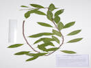 Coll. No. 2228.1, Prunus cf., P. pumila var. besseyi Coll. No. 2228.1, Prunus cf., P. pumila var. besseyi
|
2228.1
|
Field identification: Rosaceae, maybe Prunus pumila.
Plants of Jefferson County Open Space
Jefferson County, Colorado
Rosaceae
Prunus, cf.
Prunus pumila L. var. besseyi (L. H. Bailey) Gleason.
Sand Cherry.
Ranson/Edwards Homestead Open Space Park, Jefferson County, Colorado.
High plains above Rocky Flats, approximate center of parcel, in a gravel bar on west side of the road, 1.7 mi. west on CO Hwy 72 from CO Hwy 93, 1.2 mi. north on Plainview Road, 19.9 km. north northwest of the GNIS location of Golden.
39.8895°N, 105.262°W.
WGS 1984
Elev. 1944 m.
Horizontally growing stems on gravel bar. Also collected here: Salvia reflexa, Fallopia convolvulus, and Chamaesyce serpyllifolia.
Collected by permit: Jefferson County Open Space, 2019, issued: Mar 1, 2019, to: Tom Schweich.
|
Tom Schweich, with Cindy Trujillo
2228.1 |
10-Sep-2019 |
|
|
|
|
2228.2
|
Field identification: Euphorbia sp.
Plants of Jefferson County Open Space
Jefferson County, Colorado
Euphorbiaceae
Chamaesyce serpyllifolia (Pers.) Small.
Thymeleaf Sandmat.
Ranson/Edwards Homestead Open Space Park, Jefferson County, Colorado.
High plains above Rocky Flats, approximate center of parcel, in a gravel bar on west side of the road, 1.7 mi. west on CO Hwy 72 from CO Hwy 93, 1.2 mi. north on Plainview Road, 19.9 km. north northwest of the GNIS location of Golden.
39.8895°N, 105.262°W.
WGS 1984
Elev. 1944 m.
Collected with: Salvia reflexa, Fallopia convolvulus and Prunus cf. P. pumila var. besseyi.
Collected by permit: Jefferson County Open Space, 2019, issued: Mar 1, 2019, to: Tom Schweich.
|
Tom Schweich, with Cindy Trujillo
2228.2 |
10-Sep-2019 |
|
|
|
|
2228.3
|
Field identification: black bindweed -- Fallopia convolvulus.
Plants of Jefferson County Open Space
Jefferson County, Colorado
Polygonaceae
Fallopia convolvulus (L.) A.Löve.
Black Bindweed.
Ranson/Edwards Homestead Open Space Park, Jefferson County, Colorado.
High plains above Rocky Flats, approximate center of parcel, in a gravel bar on west side of the road, 1.7 mi. west on CO Hwy 72 from CO Hwy 93, 1.2 mi. north on Plainview Road, 19.9 km. north northwest of the GNIS location of Golden.
39.8895°N, 105.262°W.
WGS 1984
Elev. 1944 m.
Also collected here: Salvia reflexa, Chamaesyce serpyllifolia, and Prunus cf. P. pumila var. besseyi.
Collected by permit: Jefferson County Open Space, 2019, issued: Mar 1, 2019, to: Tom Schweich.
|
Tom Schweich, with Cindy Trujillo
2228.3 |
10-Sep-2019 |
|
|
|
Locations:
Schweich Hill.
|
|
Thursday, September 12, 2019
North Washington Open Space, looking for rabbitbrush to collect.
|
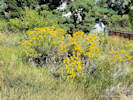 Coll. No. 2229, Ericameria nauseosa var. graveolens Coll. No. 2229, Ericameria nauseosa var. graveolens
|
2229
|
Field identification: Ericameria nauseosa var. graveolens.
|
Native and Naturalized Flora of the Golden Area, Jefferson County, Colorado
Asteraceae
Ericameria nauseosa (Pall. ex Pursh) G.L.Nesom & G.I.Baird var. graveolens (Nutt.) Reveal & Schuyler.
North Washington Open Space, Jefferson County, Colorado.
Small (4 acre) fallow city-owned parcel in northern Golden, near the intersection of Colorado Hu\ighway 93 and Washington Avenue, 2.31 km. north northwest of the GNIS location of Golden (on 12th Street near the Buffalo Rose Saloon).
39.7688°N, 105.2328°W.
WGS 1984
Elev. 1799 m.
10± shrubs along northern boundary.
Collected nearby: Lomatium orientale, Mertensia lanceolata, Colutea arboescens, Psoralidium tenuiflorum, and Viola nuttallii.
Collected by permit: City of Golden, 2019, issued: Jan 29, 2019, to: Tom Schweich.
|
Tom Schweich
2229. |
12-Sep-2019 |
|
|
|
|
2230
|
Field identification: Symphyotrichum porteri.
|
Native and Naturalized Flora of the Golden Area, Jefferson County, Colorado
Asteraceae
Symphyotrichum porteri (A. Gray) G.L. Nesom.
Smooth White Aster.
North Washington Open Space, Jefferson County, Colorado.
Small (4 acre) fallow city-owned parcel in northern Golden, near the intersection of Colorado Highway 93 and Washington Avenue, 2.31 km. north northwest of the GNIS location of Golden. Near top of hill, north central part of the parcel.
39.7687°N, 105.2329°W.
WGS 1984
Elev. 1811 m.
Also collected nearby: Cryptantha virgata, Lithospermum incisum, Penstemon secundiflorus, and Poa secunda.
Collected by permit: City of Golden, 2019, issued: Jan 29, 2019, to: Tom Schweich.
|
Tom Schweich
2230. |
12-Sep-2019 |
|
|
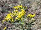 Coll. No. 2231, Senecio spartioides with a praying mantis and a beetle. Coll. No. 2231, Senecio spartioides with a praying mantis and a beetle.
|
2231
|
Field identification: Senecio spartioides.
|
Native and Naturalized Flora of the Golden Area, Jefferson County, Colorado
Asteraceae
Senecio spartioides Torr. & A. Gray.
Broomlike Ragwort.
North Washington Open Space, Jefferson County, Colorado.
Small (4 acre) fallow city-owned parcel in northern Golden, near the intersection of Colorado Highway 93 and Washington Avenue, 2.31 km. north northwest of the GNIS location of Golden. Near top of hill, central part of the parcel.
39.7685°N, 105.2331°W.
WGS 1984
Elev. 1819 m.
Remnant mixed-grass prairie, also collected nearby: Hymenopappus filifolius, Oxytropis lambertii, Eriogonum effusum and Carex inops heliophila.
Collected by permit: City of Golden, 2019, issued: Jan 29, 2019, to: Tom Schweich.
|
Tom Schweich
2231. |
12-Sep-2019 |
|
|
|
|
2232
|
Field identification: Eriogonum effusum.
|
Native and Naturalized Flora of the Golden Area, Jefferson County, Colorado
Polygonaceae
Eriogonum effusum Nutt.
Spreading Buckwheat.
North Washington Open Space, Jefferson County, Colorado.
Small (4 acre) fallow city-owned parcel in northern Golden, near the intersection of Colorado Highway 93 and Washington Avenue, 2.31 km. north northwest of the GNIS location of Golden. Near top of hill, central part of the parcel.
39.7685°N, 105.2331°W.
WGS 1984
Elev. 1818 m.
Remnant mixed-grass prairie, also collected nearby: Hymenopappus filifolius, Senecio spartioides, Oxytropis lambertii, and Carex inops var. heliophila.
Collected by permit: City of Golden, 2019, issued: Jan 29, 2019, to: Tom Schweich.
|
Tom Schweich
2232. |
12-Sep-2019 |
|
|
|
Locations:
Little Scraggy Peak.
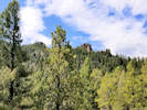 Closest I've gotton to Little Scraggy Peak. Closest I've gotton to Little Scraggy Peak.
|
|
Monday, September 16, 2019
Little Scraggy Peak
|
|
|
2233
|
Field identification: Muhlenbergia montana.
|
Plants of Colorado
Poaceae
Muhlenbergia montana (Nutt.) Hitchc.
Mountain Muhly.
Little Scraggy Peak, Jefferson County, Colorado.
Buffalo Creek Recreation Area, northeast slopes of Little Scraggy Peak, 1.24 km. southwest of the Little Scraggy trailhead, 60 km. south of the GNIS location of Golden
39.3384°N, 105.2662°W.
WGS 1984
Elev. 2436 m.
Also collected here: Antennaria parvifolia, Mertensia lanceolata, Androsace septentrionalis, and Poa fendleriana.
Area generally disturbed by minerals prospecting, fuels reduction, and mountain biking recreation.
Collected by permit: Pike-Isabel National Forest, 2019, issued: Mar 8, 2019, to: Tom Schweich.
|
Tom Schweich
2233. |
16-Sep-2019 |
|
|
|
|
2234
|
Field identification: Dieteria bigelovii.
|
Plants of Colorado
Asteraceae
Dieteria bigelovii (A. Gray) D. R. Morgan & R. L. Hartman.
Bigelow's Tansy Aster.
Little Scraggy Peak, Jefferson County, Colorado.
Buffalo Creek Recreation Area, northeast slopes of Little Scraggy Peak, 1.47 km. southwest of the Little Scraggy trailhead, 60 km. south of the GNIS location of Golden
39.3365°N, 105.2666°W.
WGS 1984
Elev. 2444 m.
Peduncles and phyllaries with glandular hairs.
Variety bigelovii if infraspecific names are to be applied.
Area generally disturbed by minerals prospecting, fuels reduction, and mountain biking recreation.
Collected by permit: Pike-Isabel National Forest, 2019, issued: Mar 8, 2019, to: Tom Schweich.
|
Tom Schweich
2234. |
16-Sep-2019 |
|
|
|
|
2235
|
Field identification: Solidago sp.
|
Plants of Colorado
Asteraceae
Solidago nana Nutt.
Baby Goldenrod.
Little Scraggy Peak, Jefferson County, Colorado.
Buffalo Creek Recreation Area, northeast slopes of Little Scraggy Peak, 1.47 km. southwest of the Little Scraggy trailhead, 60 km. south of the GNIS location of Golden.
39.3355°N, 105.2677°W.
WGS 1984
Elev. 2448 m.
Some characters approach S. nemoralis: rays 5.5 mm. #: (6,6,7), disk fls #: (6,7,6), pappi, 3 mm., cypselae, 1 mm.
Area generally disturbed by minerals prospecting, fuels reduction, and mountain biking recreation.
Collected by permit: Pike-Isabel National Forest, 2019, issued: Mar 8, 2019, to: Tom Schweich.
|
Tom Schweich
2235. |
16-Sep-2019 |
|
|
|
|
|
Field identification: Polygonum sp.
|
Plants of Colorado
Polygonaceae
Polygonum douglasii Greene.
Douglas Knotweed.
Little Scraggy Peak, Jefferson County, Colorado.
Buffalo Creek Recreation Area, northeast slopes of Little Scraggy Peak, 1.65 km. southwest of the Little Scraggy trailhead, 60.1 km. south of the GNIS location of Golden.
39.3355°N, 105.2677°W.
WGS 84
Elev. 2448 m.
Also collected nearby: Senecio spartioides, Solidago nana, and Jamesia americana.
Area generally disturbed by minerals prospecting, fuels reduction, and mountain biking recreation. Same as Coll. No. 2237.1.
Collected by permit: Pike-Isabel National Forest, 2019, issued: Mar 8, 2019, to: Tom Schweich.
|
Tom Schweich
2235.1 |
16-Sep-2019 |
|
|
 Coll. No. 2236, Jamesia americana. Coll. No. 2236, Jamesia americana.
|
2236
|
Field identification: Jamesia americana, in fruit.
|
Plants of Colorado
Hydrangeaceae
Jamesia americana Torr. & A. Gray.
Fivepetal Cliffbush.
Little Scraggy Peak, Jefferson County, Colorado.
Buffalo Creek Recreation Area, northeast slopes of Little Scraggy Peak, 1.70 km. southwest of the Little Scraggy trailhead, 60.1 km. south of the GNIS location of Golden.
39.3352°N, 105.2679°W.
WGS 1984
Elev. 2458 m.
Fruit only.
Also collected nearby: Senecio spartioides, Solidago nana, and Arctostaphylos uva-ursi.
Area generally disturbed by minerals prospecting, fuels reduction, and mountain biking recreation.
Collected by permit: Pike-Isabel National Forest, 2019, issued: Mar 8, 2019, to: Tom Schweich.
|
Tom Schweich
2236. |
16-Sep-2019 |
|
|
|
|
2237
|
Field identification: Senecio spartioides.
|
Plants of Colorado
Asteraceae
Senecio spartioides Torr. & A. Gray.
Broomlike Ragwort.
Little Scraggy Peak, Jefferson County, Colorado.
Buffalo Creek Recreation Area, northeast slopes of Little Scraggy Peak, 1.70 km. southwest of the Little Scraggy trailhead, 60.1 km. south of the GNIS location of Golden.
39.3348°N, 105.2678°W.
WGS 1984
Elev. 2464 M.
Very narrow, filiform leaves compared to those found along the foothills.
Also collected nearby: Jamesia americana, Solidago nana, and Arctostaphylos uva-ursi.
Area generally disturbed by minerals prospecting, fuels reduction, and mountain biking recreation.
Collected by permit: Pike-Isabel National Forest, 2019, issued: Mar 8, 2019, to: Tom Schweich.
|
Tom Schweich
2237. |
16-Sep-2019 |
|
|
|
|
|
|
Plants of Colorado
Polygonaceae
Polygonum douglasii Greene.
Douglas Knotweed.
Little Scraggy Peak, Jefferson County, Colorado.
Buffalo Creek Recreation Area, northeast slopes of Little Scraggy Peak, 1.70 km. southwest of the Little Scraggy trailhead, 60.1 km. south of the GNIS location of Golden.
39.3348°N, 105.2679°W.
WGS 1984
Elev. 2464 m..
Also collected nearby: Jamesia americana, Solidago nana, and Arctostaphylos uva-ursi.
Area generally disturbed by minerals prospecting, fuels reduction, and mountain biking recreation.
Collected by permit: Pike-Isabel National Forest, 2019, issued: Mar 8, 2019, to: Tom Schweich.
|
Tom Schweich
2237.1 |
16-Sep-2019 |
|
|
 Coll. No. 2238, Arctostaphylos uva-ursi Coll. No. 2238, Arctostaphylos uva-ursi
|
2238
|
Field identification: Arctostapylos uva-ursi.
|
Plants of Colorado
Ericaceae
Arctostaphylos uva-ursi (L.) Sprengel.
Bearberry.
Little Scraggy Peak, Jefferson County, Colorado.
Buffalo Creek Recreation Area, northeast slopes of Little Scraggy Peak, northwest base of large granite outcrop, 1.83 km. southwest of the Little Scraggy trailhead, 60.9 km. south of the GNIS location of Golden.
39.3343°N, 105.2684°W.
WGS 1984
Elev. 2493 m.
In fruit. This patch has more fruit than typically seen nearby.
Also collected nearby: Senecio spartioides, Solidago nana, Jamesia americana, and Polygonum douglasii.
Area generally disturbed by minerals prospecting, fuels reduction, and mountain biking recreation.
Collected by permit: Pike-Isabel National Forest, 2019, issued: Mar 8, 2019, to: Tom Schweich.
|
Tom Schweich
2238. |
16-Sep-2019 |
|
|
|
|
2239
|
Field identification: Dieteria bigelovii.
|
Plants of Colorado
Asteraceae
Dieteria bigelovii (A. Gray) D. R. Morgan & R. L. Hartman.
Bigelow's Tansy Aster.
Little Scraggy Peak, Jefferson County, Colorado.
Buffalo Creek Recreation Area, northeast slopes of Little Scraggy Peak, 2.04 km. southwest of the Little Scraggy trailhead, 61.2 km. south of the GNIS location of Golden.
39.3325°N, 105.2685°W.
WGS 1984
Elev. 2517 m.
Area generally disturbed by minerals prospecting, fuels reduction, and mountain biking recreation. Same as Coll. No. 2234.
Collected by permit: Pike-Isabel National Forest, 2019, issued: Mar 8, 2019, to: Tom Schweich.
|
Tom Schweich
2239. |
16-Sep-2019 |
|
|
|
|
2239.1
|
Field identification: Chenopodium sp.
|
Plants of Colorado
Chenopodiaceae
Chenopodium fremontii S. Watson.
Fremont's Goosefoot.
Little Scraggy Peak, Jefferson County, Colorado.
Buffalo Creek Recreation Area, northeast slopes of Little Scraggy Peak, 2.04 km. southwest of the Little Scraggy trailhead, 61.2 km. south of the GNIS location of Golden.
39.3325°N, 105.2686°W.
WGS 1984
Elev. 2517 m.
Leaves, deltate, entire w/ basal lobes, thin, sparsely farinose below; Sepals, #5, farinose. Several stems previously eaten.
Also collected here: Juniperus scopulorum, Dieteria bigelovii, and Symphyotrichum porteri.
Area generally disturbed by minerals prospecting, fuels reduction, and mountain biking recreation.
Collected by permit: Pike-Isabel National Forest, 2019, issued: Mar 8, 2019, to: Tom Schweich.
|
Tom Schweich
2239.1 |
16-Sep-2019 |
|
|
 Coll. No. 2240, Erigeron subtrinervis Coll. No. 2240, Erigeron subtrinervis
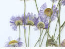 Coll. No. 2240, Erigeron subtrinervis Coll. No. 2240, Erigeron subtrinervis
|
2240
|
Field identification: Erigeron, maybe E. divergens, buds nodding.
|
Plants of Colorado
Asteraceae
Erigeron subtrinervis Rydb. ex Porter & Britton.
Threenerve Daisy.
Little Scraggy Peak, Jefferson County, Colorado.
Buffalo Creek Recreation Area, northeast slopes of Little Scraggy Peak, 2.04 km. southwest of the Little Scraggy trailhead, 61.2 km. south of the GNIS location of Golden.
39.3324°N, 105.2685°W.
WGS 1984
Elev. 2519 m.
Buds nodding, rays 100±, pappus both setae and bristles.
Also collected here: Juniperus scopulorum, Symphyotrichum porteri, Chenopodium fremontii.
Area generally disturbed by minerals prospecting, fuels reduction, and mountain biking recreation.
Collected by permit: Pike-Isabel National Forest, 2019, issued: Mar 8, 2019, to: Tom Schweich.
|
Tom Schweich
2240. |
16-Sep-2019 |
|
Coll. No. 2240, 16 September 2019, characters observed:
Perennial herb, to 40 cm.;
Stem,
hispid
(setose or setulose might better describe the pubescence, but this term rarely used by Colorado authors);
Leaves,
cauline,
alternate,
blade 27 mm. × 3 mm. wide,
reduced distally,
oblanceolate,
entire,
hispid,
eglandular,
tip,
mucronate(-ish);
Heads,
showy,
not overtopped by leaves;
Peduncles,
80-100- mm.;
Involucre,
5 mm. × 10 mm. wide;
Phyllaries,
3± graduated series,
4.5 mm. × 1.2 mm. wide,
lower < rest of involucre,
chartaceous at base, green center, margin scarious,
hispid, glandular,
tips purplish;
Receptacle,
epaleate;
Flowers,
of 2 kinds;
Ray flowers,
#100±,
tube 2.5 mm. + blade 5 mm. × 0.3 mm. wide,
lavender,
sterile (?);
Disk flowers,
many,
tube 1.7 mm. + lobes 0.3 mm.,
expanding gradually,
yellow;
Pappus,
outer crown of dissected scales 0.3-0.4 mm.,
inner capillary bristles 2.5 mm.;
Fruit (cypsela),
1 mm.,
4-angled,
brown
hairy.
|
|
|
2241
|
Field identification: Symphyotrichum porteri.
|
Plants of Colorado
Asteraceae
Erigeron subtrinervis Rydb. ex Porter & Britton.
Threenerve Daisy.
Little Scraggy Peak, Jefferson County, Colorado.
Buffalo Creek Recreation Area, northeast slopes of Little Scraggy Peak, 2.04 km. southwest of the Little Scraggy trailhead, 61.2 km. south of the GNIS location of Golden.
39.3326°N, 105.269°W.
WGS 1984
Elev. 2501 m.
Same as Coll. No. 2240
Also collected here: Juniperus scopulorum, Dieteria bigelovii, and Chenopodium fremontii.
Area generally disturbed by minerals prospecting, fuels reduction, and mountain biking recreation.
Collected by permit: Pike-Isabel National Forest, 2019, issued: Mar 8, 2019, to: Tom Schweich.
|
Tom Schweich
2241. |
16-Sep-2019 |
|
|
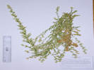 Coll. No. 2242, Laennecia schiedeana Coll. No. 2242, Laennecia schiedeana
|
2242
|
Field identification: Asteraceae, tribe Inuleae?
|
Plants of Colorado
Asteraceae
Laennecia schiedeana (Lessing) G. L. Nesom.
Pineland Marshtail.
Little Scraggy Peak, Jefferson County, Colorado.
Buffalo Creek Recreation Area, northeast slopes of Little Scraggy Peak, 2.04 km. southwest of the Little Scraggy trailhead, 61.2 km. south of the GNIS location of Golden.
39.3325°N, 105.269°W.
WGS 1984
Elev. 2506 m.
Also collected here: Juniperus scopulorum, Chenopodium fremontii, Dieteria bigelovii, and Erigeron subtrinervis.
Area generally disturbed by minerals prospecting, fuels reduction, and mountain biking recreation.
Collected by permit: Pike-Isabel National Forest, 2019, issued: Mar 8, 2019, to: Tom Schweich.
|
Tom Schweich
2242. |
16-Sep-2019 |
|
Coll. No. 2242, 16 Sep 2019, characters observed:
Annual,
75 cm.,
Stem, wispy arachnose,
Leaves,
cauline,
sessile,
auriculate,
blade 26 mm. × 5 mm. wide,
linear,
serrate, denticles spinulose,
stipitate glandular;
Peduncles, 0-4 mm.;
Involucre,
3.5 mm. × 7 mm. wide;
Phyllaries,
in 2 series,
4 mm. × 0.7 mm. wide,
center green, margin scarious,
margins flat,
glandular;
Receptacle, epaleate;
Flowers, of 1 kind;
Disk flowers,
many,
tube 3 mm. + lobes 1 mm.,
yellow,
open,
bisexual;
Pappus,
many,
well-developed bristles,
3.5 mm.,
±equal;
Cypsela,
1.4 mm. × 0.5 mm. wide,
purple,
few glands scattered around the top.
|
|
Literature Cited:
- Schlechtendal, D. de, and AD. de Chamisso, 1830.
|
|
Schlechtendal, D. de, and AD. de Chamisso.
1820
Plantarum Mexicanarum a cel viris Schiede et Deppe Collectarum.
Linnaea : Ein Journal für die Botanik in ihrem ganzen Umfange.
Bd. 5,
p. 145
| Original Text
| Comments
|
|
314. Erigeron Schiedeanum n. sp.
foliis uni
—
aut 3-nervis, alternis, confertissimis, semiamplexicaulibus,
cordatis, auriculis cauli adnatis, linearibus, obtusis
—
acutis, summis exceptis, serratis, serraturis apiceque mucronulatis,
ciliatis, pilosiusculis, creberrimeque glandulosis.
—
E radice fusifirmi, lignosa,
diametro circiter 1½ lineari caules plures adsurgunt erecti,
simplices, 4-10 pollicares, aequaliter foliati.
Folia ½-¾" longa, 1-2'" lata.
Inflorescentia terminata, 3-6 pollicaris racemum simplicem aut compositum fingit,
cujus pedicelli, si simplex, s. pedunculi, si composita est, foliis,
e quorum axillis oriuntur, superantur, caulemque terminat.
— —
In Llanos de Perote, Septbr.
lecta atque cum Conyza sophiaefolia mixta.
|
Llanos de Perote, Veracruz, Mexico.
|
In 1828 Schiede emigrated to Mexico, accompanied by Ferdinand Deppe (1794-1861), a German naturalist with previous experience in the country. The two scientists planned to collect zoological and botanical specimens, which would then be sold to museums and dealers in Europe. In July 1828 they settled in Jalapa, and performed scientific excursions throughout the state of Veracruz. Although they were able sell their collections to museums in Berlin and Vienna, the money earned was insufficient to continue operations, causing Deppe and Schiede to abandon their enterprise in late 1830. Christian Schiede died in Mexico in 1836 at the age of 38 (Wikipedia).
But ... Why is Lessing listed at the species author, and not Schlecht. & Chamisso?
|
|
Literature Cited:
- Cronquist, Arthur, 1943.
|
|
Cronquist (1943) transferred the group Coenotus to Conyza from Erigeron
in the process referring our plant to Conyza Schiedeana with little specific discussion.
| Original Text
| Comments
|
|
Conyza Schiedeana (Less.) Cronquist, nom. nov.
E. Schiedeanus Less. Linn. 5: 145. 1830.
|
|
|
|
Literature Cited:
- Nesom, Guy L., 1990.
|
|
Nesom (1990) ...
| Original Text
| Comments
|
|
Conyza Schiedeana (Less.) Cronquist, nom. nov.
The species of Laennecia are generally characterized by phyllaries with
a single midvein that is greenish rather than orange resinous, deeply
lobed disc corollas and the presence of achenial glands. Most of the
species also heve herbage with a resinous glandular, wooly vestiture.
|
|
|
... Taxonomic notes on L. schiedeana and other species are found in Blake (1917),
Cuatrecasas (1970) and McVaugh (1984)
|
- Blake, S.F. 1917. New and noteworthy Compositae, chiefly Mexican. Contr.
Gray Herb. 52:32. 1917
- Cuatrecasas, J. 1963. Notes on Neotropical Compositae, I. Phytologia 9:1-7.
1969. Conyza. VVebbia 24 (Prima Flora Colombiana. 3. Composi-
tae - Astereae):198-228.
1970. Observaciones sobre Compositae. Anales Esc. Nac. Cienc.
Biol. 18:9-15
- McVaugh, R. 1984. Conyza. Pp. 242-255. In Flora Novo-Galiciana. vol. 12.
Univ. Michigan Press, Ann Arbor.
|
14. Leannecia schiedeana (Less.) Nesom, comb. nov.
BASIONYM: Erigeron schiedeanus Less., Linnaea 5:145. 1830.
Conyza schiedeana (Less.) Cronq., Bull. Torrey Bot. Club 70:632. 1943.
TYPE: Mexico. Veracruz: Llanos de Perote, Sep 1828, Schiede 314
(B, fide Blake, 1917; Isotype seen by McVaugh 1984).
|
| |
|
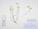 Coll. No. 2243, Crepis capillaris. Coll. No. 2243, Crepis capillaris.
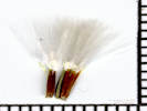 Fruit of Coll. No. 2243, Crepis capillaris Fruit of Coll. No. 2243, Crepis capillaris
|
2243
|
Field identification: Calycoseris?, nope none in Colorado, maybe Crepis sp.
|
Plants of Colorado
Asteraceae
Crepis L.
Hawksbeard.
Little Scraggy Peak, Jefferson County, Colorado.
Buffalo Creek Recreation Area, northeast slopes of Little Scraggy Peak, 2.04 km. southwest of the Little Scraggy trailhead, 61.2 km. south of the GNIS location of Golden.
39.3363°N, 105.2671°W.
WGS 1984
Elev. 2439 m.
ligulate, yellow, only one seen.
Area generally disturbed by minerals prospecting, fuels reduction, and mountain biking recreation.
Collected by permit: Pike-Isabel National Forest, 2019, issued: Mar 8, 2019, to: Tom Schweich.
|
Tom Schweich
2243. |
16-Sep-2019 |
|
|
Plants of Colorado
Asteraceae
Crepis capillaris (L.) Wallr.
Smooth Hawk's-Beard.
Little Scraggy Peak, Jefferson County, Colorado.
Buffalo Creek Recreation Area, northeast slopes of Little Scraggy Peak, 2.04 km. southwest of the Little Scraggy trailhead, 61.2 km. south of the GNIS location of Golden.
39.3363°N, 105.2671°W.
WGS 1984
Elev. 2439 m.
Ligulate, yellow, only one seen.
Area generally disturbed by minerals prospecting, fuels reduction, and mountain biking recreation.
Collected by permit: Pike-Isabel National Forest, 2019, issued: Mar 8, 2019, to: Tom Schweich.
|
Tom Schweich
2243. |
16-Sep-2019 |
|
Coll. No. 2243, 16 September 2019, characters observed:
Annual(?) herb, 30 cm.;
Stem, young, villous;
Leaves,
cauline,
alternate,
auriculate,
petiole, 10-12 mm.,
blade 35 mm. × 5 mm. wide,
reduced distally,
oblanceolate,
tomentose near base,
adaxially glandular hairy,
margin dentate,
tip acute;
Inflorescence,
heads #4-5 per stem,
showy,
not overtopped by leaves;
Peduncles,
35 mm.;
Involucre,
7 mm. × 5 mm. wide;
ovoid;
Phyllaries,
equal,
2 series,
7 mm. × 0.7 mm. wide,
green,
glandular-stipitate,
margins, ±flat;
Flowers of 1 kind;
Ray flowers (ligules),
many,
tube 2.5 mm. + blade 6 mm. × 0.6 mm. wide,
yellow;
Pappus,
simple capillary bristles,
falling as a unit,
4.5 mm.,
±equal,
smooth.
|
|
|
2244
|
Field identification: Brassicaceae, office: Berteroa incana ???
Plants of Jefferson County Open Space
Jefferson County, Colorado
Poaceae
Muhlenbergia montana (Nutt.) Hitchc.
Mountain Muhly.
Lippincott Property, Jefferson County, Colorado.
Northernmost Jefferson County, parcel jointly owned by Jefferson County Open Space and City of Boulder OSMP, approximate centroid of parcel, south end of hill above clay pit, 22.2 km. north northwest of the GNIS location of Golden.
39.903°N, 105.2761°W.
WGS 1984
Elev. 2203 m.
Open ponderosa pine woodlland on steep rocky slope of hogback, also collected nearby: Bromus briziformis and Hesperostipa comata.
Collected by permit: Jefferson County Open Space, 2019, issued: Mar 1, 2019, to: Tom Schweich.
|
Tom Schweich
2245. |
30-Sep-2019 |
|
|
|
|
|
Friday, September 20, 2019
Rocky Mountain National Park.
|
|
Other articles:
• Bear Lake Road:
at South Moraine Rd;
Locations:
Moraine Park.
 Bull elk trapped on the wrong side of the road. Bull elk trapped on the wrong side of the road.
|
|
Elk-watching at Moraine Park.
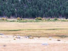
Elk in Moraine Park. |
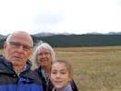
Elk-watching in Moraine Park |
|
|
|
|
Saturday, September 21, 2019
|
|
Other articles:
• Colorado State Highway 66:
East Portal;
• Colorado Trans-Basin Water Transfer:
at East Portal;
Locations:
East Portal.
 East Portal Surge Basin East Portal Surge Basin
|
|
East Portal Surge Basin
|
|
Other articles:
• Toll Memorial Trail:
Toll Memorial;
near end of trail;
on the trail;
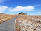 The Toll Memorial Trail The Toll Memorial Trail
 View of Fall River Canyon from the Toll Memorial Trail. View of Fall River Canyon from the Toll Memorial Trail.
|
|
Trail Ridge Road
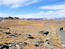
Near the east end of the Toll Memorial Trail. |
|
|
Locations:
Lippincott Ranch.
|
|
Monday, September 30 2019
Lippicott, 1 collection, bugling elk, and flocks of turkeys making a ruckus.
|
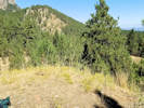 Obs. No. 1626, Obs. No. 1626, Achnatherum Eriocoma sp. ?
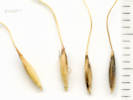 Obs. No. 1625, Obs. No. 1625, Achnatherum Eriocoma sp. ?
 Locations of Obs. No. 1625 and 1626, Locations of Obs. No. 1625 and 1626, Achnatherum Eriocoma sp. ?
|
|
Looked at a number of grasses following a report on presence of Achnatherum scribneri. This one, Obs. No. 1625, looks close but not quite. Same for Obs. No. 1626. If I were forced to pick a name, it would more likely be A. nelsonii rather than A. scribneri.
|
|
|
2245
|
Field identification: Muhlenbergia, maybe M. montana.
Plants of Jefferson County Open Space
Jefferson County, Colorado
Poaceae
Muhlenbergia montana (Nutt.) Hitchc.
Mountain Muhly.
Lippincott Property, Jefferson County, Colorado.
Northernmost Jefferson County, parcel jointly owned by Jefferson County Open Space and City of Boulder OSMP, approximate centroid of parcel, south end of hill above clay pit, 22.2 km. north northwest of the GNIS location of Golden.
39.903°N, 105.2761°W.
WGS 1984
Elev. 2203 m.
Open ponderosa pine woodlland on steep rocky slope of hogback, also collected nearby: Bromus briziformis and Hesperostipa comata.
Collected by permit: Jefferson County Open Space, 2019, issued: Mar 1, 2019, to: Tom Schweich.
|
Tom Schweich
2245. |
30-Sep-2019 |
|
|
|
Other articles:
• Washington Avenue:
Clear Ck;
Locations:
Clear Creek.
 Clear Creek in the Fall. Clear Creek in the Fall.
|
|
Friday, 11 Oct 2019
Clear Creek with turning leaves after a small snow storm.
|
|
|
|
Saturday, 19 October 2019
Lubahn Trail hike.
|
|
Other articles:
• Lubahn Trail (north loop):
along trail;
below plaque;
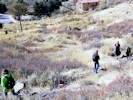 Hikers driving their radio controlled cars down the Lubahn Trial. Hikers driving their radio controlled cars down the Lubahn Trial.
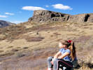 Castle Rock Castle Rock
|
|
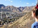
View from Lubahn Trail. |
|
|
Other articles:
• Lubahn Trail (South Loop):
at stairs;
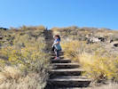 Climbing the stairs to Castle Rock. Climbing the stairs to Castle Rock.
|
|
|
|
Other articles:
• Golden Checklist Flora:
Vegetation;
• Lubahn Trail (South Loop):
Castle Rock;
Locations:
Castle Rock.
Golden.
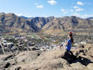 View from the top of Castle Rock. View from the top of Castle Rock.
|
|
Top of Castle Rock
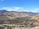
View similar to the historic view of Golden. |
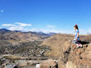
View from the top of Castle Rock. |
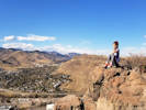
View from the top of Castle Rock. |
|
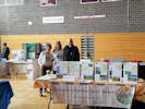 Stewards of Golden Open Space has a table at the Golden Non-Profit Expo. Stewards of Golden Open Space has a table at the Golden Non-Profit Expo.
|
|
Sunday, 20 October 2019
Mary Ann, Judy, and John with the Stewards of Golden Open Space table.
|
|
|
|
Friday, October 25, 2019
Golden, Colorado to Taos, New Mexico.
|
|
Other articles:
• Colorado Highway 17:
at Ln 9N;
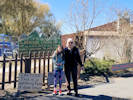 Entrance to Colorado Gators Reptile Park. Entrance to Colorado Gators Reptile Park.
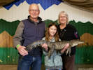 Sofia holds a live gator. Sofia holds a live gator.
|
|
Colorado Gators Reptile Park
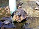
Mixed turtles and gators. |
|
|
Other articles:
• US Highway 285:
35000;
 Welcome to New Mexico Welcome to New Mexico
|
|
At the New Mexico border.
|
|
Other articles:
• US Highway 64:
at bridge;
Locations:
Rio Grande Gorge Bridge.
 Bridge over Rio Grande River. Bridge over Rio Grande River.
|
|
At the Rio Grande Bridge.
|
|
Literature Cited:
- Anderson, D., P. Haseman, and T. Schweich, 2019.
Locations:
Kinney Run.
|
|
Saturday, October 26, 2019
Date of the Kinney Run Tour by Stewards of Golden Open Space.
|
|
Other articles:
• State Road 68:
at Allbright;
Locations:
Taos.
 Launching balloons in Taos. Launching balloons in Taos.
|
|
Balloon launching in Taos
|
|
Other articles:
• Rufina Circle:
at Rufina Lane;
 Creature in Meow Wolf Creature in Meow Wolf
 Undersea garden. Undersea garden.
|
|
Meow Wolf

In Meow Wolf |
On the couch. |

Somewhere inside. |
In a nest. |
|
 In the plaza. In the plaza.
|
|
In Santa Fe.
|
 Hot tub. Hot tub.
|
|
Back at our place.
|
|
|
|
Sunday, October 27, 2019
|
|
Other articles:
• Paseo del Pueblo Norte:
Taos Pueblo;
Locations:
Taos Pueblo.
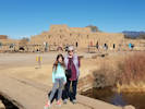 In Taos Pueblo. In Taos Pueblo.
|
|
Taos Pueblo
|
|
Other articles:
• County Road 98:
El Santuario de Chimayo Historic Site;
Locations:
El Santuario de Chimayo Historic Site.
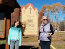 The Sanctuary of Chimayo The Sanctuary of Chimayo
|
|
El Santuario de Chimayo

The Sanctuary of Chimayo |

Sofia at the Sanctuary of Chimayo |

Sofia at the Sanctuary of Chimayo |
|
 Prickly Pear Lemonade Prickly Pear Lemonade
|
|
Lunch at Rancho de Chimayo
|
|
Other articles:
• Washington Avenue:
at arch;
 Trick or Treating in downtown Golden. Trick or Treating in downtown Golden.
|
|
Thursday, October 31, 2019
Trick or Treating in downtown Golden.
|
|
|
|
November, 2019
|
|
Other articles:
• Alley:
bet. Arapahoe & Cheyenne;
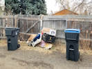 Conditions in the alley, 19 Nov 2019. Conditions in the alley, 19 Nov 2019.
|
|
Tuesday, 19 November 2019
Mess in the alley, again.
|
|
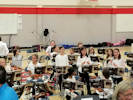 Orchestra concert with Sofia. Orchestra concert with Sofia.
 Orchestra concert with Sofia. Orchestra concert with Sofia.
 Orchestra concert with Sofia. Orchestra concert with Sofia.
|
|
Wednesday, 20 Nov 2019
Sofia's concert.
|
|
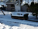 Outdoor Furniture Outdoor Furniture
|
|
Friday, 22 November 2019
Mess in the alley, again.
|
|
Other articles:
• Interstate 70:
146000;
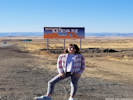 Welcome to Utah Welcome to Utah
|
|
Saturday, 23 November 2019
Golden, CO to Blanding, UT
|
|
|
|
Sunday, 24 November 2019
Blanding, UT to Williams, AZ
|
|
Other articles:
• US Highway 163:
n. of Monument Vy;
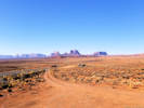 View southwest to Monument Valley View southwest to Monument Valley
|
|
|
|
Other articles:
• US Highway 163:
at AZ/UT border;
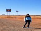 Arizona! Arizona!
|
|
First time in Arizona
|
|
Other articles:
• Arizona Highway 64:
at L Colorado Olook;
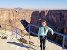 Little Colorado River Gorge Overlook Little Colorado River Gorge Overlook
|
|
Little Colorado River Gorge Overlook
|
|
Other articles:
• Arizona Highway 64:
at Desert View;
Locations:
Desert View.
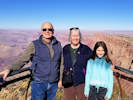 At Desert View At Desert View
|
|
Far View
|
|
Other articles:
• Arizona Highway 64:
at Grandview Pt;
Locations:
Grandview Point.
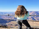 Sofia at Grandview Point Sofia at Grandview Point
|
|
At Granview Point
|
|
Other articles:
• Arizona Highway 64:
Grand Canyon;
Locations:
Grand Canyon.
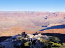 Beyond the rail at Grand Canyon. Beyond the rail at Grand Canyon.
|
|
At Grand Canyon headquarters
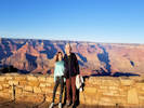
At Grand Canyon |
|
|
|
|
Monday, 25 November 2019
Williams, Arizona to Palmdale, California
|
|
Other articles:
• U. S. Interstate 40:
near Essex Road;
 View north from US Interstate 40. View north from US Interstate 40.
|
|
A view of the eastern Mojave
|
|
Other articles:
• U. S. Interstate 40:
near Newberry Sprs.;
 Dust Storm Dust Storm
 Dust Storm Dust Storm
|
|
Dust storm near Newberry Springs. We had to replace the air filter when we got to Barstow.
|
|
Other articles:
• Yucca Tree Street:
at 38969;
Locations:
Palmdale.
 The Ol' Homestead in 2019. The Ol' Homestead in 2019.
|
|
The Ol' Homestead
|
|
|
|
Tuesday, 26 November 2019
Palmdale to Rancho Santa Margarita.
|
|
Locations:
Hollywood.
 Hollywood Hollywood
 On the casting couch. On the casting couch.
|
|
A visit to Hollywood

Hollywood sign. |

The star of Mickey Mouse. |

Sofia at the Hollywood Sign |
|
 Sofia with
someone! Sofia with
someone!
 Cheryl with Betty White. Cheryl with Betty White.
 Sofia with Penelope Cruz Sofia with Penelope Cruz
|
|
Madame Tussauds Hollywood.

Sofia with Megan Markle and Prince Harry. |

Sofia with Julia Roberts. |

Sofia and
? |

Sofia and
? |

Sofia and Demi Lovato |
Sofia and Charlie Chaplin. |

Sofia in the tub. |
With the mummy. |

With Frankenstein's monster. |

I have no idea what this was. |

Hi Mom! |

John Travolta |

Edward Scissorhands |

The Godfather |

Chatting with Jack |
With E.T. |

Madonna |

Michael Jackson |

Lady Gaga, I presume! |

Bond
James Bond (???) |

? |

With President Obama. |
|
|
Other articles:
• U. S. Interstate 5:
in Irvine;
Locations:
Irvine.
 Palm trees along US I-5 in Irvine. Palm trees along US I-5 in Irvine.
|
|
Hollywood to Rancho Santa Margarita
|
|
|
|
Saturday, 30 November 2019
Willcox, Arizona, to Raton, New Mexico
|
|
Other articles:
• US Interstate 25:
near Albuquerque;
Locations:
Albuquerque.
 Coming into Albuquerque. Coming into Albuquerque.
|
|
Coming into Albuquerque
|
|
Other articles:
• US Interstate 25:
near Santa Fe;
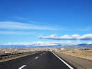 Coming into Santa Fe. Coming into Santa Fe.
|
|
Coming into Santa Fe
|
 Swimming at the Best Western, Raton. Swimming at the Best Western, Raton.
|
|
Raron, New Mexico
|
|
|
|
Sunday, December 1, 2019
Raton, New Mexico to Golden, Colorado
|
|
Other articles:
• County Route 126.:
49000;
• Forest Road 550:
at Little Scraggy Trailhead;
Locations:
North Fork Volunteer Fire Department Station 1.
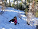 Sledding without sled. Sledding without sled.
|
|
Saturday, December 7, 2019
Annual Tree-Killin' Expedition.
Gormet lunch at North Fork Volunteer Fire Department. |

Our photo with Santa. |
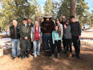
Annual visit with Santa. |
Happy Pearl Harbor Day!
|
|
Other articles:
• Mesa View Way:
480 Mesa View Dr;
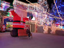 Christmas lights on Mesa View Way. Christmas lights on Mesa View Way.
|
|
Friday, December 13, 2019
|
|
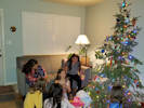 Birthday party! Birthday party!
|
|
Saturday, December 14, 2019
Birthday party!
|
|
Other articles:
• Alley:
bet. Arapahoe & Cheyenne;
 Conditions in the alley, 15 Dec 2019. Conditions in the alley, 15 Dec 2019.
|
|
Sunday, December 15, 2019
|
|
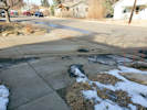 Mud tracked into Arapahoe Street from alley. Mud tracked into Arapahoe Street from alley.
|
|
Wednesday, December 18, 2019
|
 Last day of school; pajama day! Last day of school; pajama day!
|
|
Pajama Day
|
|
Other articles:
• 6th Avenue Trail:
at Triceratops Trail;
• Triceratops Trail:
at 6th Ave Trail;
at Info Kiosk;
above clay pit;
Clay Mining;
72000;
Interp. Shed south;
Interp. Shed north;
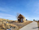 Beginning of Triceratops Trail on the 6th Avenue Trail. Beginning of Triceratops Trail on the 6th Avenue Trail.
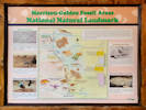 Morrison-Golden Fossil Areas National Natural Landmark Morrison-Golden Fossil Areas National Natural Landmark
|
|
Saturday, December 21st
Walked the Triceratops Trail so that I can map it.
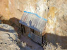
View of clay pit display from overlook. |
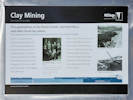
Clay Mining interpretive panel. |
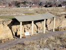
Shed over interpretive site. |
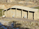
Shed over interpretive site. |
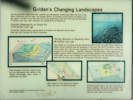
Golden's Changing Landscapes, Panel #1 |
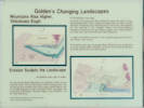
Golden's Changing Landscapes, Panel #2 |
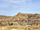
Castle Rock from Triceratops Trail |
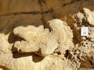
Triceratops Track |
Bird track. |
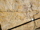
Palm fronds. |
Welcome to Triceratops Trail. |
|
|
|
|
Tuesday, 24 December 2019
|
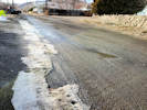 Muddy alley, 24 Dec 2019. Muddy alley, 24 Dec 2019.
|
|
|
 Sofia signs Maja's wall. Sofia signs Maja's wall.
|
|
|
|
 Christmas Dinner, 2019 Christmas Dinner, 2019
 Post-dinner electronics check. Post-dinner electronics check.
|
|
Wednesday, 25 December 2019
|
|
 Olives in Frankfurt. Olives in Frankfurt.
 The hazards of flying with grandpa. The hazards of flying with grandpa.
|
|
Friday, 27 December 2019
Frankfurt to Madrid
|
|
 Ian and Nico at the pista. Ian and Nico at the pista.
 Nico learned to ride a bike the day before we arrived. Nico learned to ride a bike the day before we arrived.
 Sofia at the pista, happy to be home. Sofia at the pista, happy to be home.
|
|
Saturday, 28 December 2019
|
|
 The gardens. The gardens.
 In the gardens. In the gardens.
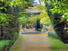 In the gardens. In the gardens.
|
|
Monday, 30 December 2019
Visit to the Palace of the Countess of Lebrija
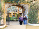
A gate. |
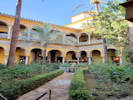
The patio. |
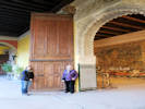
Door to the dining hall. |
The private chapel. |
|
|
|
|
Chumley collections near Buffalo Creek
| Monday, June 19, 1995 | 50
| | Wednesday, June 21, 1995 | 62
| | Wednesday, July 19, 1995 | 82
| | Wednesday, June 5, 1996 | 59
| | Saturday, August 10, 1996 | 83
|
|
|
|
|
The following summary was written on March 1, 2020, but is attached to the 2019 Field Notes here because it refers specifically to 2019 collections.
|
|
|
|
Summary of Plant Collections 2019
This is a combined summary of my 2019 plant collections for each agency that granted a scientific collections permit.
|
|
Locations:
Lippincott Ranch.
|
|
City of Boulder Open Space and Mountain Parks
The Lippincott parcel in northernmost Jefferson County is jointly owned by City of Boulder Open Space and Mountain Parks, and Jefferson County Open Space. It was acquired in 2018 and is not yet open to the public.
Collections made in the Lippincott parcel were distributed to both agencies and to Denver Botanic Garden (KHD). In addition, Boulder OSMP issued a permit to cross the adjacent Lindsay/Jeffco parcel and to collect there.
There were 116 collections made in the Lippincott parcel that resulted in 95 vouchers distributed to the City of Boulder Herbarium (CIBO). I made three collections in the Lindsay/Jeffco parcel, all of which were in sight of the Lippincott fence.
|
|
Literature Cited:
- Ackerfield, Jennifer, 2015.
- Brunquist, E. H., 1966.
- SEINet, 2019+.
- Shaw, Robert B., 2008.
- Weber, William A., and Ronald C. Wittmann, 2012.
Other articles:
• Ford Street:
at bend in road;
Locations:
Apex Gulch.
Dakota Ridge.
Deadman Gulch.
Heritage Dells.
North Table Mountain.
Schweich Hill.
|
|
City of Golden
On City of Golden parcels, I collected plants at Apex Gulch, Dakota Ridge, Deadman Gulch, Heritage Dells, North Table Mountain, and North Washington Open Space. I made forty collections that yielded 129 vouchers, the largest number being send to Denver Botanic Garden (KHD, 28 vouchers), Cal Poly State University (OBI, 18 vouchers), and Regis University (18 vouchers).
I made one interesting collection on Dakota Ridge, of Nuttallanthus texanus (Scheele) D. A. Sutton. [Syn: Linaria canadensis (L.) Dum.-Cours. var. texana (Scheele) Pennell] with common names of Blue Toadflax and Texas Toadflax. There is only one other collection from Golden. It was made more than 100 years ago by Francis W. Pennell, August 11, 1915, along the railroad tracks just west of Golden. In 2003 Loraine Yeatts collected the plant at White Ranch Open Space Park.
In connection with the Peabody Museum excavation of the Magic Mountain Archeological site in 1959-1960, E. H. Brunquist (1966) and others from the Denver Museum of Natural History surveyed the nearby area for plants. Their list numbers 185 species. This systematic collection serves as a benchmark. Re-collecting the area would provide some data about movement of plants into the area, or extirpation of plants. There are some taxonomic issues that require analysis beyond the scope of this report to resolve. Regardless, five taxa were found in 2019 that were not collected in 1959-1960. They are:
- Centaurea diffusa Lam. White Knapweed. A Colorado Noxious Weed on List B.
- Berteroa incana (L.) DC. Hoary Alyssum. A native of Eurasia.
- Nasturtium officinale R. Br. Watercress. May or not be native, Colorado authors differ in their assessment.
- Ligustrum vulgare L. Privet. An escapee from cultivation, native of Europe.
- Potentilla recta L. Sulphur Cinquefoil. A Colorado Noxious Weed on List B, and common along the Front Range. Native of Eurasia.
There are not enough modern collections from the area to begin a list of possible extirpations.
Fourteen collections were made at North Washington Open space, adding ten taxa to the list of plants found there. The total number of taxa is now 126, of which 79 are native to Colorado, 44 are alien, and 3 are undetermined as to nativity. Revision of my document Botanical Resources of the North Washington Open Space, Golden, Colorado for 2019 collections is the next item on my list after this document.
The construction of the condominiums at 410-416 North Ford Street bled over into the North Washington Open Space. The soil was disturbed, construction debris was dumped, and construction equipment was stored on the city-owned parcel. At completion of construction the construction debris and equipment were removed. The disturbed area was covered with a jute mat, and the area seeded. Based upon actual collections, the primary species seeded was Bromus carinatus Hook. & Arn. California brome. Colorado flora authors disagree whether California brome is native to the state (Shaw, 2008, and Ackerfield, 2015) or whether it is an alien grass (Weber & Wittmann, 2012). Regardless, there are no historic or recent collections of this grass made in Golden (SEINet, 2019). The closest old collection is an early 20th century collection from Mount Morrison (Bethel & Clokey #3998, 3 Jun 1921). There were no collections of B. carinatus when the Magic Mountain area was extensively collected E. H. Brunquist in 1959-1960 (Brunquist, 1966), nor were there any collections from South Table Mountain when that mesa was collected by Loraine Yeatts in 1983-1984 (SEINet, 2019).
Therefore, I think it is fair to say that the planting of the grass as construction remediation represents introduction of an alien grass to Golden, if not to Colorado. In addition, the seed was contaminated by Triticum aestivum L. Wheat as several specimens of that taxon were collected with the California brome. None of this was necessary, as there are numerous native grasses already growing in the North Washington Open Space that are easy to obtain and grow from seed.
|
|
Locations:
Colorado School of Mines Survey Field.
|
|
Colorado School of Mines
I crossed the Survey Field numerous times on my way to or from City of Golden or Jefferson County Open space properties. As it turns out I made several collections in the southeast corner that plotting of GPS data showed to be on the adjacent City of Golden parcel. So, officially, I can only count five collections in the Survey Field, from which 17 specimens were prepared. They were distributed to California Department of Agriculture, Denver Botanic Garden, California Academy of Sciences, and University of Colorado Boulder.
|
|
Literature Cited:
- Baldwin, Bruce G., Douglas H. Goldman, David J. Keil, Robert Patterson, and Thomas J. Rosatti, 2012.
- SEINet, 2019+.
Locations:
Lippincott Ranch.
North Table Mountain Park.
Ranson/Edwards Homestead Open Space Park.
Tin Cup Ridge.
|
|
Jefferson County Open Space
One hundred and seventy-five collections were made at four different properties: Lippincott parcel, North Table Mountain Park, Ranson/Edwards Homestead Open Space, and Tin Cup Ridge. These collections yielded 601 specimens that were distributed to Jefferson County Open Space (140 mounted vouchers), Denver Botanic Garden (KHD, 129 specimens), City of Boulder (CIBO, 96 specimens), etc.
At Lippincott one interesting collection was my #2150 of Hieracium albiflorum Hook. White-Flower Hawkweed. This taxon is known from Boulder County, but this appears to be the first collection from Jefferson County (SEINet, 2019). The collection was made in the southwest corner of the parcel in deep ponderosa pine woodland duff with a very sparse understory. Vouchers were distributed to JCOS, KHD and CIBO.
I also collected a small non-native forget-me-not, Myosotis sp., applying M. micrantha Pall. ex Lehm.because the inflorescence greatly exceeds the leaves and the plant is floriferous nearly to the base. Also, the hairs are hooked on the abaxial mid-rib of the leaves, a character only described for M. micrantha (Baldwin, et al., 2012). There are no other known collections from Colorado (SEINet, 1 March 2020). The voucher is at Denver Botanic Garden (KHD).
|
|
Locations:
Little Scraggy Peak.
Trout Creek Pass.
|
|
Pike San Isabel National Forest
In 2019, I collected twice in the Buffalo Creek Recreation Area on the northeast slopes of Little Scraggy Peak. Nearby areas were extensively collected by Timothy W. Chumley in 1995 and 1996, with a total of 336 collections, all of which are at RM. I also made one short stop near Trout Creek Pass, for as long as my family could stand it. Neither of these are the most exciting places to collect. However, the 39 collections yielded 129 vouchers that were sent to Denver Botanic Garden (KHD, 32 specimens), California State Polytechnic University (OBI, 23 specimens) , University of California Riverside (UCR, 19 specimens), California Academy of Sciences (CAS, 13 specimens), etc. These will all be new specimens to those herbaria from this part of Jefferson County and valuable additions to their collections.
|
|
|
|
Plans for 2020
I generally plan to continue collecting in the same areas. For the City of Golden, the North Washington Open Space is well-collected, so my activities there will primarily consist of checking for things I might have missed. More trips should be directed toward other parcels, such as Kinney Run and perhaps Dakota Ridge in the north.
For Colorado School of Mines Survey Field, my list of collections is at 94 taxa. I estimate it should be around 200 taxa based on the landscape and the sizes of the two primary parcels, so there is some more work to be done there.
For Jefferson County Open Space, the Lippincott parcel still needs some work. This work would be combined with City of Boulder Open Space and Moutain Parks. At Ranson/Edwards there is one species of milkweed that has been seen and needs to be vouchered. It may be time branch out to some other areas as well.
In the Pike San Isabel National Forest, I plan to continue working over the Little Scraggy Peak area, expanding a little into surrounding areas. I would also like to return to the Leadville Tennessee Pass area, especially the West Tennessee Creek basin. I think there are still some interesting things to find there.
|
|
|
|
| Permitting Agency |
State |
County |
Location |
Number of
Collections |
Number of
Vouchers |
Other |
CAS |
CDA |
CIBO |
COLO |
CS |
EIU |
JCOS |
KHD |
OBI |
REGIS |
UC |
UCR |
Zzyzx |
| Previous Years Collections |
1909 |
4525 |
141 |
601 |
158 |
0 |
152 |
194 |
151 |
486 |
702 |
309 |
14 |
927 |
519 |
104 |
| 2019 Collections |
| |
| City of Boulder OSMP |
|
|
|
|
|
|
|
|
|
|
|
|
|
|
|
|
| |
Colorado |
Jefferson |
Lindsay/JEFFCO |
3 |
12 |
|
1 |
|
3 |
|
|
|
2 |
3 |
2 |
|
|
1 |
|
| |
| City of Golden |
| |
Colorado |
Jefferson |
Apex Gulch |
7 |
28 |
|
1 |
3 |
|
2 |
2 |
|
5 |
6 |
4 |
2 |
|
3 |
|
| |
Colorado |
Jefferson |
Dakota Ridge |
1 |
2 |
|
|
|
|
1 |
|
|
|
1 |
|
|
|
|
|
| |
Colorado |
Jefferson |
Deadman Gulch |
9 |
21 |
|
|
|
|
1 |
1 |
1 |
|
8 |
4 |
3 |
1 |
2 |
|
| |
Colorado |
Jefferson |
Heritage Dells |
1 |
6 |
|
|
1 |
1 |
1 |
|
|
1 |
1 |
1 |
|
|
|
|
| |
Colorado |
Jefferson |
North Table Mountain |
8 |
24 |
|
3 |
1 |
|
|
1 |
2 |
2 |
3 |
4 |
4 |
2 |
2 |
|
| |
Colorado |
Jefferson |
North Washington Open Space |
14 |
48 |
|
1 |
7 |
|
7 |
4 |
2 |
1 |
9 |
5 |
9 |
1 |
2 |
|
| |
Subtotal for City of Golden |
40 |
129 |
0 |
5 |
12 |
1 |
12 |
8 |
5 |
9 |
28 |
18 |
18 |
4 |
9 |
|
| |
| Colorado School of Mines |
| |
Colorado |
Jefferson |
Colorado School of Mines Survey Field |
5 |
17 |
|
2 |
5 |
|
2 |
|
|
|
4 |
1 |
1 |
1 |
1 |
|
| |
| Jefferson County Open Space |
| |
Colorado |
Jefferson |
Lippincott Property |
116 |
411 |
6 |
12 |
10 |
95 |
17 |
5 |
6 |
97 |
87 |
34 |
25 |
2 |
15 |
|
| |
Colorado |
Jefferson |
North Table Mountain Park |
8 |
26 |
|
2 |
1 |
|
2 |
1 |
|
6 |
6 |
3 |
3 |
1 |
1 |
|
| |
Colorado |
Jefferson |
Ranson/Edwards Homestead Open Space Park |
37 |
111 |
1 |
5 |
7 |
1 |
5 |
2 |
1 |
23 |
22 |
21 |
9 |
3 |
11 |
|
| |
Colorado |
Jefferson |
Tin Cup Ridge |
14 |
53 |
|
3 |
1 |
|
5 |
3 |
1 |
14 |
14 |
6 |
3 |
|
3 |
|
| |
Subtotal for Jefferson County Open Space |
175 |
601 |
7 |
22 |
19 |
96 |
29 |
11 |
8 |
140 |
129 |
64 |
40 |
6 |
30 |
|
| |
| Pike-Isabel National Forest |
| |
Colorado |
Chaffee |
Trout Creek Pass |
7 |
26 |
|
5 |
|
|
|
|
|
|
7 |
6 |
3 |
|
5 |
|
| |
Colorado |
Jefferson |
Little Scraggy Peak |
32 |
103 |
3 |
8 |
3 |
1 |
12 |
3 |
3 |
2 |
25 |
17 |
7 |
4 |
14 |
|
| |
Subtotal for Pike-San Isabel National Forest |
39 |
129 |
3 |
13 |
3 |
1 |
12 |
3 |
3 |
2 |
32 |
23 |
10 |
4 |
19 |
|
| |
| Total for 2019 Collections |
262 |
888 |
10 |
43 |
39 |
101 |
55 |
22 |
16 |
153 |
196 |
108 |
69 |
15 |
60 |
|
| Grand Total for All Collections |
2171 |
5413 |
151 |
644 |
197 |
101 |
207 |
216 |
167 |
639 |
898 |
417 |
83 |
942 |
579 |
104 |
|
|
|
|
[Previous Page]
[Next Page]
Go to page: [1800s] [1900s] [1910s] [1920s] [1930s] [1940s] [1950s] [1960s] [1970s] [1980s] [1990] [1991] [1992] [1993] [1994] [1995] [1996] [1997] [1998] [1999] [2000] [2001] [2002] [2003] [2004] [2005] [2006] [2007] [2008] [2009] [2010] [2011] [2012] [2013] [2014] [2015] [2016] [2017] [2018] [2019] [2020] [2021] [2022] [2023] [2024] [A]
|
|
If you have a question or a comment you may write to me at:
tomas@schweich.com
I sometimes post interesting questions in my FAQ, but I never disclose your full name or address.
|
[Home Page] [Site Map]
Date and time this article was prepared:
7/13/2024 8:10:57 AM
|
 Eastern Mojave Vegetation