Eastern Mojave Vegetation
Tom Schweich
|
Eastern Mojave Vegetation | Collector's List for Tom Schweich |
|
Tom Schweich |
|

|
|
|
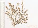
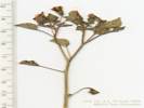
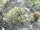
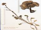
Name List: Salazaria mexicana
2.2 Salazaria mexicana Torrey.
in "Woods Wash," i.e., that portion of Black Canyon Wash on the south side of the Woods Mountains (35.0299,-115.3492,WGS1984) Small fragment.
4/16/1993
Woods Mountains, San Bernardino County, California.
|
Black Canyon Road - Mojave National Preserve:
Woods Mtns Petroglyphs.
Field Notes:
Coll. No. 2.3.
|
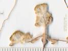
Name List: Ambrosia salsola var. salsola
2.3 Ambrosia salsola (Torr. & A. Gray) Strother & B. G. Baldwin var. salsola.
in "Woods Wash," i.e., that portion of Black Canyon Wash on the south side of the Woods Mountains (35.0299,-115.3492,WGS 1984.) (Insufficient material for voucher.)
4/16/1993
Woods Mountains, San Bernardino County, California.
|
Black Canyon Road - Mojave National Preserve:
Woods Mtns Petroglyphs.
Field Notes:
Coll. No. 3.1.
|
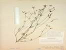
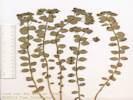
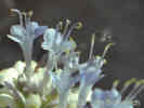
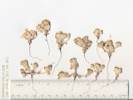
Name List: Verbena gooddingii
3.1 Verbena gooddingii Briq.
In "Woods Wash," i.e., that portion of Black Canyon Wash on the southwest side of the Woods Mountains, 2.3 miles east southeast of the intersection of Black Canyon Road and Wild Horse Canyon Road. (35.0265,-115.3498,WGS 1984.)
4/16/1993
Woods Mountains, San Bernardino County, California.
(UC
)
|
Comments: 9 Sep 2013, Coll. No. 3.1, 16 Apr 1993, characters observed while keying: Annual/perennial unknown, perennial assumed, subshrub, soft-hairy; Leaves, opposite, petiole 12 mm., blade 33 mm., lobed at base, toothed; Calyx, 8 mm., cylindric, 5-toothed, hairs spreading; Corolla, petals fused, radial, 12 mm., throat hairy, 5-lobed, limb 7 mm., blue; Ovary, 4-chambered.
Black Canyon Road - Mojave National Preserve:
Woods Mtns Petroglyphs.
Field Notes:
Coll. No. 3.4.
|
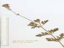
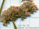
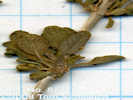
Name List: Phacelia fremontii
3.4 Phacelia fremontii Torr.
in "Woods Wash," i.e., that portion of Black Canyon Wash on the south side of the Woods Mountains (35.0299,-115.3491,WGS1984) Some dimensions and counts are small for P. fremontii; however, I this this is an early, small specimen.
4/16/1993
Woods Mountains, San Bernardino County, California.
(Zzyzx s.n.
)
|
Comments: 3 Jan 2012, Coll. No. 3.4, keyed 3 Jan 2013, characters observed: Annual, 11 cm., from slender taproot; Stem hairy to glandular-hairy distally; Leaf 6 mm., blades deeply pinnately lobed; Inflorescence coiled; Bracts 5 mm., entire, tip rounded, glandular-hairy; Corollas funnelform, 12 mm. x 10 mm. dia, deciduous in fruit Ovary 2 mm., hairy; Style 4.5 mm, forked; Stamens included; Seeds few. I think this is an early, small P. fremontii.
Black Canyon Road - Mojave National Preserve:
Woods Mtns Petroglyphs.
Field Notes:
Coll. No. 4.1.
|
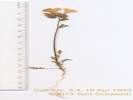
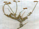
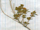
Name List: Gilia
4.1 Gilia .
In "Woods Wash," i.e., that portion of Black Canyon Wash on the south side of the Woods Mountains (35.0299,-115.3492,WGS1984) (Keys like a large G. minor, but fine details of corolla throat markings have faded.)
4/16/1993
Woods Mountains, San Bernardino County, California.
(Zzyzx s.n.
)
|
Comments: 2 Jan 2013, Coll. No. 4.1, keyed 2 Jan 2013, characters observed: Annual to 32 cm.; Stem ascending, glandular in distal half; Leaves, rosette and cauline, deeply pinnately lobed; Basal and lower leaves, 50 mm., hairs non-glandular, cob-webby; Cauline leaves alternate, terminal lobe �= lateral lobes; Inflorescence open cyme, not in heads; Pedicels varying, 1-12 mm.; Calyx 3 mm in flower, to 5 mm in fruit, lobes equal, glandular, membrane not spout-like distally; Corolla funnel-shaped, 8-9 mm., radial, lobes < tube, tube purple to mid-throat, no spots; Stigma, 0.7 mm., = stamens, forked; Stamens 5, equal; Filaments 6-7 mm., free distal 1 mm.; Seeds, many per chamber, light brown, gelatinous when wet. Keys to a large G. minor but fine details of corolla throat colors have faded.
Black Canyon Road - Mojave National Preserve:
Woods Mtns Petroglyphs.
Field Notes:
Coll. No. 4.3.
|
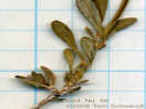
Name List: Physalis crassifolia
4.3 Physalis crassifolia Benth.
in "Woods Wash," i.e., that portion of Black Canyon Wash on the south side of the Woods Mountains (35.0299,-115.3492,WGS1984) Small fragment, without fruiting material.
4/16/1993
Woods Mountains, San Bernardino County, California.
|
Comments: 15 Sep 2013, Coll. No. 4.3, 16 April 1993, characters observed while keying: Annual/perennial unknown, subshrub; Hairs, dense, short, unbranched, glandular; Stem ridged; Leaf, petiole 8-10 mm, blade 11 mm, ovate, margin wavy; Pedicel 7 mm; Calyx, in flower 4 mm, in fruit unknown; Corolla, 7 mm, yellow Fruit unknown.
|
Name List: Nicotiana obtusifolia
7.1 Nicotiana obtusifolia Martens & Galeotti.
In "Woods Wash," i.e., that portion of Black Canyon Wash on the south side of the Woods Mountains, near Hole in the Wall, and about 2.5 miles east southeast of the intersection of Wild Horse Canyon Road with Black Canyon Road. (35.0264,-115.3475,WGS 1984.)
4/16/1993
Woods Mountains, San Bernardino County, California.
(UC
)
|
Black Canyon Road - Mojave National Preserve:
Woods Mtns Petroglyphs.
Field Notes:
Coll. No. 8.2.
|
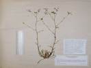
Name List: Acmispon rigidus
8.2 Acmispon rigidus (Benth.) Brouillet.
In "Woods Wash," i.e., that portion of Black Canyon Wash on the south side of the Woods Mountains, 2.8 miles east southeast of the Hole-in-the-Wall Information Center. (35.0263,-115.3510,WGS 1984.)
4/16/1993
Woods Mountains, San Bernardino County, California.
(Zzyzx s.n.
)
|
Comments: 29 Nov 2012, Coll. No. 8.2, keyed 29 Nov 2012, characters observed: Perennial shrub or subshrub, to 40 cm., unarmed; Stem glabrous; Stipules gland-like; Leaves ternate, axis 3-4 mm.; Leaflets 3, not gland-dotted, few hairs, appressed, leaflet length 5x width; Inflorescence umbel, 1-3 flowered; Calyx conspicuous, strigose; Sepals fused > 1/2 length; Flower bilateral; Corolla conspicuous, 10 mm.; Stamens many fused, 1 free; Fruit indehiscent (expected to be dehiscent, perhaps insufficiently mature), flat.
Field Notes:
Coll. No. 8.3.
|
Name List: Dichelostemma capitatum ssp. capitatum
8.3 Dichelostemma capitatum (Benth.) Alph. Wood ssp. capitatum.
in "Woods Wash," i.e., that portion of Black Canyon Wash on the south side of the Woods Mountains (35.0298,-115.3491,WGS1984) Insufficient material for herbarium voucher.
4/16/1993
Woods Mountains, San Bernardino County, California.
| Comments: 15 August 2012, Collection No. 8.3, 15 August 2012, characters observed while keying: Geophyte, scapose, > 30 cm., Scape straight, Bracts 12 mm., purple, Pedicels 4 mm., Perianth 17 mm., parts fused at base, tube not narrowed above ovary, Stamens 6, 3 larger, 3 smaller, Filaments forming a crown-like tube outside anthers.
|
Name List: Lepidium
10. Lepidium .
4/16/1993
, (No county information available.), (No state information available.)
|
|
Name List: Salvia columbariae
12. Salvia columbariae Benth.
4/16/1993
, (No county information available.), (No state information available.)
|
California Highway 178:
in Freeman Cyn.
Field Notes:
Coll. No. 14.
|
Name List: Salvia dorrii var. pilosa
14. Salvia dorrii (Kellogg) Abrams var. pilosa (A. Gray) J. L. Strachan & Rev.
Along California Highway 178, 3 km southeast of Walker Pass. (35.6493,-117.9975,WGS1984) Common in wash.
5/20/1993
Walker Pass, Kern County, California.
(UC1953387‡
)
|
Bonanza King Road:
at Bonanza King Cyn.
Field Notes:
Coll. No. 15.
|
Name List: Dudleya saxosa ssp. aloides
15. Dudleya saxosa (M. E. Jones) Britton & Rose ssp. aloides (Rose) Moran.
Mouth of the canyon. (34.9812,-115.5081,WGS1984) Occasional, in crevice of limestone outcrop.
5/25/1993
Bonanza King Canyon, San Bernardino County, California.
(UC1953413‡
)
|
Wild Horse Canyon Road - Mojave National Preserve:
near Wild Horse Mesa.
Effects of the Hackberry Complex Fire in Mojave National Preserve, June 22-25, 2005.:
330350.
Field Notes:
Coll. No. 16.
20060607220.
|
Name List: Quercus chrysolepis
16. Quercus chrysolepis Liebm.
North slope of Wild Horse Mesa.With Amelanchier utahensis, Garrya flavescens, Juniperus osteosperma, Pinus monophylla, and Rhamnus ilicifolia. Rare.
5/25/1993
Wild Horse Mesa, San Bernardino County, California.
(UC(TAS)
)
|
|
Name List: Keckiella antirrhinoides ssp. microphylla
17. Keckiella antirrhinoides (Benth.) Straw ssp. microphylla (A. Gray) N. Holmgren.
With Juniperus osteosperma and Pinus monophylla. Rare, small colony in joints of welded tuff.
5/25/1993
Lobo Point, San Bernardino County, California.
(UC(TAS)
)
|
|
Name List: Krameria erecta
18. Krameria erecta Schultes.
With Coleogyne ramosissima and Juniperus osteosperma. Rare.
5/26/1993
Lobo Point, San Bernardino County, California.
(Zzyzx s.n.
)
|
|
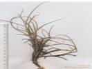
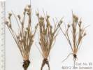
Name List: Woodsia
19. Woodsia .
Rare, in shaded rock crevices on north slopes.
5/26/1993
Lobo Point, San Bernardino County, California.
(UC(TAS)
)
|
|
Name List: Penstemon eatonii ssp. eatonii
20. Penstemon eatonii A. Gray ssp. eatonii.
With Pinus monophylla. Occasional, on north slopes.
5/26/1993
Lobo Point, San Bernardino County, California.
(UC(TAS)
)
|
|
Name List: Physalis acutifolia
21. Physalis acutifolia (Miers) Sandw.
With Juniperus osteosperma. Occasional, in shaded places.
5/26/1993
Lobo Point, San Bernardino County, California.
(UC(TAS)
, Zzyzx s.n.
)
|
|
Name List: Delphinium parishii ssp. parishii
22. Delphinium parishii A. Gray ssp. parishii A. Gray.
With Pinus monophylla. Occasional, on shaded slopes.
5/26/1993
Lobo Point, San Bernardino County, California.
(Zzyzx s.n.
)
|
|
Name List: Asclepias erosa
23. Asclepias erosa Torrey.
Rare, on alluvial soil.
5/27/1993
Lobo Point, San Bernardino County, California.
(Zzyzx s.n.
)
|
|
Name List: Dalea searlsiae
24. Dalea searlsiae (A. Gray) Barneby.
Rare, in wash, at the water tank north of Wild Horse Mesa.
5/27/1993
Wild Horse Mesa, San Bernardino County, California.
(Zzyzx s.n.
)
|
|
Name List: Frasera albomarginata
25. Frasera albomarginata S. Watson.
North slope, on Winkler Fm., Tertiary lacustrine limestone. (35.0471,-115.4584,WGS1984)
5/27/1993
Wild Horse Mesa, San Bernardino County, California.
(Zzyzx s.n.
)
|
|
Name List: Fraxinus anomala
26. Fraxinus anomala S. Watson.
North slope.With Garrya flavescens, Pinus monophylla, and Rhamnus ilicifolia. Occasional.
5/27/1993
Wild Horse Mesa, San Bernardino County, California.
(Zzyzx s.n.
)
| Comments: 8/25/2002, When I went to file this specimen, I discovered it was incorrectly determined as Amelanchier utahensis. Need to print a new label, steam the old one off and replace it.
|
Name List: Mirabilis laevis var. villosa
27. Mirabilis laevis (Benth.) Curran var. villosa (Kellogg) Spellenb.
Under Juniperus osteosperma. Occasional.
5/27/1993
Lobo Point, San Bernardino County, California.
(Zzyzx s.n.
)
|
|
Name List: Ribes velutinum
28. Ribes velutinum E. Greene.
Jackass Canyon (36.5383,-117.5423,WGS1984) Thicket.
5/18/1995
Hunter Mountain, Inyo County, California.
(UC1953414‡
)
|
|
Name List: Eriogonum wrightii
29. Eriogonum wrightii Torr. ex Benth.
Under Pinus monophylla. Occasional.
4/29/1996
Lobo Point, San Bernardino County, California.
(UC(TAS)
, Zzyzx s.n.
)
|
|
Name List: Ambrosia eriocentra
30. Ambrosia eriocentra (A. Gray) Payne.
In washes with Prunus fasciculata. Common.
4/29/1996
Lobo Point, San Bernardino County, California.
(Zzyzx s.n.
)
|
|
Name List: Artemisia ludoviciana
31. Artemisia ludoviciana Nutt.
In woodland with Pinus monophylla and Rhus trilobata. Uncommon.
4/29/1996
Lobo Point, San Bernardino County, California.
(Zzyzx s.n.
)
|
|
Name List: Baccharis sergiloides
32. Baccharis sergiloides A. Gray.
In wash near Lobo Point. Uncommon.
4/29/1996
Lobo Point, San Bernardino County, California.
(UC(TAS)
, Zzyzx s.n.
)
|
|
Name List: Ephedra viridis
33. Ephedra viridis Cov.
In woodland under Pinus monophylla. Common.
4/29/1996
Lobo Point, San Bernardino County, California.
(UC(TAS)
, Zzyzx s.n.
)
|
|
Name List: Symphoricarpos longiflorus
35. Symphoricarpos longiflorus A. Gray.
In shade beside wash with Pinus monophylla and Rhus trilobata. Uncommon.
4/29/1996
Lobo Point, San Bernardino County, California.
|
|
Name List: Rhus trilobata
36. Rhus trilobata Nutt.
In woodland with Pinus monophylla. Common.
4/29/1996
Lobo Point, San Bernardino County, California.
(UC(TAS)
, Zzyzx s.n.
)
|
|
Name List: Lycium
37. Lycium .
Uncommon.
4/29/1996
Lobo Point, San Bernardino County, California.
(Zzyzx s.n.
)
|
|
Name List: Purshia tridentata var. glandulosa
38. Purshia tridentata (Pursh) DC. var. glandulosa (Curran) M. E. Jones.
In scrub and woodland with Pinus monophylla and Juniperus osteosperma. Common.
4/29/1996
Lobo Point, San Bernardino County, California.
(Zzyzx s.n.
)
|
|
Name List: Ericameria linearifolia
39. Ericameria linearifolia (DC.) Urb. & J. Wussow.
In scrub and woodland. Common.
4/29/1996
Lobo Point, San Bernardino County, California.
(Zzyzx s.n.
)
|
|
Name List: Ericameria cuneata
40. Ericameria cuneata (A. Gray) McClatchie.
In rocks. Common.
4/29/1996
Lobo Point, San Bernardino County, California.
(UC(TAS)
, Zzyzx s.n.
)
|
|
Name List: Fallugia paradoxa
41. Fallugia paradoxa (D. Don) Endl.
2.7 km northwest of Hole-in-the-Wall, 14.7 km northeast of Mitchell Caverns.Alongside washes. Uncommon.
4/29/1996
Lobo Point, San Bernardino County, California.
(UC(TAS)
, Zzyzx s.n.
)
|
|
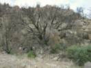
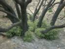
Name List: Quercus chrysolepis
42. Quercus chrysolepis Liebm.
In sheltered valley on north slope of Wild Horse Mesa. Rare.
4/30/1996
Wild Horse Mesa, San Bernardino County, California.
(Zzyzx s.n.
)
|
|
Name List: Frasera albomarginata
43. Frasera albomarginata S. Watson.
(35.0471,-115.4584,WGS1984) Carbonate-based soils, north slope of Wild Horse Mesa. Uncommon.
4/30/1996
Wild Horse Mesa, San Bernardino County, California.
(Zzyzx s.n.
)
|
|
Name List: Amelanchier utahensis
44. Amelanchier utahensis Koehne.
North slope. Uncommon.
4/30/1996
Wild Horse Mesa, San Bernardino County, California.
(Zzyzx s.n.
)
|
|
Name List: Garrya flavescens
45. Garrya flavescens S. Watson.
North slope. Uncommon.
4/30/1996
Wild Horse Mesa, San Bernardino County, California.
(UC(TAS)
)
|
|
Name List: Rhamnus ilicifolia
46. Rhamnus ilicifolia Kellogg.
North slope. Uncommon.
4/30/1996
Wild Horse Mesa, San Bernardino County, California.
(UC(TAS)
)
|
|
Name List: Frasera albomarginata
47. Frasera albomarginata S. Watson.
South slope. (35.1754,-115.3868,WGS1984) Winkler Formation (Tertiary lacustrine limestone). Uncommon.
5/1/1996
Pinto Mountain, San Bernardino County, California.
(Zzyzx s.n.
)
|
Cedar Canyon Road - Mojave National Preserve:
Pinto Mountain.
Field Notes:
1 May 2012.
|
Name List: Distichlis spicata
48. Distichlis spicata (L.) E. Greene.
Sterile collection. South slope.On Winkler Formation (Tertiary lacustrine limestone) with Swertia albomarginata. Uncommon.
5/1/1996
Pinto Mountain, San Bernardino County, California.
|
|
Name List: Salvia dorrii
49. Salvia dorrii (Kellogg) Abrams.
On the ridge south of Lee Pump, Jackass Canyon, Hunter Mountain (36.5366,-117.5456,WGS1984) Uncommon.
5/18/1995
Lee Pump, Inyo County, California.
(UC1953385‡
)
|
|
Name List: Salvia dorrii
61. Salvia dorrii (Kellogg) Abrams.
East aide of South Warner Mountains, near the mouth of North Deep Creek Canyon, 3.6 km southwest of Cedarville, CA. (41.5124,-120.1305,WGS1984) Uncommon
6/29/1996
Warner Mountains, Modoc County, California.
(UC1953386‡
)
|
|
Name List: Purshia tridentata var. tridentata
62. Purshia tridentata (Pursh) DC. var. tridentata.
East side of South Warner Mountains, near the mouth of North Deep Creek Canyon, 3.6 km southwest of Cedarville, CA. (41.5124,-120.1305,WGS1984) Uncommon
6/29/1996
Warner Mountains, Modoc County, California.
(UC1953408‡
)
|
|
Name List: Forestiera pubescens
63. Forestiera pubescens Nutt.
At the water tank, in the wash on the north slope of mesa, 3� km west northwest of Hole-in-the-Wall, 278 km northwest of Los Angeles, California. (35.0529,-115.4568,WGS1984)
4/30/1996
Wild Horse Mesa, San Bernardino County, California.
(UC(TAS)
)
| Comments: 1/2/2005, I am not going to mount this collection, but assume it is available for exchange, because I have so many other vouchers.
Fairview Avenue, City of Alameda, California:
near Southwood.
Field Notes:
Coll. No. 83.
|
Name List: Juncus bufonius var. bufonius
83. Juncus bufonius L. var. bufonius.
Garden weed. Sunny to part-shade habitats. (37.7625,-122.2300,WGS 1984.)
4/12/1997
Alameda, Alameda County, California.
(CAS1131494‡
, UC2015269‡
)
|
Comments: 9 June 2012, Coll. No. 83, 9 June 2012, characters observed while keying: Annual, 10-11 cm.; Stem branched; Leaf margin glabrous; Perianth green to lt. brown; Bracts 6 in 2 series, 6 mm., lowest bract > infl., tip acuminate; Ovary 4 mm., 3 chambers; Fruit a capsule, tip rounded, < petals; Seeds many.
Lobo Point Road:
at Rhyolite outcrop.
Field Notes:
Coll. No. 84.
|
Name List: Euphorbia schizoloba
84. Euphorbia schizoloba Engelm.
Near Lobo Point, 1.9 miles northwest of the Hole-in-the-Wall Information Center. (35.0549,-115.4254,WGS 1984.) On rocks, faulted rhyolite with Salvia mohavensis, Rhus trilobata, Eriogonum fasciculatum, and Ferocactus cylindracus.
4/28/1997
Lobo Point, San Bernardino County, California.
(d: UC(41)
, Zzyzx s.n.
)
|
Comments: 7 Dec 2012, Coll. No. 84, keyed 7 Dec 2012, characters observed: Perennial, to 30 cm.; Stem erect; Leaves alternate, ovate, margin entire; Petiole � 1 mm.; Inflorescence open, � flower-like, bisexual; Involucre without obvious white petal-like appendages on glands; Seed 2.7 mm., slightly ridged.
Field Notes:
Coll. No. 85, 28 Apr 1997.
|
Name List: Salvia mohavensis
85. Salvia mohavensis E. Greene.
Near Lobo Point, 2.7 km by air northwest of Hole-in-the-Wall, on faulted rhyolite, with Euphorbia, Rhus trilobata, Eriogonum fasciculatum, and Ferocactus cylindraceus. (35.0549,-115.4259,WGS 1984.) No flowers on this collection.
4/28/1997
Lobo Point, San Bernardino County, California.
(Zzyzx s.n.
)
|
Lobo Point Road:
at Rhyolite outcrop.
Field Notes:
Coll. No. 86, 28 Apr 1997.
|
Name List: Eriogonum fasciculatum ssp. polifolium
86. Eriogonum fasciculatum Benth. ssp. polifolium (A. DC.) Torrey & A. Gray.
Near Lobo Point, 2.7 km northwest of Hole-in-the-Wall growing in rocks on faulted rhyolite, with Euphorbia, Rhus trilobata, Salvia mohavensis, and Ferocactus cylindraceus. (35.0549,-115.4259,WGS1984)
4/28/1997
Lobo Point, San Bernardino County, California.
(UC(TAS)
, Zzyzx s.n.
)
|
Lobo Point Road:
at Rhyolite outcrop.
Field Notes:
Coll. No. 87, 28 Apr 1997.
|
Name List: Salvia mohavensis
87. Salvia mohavensis E. Greene.
Near Lobo Point, 2.7 km northwest of Hole-in-the-Wall, on rocks of faulted rhyolite, with Euphorbia, Rhus trilobata, Eriogonum fasciculatum, and Ferocactus cylindraceus. (35.0549,-115.4259,WGS 1984.)
4/28/1997
Lobo Point, San Bernardino County, California.
(UCR248631‡
, Zzyzx s.n.
)
|
Lobo Point Road:
at Rhyolite outcrop.
Field Notes:
28 Apr 1997.
|
Name List: Ephedra nevadensis
88. Ephedra nevadensis S. Watson.
Near Lobo Point, on rocks, faulted rhyolite, with Euphorbia, Rhus trilobata, Eriogonum fasciculatum, Salvia mohavensis, and Ferocactus cylindraceus. (35.0549,-115.4259,WGS 1984.) Coll. Nos. 88 and 89, included here with #88, comprise a mixed collection of male and female plants.
4/28/1997
Lobo Point, San Bernardino County, California.
(UC(TAS)
, Zzyzx s.n.
)
|
Comments: 8/25/2002, Collection No. 89 has been combined with Collection No. 88.
Lobo Point Road:
near Wild Horse Cyn Rd.
Field Notes:
Coll. No. 90, 28 Apr 1997.
|
Name List: Eriastrum eremicum var. eremicum
90. Eriastrum eremicum (Jeps.) H. Mason var. eremicum.
Unknown little purple flower, Near Lobo Point, in open areas on alluvial ridge among Juniperus osteosperma, Coleogyne ramosissima, Erigonum fasciculatum, and Opuntia acanthocarpa. (35.0611,-115.4397,WGS1984)
4/28/1997
Lobo Point, San Bernardino County, California.
(Zzyzx s.n.
)
|
Comments: 8/25/2002, This collection was made along the road to Lobo Point, at the spot some use for a turn-around. , 10 Jan 2013, Coll. No. 90, keyed 10 January 2013, characters observed: Annual, to 6 cm.; Corolla, lobes 5-6 mm., blue, unequal; Stamens, attached well below the sinus, exserted > 1/2 length of corolla lobes, unequal.
Field Notes:
28 Apr 1997.
|
Name List: Coleogyne ramosissima
91. Coleogyne ramosissima Torrey.
Near Lobo Point, in open areas on alluvial ridge among Juniperus osteosperma, and Eriogonum fasciculatum. (35.0512,-115.4234,WGS1984)
4/28/1997
Lobo Point, San Bernardino County, California.
(Zzyzx s.n.
)
|
Wild Horse Canyon Road - Mojave National Preserve:
near Wild Horse Mesa.
Field Notes:
Coll. No. 92.
|
Name List: Ericameria linearifolia
92. Ericameria linearifolia (DC.) Urb. & J. Wussow.
Turpentine smell, yellow perennial composite. North slope of Wild Horse Mesa, 3.7 miles west of Hole-in-the-Wall, 7.5 miles north northeast of Mitchell Caverns. (35.0421,-115.4606,WGS1984)
4/29/1997
Wild Horse Mesa, San Bernardino County, California.
(d: UC(41)
, Zzyzx s.n.
)
|
Comments: 27 Oct 2013, Coll. No. 92, 29 April 1997, characters observed while keying: Woody perennial, to 50 cm.; Stems erect; Leaves, alternate throughout, entire, glabrous, dotten with glands in sunken pits, resinous; Inflorescence, solitary heads on 35 mm. peduncles, some flowers with strap-shaped corollas, head radiate, composed of 2 kinds of flowers; Phyllaries, in 2+ overlapping series, ±equal in length, 6 mm. × 2.7 mm. wide, margins transparent, outer without oil glands, tips acuminate; Receptacle epaleate; Pappus of many well-developed bristles on ray and disc flowers, ±cylindric; Corolla, ray and disc, yellow.
Wild Horse Canyon Road - Mojave National Preserve:
near Wild Horse Mesa.
Field Notes:
29 Apr 1997.
|
Name List: Eriophyllum pringeli
93. Eriophyllum pringeli A. Gray.
Wooly composite. North slope of Wild Horse Mesa, 3.7 miles west of Hole-in-the-Wall, 7.5 miles north northeast of Mitchell Caverns. (35.0421,-115.4606,WGS1984)
4/29/1997
Wild Horse Mesa, San Bernardino County, California.
(Zzyzx s.n.
)
|
Wild Horse Canyon Road - Mojave National Preserve:
near Wild Horse Mesa.
Field Notes:
Coll. No. 95.
|
Name List: Layia glandulosa
95. Layia glandulosa (Hook.) Hook. & Arn.
White flowers. North slope of Wild Horse Mesa, 3.7 miles west of Hole-in-the-Wall, 7.5 miles north northeast of Mitchell Caverns. (35.0421,-115.4606,WGS1984)
4/29/1997
Wild Horse Mesa, San Bernardino County, California.
(d: UC(41)
, Zzyzx s.n.
)
|
Wild Horse Canyon Road - Mojave National Preserve:
near Wild Horse Mesa.
Field Notes:
Coll. No. 96, Phacelia ramosissima.
|
Name List: Phacelia ramosissima
96. Phacelia ramosissima Douglas ex Lehm.
Purple flowers. North slope of Wild Horse Mesa. (35.0421,-115.4606,WGS 1984.)
4/29/1997
Wild Horse Mesa, San Bernardino County, California.
(Zzyzx s.n.
)
|
Comments: 13 Jan 2013, Coll. No. 96, keyed 13 Jan 2013, characters observed: Perennial, to 35 cm. tall, glandular and straight hairy; Stem decumbent to ascending; Leaves alternate, pinnate compound, pinnae lobed; Inflorescence coiled, unrolling, perianth in 2 or more whorls, parts in 5s, bisexual; Calyx lobes 5, free, 6 mm., elliptic-lanceolate, tip acute; Corolla tube fused 6 mm + lobes (5) 2 mm., = 8+ mm, radial; Ovary superior, 1 mm., entire, straight hairy distally, style attached to top; Style hairy proximally; Stigmas 2, exserted; Stamens 5, alternate, all fertile; Filaments fused near base (with accessory tissue where fused), turning downward at anther Anthers purple.
Field Notes:
29 Apr 1997.
|
Name List: Coleogyne ramosissima
98. Coleogyne ramosissima Torrey.
-- lost? (35.0432,-115.4609,WGS1984)
4/29/1997
, (No location information available.), (No county information available.), (No state information available.)
|
Wild Horse Canyon Road - Mojave National Preserve:
near Wild Horse Mesa.
Field Notes:
29 Apr 1997.
|
Name List: Phlox stansburyi var. stansburyi
99. Phlox stansburyi (Torrey) A. A. Heller var. stansburyi.
Pink flowers, along trail. North slope of Wild Horse Mesa, 3.7 miles west of Hole in the Wall. (35.0432,-115.4609,WGS 1984.)
4/29/1997
Wild Horse Mesa, San Bernardino County, California.
(d: UC(41)
, Zzyzx s.n.
)
|
Comments: 1 Jan 2013, Coll. No. 99, keyed 1 Jan 2012, characters observed:
Field Notes:
29 Apr 1997.
|
Name List: Amelanchier utahensis
100. Amelanchier utahensis Koehne.
Uncommon. With Garrya flavescens, Pinus monophylla, and Juniperus osteosperma.
4/29/1997
Wild Horse Mesa, San Bernardino County, California.
(Zzyzx s.n.
)
|
Field Notes:
29 Apr 1997.
|
Name List: Garrya flavescens
101. Garrya flavescens S. Watson.
Uncommon. With Amelanchier utahensis, Pinus monophylla, and Juniperus osteosperma.
4/29/1997
Wild Horse Mesa, San Bernardino County, California.
(Zzyzx s.n.
)
|
Field Notes:
29 Apr 1997.
|
Name List: Rhamnus ilicifolia
102. Rhamnus ilicifolia Kellogg.
Uncommon. With Quercus chrysolepis, Pinus monophylla, and Juniperus osteosperma.
4/29/1997
Wild Horse Mesa, San Bernardino County, California.
(Zzyzx s.n.
)
|
Field Notes:
29 Apr 1997.
|
Name List: Baccharis sergiloides
103. Baccharis sergiloides A. Gray.
Uncommon. NWHM, at water tank. (35.0530,-115.4579,WGS1984)
4/29/1997
Wild Horse Mesa, San Bernardino County, California.
(UC(TAS)
)
|
Wild Horse Canyon Road - Mojave National Preserve:
near Wild Horse Mesa.
Field Notes:
Coll. No. 104.
|
Name List: Packera multilobata
104. Packera multilobata (Torr. & A. Gray) W. A. Weber & �. L�ve.
Yellow, annual. North face of Wild Horse Mesa, at the water tank, 3.5 miles west northwest of Hole-in-the-Wall, 8.25 miles north northeast of Mitchell Caverns. (35.0530,-115.4579,WGS1984)
4/29/1997
Wild Horse Mesa, San Bernardino County, California.
(d: UC(41)
, d: UC(41)
)
|
Comments: 5 Nov 2013, Coll. No. 104, 29 April 1997, characters observed while keying: Annual, tap-rooted, 20-30 cm.; Stem, tomentose in leaf axils and at base of heads; Leaves, basal and cauline, alternate, basal pinnately lobed, tomentose at base, persistent; Inflorescence, some flowers with strap-shaped corollas, head composed of 2 kinds of flowers, radiate, heads 8-10; Phyllaries, in 1 series, #≥18, ±equal, free at base, not enfolding ray flowers, some margins slightly scarious, tip acute, green, minutely wooly; Receptacle, epaleate, flat; Pappus, of well-developed bristles on ray and disc flowers, thin, short plumose, dehiscing readily; Ray flowers yellow, blade 6.5 mm.
Field Notes:
29 Apr 1997.
|
Name List: Forestiera pubescens
105. Forestiera pubescens Nutt.
NWHM, at water tank. (35.0530,-115.4579,WGS 1984.)
4/29/1997
Wild Horse Mesa, San Bernardino County, California.
(UC(TAS)
, Zzyzx s.n.
)
|
Field Notes:
29 Apr 1997.
|
Name List: Coleogyne ramosissima
106. Coleogyne ramosissima Torrey.
In the wash below Winkler's Cabin.With Eriogonum fasciculatum, Juniperus osteosperma, Prunus fasciculata, Purshia tridentata glandulosa, and Salvia dorrii.
4/29/1997
Wild Horse Mesa, San Bernardino County, California.
(UC(TAS)
, Zzyzx
)
|
Field Notes:
29 Apr 1997.
|
Name List: Salvia dorrii var. pilosa
107. Salvia dorrii (Kellogg) Abrams var. pilosa (A. Gray) J. L. Strachan & Rev.
In the wash below Winkler's CabinWith Eriogonum fasciculatum, Coleogyne ramosissima, Juniperus osteosperma, Prunus fasciculata, and Purshia tridentata glandulosa
4/29/1997
Wild Horse Mesa, San Bernardino County, California.
(Zzyzx s.n.
)
|
Field Notes:
29 Apr 1997.
|
Name List: Eriogonum fasciculatum ssp. polifolium
108. Eriogonum fasciculatum Benth. ssp. polifolium (A. DC.) Torrey & A. Gray.
In the wash below Winkler's CabinWith Coleogyne ramosissima, Juniperus osteosperma, Prunus fasciculata, Purshia tridentata glandulosa, and Salvia dorrii.
4/29/1997
Wild Horse Mesa, San Bernardino County, California.
(UC(TAS)
, Zzyzx s.n.
)
|
Field Notes:
Coll. No. 109.
|
Name List: Castilleja chromosa
109. Castilleja chromosa A. Nelson.
In the wash below Winkler's Cabin (35.0556,-115.4528,WGS 1984.) With Coleogyne ramosissima, Eriogonum fasciculatum, Juniperis osteosperma, Prunus fasciculata, Purshia tridentata var. glandulosa, and Salvia dorrii. [C. angustifolia (Nutt.) G. Don, misappl.]
4/29/1997
Wild Horse Mesa, San Bernardino County, California.
(d: UC(41)
, Zzyzx s.n.
)
| Comments: 18 Sep 2013, Coll. No. 109, 29 April 1997, characters observed while keying: Perennial, of dry places, 30 cm.; Stems clustered; Hairs, not branched, multi-cellular, non-glandular throughout; Leaves, 3-lobed, not fleshy; Inflorescence reddish; Calyx, 21 mm, divided 4/21 (19%) abaxially/front, and 8/21 (38%) adaxial/back.
Field Notes:
29 Apr 1997.
|
Name List: Salvia dorrii var. pilosa
110. Salvia dorrii (Kellogg) Abrams var. pilosa (A. Gray) J. L. Strachan & Rev.
In the wash below Winkler's CabinWith Eriogonum fasciculatum, Coleogyne ramosissima, Juniperus osteosperma, Prunus fasciculata, and Purshia tridentata var. glandulosa.
4/29/1997
Wild Horse Mesa, San Bernardino County, California.
(UC(TAS)
, Zzyzx s.n.
)
|
Field Notes:
29 Apr 1997.
|
Name List: Lycium cooperi
111. Lycium cooperi A. Gray.
Lobo Point Camp, 2.6 km northwest of Hole-in-the-Wall, 14.7 km northeast of Mitchell Caverns. (35.0512,-115.4234,WGS1984) Changed det from L. andersonii, 10/16/98
4/30/1997
Lobo Point, San Bernardino County, California.
(UC(TAS)
, Zzyzx s.n.
)
|
Field Notes:
29 Apr 1997.
|
Name List: Purshia tridentata var. glandulosa
112. Purshia tridentata (Pursh) DC. var. glandulosa (Curran) M. E. Jones.
Lobo Point Camp, 2.6 km northwest of Hole-in-the-Wall, 14.7 km northeast of Mitchell Caverns. (35.0512,-115.4234,WGS1984)
4/30/1997
Lobo Point, San Bernardino County, California.
(UC(TAS)
, Zzyzx s.n.
)
|
Field Notes:
29 Apr 1997.
|
Name List: Pinus monophylla
113. Pinus monophylla Torrey & Fremont.
Lobo Point Camp, 2.6 km northwest of Hole-in-the-Wall, 14.7 km northeast of Mitchell Caverns. (35.0512,-115.4234,WGS1984) Verbatim coordinates: N 35� 03.069' W 115� 25.406
4/30/1997
Lobo Point, San Bernardino County, California.
(UC(TAS)
, Zzyzx s.n.
)
|
Field Notes:
29 Apr 1997.
|
Name List: Juniperus osteosperma
114. Juniperus osteosperma (Torrey) Little.
Lobo Point Camp, 2.6 km northwest of Hole-in-the-Wall, 14.7 km northeast of Mitchell Caverns. Verbatim coordinates: N 35� 03.069 W 115� 25.406
4/30/1997
Lobo Point, San Bernardino County, California.
(UC(TAS)
, Zzyzx s.n.
)
|
Field Notes:
29 Apr 1997.
|
Name List: Yucca baccata
115. Yucca baccata Torrey.
Lobo Point Camp, 2.6 km northwest of Hole-in-the-Wall, 14.7 km northeast of Mitchell Caverns. Verbatim Coordinates: N 35� 07.004' W 115� 27.145'
4/30/1997
Lobo Point, San Bernardino County, California.
(UC(TAS)
)
|
Lobo Point Road:
at the camp site.
Field Notes:
Coll. No. 116.
|
Name List: Eriophyllum pringeli
116. Eriophyllum pringeli A. Gray.
"Little yellow cob-webby things." Lobo Point Camp, 2.6 km northwest of Hole-in-the-Wall, 14.7 km northeast of Mitchell Caverns. (35.0512,-115.0423,WGS 1984.) Common in the Lobo Point Camp.
4/30/1997
Lobo Point, San Bernardino County, California.
(UC
, Zzyzx s.n.
)
|
Comments:
18 Oct 2013,
Coll. No. 116, 29 April 1997, characters observed while chasing my tail around the Gnaphalieae:
Annual, to 2.5 cm., densely wooly;
Leaves, alternate, 5.5 mm. × 3 mm. wide, 3-lobed, lobes ±folded abaxially, not spiny;
Inflorescence, ray flowers 0, flowers of
Lobo Point Road:
at the camp site.
Field Notes:
Coll. No. 117, 29 Apr 1997.
|
Name List: Eriastrum sparsiflorum
117. Eriastrum sparsiflorum (Eastw.) H. Mason.
"Lavender flowers." Lobo Point Camp, 2.6 km northwest of Hole-in-the-Wall, 14.7 km northeast of Mitchell Caverns. (35.0512,-115.0423,WGS 1984.) Common in the Lobo Point Camp.
4/30/1997
Lobo Point, San Bernardino County, California.
(Zzyzx s.n.
)
| | ||||||||||||||||||||||||||||||||||