Eastern Mojave Vegetation
Tom Schweich
|
Eastern Mojave Vegetation
| Halloran Springs Road |
|
Tom Schweich |

|
Halloran Springs Road goes from US I-15 near Halloran Springs, past Halloran Springs to California Highway 127 at Silver Lake. |
|
Literature Cited:
Other articles:
|
Junction: US Interstate 15, southwest to Baker, or northeast to Las Vegas. |
|
Literature Cited:
Other articles:
|
In one of the early studies on desert varnish, Engel and Sharp (1958) performed wet chemical analyses on varnish, the underlying weathered rind, and fresh rock from ten locations in southeast California. One of the locations was near Halloran Spring, on the floor of Halloran Wash 75 yards north of U. S. Highway 91 (now Interstate 10), a quarter mile east of Halloran Spring. Engel and Sharp found that (1) varnish on stones seated in soil or colluvium is derived largely from that material, (2) varnish on large bedrock esposures come from weathered parts of the rock, (3) air-borne material is probably a minor contributor. |
|
Other articles:
|
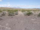
Halloran Springs right by the road. |
|
Other articles:
Locations: Halloran Springs. |
Halloran Springs |
|
Other articles:
|
Junction: Francis Springs Road, north and east past Squaw Mountain to the Power Line Road. |
| Junction: Road along Bull Springs Wash | |
|
Other articles:
|
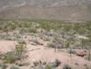
Small dark hills and road recurving down tributary to Bull Wash. |
|
Other articles:
Locations:
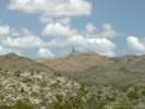
Solomons Knob.
|
View east toward Solomons Knob. |
|
Locations: Hytens Well. |
Junction: Road to Hytens Well |
| Junction: Road south toward US I-15 | |
|
Other articles:
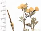
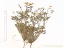
Locations:
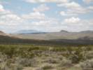
Turquoise Mountain.
|
Turquoise Mountain to the northeast. |
|
Locations: Wander Mine. |
Wander Mine |
|
Other articles:
Locations:
Wander Mine.
|
|
|
Other articles:
Locations:
Cree Camp.
|
Junction: Road to Cree Camp The road to Cree Camp goes south past the Wander Mine, down the slope past Cree Camp, coming out at a Power Line Road near US Interstate 15. From there, you will have to follow the Power Line Road northeast to Halloran Springs, or southwest to California Highway 127 near Baker. It is not possible to access Interstate 15 directly. |
|
Junction: County Road north toward Turquoise Mountain I think this might be BLM Route NN 581. | |
|
Other articles:
|
|
| Junction: County Road northeast toward Turquoise Mountain | |
|
Other articles:
|
|
|
Other articles:
|
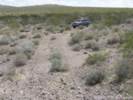
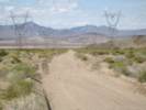
View west on Halloran Springs Road. |
| Junction: Road northwest toward Power Line | |
|
Other articles:
|
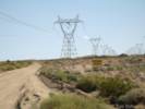
Junction: Power Line Road, northeast on the northern margin of Turquoise Mountain and Squaw Mountain. |
| Junction: Appaloosa Way | |
|
Literature Cited:
|
Near this location, Sandquist (2004) partially defoliated Brittle Bush (Encelia farinosa) to determine how the plants might compensate. Sandquist learned that the plants compensated by growing more leaves with more foliage area than the control plants. The consequences of increased foliage production were only marginally apparent and there were no strong immediate costs associated with compensatory foliage growth. |
|
Other articles:
Locations:
Kavorka Hills.
|
|
|
Other articles:
|
|
| Junction: Road going northwest | |
|
Other articles:
|
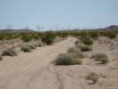
Junction: Power Line Road, the Power Line Road and Halloran Springs Road diverge, with the power lines going slightly north of Silver Lake. |
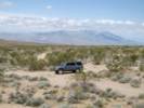
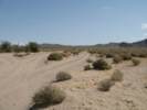
 Close to the end of Halloran Springs Road. Close to the end of Halloran Springs Road.
|
This was pretty much the end of Halloran Springs Road. From this point I had to drive cross country to get over to a power line tower. From a tower I was able to follow a power company access path to the main Power Line Road. |
 The beginning of Halloran Springs Road in Silver Lake. The beginning of Halloran Springs Road in Silver Lake.
|
The beginnings of Halloran Springs Road at Silver Lake. |
|
Other articles:
|
Junction: CA Highway 127, south to Baker, or north to Shoshone. |
| If you have a question or a comment you may write to me at: tomas@schweich.com I sometimes post interesting questions in my FAQ, but I never disclose your full name or address. |
Date and time this article was prepared: 7/13/2024 8:02:59 AM |