Eastern Mojave Vegetation
Tom Schweich
|
Eastern Mojave Vegetation
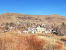
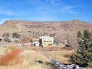
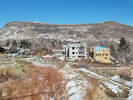
| Rubey Drive, Golden, Jefferson County, Colorado |
|
Tom Schweich |

|
Rubey Drive and North Rubey Drive. | ||||||
|
Other articles:
|
Intersection: Washington Avenue | ||||||
|
Other articles:
|
Intersection: Iowa Drive, Iowa Street | ||||||
|
Other articles:
|
Junction: Path to Arapahoe Street
| ||||||
|
Other articles:
|
| ||||||
| Intersection: Golden Park Drive | |||||||
| Intersection: Golden Park Place | |||||||
|
Other articles:
|
| ||||||
|
Other articles:
|
Pedestrian Bridge: over CO Highway 93, Magpie Gulch Trail, to Iowa Street or Canyon Point Circle | ||||||
| Intersection: Cody Trail | |||||||
|
Literature Cited:
|
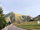
This is appoximately the center of the NE1/4 SW1/4 Sect 28, T3S, R70W. Somewhere in this quarter-quarter are the locations of two trenches dug to explore a small graben of Quaternary age, thought to be related to the Golden fault. Excavations revealed a complex geologic picture suggesting two periods of fault rupture with a total of 5.5 m of displacement. Dating of zircons and glass shards from an ash deposited in the graben and disrupted by faulting yielded dates of 0.6 to 0.7 million years, suggesting faulting occurred more recently than those dates (Kirkham, 1977). | ||||||
|
Other articles:
|
Intersection: 5th Street, High Point Drive | ||||||
| If you have a question or a comment you may write to me at: tomas@schweich.com I sometimes post interesting questions in my FAQ, but I never disclose your full name or address. |
Date and time this article was prepared: 7/13/2024 8:05:23 AM |