Eastern Mojave Vegetation Coyote Road  
 

Tom Schweich  

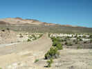
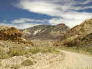
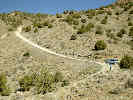
Home Page  The names Coyote Road goes west from Silver Peak to Coyote Summit in the Silver Peak Range. The road west, down the canyon to The Crossing, and thence to Nevada Highway 264 has no name. For simplicity, I have named this entire route Coyote Road.

Other articles:
• NV Hwy 264:  30000;  

Junction: Nevada Highway 264

Other articles:
• Field Notes:  20040526285;

Locations: Fish Lake Valley.  

Full Size Image
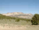
Piper Peak in the Silver Peak Range
 
  Junction


Literature Cited:
- Load, Jayson, and Gary Sohler, 1985.

Other articles:
• Field Notes:  26 May 2004;   12-Jun-08;

Locations: Fish Lake Hot Well.  

Fish Lake Hot Well

Full Size Image
Fish Lake Hot Well
A cement-lined soaking pool on the edge of a truly remote barren desert wash. Natural mineral water emerges from a well casing at 105°, at a rate of more than 50 gallons per minute.

Other articles:
• Field Notes:   12-Jun-08;  

Full Size Image
White Mountains across Fish Lake Valley

Other articles:
• The Gap Road:  The Crossing;  

Junction: Road North Through The Gap

Other articles:
• Field Notes:  20080612050;  

Full Size Image
Looking north from The Crossing


Locations: The Crossing.  

The Crossing


Other articles:
• Field Notes:  20080612050;  

Full Size Image
Looking south from The Crossing.

Other articles:
• Field Notes:  20080612070;  

Full Size Image
Looking across The Crossing.

Other articles:
• Field Notes:  26 May 2004;

Locations: Fish Lake Valley.  

Full Size Image
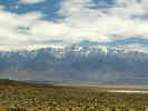
Fish Lake Valley and the White Mountains
 

Literature Cited:
- Petronis, Michael S., John W. Geissman, John S. Oldow, and William C. McIntosh, 2002.

Other articles:
• Field Notes:  20040526265;

Locations: Rhyolite Ridge.  

Full Size Image
Rhyolite Ridge as seen from the west.
Location where I found Salvia dorrii.


Argentite Canyon


Other articles:
• Field Notes:  26-May-04 at Cave Spring;

Locations: Cave Spring.  

Full Size Image
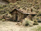
The Cabin at Cave Spring
Cave Spring

Other articles:
• Field Notes:  20040526205;  

Full Size Image
Location in Silver Peak Range.
 

Other articles:
• Field Notes:  Coll. No. 426;  

Small spring, north side of road, south base of Rhyolite Ridge.

Literature Cited:
- Petronis, Michael S., John W. Geissman, John S. Oldow, and William C. McIntosh, 2002.

Locations: Rhyolite Ridge. Silver Peak Range.  

Full Size Image
Rhyolite Ridge as seen from Coyote Pass


Other articles:
• Field Notes:  26-May-04;  26-May-04;  Coll. No. 418;  Coll. No. 419;  20040526110;  Coll. No. 421;  Coll. No. 422, 26 May 2004;  20040526140;

Locations: Coyote Summit.  

Coyote Summit

Full Size Image
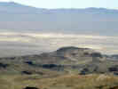
Clayton Valley Dunes from Coyote Summit.
Full Size Image
Location in Coyote Summit
Full Size Image
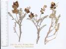
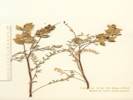
Coll. No. 419, Astragalus lentiginosus var. fremontii
Full Size Image
Coll. No. 418, Astragalus lentiginosus var. fremontii
Full Size Image
Coll. No. 419, Astragalus lentiginosus var. fremontii
Full Size Image
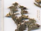
Coll. No. 421, Lappula redowskii occidentalis var. cupulata
Full Size Image
Coll. No. 421, Lappula redowskii occidentalis var. cupulata
Full Size Image
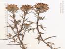
Coll. No. 422, Castilleja chromosa, at Coyote Summit
Full Size Image
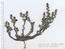
Coll. No. 423
 

Literature Cited:
- Petronis, Michael S., John W. Geissman, John S. Oldow, and William C. McIntosh, 2002.

Locations: Mineral Ridge.  

Petronis, Geissman, Oldow, and MacIntosh (2002) studied the structural evolution of the Silver Peak extensional complex. They focused on the northeastern portion of the Silver Peak Range, north of Coyote Road at such localities as Mineral Ridge and Rhyolite Ridge. Using paleomagnetic data from 123 sites, they showed about 25° of clockwise rotation since the middle Miocene. This, coupled with northwest extension and detachment faulting of Mineral Ridge, supports the theory that the Silver Peak complex transfers displacement from the Furnace Creek – Death Valley Fault Zone to the Walker Lane Fault Zone.

Other articles:
• Field Notes:  26-May-04;  

Full Size Image
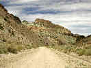
Coyote Road


Coyote Spring


Other articles:
• Field Notes:  26-May-04;

Locations: Red Mountain.  

Full Size Image
Red Mountain, as seen from the east.


Other articles:
• Nevada Highway 265:   at Silver Peak;
• Nivloc Road:  Silver Peak;
• Silver Peak Road:  Silver Peak;

Locations: Silver Peak.  

Silver Peak

Junction:
  • Nevada Highway 265
  • Silver Peak Road
  • Nivloc Road
If you have a question or a comment you may write to me at: tomas@schweich.com I sometimes post interesting questions in my FAQ, but I never disclose your full name or address.  


[Home Page] [Site Map]

Date and time this article was prepared: 8/1/2026 3:11:06 PM