
Topics in this Article:
1800s
1900s
1910s
1920s
1930s
1940s
1950s
1960s
1970s
1980s
1990
1991
1992
1993
1995
1996
1997
1998
1999
2000
2001
2002
2003
2004
2005
2006
2007
2008
2008 Tour de Swertia albomarginata
Mono Lake, August 2008
2009
2010
2011
2012
2013
2014
2015
2016
2017
2018
2019
2020
2021
2022
2023
2024
2025
Contents
Literature Cited
|
|
When I first read the field notes of Annie Alexander and Louise Kellogg, I was fascinated by the descriptions they wrote about the places they went and the plants and animals they found there. By publishing my field notes on the Internet I hope to follow a little bit in their tradition.
|
|
|
|
1970s
|
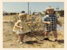
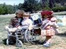
 Lydia, Matt and Tom in May 1970 Lydia, Matt and Tom in May 1970
|
|
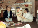
Paul and Lydia visit Tom and Cheryl in Eugene
|
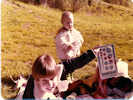
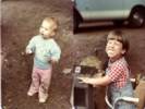
 Matt and Danielle in th yard at Great Grammy's Matt and Danielle in th yard at Great Grammy's
 Visiting Great Grammy Visiting Great Grammy
|
|
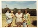
Matt and Cheryl at Great Grammy's with Suzanne and Danielle.
|
|
Other articles:
• Sunshine Acres Drive:
at 137½ Sunshine Acres Dr.;
 "Karum-bee!"
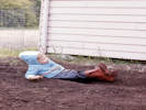
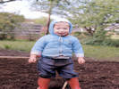
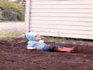
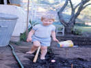
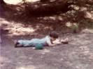
Matt flopping down in the garden. "Karum-bee!"
Matt flopping down in the garden.
 Working in the garden. Working in the garden.
|
|
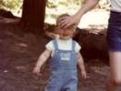
Matt in our garden.
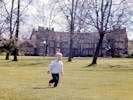
Matt on the campus of the University of Oregon. |
"Karum-bee!"
Matt flopping down in the garden. |
|
|
Other articles:
• Sunshine Acres Drive:
at 137½ Sunshine Acres Dr.;
 Matt in the window. Matt in the window.
 Matt in the soon-to-be garden. Matt in the soon-to-be garden.
|
|

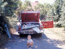
Mat feeding the ducks. |
|
|
Other articles:
• Oregon Route 58:
at Blk Cyn CG;
• Sunshine Acres Drive:
at 137½ Sunshine Acres Dr.;
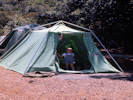
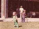
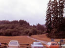
 Getting ready to go camping. Getting ready to go camping.
 Ready to go camping Ready to go camping
|
|
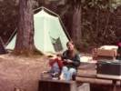
Camping along the Willamette River. I think this might have been Black Canyon Campground
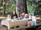
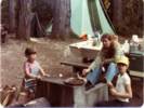
Cheryl and Matt at dinner. |
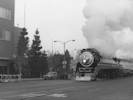
Matt watches the lead engine go by. |
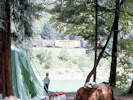
Matt watches a train go by. |
|
|
Other articles:
• Sunshine Acres Drive:
at 137½ Sunshine Acres Dr.;
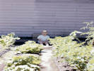 Matt in the garden. Matt in the garden.
|
|
Garden
|
|
|
|
1971
|
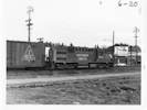 SP5160 works the hump at Eugene. SP5160 works the hump at Eugene.
 EFCX1165, last car in a hump cut. EFCX1165, last car in a hump cut.
|
|
|
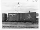
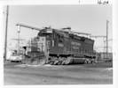 SP 8860 at Eugene locomotive service track SP 8860 at Eugene locomotive service track
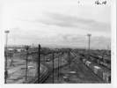 The Bowl at Eugene, Oregon The Bowl at Eugene, Oregon
 The One-Spot (car repair facility) at Eugene, Oregon. The One-Spot (car repair facility) at Eugene, Oregon.
|
|
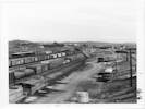
The Receiving Yard at Eugene. |
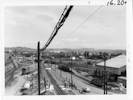
The hump lead at Eugene, Oregon. |
Scenes from around the Eugene railroad yard.
|
 Memento received on Jul 20, 1871. Memento received on Jul 20, 1871.
|
|
Memento from my railroad days.
In July 1971, my last days at the Eugene, Oregon, railroad yard we had a national railroad strike.
On the local level, it was mostly friendly, because most of the action was far away in Washington, DC.
The railroads promulgated a new set of railroad labor contracts, which came over the teletpyes in the next room.
The teletypes went on for hours.
The local chairman issued his response, shown at left.
The chairman is instructing the brothers to keep good records for claims to be submitted when "
this is over."
I think that was the view of the local management as well.
I was assigned to operate the VR-2, the hump control computer at Eugene.
Kurt Nygaard was the PICL clerk.
We worked together to keep the Eugene Yard inventory correct.
I'm not sure how well we did.
We ran a few trains, but there was no one to walk the trains to check the consist,
so perhaps there were a few missing cars and a few sleepers in the consists.
Charlie Babers and Howard Mayberry ran the dispatcher's office.
I don't remember who ran the hump, or who was cutting cars out on the hump lead.
Generally, things were well.
Only once did a car of methanol get stuck in the retarders,
and the hump dropped another car of methanol on top of it.
We tried to release the retarder and just barely got the first car unstuck
when the second car hit it.
There was a big bang, and both cars' exteriors were soaked in methanol,
but fortunately there was no fire.
Another of my assignments was to go to the Eugene Hotel to collect the food.
We were supposed to eat before we arrived in the morning.
Then the railroad would supply a late lunch - early dinner.
The food was excellent, and we looked forward to it each day.
The strike ended the morning that the movers were packing our house for the move back to the San Francisco Bay Area.
As soon as the end of strike was announced, the management released me.
I drove home, picked up Cheryl and Matt, and we drove as far as Dunsmuir for that night.
|
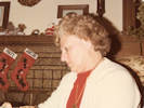
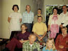 Family a the Arleta house. Family a the Arleta house.
 Family gathering at Arleta Family gathering at Arleta
|
|
|
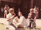
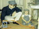 Tom and Matt run the train. Tom and Matt run the train.
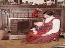
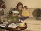 Lydia tries to get Matt to sing Christmas carols. Lydia tries to get Matt to sing Christmas carols.
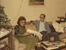 Lydia, Matt, and Paul sing Christmas carols. Lydia, Matt, and Paul sing Christmas carols.
|
|
Singing Christmas carols and playing with the train.
|
|
|
|
1972
|
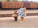 San Luis Obispo, March or April, 1972 San Luis Obispo, March or April, 1972
|
|
|
 Tiny Tots father/child campout on Mount Diablo. Tiny Tots father/child campout on Mount Diablo.
 Tiny Tots father/child campout on Mount Diablo. Tiny Tots father/child campout on Mount Diablo.
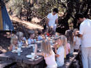 Tiny Tots father/child campout on Mount Diablo. Tiny Tots father/child campout on Mount Diablo.
|
|
Tiny Tots father and child campout on Mount Diablo.
|
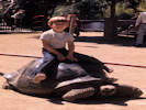 Matt on a tortoise. Matt on a tortoise.
|
|
Visit to the Oakland Zoo.
|
|
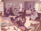 April 1973, unknown gathering April 1973, unknown gathering
|
|
April 1973
Some unknown gathering at Lydia & Paul's house in Granada Hills(?)
|
|
Other articles:
• Lyon Avenue:
at 3551 Lyon;
 Blimp in the backyard. Blimp in the backyard.
 Front of house. Front of house.
|
|
May 1973

Jacob in the back yard. |
|
 Matt and Jacob in middle bedroom of Lyon Avenue. Matt and Jacob in middle bedroom of Lyon Avenue.
|
|
|
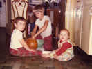
 Danielle, Jacob, Matt, and Michelle Danielle, Jacob, Matt, and Michelle
|
|
Danielle, Jacob, Matt, and Michelle.
|
|
|
|
1975
|
 Matt's School Photo, 1975 Matt's School Photo, 1975
|
|
|
|
|
|
1976
Golden Transcript has been searched for "North Table Mountain."
|
|
Other articles:
• North Table Loop:
near top;
Locations:
North Table Mountain.
|
|
|
North Table accident
An earth mover carrying 30 tons of gravel slid off a steep gravel road into the west side of North Table Mountain Tuesday to avoid hitting another track stalled on the narrow road. No one was injured in the accident and the earth mover was soon backed away from the side of the mountain and driven down the slope, though it had a damaged steering tie rod. The truck belongs to Western Paving and Construction of Denver, which started hauling gravel Monday from a quarry on top of the mountain foreman Ralph Cummins said. The access road angles steeply up the west side of the mountain from Hwy. 93. (Photo by John Holmberg)
|
Golden Transcript, Volume 110, Number 134, June 25, 1976, p. 1.
|
|
Other articles:
• North Table Loop:
near top;
Locations:
North Table Mountain.
|
|
|
Fire hits North Table Mountain
Fire hits North Table Mountain
Gravel operation sparks question of conveyor belt
Gravel operation sparks question of conveyor belt
By JOHN HOLMBERG Transcript Staff Writer
Two Golden residents living immediately west of North Table Mountain have complained to the Transcript and city officials about noise and dust caused by Western Paving and Constructions gravel crushing and hauling operation on North Table Mountain.
Bill Henderson of the Jeffco Board of Adjustment said there is some question about the legality of the operation due to the vagueness of the 1972 resolution by the board that granted the Denver company its zoning variance and permit for mining.
The question involves the method of hauling the gravel off the mountain. The company is using a steep (approximately 18 per cent grade) gravel service road that cuts diagonally up the west side of the mountain instead of a conveyor belt the company has shown plans for during hearings prior to the issuing of their permit.
Large earth movers are hauling 30 ton loads down the road. There was an accident Tuesday, June 8 when a mover had to run into the side of the mountain to stop and avoid hitting a truck that had been stalled on the way up the road.
The residents complained the noise and dust is largely caused by the movers climbing the hill at high r.p.m.s and coming down with the heavy loads.
Bob Wolfe, head of the North Table operation for Western Paving, said the present operation (supplying gravel from the mountain for Lakewoods road resurfacing program) will be completed Friday. The company will then consider the economic feasability of starting a full scale gravel quarrying operation on the mountain. The contract with Lakewood has involved operations over the past three weeks.
The company has done no quarrying or hauling on the mountain before this contract, though the permit was issued November 1973.
Wolfe said he wasnt certain whether the service road would still be used if the company goes into full scale operation on the mountain, or whether a conveyor belt will be constructed. He said the conveyor belt would be very expensive. and would take some time to build. Chuck Hearn, Golden city planner, recalled that during the permit hearings, the mining variance was contingent on Western Paving building a conveyor.
"Their plans included drawings of the conveyor. There was to be no hauling through Golden on the west side of the mountain, he said. If they go into full scale operation using that service road, there are going to be problems.
|
Golden Transcript, Volume 110, Number 134, June 25, 1976, p. 1.
|
|
Locations:
North Table Mountain.
|
|
|
window on the world
By MARY KOCH
Colorado School of Mines
This place is a natural place for a school of mines. Here are all the ingredients of the master chef, the recipes, fixed in eternity and yet not fixed. Even now the great Rocky Mountains push upward, growing as fast as they wash away. Even now engineers debate not the inevitability of the next climatic age, only its extremes. Mud and ice, swamp and desert, all lived and died here, all exist here still, clothed in centuries.
Three days ago we landed Viking 1 spacecraft on Mars. The enormity of this achievement is difficult to grasp. We look at the pictures, transmitted over 213 million miles, and wonder and anticipate. However, we too live in the midst of an area which was likewise viewed with the pulse of wonder and anticipation when, almost one hundred years ago, a handful of students and their professors climbed North Table Mountain. With them we share the excitement of discovery. In their terrestial adventure on this planet certainly their eyes were as wide with wonder, the rewards of their journey as unknown, as we now experience in our exploration of Mars. Let us go, therefore, you and I, back in time through \ the yellowed pages of the old Golden Weekly Globe to that fine October day in 1878.
We have often heard people
remark as they came in from the plains between our Table Mountains, What an extraordinary wall that is on top of these hills, what can be the cause of it, and what is it made of? A wall rising from 100 to 200 feet, straight as the palisades of a fortification, yet split up into thousands of pointed columns looking from the valley of Clear Creek below like so many bamboo canes pressed closely together. We propose to answer this question and clear up this mystery by the. results of a day's excursion of the School of Mines.
"The Ascension. On reaching the foot of North Table Mountain, the party began to ascend at a point (located just beyond the current railroad track on tenth street). The slopes of the hill were profusely covered with large blocks of lava, basalt and
volcanic ashes that had rolled down from the Palisades, showing how rapidly those beautiful fortresses of nature are fading away
through the agencies of rain, snow and frost
This we saw exemplified also in the fading autumnal leaves of the aspen and Virginia Creeper clothing the sides of the ravine.
At the bottom of the slope we found specimens of nearly every kind of rock that was in place above us. There were big solid boulders of basalt which when broken displayed a dark colored rock, not unlike granite, composed of a variety of minerals
Another kind resembled pumice or cinder, the little cavities in many instances being filled with crystal shaped like almonds, from which this volcanic ash .. is called almond rock
Other large boulders seemed composed of a number of little nodules as if Dame Nature in making up her volcanic ash had been rather hasty and had mixed it very badly
Hammers were busy chipping open these specimens and collecting minerals, so the toil up Zion Hill was not unrewarded.
A Buried Primeval Forest. On reaching the base of the great wall an exposure of horizontal sandstone was discovered full of petrified impressions of leaves. Here, as leaf after leaf was brought to light the professor explained that the party were exhuming the foliage of a primeval tropical forest of palms, magnolias, and other trees that grow near some fresh water swamp or lake by whose mud they had been entombed and covered over. Time and pressure had turned the mud into sandstone and the leaf impressions into fossils.
There was a shout from one of the party, who claimed that he had found a fossil animal in the strata, and more miraculous, still a live one. It proved to be a centipede which had crept in between the shale for winter quarters.
In the next article we ascend the basaltic cap and discover the chimney of an old crater.
|
Golden Transcript, Volume 110, Number 134, June 25, 1976, p. 1.
|
 SP 4449 in Jack London Village SP 4449 in Jack London Village
 SP 4449 in Jack London Village SP 4449 in Jack London Village
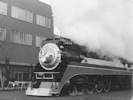 SP 4449 in Jack London Village SP 4449 in Jack London Village
|
|
|
|
Locations:
North Table Mountain.
|
|
|
window on the world
By MARY KOCH
Colorado School of Mines
Because the lava came when the mountains were new, this valley exists. Water, rushing through mountain canyons onto the ancient plains, poured over and around immense lava beds at the edge of the front range. Some of the lava held, giving ground so slowly that eventually the water lowered itself into the hollows it created, and was forced to be content with but a single track across the massive rock basin to the east. At last the lava yielded; the water cut through; but too late the victory. The great flow of water lessened. The track became a canyon but only that. The earth, its dark-brown tasaltic caps firmly in place, rose safe above the broad riverthat became a lakethat became, finally, but a remnant of a complex sage, a sequel that modem man has channeled and rechanneled to suit his convenience.
They remain today, this lava-saved earth, these pieces of plain become mountains, virtually as they were a 100 years agoo when the following report appeared in the Golden Weekly Globe. This is the second half of the report on the ascent of the east face of North Table Mountain by Mines Professors and Moss and a handful of students.
October 1878: As we discussed certain fruit and other remains of a strictly recent period near a brook issuing from the top of the mountain, the party had opportunity to consider the lofty pillared wall above them ... lt looked like the ragged outlines of an ancient castle. There were two rows or terraces of pillars separated by a rough mass of mud looking as if it had been melted and poured over. The pillars stood from fifty to sixty feet high and still retained a very rough outline of a five-sided prism, cracked and jointed and seamed as if they had passed through Vulcans furnace and been badly moulded. (Here the report details the cooling process in lava, and notes the exquisite little goedes and fairy-like caverns found in the rocks).
The two sets of pillars with the terrace between them seem to imply that there were two separate flows of lava, one succeeding the other after the first had cooled.
And now let us climb the wall and go to the crater, the main source of all this outflow. (The party found themselves on top of the mountain, with dark patches of a slag-like substance cropping out in bare places among the green
After the sandstones (containing the buried primeval forest at the base of the lava) were deposited, there appeared to have been a period of calm and quiet, but it was disturbed by great cracks in the earth opening and belching forth floods of lava...
The wall...is nothing more than a vast sheet...of lava. One of its immediate sources is a crater...on top of this very mountain ... Toward the northwest corner ... a high rock begins to loom up something like a half section of a brick kiln chimney ... (We) found a large area covering several acres, composed of lava rocks arranged in horizontal layers and jointed into sections so much resembling masonry that it was difficult not to suppose some ancient tribe had here built their cliff dwellings... The structures assumed the shape of a honey-comb; above these rose the half section of the chimney to a height of about 30 feet. It was composed of a series of layers ... 70 in number, each one marking a separate flow of lava. From the top of this cone we noticed a similar structure at a little distance...
...the professor offered the following explanation: We are sitting on the top of a portion of the chimney of an old crater. What its height was is impossible to tell, because vast floods of water have rushed over the top of this mountain and have probably removed hundreds of feet of lava from its area. We may form some idea from the honey-comb around us which covers some 20 acres. We can draw a limited idea of the material it ejected from the sheet of lava 200 feet thick which caps these two table mountains and slopes off toward the south.
The report concludes with a slim sketch right out of a 6-million-year-old Disney Fantasia, complete with craters, dykes, fissures, and monstrous quantities of smoke and firey lava.
|
Golden Transcript, Volume 110, Number 134, June 25, 1976, p. 1.
|
|
Locations:
North Table Mountain.
|
|
|
Fire hits North Table Mountain
Fire hits North Table Mountain
A grass fire burned 60 acres of grassland on the southeast corner of North Table Mountain Friday. The Fairmount volunteer fire department responded to the blaze and called the Golden firemen for assistance at 3:30 p.m. when wind caused rapid spreading of the fire, making it hard to bring
under control. Thirty to forty men from the two departments finally stopped the blaze after about two hours of efforts. The fire started behind houses on the side on the mountain off of Easley Road. (Photo by John Holmberg)
|
Golden Transcript, Volume 110, Number 180, August 30, 1976.
|
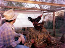
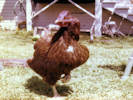
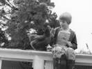 Matt with a chicken on top of the chicken house. Matt with a chicken on top of the chicken house.
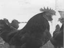 Our rooster. Our rooster.
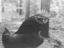 Our rooster. Our rooster.
|
|
Matt with one of our chickens.
|
|
|
|
1977
Colorado Transcript has been searched for "North Table Mountain"
|
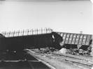 Derailment at Roseville. Derailment at Roseville.
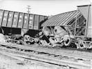 Derailment at Roseville. Derailment at Roseville.
|
|
Derailment at Roseville.
|
|
Other articles:
• 1st Street:
at Tucker Gulch;
|
|
|
Peery subdivision gets a bridge
Peery subdivision gets a bridge
By JOHN HOLMBERG Transcript Staff Writer
A planned subdivision of about 95 lots with $50,000 to $60,000 houses on the lower slopes of North Table Mountain is one step closer to reality. City council decided last week to build a bridge over Tucker Gulch at 1st Street to provide better access to the Peery subdivision and other homes in the area east of Tucker Gulch next to North Table Mountain.
The only access now to the area is over the 7th Place bridge and Boyd Street off of Colo. 58. If 7th Place was blocked, an emergency situation would develop using only Boyd Street to reach a fire, according to Chuck
Hearn, Golden city planner.
Council also decided to improve the supply of water into the area to improve fire protection for existing homes and handle the additional demands of the proposed subdivision. There will be two supply systems to serve the area. One will come from a water lank on the west slope of North Table Mountain to serve the higher homes. The other will come from the city resevoir (sic) next to Hwy. 93 to serve homes in the valley near Tucker Gulch.
Hearn says the new two-source system will improve existing water lines by eliminating many dead-end lines. These lines will be replaced with continuous loop lines, which are
easier to maintain and will increase water pressure throughout the system, important for fire protection. The normal requirement of a park within a subdivision was waived by council because Peery had previously donated the Norman D. Park on Tucker Gulch near the proposed subdivision. Peery also plans to design some open space into the subdivision.
The Planning Commission will have a final review of the preliminary plat for the subdivision at their next meeting, Feb. 2. They will make any recommendations for improvements at that time before sending the plat to city council.
|
Golden Transcript, Volume 111, Number 26, January 26, 1977.
|
|
|
|
February 16, 1977: Birth of Rachel Elisabeth Schweich.
|
 Grandmother and Grandaddy at the Oakland Airport. Grandmother and Grandaddy at the Oakland Airport.
 Lydia and Jacob, 1977 Lydia and Jacob, 1977
|
|
|
 Portia and Jacob before field trip, June 1977 Portia and Jacob before field trip, June 1977
 Going to Milena's birthday party, June 1977. Going to Milena's birthday party, June 1977.
 Three friends at the zoo -- Johnny, Jacob and Portia, June 1977 Three friends at the zoo -- Johnny, Jacob and Portia, June 1977
|
|
|
 Lydia, Rachel and Jacob. Lydia, Rachel and Jacob.
|
|
|
 All dressed up for the Renaissance Faire, Sept. '77 All dressed up for the Renaissance Faire, Sept. '77
 Rachel standing, Sept 1977 Rachel standing, Sept 1977
 Rachel standing up. Rachel standing up.
|
|
|
 Rachel "Bat-Girl" Rachel "Bat-Girl"
 Carving the pumpkin Carving the pumpkin
 Halloween Party 1977 Halloween Party 1977
|
|
Halloween Sack Races |
|
 Jacob and Heather Jacob and Heather
|
|
Jacob and Heather
|
|
|
|
1978
|
 Matt's 10th Birthday Matt's 10th Birthday
|
|
Matt's 10th Birthday
|
 Charlene and Heather, 1978 Charlene and Heather, 1978
|
|
|
 Jacob and Cheryl at picnic table Jacob and Cheryl at picnic table
 Rachel and Jacob Rachel and Jacob
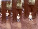 Rachel liked to try this way between the trees. Rachel liked to try this way between the trees.
|
|

Matt trying to sneak into camp. |
Jacob feeds a squirrel |
Rachel unhappy about something. |
Matt's tent collapsed. |
Roasting marshmallows at Hendy Woods |
Rachel and Jacob enjoy marshmallows |
Camping at Hendy Woods State Park, Mendocino County, California, in August, 1978.
|
 Rachel, Jacob and Matt at the Merry-Go-Round. Rachel, Jacob and Matt at the Merry-Go-Round.
 At the Tilden Merry-Go-Round. At the Tilden Merry-Go-Round.
|
|
|
|
 "Tom and his chickens" in grandmother's handwriting. "Tom and his chickens" in grandmother's handwriting.
 "Tom and his chickens, Lyon Avenue, Oakland, 11/78" in grandmother's handwriting. "Tom and his chickens, Lyon Avenue, Oakland, 11/78" in grandmother's handwriting.
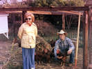 "Lydia & Tom & checkens" in Lydia's handwriting. "Lydia & Tom & checkens" in Lydia's handwriting.
|
|
November 1978
|
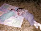
 Rachel at 22 months. Rachel at 22 months.
|
|
|
|
 Christmas, 1978 Christmas, 1978
 Christmas, 1978 Christmas, 1978
 "Lydia at Tom's house, Christmas, 1978" "Lydia at Tom's house, Christmas, 1978"
|
|
Christmas 1978
|
|
|
|
1979
|
 Lydia and Rachel do dishes. Lydia and Rachel do dishes.
 Chicken in the barkyard. Chicken in the barkyard.
 Redwood Heights Park. Redwood Heights Park.
|
|

Rooster in the chicken pen. |

Chickens in their pen. |
|
|
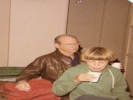 "Paul & Matt drinking coffee or tea in the Cripple Creek Hotel" in Lydia's handwriting. "Paul & Matt drinking coffee or tea in the Cripple Creek Hotel" in Lydia's handwriting.
|
|
July, 1979
Lydia & Paul take Matt to Alaska.
|
|
Other articles:
• Bear Valley Trail:
at Bear Vy TH;
at Divide Meadow;
• Coast Trail:
near Millers Point;
at Wildcat Camp;
near Double Pt.;
near Pelican Lk;
Locations:
Alamere Falls.
Divide Meadow.
Double Point.
Millers Point.
Pelican Lake.
Wildcat Beach.
Wildcat Camp.
 Wildcat Camp. Wildcat Camp.
|
|
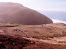
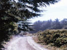
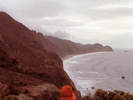
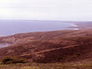
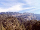
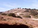
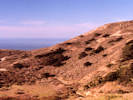
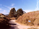
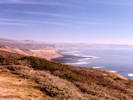
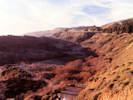
October, 1979
Backpacking at Point Reyes.
Hiking along Wildcat Loop above Glen Camp. |
Marine terrace at Millers Point with 6 foot deep tension crack. |
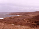
Looking north from Millers Point; Coast Trail and marine terraces. |
Leaving Millers Point. |
Coast Trail, Millers Point, and Point Resistance from above; looking north. |
Bear Valley Trailhead. |
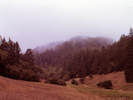
Divide Meadow. |
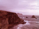
Millers Point and Double Point in the distance. |

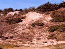
Clastic dike on Wildcat beach. |
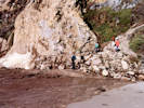
Mud and rock washed onto the beach by rain. |
Eating lunch behind a pressure ridge at North Double Point. |
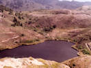
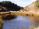
Pelican Lake. |
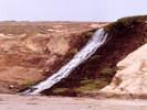
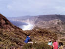
Alamere Falls. |
I think there might have been three trips to Point Reyes in Fall 1979, because some of the slides are marked in each of the three months.
|
|
|
|
|
|
Other articles:
• Mesa Road:
at Palomarin Bch;
• Coast Trail:
at Alamere Creek;
near Pelican Lk;
near Crystal Lk;
at Bass Lake;
at Lake Ranch;
Locations:
Alamere Creek.
Bass Lake.
Crystal Lake.
Lake Ranch.
Palomarin Beach.
Pelican Lake.
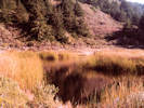
 Pressure ridges between Pelican and Crystal Lakes. Pressure ridges between Pelican and Crystal Lakes.
|
|
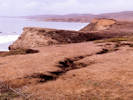
December 1979
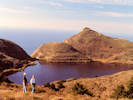
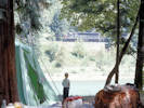
Cheryl and Matt at Pelican Lake. |
Head scarp near (above) Lake Ranch. |
Head scarp above Crystal Lake. |
Crystal Lake. |
Headscarp at Crystal Lake. |
Crystal Lake. |
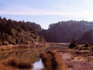
Crystal Lake. |
Headscarp where the Coast Trail crosses Alamere Cree. |
Trail Junction at Lake Ranch. |
Palomarin Beach, looking south towards Bolinas. |
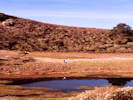
Cheryl and Matt at Lake Ranch. |
Bass Lake. |
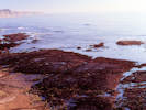
Palomarin Beach. |
Cheryl and Matt at the Palomarin Slide, provides access to the beach. |
|
|
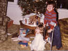 Jacob and Rachel at Christmas. Jacob and Rachel at Christmas.
 Heather, Jacob, Rachel, and Matt. Heather, Jacob, Rachel, and Matt.
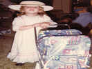 Rachel Schweich, Christmas 1979 Rachel Schweich, Christmas 1979
|
|
Christmas, 1979
|
|
|
|
[Previous Page]
[Next Page]
Go to page: [1800s] [1900s] [1910s] [1920s] [1930s] [1940s] [1950s] [1960s] [1970s] [1980s] [1990] [1991] [1992] [1993] [1994] [1995] [1996] [1997] [1998] [1999] [2000] [2001] [2002] [2003] [2004] [2005] [2006] [2007] [2008] [2009] [2010] [2011] [2012] [2013] [2014] [2015] [2016] [2017] [2018] [2019] [2020] [2021] [2022] [2023] [2024] [2025] [A]
|
|
If you have a question or a comment you may write to me at:
tomas@schweich.com
I sometimes post interesting questions in my FAQ, but I never disclose your full name or address.
|
[Home Page] [Site Map]
Date and time this article was prepared:
4/21/2025 8:21:32 PM
|
 Eastern Mojave Vegetation