Eastern Mojave Vegetation Chimney Gulch Trail, Jefferson County, Colorado  
 

Tom Schweich  

Home Page  From Clear Creek to Windy Saddle.


Other articles:
• Lookout Mountain Road:   at Windy Saddle;
• Field Notes:   30 Oct 2014;

Locations: Windy Saddle.  

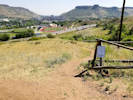
Windy Saddle

Full Size Image
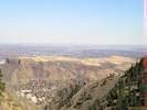
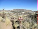
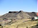
The entire top of South Table Mountain as seen from Windy Saddle
Junction: Lookout Mountain Road, Lookout Mountain Trail
  Trail drops off the road.

Other articles:
• Field Notes:   30 Oct 2014;  

Full Size Image
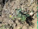
Two Colorado noxious weeds growing together at Windy Saddle
Dalmatian Toadflax and Myrtle Spurge, two Colorado noxious weeds, growing together.

Other articles:
• Field Notes:   30 Oct 2014;  

Full Size Image
Near the top of Chimney Gulch
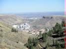
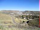
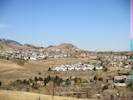
Golden from near Windy Gap.
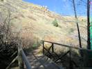
  Bridge over creek.
  Trail passes through forest.
  Viewpoint at switchback.

Other articles:
• Field Notes:   30 Oct 2014;  

Full Size Image
Lower bridge in Chimney Gulch
Bridge over creek.

Other articles:
• Field Notes:   30 Oct 2014;  

Full Size Image
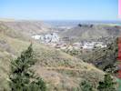
Climbing in Chimney Gulch
View to Golden below.
  Cross small watercourse.

Other articles:
• Field Notes:   30 Oct 2014;  

Full Size Image
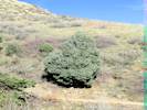
Juniperus scopulorum Sarg. (Rocky Mountain Juniper) in Chimney Gulch
Juniperus scopulorum Rocky Mountain Juniper.

Other articles:
• Field Notes:  Saturday, November 1st;  

Full Size Image
Part of the Chimney Gulch Trail seen from the Buffalo Bill Museum.
 

Other articles:
• Field Notes:   30 Oct 2014;

Locations: Chimney Gulch.  

Full Size Image
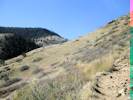
Climbing in Chimney Gulch
 

Other articles:
• Field Notes:   30 Oct 2014;  

Full Size Image
Chimney Gulch Trail just above Lookout Mountain Road.
Switchbacks above Lookout Mountain Road.

Other articles:
• Lookout Mountain Road:   at Chimney Gl Trl;  

Cross Lookout Mountain Road.
  Trail up leaves driveway.
  Driveway for 1959 Mount Zion Drive.

Other articles:
• Field Notes:   30 Oct 2014;  

Full Size Image
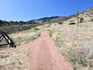
Chimney Gulch Trail
Trail down from driveway.

Other articles:
• Field Notes:   30 Oct 2014;  

Full Size Image
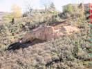
Outcrop of sedimentary rock in Chimney Gulch
View of sedimentary outcrop in Chimney Gulch.

Other articles:
• Social Trail (Parfet Estates Drive to Landing Zone):  10000;
• Field Notes:   30 Oct 2014;  Saturday, August 11th;  

Full Size Image
Intersection with the old trail.
Full Size Image
The old closed trail used by mountain bikers and hikers.
Full Size Image
Castle Rock from lower portion of Chimney Gulch Trail.
Full Size Image
North Golden from lower Chimney Gulch Trail
Junction with closed trail to Landing Zone, and social trail to Parfet Estates Drive. View of Castle Rock and North Golden.

Other articles:
• Field Notes:  Saturday, August 11th;  

Full Size Image
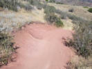
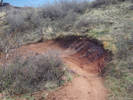
Typical trail widening on the upper part of a curve.
High bank on the upper part of a curve. I measured 11 feet from the rock on the right to the highest bicycle tire track on the left, then another two feet up the base slope to the vegetation.

Other articles:
• Field Notes:  Monday, 3 Apr 2017;  

Full Size Image
Chimney Gulch Trail
High bank on curve of Chimney Gulch Trail.

Other articles:
• Welch Ditch:   at Chim. Gl.;

Locations: Welch Ditch.  

Junction: Welch Ditch.Pretty much just social trails west into Clear Creek Canyon along the unused ditch, soon to be redeveloped into a trail by Jefferson County Open Space.

Cross Welch Ditch. Social trails west into Clear Creek Canyon, or east.

Literature Cited:
- Hellmund Associates, 1998.

Other articles:
• Field Notes:  Saturday, August 11th;  

Full Size Image
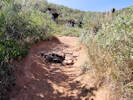
Trail widened to 9 feet.
Trail widened to 9 feet as mountain bikers swing wide to avoid the rocks. Maximum incisement is nearly 2 feet.

Other articles:
• Field Notes:  Saturday, August 11th;  

Full Size Image
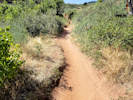
Typical narrow cross-section of the Chimney Gulch Trail.
Full Size Image
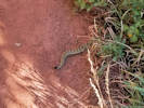
Rattlesnake on the Chimney Gulch Trail.
Typical narrow cross-section of Chimney Gulch Trail. The trail here is 3 feet wide, a little less than a foot deep, and the trampled area at left is 4 feet wide.

Other articles:
• Golden Checklist Flora:   glider;
• U. S. Highway 6:   at pkg;

Locations: Lower Chimney Gulch.  

Parking area on 6th Avenue (US Highway 6).
  Cross under 6th Avenue.

Other articles:
• Field Notes:  Coll. No. 3548, 25 Mar 2026;  

Coll. No. 3548, Malus domestica.

Full Size Image
Flowers of Coll. No. 3548, Malus domestica.
Full Size Image
Coll. No. 3548, Malus domestica.

Other articles:
• 6th Avenue Trail:   at Chimney Gl Trl;  

Junction: 6th Avenue Trail
If you have a question or a comment you may write to me at: tomas@schweich.com I sometimes post interesting questions in my FAQ, but I never disclose your full name or address.  


[Home Page] [Site Map]

Date and time this article was prepared: 4/24/2026 5:01:00 PM