Eastern Mojave Vegetation
Tom Schweich
|
Eastern Mojave Vegetation
| Nevada Highway 318 |
|
Tom Schweich |

|
Nevada Highway 318 runs north and south through the White River Valley from US Highway 6 south of Ely, Nevada, to a junction with US Highway 93, just south of Hiko, Nevada. The maps also show a Nevada State Route 38 that shares the route with State Route 318 for the most part, and runs parallel with State Route 318 for a smaller part. |
|
|
Other articles:
|
The northern end of Nevada State Route 318 is at its: Junction: US Highway 6,, northeast to Ely, Nevada, or southwest to Tonopah, Nevada. | |
|
Other articles:
Locations:
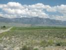
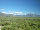
Egan Range.
White River Valley.
|
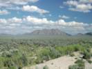
Small bluff above valley. | |
|
|
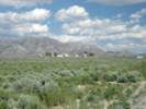
Preston | |
|
Locations: Lund. |
Lund | |
|
Other articles:
|
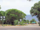
Junction: Gibson Road | |
|
White Pine County above
Nye County below | ||
|
Other articles:
|
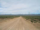
Junction: Wells Station Road, west across the White River Valley, then over Wells Station Summit, and northwest through the northern portion of the Grant Range to Currant on US Highway 6. | |
|
Other articles:
Locations:
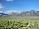
White Horse Pasture.
White River.
|
| |
|
Other articles:
Locations:
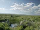
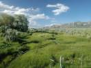
Hardy Springs.
|
Hardy Springs | |
|
Other articles:
Locations:
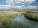
Egan Range.
White Horse Pasture.
White River (historical location).
|
Emigrant Springs | |
|
Other articles:
Locations: Sunnyside. |
SunnysideSeveral collections of Frasera albomarginata have been made at locations close to Sunnyside. | |
|
Other articles:
Locations:
Hot Creek Springs.
|
| |
|
Other articles:
Locations:
Egan Range.
|
Road to Adams McGill Reservoir | |
|
Other articles:
Locations:
Gap Mountain.
|
Gap Mountain | |
|
Other articles:
|
Junction: "Bristol Cletty Road" or "Silver King Road", southeast to Bristol Wells, and the Bristol Silver Mines. | |
|
Other articles:
|
Junction(?): Cave Valley Road. I'm not sure that Cave Valley Road actually comes all the way out to Nevada State Route 318. However, if it does, it would do so at this point opposite Fox Mountain. | |
|
Literature Cited:
Locations: Hiko. |
Hiko | |
|
Other articles:
|
Junction: Logan Canyon Road, west, into the Mount Irish Range. E. C. Jaeger collected Frasera albomarginata on Mount Irish. | |
|
Other articles:
|
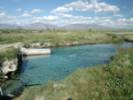
Junction: Nevada State Route 375 | |
| Crystal Springs | ||
|
Other articles:
|
Junction:
| |
| If you have a question or a comment you may write to me at: tomas@schweich.com I sometimes post interesting questions in my FAQ, but I never disclose your full name or address. |
Date and time this article was prepared: 7/13/2024 8:12:37 AM |