Eastern Mojave Vegetation
|
Eastern Mojave Vegetation
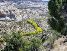
| The Hogback, Garfield County, Utah. |
|
Gazetteer Query: G.N.I.S. |
||
|
Narrow ridge of rock between Calf Creek and Boulder Creek, traversed by Utah Highway 12.
Articles that refer to this location:
| ||
| No collections made at this location. | ||
| If you have a question or a comment you may write to me at: tomas@schweich.com I sometimes post interesting questions in my FAQ, but I never disclose your full name or address. |
A, B, C,
D, E, F,
G, H, I,
J, K, L,
M, Date and time this article was prepared:12:57:02 PM, 10/2/2026. | |