Eastern Mojave Vegetation
Tom Schweich
|
Eastern Mojave Vegetation
| California Highway 58 |
|
Tom Schweich |

|
(No Preface) |
|
Other articles:
Locations:
Santa Margarita.
|
Santa MargaritaJunction: US Highway 101, north through the Salinas Valley to San Francisco, south to San Luis Obispo and then along the coast to Los Angeles. |
|
Other articles:
|
Corner of Estrada Road and W. Pozo Road. |
|
Other articles:
|
Corner of West Pozo Road and Calf Canyon Road |
|
Other articles:
Locations:
Shell Creek.
|
Shell CreekThis small creek drains north to Shandon, where it joins the Estrella River. |
|
Other articles:
|
Junction: Pozo Road |
|
Other articles:
|
Junction: Soda Lake Road, south to Soda Lake and beyond. |
|
Locations:
Carrizo Plain.
|
Carrizo PlainThis large land-locked valley was formed by the San Andreas Rift Zone, which runs along the east side fot he valley. |
|
Locations:
Temblor Range.
|
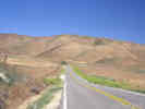
The climb to the summit of the Temblor Range from Carrizo Plain is short and steep. |
|
Other articles:
|
Junction: Seven Mile Road Turn right (south) here for Elkhorn Road and to tour the San Andreas Fault. |
|
Locations:
Temblor Range.
|
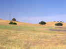
Small meadow at the summit of California Highway 58 where is crosses the Temblor Range, |
|
Locations:
Temblor Range.
|
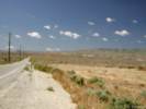
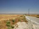
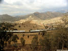
California Highway 58 descends from the summit of the Temblor Range into the San Joaquin Valley. |
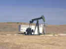 Oil Well near McKittrick, CA Oil Well near McKittrick, CA
|
Oil well beside California Highway 58 west of McKittrick. |
|
Other articles:
|
Junction: California Highway 33, south to Taft, Maricopa, Ojai and Ventura. |
|
Locations:
McKittrick.
|
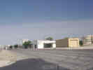
McKittrickMcKittrick is an oil town in the southeastern San Joaquin Valley. |
|
Other articles:
|
Junction California Highway 33, north to Avenal and Coalinga. |
|
Other articles:
Locations:
San Joaquin Valley.
|
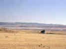
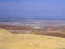
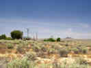
View of the Cymric Oil Field from beside California Highway 58. The town of McKittrick is on the other side of the foreground ridge. |
|
Other articles:
Locations:
San Joaquin Valley.
|
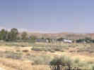
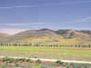
View of the San Joaquin Valley, looking northeast toward Buttonwillow. |
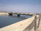 California Aqueduct. California Aqueduct.
|
California Highway 58 crosses the California Aqueduct near Buttonwillow. |
|
|
Buttonwillow |
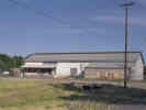
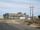
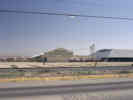 Cooperative Cotton Gin near Buttonwillow. Cooperative Cotton Gin near Buttonwillow.
|
Cotton is a major crop in the southern San Joaquin Valley. This large cooperative cotton gin is along California Highway 58 near Buttonwillow. |
|
Other articles:
|
Junction:
|
|
Other articles:
Locations: Bakersfield. |
BakersfieldJunction:
|
|
Other articles:
|
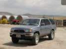
As I was descending into Bakersfield on California Highway 58 on April 25, 2005, the 4Runner turned over 100,000 miles at General Beale Road. We got off to buy some produce and to take this photo. |
|
Other articles:
|
Tehachapi Loop |
|
Other articles:
|
|
|
|
Tehachapi |
|
Locations:
Tehachapi.
|
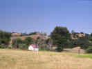
View across the Tehachapi Valley to windmills on the Tehachapi Mountains. |
|
Literature Cited:
Other articles:
Locations: Kramer Junction. Mojave. |
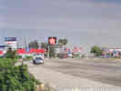
MojaveJunction:
|
|
Locations:
Boron.
|
|
|
Locations: Boron. |
Boron |
|
Other articles:
|
Kramer Station, near crossing of Burlington Northern Santa Fe railroad. |
|
Other articles:
|
Kramer JunctionJunction: U. S. Highway 395Turn north on U. S. Highway 395 for the Randsburg mining area, Ridgecrest, and the Owens Valley. |
|
Other articles:
|
Junction: Helendale Road. |
|
Other articles:
|
Junction: Hinkley Road. Turn north on Hinkley Road for access to Black Canyon Road and Opal Mountain Road. |
|
Other articles:
|
Junction: Lenwood Road. Turn north on Lenwood Road for Old Highway 58, on the north side of Barstow. |
|
Other articles:
|
Junction: Main Street and National Trails Highway, old US Highway 66. |
|
Other articles:
Locations: Barstow. |
BarstowJunction: US Interstate 15California city, crossroads for early emigrant trails, railroads and highways in the California Desert, on the Mojave River. Once a small mining center and railroad town in California's Mojave Desert, Barstow is located at the junction of 3 major highways -- Interstate 15, Interstate 40 and State Highway 58. It is centrally located in the western Mojave at the entrance to the Mojave National Preserve and is home of the U.S. Army National Training Center, Marine Corps Logistics Base, NASA's Goldstone Deep Space Network and Burlington Northern-Santa Fe Railroad Yards. Population is 21,500 and elevation is 2,106 feet above sea level. |
| If you have a question or a comment you may write to me at: tas4@schweich.com I sometimes post interesting questions in my FAQ, but I never disclose your full name or address. |
Date and time this article was prepared: 4/27/2024 3:15:42 PM |