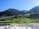
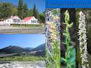
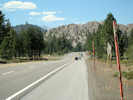
 Eastern Sierra Nevada, California and Nevada
Tom Schweich
|
Eastern Sierra Nevada, California and Nevada
| U. S. Highway 395 |
|
|
Tom Schweich |

|
(No Preface) | ||||||
|
Canada above
. Washington below . | |||||||
|
|
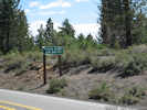
LaurierBeginning of US Highway 395. | ||||||
|
Locations: Kettle Falls (historical). |
Just to the east is the site of the former Kettle Falls before they wer einundated by Grand Coulee dam. | ||||||
|
Cross Columbia River | |||||||
|
Locations: Kettle Falls. |
Kettle Falls | ||||||
| Junction: U. S. Highway 2 | |||||||
|
Other articles:
|
Junction: U. S. Interstate 90, East. | ||||||
|
Locations: Spokane. |
Spokane | ||||||
|
Other articles:
|
Junction: U. S. Interstate 90, West. | ||||||
|
|
Pasco | ||||||
| Bridge over Columbia River. | |||||||
|
|
Kennewick | ||||||
| Junction: U. S. Interstate 82, North. | |||||||
|
Washington above
Columbia River Oregon below | |||||||
|
|
UmatillaJunction: U. S. Interstate 82, South. | ||||||
| Stanfield, Oregon. | |||||||
|
Other articles:
|
Junction: US Interstate 84 US Highway 395 follows the route of I 84 from Stanfield to Pendleton, Oregon. | ||||||
|
Other articles:
Locations: Pendleton. |
PendletonJunction: U. S. Interstate 84, East. | ||||||
|
Other articles:
Locations: Mount Vernon. |
Mt. VernonJunction: US Highway 26, west to Prineville. | ||||||
|
Other articles:
Locations: John Day. |
John DayJunction: US Highway 26, east. | ||||||
|
Other articles:
|
Junction: US Highway 20, east to Idaho near Nyssa. | ||||||
|
Other articles:
Locations: Burns. |
BurnsJunction: Oregon Highway 78, to Oregon Highway 205 to Malheur National Wildlife Refuge, and Burns Junction on US Highway 95. | ||||||
|
Other articles:
|
Junction: US Highway 20, west to Bend, then Albany, and ultimately Newport, Oregon. | ||||||
|
Literature Cited:
Locations: Alkali Lake. Alkali Lake Dunes. Horror Spring. Hutton Spring. |
Alkali LakeAlkali Lake and Dunes, and Hutton Spring, to the west.Bruce Pavlik's (1985) review of sand dune flora of the western United States included the Alkali Lake Dunes as its northernmost locality. Hutton Spring, on the northwest margin of Alkali Lake, is the sole habitat of the Hutton tui chub, classified as a threatened subspecies by the U. S. Fish and Wildlife Service. On the southwestern margin of Alkali Lake is a pretty messy chemical waste disposal site. About 25,000 drums of pesticide manufacturing waste were disposed of here in the late 1960s and 1970s. In 1976, the drums were crushed and buried in place in shallow trenches and fenced. Current analysis concludes that the site does not present a significant risk to the public or the environment. | ||||||
|
Other articles:
|
Junction: Oregon Route 140, east in the direction of Denio, Nevada. | ||||||
|
Other articles:
|
Junction: Oregon Route 140, west to Klamath Falls, and Medford. | ||||||
|
|
Lakeview | ||||||
|
|
New Pine CreekOregon aboveCalifornia below | ||||||
| New Pine Creek Winery | |||||||
| Fandango Pass Road | |||||||
|
Locations: Warner Mountains. |
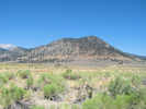
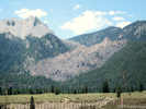
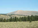
North Warner Mountains to the east. | ||||||
|
Other articles:
|
Junction: California Highway 299, east, to Cedarville. | ||||||
|
Other articles:
Locations: Alturas. |
AlturasJunction: California Highway 299, west to Redding, and ultimately Eureka, California. | ||||||
|
Locations: Warner Mountains. |
South Warner Mountains to the east. | ||||||
|
|
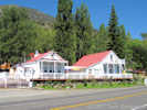
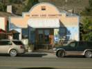
LikelyHome of the "Most Likely Café." | ||||||
| Junction: Lassen County Road A3. | |||||||
|
Other articles:
|
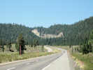
Junction: California Highway 36, west to Red Bluff, and ultimately Scotia on US Highway 101.
Susanville is 3 miles west on California Highway 36. | ||||||
| Junction: Lassen County Road A3. | |||||||
|
Literature Cited:
Locations: Honey Lake. |
Honey Lake | ||||||
|
Literature Cited:
Locations: Fort Sage Mountains. |
DoyleFort Sage Mountains to the east | ||||||
|
Literature Cited:
Locations: Seven Lakes Mountain. |
Seven Lakes Mountain to the east. | ||||||
|
Literature Cited:
Other articles:
Locations: Petersen Mountain. |
Hallelujah JunctionJunction: California Highway 70, west over Beckwourth Pass into Sierra Valley, the headwaters of the Feather River, and the northern terminus of California Highway 49.Petersen Mountain to the east in Nevada. | ||||||
|
Literature Cited:
|
California above
Nevada below | ||||||
|
Other articles:
|
RenoJunction: U. S. Interstate 80, west to San Francisco, or east across Nevada. | ||||||
|
Other articles:
|
Junction:
| ||||||
|
Other articles:
|
Junction: U. S. Highway 50, east across central Nevada. | ||||||
|
|
Carson City | ||||||
|
Other articles:
|
Junction: U. S. Highway 50, west to Lake Tahoe and Sacramento. | ||||||
|
Other articles:
|
Junction: Nevada Highway 88, south to the Nevada-California border and California Highway 88, the Carson Pass highway. | ||||||
|
Other articles:
Locations:
Minden.
|
Intersection: 6th Street | ||||||
|
Locations: Minden. |
Minden | ||||||
|
Locations: Gardnerville. |
Gardnerville | ||||||
|
Other articles:
|
Carson Valley Museum and Cultural Center | ||||||
|
Other articles:
|
At the north end of Double Spring Flat: Junction: Leviathan Mine Road, west, then south past the Leviathan Mine to California Highway 89. | ||||||
|
Literature Cited:
Locations: Double Springs Flat. |
Double Springs Flat | ||||||
|
|
Holbrook JunctionFrom Holbrook Junction south to Sonora Junction, U. S. Highway 395 follows the course of the West Walker River. | ||||||
|
Other articles:
|
Junction: Nevada Highway 208, east and then north to Yerington. | ||||||
|
Locations: Topaz Lake. |
Topaz LakeTopaz Lake is an artificial lake in the northwest corner of fault-bounded Antelope Valley. | ||||||
|
Literature Cited:
|
Nevada above
California below | ||||||
|
Other articles:
|
Junction: California Highway 89, over Monitor Pass, north on the west side of Lake Tahoe to Truckee, Lassen National Park, and ultimately to Mount Shasta. | ||||||
|
Locations: Coleville. |
Coleville | ||||||
|
Locations: Walker. |
Walker | ||||||
|
Other articles:
|
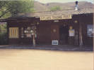
3 Flags Trading Post | ||||||
|
Literature Cited:
Locations: Tollhouse Flat. |
At Tollhouse Flat, on the east side of the West Walker River, is a reference section for the Tollhouse Flat Member of the Eureka Valley Tuff, as designated by Noble, et al. (1974). | ||||||
|
Locations:
Sweetwater Mountains.
|
Sweetwater Mountains | ||||||
|
Locations: West Walker River. |
From Sonora Junction northward to Topaz Lake, U. S. Highway 395 follows the course of the West Walker River. | ||||||
|
Other articles:
|
Sonora Junction:Junction: California Highway 108, west over Sonora Pass, to Sonora, Oakdale, and Modesto. | ||||||
|
Locations: Fales Hot Springs. |
Fales Hot Springs, south of highway. | ||||||
|
Other articles:
Locations:
By-Day Creek.
|
Here I also found the Bridgeport Remote Automated Weather Station (RAWS). Current data can be obtained from: http://raws.wrh.noaa.gov/cgi-bin/roman/meso_base.cgi?stn=BPOC1. This little road could be followed about 3/4 mile southwest to the mouth of By-Day Creek. | ||||||
|
Literature Cited:
Locations: Bridgeport Valley. |
Bridgeport Valley | ||||||
|
Other articles:
|
|||||||
|
Locations: Bridgeport. |
Bridgeport | ||||||
|
Other articles:
|
|||||||
|
Other articles:
Locations: East Walker River. |
Junction: California Highway 182, north past Bridgeport Reservoir and down the East Walker River Canyon to the California - Nevada border.
U. S. Highway 395 crosses the East Walker River at Bridgeport. | ||||||
|
Locations: Willow Springs. |
Willow Springs | ||||||
|
Other articles:
|
Junction: California Highway 270 "Bodie Road". Bodie is about 13 miles to the east. | ||||||
|
Other articles:
|
|||||||
|
Other articles:
|
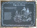
Edge of a Dream: Eastern Sierra Scenic Byway plaque. | ||||||
|
Other articles:
Locations:
Dog Town.
|
Dog Town
| ||||||
|
Other articles:
|
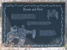
Boom and Bust: Eastern Sierra Scenic Byway plaque. | ||||||
|
Other articles:
|
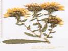
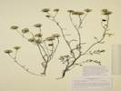
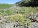
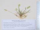
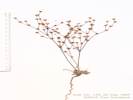
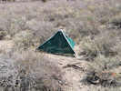
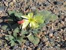
Location of Collection No. 893, Grindelia squarrosa var. serrulata. | ||||||
|
Other articles:
|
Junction: Virginia Lakes Road Virginia Lakes is 6 miles to the southwest. | ||||||
| East Walker River drainage and Bridgeport Valley to the north. | |||||||
|
Other articles:
Locations: Conway Summit. Mono Basin. |
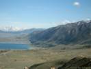
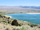
Walker River basin above, to the north
Conway Summit, elevation: 8143 ft., 2482 m. Mono Lake basin below, to the south | ||||||
|
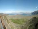
Locations: Mono Basin. |
Mono Lake basin to the south. | ||||||
|
Other articles:
|
| ||||||
|
Other articles:
Locations: Mono Diggins. |
Junction: Road to Rattlesnake Gulch, name of this road is unknown. | ||||||
|
Other articles:
|
Junction: Conway Ranch Road | ||||||
|
Other articles:
|
Junction: Unknown Road, west to cemetery and access to Copper Mountain. | ||||||
|
Literature Cited:
Other articles:
Locations: Copper Mountain. Copper Mountain. Jordan. |
| ||||||
|
Locations: Wilson Creek. |
Crossing Wilson Creek. | ||||||
|
Other articles:
|
Junction: Mill Creek Powerhouse Road | ||||||
|
Other articles:
|
Junction:
| ||||||
|
Other articles:
|
Junction: Forest Road 2N03, "Old Hwy 395", runs just west of present day highway. | ||||||
|
Locations: Mono City. |
Mono CityStreet access to Mono City is by way of California Highway 167 and Mono Lake Drive. | ||||||
|
Locations: Mill Creek. |
Crossing Mill Creek. | ||||||
|
Literature Cited:
Locations: Thompson Ranch. |
Thompson Ranch to the west of the highway. | ||||||
| Junction: Thompson Road | |||||||
|
Locations: Dechambeau Creek. |
Crossing Dechambeau Creek. | ||||||
|
Other articles:
|
Junction: Forest Road 2N03, "Old Hwy 395", to the north crossing Dechambeau Creek and Mill Creek, just west of current alignment. | ||||||
|
Other articles:
|
Junction: Cemetery Road (FR 02N40), to Mono Lake County Park, the Mono Lake Cemetery, and access to Mill Creek, Black Point, and Dechambeau Ponds. | ||||||
|
Locations: Mono Inn. |
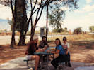
Mono InnHad the antelope for dinner; not bad. Good view of the lake. | ||||||
|
Other articles:
|
| ||||||
|
Other articles:
Locations:
Mono Lake, northwest shore (as a col. locality).
|
| ||||||
|
Literature Cited:
Other articles:
Locations: Andy Thompson Creek. Hammond Station. Mono Lake Post Office. Tioga Lodge. |
Tioga Lodge
Many plant collections use this location as a point of reference. | ||||||
|
Literature Cited:
Other articles:
Locations: Mono Lake. Picnic Grounds. |
| ||||||
|
Other articles:
|
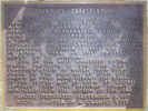
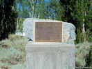
Near the Picnic Grounds is the memorial plaque for Sheriff James P. Dolan.
| ||||||
|
Other articles:
|
Junction: Forest Road 01N44 “Southwest Shore”, along the shore to to Test Station Road, crossing Lee Vining Creek. | ||||||
|
Other articles:
|
Junction: Forest Road 01N46 “Mono Visitor Center Drive” | ||||||
|
Other articles:
|
Great clouds of yellow "smoke," actually clouds of Pinyon pollen stirred up by gusty winds. | ||||||
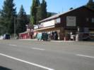
 El Mono Hotel and Latte Da Coffee Caf e. El Mono Hotel and Latte Da Coffee Caf e.
 Looking north on US Highway 395 Looking north on US Highway 395
|
|||||||
|
Literature Cited:
Other articles:
Locations: Lee Vining. |
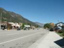
Lee Vining
| ||||||
|
Other articles:
|
|||||||
|
Locations: Lee Vining Creek. |
Crossing Lee Vining Creek. | ||||||
|
Other articles:
|
Junction: California Highway 120, west through Yosemite National Park.
California Highway 120 follows the route of US Highway 395 for 4.8 miles to the south (below). | ||||||
|
Other articles:
|
Junction: Test Station Road, east to the south shore of Mono Lake, to South Tufa. | ||||||
|
Other articles:
|
Junction: Forest Road 01N16 “Horse Meadows Road”, generally west between the south moraine of Lee Vining Canyon, and Williams Butte. | ||||||
|
Locations: Williams Butte. |
Williams Butte to the west | ||||||
|
Other articles:
|
Junction:
| ||||||
|
Other articles:
Locations:
Williams Butte.
|
Williams Butte to the northwest. | ||||||
|
Other articles:
|
View to the southwest of Parker Canyon and June Lakes Canyon. | ||||||
|
Other articles:
|
North June Lake JunctionJunction: California Highway 158 | ||||||
|
Other articles:
Locations:
Rush Creek.
|
Crossing Rush Creek. | ||||||
|
Other articles:
|
California Highway 120 follows the route of US Highway 395 for 4.8 miles to the north (up).
Junction: California Highway 120, east to Benton at US Highway 6. | ||||||
|
Other articles:
|
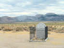
Grave of the Unknown Prospector, dedicated in 2003. It seems to me, though, that before Caltrans rebuilt this intersection, the memorial at this site was the "Grave of the Unknown Fisherman." | ||||||
|
Other articles:
|
Junction: Forest Road 1S52. Shown as 1S09 on the 2007 Motorized Vehicle Restrictions Map, listed as 01S52 and named as "West Portal Road" in the USFS Transportation data set, this road may have some relation to the "Old Mono Highway." The first half-mile of this road does not carry the Forest Road designation, presumably because it is on the private property of the LADWP. The junction with the current-signed "West Portal Road" is about 0.6 mi south. | ||||||
|
Other articles:
|
Junction:
Aqueduct crosses under US Highway 395, road here also. | ||||||
|
Other articles:
|
Junction: Forest Road 1S32, south to North Loop Road near June Lake; also access to 1S31 to the Horseshoe Canyon Moraine. | ||||||
|
Other articles:
|
Junction:
| ||||||
|
Other articles:
|
Junction:
| ||||||
|
Literature Cited:
Other articles:
Locations: Aeolian Buttes. |
Junction: Forest Road 1S116 Vista Point. Aeolian Buttes to the east, between the highway and Mono Craters.
| ||||||
|
Other articles:
|
Junction: Forest Road 1S35 "Punch Bowl Cutoff | ||||||
|
Other articles:
Locations: June Lake Junction. |
South June Lake JunctionJunction: California Highway 158, west to June Lake. | ||||||
|
Other articles:
|
|||||||
|
Other articles:
|
Junction: "Pumice Mine Road," Forest Road 1S40 | ||||||
|
Literature Cited:
Locations: Wilson Butte. |
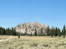
Wilson Butte on west side of highway. | ||||||
|
Other articles:
Locations:
Airfield Flat.
|
Not-so-good photo of the little sand flat to the south of Wilson Butte. I stopped here to look for Astragalus monoensis since the type locality is described as "near Deadman Summit." I have already found the species in nearby "Airfield Flat," but I could not find it here, leading to the suggestion that "Airfield Flat" is the likely type locality. | ||||||
|
Other articles:
|
Wilson Butte as seen from the south side near US Highway 395. | ||||||
|
Other articles:
|
Junction:
| ||||||
|
Other articles:
Locations:
Mono Basin.
|
Mono Lake basin to the north. | ||||||
|
Other articles:
Locations:
Deadman Summit.
|
Mono Lake basin above, to the north
Deadman Summit. Elevation: 8041 ft. Owens River basin below, to the south. | ||||||
|
Other articles:
|
Junction: Forest Road 02S11 "Section 21 Timber", west exit from highway. | ||||||
|
Other articles:
Locations: Airfield Flat. |
Junction: Forest Road 2S03 "Alpers Canyon" "Airfield Flat" to the north. There was a airfield in the sand flat to the north. One source has it a WWI airfield. I kind of doubt that. WWII seems more likely to me. You can access Airfield Flat from Bald Mountain Road. | ||||||
|
Locations: Deadman Creek. |
Crossing Deadman Creek | ||||||
|
Other articles:
|
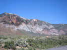
Obsidian flow to west of highway. | ||||||
|
Literature Cited:
|
Junction: Deadman Creek Road
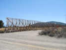
Snow fences along US Highway 395 at Deadman Creek Road. Watch for 1950s Caltrans-installed snow fences to the west. Fences were constructed upwind to keep wind-driven snow off the highway. Snow drifts build up along the eastern side of the fences, helping keep the road open with minimal plowing. The effects of higher and lower amounts of precipitation over time can be evaluated by looking at shrubs on either side of the snow fences. Near Deadman Creek, Michael Loik (UC Santa Cruz) and graduate students are studying simulations of increased and decreased snow depth scenarios as envisioned by some climate change models. Fluctuating snow depth results in variable soil moisture available for shrub and tree growth in the subsequent spring and summer, effects resonating through processes in the ecosystem such as litterfall, root growth, soil carbon storage, and soil nitrogen content. Their work on carbon, water, and nutrient fluxes driven by snow depth/melt timing in this system helps understand community-level responses to snow depth changes. Such responses include natural recruitment of Jeffrey and lodgepole pines (Pinus jeffreyi and P. contorta), as well as Great Basin sagebrush and antelope bitterbrush (Artemisia tridentata and Purshia tridentata) (McNulty, 2004). | ||||||
|
Other articles:
|
Bald Mountain and Lookout to the east of the highway. | ||||||
|
Other articles:
|
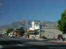
View north to Crestview and the final climb to Deadman Summit. | ||||||
|
Other articles:
|
Junction: Owens River Road, Forest Road 2S07 | ||||||
|
Other articles:
|
Junction: Forest Road 3S23, "Mammoth Scenic Loop", also known as the Mammoth Lakes Volcanic Escape Route. | ||||||
|
Other articles:
|
Junction: Forest Road 3S04 | ||||||
|
Other articles:
Locations:
Smokey Bear Flat.
|
Smokey Bear Flat | ||||||
|
Other articles:
|
Junction: Old Highway 395, North | ||||||
|
Literature Cited:
Locations: Basalt Canyon. |
Cross creek that drains Basalt Canyon to the west. Site of exploration for geothermal fluids to bring to Casa Diablo Hot Springs. | ||||||
|
Locations: Casa Diablo Hot Springs. |
Casa Diablo Hot Springs and power plant to the east. | ||||||
|
Literature Cited:
Other articles:
|
Junction: California Highway 203, west to Mammoth Lakes and the Devils Postpile National Monument. | ||||||
|
Other articles:
|
Junction: Old Highway 395, South | ||||||
|
Literature Cited:
Other articles:
Locations: Laurel Mountain. |
Laurel Mountain.Laurel Mountain is one of the best-exposed paleohydrothermal systems yet studied. Lackey and Valley (2004) evaluated fluid flow during contact metamorphism that caused wollastonite growth in calcareous metasandstones at Laurel Mountain in the Mount Morrison pendant at the eastern margin of the Sierra Nevada batholith, California. | ||||||
|
Other articles:
|
Junction: Hot Creek Hatchery Road or Owens River Road This is the road that goes northeast along Hot Creek. Some maps show this as Owens River Road, others as Hot Creek Hatchery Road. | ||||||
|
Locations: Long Valley Caldera. |
Long Valley CalderaThe U. S. G. S. operates a general information web site: Long Valley Caldera Location and Background Page | ||||||
|
Literature Cited:
Other articles:
Locations: Convict Lake. |
Field Trip Stop 2-5 "Convict Creek Moraines" of the 2009 Desert Symposium (Reynolds and Jessey, 2009). Looking south toward Convict Lake, one can see a 900-foot-high ridge that is a gigantic lateral moraine separating Tobacco Flat to the south from Long Valley to the north. The moraine is thought to be of Tahoe age. On the right (west) side of the road is a massive Tioga moraine made up of a series of arcuate end moraines. | ||||||
|
Other articles:
|
Junction: Benton Crossing Road | ||||||
| Cross Convict Creek | |||||||
|
Literature Cited:
|
Junction: Mount Morrison Road, access to Sierra Nevada Aquatic Research Laboratory (SNARL). A flora of SNARL has been published by UC Santa Barbara Museum of Systematics and Ecology (Orr and Howald, 2000). | ||||||
|
Locations: McGee Mountain. |
McGee Mountain | ||||||
|
Locations:
Lake Crowley.
|
Lake Crowley | ||||||
|
Literature Cited:
Other articles:
|
Big Pumice Cut
| ||||||
|
|
Tom's Place | ||||||
|
Other articles:
|
Summit of Sherwin Grade.
Type locality of Eriogonum nodosum Small ssp. monoense S. Stokes, J. T. Howell #14362. | ||||||
|
Other articles:
|
Junction: Rock Creek Road, Owens Gorge Road | ||||||
|
Literature Cited:
Other articles:
Locations: Owens River Gorge. Volcanic Tableland. |
Owens River Gorge. Field Trip Stop 2-3, "Owens River Gorge," of the 2009 Desert Symposium (Reynolds and Jessey, 2009) and LADWP Power Plant Middle Gorge. For comparison with Day 1 Cottonwood and Division Cr. plants, the Owens Gorge Power Plants are triplets, each generating 37.5 megawatts. The three plants operate simultaneously, and generate 100 megawatts. They also operate on aqueduct flow minus the water used in the Owens Gorge Fishery. About 120,000 acre feet of water goes through the plants each year, generating 225,000 megawatt-hours, enough for 200,000 homes. The penstock in Owens Gorge is eight feet in diameter. | ||||||
|
Junction: Pleasant Valley Dam Road and Saw Mill Road
Turn east here to access the Owens River Gorge. | |||||||
|
Locations: Red Hill. |
Junction: Ed Powers Road, Red Hill is about one mile south. | ||||||
|
Other articles:
Locations: Bishop. |
Junction: U. S. Highway 6, north east to Tonopah and Ely, Nevada. | ||||||
|
Other articles:
|
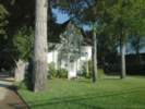
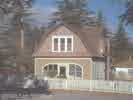
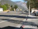
Older house on the main street of Bishop. | ||||||
|
Other articles:
|
Jack's Restaurant. I had breakfast here once. It was pretty good. | ||||||
|
Locations: Bishop. |
Bishop | ||||||
|
Other articles:
|
Junction:
| ||||||
|
Other articles:
|
Junction: Warm Springs Road, west and east across the Owens River to the base of the White Mountains, access to Black Canyon. | ||||||
|
Other articles:
Locations:
Mount Tom.
|
Mount Tom is 12 miles west of Bishop. The dark rocks on the top of Mt Tom are Paleozoic metamorphic rocks that have been intruded by Mesozoic granite batholith. | ||||||
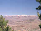
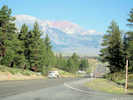
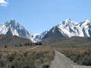
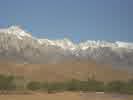
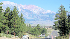
 South rim of Long Valley, as seen from US Highway 395 South rim of Long Valley, as seen from US Highway 395
|
View of the south wall of the Long Valley Caldera. | ||||||
|
Literature Cited:
|
At about this point, 8 miles north of Big Pine, Sara J. Manning investigated the relative effects os some biotic and abiotic factors on growth and productivity of two Owens Valley Shrubs: Happlopappus cooperi and Chrysothamus teretifolius (Manning, 1989). | ||||||
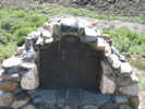
| Keough Hot Springs | |||||||
|
Locations:
Klondike Lake.
|
Klondike Lake is located in an alkali sink north of Big Pine. Before 1986, the alkali sink was intermittently filled with water from the Owens River via the Big Pine Canal and the Lyman Ditch. Under the Klondike Lake Enhancement/Mitigation Project in 1986, the lake level has been maintained via water releases from the Big Pine Canal. The Mono Lake Committee lists Klondike Lake as one of the best water bird areas in the Eastern Sierra. The lake is heavily used for recreation on summer weekends, including swimming, water-skiing, sailing and windsurfing. The lake can be seen from US Highway 395, about two miles north of California Highway 168 in Big Pine. A cattle guard and information board mark the turnoff. Turn east onto an unmarked dirt road. There is a left turn lane from US Highway 395 if coming from the north. | ||||||
|
Other articles:
|
Junction: California Highway 168, east over Westgard Pass and through Deep Springs Valley into Fish Lake Valley. | ||||||
|
Other articles:
|
Junction: Baker Creek Road | ||||||
|
Other articles:
|
Junction: West Crocker Street, gives access to Glacier Lodge Road. | ||||||
|
|
Big Pine | ||||||
|
Locations: Big Pine Creek. |
Cross Big Pine Creek. | ||||||
|
Locations:
Crater Mountain.
|
Crater Mountain to the west. | ||||||
|
Other articles:
|
Junction: Fish Springs Road, north end. | ||||||
| To the west is the Fish Springs Fish Hatchery. | |||||||
| To the west, across the alfalfa field, is the populated place of Fish Springs. | |||||||
|
Other articles:
|
Junction: Fish Springs Road, south end. | ||||||
|
Locations: Poverty Hills. |
Poverty Hills to the west of the highway. | ||||||
|
Literature Cited:
Locations: Tinemaha Reservoir. |
Tinemaha Reservoir to east side of the highway. | ||||||
|
DeLorme's Northern California Atlas and Gazetteer above 37° North. DeLorme's Southern California Atlas and Gazetteer below. | |||||||
| Junction: Black Rock Springs Road | |||||||
|
Locations: Sawmill Creek. |
Cross the channelized Sawmill Creek which is enroute to the Los Angeles Aqueduct. To the west is Sawmill Creek, Sawmill Meadow, Sawmill Lake, Sawmill Point, and Sawmill Pass. There are collections of Frasera puberulenta from Sawmill Creek, Sawmill Meadow, and Sawmill Pass. | ||||||
|
Other articles:
|
Junction: Tinemaha Road | ||||||
| Junction: Fort Independence Road | |||||||
|
Literature Cited:
Other articles:
|
Junction: Miller Street
Field Trip Stop 3-2 of the 2009 Desert Symposium (Reynolds and Jessey, 2009). Look west-northwest at debris flow which came down north fork of Oak Creek. | ||||||
| Cross Oak Creek | |||||||
| Junction: Fish Hatchery Road | |||||||
|
Other articles:
Locations:
Independence.
|
|||||||
|
Literature Cited:
Other articles:
Locations: Independence. |
Independence
The Eastern California Museum is near the corner of West Market Street and Grant Street. It has a collection of eastern California minerals and mining equipment. It also has an excellent exhibit of Native American baskets and artifacts and reproductions of rock art. The life of Japanese-Americans interned at Manzanar is also exhibited. | ||||||
|
Other articles:
|
Junction: Mazourka Canyon Road | ||||||
|
Literature Cited:
|
Golden Bear Dike to the southeast.
The Golden Bear dike in the Sierra Nevada and the Coso dikes in the Coso Range crop out on opposite sides of Owens Valley, California, and strike roughly perpendicular to it. Neither dike reappears along strike across the valley. New data demonstrate that the dike sets are ca. 83 Ma in age, share nearly identical mineralogy and petrography, and intrude similar wall rocks including distinctive 102 Ma leucogranite. These data suggest that the dike sets were originally continuous and were offset dextrally by ~65 km. This displacement estimate is consistent with other recent estimates of total slip across Owens Valley. If faulting began during the Pliocene, the average slip rate was signifi cantly faster than the current rate. Alternatively, motion could have been episodic and have begun as early as the Late Cretaceous (Kylander-Clark, et al., 2005). | ||||||
|
Literature Cited:
Locations:
Manzanar.
|
ManzanarManzanar was an one of ten internment camps where 110,000 people of Japanese ancestry were sent to live during World War II. Jeanne Wakatsuki Houston's 1973 book, Farewell to Manzanar, is a very readable account of one young woman's experience there. | ||||||
|
Literature Cited:
Locations: Alabama Gates Paleoseismic Site. |
Alabama Gates Paleoseismic Site. Bacon and Pezzopane (2007) excavated three fault trenches and one 2-m deep pit within about 10-20 m of each other along the north-striking fault trace near Alabama Gates. | ||||||
|
Literature Cited:
Locations: Alabama Hills. |
The northeastern portion of the Alabama Hills is composed of Jurassic arc-marginal volcanogenic sedimentary units that correlate with similar units in the southern Inyo Mountains (Dunne and Walker, 1993). | ||||||
|
Literature Cited:
Locations: Quaker Paleoseismic Site. |
Quaker Paleoseismic Site. Bacon and Pezzopane (2007) excavated four fault trenches within 20-50 m of one another along a 100-m length of the Owens Valley fault. Three stratigraphic pits, each 3-4 m in depth, were excavated on nearby geomorphic surfaces in order to map the unfaulted stratigraphy. | ||||||
|
Literature Cited:
|
Junction: Panborne Lane | ||||||
|
Locations:
Lone Pine.
|
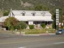
Lone PineI left Lone Pine early one May morning, bound for the Nelson Range and Hunter Mountain. The sun had just come up over the Inyo Mountains and was shining stongly. I pulled over just to take this picture. | ||||||
|
Other articles:
|
Junction: Whitney Portal Road Turn west here to visit the Lone Pine Fault. | ||||||
|
Other articles:
|
Junction: California Highway 136, to California Highway 190 and Death Valley. | ||||||
|
Locations: Carroll Creek. |
Carroll Creek. Annie M. Alexander and Louise Kellogg collected Salvia dorrii on the mesa above Carroll Creek Canyon. Also accessible from Horseshoe Meadows Road. | ||||||
|
Locations: Bartlett. |
Bartlett | ||||||
|
Other articles:
|
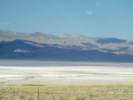
The margin of Owens Lake is lined with industrial plants in various states of decay. | ||||||
|
Other articles:
Locations:
Cerro Gordo.
Owens Lake.
|
For 16 miles (26 km), US Highway 395 passes along the western shore of Owens (Dry) Lake. | ||||||
|
Other articles:
|
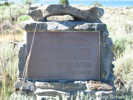
Junction: Cottonwood Road, Forest Road 17S01, west, a short way up Cottonwood Creek Canyon. This was the route by which Carl Purpus descended into Owens Valley in 1896. | ||||||
|
Literature Cited:
Other articles:
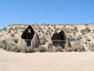
Locations: Cottonwood Charcoal Kilns. |
Cottonwood Charcoal Kilns
The historic plaque is at the highway; the kilns are about 1 mile east on a dirt road. | ||||||
|
Literature Cited:
|
The Los Angeles Aqueduct Cottonwood Treatment Plant is west of the highway. At this location ferric chloride is injected into the water to coagulate Arsenic in the water. The dissolved Arsenic precipitates with the iron and is deposited in the inlet channel to Haiwee reservoir. The primary source of the Arsenic is thought to be the hot springs in Hot Creek, near Mammoth Lakes. | ||||||
|
Locations: Cottonwood Creek. |
Crossing Cottonwood Creek | ||||||
|
Other articles:
Locations: Olancha. |
OlanchaJunction: California Highway 190, east to Death Valley. | ||||||
|
Literature Cited:
Locations: Coso Range. |
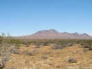
Coso Range to the east. The Golden Bear dike in the Sierra Nevada and the Coso dikes in the Coso Range crop out on opposite sides of Owens Valley, California, and strike roughly perpendicular to it. Neither dike reappears along strike across the valley. New data demonstrate that the dike sets are ca. 83 Ma in age, share nearly identical mineralogy and petrography, and intrude similar wall rocks including distinctive 102 Ma leucogranite. These data suggest that the dike sets were originally continuous and were offset dextrally by ~65 km. This displacement estimate is consistent with other recent estimates of total slip across Owens Valley. If faulting began during the Pliocene, the average slip rate was signifi cantly faster than the current rate. Alternatively, motion could have been episodic and have begun as early as the Late Cretaceous (Kylander-Clark, et al., 2005). | ||||||
|
Literature Cited:
Locations: North Haiwee Reservoir. |
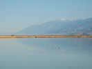
North Haiwee Reservoir | ||||||
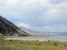
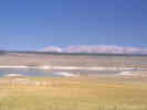
|
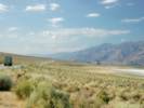
Locations: Owens Valley. |
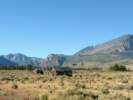
Owens Valley to the north
Rose Valley to the south | ||||||
|
Literature Cited:
Locations: South Haiwee Reservoir. |
South Haiwee Reservoir | ||||||
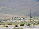
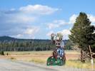
| Dunmovin | |||||||
|
Literature Cited:
Other articles:
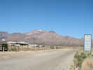
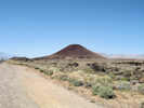
Locations: Coso Junction. |
Coso Junction
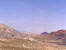
View left (northeast) of white pumice mine cuts. The Sugarloaf perlite dome is to the southeast, along with cinder cones of the Coso Volcanic Field. The Coso Geothermal Field hosts a power-generating project in continuous operation for two decades. In 2002, four geothermal power plants were located in the main production area, constructed from 1987 through 1990. Turbine-generator sets are operated by steam; the geothermal system is heated by magma that has been migrating upward from a depth of 10 km to as shallow as 5 km. This near-surface system is evidenced by hot springs, mud pots, mud volcanoes, and fumaroles. Banerjee, et al. (2011) assessed the relative importance of deeply circulating meteoric water and direct mantle fluid inputs on near-surface 3He/4He anomalies reported at the Coso and Beowawe geothermal fields of the western United States. The depth of meteoric fluid circulation is a critical factor that controls the temperature, extent of fluid-rock isotope exchange, and mixing with deeply sourced fluids containing mantle volatiles. The influence of mantle fluid flux on the reported helium anomalies appears to be negligible in both systems. This study illustrates the importance of deeply penetrating permeable fault zones (10-12 to 10-15 m2) in focusing groundwater and mantle volatiles with high 3He/4He ratios to shallow crustal levels. These continental geothermal systems are driven by free convection, and fluid flow is guided by faults rather than topographic gradients. | ||||||
|
Locations: Rose Valley. |
Rose Valley | ||||||
|
Locations:
Red Hill.
|
Red Hill | ||||||
|
Locations: Little Lake. |
Little Lake (lake) | ||||||
| Little Lake (populated place) | |||||||
|
Literature Cited:
Other articles:
|
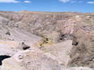
Junction: Little Lake Road Turn west here to view the outcrop of columnar basalt at Field Trip Stop 1-3 of the 2009 Desert Symposium (Reynolds and Jessey, 2009). | ||||||
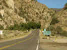
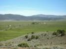
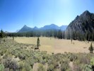
 Looking North Along U. S. Highway 395 Near Nine Mile Canyon. Looking North Along U. S. Highway 395 Near Nine Mile Canyon.
|
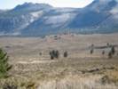
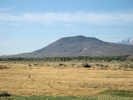
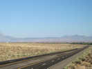
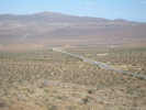
Extreme northern end of Indian Wells Valley. | ||||||
| Junction: Nine Mile Canyon Road | |||||||
|
Inyo County above
Kern County below | |||||||
|
Other articles:
|
Junction: California Highway 14, south to Los Angeles. | ||||||
|
Other articles:
Locations: Inyokern. |
InyokernJunction: California Highway 178, east to Death Valley, or west over Walker Pass to Bakersfield. | ||||||
|
Other articles:
|
Junction: Searles Station Road | ||||||
|
Other articles:
|
Junction: Garlock Road, to Garlock and Red Rock Canyon via Redrock Randsburg Road and CA Hwy 14. | ||||||
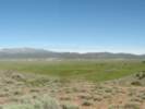
 US Hwy 395 crosses Fremont Valley US Hwy 395 crosses Fremont Valley
|
US Highway 395 crosses the extreme east end of Fremont Valley. | ||||||
|
Other articles:
|
Junction: Redrock Randsburg Road, to Garlock and Red Rock Canyon via California Highway 14. | ||||||
|
Locations: Johannesburg. |
Johannesburg | ||||||
|
Kern County above
San Bernardino County below | |||||||
|
Other articles:
|
Junction: Trona Road | ||||||
|
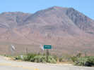
Locations: Red Mountain. |
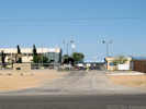
Red MountainRed Mountain is the name of the mountain directly east of the highway. It is also the name of the small town located on US Hwy 395 about 23 miles north of Kramer Junction and 23 miles south of Ridgecrest. One of three active ghost towns in this immediate area: Randsburg, Johanesburg, and Red Mountain. Population 130 people. | ||||||
| Junction: Red Mountain Road | |||||||
|
Literature Cited:
|
The Kelly Mine and tailings pile is west of the highway. It has been investigated as a source of arsenic soil contamination in the yards of Red Mountain residences. | ||||||
|
Locations:
Atolia.
|
Atolia | ||||||
|
Locations:
Red Mountain.
|
Red Mountain to the north and east of the highway. | ||||||
 Solar Electric Generating Systems Solar Electric Generating Systems
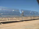 Solar Electric Generating Systems Solar Electric Generating Systems
|
FPL Systems, Solar Electric Generating Systems. | ||||||
|
Other articles:
Locations: Kramer Junction. |
Kramer JunctionJunction: California Highway 58, west to Bakersfield and ultimately US Highway 101 near Santa Margarita, or east to Barstow. | ||||||
|
Literature Cited:
Locations: Kramer Hills. |
Kramer Hills | ||||||
|
Other articles:
|
Junction: California Highway 18 | ||||||
|
Other articles:
|
Junction: U. S. Interstate 15, south through San Bernardino to San Diego. | ||||||
| If you have a question or a comment you may write to me at: tas4@schweich.com I sometimes post interesting questions in my FAQ, but I never disclose your full name or address. |
Date and time this article was prepared: 4/27/2024 3:30:41 PM |