Eastern Mojave Vegetation
Tom Schweich
|
Eastern Mojave Vegetation
| Field Notes (Continued) |
|
Tom Schweich |

Topics in this Article: 1800s 1900s 1910s 1920s 1930s 1940s 1950s 1960s 1970s 1980s 1990 1991 1992 1993 1995 1996 1997 1998 1999 2000 2001 2002 2003 2004 2005 2006 2007 2008 2008 Tour de Swertia albomarginata Mono Lake, August 2008 2009 2010 2011 2012 2013 2014 2015 2016 2017 2018 2019 2020 2021 2022 2023 2024 Contents Literature Cited |
When I first read the field notes of Annie Alexander and Louise Kellogg, I was fascinated by the descriptions they wrote about the places they went and the plants and animals they found there. By publishing my field notes on the Internet I hope to follow a little bit in their tradition. | |||||||
|
|
2000 | |||||||
|
|
Sunday, April 2nd | |||||||
|
Other articles:
|
203 |
Toxicoscordion fremontii (Torr.) Rydb. Fremont's Death Camas.
Diablo Range, San Benito County, California. In the saddle between Lorenzo Vasquez Canyon and Miller Canyon, on Coalinga Road, 11 miles south of the Junction with State Highway 25. 36.3603°N, 120.8488°W. WGS 1984. Elev. 900 m. Small grassland under oaks, on ridge. Coll. No. 203, 2 Apr 2000, characters observed: Perennial geophyte, to 40 cm.; Bracts, 7 mm.; Pedicel, 11 mm.; Flowers, bisexual on lower branches; Perianth, rotate; Petals, 9.5 mm. × 2.3 mm. wide; Stamens, 6 mm., stamens < perianth; Filaments, straight, proximally thick. | ||||||
|
Other articles:
|
204 |
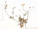
Ranunculus californicus Benth. var. californicus. California Buttercup.
Diablo Range, San Benito County, California. In the saddle between Lorenzo Vasquez Canyon and Miller Canyon, on Coalinga Road, 11 miles south of the Junction with State Highway 25. 36.3603°N, 120.8488°W. WGS 1984. Elev. 900 m. Small grassland under oaks, on ridge. Coll. No. 204, 2 Apr 2000, characters observed: Herbaceous perennial, to 25 cm.; Stem, not floating, not rooting at nodes, erect, hairy; Leaves, basal and cauline, cauline, alternate, deeply lobed; Flower, radial; Perianth, parts in 2 whorls, sepals and petals different; Sepals, 5 mm. × 2.5 mm. wide, spurs 0, yellow, hairy abaxially, reflexed; Petals, #11, 7 mm. × 2.8 mm. wide, clawed, yellow, round nectary near base of blade; Stamens, yellow; Ovule, 1 per ovary; Pistils, many; Style, present; Fruit, follicle (not a berry), 3.2 mm. × 3 mm. wide × 1 mm. thick, width 3 × depth, not inflated, wall tough, not papery, faces smoooth, beak, 0.6 mm., curved. | ||||||
|
Other articles:
|
205 |
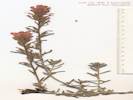
Castilleja foliolosa Hook. & Arn. Chaparral Paintbrush.
San Carlos Creek, San Benito County, California. Along creek 1 mile below New Idria Mine. 36.4261°N, 120.6694°W. WGS 1984. Elev. 800 m. Steep hill slope on sandstone. Coll. No. 205, 2 April 2000, characters observed: Perennial subshrub, to 30 cm.; Stems, decumbent to ascending; Herbage gray-green; Hairs, much branched; Leaves, alternate, sessile, 14 mm. oblong, to few 3- lobed distally; Calyx, 14 mm., cleft equally 4 mm., entire on sides; Corolla, tube 8 mm. + beak 13 mm. = 21 mm., lower lip small. | ||||||
|
Other articles:
|
206 |
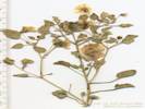
Erysimum capitatum (Hook.) Greene. Sanddune Wallflower.
New Idria Mine, San Benito County, California. Along creek 1 mile below New Idria Mine. 36.4261°N, 120.6694°W. WGS 1984. Elev. 800 m. Steep hill slope on sandstone. Coll. No. 206, 2 Apr 2000, characters observed: Perennial or biennial, to 45 cm.; Stems, proximal not woody; Leaves, basal and cauline, basal, petiole + blade, 100 mm. × 3 mm. wide, margin sparsely toothed, proximal cauline leaves, adaxial surface, hairs 2 & 3 rayed; Pedicels, 3-5 mm., elongating as flower matures; Petals, yellow, 16 mm. × 4.5 mm. wide; Fruit, unknown; Seeds, unknown. | ||||||
|
Other articles:
|
207 |
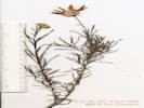
Ericameria linearifolia (DC.) Urb. & J. Wussow. Narrowleaf Goldenbush.
San Carlos Creek, San Benito County, California. Along San Carlos Creek 1 mile below New Idria Mine. 36.4259°N, 120.6693°W. WGS 1984. Elev. 800 m. Steep hill slope on sandstone. Coll. No. 207, 2 April 2000, characters observed: Perennial, herb, woody below, to 30 cm.; Leaves, alternate, some in clusters, linear, 20 mm. × 1 mm. wide, glandular-sticky, regularly spaced resin pits; Inflorescence, some flowers with strap-shaped corollas, head composed of two kinds of flowers; Receptacle, epaleate; Phyllaries, in 5 not-fully-overlapping series, graduated in size, 6-11 mm. × 1.5-2.5 mm. wide, mid phyllary vein prominent throughout length though not raised, margin fringed; Rays, 7, yellow, 22-23 mm. × 5 mm. wide, 0-2 appendages to 14 mm.; Disk flowers, ±20; Pappus of well-developed bristles on both ray and disk flowers, ± cylindric; Pistil, style 8 mm. + stigma 1.5 mm. + appendages 1.0 mm.; Fruit, dense silky hairy. This collection is determined as Ericameria linearifolia, although it does not key there, primarily because the phyllaries are definitely not equal, whereas E. linearifolia requires phyllaries that are ±equal. The ray corollas are larger than typically described, and some of them have long thin appendages. | ||||||
|
Other articles:
|
209 |
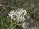
Dichelostemma capitatum (Benth.) Alph. Wood ssp. capitatum. Bluedicks.
San Carlos Creek, San Benito County, California. Hillsides, 2 miles by road below the townsite of New Idria, 86 km southwest of Fresno, California. 36.4465°N, 120.6636°W. Elev. 700 m. Hill slopes above and below road. Coll. No. 209, 2 Apr 2000, characters observed: Perennial geophyte, to 35 cm.; Scape, curved; Bracts, 12.5 mm.; Pedicel, 5 mm.; Perianth, tube 6 mm. + lobes 9.5 mm. = 15.5 mm., blue-purple, inner crown, 1.5 mm. > anthers, color unknown, straw color when dry; Stamens, #6; Anthers, unequal, #3 @ 2.7 mm., #3 @ 4.2 mm. | ||||||
|
Other articles:
|
210 |
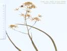
Ephedra californica S. Watson. Desert Tea.
Griswold Canyon, San Benito County, California. Hillslopes, on New Idria Road in Griswold Canyon, 5 miles by road south of Panoche, 16.5 miles by road northwest of New Idria, 36.545°N, 120.8374°W. WGS 1984. Elev. 500 m. Hill slopes above road. | ||||||
|
|
Wednesday, April 26th | |||||||
|
Other articles:
|
212 |
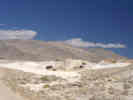
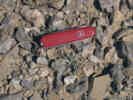
Physalis Physalis crassifolia Benth. Thick Leaved Ground Cherry. Baxter, San Bernardino County, California. Former railroad roadbed at Cave Mountain Limestone mine, mouth of Afton Canyon, north side of Mojave River, ½ mile northwest of current Union Pacific Railroad station named Basin. 35.047°N, 116.3027°W. Elev. 360 m. Only one seen.
Coll. No. 212, 26 April 2000, characters observed:
| ||||||
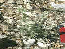
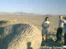
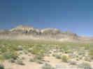
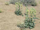
 "Rock Nettle" (Eucnide urens) in the Cave Mountain (Baxter) Limestone Quarry "Rock Nettle" (Eucnide urens) in the Cave Mountain (Baxter) Limestone Quarry
|
213 | Eucnide urens, several seen in rocks and cliff faces. 11S 0563596 3878478 | ||||||
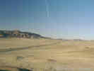
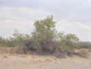
| Drove back nearly to Interstate 15 on Basin Road, to a place at which I had seen Creosote Bush, Desert Willow, and Mesquite growing together. This location could be described as on Basin Road, 1½ miles South of U. S. Interstate 15, 11S 0566602 3882202, Mojave River Sink, Chilopsis, Prosopis and Larrea all growing on sand hillocks. | ||||||||
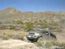
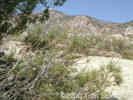
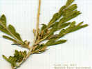
 Chilopsis linearis "Desert Willow" Chilopsis linearis "Desert Willow"
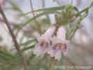 Chilopsis linearis "Desert Willow" Chilopsis linearis "Desert Willow"
|
214 |
Field identification: Chilopsis linearis, one of many.
Chilopsis linearis (Cav.) Sweet ssp. arcuata (Fosb.) Henrickson. Desert Willow. Mojave River Wash, San Bernardino County, California. South of US Interstate 15, 214 km northeast of Los Angeles, California. 35.0876°N, 116.2661°W. NAD1983 Elev. 350 m. One of many plants in this area. | ||||||
| 215 |
Field identification: Prosopis sp., not many flowers here, though I had seen many flowers on other bushes elsewhere along Basin Road.
Prosopis glandulosa Torrey var. torreyana (L. Benson) M. Johnston. Honey Mesquite. Mojave River Wash, San Bernardino County, California. 214 km northeast of Los Angeles, California. 35.0876°N, 116.2661°W. NAD1983 Elev. 350 m. Not many flowers here, though I had seen many flowers on other bushes elsewhere along Basin Road. | |||||||
| Along the highway through this area, there were many Palo Verde, though I could find none away from the highway. I drove across the north side of Basin Road, parked, and then walked back under the bridge to a specimen that was accessible on the south side of Interstate 15, west of the Basin Road bridge. | ||||||||
|
Other articles:
|
216 |
Parkinsonia aculeata L. Mexican Palo Verde. Mojave River Wash, San Bernardino County, California. On Interstate 15 at Basin Road, collected north side of highway, at the edge of the wash, west of Basin Road overpass. 35.1007°N, 116.2704°W. WGS 1984, Elev. 337 m. Has spines at nodes. | ||||||
| Spent the night at Zzyzx. | ||||||||
|
Other articles:
|
Thursday, April 27, 2000 | |||||||
| Next morning drive to Wild Horse Mesa. Checked my plot on the north slope of Wild Horse Mesa Clear and warm last night in Zzyzx, 75-76° F in Baker at 8:30 AM. Radio predicting record-setting temperature in the high desert. At NWHM and LP there is a nice breeze out of the southwest that is keeping temperatures down to 75-80° F. Excellent displays of Apricot Mallow (Sphaeralcea ambigua) along I-15 above 2000 feet. | ||||||||
|
Other articles:
|
217 |
Castilleja sp., solitary plants or growing in Prunus fasciculata.
Castilleja chromosa Nelson. Desert Indian Paintbrush. Wild Horse Mesa, San Bernardino County, California. North face of Wild Horse Mesa, about 1.5 miles by road and trail southwest of Wild Horse Canyon Road, and about 8 miles north northeast of Mitchell Caverns. 35.0471°N, 115.4583°E. WGS 1984. Elev. 1540 m. Solitary plants or growing in Prunus fasciculata. Coll. No. 217, 27 April 2000, characters observed: Perennial subshrub, to 25 cm., green, hairs simple, not glandular anywhere especially proximal to inflorescence, pinyon-juniper woodland; Leaves alternate (sometimes nearly appearing opposite), sessile, 50 mm. × 5 mm. wide, lanceolate to 5-lobed distally, not fleshy; Calyx, 18 mm., cleft ab- and ad-axially 5 mm. (28%), lobes not curved upward; Corolla, tube 11 mm. + beak 13 mm. = 24 mm., straight, not curved through abaxial side of side of calyx sinus, upper lobes tip open, projected forward, lower lip small; Stamens, 4, fused in pairs; Anther, sacs per stamen obscured by twinning, looks like at least 3 sacs per pair of stamens; Stigma, lobes obscured by pollen. | ||||||
|
Other articles:
|
218 |
Phlox stansburyi (Torrey) A. A. Heller var. stansburyi. Cold-Desert Phlox.
Wild Horse Mesa, San Bernardino County, California. North face of Wild Horse Mesa, about 1.5 miles by road and trail southwest of Wild Horse Canyon Road, and about 8 miles north northeast of Mitchell Caverns. 35.0471°N, 115.4583°W. WGS 1984. Elev. 1540 m. Solitary plants or growing out of Coleogyne ramosissima. Coll. No. 218, 27 Apr 2000, characters observed: Perennial, subshrub, open, not matted or cushion-like, Stem, woody below, Leaves, mostly opposite, some alternate, simple, entire, 45 mm. × 3 mm. wide, lance-linear; Inflorescence, not head-like; Calyx, lobes equal, membrane ±keeled; Corolla, salverform, tube 11 mm. + lobes 6 mm. = 17 mm.; Anthers, 3 short, 2 long; Style, 5.5 mm.; Stigma, 1 mm. | ||||||
|
Other articles:
|
219 |
Astragalus sp., on the old road with Dalea searlesiae, just starting to bloom.
Astragalus lentiginosus Hook. var. fremontii (A. Gray) S. Watson. Fremont's Milkvetch. Wild Horse Mesa, San Bernardino County, California. North slopes of Wild Horse Mesa, 5.73 km west of the current (2012) Hole-in-the-Wall Visitor Center, 12.49 km north northeast of Mitchell Caverns. 35.0471°N, 115.4583°W. wgs 1984. Elev. 1540 m. On the old road with Dalea searlesiae, just starting to bloom. Same as Coll. No. 248. | ||||||
|
Other articles:
|
220 |
Chamaesyce, in the old road.
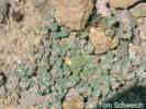
Chamaesyce albomarginata (Torrey & A. Gray) Small. Rattlesnake Weed. Wild Horse Mesa, San Bernardino County, California. North face of Wild Horse Mesa, about 1.5 miles by road and trail southwest of Wild Horse Canyon Road, and about 8 miles north northeast of Mitchell Caverns. 35.0471°N, 115.4583°W. WGS 1984. Elev. 1540 m. In the old road. Coll. No. 220, 27 Apr 2000, characters observed: Perennial, tap-rooted, prostrate, to 7 cm. dia.; Leaves, opposite, ovate, 5 mm. × 4 mm. wide, margins entire, petioles 0.7 mm., stipules fused into wide membraneous scale; Inflorescence, 1 involucre per node, of separate ♂ and ♀ flowers; Involucre, glabrous, appendage white; Styles, #3, each divided ½; Fruit, glabrous. | ||||||
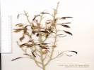
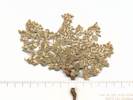
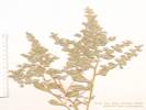
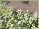
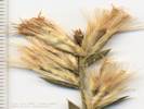
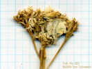 Collection No. 221, Chrysothamnus depressus longflower rabbitbrush Collection No. 221, Chrysothamnus depressus longflower rabbitbrush
 Collection No. 221, Chrysothamnus depressus Longflower rabbitbrush Collection No. 221, Chrysothamnus depressus Longflower rabbitbrush
|
221 | Chrysothamnus depressus Nutt. Longflower Rabbitbrush. Longflower rabbitbrush, Wild Horse Mesa, San Bernardino County, California. 4 km west of Hole-in-the-Wall, 278 km northeast of Los Angeles, California. 35.0468°N, 115.458°W. NAD1983 Elev. 1540 m. Low-growing woody perennial, occasional in experimental plots, no flowers when collected, with Juniperus osteosperma, Pinus monophylla, Coleogyne ramosissima, Erigonum fasciculatum in Frasera albomarginata plot. See also collection number 265. | ||||||
|
Other articles:
|
222 |
Cryptantha flavoculata (A. Nelson) Payson. Roughseed Cryptantha. Wild Horse Mesa, San Bernardino County, California. In open areas on limestone, about 5.5 km. west of Hole-in-the-Wall. 35.0471°N, 115.4583°W. WGS 1984. Elev. 1540 m. Solitary Plants. Stinging hairs. With Swertia albomarginata, Juniperus osteosperma, Pinus monophylla, Coleogyne ramosissima, and Eriogonum fasciculatum. Coll. No. 222, 27 April 2000, characters observed while keying: Perennial to 20 cm.; Hairs of two kinds, short appressed, long single-celled “bulbous-based bristles;” Leaves basal and cauline, cauline alternate, to 65 mm. × 12 mm. wide; Corolla, salverform, white, tube 4 mm. + lobe 3.5 mm., appendages prominent; Nutlets not sufficiently developed. | ||||||
| 223 | Forestiera pubescens, in bottom of wash at the water tank. | |||||||
| Drove over to Lobo Point for lunch. | ||||||||
| 224 | Sphaeralcea ambigua, with Ferocactus cylindraceus, Ericameria cooperi, on ridge line south of Lobo Point with southwest exposure. Most plants of this species in less exposed areas are not im bloom yet. | |||||||
| At Lobo Point, I climbed up the ridge south of the campsite looking for Loeseliastrum and Salvia mohavensis but did not find either one. | ||||||||
|
Other articles:
|
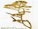
225 |
Lotus sp., on outcrops of pyroclastic mud flow, growing from fractures in rock.
Acmispon rigidus (Benth.) Brouillet. Desert Rock Pea. Lobo Point, San Bernardino County, California. On north-facing outcrops of pyroclastic mudflow, growing from fractures in rock, 170 m south of the campsite, now closed, 2.65 km northwest of the current (2012) Hole-in-the-Wall Visitor Center, 14.55 km northeast of Mitchell Caverns 35.0498°N, 115.4233°W. WGS 1984. Elev. 1395 m. | ||||||
| Along the road out of the Lobo Point campsite, between the Opal Beds and the Andesite outcrop. | ||||||||
|
Other articles:
|
226 | Ephedra nevadensis, from both male and female plants, great clouds of pollen are produced by the male plants when tapped. Finding this plant in bllom was a surprise; I dont think I have ever seen such a heavy bloom in this species. | ||||||
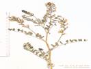
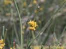
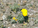 Undetermined Poppy near Lobo Point Undetermined Poppy near Lobo Point
|
228 | Eschscholtzia sp., on the andesite flat next to road. | ||||||
| Walked over to the outcrop with the Salvia mohavensis, found 5-6 plants, but no buds or flowers. | ||||||||
| Drove to Pinto Mountain to check my experimental plots in Frasera albomarginata there. | ||||||||
|
Other articles:
|
229 |
Blue flower, Linum(?), few seen.
Linum lewisii Pursh var. lewisii. Prairie Blue Flax. Pinto Mountain, San Bernardino County, California. On the lowest south-facing slopes of Pinto Mountain, 600 meters north of Cedar Canyon Road, and 12.7 km by air southeast of Cima. 35.1728°N, 115.3847°W. WGS 1984. Elev. 1700 m. Blue flower. Few seen. | ||||||
| 230 | Thamnosma montana | |||||||
|
There were some new rosettes of Frasera albomarginata at Pinto Mountain. The unknown orange flower with the petals that fall out was in bud, but not flower. I collected very similar, but a little taller and with blue flowers.
Weather stayed warm 75-80°F and breezy. Worlds tallest thermometer at Baker said 101°F at 5:30 PM when I drove through there. Rob said the high was 104°F at Zzyzx. | ||||||||
|
|
Saturday, April 29, 2000 | |||||||
|
Literature Cited:
Other articles:
Locations: Afton Canyon. |
| |||||||
|
|
Sunday, April 30, 2000 | |||||||
|
Literature Cited:
Other articles:
Locations: Black Butte. Stump Spring. Tule Spring. |
| |||||||
| 231 |
Same as Coll. No. 232. | |||||||
|
Other articles:
Locations:
Tule Spring.
|
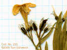
232 |
Tule Spring, Inyo County, California. At a former settlement 0.5 km southeast of the Spring, 14 km east of Tecopa, Inyo County, and 90 km southwest of Las Vegas, Nevada. 35.8142°N, 116.0523°W. WGS1984 Elev. 715 m. Coll. No. 232, 30 Apr 2000, characters observed; Perennial, woody shrub, to 1 m.; Stem, some branch tips spiny, smooth not striate; Leaves, petiole 4-5 mm., blade 16-18 mm. × 9.0-9.5 mm. wide, length 1.7-2.0 × width, margins entire; Inflorescence, dioecious or monoecious (staminate or pistillate flowers are borne separately, but when the collection was made, I did not note separate branches or separate plants); Bracts, fruiting, to 5 mm. × 4 mm. wide, ±leaf-like (small, per description in TJM2, but all different sizes and likely still growing). | ||||||
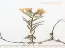
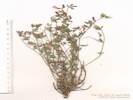
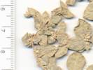
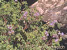
 Collection No. 233, Lepidium fremontii var. lepidium, desert pepperweed. Collection No. 233, Lepidium fremontii var. lepidium, desert pepperweed.
|
233 | Lepidium sp. | ||||||
|
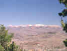
At Tule Spring there is a water tank and several foundations. Tamarisk has been cut recently.
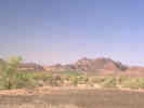
The Kingston Range isto the south, the Spring Mountains (with some snow on the top) to the east, and the Nopah Range to the north. The source of water for Tule Spring is probably the low axis of valley. The fine-grained sediments of alluvial fans from Alexander Hills and Nopah Range may have dammed water exiting the California Valley, or possibly there is a sill or ground water basin. Looking at the Kingston Range, there is a spring at the trees between the 2 talc mines. | ||||||||
| Lichen, in tufa at the white spring mound. | ||||||||
| Stop 6. Hidden Hills Ranch, Pahrump Valley Fault zone, cienega deposits. | ||||||||
| 235 | Lycium sp., on top of the spring deposits, 11S 0603473 3984730 | |||||||
|
Locations: Stump Spring. |
236 | Heliotropum curassavicum, bank of moist wash at Stump Spring, 11S 0605922 3982482 | ||||||
| Field trip stop at Black Butte, 11S 0615140 3970108 | ||||||||
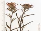
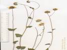
 Collection No. 237, Amsonia tomentosa, woolly bluestar. Collection No. 237, Amsonia tomentosa, woolly bluestar.
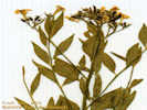 Collection No. 237, Amsonia tomentosa, woolly bluestar. Collection No. 237, Amsonia tomentosa, woolly bluestar.
|
237 | Amsonia tomentosa Torrey & Fremont, woolly bluestar, colony on edge of wash north of Black Butte, 11S 0612767 3971874 | ||||||
| 238 | Undet. annual, perhaps a "Plaintain," such as Plantago patagonica, many seen along the road, 11S 0608236 3976215. | |||||||
|
|
Monday, May 1, 2000 | |||||||
| Monday morning, beautiful clear breezy desert day. | ||||||||
|
Locations: Shoshone. |
241 | Phacelia sp., on top of lake beds, possibly aligned to subsurface shrinkage polygons, on Highway 178, 1 miles east of Shoshone, CA, 11S 0567623 3981612. | ||||||
|
Other articles:
|
Monday, June 5, 2000Monday morning I drove down to Lobo Point to check plots there and at Wild Horse Mesa. Started with my plot in Salvia dorrii. Discovered that I didn't have the work sheets for this plot. So I had to search for each plant and record information on a blank sheet of paper. I hope I found all the plants. Also found a few new plants, which I staked. Some of the smaller S. dorrii have completely dried up, and a few of those I could find no sign of.After checking my Salvia dorrii plot, I drove into Lobo Point. | |||||||
|
Other articles:
|
Sunday, June 4, 2000Left Atascadero about 8:15 AM and arrived at Baker about 5 hours later, 1:15 PM. Tehachapi was breezy and cool when I stopped for gas. The next stop at Fields Road Rest Stop, then Baker at 106°F. Got gas and a Chulupa (I guess it's not politically correct to call them an "Indian Taco".) then pressed on to Pinto Mountain arriving about 3:00 PM. Staked one new Frasera albomarginata and saw a couple in bloom out side my plot. | |||||||
| 242 | Purshia neomexicana, on Winkler Formation at Pinto Mountain, two bushes each about 1 meter in diameter. | |||||||
| When I pulled into Mid Hills Campground the thermometer read 92°F, although sitting in the shade was quite comfortable. The flies, however, were horrible, I've never experienced them so bad. They went for my nose, eyes and ears. Plain water didn't interest them at all. Don't have any idea whether insect repellent would work or not. | ||||||||
| 243 | Salvia mohavensis 11S 0643477 3880238, on rhyolite outcrop with Skunkbush (Rhus trilobata), Barrel Cactus (Ferocactus cylindraceus), and California Buckwheat (Eriogonum fasciculatum). | |||||||
| At Lobo Point, I climbed up the landslide looking at plants. The Keckiella antirrhinoides was not collectible. It looked more like the flowers dried up than the plant had finished blooming. The Krameria is in seed, and I should collect some on the way down. | ||||||||
| 244 | Acacia greggii, on the east faciong slope of Lobo Point, the only plant seen in bloom on the entire trip. | |||||||
|
Other articles:
|
Near the top of the landslide, on the south side, I looked for the mystery "Phacelia" I saw here several years ago. Could not find any sign of it. However, I did see many Salvia mohavensis in bloom here. | |||||||
| 245 | Nicotiana trigonophylla(?), only one seen, not in very good condition, in the watercourse on the south side of the landslide at Lobo Point. | |||||||
|
Other articles:
|
246 |
Unknown Composite, many of the flower heads had no ray flowers.
Bahiopsis parishii (Greene) E. E. Schill. & Panero. Parish's Golden Eye. Lobo Point, San Bernardino County, California. In the watercourse on the south side of the landslide on the east side of Lobo Point, about 1.7 miles west northwest of Hole-in-the-Wall, and 9 miles north northeast of Mitchell Caverns. 35.051°N, 115.4257°W. WGS 1984. Elev. 1475 m. Common, many heads had no ray flowers. Coll. No. 246, 5 June 2000, characters observed: Perennial (assumed), to 40 cm.; Leaves, basal unknown, cauline present; Phyllaries, in 2 series, ±equal, abruptly narrowed at middle, not subtending ray flowers; Receptacle, flat, paleate, palea folded around disk flower ovary; Flowers, of two kinds, heads radiate; Rays, yellow, sterile, style 0, pappus of short scales; Disk, pappus of short scales and 2 long scales; Fruit, compressed, hairy, but margin not ciliate. | ||||||
| 247 | Krameria erecta in seed. | |||||||
| Walked up the landslide and across to the rim. Keckiella finished blooming but seed capsules have yet to develop. More Salvia mohavensis in bloom in the watercouse, not out on the landslide. Opuntia acanthocarpa finished bloom here, not like Pinto Mountain where many are still in bloom. Eriogonun fasciculatum in bloom. Goddam flies in my ears and up my nose. A few clouds went through and a good breeze, so maybe it won't be so hot today. | ||||||||
| Drove over the Wild Horse Mesa to check my Frasera albomarginata plot there. | ||||||||
|
Other articles:
|
248 |
Astragalus sp. Seed pods, this plant is in the old road, near where an Astragalus was collected in April, 2000.
Astragalus sp. Milkvetch. Wild Horse Mesa, San Bernardino County, California. North slope of the Mesa, on old roads. Elev. 1385 m. Seed pods only, no flowers, near where Astragalus sp. was collected in April, 2000. Dried out, falling apart, discarded. | ||||||
| 249 | Dalea searlesiae, look more dried out than finished blooming, common on the old roads on the north face of Wild Horse Mesa. | |||||||
| 250 | Stanleya pinnata, colony under Pinyon Pine beside old road, just beginning to bloom. | |||||||
| Walked up the trail to the saddle north of Wild Horse Mesa, and clambered down the wash looking for oaks and ashes. Found three more of the Canyon Live Oak (Quercus chrysolepis), so that now we know there are at least four in this area. Did not find any Single-Leaved Ash (Fraxinus anomala), so far I have only found one male plant of this species at this location. | ||||||||
| Drove to Winkler's Cabin. Read the recent logs, and added my own entry. Water no longer comes out to the entrance of the mine. | ||||||||
| Drove out, and stopped in a wide sandy ravine, often used by campers, to collect a bit more. | ||||||||
| 251 | Eriogonum fasciculatum 11S 0641620 3880590, alt, 1437 m, on the road to Wild Horse Mesa, sandy wash, with Juniperus osteosperma, Prunus fasciculata, Yucca baccata and Ephedra nevadensis. | |||||||
|
Other articles:
|
252 |
Eriogonum sp., not in bloom yet.
Collection immature, discarded. | ||||||
| 254 | Opuntia acanthocarpa, flowers collected and sectioned. | |||||||
|
Other articles:
|
255 |
Asclepias erosa, large colony in Wild Horse Canyon wash. 11S 0641928 3880944
Asclepias erosa Torrey. Desert Milkweed. Wild Horse Canyon, San Bernardino County, California. In Wild Horse Canyon Wash on the cherry stem road into the Blue Jay Mine, north end of Wild Horse Mesa. 278 km northeast of Los Angeles, California. 35.0608°N, 115.4446°W. WGS 1984. Elev. 1442 m. | ||||||
|
|
Tuesday, June 6, 2000Drove to Caruthers Canyon, and walked up to the Giant Ledge Mine. Saw several F. albomarginata on bloom. Climbed hill looking for Petrophyton, but none found. | |||||||
|
Other articles:
|
256 | Eriodictyon, along Caruthers Canyon Road, approximately 1/2 mile north of OX Ranch well. | ||||||
| Frasera albomarginata, on Harris Springs Road, 11S 0630078 4012053, beginning to bloom, open forest on limestone fan, with Junost, Pinmon, Dalsea, Cercoparpus, Garrya, Arctostaphylous, Purmex, Ameuta, and Quegam(?) | ||||||||
|
|
Wednesday, June 7, 2000 | |||||||
| 257 | Frasera albomarginata, beginning to bloom, on old road. | |||||||
| 259 | Quercus gambelii | |||||||
| 260 | Frasera albomarginata Potosi Mountain Road, just past private camps, loose limestone soil on moderate slopes, 11S 0633558 3983993, alt, 1832 m. | |||||||
| 261 | Asclepias sp. | |||||||
| 262 | Penstemon eatonii | |||||||
|
Literature Cited:
Locations: Dry Lakes Plateau. |
June 10-11, 2000. Saturday and Sunday. Dry Lakes Plateau, Bodie Hills. Leader: Anne Halford. Meet at 9:30 am at the Mono Lake Visitors Center. 4-wheel drive required. Hiking will be moderate. Camping will be primitive so bring all applicable "car-camping" supplies including water. The Dry Lakes Plateau located at the northwest edge of the Bodie Hills at an elevation of 8,000 is a large volcanic plateau containing two pleistocene lake basins. This "island in the sky" offers an incrediable array of floristic diversity that includes 5 rare plant species such as the Great Basin "vernal pool" endemic, Polyctenium williamsae or combleaf, a diminutive perennial in the Brassicaceae Family. Other rarities well find are the Bodie Hills draba (Cusickiella quadricostata), Bodie Hills Arabis (Arabis bodiensis), Long Valley milk-vetch (Astragalus johannis-howellii) and Mono Phacelia (Phacelia monoensis). After a day of exploring the plateau we will enjoy an evening under the scintillating Great Basin skies. We will depart the plateau around 12:00 on Sunday.
FIELD TRIP REPORT by Michael Honer Dry Lakes Plateau, Bodie Hills - June 10-11 Far off on the northeastern edge of California lies a broad volcanic plateau nestled between the Bodie Hills and the Nevada border. The Sweetwater Mountains dominate the northwest horizon while Beauty Peak gazes down from the east. Signs of prehistoric people are numerous and a mild breeze drifts over the hills as Pronghorn Antelope graze across the Dry Lakes and adjoining uplands. Into this serene landscape rumbles a convoy of eight 4WD vehicles, led by botanist Anne Halford and archeologist Kirk Halford. CNPS members from as far as Sand Diego and Sacramento, and as near as Bishop and Bodie have traveled to this remote location to observe a relatively undisturbed piece of the Great Basin flora, and witness evidence of 10,000 years of human habitation. Our first stop led us to examine discreet populations of Mono Phacelia (Phacelia monoenesis) and Bodie Hills draba (Cusickiella quadricostata) growing on soft friable Rhyolitic clays along the rugged road up to the plateau. These two diminuitive plants, both with tiny yellow flowers, were the first rare species encountered. We take a quick lunch surrounded by Long Valley milk-vetch (Astragalus johannis-howellii), followed by a short hike down to the dry lakebed. Here Anne located a few rare individuals of the Great Basin vernal pool species; combleaf (Polyctenium williamsii). This is the first time in 9 years that these lakes have been dry so we feel lucky to have spotted a few of these small white-flowered endemics. Proceeding farther north, we park our vehicles on the Nevada Border next to some conveniently located tall stands of mountain mahogany. Soon were striking out west across the rugged basalt plateau. We step over Penstemon humilis as were treated to absorbing lectures on packrat middens which record the arrival of pinyon pine here almost 5,000 years ago. We stumble over Senecio multilobatis and find mounds of Polygala intermontana which are relatively infrequent in the Bodie Hills. Sitting on a ridge overlooking an unusual sedge bog, were prompted to think of the detailed long-term climatic information that is buried there and revealed by recent core samples. After the days explorations, we settle in to camp on a broad plane at 8,000; leading down to the lakebed. Kirk shows us secret grinding slicks and other tools used by ancient campers. Some of the group prefer to explore nearby water tanks effaced by the graffitti of more contemporary campers, the Basque, Peruvian, and French shepherds stationed here since the turn of the last century. The chilly evening is spent recounting various earthquake anecdotes around the fire while sharing some splendid lemon pound birthday cake. Up bright and early, our objective is to casually hike up to Beauty Peak. On top at 9,018 were dazzled by about a 378 degree view, as a few young Bodie Hills Arabis (Arabis bodiensis) look on. Eventually we make our way back down to the vehicles, satisfied and thankful for the opportunity to explore such a culturally rich and botanically diverse region. Clouds of road dust drift across the Dry Lakes Plateau as we wind our way back downhill. | |||||||
|
Other articles:
|
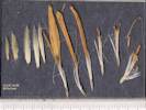
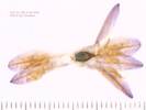
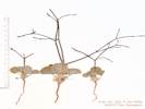
265 |
Chrysothamnus depressus Nutt. Longflower Rabbitbrush.
Wild Horse Mesa, San Bernardino County, California. North face of Wild Horse Mesa, 3¼ miles west of Hole-in-the-Wall, 8 miles north northeast of Mitchell Caverns. 35.051°N, 115.4567°W. WGS 1984. Elev. 1490 m. Low growing composite, occasional in my Swertia albomarginata plots. North-facing lacustrine limestone slopes of the informally named Winkler Formation. Collected under Permit#: MOJA-2001-SCI-0015, Vegetation of Lobo Point and North Wild Horse Mesa. Coll. No. 265, 1 Sep 2000, characters observed while keying: Woody perennial shrub, to 30 cm.; Stem, young, puberulent (not tomentose); Leaves, alternate, lanceolate, entire, without embedded oil glands, with short stalked glands; Inflorescence, none of the flowers with strap-shaped corollas, flowers of 1 kind; Involucre, obconic, 10 mm.; Phyllaries, graduated in 5 series, arranged in vertical ranks, without embedded oil glands; Corolla, yellow; Pappus of well-developed bristles, #many, Style appendages ±=stigmatic portion; Fruit with few glandular hairs. | ||||||
|
|
Saturday, September 17, 2000 | |||||||
|
Locations: Alameda. Altamont Pass. Atascadero. Coalinga. Los Olivos. |
After a long drive and late arrival in Atascadero from Alameda last night, this morning we took the morning walk up the hill with my dad. Near the top, in dry areas where the grass has been cut, we find a low shrub with ascending branches and a very pungeant odor. It has purple flowers with stamens and pistil extremely exserted. Later we key this out to be Trichostema lanceolatum Benth; common name of Vinegar Weed. After we left Atascadero, we could recognize the plant in the fields along the highway, as far south as Los Olivos along Highway 101, and then again as we came back north on Interstate 5 from about Coalinga to Altamont Pass There was also a buckwheat in bloom; the leaves were completely dried out, but the spindly stems had very small white flowers. | |||||||
|
|
Sunday September 18, 2000 | |||||||
|
Locations: Templeton. |
In the evening we returned to a relative's home in Templeton, the local toads were waiting for us. I'm not sure what kind of toads they were. There were not Spadefoot toads (no spade on their feet) and not red-spotted toads, the spots weren't red, and they had stripes on their legs .... oh well another unsolved mystery. | |||||||
|
|
Monday, September 19, 2000 | |||||||
|
Locations: Los Angeles. Pismo Beach. Ventura. |
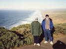
Monday morning, we drove down the coast on Highway 101 so she could see the ocean. Unfortunately, it was a foggy day, so I think we saw the water for only a short portion at Pismo Beach, and briefly at Ventura. Then we plunged into the Wilderness of Los Angeles. | |||||||
|
|
Thursday, September 21, 2000 | |||||||
|
Other articles:
Locations:
Algodones Dunes.
Blythe.
Chocolate Mountains.
El Centro.
Milpitas Wash.
Palo Verde Mountains.
Parker.
San Diego.
|
We left San Diego about 1:00 PM; heading east on I-8 to El Centro, then north and east on California Highway 78 through Blythe to Parker, Arizona, where we crashed for the night. At the Algodones Dunes overlook, we stopped for a photo where I discovered my camera wasn't working. Only much later, after buying new batteries at the Radio Shack in El Centro, did I discover the primary reason why my camera wasn't working. It had no film inside. Highway 78 makes a wide detour around the Newmont Mining Company Montezuma Mine on the southwest side of the Chocolate Mountains. Milpitas Wash, draining the Palo Verde Mountains was pretty impressive. A wide band of green coming out of the mountains. From Blythe we went north on U. S. Highway 95 to Agnes Wilson Road, and then crossed over to the Arizona side of the river. Had some pretty good Mexican food in a little place called Jalapeño's in Parker, Arizona. | |||||||
|
|
Friday, September 22, 2000 | |||||||
|
Other articles:
Locations:
Colorado River.
Cross Roads.
Parker Dam.
Watson Wash.
|
| |||||||
|
Other articles:
Locations:
Chemeheuvi Wash.
Chemehuevi Indian Reservation.
Colorado River.
Copper Basin.
Lake Havasu City.
Parker Dam.
Whipple Mountains.
Whipple Wash.
|
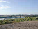
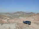
From Parker Dam we explored Trails End Camp Road north into the Whipple Mountains. We found the road to Copper Basin and Copper Basin Reservoir. Unfortunately it had numerous No Trespassing signs so we didn't follow it. The Power Line Road looked pretty good, so we decided to follow it and see if we could get all the way through to Needles. It was a interesting road, pretty good, and only a few rough spots. The highest point of the road is about 400 m elevation, or about 200 m above the Colorado River. From several locations, we could see Lake Havasu City to the east across the river. There were a few spots to go back to, one would be Whipple Wash, a major wash into the heart of the Whipple Mountains. It's wilderness though, so it would take a long walk or maybe a backpack to get into there. We also recognized the boundaries of the Chemehuevi Indian Reservation and Chemehuevi Wash, but otherwise it would have taken careful navigation on USGS quadrangle maps to know where we were. | |||||||
|
Other articles:
Locations:
Homer.
Needles.
|
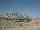
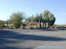
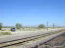
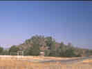
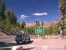
At Havasu Lake Road, we left the Power Line Road and drove to U. S. Highway 95, which we took north to Needles. At Needles few got groceries, and then headed for the eastern Mojave. We stopped at Homer to take some photographs because Annie Alexander and Louise Kellogg collected there. Homer now exists only as a railroad siding with another track for setting out bad orders, a station sign and some old Tamarisk trees. It looks like there might have been some railroad buildings there at some time, but now the area just consists of some trash and disturbed vegetation. | |||||||
|
Other articles:
Locations:
Goffs.
|
At Goffs, the school house was closed, so we did not stop. | |||||||
|
Other articles:
Locations:
Bobcat Hills.
Fenner Valley.
Goffs.
Hackberry Mountain.
Vontrigger Hills.
|
| |||||||
|
Locations: Payne Well. Rock Spring. Watson Wash. |
Before crossing Watson Wash near Rock Spring, we turned north and drove up toward the corral at Payne Well. Last June when I shared lunch in Caruthers Canyon with a couple of geologists from the Park Service, one of them asked me about a "pink-flowered" shrub to be found at this spot. Thinking he might be referring to Prunus andersonii Desert Peach, which I have never found in the eastern Mojave, I wanted to check it out. We found nothing unusual at this spot, but did see a lot of Apache Plume (Fallugia paradoxa) in seed, with pinkish plumes as tails on the seeds. I suspect that the Apache Plumes were the pink "flowers" he was referring to. | |||||||
|
Other articles:
Locations: Pinto Mountain. |
We stopped at Pinto Mountain to collect data at my experimental plot there. There were a couple of curious burros, one kept getting closer and then running away. At Pinto Mountain most of my plants were still alive, I think one seedling died since last spring, but there were no new seedlings that germinated this summer. | |||||||
| We got a flat tire just as we turned into the Mid Hills Campground. I think this is the first flat tire I've had on the 4 Runner. I learned a couple of things. One was that if the tire is really flat, there isn't room to get the Toyota-supplied jack under the front suspension A-arm. We had to dig a little hole under the A-arm to fit the jack. | ||||||||
|
|
Saturday, September 23, 2000 | |||||||
|
Locations: Halloran Summit. |
Saturday morning I got up early and tried to get the tire fixed at Halloran Summit on Interstate-15. But it turned out that there was an L-shaped cut in the tire about 3/4" on a side. It could barely be patched. The patch held air, but I would not have wanted to actually drive on the tire. When I tried to get a new tire in Baker, I learned that the 4 Runner had an odd-sized tire that dealers don't normally carry. Well, at that point, my choices were to take our chances with a bum-patched tire, or drive to Las Vegas to get a new tire. I decided to take our chances. I figured that if we had another flat maybe the bum tire could get us into cell phone range at Hole-in-the-Wall, where we could try to figure out what the step would be | |||||||
|
Locations: Wild Horse Mesa. |
At Wild Horse Mesa most of the Frasera albomarginata were in good condition, I think maybe two died over the summer out of 40 or so. | |||||||
| Also at Wild Horse Mesa, a plant was in bloom for first time that I remember since establishing my plots. So I collected some of that, hopefully to identify it. It might be a Brickellia, but not B. californica, since I've seen that elsewhere. It might also be Tetradymia canescens. | ||||||||
| I also checked the Salvia dorrii plot, they're in good shape, with about 4 small plants dying out of about 80 plants. | ||||||||
|
|
Sunday, September 24, 2000 | |||||||
|
Locations: Kettlemen City. Wild Horse Canyon. |
020 Then Sunday we pretty much got up, packed and drive home. Driving down through Wild Horse Canyon, the Gutierrezia was blooming, making a bright yellow against the rock with desert varnish. Took a photo at the narrows in Wild Horse Canyon, but I suspect the photograph won't have same visual impact. From Essex to Mojave, the wind was pretty strong, but from the east, not the west as usual. Overall the drive home took about 8 1/2 hours including the hamburger at In-N-Out Burger in Kettlemen City. | |||||||
|
|
Friday, October 6, 2000 | |||||||
|
Other articles:
Locations:
Manteca.
Oakdale.
Sonora.
|
| |||||||
| The Old Priest Grade was closed, for road work, and the park in Groveland closed for construction, so I made the next stop at Big Oak Flat. | ||||||||
|
Other articles:
Locations:
Tenaya Lake.
|
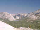
At Olmstead Point, I took the obligatory photo of the back of Half Dome, and then walked up onto the granite, for a view and photo of Tenaya Lake. | |||||||
|
Other articles:
Locations:
Tuolumne Meadows.
|
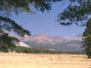
Stopped at the first view to Tuolumne Meadows for a photo, and then had lunch at Lembert Dome. | |||||||
|
Other articles:
Locations:
Tioga Pass.
|
Was too shy to take a photo of the Tioga Pass sign at the Yosemite National Park exit booth. But I did take a picture of this lake which is right at the summit. | |||||||
|
Other articles:
Locations:
Tioga Lake.
|
Stopped at Tioga Lake for a photo. | |||||||
|
Other articles:
Locations:
Lee Vining.
Lee Vining Canyon.
|
At Lee Vining, I got gas and then drove south on U. S. Highway 395 towards Big Pine, stopping at Von's in Bishop for food. Took me a while, but I finally learned that the only Chevron station in Bishop is along Highway 395 on the north end of town. I filled up again with gas in Big Pine and then headed east to Eureka Valley on Death Valley Road. | |||||||
|
Other articles:
|
The road to Eureka Valley is called Death Valley Road. It had a Road Closed sign in the middle of the road, and the highway mileage sign implies that Saline Valley Road, and Eureka Valley Road was closed, while the road should be open through to Scotty's Castle. | |||||||
|
Other articles:
|
After climbing up the alluvial fan through Devil's Gate, the road comes to Waucoba Saline Road at the summit. | |||||||
|
Other articles:
Locations:
Little Cow Horn Valley.
|
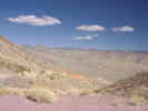
Starting down the east side, Little Cow Horn Valley is a small closed basin without an outlet for running water. The center of the valley has different vegetation, as might be expected, but no playa. | |||||||
|
Other articles:
Locations:
Joshua Flats.
|
| |||||||
|
Literature Cited:
Other articles:
Locations: Eureka Sand Dunes. Eureka Valley. Last Chance Range. |
| |||||||
|
|
Saturday, October 7, 2000 | |||||||
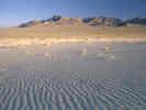
| Saturday morning I got up early, about 6:30 AM. It was quite cool, perhaps 45°F. Had a quick breakfast and a cup of coffee. Packed up my tent and sleeping bag and started up the sand dunes about 7:30 AM. Some areas of the sand were hard and easy to walk on, other areas were very soft and wouldn't support my weight even on flat areas. | ||||||||
|
Locations:
Eureka Sand Dunes.
|
On one of the lower slopes the angle of the sun was low enough to accentuate the sand ripples so I took a photograph. | |||||||
|
Locations:
Eureka Sand Dunes.
|
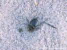
Near the top was a small chute in the sand where small amounts of organic matter had accumulated. Here were many of the black beetles that I had seen lower down. One thing I noticed was that the beetle tracks would stop suddenly with a little mound of disturbed sand. I decided that this was the point at which the beetle burrowed into the sand for the day. | |||||||
|
Other articles:
Locations:
Eureka Sand Dunes.
|
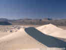
The last pitch before the top I took on all fours, as the sand was slipping backward almost as fast and I could take steps. | |||||||
| One thing I noticed upon arriving at the top, was that I had taken the longest and most difficult route to the top. It would have been much easier to walk around the dunes to the south side and then walk up to the top on a single slope without all the up and down I did while climbing from the north side. | ||||||||
| Some of the other treasures I found were a 45-caliber bullet, with the tip only slightly dented by the sand, and a much corroded and sand-encrusted 16p nail. At one spot were many pistachio nut shells. They were only slightly weathered, and repeatedly visited by the local kangaroo rats, as evidenced by numerous tracks. | ||||||||
|
Other articles:
Locations: Hanging Rock Canyon. |
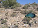
After returning to camp from climbing the dunes, I discovered that I had a good strong cell phone signal, so I made a few calls. Then, I drove out the Eureka Valley Road to Death Valley Road. Ascended quickly up Hanging Rock Canyon to Crater. This is a former mining area that looks to have undergone some restoration efforts, but is still quite a mess. As my objective was to find a convenient route into Last Chance Mountain to find Frasera albomarginata, I continued on Death Valley Road for several more miles. Finally I came to a point that allowed a view ahead for a few miles. In the canyon below was Crankshaft Junction. | |||||||
|
Other articles:
|
One of the routes I had considered was to approach Last Chance Mountain from the east side by driving past Crankshaft Junction, taking a road to a place called Last Chance Spring, and then climbing from there. From my new vantage point it was clear that I would have to drop down into Last Chance Canyon, then climb a steep fan for several miles to get to the spring, followed by a steep climb from there on foot. | |||||||
|
Literature Cited:
Other articles:
Locations: Crater. Death Valley. Last Chance Mountain. Magruder Mountain. |
| |||||||
|
Locations:
Last Chance Mountain.
|
266 | Just below the peak on the west side was a flat bench with some finely broken limestone gravel. I walked down there and found about six old Frasera albomarginata stalks, and perhaps a dozen rosettes. The rosettes were quite small, and had very distinct white margins. Associated with Frasera albomarginata were Pinus monophylla, Purshia glandulosa, Juniperus osteosperma, Artemisia tridentata, Salvia dorrii, and perhaps an Arennaria. Despite having carefully having gotten my GPS receiver out, I had left it in the back of the car, so I was unable determine GPS coordinates. However, from the Last Chance Mountain USGS 7½" quadrangle, I believe the coordinates are Zone 11, 4123900N, 439150E, elevation 2380 m (6,528 ft.). | ||||||
| To return to the vehicle, I chose to cross the slope at that contour and then descend the ridge to the south. This was very steep with much loose rock. Even at the bottom of the slope near the floor of the canyon, the limestone cobbles and gravel from this slope were piled up several feet above the surrounding alluvium. I think next time, I would climb back up to the main ridge and then descend to the southwest along the right that I climbed initially. | ||||||||
| For lunch I drove back to the "mine." This mine has two adits that I saw and much bulldozing around. The mine does not appear on any maps of the area. | ||||||||
|
Other articles:
Locations:
Hanging Rock Canyon.
|
After lunch, I drove down Hanging Rock Canyon on Death Valley Road, through Joshua Flat and Little Cow Horn Valley, ending up in Bishop for the night. | |||||||
|
|
Sunday, October 8, 2000 | |||||||
| Sunday morning I drove into the White Mountains. My objective was to find Frasera albomarginata in Mollie Gibson Canyon. In my mind, Mollie Gibson was the first main canyon on the north side of Higway 168 as it heads down hill into Deep Springs Valley. I started to drive into this canyon, but found my way blocked by lack of a road. Thinking that perhaps the road had been recently washed out, I began to hike up this canyon. The rocks in the canyon walls were shale, not the limestone that I remembered from Mollie Gibson Canyon and that I needed to find Frasera albomarginata. I continued to hike for about a half-hour thinking that just around the next bend the narrow canyon would open up into a wide canyon in limestone. When it became obvious that that would never happen in this canyon, and I was painfully aware of the effects of yesterday on my body, I turned around and walked back to the car. | ||||||||
| I drove down the road a bit farther. I think Mollie Gibson Canyon would have been the next canyon. A mound of dirt blocked the road into this canyon. The third canyon had a road that immediately began to climb up a fan. I'm quite sure this third canyon was not Mollie Gibson Canyon. By this time, I had enough climbing and looking, so I decided to drive up White Mountain Road looking for Frasera albomarginata. I was surprised by how little limestone there was along this road. There was very little habitat on this road, and the two places that looked like they might have Frasera albomarginata did not. | ||||||||
|
Locations:
Bishop.
|
I left Sierra View in the White Mountains at about 11:00 AM, stopping to take pictures several places along the way. Filled the gas tank again in Bridgeport and then headed for Highway 108 over Sonora Pass. | |||||||
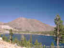
 Sweetwater Mountains from Leavitt Falls. Sweetwater Mountains from Leavitt Falls.
|
I expected a bridge over the West Walker River at the intersection of Highway 108 and U. S. Highway 395. There was no bridge there, so the bridge I'm remembering must be a little farther north on U. S. Highway 395. | |||||||
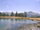
 Leavitt Meadows and the West Walker River. Leavitt Meadows and the West Walker River.
|
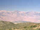
Had a sandwich Leavitt Falls Overlook. From here you can get a good view of Leavitt Meadows. By walking a short way to the north, one can obtain a good view of the Sweetwater Mountains. | |||||||
|
Other articles:
Locations:
Sonora Pass.
|
Saw two dried stalks of Frasera speciosa in the Sonora Pass summit parking area. | |||||||
| Drove mostly straight home, stopping here and there for photographs, arriving at home about 6:30 PM. | ||||||||
|
Other articles:
Locations:
Point Reyes.
|
December 2000Trip to Point Reyes with Martha and Dad. | |||||||
|
[Previous Page]
[Next Page]
Go to page: [1800s] [1900s] [1910s] [1920s] [1930s] [1940s] [1950s] [1960s] [1970s] [1980s] [1990] [1991] [1992] [1993] [1994] [1995] [1996] [1997] [1998] [1999] [2000] [2001] [2002] [2003] [2004] [2005] [2006] [2007] [2008] [2009] [2010] [2011] [2012] [2013] [2014] [2015] [2016] [2017] [2018] [2019] [2020] [2021] [2022] [2023] [2024] [A] | ||||||||
| If you have a question or a comment you may write to me at: tas4@schweich.com I sometimes post interesting questions in my FAQ, but I never disclose your full name or address. |
Date and time this article was prepared: 4/27/2024 3:22:47 PM |
|||||||