Eastern Mojave Vegetation
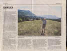
Tom Schweich
|
Eastern Mojave Vegetation
| Field Notes (Continued) |
|
Tom Schweich |

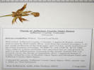
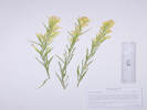
Topics in this Article: 1800s 1900s 1910s 1920s 1930s 1940s 1950s 1960s 1970s 1980s 1990 1991 1992 1993 1995 1996 1997 1998 1999 2000 2001 2002 2003 2004 2005 2006 2007 2008 2008 Tour de Swertia albomarginata Mono Lake, August 2008 2009 2010 2011 2012 2013 2014 2015 2016 2017 2018 2019 2020 2021 2022 2023 2024 Contents Literature Cited |
When I first read the field notes of Annie Alexander and Louise Kellogg, I was fascinated by the descriptions they wrote about the places they went and the plants and animals they found there. By publishing my field notes on the Internet I hope to follow a little bit in their tradition. | ||||||||||||||||||||||||||||||||||||||||||||||||||||||||||||||||||||||||||||||||||||||||||||||||||||||||||||||||||||||||||||||||||||||||||||||||||||||||||||||||||||||||||||||||||||||||||||||||||||||||||||||||||||||||||||||||||||||||||||||||||||||||||||||||||||||||||||||||||||||||||||||||||||||||||||||||||||||||||||||||||||||||||||||||||||||||||||||||||||||||||||||||||||||||||||||||||||||||||||||||||||||||||||||||||||||||||||||||||||||||||||||||||||||||||||||||||||||||||||||||||||||||||||||||||||||||||||||||||||||||||||||||||||||||||||||||||||||||||||||||||||||||||||||||||||||||||||||||||||||||||||||||||||||||||||||||||||||||||||||||||||||||||||||||||||||||||||||||||||||||||||||||||||||||||||||||||||||||||||||||||||||||||||||||||||||||||||||||||||||||||||||||||||||||||||||||||||||||||||||||||||||||||||||||||||||||||||||||||||||||||||||||||||||||||||||||||||||||||||||||||||||||||||||||||||||||||||||||||||||||||||||||||||||||||||||||||||||||||||||||||||||||||||||||||||||||||||||||||||||
|
|
2021 | ||||||||||||||||||||||||||||||||||||||||||||||||||||||||||||||||||||||||||||||||||||||||||||||||||||||||||||||||||||||||||||||||||||||||||||||||||||||||||||||||||||||||||||||||||||||||||||||||||||||||||||||||||||||||||||||||||||||||||||||||||||||||||||||||||||||||||||||||||||||||||||||||||||||||||||||||||||||||||||||||||||||||||||||||||||||||||||||||||||||||||||||||||||||||||||||||||||||||||||||||||||||||||||||||||||||||||||||||||||||||||||||||||||||||||||||||||||||||||||||||||||||||||||||||||||||||||||||||||||||||||||||||||||||||||||||||||||||||||||||||||||||||||||||||||||||||||||||||||||||||||||||||||||||||||||||||||||||||||||||||||||||||||||||||||||||||||||||||||||||||||||||||||||||||||||||||||||||||||||||||||||||||||||||||||||||||||||||||||||||||||||||||||||||||||||||||||||||||||||||||||||||||||||||||||||||||||||||||||||||||||||||||||||||||||||||||||||||||||||||||||||||||||||||||||||||||||||||||||||||||||||||||||||||||||||||||||||||||||||||||||||||||||||||||||||||||||||||||||||||
|
|
January 2021 | ||||||||||||||||||||||||||||||||||||||||||||||||||||||||||||||||||||||||||||||||||||||||||||||||||||||||||||||||||||||||||||||||||||||||||||||||||||||||||||||||||||||||||||||||||||||||||||||||||||||||||||||||||||||||||||||||||||||||||||||||||||||||||||||||||||||||||||||||||||||||||||||||||||||||||||||||||||||||||||||||||||||||||||||||||||||||||||||||||||||||||||||||||||||||||||||||||||||||||||||||||||||||||||||||||||||||||||||||||||||||||||||||||||||||||||||||||||||||||||||||||||||||||||||||||||||||||||||||||||||||||||||||||||||||||||||||||||||||||||||||||||||||||||||||||||||||||||||||||||||||||||||||||||||||||||||||||||||||||||||||||||||||||||||||||||||||||||||||||||||||||||||||||||||||||||||||||||||||||||||||||||||||||||||||||||||||||||||||||||||||||||||||||||||||||||||||||||||||||||||||||||||||||||||||||||||||||||||||||||||||||||||||||||||||||||||||||||||||||||||||||||||||||||||||||||||||||||||||||||||||||||||||||||||||||||||||||||||||||||||||||||||||||||||||||||||||||||||||||||||
|
|
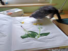
Wednesday January 6, 2020Collections ready to distribute. | ||||||||||||||||||||||||||||||||||||||||||||||||||||||||||||||||||||||||||||||||||||||||||||||||||||||||||||||||||||||||||||||||||||||||||||||||||||||||||||||||||||||||||||||||||||||||||||||||||||||||||||||||||||||||||||||||||||||||||||||||||||||||||||||||||||||||||||||||||||||||||||||||||||||||||||||||||||||||||||||||||||||||||||||||||||||||||||||||||||||||||||||||||||||||||||||||||||||||||||||||||||||||||||||||||||||||||||||||||||||||||||||||||||||||||||||||||||||||||||||||||||||||||||||||||||||||||||||||||||||||||||||||||||||||||||||||||||||||||||||||||||||||||||||||||||||||||||||||||||||||||||||||||||||||||||||||||||||||||||||||||||||||||||||||||||||||||||||||||||||||||||||||||||||||||||||||||||||||||||||||||||||||||||||||||||||||||||||||||||||||||||||||||||||||||||||||||||||||||||||||||||||||||||||||||||||||||||||||||||||||||||||||||||||||||||||||||||||||||||||||||||||||||||||||||||||||||||||||||||||||||||||||||||||||||||||||||||||||||||||||||||||||||||||||||||||||||||||||||||||
|
|
February 2021 | ||||||||||||||||||||||||||||||||||||||||||||||||||||||||||||||||||||||||||||||||||||||||||||||||||||||||||||||||||||||||||||||||||||||||||||||||||||||||||||||||||||||||||||||||||||||||||||||||||||||||||||||||||||||||||||||||||||||||||||||||||||||||||||||||||||||||||||||||||||||||||||||||||||||||||||||||||||||||||||||||||||||||||||||||||||||||||||||||||||||||||||||||||||||||||||||||||||||||||||||||||||||||||||||||||||||||||||||||||||||||||||||||||||||||||||||||||||||||||||||||||||||||||||||||||||||||||||||||||||||||||||||||||||||||||||||||||||||||||||||||||||||||||||||||||||||||||||||||||||||||||||||||||||||||||||||||||||||||||||||||||||||||||||||||||||||||||||||||||||||||||||||||||||||||||||||||||||||||||||||||||||||||||||||||||||||||||||||||||||||||||||||||||||||||||||||||||||||||||||||||||||||||||||||||||||||||||||||||||||||||||||||||||||||||||||||||||||||||||||||||||||||||||||||||||||||||||||||||||||||||||||||||||||||||||||||||||||||||||||||||||||||||||||||||||||||||||||||||||||||
|
Other articles:
|
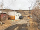
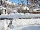
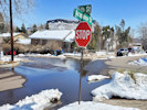
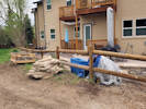
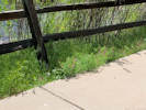
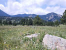
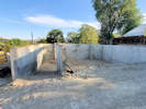
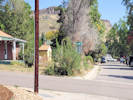
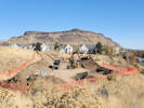
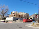
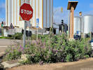
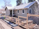
Wednesday, February 3, 2021“Front” yard before landscaping.
| ||||||||||||||||||||||||||||||||||||||||||||||||||||||||||||||||||||||||||||||||||||||||||||||||||||||||||||||||||||||||||||||||||||||||||||||||||||||||||||||||||||||||||||||||||||||||||||||||||||||||||||||||||||||||||||||||||||||||||||||||||||||||||||||||||||||||||||||||||||||||||||||||||||||||||||||||||||||||||||||||||||||||||||||||||||||||||||||||||||||||||||||||||||||||||||||||||||||||||||||||||||||||||||||||||||||||||||||||||||||||||||||||||||||||||||||||||||||||||||||||||||||||||||||||||||||||||||||||||||||||||||||||||||||||||||||||||||||||||||||||||||||||||||||||||||||||||||||||||||||||||||||||||||||||||||||||||||||||||||||||||||||||||||||||||||||||||||||||||||||||||||||||||||||||||||||||||||||||||||||||||||||||||||||||||||||||||||||||||||||||||||||||||||||||||||||||||||||||||||||||||||||||||||||||||||||||||||||||||||||||||||||||||||||||||||||||||||||||||||||||||||||||||||||||||||||||||||||||||||||||||||||||||||||||||||||||||||||||||||||||||||||||||||||||||||||||||||||||||||||
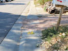
 Removing the frozen lawn. Removing the frozen lawn.
|
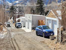
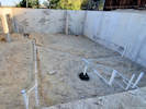
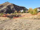
Construction underway. | ||||||||||||||||||||||||||||||||||||||||||||||||||||||||||||||||||||||||||||||||||||||||||||||||||||||||||||||||||||||||||||||||||||||||||||||||||||||||||||||||||||||||||||||||||||||||||||||||||||||||||||||||||||||||||||||||||||||||||||||||||||||||||||||||||||||||||||||||||||||||||||||||||||||||||||||||||||||||||||||||||||||||||||||||||||||||||||||||||||||||||||||||||||||||||||||||||||||||||||||||||||||||||||||||||||||||||||||||||||||||||||||||||||||||||||||||||||||||||||||||||||||||||||||||||||||||||||||||||||||||||||||||||||||||||||||||||||||||||||||||||||||||||||||||||||||||||||||||||||||||||||||||||||||||||||||||||||||||||||||||||||||||||||||||||||||||||||||||||||||||||||||||||||||||||||||||||||||||||||||||||||||||||||||||||||||||||||||||||||||||||||||||||||||||||||||||||||||||||||||||||||||||||||||||||||||||||||||||||||||||||||||||||||||||||||||||||||||||||||||||||||||||||||||||||||||||||||||||||||||||||||||||||||||||||||||||||||||||||||||||||||||||||||||||||||||||||||||||||||||
|
Other articles:
Letters:
Monday, March 1, 2021.
|
|||||||||||||||||||||||||||||||||||||||||||||||||||||||||||||||||||||||||||||||||||||||||||||||||||||||||||||||||||||||||||||||||||||||||||||||||||||||||||||||||||||||||||||||||||||||||||||||||||||||||||||||||||||||||||||||||||||||||||||||||||||||||||||||||||||||||||||||||||||||||||||||||||||||||||||||||||||||||||||||||||||||||||||||||||||||||||||||||||||||||||||||||||||||||||||||||||||||||||||||||||||||||||||||||||||||||||||||||||||||||||||||||||||||||||||||||||||||||||||||||||||||||||||||||||||||||||||||||||||||||||||||||||||||||||||||||||||||||||||||||||||||||||||||||||||||||||||||||||||||||||||||||||||||||||||||||||||||||||||||||||||||||||||||||||||||||||||||||||||||||||||||||||||||||||||||||||||||||||||||||||||||||||||||||||||||||||||||||||||||||||||||||||||||||||||||||||||||||||||||||||||||||||||||||||||||||||||||||||||||||||||||||||||||||||||||||||||||||||||||||||||||||||||||||||||||||||||||||||||||||||||||||||||||||||||||||||||||||||||||||||||||||||||||||||||||||||||||||||||||
|
Other articles:
|
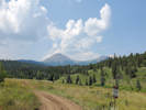
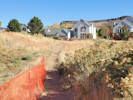
Saturday, March 6, 2021Neighborhood walk; the south-facing façade of this duplex under construction caught our attention. | ||||||||||||||||||||||||||||||||||||||||||||||||||||||||||||||||||||||||||||||||||||||||||||||||||||||||||||||||||||||||||||||||||||||||||||||||||||||||||||||||||||||||||||||||||||||||||||||||||||||||||||||||||||||||||||||||||||||||||||||||||||||||||||||||||||||||||||||||||||||||||||||||||||||||||||||||||||||||||||||||||||||||||||||||||||||||||||||||||||||||||||||||||||||||||||||||||||||||||||||||||||||||||||||||||||||||||||||||||||||||||||||||||||||||||||||||||||||||||||||||||||||||||||||||||||||||||||||||||||||||||||||||||||||||||||||||||||||||||||||||||||||||||||||||||||||||||||||||||||||||||||||||||||||||||||||||||||||||||||||||||||||||||||||||||||||||||||||||||||||||||||||||||||||||||||||||||||||||||||||||||||||||||||||||||||||||||||||||||||||||||||||||||||||||||||||||||||||||||||||||||||||||||||||||||||||||||||||||||||||||||||||||||||||||||||||||||||||||||||||||||||||||||||||||||||||||||||||||||||||||||||||||||||||||||||||||||||||||||||||||||||||||||||||||||||||||||||||||||||||
|
Other articles:
Locations:
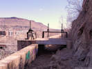
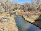
Welch Ditch.
|
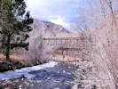
Walk on the Welch Ditch.
| ||||||||||||||||||||||||||||||||||||||||||||||||||||||||||||||||||||||||||||||||||||||||||||||||||||||||||||||||||||||||||||||||||||||||||||||||||||||||||||||||||||||||||||||||||||||||||||||||||||||||||||||||||||||||||||||||||||||||||||||||||||||||||||||||||||||||||||||||||||||||||||||||||||||||||||||||||||||||||||||||||||||||||||||||||||||||||||||||||||||||||||||||||||||||||||||||||||||||||||||||||||||||||||||||||||||||||||||||||||||||||||||||||||||||||||||||||||||||||||||||||||||||||||||||||||||||||||||||||||||||||||||||||||||||||||||||||||||||||||||||||||||||||||||||||||||||||||||||||||||||||||||||||||||||||||||||||||||||||||||||||||||||||||||||||||||||||||||||||||||||||||||||||||||||||||||||||||||||||||||||||||||||||||||||||||||||||||||||||||||||||||||||||||||||||||||||||||||||||||||||||||||||||||||||||||||||||||||||||||||||||||||||||||||||||||||||||||||||||||||||||||||||||||||||||||||||||||||||||||||||||||||||||||||||||||||||||||||||||||||||||||||||||||||||||||||||||||||||||||||
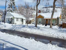
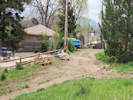
 “Front” yard after landscaping. “Front” yard after landscaping.
 “Front” yard after landscaping. “Front” yard after landscaping.
|
“Front” yard after landscaping. | ||||||||||||||||||||||||||||||||||||||||||||||||||||||||||||||||||||||||||||||||||||||||||||||||||||||||||||||||||||||||||||||||||||||||||||||||||||||||||||||||||||||||||||||||||||||||||||||||||||||||||||||||||||||||||||||||||||||||||||||||||||||||||||||||||||||||||||||||||||||||||||||||||||||||||||||||||||||||||||||||||||||||||||||||||||||||||||||||||||||||||||||||||||||||||||||||||||||||||||||||||||||||||||||||||||||||||||||||||||||||||||||||||||||||||||||||||||||||||||||||||||||||||||||||||||||||||||||||||||||||||||||||||||||||||||||||||||||||||||||||||||||||||||||||||||||||||||||||||||||||||||||||||||||||||||||||||||||||||||||||||||||||||||||||||||||||||||||||||||||||||||||||||||||||||||||||||||||||||||||||||||||||||||||||||||||||||||||||||||||||||||||||||||||||||||||||||||||||||||||||||||||||||||||||||||||||||||||||||||||||||||||||||||||||||||||||||||||||||||||||||||||||||||||||||||||||||||||||||||||||||||||||||||||||||||||||||||||||||||||||||||||||||||||||||||||||||||||||||||||
|
Other articles:
|
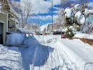
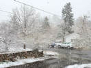
Monday, March 15, 2021Cleaning up from the big snow storm.
| ||||||||||||||||||||||||||||||||||||||||||||||||||||||||||||||||||||||||||||||||||||||||||||||||||||||||||||||||||||||||||||||||||||||||||||||||||||||||||||||||||||||||||||||||||||||||||||||||||||||||||||||||||||||||||||||||||||||||||||||||||||||||||||||||||||||||||||||||||||||||||||||||||||||||||||||||||||||||||||||||||||||||||||||||||||||||||||||||||||||||||||||||||||||||||||||||||||||||||||||||||||||||||||||||||||||||||||||||||||||||||||||||||||||||||||||||||||||||||||||||||||||||||||||||||||||||||||||||||||||||||||||||||||||||||||||||||||||||||||||||||||||||||||||||||||||||||||||||||||||||||||||||||||||||||||||||||||||||||||||||||||||||||||||||||||||||||||||||||||||||||||||||||||||||||||||||||||||||||||||||||||||||||||||||||||||||||||||||||||||||||||||||||||||||||||||||||||||||||||||||||||||||||||||||||||||||||||||||||||||||||||||||||||||||||||||||||||||||||||||||||||||||||||||||||||||||||||||||||||||||||||||||||||||||||||||||||||||||||||||||||||||||||||||||||||||||||||||||||||||
|
Other articles:
|
Thursday, March 18, 2021 | ||||||||||||||||||||||||||||||||||||||||||||||||||||||||||||||||||||||||||||||||||||||||||||||||||||||||||||||||||||||||||||||||||||||||||||||||||||||||||||||||||||||||||||||||||||||||||||||||||||||||||||||||||||||||||||||||||||||||||||||||||||||||||||||||||||||||||||||||||||||||||||||||||||||||||||||||||||||||||||||||||||||||||||||||||||||||||||||||||||||||||||||||||||||||||||||||||||||||||||||||||||||||||||||||||||||||||||||||||||||||||||||||||||||||||||||||||||||||||||||||||||||||||||||||||||||||||||||||||||||||||||||||||||||||||||||||||||||||||||||||||||||||||||||||||||||||||||||||||||||||||||||||||||||||||||||||||||||||||||||||||||||||||||||||||||||||||||||||||||||||||||||||||||||||||||||||||||||||||||||||||||||||||||||||||||||||||||||||||||||||||||||||||||||||||||||||||||||||||||||||||||||||||||||||||||||||||||||||||||||||||||||||||||||||||||||||||||||||||||||||||||||||||||||||||||||||||||||||||||||||||||||||||||||||||||||||||||||||||||||||||||||||||||||||||||||||||||||||||||||
|
Other articles:
|
Saturday, March 20, 2021I noticed the snow in Parkway C and D has completely melted off whereas Parkway A and B still have lots of snow. | ||||||||||||||||||||||||||||||||||||||||||||||||||||||||||||||||||||||||||||||||||||||||||||||||||||||||||||||||||||||||||||||||||||||||||||||||||||||||||||||||||||||||||||||||||||||||||||||||||||||||||||||||||||||||||||||||||||||||||||||||||||||||||||||||||||||||||||||||||||||||||||||||||||||||||||||||||||||||||||||||||||||||||||||||||||||||||||||||||||||||||||||||||||||||||||||||||||||||||||||||||||||||||||||||||||||||||||||||||||||||||||||||||||||||||||||||||||||||||||||||||||||||||||||||||||||||||||||||||||||||||||||||||||||||||||||||||||||||||||||||||||||||||||||||||||||||||||||||||||||||||||||||||||||||||||||||||||||||||||||||||||||||||||||||||||||||||||||||||||||||||||||||||||||||||||||||||||||||||||||||||||||||||||||||||||||||||||||||||||||||||||||||||||||||||||||||||||||||||||||||||||||||||||||||||||||||||||||||||||||||||||||||||||||||||||||||||||||||||||||||||||||||||||||||||||||||||||||||||||||||||||||||||||||||||||||||||||||||||||||||||||||||||||||||||||||||||||||||||||||
|
|
Apil Fools Day, Thursday, 1 April 2021Went into the herbarium today to straighten out some collections. Coll. No. 1108 Packera plattensis should be Senecio integerrimus
Coll. No. 1232 Eriogonum flavum should be Eriogonum arcuatum
Coll. No. 1637 Packera plattensis should be Senecio integerrimus
Coll. No. 1817 Packera plattensis should be P. fendleri
Coll. No. 1902 Packera plattensis should be P. fendleri
Coll. No. 1914 Packera plattensis, correct Coll. No. 2009 Solidago missouriensis should be S. multiradiata.
Coll. No. 2044 Packera plattensis should be P. fendleri I think I must have missed this one!
Coll. No. 2064 Packera plattensis, correct
Coll. No. 2085 Packera plattensis, correct. Coll. No. 2105 Elymus lanceolatus annotated to Pascopyrum smithii by Janet L. Wingate.
Coll. No. 2118 Poa secunda annotated to Schedonorus arundinaceus by Janet L. Wingate. Auricles present and ciliate.
Coll. No. 2176 Bromus pumpelliantus annotated to Bromus porteri. Anthers too small for B. pumbellianthus. Question if rhizomatous.
Coll. No. 2188 Achnatherum robustum annotated to Achnatherum nelsonii by Janet L. Wingate. Culm collars not hairy.
Coll. No. 2204 Eleocharis cf. obtusa annotated to Eleocharis engelmannii by Janet L. Wingate. Flat depressed tubercle.
List updated 6 Apr 2021. Annotations received May 26, 2021 Coll. 2304, Poa fendleriana annotated to Poa secunda.
Coll. No. 2362, Bromus secalinus, annotated to Bromus japonicus
Coll. No. 2362.1 , Bromus secalinus, annotated to Bromus japonicus
| ||||||||||||||||||||||||||||||||||||||||||||||||||||||||||||||||||||||||||||||||||||||||||||||||||||||||||||||||||||||||||||||||||||||||||||||||||||||||||||||||||||||||||||||||||||||||||||||||||||||||||||||||||||||||||||||||||||||||||||||||||||||||||||||||||||||||||||||||||||||||||||||||||||||||||||||||||||||||||||||||||||||||||||||||||||||||||||||||||||||||||||||||||||||||||||||||||||||||||||||||||||||||||||||||||||||||||||||||||||||||||||||||||||||||||||||||||||||||||||||||||||||||||||||||||||||||||||||||||||||||||||||||||||||||||||||||||||||||||||||||||||||||||||||||||||||||||||||||||||||||||||||||||||||||||||||||||||||||||||||||||||||||||||||||||||||||||||||||||||||||||||||||||||||||||||||||||||||||||||||||||||||||||||||||||||||||||||||||||||||||||||||||||||||||||||||||||||||||||||||||||||||||||||||||||||||||||||||||||||||||||||||||||||||||||||||||||||||||||||||||||||||||||||||||||||||||||||||||||||||||||||||||||||||||||||||||||||||||||||||||||||||||||||||||||||||||||||||||||||||
|
Other articles:
|
Thursday, April 8 2021.Welch Ditch Loop
| ||||||||||||||||||||||||||||||||||||||||||||||||||||||||||||||||||||||||||||||||||||||||||||||||||||||||||||||||||||||||||||||||||||||||||||||||||||||||||||||||||||||||||||||||||||||||||||||||||||||||||||||||||||||||||||||||||||||||||||||||||||||||||||||||||||||||||||||||||||||||||||||||||||||||||||||||||||||||||||||||||||||||||||||||||||||||||||||||||||||||||||||||||||||||||||||||||||||||||||||||||||||||||||||||||||||||||||||||||||||||||||||||||||||||||||||||||||||||||||||||||||||||||||||||||||||||||||||||||||||||||||||||||||||||||||||||||||||||||||||||||||||||||||||||||||||||||||||||||||||||||||||||||||||||||||||||||||||||||||||||||||||||||||||||||||||||||||||||||||||||||||||||||||||||||||||||||||||||||||||||||||||||||||||||||||||||||||||||||||||||||||||||||||||||||||||||||||||||||||||||||||||||||||||||||||||||||||||||||||||||||||||||||||||||||||||||||||||||||||||||||||||||||||||||||||||||||||||||||||||||||||||||||||||||||||||||||||||||||||||||||||||||||||||||||||||||||||||||||||||
|
Other articles:
|
2446 |
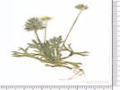
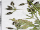
Field identification: Ranunculus testiculatus
| |||||||||||||||||||||||||||||||||||||||||||||||||||||||||||||||||||||||||||||||||||||||||||||||||||||||||||||||||||||||||||||||||||||||||||||||||||||||||||||||||||||||||||||||||||||||||||||||||||||||||||||||||||||||||||||||||||||||||||||||||||||||||||||||||||||||||||||||||||||||||||||||||||||||||||||||||||||||||||||||||||||||||||||||||||||||||||||||||||||||||||||||||||||||||||||||||||||||||||||||||||||||||||||||||||||||||||||||||||||||||||||||||||||||||||||||||||||||||||||||||||||||||||||||||||||||||||||||||||||||||||||||||||||||||||||||||||||||||||||||||||||||||||||||||||||||||||||||||||||||||||||||||||||||||||||||||||||||||||||||||||||||||||||||||||||||||||||||||||||||||||||||||||||||||||||||||||||||||||||||||||||||||||||||||||||||||||||||||||||||||||||||||||||||||||||||||||||||||||||||||||||||||||||||||||||||||||||||||||||||||||||||||||||||||||||||||||||||||||||||||||||||||||||||||||||||||||||||||||||||||||||||||||||||||||||||||||||||||||||||||||||||||||||||||||||||||||||||||||||
|
Other articles:
|
Wednesday, 21 April 2021 | ||||||||||||||||||||||||||||||||||||||||||||||||||||||||||||||||||||||||||||||||||||||||||||||||||||||||||||||||||||||||||||||||||||||||||||||||||||||||||||||||||||||||||||||||||||||||||||||||||||||||||||||||||||||||||||||||||||||||||||||||||||||||||||||||||||||||||||||||||||||||||||||||||||||||||||||||||||||||||||||||||||||||||||||||||||||||||||||||||||||||||||||||||||||||||||||||||||||||||||||||||||||||||||||||||||||||||||||||||||||||||||||||||||||||||||||||||||||||||||||||||||||||||||||||||||||||||||||||||||||||||||||||||||||||||||||||||||||||||||||||||||||||||||||||||||||||||||||||||||||||||||||||||||||||||||||||||||||||||||||||||||||||||||||||||||||||||||||||||||||||||||||||||||||||||||||||||||||||||||||||||||||||||||||||||||||||||||||||||||||||||||||||||||||||||||||||||||||||||||||||||||||||||||||||||||||||||||||||||||||||||||||||||||||||||||||||||||||||||||||||||||||||||||||||||||||||||||||||||||||||||||||||||||||||||||||||||||||||||||||||||||||||||||||||||||||||||||||||||||||
|
Other articles:
|
Thursday, 22 April 2021 | ||||||||||||||||||||||||||||||||||||||||||||||||||||||||||||||||||||||||||||||||||||||||||||||||||||||||||||||||||||||||||||||||||||||||||||||||||||||||||||||||||||||||||||||||||||||||||||||||||||||||||||||||||||||||||||||||||||||||||||||||||||||||||||||||||||||||||||||||||||||||||||||||||||||||||||||||||||||||||||||||||||||||||||||||||||||||||||||||||||||||||||||||||||||||||||||||||||||||||||||||||||||||||||||||||||||||||||||||||||||||||||||||||||||||||||||||||||||||||||||||||||||||||||||||||||||||||||||||||||||||||||||||||||||||||||||||||||||||||||||||||||||||||||||||||||||||||||||||||||||||||||||||||||||||||||||||||||||||||||||||||||||||||||||||||||||||||||||||||||||||||||||||||||||||||||||||||||||||||||||||||||||||||||||||||||||||||||||||||||||||||||||||||||||||||||||||||||||||||||||||||||||||||||||||||||||||||||||||||||||||||||||||||||||||||||||||||||||||||||||||||||||||||||||||||||||||||||||||||||||||||||||||||||||||||||||||||||||||||||||||||||||||||||||||||||||||||||||||||||||
|
|
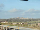
Monday, 26 April 2021Golden to Santa Fe. | ||||||||||||||||||||||||||||||||||||||||||||||||||||||||||||||||||||||||||||||||||||||||||||||||||||||||||||||||||||||||||||||||||||||||||||||||||||||||||||||||||||||||||||||||||||||||||||||||||||||||||||||||||||||||||||||||||||||||||||||||||||||||||||||||||||||||||||||||||||||||||||||||||||||||||||||||||||||||||||||||||||||||||||||||||||||||||||||||||||||||||||||||||||||||||||||||||||||||||||||||||||||||||||||||||||||||||||||||||||||||||||||||||||||||||||||||||||||||||||||||||||||||||||||||||||||||||||||||||||||||||||||||||||||||||||||||||||||||||||||||||||||||||||||||||||||||||||||||||||||||||||||||||||||||||||||||||||||||||||||||||||||||||||||||||||||||||||||||||||||||||||||||||||||||||||||||||||||||||||||||||||||||||||||||||||||||||||||||||||||||||||||||||||||||||||||||||||||||||||||||||||||||||||||||||||||||||||||||||||||||||||||||||||||||||||||||||||||||||||||||||||||||||||||||||||||||||||||||||||||||||||||||||||||||||||||||||||||||||||||||||||||||||||||||||||||||||||||||||||||
|
Other articles:
|
Santa Fe Trail wagon ruts. | ||||||||||||||||||||||||||||||||||||||||||||||||||||||||||||||||||||||||||||||||||||||||||||||||||||||||||||||||||||||||||||||||||||||||||||||||||||||||||||||||||||||||||||||||||||||||||||||||||||||||||||||||||||||||||||||||||||||||||||||||||||||||||||||||||||||||||||||||||||||||||||||||||||||||||||||||||||||||||||||||||||||||||||||||||||||||||||||||||||||||||||||||||||||||||||||||||||||||||||||||||||||||||||||||||||||||||||||||||||||||||||||||||||||||||||||||||||||||||||||||||||||||||||||||||||||||||||||||||||||||||||||||||||||||||||||||||||||||||||||||||||||||||||||||||||||||||||||||||||||||||||||||||||||||||||||||||||||||||||||||||||||||||||||||||||||||||||||||||||||||||||||||||||||||||||||||||||||||||||||||||||||||||||||||||||||||||||||||||||||||||||||||||||||||||||||||||||||||||||||||||||||||||||||||||||||||||||||||||||||||||||||||||||||||||||||||||||||||||||||||||||||||||||||||||||||||||||||||||||||||||||||||||||||||||||||||||||||||||||||||||||||||||||||||||||||||||||||||||||||
|
Other articles:
Locations:
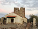
Fort Union.
|
Fort Union
| ||||||||||||||||||||||||||||||||||||||||||||||||||||||||||||||||||||||||||||||||||||||||||||||||||||||||||||||||||||||||||||||||||||||||||||||||||||||||||||||||||||||||||||||||||||||||||||||||||||||||||||||||||||||||||||||||||||||||||||||||||||||||||||||||||||||||||||||||||||||||||||||||||||||||||||||||||||||||||||||||||||||||||||||||||||||||||||||||||||||||||||||||||||||||||||||||||||||||||||||||||||||||||||||||||||||||||||||||||||||||||||||||||||||||||||||||||||||||||||||||||||||||||||||||||||||||||||||||||||||||||||||||||||||||||||||||||||||||||||||||||||||||||||||||||||||||||||||||||||||||||||||||||||||||||||||||||||||||||||||||||||||||||||||||||||||||||||||||||||||||||||||||||||||||||||||||||||||||||||||||||||||||||||||||||||||||||||||||||||||||||||||||||||||||||||||||||||||||||||||||||||||||||||||||||||||||||||||||||||||||||||||||||||||||||||||||||||||||||||||||||||||||||||||||||||||||||||||||||||||||||||||||||||||||||||||||||||||||||||||||||||||||||||||||||||||||||||||||||||||
|
Other articles:
Locations:
Wolf Creek.
|
Wolf Creek near Fort Union.
| ||||||||||||||||||||||||||||||||||||||||||||||||||||||||||||||||||||||||||||||||||||||||||||||||||||||||||||||||||||||||||||||||||||||||||||||||||||||||||||||||||||||||||||||||||||||||||||||||||||||||||||||||||||||||||||||||||||||||||||||||||||||||||||||||||||||||||||||||||||||||||||||||||||||||||||||||||||||||||||||||||||||||||||||||||||||||||||||||||||||||||||||||||||||||||||||||||||||||||||||||||||||||||||||||||||||||||||||||||||||||||||||||||||||||||||||||||||||||||||||||||||||||||||||||||||||||||||||||||||||||||||||||||||||||||||||||||||||||||||||||||||||||||||||||||||||||||||||||||||||||||||||||||||||||||||||||||||||||||||||||||||||||||||||||||||||||||||||||||||||||||||||||||||||||||||||||||||||||||||||||||||||||||||||||||||||||||||||||||||||||||||||||||||||||||||||||||||||||||||||||||||||||||||||||||||||||||||||||||||||||||||||||||||||||||||||||||||||||||||||||||||||||||||||||||||||||||||||||||||||||||||||||||||||||||||||||||||||||||||||||||||||||||||||||||||||||||||||||||||||
|
Other articles:
Locations:
Mora River.
|
We look for the Mora River. | ||||||||||||||||||||||||||||||||||||||||||||||||||||||||||||||||||||||||||||||||||||||||||||||||||||||||||||||||||||||||||||||||||||||||||||||||||||||||||||||||||||||||||||||||||||||||||||||||||||||||||||||||||||||||||||||||||||||||||||||||||||||||||||||||||||||||||||||||||||||||||||||||||||||||||||||||||||||||||||||||||||||||||||||||||||||||||||||||||||||||||||||||||||||||||||||||||||||||||||||||||||||||||||||||||||||||||||||||||||||||||||||||||||||||||||||||||||||||||||||||||||||||||||||||||||||||||||||||||||||||||||||||||||||||||||||||||||||||||||||||||||||||||||||||||||||||||||||||||||||||||||||||||||||||||||||||||||||||||||||||||||||||||||||||||||||||||||||||||||||||||||||||||||||||||||||||||||||||||||||||||||||||||||||||||||||||||||||||||||||||||||||||||||||||||||||||||||||||||||||||||||||||||||||||||||||||||||||||||||||||||||||||||||||||||||||||||||||||||||||||||||||||||||||||||||||||||||||||||||||||||||||||||||||||||||||||||||||||||||||||||||||||||||||||||||||||||||||||||||||
|
Other articles:
Locations:
Santa Fe.
|
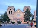
The Cathedral in Santa Fe. | ||||||||||||||||||||||||||||||||||||||||||||||||||||||||||||||||||||||||||||||||||||||||||||||||||||||||||||||||||||||||||||||||||||||||||||||||||||||||||||||||||||||||||||||||||||||||||||||||||||||||||||||||||||||||||||||||||||||||||||||||||||||||||||||||||||||||||||||||||||||||||||||||||||||||||||||||||||||||||||||||||||||||||||||||||||||||||||||||||||||||||||||||||||||||||||||||||||||||||||||||||||||||||||||||||||||||||||||||||||||||||||||||||||||||||||||||||||||||||||||||||||||||||||||||||||||||||||||||||||||||||||||||||||||||||||||||||||||||||||||||||||||||||||||||||||||||||||||||||||||||||||||||||||||||||||||||||||||||||||||||||||||||||||||||||||||||||||||||||||||||||||||||||||||||||||||||||||||||||||||||||||||||||||||||||||||||||||||||||||||||||||||||||||||||||||||||||||||||||||||||||||||||||||||||||||||||||||||||||||||||||||||||||||||||||||||||||||||||||||||||||||||||||||||||||||||||||||||||||||||||||||||||||||||||||||||||||||||||||||||||||||||||||||||||||||||||||||||||||||||
|
|
Tuesday, 27 April 2021 | ||||||||||||||||||||||||||||||||||||||||||||||||||||||||||||||||||||||||||||||||||||||||||||||||||||||||||||||||||||||||||||||||||||||||||||||||||||||||||||||||||||||||||||||||||||||||||||||||||||||||||||||||||||||||||||||||||||||||||||||||||||||||||||||||||||||||||||||||||||||||||||||||||||||||||||||||||||||||||||||||||||||||||||||||||||||||||||||||||||||||||||||||||||||||||||||||||||||||||||||||||||||||||||||||||||||||||||||||||||||||||||||||||||||||||||||||||||||||||||||||||||||||||||||||||||||||||||||||||||||||||||||||||||||||||||||||||||||||||||||||||||||||||||||||||||||||||||||||||||||||||||||||||||||||||||||||||||||||||||||||||||||||||||||||||||||||||||||||||||||||||||||||||||||||||||||||||||||||||||||||||||||||||||||||||||||||||||||||||||||||||||||||||||||||||||||||||||||||||||||||||||||||||||||||||||||||||||||||||||||||||||||||||||||||||||||||||||||||||||||||||||||||||||||||||||||||||||||||||||||||||||||||||||||||||||||||||||||||||||||||||||||||||||||||||||||||||||||||||||||
|
Other articles:
Locations:
Bandelier National Monument.
Cañon de los Frijoles.
|
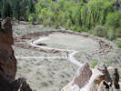
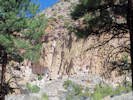
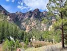
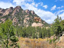
Bandelier National Monument
| ||||||||||||||||||||||||||||||||||||||||||||||||||||||||||||||||||||||||||||||||||||||||||||||||||||||||||||||||||||||||||||||||||||||||||||||||||||||||||||||||||||||||||||||||||||||||||||||||||||||||||||||||||||||||||||||||||||||||||||||||||||||||||||||||||||||||||||||||||||||||||||||||||||||||||||||||||||||||||||||||||||||||||||||||||||||||||||||||||||||||||||||||||||||||||||||||||||||||||||||||||||||||||||||||||||||||||||||||||||||||||||||||||||||||||||||||||||||||||||||||||||||||||||||||||||||||||||||||||||||||||||||||||||||||||||||||||||||||||||||||||||||||||||||||||||||||||||||||||||||||||||||||||||||||||||||||||||||||||||||||||||||||||||||||||||||||||||||||||||||||||||||||||||||||||||||||||||||||||||||||||||||||||||||||||||||||||||||||||||||||||||||||||||||||||||||||||||||||||||||||||||||||||||||||||||||||||||||||||||||||||||||||||||||||||||||||||||||||||||||||||||||||||||||||||||||||||||||||||||||||||||||||||||||||||||||||||||||||||||||||||||||||||||||||||||||||||||||||||||||
|
Other articles:
Locations:
Valles Caldera.
|
Valles Caldera | ||||||||||||||||||||||||||||||||||||||||||||||||||||||||||||||||||||||||||||||||||||||||||||||||||||||||||||||||||||||||||||||||||||||||||||||||||||||||||||||||||||||||||||||||||||||||||||||||||||||||||||||||||||||||||||||||||||||||||||||||||||||||||||||||||||||||||||||||||||||||||||||||||||||||||||||||||||||||||||||||||||||||||||||||||||||||||||||||||||||||||||||||||||||||||||||||||||||||||||||||||||||||||||||||||||||||||||||||||||||||||||||||||||||||||||||||||||||||||||||||||||||||||||||||||||||||||||||||||||||||||||||||||||||||||||||||||||||||||||||||||||||||||||||||||||||||||||||||||||||||||||||||||||||||||||||||||||||||||||||||||||||||||||||||||||||||||||||||||||||||||||||||||||||||||||||||||||||||||||||||||||||||||||||||||||||||||||||||||||||||||||||||||||||||||||||||||||||||||||||||||||||||||||||||||||||||||||||||||||||||||||||||||||||||||||||||||||||||||||||||||||||||||||||||||||||||||||||||||||||||||||||||||||||||||||||||||||||||||||||||||||||||||||||||||||||||||||||||||||||
|
Other articles:
Locations:
Jemez River.
|
Lunch along the Jemez River
| ||||||||||||||||||||||||||||||||||||||||||||||||||||||||||||||||||||||||||||||||||||||||||||||||||||||||||||||||||||||||||||||||||||||||||||||||||||||||||||||||||||||||||||||||||||||||||||||||||||||||||||||||||||||||||||||||||||||||||||||||||||||||||||||||||||||||||||||||||||||||||||||||||||||||||||||||||||||||||||||||||||||||||||||||||||||||||||||||||||||||||||||||||||||||||||||||||||||||||||||||||||||||||||||||||||||||||||||||||||||||||||||||||||||||||||||||||||||||||||||||||||||||||||||||||||||||||||||||||||||||||||||||||||||||||||||||||||||||||||||||||||||||||||||||||||||||||||||||||||||||||||||||||||||||||||||||||||||||||||||||||||||||||||||||||||||||||||||||||||||||||||||||||||||||||||||||||||||||||||||||||||||||||||||||||||||||||||||||||||||||||||||||||||||||||||||||||||||||||||||||||||||||||||||||||||||||||||||||||||||||||||||||||||||||||||||||||||||||||||||||||||||||||||||||||||||||||||||||||||||||||||||||||||||||||||||||||||||||||||||||||||||||||||||||||||||||||||||||||||||
|
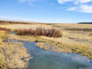
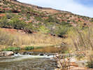
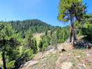
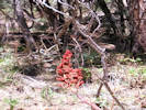
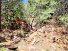
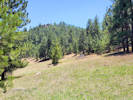
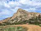
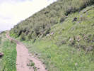
Locations: Clear Creek Canyon Park. Welch Ditch. |
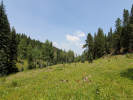
Wednesday, 5 May 2021Welch Ditch in Clear Creek Canyon Park | ||||||||||||||||||||||||||||||||||||||||||||||||||||||||||||||||||||||||||||||||||||||||||||||||||||||||||||||||||||||||||||||||||||||||||||||||||||||||||||||||||||||||||||||||||||||||||||||||||||||||||||||||||||||||||||||||||||||||||||||||||||||||||||||||||||||||||||||||||||||||||||||||||||||||||||||||||||||||||||||||||||||||||||||||||||||||||||||||||||||||||||||||||||||||||||||||||||||||||||||||||||||||||||||||||||||||||||||||||||||||||||||||||||||||||||||||||||||||||||||||||||||||||||||||||||||||||||||||||||||||||||||||||||||||||||||||||||||||||||||||||||||||||||||||||||||||||||||||||||||||||||||||||||||||||||||||||||||||||||||||||||||||||||||||||||||||||||||||||||||||||||||||||||||||||||||||||||||||||||||||||||||||||||||||||||||||||||||||||||||||||||||||||||||||||||||||||||||||||||||||||||||||||||||||||||||||||||||||||||||||||||||||||||||||||||||||||||||||||||||||||||||||||||||||||||||||||||||||||||||||||||||||||||||||||||||||||||||||||||||||||||||||||||||||||||||||||||||||||||||
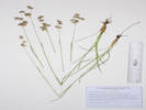
| 2447 |
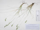
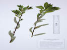
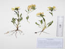
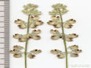
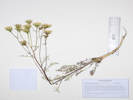
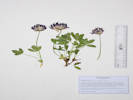
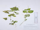
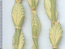
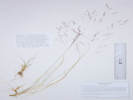
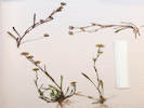
Amelanchier alnifolia, many shrubs to 2 m., reddish-brown bark.
| ||||||||||||||||||||||||||||||||||||||||||||||||||||||||||||||||||||||||||||||||||||||||||||||||||||||||||||||||||||||||||||||||||||||||||||||||||||||||||||||||||||||||||||||||||||||||||||||||||||||||||||||||||||||||||||||||||||||||||||||||||||||||||||||||||||||||||||||||||||||||||||||||||||||||||||||||||||||||||||||||||||||||||||||||||||||||||||||||||||||||||||||||||||||||||||||||||||||||||||||||||||||||||||||||||||||||||||||||||||||||||||||||||||||||||||||||||||||||||||||||||||||||||||||||||||||||||||||||||||||||||||||||||||||||||||||||||||||||||||||||||||||||||||||||||||||||||||||||||||||||||||||||||||||||||||||||||||||||||||||||||||||||||||||||||||||||||||||||||||||||||||||||||||||||||||||||||||||||||||||||||||||||||||||||||||||||||||||||||||||||||||||||||||||||||||||||||||||||||||||||||||||||||||||||||||||||||||||||||||||||||||||||||||||||||||||||||||||||||||||||||||||||||||||||||||||||||||||||||||||||||||||||||||||||||||||||||||||||||||||||||||||||||||||||||||||||||||||||||||||
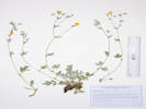
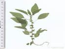
| 2448 |
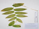
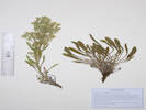
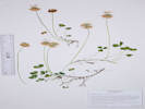
Berberis repens
| ||||||||||||||||||||||||||||||||||||||||||||||||||||||||||||||||||||||||||||||||||||||||||||||||||||||||||||||||||||||||||||||||||||||||||||||||||||||||||||||||||||||||||||||||||||||||||||||||||||||||||||||||||||||||||||||||||||||||||||||||||||||||||||||||||||||||||||||||||||||||||||||||||||||||||||||||||||||||||||||||||||||||||||||||||||||||||||||||||||||||||||||||||||||||||||||||||||||||||||||||||||||||||||||||||||||||||||||||||||||||||||||||||||||||||||||||||||||||||||||||||||||||||||||||||||||||||||||||||||||||||||||||||||||||||||||||||||||||||||||||||||||||||||||||||||||||||||||||||||||||||||||||||||||||||||||||||||||||||||||||||||||||||||||||||||||||||||||||||||||||||||||||||||||||||||||||||||||||||||||||||||||||||||||||||||||||||||||||||||||||||||||||||||||||||||||||||||||||||||||||||||||||||||||||||||||||||||||||||||||||||||||||||||||||||||||||||||||||||||||||||||||||||||||||||||||||||||||||||||||||||||||||||||||||||||||||||||||||||||||||||||||||||||||||||||||||||||||||||||||
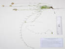
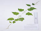
| 2449 |
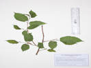
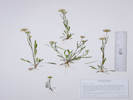
Betula occidentalis
| ||||||||||||||||||||||||||||||||||||||||||||||||||||||||||||||||||||||||||||||||||||||||||||||||||||||||||||||||||||||||||||||||||||||||||||||||||||||||||||||||||||||||||||||||||||||||||||||||||||||||||||||||||||||||||||||||||||||||||||||||||||||||||||||||||||||||||||||||||||||||||||||||||||||||||||||||||||||||||||||||||||||||||||||||||||||||||||||||||||||||||||||||||||||||||||||||||||||||||||||||||||||||||||||||||||||||||||||||||||||||||||||||||||||||||||||||||||||||||||||||||||||||||||||||||||||||||||||||||||||||||||||||||||||||||||||||||||||||||||||||||||||||||||||||||||||||||||||||||||||||||||||||||||||||||||||||||||||||||||||||||||||||||||||||||||||||||||||||||||||||||||||||||||||||||||||||||||||||||||||||||||||||||||||||||||||||||||||||||||||||||||||||||||||||||||||||||||||||||||||||||||||||||||||||||||||||||||||||||||||||||||||||||||||||||||||||||||||||||||||||||||||||||||||||||||||||||||||||||||||||||||||||||||||||||||||||||||||||||||||||||||||||||||||||||||||||||||||||||||||
| 2450 |
Ribes cereum
| ||||||||||||||||||||||||||||||||||||||||||||||||||||||||||||||||||||||||||||||||||||||||||||||||||||||||||||||||||||||||||||||||||||||||||||||||||||||||||||||||||||||||||||||||||||||||||||||||||||||||||||||||||||||||||||||||||||||||||||||||||||||||||||||||||||||||||||||||||||||||||||||||||||||||||||||||||||||||||||||||||||||||||||||||||||||||||||||||||||||||||||||||||||||||||||||||||||||||||||||||||||||||||||||||||||||||||||||||||||||||||||||||||||||||||||||||||||||||||||||||||||||||||||||||||||||||||||||||||||||||||||||||||||||||||||||||||||||||||||||||||||||||||||||||||||||||||||||||||||||||||||||||||||||||||||||||||||||||||||||||||||||||||||||||||||||||||||||||||||||||||||||||||||||||||||||||||||||||||||||||||||||||||||||||||||||||||||||||||||||||||||||||||||||||||||||||||||||||||||||||||||||||||||||||||||||||||||||||||||||||||||||||||||||||||||||||||||||||||||||||||||||||||||||||||||||||||||||||||||||||||||||||||||||||||||||||||||||||||||||||||||||||||||||||||||||||||||||||||||||
|
Other articles:
|
2451 |
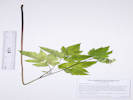
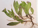
Acer negundo
| |||||||||||||||||||||||||||||||||||||||||||||||||||||||||||||||||||||||||||||||||||||||||||||||||||||||||||||||||||||||||||||||||||||||||||||||||||||||||||||||||||||||||||||||||||||||||||||||||||||||||||||||||||||||||||||||||||||||||||||||||||||||||||||||||||||||||||||||||||||||||||||||||||||||||||||||||||||||||||||||||||||||||||||||||||||||||||||||||||||||||||||||||||||||||||||||||||||||||||||||||||||||||||||||||||||||||||||||||||||||||||||||||||||||||||||||||||||||||||||||||||||||||||||||||||||||||||||||||||||||||||||||||||||||||||||||||||||||||||||||||||||||||||||||||||||||||||||||||||||||||||||||||||||||||||||||||||||||||||||||||||||||||||||||||||||||||||||||||||||||||||||||||||||||||||||||||||||||||||||||||||||||||||||||||||||||||||||||||||||||||||||||||||||||||||||||||||||||||||||||||||||||||||||||||||||||||||||||||||||||||||||||||||||||||||||||||||||||||||||||||||||||||||||||||||||||||||||||||||||||||||||||||||||||||||||||||||||||||||||||||||||||||||||||||||||||||||||||||||||
|
Other articles:
|
2452 |
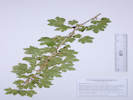
Acer glabrum.
| |||||||||||||||||||||||||||||||||||||||||||||||||||||||||||||||||||||||||||||||||||||||||||||||||||||||||||||||||||||||||||||||||||||||||||||||||||||||||||||||||||||||||||||||||||||||||||||||||||||||||||||||||||||||||||||||||||||||||||||||||||||||||||||||||||||||||||||||||||||||||||||||||||||||||||||||||||||||||||||||||||||||||||||||||||||||||||||||||||||||||||||||||||||||||||||||||||||||||||||||||||||||||||||||||||||||||||||||||||||||||||||||||||||||||||||||||||||||||||||||||||||||||||||||||||||||||||||||||||||||||||||||||||||||||||||||||||||||||||||||||||||||||||||||||||||||||||||||||||||||||||||||||||||||||||||||||||||||||||||||||||||||||||||||||||||||||||||||||||||||||||||||||||||||||||||||||||||||||||||||||||||||||||||||||||||||||||||||||||||||||||||||||||||||||||||||||||||||||||||||||||||||||||||||||||||||||||||||||||||||||||||||||||||||||||||||||||||||||||||||||||||||||||||||||||||||||||||||||||||||||||||||||||||||||||||||||||||||||||||||||||||||||||||||||||||||||||||||||||||
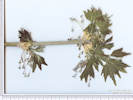
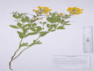
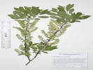
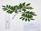
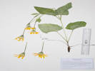
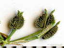
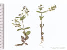
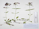
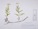
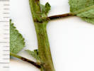
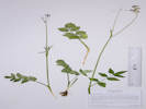
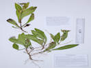
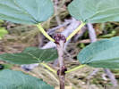
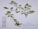 Coll. No. 2453, Prunus americana Coll. No. 2453, Prunus americana
|
2453 |
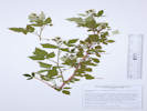
Prunus americana
| |||||||||||||||||||||||||||||||||||||||||||||||||||||||||||||||||||||||||||||||||||||||||||||||||||||||||||||||||||||||||||||||||||||||||||||||||||||||||||||||||||||||||||||||||||||||||||||||||||||||||||||||||||||||||||||||||||||||||||||||||||||||||||||||||||||||||||||||||||||||||||||||||||||||||||||||||||||||||||||||||||||||||||||||||||||||||||||||||||||||||||||||||||||||||||||||||||||||||||||||||||||||||||||||||||||||||||||||||||||||||||||||||||||||||||||||||||||||||||||||||||||||||||||||||||||||||||||||||||||||||||||||||||||||||||||||||||||||||||||||||||||||||||||||||||||||||||||||||||||||||||||||||||||||||||||||||||||||||||||||||||||||||||||||||||||||||||||||||||||||||||||||||||||||||||||||||||||||||||||||||||||||||||||||||||||||||||||||||||||||||||||||||||||||||||||||||||||||||||||||||||||||||||||||||||||||||||||||||||||||||||||||||||||||||||||||||||||||||||||||||||||||||||||||||||||||||||||||||||||||||||||||||||||||||||||||||||||||||||||||||||||||||||||||||||||||||||||||||||||
|
Locations:
Lippincott Ranch.
Lippincott Ranch (North).
|
Thursday, 6 May 2021Lippincott with John Vickery.
| ||||||||||||||||||||||||||||||||||||||||||||||||||||||||||||||||||||||||||||||||||||||||||||||||||||||||||||||||||||||||||||||||||||||||||||||||||||||||||||||||||||||||||||||||||||||||||||||||||||||||||||||||||||||||||||||||||||||||||||||||||||||||||||||||||||||||||||||||||||||||||||||||||||||||||||||||||||||||||||||||||||||||||||||||||||||||||||||||||||||||||||||||||||||||||||||||||||||||||||||||||||||||||||||||||||||||||||||||||||||||||||||||||||||||||||||||||||||||||||||||||||||||||||||||||||||||||||||||||||||||||||||||||||||||||||||||||||||||||||||||||||||||||||||||||||||||||||||||||||||||||||||||||||||||||||||||||||||||||||||||||||||||||||||||||||||||||||||||||||||||||||||||||||||||||||||||||||||||||||||||||||||||||||||||||||||||||||||||||||||||||||||||||||||||||||||||||||||||||||||||||||||||||||||||||||||||||||||||||||||||||||||||||||||||||||||||||||||||||||||||||||||||||||||||||||||||||||||||||||||||||||||||||||||||||||||||||||||||||||||||||||||||||||||||||||||||||||||||||||||
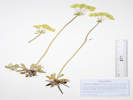
| 2454 |
Anemone patens
| ||||||||||||||||||||||||||||||||||||||||||||||||||||||||||||||||||||||||||||||||||||||||||||||||||||||||||||||||||||||||||||||||||||||||||||||||||||||||||||||||||||||||||||||||||||||||||||||||||||||||||||||||||||||||||||||||||||||||||||||||||||||||||||||||||||||||||||||||||||||||||||||||||||||||||||||||||||||||||||||||||||||||||||||||||||||||||||||||||||||||||||||||||||||||||||||||||||||||||||||||||||||||||||||||||||||||||||||||||||||||||||||||||||||||||||||||||||||||||||||||||||||||||||||||||||||||||||||||||||||||||||||||||||||||||||||||||||||||||||||||||||||||||||||||||||||||||||||||||||||||||||||||||||||||||||||||||||||||||||||||||||||||||||||||||||||||||||||||||||||||||||||||||||||||||||||||||||||||||||||||||||||||||||||||||||||||||||||||||||||||||||||||||||||||||||||||||||||||||||||||||||||||||||||||||||||||||||||||||||||||||||||||||||||||||||||||||||||||||||||||||||||||||||||||||||||||||||||||||||||||||||||||||||||||||||||||||||||||||||||||||||||||||||||||||||||||||||||||||||||
| 2455 |
Claytonia rosea
| ||||||||||||||||||||||||||||||||||||||||||||||||||||||||||||||||||||||||||||||||||||||||||||||||||||||||||||||||||||||||||||||||||||||||||||||||||||||||||||||||||||||||||||||||||||||||||||||||||||||||||||||||||||||||||||||||||||||||||||||||||||||||||||||||||||||||||||||||||||||||||||||||||||||||||||||||||||||||||||||||||||||||||||||||||||||||||||||||||||||||||||||||||||||||||||||||||||||||||||||||||||||||||||||||||||||||||||||||||||||||||||||||||||||||||||||||||||||||||||||||||||||||||||||||||||||||||||||||||||||||||||||||||||||||||||||||||||||||||||||||||||||||||||||||||||||||||||||||||||||||||||||||||||||||||||||||||||||||||||||||||||||||||||||||||||||||||||||||||||||||||||||||||||||||||||||||||||||||||||||||||||||||||||||||||||||||||||||||||||||||||||||||||||||||||||||||||||||||||||||||||||||||||||||||||||||||||||||||||||||||||||||||||||||||||||||||||||||||||||||||||||||||||||||||||||||||||||||||||||||||||||||||||||||||||||||||||||||||||||||||||||||||||||||||||||||||||||||||||||||
|
Other articles:
Locations:
Colorado School of Mines Survey Field.
Kinney Run.
|
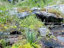
Saturday, 8 May 2021Survey Field and Kinney Run with Bob Lagier.
| ||||||||||||||||||||||||||||||||||||||||||||||||||||||||||||||||||||||||||||||||||||||||||||||||||||||||||||||||||||||||||||||||||||||||||||||||||||||||||||||||||||||||||||||||||||||||||||||||||||||||||||||||||||||||||||||||||||||||||||||||||||||||||||||||||||||||||||||||||||||||||||||||||||||||||||||||||||||||||||||||||||||||||||||||||||||||||||||||||||||||||||||||||||||||||||||||||||||||||||||||||||||||||||||||||||||||||||||||||||||||||||||||||||||||||||||||||||||||||||||||||||||||||||||||||||||||||||||||||||||||||||||||||||||||||||||||||||||||||||||||||||||||||||||||||||||||||||||||||||||||||||||||||||||||||||||||||||||||||||||||||||||||||||||||||||||||||||||||||||||||||||||||||||||||||||||||||||||||||||||||||||||||||||||||||||||||||||||||||||||||||||||||||||||||||||||||||||||||||||||||||||||||||||||||||||||||||||||||||||||||||||||||||||||||||||||||||||||||||||||||||||||||||||||||||||||||||||||||||||||||||||||||||||||||||||||||||||||||||||||||||||||||||||||||||||||||||||||||||||||
| 2456 |
Euphorbia myrsinites
| ||||||||||||||||||||||||||||||||||||||||||||||||||||||||||||||||||||||||||||||||||||||||||||||||||||||||||||||||||||||||||||||||||||||||||||||||||||||||||||||||||||||||||||||||||||||||||||||||||||||||||||||||||||||||||||||||||||||||||||||||||||||||||||||||||||||||||||||||||||||||||||||||||||||||||||||||||||||||||||||||||||||||||||||||||||||||||||||||||||||||||||||||||||||||||||||||||||||||||||||||||||||||||||||||||||||||||||||||||||||||||||||||||||||||||||||||||||||||||||||||||||||||||||||||||||||||||||||||||||||||||||||||||||||||||||||||||||||||||||||||||||||||||||||||||||||||||||||||||||||||||||||||||||||||||||||||||||||||||||||||||||||||||||||||||||||||||||||||||||||||||||||||||||||||||||||||||||||||||||||||||||||||||||||||||||||||||||||||||||||||||||||||||||||||||||||||||||||||||||||||||||||||||||||||||||||||||||||||||||||||||||||||||||||||||||||||||||||||||||||||||||||||||||||||||||||||||||||||||||||||||||||||||||||||||||||||||||||||||||||||||||||||||||||||||||||||||||||||||||||
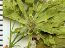
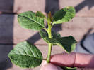
 Coll. No. 2457, Acer negundo. Coll. No. 2457, Acer negundo.
|
2457 |
Acer negundo
| |||||||||||||||||||||||||||||||||||||||||||||||||||||||||||||||||||||||||||||||||||||||||||||||||||||||||||||||||||||||||||||||||||||||||||||||||||||||||||||||||||||||||||||||||||||||||||||||||||||||||||||||||||||||||||||||||||||||||||||||||||||||||||||||||||||||||||||||||||||||||||||||||||||||||||||||||||||||||||||||||||||||||||||||||||||||||||||||||||||||||||||||||||||||||||||||||||||||||||||||||||||||||||||||||||||||||||||||||||||||||||||||||||||||||||||||||||||||||||||||||||||||||||||||||||||||||||||||||||||||||||||||||||||||||||||||||||||||||||||||||||||||||||||||||||||||||||||||||||||||||||||||||||||||||||||||||||||||||||||||||||||||||||||||||||||||||||||||||||||||||||||||||||||||||||||||||||||||||||||||||||||||||||||||||||||||||||||||||||||||||||||||||||||||||||||||||||||||||||||||||||||||||||||||||||||||||||||||||||||||||||||||||||||||||||||||||||||||||||||||||||||||||||||||||||||||||||||||||||||||||||||||||||||||||||||||||||||||||||||||||||||||||||||||||||||||||||||||||||||
| 2458 |
Prunus americana
| ||||||||||||||||||||||||||||||||||||||||||||||||||||||||||||||||||||||||||||||||||||||||||||||||||||||||||||||||||||||||||||||||||||||||||||||||||||||||||||||||||||||||||||||||||||||||||||||||||||||||||||||||||||||||||||||||||||||||||||||||||||||||||||||||||||||||||||||||||||||||||||||||||||||||||||||||||||||||||||||||||||||||||||||||||||||||||||||||||||||||||||||||||||||||||||||||||||||||||||||||||||||||||||||||||||||||||||||||||||||||||||||||||||||||||||||||||||||||||||||||||||||||||||||||||||||||||||||||||||||||||||||||||||||||||||||||||||||||||||||||||||||||||||||||||||||||||||||||||||||||||||||||||||||||||||||||||||||||||||||||||||||||||||||||||||||||||||||||||||||||||||||||||||||||||||||||||||||||||||||||||||||||||||||||||||||||||||||||||||||||||||||||||||||||||||||||||||||||||||||||||||||||||||||||||||||||||||||||||||||||||||||||||||||||||||||||||||||||||||||||||||||||||||||||||||||||||||||||||||||||||||||||||||||||||||||||||||||||||||||||||||||||||||||||||||||||||||||||||||||
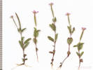
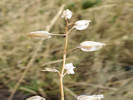
 Physaria ×1? Physaria ×1?
 Physaria ×1? Physaria ×1?
 Physaria ×1? Physaria ×1?
|
Counted 55 plants of the putative Physaria ×1. | ||||||||||||||||||||||||||||||||||||||||||||||||||||||||||||||||||||||||||||||||||||||||||||||||||||||||||||||||||||||||||||||||||||||||||||||||||||||||||||||||||||||||||||||||||||||||||||||||||||||||||||||||||||||||||||||||||||||||||||||||||||||||||||||||||||||||||||||||||||||||||||||||||||||||||||||||||||||||||||||||||||||||||||||||||||||||||||||||||||||||||||||||||||||||||||||||||||||||||||||||||||||||||||||||||||||||||||||||||||||||||||||||||||||||||||||||||||||||||||||||||||||||||||||||||||||||||||||||||||||||||||||||||||||||||||||||||||||||||||||||||||||||||||||||||||||||||||||||||||||||||||||||||||||||||||||||||||||||||||||||||||||||||||||||||||||||||||||||||||||||||||||||||||||||||||||||||||||||||||||||||||||||||||||||||||||||||||||||||||||||||||||||||||||||||||||||||||||||||||||||||||||||||||||||||||||||||||||||||||||||||||||||||||||||||||||||||||||||||||||||||||||||||||||||||||||||||||||||||||||||||||||||||||||||||||||||||||||||||||||||||||||||||||||||||||||||||||||||||||||
|
Other articles:
|
Hairy Willow Herb. | ||||||||||||||||||||||||||||||||||||||||||||||||||||||||||||||||||||||||||||||||||||||||||||||||||||||||||||||||||||||||||||||||||||||||||||||||||||||||||||||||||||||||||||||||||||||||||||||||||||||||||||||||||||||||||||||||||||||||||||||||||||||||||||||||||||||||||||||||||||||||||||||||||||||||||||||||||||||||||||||||||||||||||||||||||||||||||||||||||||||||||||||||||||||||||||||||||||||||||||||||||||||||||||||||||||||||||||||||||||||||||||||||||||||||||||||||||||||||||||||||||||||||||||||||||||||||||||||||||||||||||||||||||||||||||||||||||||||||||||||||||||||||||||||||||||||||||||||||||||||||||||||||||||||||||||||||||||||||||||||||||||||||||||||||||||||||||||||||||||||||||||||||||||||||||||||||||||||||||||||||||||||||||||||||||||||||||||||||||||||||||||||||||||||||||||||||||||||||||||||||||||||||||||||||||||||||||||||||||||||||||||||||||||||||||||||||||||||||||||||||||||||||||||||||||||||||||||||||||||||||||||||||||||||||||||||||||||||||||||||||||||||||||||||||||||||||||||||||||||||
|
|
Sunday, May 16, 2021 | ||||||||||||||||||||||||||||||||||||||||||||||||||||||||||||||||||||||||||||||||||||||||||||||||||||||||||||||||||||||||||||||||||||||||||||||||||||||||||||||||||||||||||||||||||||||||||||||||||||||||||||||||||||||||||||||||||||||||||||||||||||||||||||||||||||||||||||||||||||||||||||||||||||||||||||||||||||||||||||||||||||||||||||||||||||||||||||||||||||||||||||||||||||||||||||||||||||||||||||||||||||||||||||||||||||||||||||||||||||||||||||||||||||||||||||||||||||||||||||||||||||||||||||||||||||||||||||||||||||||||||||||||||||||||||||||||||||||||||||||||||||||||||||||||||||||||||||||||||||||||||||||||||||||||||||||||||||||||||||||||||||||||||||||||||||||||||||||||||||||||||||||||||||||||||||||||||||||||||||||||||||||||||||||||||||||||||||||||||||||||||||||||||||||||||||||||||||||||||||||||||||||||||||||||||||||||||||||||||||||||||||||||||||||||||||||||||||||||||||||||||||||||||||||||||||||||||||||||||||||||||||||||||||||||||||||||||||||||||||||||||||||||||||||||||||||||||||||||||||||
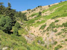
 Area where the Crepis occidentalis (?) was found. Area where the Crepis occidentalis (?) was found.
 Area where the Crepis occidentalis (?) was found. Area where the Crepis occidentalis (?) was found.
 Rosette of immature Crepis occidentalis(?) Rosette of immature Crepis occidentalis(?)
|
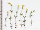
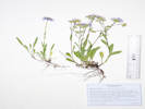
Possible Crepis occidentalis.
| ||||||||||||||||||||||||||||||||||||||||||||||||||||||||||||||||||||||||||||||||||||||||||||||||||||||||||||||||||||||||||||||||||||||||||||||||||||||||||||||||||||||||||||||||||||||||||||||||||||||||||||||||||||||||||||||||||||||||||||||||||||||||||||||||||||||||||||||||||||||||||||||||||||||||||||||||||||||||||||||||||||||||||||||||||||||||||||||||||||||||||||||||||||||||||||||||||||||||||||||||||||||||||||||||||||||||||||||||||||||||||||||||||||||||||||||||||||||||||||||||||||||||||||||||||||||||||||||||||||||||||||||||||||||||||||||||||||||||||||||||||||||||||||||||||||||||||||||||||||||||||||||||||||||||||||||||||||||||||||||||||||||||||||||||||||||||||||||||||||||||||||||||||||||||||||||||||||||||||||||||||||||||||||||||||||||||||||||||||||||||||||||||||||||||||||||||||||||||||||||||||||||||||||||||||||||||||||||||||||||||||||||||||||||||||||||||||||||||||||||||||||||||||||||||||||||||||||||||||||||||||||||||||||||||||||||||||||||||||||||||||||||||||||||||||||||||||||||||||||||
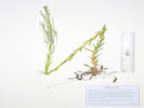
 Leaves of Artemisia campestris (?) Leaves of Artemisia campestris (?)
|
Uh-oh, what I have been passing off as Artemisia dracunculus may have been A. campestris. | ||||||||||||||||||||||||||||||||||||||||||||||||||||||||||||||||||||||||||||||||||||||||||||||||||||||||||||||||||||||||||||||||||||||||||||||||||||||||||||||||||||||||||||||||||||||||||||||||||||||||||||||||||||||||||||||||||||||||||||||||||||||||||||||||||||||||||||||||||||||||||||||||||||||||||||||||||||||||||||||||||||||||||||||||||||||||||||||||||||||||||||||||||||||||||||||||||||||||||||||||||||||||||||||||||||||||||||||||||||||||||||||||||||||||||||||||||||||||||||||||||||||||||||||||||||||||||||||||||||||||||||||||||||||||||||||||||||||||||||||||||||||||||||||||||||||||||||||||||||||||||||||||||||||||||||||||||||||||||||||||||||||||||||||||||||||||||||||||||||||||||||||||||||||||||||||||||||||||||||||||||||||||||||||||||||||||||||||||||||||||||||||||||||||||||||||||||||||||||||||||||||||||||||||||||||||||||||||||||||||||||||||||||||||||||||||||||||||||||||||||||||||||||||||||||||||||||||||||||||||||||||||||||||||||||||||||||||||||||||||||||||||||||||||||||||||||||||||||||||||
|
Locations:
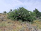
Schweich Hill.
|
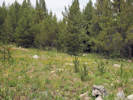
Construction spilling over into North Washington Open Space. | ||||||||||||||||||||||||||||||||||||||||||||||||||||||||||||||||||||||||||||||||||||||||||||||||||||||||||||||||||||||||||||||||||||||||||||||||||||||||||||||||||||||||||||||||||||||||||||||||||||||||||||||||||||||||||||||||||||||||||||||||||||||||||||||||||||||||||||||||||||||||||||||||||||||||||||||||||||||||||||||||||||||||||||||||||||||||||||||||||||||||||||||||||||||||||||||||||||||||||||||||||||||||||||||||||||||||||||||||||||||||||||||||||||||||||||||||||||||||||||||||||||||||||||||||||||||||||||||||||||||||||||||||||||||||||||||||||||||||||||||||||||||||||||||||||||||||||||||||||||||||||||||||||||||||||||||||||||||||||||||||||||||||||||||||||||||||||||||||||||||||||||||||||||||||||||||||||||||||||||||||||||||||||||||||||||||||||||||||||||||||||||||||||||||||||||||||||||||||||||||||||||||||||||||||||||||||||||||||||||||||||||||||||||||||||||||||||||||||||||||||||||||||||||||||||||||||||||||||||||||||||||||||||||||||||||||||||||||||||||||||||||||||||||||||||||||||||||||||||||||
|
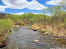
Locations: Welch Ditch. |
Wednesday, 19 May 2021Welch Ditch. | ||||||||||||||||||||||||||||||||||||||||||||||||||||||||||||||||||||||||||||||||||||||||||||||||||||||||||||||||||||||||||||||||||||||||||||||||||||||||||||||||||||||||||||||||||||||||||||||||||||||||||||||||||||||||||||||||||||||||||||||||||||||||||||||||||||||||||||||||||||||||||||||||||||||||||||||||||||||||||||||||||||||||||||||||||||||||||||||||||||||||||||||||||||||||||||||||||||||||||||||||||||||||||||||||||||||||||||||||||||||||||||||||||||||||||||||||||||||||||||||||||||||||||||||||||||||||||||||||||||||||||||||||||||||||||||||||||||||||||||||||||||||||||||||||||||||||||||||||||||||||||||||||||||||||||||||||||||||||||||||||||||||||||||||||||||||||||||||||||||||||||||||||||||||||||||||||||||||||||||||||||||||||||||||||||||||||||||||||||||||||||||||||||||||||||||||||||||||||||||||||||||||||||||||||||||||||||||||||||||||||||||||||||||||||||||||||||||||||||||||||||||||||||||||||||||||||||||||||||||||||||||||||||||||||||||||||||||||||||||||||||||||||||||||||||||||||||||||||||||||
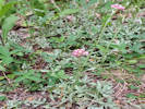
 Coll. No. 2459, Dodecatheon pulchellum Coll. No. 2459, Dodecatheon pulchellum
|
2459 |
Dodecatheon pulchellum
| |||||||||||||||||||||||||||||||||||||||||||||||||||||||||||||||||||||||||||||||||||||||||||||||||||||||||||||||||||||||||||||||||||||||||||||||||||||||||||||||||||||||||||||||||||||||||||||||||||||||||||||||||||||||||||||||||||||||||||||||||||||||||||||||||||||||||||||||||||||||||||||||||||||||||||||||||||||||||||||||||||||||||||||||||||||||||||||||||||||||||||||||||||||||||||||||||||||||||||||||||||||||||||||||||||||||||||||||||||||||||||||||||||||||||||||||||||||||||||||||||||||||||||||||||||||||||||||||||||||||||||||||||||||||||||||||||||||||||||||||||||||||||||||||||||||||||||||||||||||||||||||||||||||||||||||||||||||||||||||||||||||||||||||||||||||||||||||||||||||||||||||||||||||||||||||||||||||||||||||||||||||||||||||||||||||||||||||||||||||||||||||||||||||||||||||||||||||||||||||||||||||||||||||||||||||||||||||||||||||||||||||||||||||||||||||||||||||||||||||||||||||||||||||||||||||||||||||||||||||||||||||||||||||||||||||||||||||||||||||||||||||||||||||||||||||||||||||||||||||
| 2460 |
Rhus trilobata
| ||||||||||||||||||||||||||||||||||||||||||||||||||||||||||||||||||||||||||||||||||||||||||||||||||||||||||||||||||||||||||||||||||||||||||||||||||||||||||||||||||||||||||||||||||||||||||||||||||||||||||||||||||||||||||||||||||||||||||||||||||||||||||||||||||||||||||||||||||||||||||||||||||||||||||||||||||||||||||||||||||||||||||||||||||||||||||||||||||||||||||||||||||||||||||||||||||||||||||||||||||||||||||||||||||||||||||||||||||||||||||||||||||||||||||||||||||||||||||||||||||||||||||||||||||||||||||||||||||||||||||||||||||||||||||||||||||||||||||||||||||||||||||||||||||||||||||||||||||||||||||||||||||||||||||||||||||||||||||||||||||||||||||||||||||||||||||||||||||||||||||||||||||||||||||||||||||||||||||||||||||||||||||||||||||||||||||||||||||||||||||||||||||||||||||||||||||||||||||||||||||||||||||||||||||||||||||||||||||||||||||||||||||||||||||||||||||||||||||||||||||||||||||||||||||||||||||||||||||||||||||||||||||||||||||||||||||||||||||||||||||||||||||||||||||||||||||||||||||||||
| 2461 |
Rubus deliciousus
| ||||||||||||||||||||||||||||||||||||||||||||||||||||||||||||||||||||||||||||||||||||||||||||||||||||||||||||||||||||||||||||||||||||||||||||||||||||||||||||||||||||||||||||||||||||||||||||||||||||||||||||||||||||||||||||||||||||||||||||||||||||||||||||||||||||||||||||||||||||||||||||||||||||||||||||||||||||||||||||||||||||||||||||||||||||||||||||||||||||||||||||||||||||||||||||||||||||||||||||||||||||||||||||||||||||||||||||||||||||||||||||||||||||||||||||||||||||||||||||||||||||||||||||||||||||||||||||||||||||||||||||||||||||||||||||||||||||||||||||||||||||||||||||||||||||||||||||||||||||||||||||||||||||||||||||||||||||||||||||||||||||||||||||||||||||||||||||||||||||||||||||||||||||||||||||||||||||||||||||||||||||||||||||||||||||||||||||||||||||||||||||||||||||||||||||||||||||||||||||||||||||||||||||||||||||||||||||||||||||||||||||||||||||||||||||||||||||||||||||||||||||||||||||||||||||||||||||||||||||||||||||||||||||||||||||||||||||||||||||||||||||||||||||||||||||||||||||||||||||||
| 2462 |
Ribes cereum
| ||||||||||||||||||||||||||||||||||||||||||||||||||||||||||||||||||||||||||||||||||||||||||||||||||||||||||||||||||||||||||||||||||||||||||||||||||||||||||||||||||||||||||||||||||||||||||||||||||||||||||||||||||||||||||||||||||||||||||||||||||||||||||||||||||||||||||||||||||||||||||||||||||||||||||||||||||||||||||||||||||||||||||||||||||||||||||||||||||||||||||||||||||||||||||||||||||||||||||||||||||||||||||||||||||||||||||||||||||||||||||||||||||||||||||||||||||||||||||||||||||||||||||||||||||||||||||||||||||||||||||||||||||||||||||||||||||||||||||||||||||||||||||||||||||||||||||||||||||||||||||||||||||||||||||||||||||||||||||||||||||||||||||||||||||||||||||||||||||||||||||||||||||||||||||||||||||||||||||||||||||||||||||||||||||||||||||||||||||||||||||||||||||||||||||||||||||||||||||||||||||||||||||||||||||||||||||||||||||||||||||||||||||||||||||||||||||||||||||||||||||||||||||||||||||||||||||||||||||||||||||||||||||||||||||||||||||||||||||||||||||||||||||||||||||||||||||||||||||||||
| 2463 |
Prunus virginiana.
| ||||||||||||||||||||||||||||||||||||||||||||||||||||||||||||||||||||||||||||||||||||||||||||||||||||||||||||||||||||||||||||||||||||||||||||||||||||||||||||||||||||||||||||||||||||||||||||||||||||||||||||||||||||||||||||||||||||||||||||||||||||||||||||||||||||||||||||||||||||||||||||||||||||||||||||||||||||||||||||||||||||||||||||||||||||||||||||||||||||||||||||||||||||||||||||||||||||||||||||||||||||||||||||||||||||||||||||||||||||||||||||||||||||||||||||||||||||||||||||||||||||||||||||||||||||||||||||||||||||||||||||||||||||||||||||||||||||||||||||||||||||||||||||||||||||||||||||||||||||||||||||||||||||||||||||||||||||||||||||||||||||||||||||||||||||||||||||||||||||||||||||||||||||||||||||||||||||||||||||||||||||||||||||||||||||||||||||||||||||||||||||||||||||||||||||||||||||||||||||||||||||||||||||||||||||||||||||||||||||||||||||||||||||||||||||||||||||||||||||||||||||||||||||||||||||||||||||||||||||||||||||||||||||||||||||||||||||||||||||||||||||||||||||||||||||||||||||||||||||||
|
Other articles:
|
2464 |
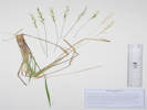
Descurainia sofia | |||||||||||||||||||||||||||||||||||||||||||||||||||||||||||||||||||||||||||||||||||||||||||||||||||||||||||||||||||||||||||||||||||||||||||||||||||||||||||||||||||||||||||||||||||||||||||||||||||||||||||||||||||||||||||||||||||||||||||||||||||||||||||||||||||||||||||||||||||||||||||||||||||||||||||||||||||||||||||||||||||||||||||||||||||||||||||||||||||||||||||||||||||||||||||||||||||||||||||||||||||||||||||||||||||||||||||||||||||||||||||||||||||||||||||||||||||||||||||||||||||||||||||||||||||||||||||||||||||||||||||||||||||||||||||||||||||||||||||||||||||||||||||||||||||||||||||||||||||||||||||||||||||||||||||||||||||||||||||||||||||||||||||||||||||||||||||||||||||||||||||||||||||||||||||||||||||||||||||||||||||||||||||||||||||||||||||||||||||||||||||||||||||||||||||||||||||||||||||||||||||||||||||||||||||||||||||||||||||||||||||||||||||||||||||||||||||||||||||||||||||||||||||||||||||||||||||||||||||||||||||||||||||||||||||||||||||||||||||||||||||||||||||||||||||||||||||||||||||||
|
Other articles:
Locations: Goose Creek. Hankins Gulch. Letters: Sunday, May 23, 2021. |
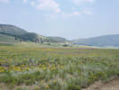
Sunday, 24 May 2021Goose Creek
| ||||||||||||||||||||||||||||||||||||||||||||||||||||||||||||||||||||||||||||||||||||||||||||||||||||||||||||||||||||||||||||||||||||||||||||||||||||||||||||||||||||||||||||||||||||||||||||||||||||||||||||||||||||||||||||||||||||||||||||||||||||||||||||||||||||||||||||||||||||||||||||||||||||||||||||||||||||||||||||||||||||||||||||||||||||||||||||||||||||||||||||||||||||||||||||||||||||||||||||||||||||||||||||||||||||||||||||||||||||||||||||||||||||||||||||||||||||||||||||||||||||||||||||||||||||||||||||||||||||||||||||||||||||||||||||||||||||||||||||||||||||||||||||||||||||||||||||||||||||||||||||||||||||||||||||||||||||||||||||||||||||||||||||||||||||||||||||||||||||||||||||||||||||||||||||||||||||||||||||||||||||||||||||||||||||||||||||||||||||||||||||||||||||||||||||||||||||||||||||||||||||||||||||||||||||||||||||||||||||||||||||||||||||||||||||||||||||||||||||||||||||||||||||||||||||||||||||||||||||||||||||||||||||||||||||||||||||||||||||||||||||||||||||||||||||||||||||||||||||||
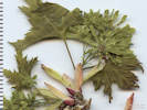
 Coll. No. 2465, Erigeron vetensis Coll. No. 2465, Erigeron vetensis
|
2465 |
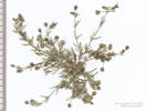
Erigeron, perhaps E. vetensis.
| |||||||||||||||||||||||||||||||||||||||||||||||||||||||||||||||||||||||||||||||||||||||||||||||||||||||||||||||||||||||||||||||||||||||||||||||||||||||||||||||||||||||||||||||||||||||||||||||||||||||||||||||||||||||||||||||||||||||||||||||||||||||||||||||||||||||||||||||||||||||||||||||||||||||||||||||||||||||||||||||||||||||||||||||||||||||||||||||||||||||||||||||||||||||||||||||||||||||||||||||||||||||||||||||||||||||||||||||||||||||||||||||||||||||||||||||||||||||||||||||||||||||||||||||||||||||||||||||||||||||||||||||||||||||||||||||||||||||||||||||||||||||||||||||||||||||||||||||||||||||||||||||||||||||||||||||||||||||||||||||||||||||||||||||||||||||||||||||||||||||||||||||||||||||||||||||||||||||||||||||||||||||||||||||||||||||||||||||||||||||||||||||||||||||||||||||||||||||||||||||||||||||||||||||||||||||||||||||||||||||||||||||||||||||||||||||||||||||||||||||||||||||||||||||||||||||||||||||||||||||||||||||||||||||||||||||||||||||||||||||||||||||||||||||||||||||||||||||||||||
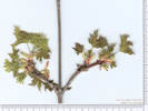
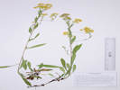
 Coll. No. 2466, Antennaria parvifolia Coll. No. 2466, Antennaria parvifolia
|
2466 |
Antennaria rosea — too short to be A. rosea.
| |||||||||||||||||||||||||||||||||||||||||||||||||||||||||||||||||||||||||||||||||||||||||||||||||||||||||||||||||||||||||||||||||||||||||||||||||||||||||||||||||||||||||||||||||||||||||||||||||||||||||||||||||||||||||||||||||||||||||||||||||||||||||||||||||||||||||||||||||||||||||||||||||||||||||||||||||||||||||||||||||||||||||||||||||||||||||||||||||||||||||||||||||||||||||||||||||||||||||||||||||||||||||||||||||||||||||||||||||||||||||||||||||||||||||||||||||||||||||||||||||||||||||||||||||||||||||||||||||||||||||||||||||||||||||||||||||||||||||||||||||||||||||||||||||||||||||||||||||||||||||||||||||||||||||||||||||||||||||||||||||||||||||||||||||||||||||||||||||||||||||||||||||||||||||||||||||||||||||||||||||||||||||||||||||||||||||||||||||||||||||||||||||||||||||||||||||||||||||||||||||||||||||||||||||||||||||||||||||||||||||||||||||||||||||||||||||||||||||||||||||||||||||||||||||||||||||||||||||||||||||||||||||||||||||||||||||||||||||||||||||||||||||||||||||||||||||||||||||||||
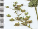
 Bob Legier photographs the Packera, perhaps P. werneriifolia. Bob Legier photographs the Packera, perhaps P. werneriifolia.
 Coll. No. 2467, Packera werneriifolia Coll. No. 2467, Packera werneriifolia
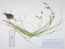
|
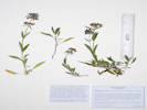
2467 |
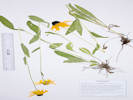
Packera, perhaps P. werneriifolia
Coll. No. 2467, 23 May 2021, characters observed: Perennial herb, 9-10 cm., tap-rooted; Stem, green, lanate-tomentose throughout; Leaves, cauline, appearing basal, blade, narrowly oblanceolate, 70 mm. × 4 mm. wide, abruptly reduced, giving plant scapose appearance, abaxial, glabrate, adaxial, thinly tomentose, margins, entire, revolute; Inflorescence, flat-topped, heads, #7-10 per stem, not overtopped by leaves; Peduncles, 3-22 mm., tomentose; Involucre, 8 mm. × 8 mm. wide, ovoid, tomentose; Phyllaries, in 2 series, non-imbricate and appearing to be a single series, 6.5 mm. × 1 mm. wide, flat, not clasping ray ovaries, tip, acute, margins of inner phyllaries scarious, calyculi present, green; Flowers, 2 kinds; Ray flowers, #9, tube 3 mm. + blade 4.5 mm. × 2 mm. wide, yellow, fertile; Disk flowers, #40-50, tube 4 mm. + lobes 0.5 mm., yellow, throat expanding gradually; Pappus, many well-developed bristles, 5 mm., ±unequal; Cypsela, immature, 1.5 mm. × 0.5 mm. wide, green, glabrous, beakless. | |||||||||||||||||||||||||||||||||||||||||||||||||||||||||||||||||||||||||||||||||||||||||||||||||||||||||||||||||||||||||||||||||||||||||||||||||||||||||||||||||||||||||||||||||||||||||||||||||||||||||||||||||||||||||||||||||||||||||||||||||||||||||||||||||||||||||||||||||||||||||||||||||||||||||||||||||||||||||||||||||||||||||||||||||||||||||||||||||||||||||||||||||||||||||||||||||||||||||||||||||||||||||||||||||||||||||||||||||||||||||||||||||||||||||||||||||||||||||||||||||||||||||||||||||||||||||||||||||||||||||||||||||||||||||||||||||||||||||||||||||||||||||||||||||||||||||||||||||||||||||||||||||||||||||||||||||||||||||||||||||||||||||||||||||||||||||||||||||||||||||||||||||||||||||||||||||||||||||||||||||||||||||||||||||||||||||||||||||||||||||||||||||||||||||||||||||||||||||||||||||||||||||||||||||||||||||||||||||||||||||||||||||||||||||||||||||||||||||||||||||||||||||||||||||||||||||||||||||||||||||||||||||||||||||||||||||||||||||||||||||||||||||||||||||||||||||||||||||||||
| 2468 |
Erigeron, likely E. compositus.
| ||||||||||||||||||||||||||||||||||||||||||||||||||||||||||||||||||||||||||||||||||||||||||||||||||||||||||||||||||||||||||||||||||||||||||||||||||||||||||||||||||||||||||||||||||||||||||||||||||||||||||||||||||||||||||||||||||||||||||||||||||||||||||||||||||||||||||||||||||||||||||||||||||||||||||||||||||||||||||||||||||||||||||||||||||||||||||||||||||||||||||||||||||||||||||||||||||||||||||||||||||||||||||||||||||||||||||||||||||||||||||||||||||||||||||||||||||||||||||||||||||||||||||||||||||||||||||||||||||||||||||||||||||||||||||||||||||||||||||||||||||||||||||||||||||||||||||||||||||||||||||||||||||||||||||||||||||||||||||||||||||||||||||||||||||||||||||||||||||||||||||||||||||||||||||||||||||||||||||||||||||||||||||||||||||||||||||||||||||||||||||||||||||||||||||||||||||||||||||||||||||||||||||||||||||||||||||||||||||||||||||||||||||||||||||||||||||||||||||||||||||||||||||||||||||||||||||||||||||||||||||||||||||||||||||||||||||||||||||||||||||||||||||||||||||||||||||||||||||||||
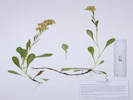
 Coll. No. 2469, Arctostaphylos uva-ursi Coll. No. 2469, Arctostaphylos uva-ursi
|
2469 |
Arctostaphylos uva-ursi.
| |||||||||||||||||||||||||||||||||||||||||||||||||||||||||||||||||||||||||||||||||||||||||||||||||||||||||||||||||||||||||||||||||||||||||||||||||||||||||||||||||||||||||||||||||||||||||||||||||||||||||||||||||||||||||||||||||||||||||||||||||||||||||||||||||||||||||||||||||||||||||||||||||||||||||||||||||||||||||||||||||||||||||||||||||||||||||||||||||||||||||||||||||||||||||||||||||||||||||||||||||||||||||||||||||||||||||||||||||||||||||||||||||||||||||||||||||||||||||||||||||||||||||||||||||||||||||||||||||||||||||||||||||||||||||||||||||||||||||||||||||||||||||||||||||||||||||||||||||||||||||||||||||||||||||||||||||||||||||||||||||||||||||||||||||||||||||||||||||||||||||||||||||||||||||||||||||||||||||||||||||||||||||||||||||||||||||||||||||||||||||||||||||||||||||||||||||||||||||||||||||||||||||||||||||||||||||||||||||||||||||||||||||||||||||||||||||||||||||||||||||||||||||||||||||||||||||||||||||||||||||||||||||||||||||||||||||||||||||||||||||||||||||||||||||||||||||||||||||||||
|
Other articles:
|
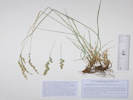
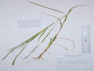
2470 |
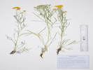
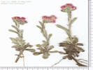
Oxytropis multiceps.
| |||||||||||||||||||||||||||||||||||||||||||||||||||||||||||||||||||||||||||||||||||||||||||||||||||||||||||||||||||||||||||||||||||||||||||||||||||||||||||||||||||||||||||||||||||||||||||||||||||||||||||||||||||||||||||||||||||||||||||||||||||||||||||||||||||||||||||||||||||||||||||||||||||||||||||||||||||||||||||||||||||||||||||||||||||||||||||||||||||||||||||||||||||||||||||||||||||||||||||||||||||||||||||||||||||||||||||||||||||||||||||||||||||||||||||||||||||||||||||||||||||||||||||||||||||||||||||||||||||||||||||||||||||||||||||||||||||||||||||||||||||||||||||||||||||||||||||||||||||||||||||||||||||||||||||||||||||||||||||||||||||||||||||||||||||||||||||||||||||||||||||||||||||||||||||||||||||||||||||||||||||||||||||||||||||||||||||||||||||||||||||||||||||||||||||||||||||||||||||||||||||||||||||||||||||||||||||||||||||||||||||||||||||||||||||||||||||||||||||||||||||||||||||||||||||||||||||||||||||||||||||||||||||||||||||||||||||||||||||||||||||||||||||||||||||||||||||||||||||||
|
Locations:
Cressmans Gulch (lower).
Dakota Ridge.
|
Tuesday, 25 May 2021 | ||||||||||||||||||||||||||||||||||||||||||||||||||||||||||||||||||||||||||||||||||||||||||||||||||||||||||||||||||||||||||||||||||||||||||||||||||||||||||||||||||||||||||||||||||||||||||||||||||||||||||||||||||||||||||||||||||||||||||||||||||||||||||||||||||||||||||||||||||||||||||||||||||||||||||||||||||||||||||||||||||||||||||||||||||||||||||||||||||||||||||||||||||||||||||||||||||||||||||||||||||||||||||||||||||||||||||||||||||||||||||||||||||||||||||||||||||||||||||||||||||||||||||||||||||||||||||||||||||||||||||||||||||||||||||||||||||||||||||||||||||||||||||||||||||||||||||||||||||||||||||||||||||||||||||||||||||||||||||||||||||||||||||||||||||||||||||||||||||||||||||||||||||||||||||||||||||||||||||||||||||||||||||||||||||||||||||||||||||||||||||||||||||||||||||||||||||||||||||||||||||||||||||||||||||||||||||||||||||||||||||||||||||||||||||||||||||||||||||||||||||||||||||||||||||||||||||||||||||||||||||||||||||||||||||||||||||||||||||||||||||||||||||||||||||||||||||||||||||||||
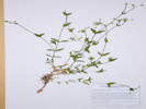
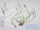
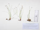
| 2471 |
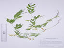
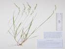
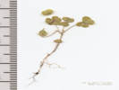
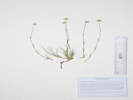
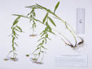
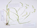
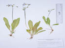
Collinsia parviflora.
| ||||||||||||||||||||||||||||||||||||||||||||||||||||||||||||||||||||||||||||||||||||||||||||||||||||||||||||||||||||||||||||||||||||||||||||||||||||||||||||||||||||||||||||||||||||||||||||||||||||||||||||||||||||||||||||||||||||||||||||||||||||||||||||||||||||||||||||||||||||||||||||||||||||||||||||||||||||||||||||||||||||||||||||||||||||||||||||||||||||||||||||||||||||||||||||||||||||||||||||||||||||||||||||||||||||||||||||||||||||||||||||||||||||||||||||||||||||||||||||||||||||||||||||||||||||||||||||||||||||||||||||||||||||||||||||||||||||||||||||||||||||||||||||||||||||||||||||||||||||||||||||||||||||||||||||||||||||||||||||||||||||||||||||||||||||||||||||||||||||||||||||||||||||||||||||||||||||||||||||||||||||||||||||||||||||||||||||||||||||||||||||||||||||||||||||||||||||||||||||||||||||||||||||||||||||||||||||||||||||||||||||||||||||||||||||||||||||||||||||||||||||||||||||||||||||||||||||||||||||||||||||||||||||||||||||||||||||||||||||||||||||||||||||||||||||||||||||||||||||||
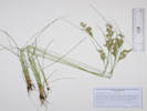
| 2472 |
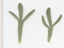
Annual Veronica, either V. arvense or V. biloba.
| ||||||||||||||||||||||||||||||||||||||||||||||||||||||||||||||||||||||||||||||||||||||||||||||||||||||||||||||||||||||||||||||||||||||||||||||||||||||||||||||||||||||||||||||||||||||||||||||||||||||||||||||||||||||||||||||||||||||||||||||||||||||||||||||||||||||||||||||||||||||||||||||||||||||||||||||||||||||||||||||||||||||||||||||||||||||||||||||||||||||||||||||||||||||||||||||||||||||||||||||||||||||||||||||||||||||||||||||||||||||||||||||||||||||||||||||||||||||||||||||||||||||||||||||||||||||||||||||||||||||||||||||||||||||||||||||||||||||||||||||||||||||||||||||||||||||||||||||||||||||||||||||||||||||||||||||||||||||||||||||||||||||||||||||||||||||||||||||||||||||||||||||||||||||||||||||||||||||||||||||||||||||||||||||||||||||||||||||||||||||||||||||||||||||||||||||||||||||||||||||||||||||||||||||||||||||||||||||||||||||||||||||||||||||||||||||||||||||||||||||||||||||||||||||||||||||||||||||||||||||||||||||||||||||||||||||||||||||||||||||||||||||||||||||||||||||||||||||||||||||
| 2472.1 |
Cryptantha sp.
| ||||||||||||||||||||||||||||||||||||||||||||||||||||||||||||||||||||||||||||||||||||||||||||||||||||||||||||||||||||||||||||||||||||||||||||||||||||||||||||||||||||||||||||||||||||||||||||||||||||||||||||||||||||||||||||||||||||||||||||||||||||||||||||||||||||||||||||||||||||||||||||||||||||||||||||||||||||||||||||||||||||||||||||||||||||||||||||||||||||||||||||||||||||||||||||||||||||||||||||||||||||||||||||||||||||||||||||||||||||||||||||||||||||||||||||||||||||||||||||||||||||||||||||||||||||||||||||||||||||||||||||||||||||||||||||||||||||||||||||||||||||||||||||||||||||||||||||||||||||||||||||||||||||||||||||||||||||||||||||||||||||||||||||||||||||||||||||||||||||||||||||||||||||||||||||||||||||||||||||||||||||||||||||||||||||||||||||||||||||||||||||||||||||||||||||||||||||||||||||||||||||||||||||||||||||||||||||||||||||||||||||||||||||||||||||||||||||||||||||||||||||||||||||||||||||||||||||||||||||||||||||||||||||||||||||||||||||||||||||||||||||||||||||||||||||||||||||||||||||||
| 2473 |
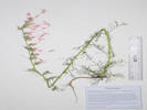
Lithospermum arvense.
| ||||||||||||||||||||||||||||||||||||||||||||||||||||||||||||||||||||||||||||||||||||||||||||||||||||||||||||||||||||||||||||||||||||||||||||||||||||||||||||||||||||||||||||||||||||||||||||||||||||||||||||||||||||||||||||||||||||||||||||||||||||||||||||||||||||||||||||||||||||||||||||||||||||||||||||||||||||||||||||||||||||||||||||||||||||||||||||||||||||||||||||||||||||||||||||||||||||||||||||||||||||||||||||||||||||||||||||||||||||||||||||||||||||||||||||||||||||||||||||||||||||||||||||||||||||||||||||||||||||||||||||||||||||||||||||||||||||||||||||||||||||||||||||||||||||||||||||||||||||||||||||||||||||||||||||||||||||||||||||||||||||||||||||||||||||||||||||||||||||||||||||||||||||||||||||||||||||||||||||||||||||||||||||||||||||||||||||||||||||||||||||||||||||||||||||||||||||||||||||||||||||||||||||||||||||||||||||||||||||||||||||||||||||||||||||||||||||||||||||||||||||||||||||||||||||||||||||||||||||||||||||||||||||||||||||||||||||||||||||||||||||||||||||||||||||||||||||||||||||||
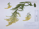
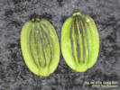
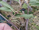
 Coll. No. 2473.1, Euphorbia esula Coll. No. 2473.1, Euphorbia esula
|
2473.1 |
Euphorbia esula.
| |||||||||||||||||||||||||||||||||||||||||||||||||||||||||||||||||||||||||||||||||||||||||||||||||||||||||||||||||||||||||||||||||||||||||||||||||||||||||||||||||||||||||||||||||||||||||||||||||||||||||||||||||||||||||||||||||||||||||||||||||||||||||||||||||||||||||||||||||||||||||||||||||||||||||||||||||||||||||||||||||||||||||||||||||||||||||||||||||||||||||||||||||||||||||||||||||||||||||||||||||||||||||||||||||||||||||||||||||||||||||||||||||||||||||||||||||||||||||||||||||||||||||||||||||||||||||||||||||||||||||||||||||||||||||||||||||||||||||||||||||||||||||||||||||||||||||||||||||||||||||||||||||||||||||||||||||||||||||||||||||||||||||||||||||||||||||||||||||||||||||||||||||||||||||||||||||||||||||||||||||||||||||||||||||||||||||||||||||||||||||||||||||||||||||||||||||||||||||||||||||||||||||||||||||||||||||||||||||||||||||||||||||||||||||||||||||||||||||||||||||||||||||||||||||||||||||||||||||||||||||||||||||||||||||||||||||||||||||||||||||||||||||||||||||||||||||||||||||||||
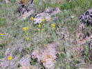 Coll. No. 2474, Erysimum capitatum Coll. No. 2474, Erysimum capitatum
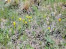 Coll. No. 2474, Erysimum capitatum Coll. No. 2474, Erysimum capitatum
|
2474 |
Erysimum capitatum
Thermopsis divaricarpa.
Thermopsis rhombifolia (Nutt. ex Pursh) Nutt. ex Richardson var. divaricarpa (A. Nelson) Isely.
Spreadfruit Goldenbanner.
Dakota Ridge, Jefferson County, Colorado.
Northwestern corner of Golden, south end of Dakota Ridge, a hogback that is structurally a continuation of Dinosaur Ridge, west limb at the south end on a small parcel owned by the City of Golden, 4.32 km. north northwest of the GNIS location of Golden.
39.7823°N, 105.2381°W.
WGS 1984
Elev. 1893 m.
Mostly mixed grasses and forbs below the Cercocarpus montanus belt, with Celtis reticulata, Rhus trilobata, Potentilla fissa, Grindelia squarrosa, and Gutierrezia sarothrae.
Collected by permit: City of Golden, 2021, issued: Jan 27, 2021, to: Tom Schweich.
Potentilla fissa
Potentilla fissa Nutt. ex Torr. & A.Gray.
Bigflower Cinquefoil.
Dakota Ridge, Jefferson County, Colorado.
Northwestern corner of Golden, south end of Dakota Ridge, a hogback that is structurally a continuation of Dinosaur Ridge, west limb at the south end on a small parcel owned by the City of Golden, 4.30 km. north northwest of the GNIS location of Golden.
39.7823°N, 105.2379°W.
WGS 1984
Elev. 1892 m.
Mostly mixed grasses and forbs just below the Cercocarpus montanus belt, with Celtis reticulata, Rhus trilobata, Thermopsis rhombifola var. divaricarpa, Grindelia squarrosa, and Gutierrezia sarothrae.
In fractures in rocks of an outcrop identified by a local geologist as Lykins conglomerate.
Collected by permit: City of Golden, 2021, issued: Jan 27, 2021, to: Tom Schweich.
Undetermined. Pretty clearly Pediomelum tenuiflorum when examined under a microscope.
Locations:
Tucker Gulch (lower).
Vanover Park.
Tucker Gulch and Vanover Park.
Lithospermum arvense.
Lithospermum arvense L.
Corn Gromwell.
Tucker Gulch (lower), Jefferson County, Colorado.
Along the City of Golden Tucker Gulch Trail between 1st Street and 7th Place, 1.45 km. north northwest of the GNIS location of Golden.
39.7651°N, 105.2252°W.
WGS 1984
Elev. 1756 m.
Scattered in grasses under trees, also collected here: Asperugo procumbens, Alliaria petiolata, Lunaria annua, and Veronica biloba.
Collected by permit: City of Golden, 2021, issued: Jan 27, 2021, to: Tom Schweich.
Lunaria annua.
Lunaria annua L.
Money Plant.
Tucker Gulch (lower), Jefferson County, Colorado.
On both banks of Tucker Gulch near the City of Golden Tucker Gulch Trail between 1st Street and 7th Place, 1.45 km. north northwest of the GNIS location of Golden.
39.7651°N, 105.2252°W.
WGS 1984
Elev. 1756 m.
Flower, with partially developed fruit.
Nautralized.
Collected by permit: City of Golden, 2021, issued: Jan 27, 2021, to: Tom Schweich.
Fumaria vaillantii.
Fumaria vaillantii Loisel.
Earthsmoke.
Tucker Gulch (lower), Jefferson County, Colorado.
On east bank of Tucker Gulch near the City of Golden Tucker Gulch Trail between 1st Street and 7th Place, 1.51 km. north northwest of the GNIS location of Golden.
39.7654°N, 105.2255°W.
WGS 1984
Elev. 1767 m.
Slope above creek.
Very few plants here, but more on the north bank of Clear Creek, cf., my Coll. No. 2484.
Collected by permit: City of Golden, 2021, issued: Jan 27, 2021, to: Tom Schweich.
Alliaria petiolata.
Alliaria petiolata (M. Bieb.) Cavara & Grande.
Garlic Mustard.
Tucker Gulch (lower), Jefferson County, Colorado.
On east bank of Tucker Gulch near the City of Golden Tucker Gulch Trail between 1st Street and 7th Place, 1.49 km. north northwest of the GNIS location of Golden.
39.7653°N, 105.2255°W.
WGS 1984
Elev. 1763 m.
Also collected nearby: Lithospermum arvense, Lunaria annua, Fumaria vaillantii, and Veronica biloba.
Colorado Noxious Weed Watch List.
Collected by permit: City of Golden, 2021, issued: Jan 27, 2021, to: Tom Schweich.
Veronica biloba.
Veronica biloba L.
Twolobe Speedwell.
Tucker Gulch (lower), Jefferson County, Colorado.
In a sunny spot beside the city of Golden Tucker Gulch Trail, between 1st Street and 7th Place, 1.54 km. north northwest of the GNIS location of Golden.
39.7656°N, 105.2257°W.
WGS 1984
Elev. 1769 m.
Also collected nearby: Lithospermum arvense, Alliaria petiolata, Lunaria annua, and Fumaria vaillantii.
Collected by permit: City of Golden, 2021, issued: Jan 27, 2021, to: Tom Schweich.
Undetermined.
Upon further review: Asperugo procumbens.
Asperugo procumbens L.
German Madwort.
Tucker Gulch (lower), Jefferson County, Colorado.
Along the City of Golden Tucker Gulch Trail, about mid-way between 1st Street and 7th Place, 1.36 km. north northwest of the GNIS location of Golden.
39.7646°N, 105.2245°W.
WGS 1984
Elev. 1761 m.
Annual, flowers blue-purple.
Also collected nearby: Lithospermum arvense, Alliaria petiolata, Lunaria annua, Veronica biloba, and Fumaria vaillantii.
At the south end of a bridge over the gulch, on a bank above creek, extending from the edge of the concrete trail nearly down to the creek.
Collected by permit: City of Golden, 2021, issued: Jan 27, 2021, to: Tom Schweich.
Other articles:
Locations:
Vanover Park.
Fumaria vaillantii. Fumaria vaillantii Loisel.
Earthsmoke.
Vanover Park, Jefferson County, Colorado.
North bank of Clear Creek between Tucker Gulch and Ford Street, 415 m. north east of the GNIS location of Golden.
39.7581°N, 105.2195°W.
WGS 1984
Elev. 1728 m.
Under willows next to Clear Creek, and under the fence on the bridge abutment; persistent here because this collection duplicates Stanley Smookler #54, 16 May 1993 ( KHD12404).
Collected by permit: City of Golden, 2021, issued: Jan 27, 2021, to: Tom Schweich.
Locations:
North Table Mountain Park.
North Table Mountain with Cindy Trujillo
Euphorbia brachycera.
Euphorbia brachycera Engelm.
Horned Spurge.
North Table Mountain Park, Jefferson County, Colorado.
Beside informal horse trail along the northern boundary of the park, 6.28 km. north northeast of the GNIS location of Golden.
39.798°N, 105.2098°W.
WGS 1984
Elev. 1805 m.
In mixed grasses and forbs.
Also seen next to North Table Loop trail.
Collected by permit: Jefferson County Open Space, 2021, issued: Apr 1, 2021, to: Tom Schweich.
Coll. No. 2485, 2 June 2021, characters observed:
Perennial, to 25-30 cm.,
glabrous throughout;
Stem,
erect,
herbaceous;
Leaves,
alternate,
sessile,
lanceolate, 16 mm. × 8 mm. wide,
margin entire,
tip acute,
green throughout;
Flowers,
arranged in a cyathium,
glands entire with “horns” on either side.
Scutellaria brittonii.
Scutellaria brittonii Porter.
Britton's Skullcap.
North Table Mountain Park, Jefferson County, Colorado.
Northern part of park, along an informal horse trail, 6.24 km. north northeast of the GNIS location of Golden.
39.7977°N, 105.2093°W.
WGS 1984
Elev. 1815 m.
Also collected here: Senecio integerrimus, Ellisia nyctelea, Boechera fendleri, Delphinium carolinianum virescens, Potentilla pensylvanica, Viola nuttallii, &c.
In a nearly closed depression on the toe of an ancient landslide.
Collected by permit: Jefferson County Open Space, 2021, issued: Apr 1, 2021, to: Tom Schweich.
Ellisia nyctelea.
Ellisia nyctelea (L.) L.
Aunt Lucy.
North Table Mountain Park, Jefferson County, Colorado.
Northern part of park, along an informal horse trail, 6.24 km. north northeast of the GNIS location of Golden.
39.7977°N, 105.2093°W.
WGS 1984
Elev. 1815 m.
Few plants here.
Also collected here: Senecio integerrimus, Boechera fendleri, Scutellaria brittonii, Delphinium carolinianum virescens, Potentilla pensylvanica, Viola nuttallii, &c.
In a nearly closed depression on the toe of an ancient landslide.
Collected by permit: Jefferson County Open Space, 2021, issued: Apr 1, 2021, to: Tom Schweich.
Other articles:
Phlox multiflora.
Phlox multiflora A. Nelson.
Mountain Phlox.
North Table Mountain Park, Jefferson County, Colorado.
North slopes of North Table Mountain, along the North Table Loop trail, 6.13 km. north northeast of the GNIS location of Golden. Closest access point is the neighborhood access trail on W. 53rd Drive.
39.7954°N, 105.2022°W.
WGS 1984
Elev. 1836 m.
Flowers pink to white, fading blue.
Also observed and collected on slopes above the North Table Loop from this point west to the power lines.
Collected by permit: Jefferson County Open Space, 2021, issued: Apr 1, 2021, to: Tom Schweich.
Physocarpus monogynus (Torr.) J.M. Coult.
Mountain Ninebark.
North Table Mountain Park, Jefferson County, Colorado.
North slopes of North Table Mountain, along the North Table Loop trail, 6.13 km. north northeast of the GNIS location of Golden. Closest access point is the neighborhood access trail on W. 53rd Drive.
39.7953°N, 105.2024°W.
WGS 1984
Elev. 1835 m.
In flower.
Also collected here: Phlox multiflora.
Collected by permit: Jefferson County Open Space, 2021, issued: Apr 1, 2021, to: Tom Schweich.
Other articles:
Our old power pole got replaced.
Other articles:
Locations:
Lippincott Ranch.
Lippincott, with John Vickery
Carex nebrascensis.
Carex nebrascensis Dewey.
Nebraska Sedge.
Lippincott Ranch, Jefferson County, Colorado.
Central part of ranch, at the south end of the clay pit, where the emphemeral stream has been diverted through the pit, 22.2 km. north northwest of Golden.
39.9027°N, 105.2751°W.
WGS 1984
Elev. 2000 m.
Growing in flowing water.
Also collected nearby: Erigeron flagellaris, Astragalus agrestis, Trifolium repens, Prunella vulgaris, Juncus bufonius, and Alopecurus carolinianus.
Jointly owned by City of Boulder Open Space and Mountain Parks and Jefferson County Open Space.
Collected by permit: Jefferson County Open Space, 2021, issued: Apr 1, 2021, to: Tom Schweich.
Salix irrorata.
Salix irrorata Andersson.
Dewystem Willow.
Lippincott Ranch, Jefferson County, Colorado.
Central part of ranch near the former clay mine headquarters, beside a former stream channel now abandoned to the new route through the clay pit, 22.1 km north northwest of Golden.
39.9025°N, 105.2749°W.
WGS 1984
Elev. 2001 m.
Shrub to 2 m., stems yellow brown, prior year's pruinose.
Also collected nearby: Erigeron flagellaris, Astragalus agrestis, Trifolium repens, Prunella vulgaris, Carex nebrascensis, Juncus bufonius, and Alopecurus carolinianus.
Jointly owned by City of Boulder Open Space and Mountain Parks and Jefferson County Open Space.
Collected by permit: Jefferson County Open Space, 2021, issued: Apr 1, 2021, to: Tom Schweich.
Astragalus agrestis.
Astragalus agrestis Douglas ex G. Don.
Purple Milkvetch.
Lippincott Ranch, Jefferson County, Colorado.
Central part of ranch, at the south end of the clay pit, where the emphemeral stream has been diverted through the pit, 22.2 km. north northwest of Golden.
39.9028°N, 105.2751°W.
WGS 1984
Elev. 2003 m.
Colonizing a small spoils pile in former clay mine, heavy clay soil, rhizomes not found to 5 inch depth
Also collected nearby: Erigeron flagellaris, Trifolium repens, Prunella vulgaris, Carex nebrascensis, Juncus bufonius, and Alopecurus carolinianus.
Jointly owned by City of Boulder Open Space and Mountain Parks and Jefferson County Open Space.
Collected by permit: Jefferson County Open Space, 2021, issued: Apr 1, 2021, to: Tom Schweich.
Unknown.
Anthriscus caucalis M. Bieb.
Bur Chervil.
Lippincott Ranch, Jefferson County, Colorado.
In the narrow “wasp waist” part of the ranch, 525 m. northwest of the main gate, 22.1 km. north northwest of the GNIS location of Golden.
39.902°N, 105.2766°W.
WGS 1984
Elev. 2016 m.
Under ponderosa pines, with Pseudostellaria.
Coordinates estimated with GoogleEarth. Lippincott Ranch is jointly owned by City of Boulder Open Space and Mountain Parks and Jefferson County Open Space.
Collected by permit: Jefferson County Open Space, 2021, issued: Apr 1, 2021, to: Tom Schweich.
Myosotis micrantha.
Myosotis micrantha Pall. ex Lehm.
Small-Flowered Forget-Me-Not.
Lippincott Ranch, Jefferson County, Colorado.
West-central portion of ranch, in rocky grassland below the ponderosa pines. 22.2 km. north northwest of the GNIS location of Golden.
39.9022°N, 105.2782°W.
WGS 1984
Elev. 2047 m.
Abaxial leaf hairs hooked, esp. on midrib. About 200 m. east of my Coll. No. 2154 of same taxon.
Small colony below rocks. Also here: Amorpha nana, Ceanothus herbaceus, Gentiana affinis, Solidago rigida, and Symphyotrichum ericoides.
Jointly owned by City of Boulder Open Space and Mountain Parks and Jefferson County Open Space.
Collected by permit: Jefferson County Open Space, 2021, issued: Apr 1, 2021, to: Tom Schweich.
Poa sp.
Poa fendleriana (Steud.) Vasey.
Muttongrass.
Lippincott Ranch, Jefferson County, Colorado.
Southwest corner of the ranch, near the railroad tracks, in deep ponderosa pine forest duff, 22.3 km. north northwest of the GNIS location of Golden.
39.9018°N, 105.2815°W.
WGS 1984
Elev. 2084 m.
Also seen or collected nearby: Juniperus communis, J. scopulorum, Pinus ponderosa with Arceuthobium vaginatum, Hieracium albiflorum, Berberis repens, and Corallorhiza maculata.
Collected by permit: Jefferson County Open Space, 2021, issued: Apr 1, 2021, to: Tom Schweich.
Coll. No. 2494, 4 June 2021, characters observed:
Perennial tufted grass, to 35 cm;
Sheath, open;
Ligule, membraneous;
Inflorescence,
45 mm. × 9 mm. wide,
panicle,
discontinuous on rachis;
Spikelets,
many,
5.5 mm. × 5 mm. wide;
Compression, lateral;
Glumes,
keeled,
<lowest floret,
lower, 2.3 mm., veins 1,
upper, 3.5 mm., veins 3;
Florets,
4 per spikelet,
3 pistillate,
1 sterile;
Rachilla,
extends 1 mm. beyond sterile floret,
Lemma,
3.5 mm. × 2 mm. wide,
proximal body pappillate,
veins 5 (obscure)
proximal mid-vein and marginal veins hairy,
chartaceous distally;
Palea,
3 mm.,
keels ciliate.
Maianthemum racemosum.
Maianthemum racemosum (L.) Link ssp. amplexicaule (Nutt.) LaFrankie.
Feathery False Lily of the Valley.
Lippincott Ranch, Jefferson County, Colorado.
Southwestern corner of the ranch, just below the railroad, on wooded northwest slope with ponderosa pine and Juniperus communis, 22.3 km. north northwest of the GNIS location of Golden.
39.9019°N, 105.2817°W.
WGS 1984
Elev. 2099 m.
Also seen or collected nearby: Arnica cordifolia, Pseudognaphalium macounii, and Pterospora andromedea.
Collected by permit: Jefferson County Open Space, 2021, issued: Apr 1, 2021, to: Tom Schweich.
Other articles:
Acer glabrum.
Acer glabrum Torr.
Rocky Mountain Maple.
Lippincott Ranch, Jefferson County, Colorado.
Southwestern corner of the ranch, at base of railroad embankment, 22.3 km. north northwest of the GNIS location of Golden.
39.9022°N, 105.2826°W.
WGS 1984
Elev. 2060 m.
Large tree, multiple trunks, up to 10" d.b.h.
Also collected nearby: Corydalis aurea, Brickellia grandiflora, and Polansia dodecandra.
Collected by permit: Jefferson County Open Space, 2021, issued: Apr 1, 2021, to: Tom Schweich.
Betula sp., maybe B. pendula.
Betula pendula Roth.
European White Birch.
Lippincott Ranch, Jefferson County, Colorado.
Southwest corner of the ranch, bottom of a small gulch, below the railroad embankment, 22.4 km. north northwest of the GNIS location of Golden.
39.9026°N, 105.2821°W.
WGS 1984
Elev. 2053 m.
Jointly owned by City of Boulder Open Space and Mountain Parks and Jefferson County Open Space.
Collected by permit: Jefferson County Open Space, 2021, issued: Apr 1, 2021, to: Tom Schweich.
Cystopteris fragilis (L.) Bernh.
Brittle Bladderfern.
Lippincott Ranch, Jefferson County, Colorado.
Southwest corner of the ranch, bottom of a small gulch, below the railroad embankment, 22.4 km. north northwest of the GNIS location of Golden.
39.9027°N, 105.2819°W.
WGS 1984
Elev. 2067 m.
Deep ponderosa pine forest growing from bases of rocks.
Jointly owned by City of Boulder Open Space and Mountain Parks and Jefferson County Open Space.
Collected by permit: Jefferson County Open Space, 2021, issued: Apr 1, 2021, to: Tom Schweich.
Hydrophyllum fendleri.
Hydrophyllum fendleri (A. Gray) A. Heller.
Fendler's Waterleaf.
Lippincott Ranch, Jefferson County, Colorado.
Southwest corner of the ranch, along an unnamed intermittent stream tributary to Bull Gulch, 22.5 km. north northwest of the GNIS location of Golden.
39.9038°N, 105.2806°W.
WGS 1984
Elev. 2023 m.
Also collected nearby: Besseya plantaginea.
Jointly owned by City of Boulder Open Space and Mountain Parks and Jefferson County Open Space.
Collected by permit: Jefferson County Open Space, 2021, issued: Apr 1, 2021, to: Tom Schweich.
Clematis hirsutissima.
Clematis hirsutissima Pursh.
Hairy Clematis, Sugar Bowls.
Lippincott Ranch, Jefferson County, Colorado.
Southwest corner of the ranch, along an unnamed intermittent stream tributary to Bull Gulch, 22.6 km. north northwest of the GNIS location of Golden.
39.9052°N, 105.2792°W.
WGS 1984
Elev. 2014 m.
Also collected or seen here: Corylus cornuta, Frasera speciosa, Lonicera tatarica, Ranunculus sceleratus, Besseya plantaginea, and Urtica dioica.
Jointly owned by City of Boulder Open Space and Mountain Parks and Jefferson County Open Space.
Collected by permit: Jefferson County Open Space, 2021, issued: Apr 1, 2021, to: Tom Schweich.
Lonicera tatarica.
Lonicera tatarica L.
Tatarian Honeysuckle.
Lippincott Ranch, Jefferson County, Colorado.
Southwest corner of the ranch, along an unnamed intermittent stream tributary to Bull Gulch, in the stream bed, 22.6 km. north northwest of the GNIS location of Golden.
39.9055°N, 105.2789°W.
WGS 1984
Elev. 1990 m.
Also collected or seen here: Corylus cornuta, Clematis hirsutissima, Frasera speciosa, Ranunculus sceleratus, Besseya plantaginea, Persicaria hydropiper, and Urtica dioica.
Jointly owned by City of Boulder Open Space and Mountain Parks and Jefferson County Open Space.
Collected by permit: Jefferson County Open Space, 2021, issued: Apr 1, 2021, to: Tom Schweich.
Barbarea sp., maybe B. vulgaris.
Barbarea vulgaris R. Br.
Garden Yellowrocket.
Lippincott Ranch, Jefferson County, Colorado.
Southwest corner of the ranch, along an unnamed intermittent stream tributary to Bull Gulch, in the stream bed, 22.7 km. north northwest of the GNIS location of Golden.
39.9058°N, 105.2787°W.
WGS 1984
Elev. 1988 m.
Also seen or collected here, Actaea rubra, Lathryrus sp., and Gratiola neglecta.
Jointly owned by City of Boulder Open Space and Mountain Parks and Jefferson County Open Space.
Collected by permit: Jefferson County Open Space, 2021, issued: Apr 1, 2021, to: Tom Schweich.
Actaea sp.
Actaea rubra (Aiton) Willd.
Red Baneberry.
Lippincott Ranch, Jefferson County, Colorado.
Southwest corner of the ranch, on the bank of an unnamed intermittent stream tributary to Bull Gulch, 22.7 km. north northwest of the GNIS location of Golden.
39.9058°N, 105.2787°W.
WGS 1984
Elev. 1988 m.
Immature, flowers only.
Also collected here: Barbarea vularis, and Gratiola neglecta.
Jointly owned by City of Boulder Open Space and Mountain Parks and Jefferson County Open Space.
Collected by permit: Jefferson County Open Space, 2021, issued: Apr 1, 2021, to: Tom Schweich.
Lathyrus sp.
Lathyrus lanszwertii Kellogg var. laetivirens (Greene ex Rydb.) S. L. Welsh.
Aspen Pea.
Lippincott Ranch, Jefferson County, Colorado.
Southwest corner of the ranch, on the bank of an unnamed intermittent stream tributary to Bull Gulch, 22.7 km. north northwest of the GNIS location of Golden.
39.9058°N, 105.2787°W.
WGS 1984
Elev. 1990 m.
Flowers white with purple veins, tendrils variously coiled.
In grasses, also collected nearby: Actaea rubra, Barbarea vulgaris, and Gratiola neglecta.
Jointly owned by City of Boulder Open Space and Mountain Parks and Jefferson County Open Space.
Collected by permit: Jefferson County Open Space, 2021, issued: Apr 1, 2021, to: Tom Schweich.
Coll. No. 2503, 4 June 2021, characters observed:
Perennial herb, to 40 cm.;
Leaves,
pinnately compound with tendrils,
leaflets, 6 (3 pair),
tendril, to 40 mm., some forked, most coiled;
Calyx, fused 3.5 mm., free 2 mm.;
Flowers,
zygomorphic,
petals, white,
banner, 12 mm., flexed at middle, veins purple;
Style,
flattened.
In Ackerfield (2015), Lathyrus lanszwertii Kellogg var. laetivirens (Greene ex Rydb.) S. L. Welsh.
In Weber & Wittmann (2012), Lathyrus leucanthus Rydb.
In Plants of the World (2021), Lathyrus laetivirens Greene ex Rydb.
Lepidium campestre
Ribes inerme, in fruit.
Ribes inerme Rydb.
White Stem Gooseberry.
Bull Gulch, Jefferson County, Colorado.
At the base of several boulders on the south side of Bull Gulch, near the location of the ranch road crossing of the gulch, 22.9 km. north northwest of the GNIS location of Golden.
39.9077°N, 105.2767°W.
WGS 1984
Elev. 1964 m.
Developing fruit.
Variety inerme if infraspecific names are to be applied. In Lippincott Ranch, jointly owned by City of Boulder Open Space and Mountain Parks and Jefferson County Open Space.
Collected by permit: Jefferson County Open Space, 2021, issued: Apr 1, 2021, to: Tom Schweich.
Asperugo procumbens.
Asperugo procumbens L.
German Madwort.
Lippincott Ranch, Jefferson County, Colorado.
In the bed of a small intermittent stream near its mouth at Bull Gulch, near the location of the ranch road crossing of the gulch, 22.9 km. north northwest of the GNIS location of Golden.
39.9076°N, 105.2767°W.
WGS 1984
Elev. 1964 m.
Jointly owned by City of Boulder Open Space and Mountain Parks and Jefferson County Open Space.
Collected by permit: Jefferson County Open Space, 2021, issued: Apr 1, 2021, to: Tom Schweich.
Rubus idaeus.
Rubus idaeus L. var. strigosus (Michx.) Maxim.
American Red Raspberry.
Bull Gulch, Jefferson County, Colorado.
Lippincott Ranch, gravel bar in Bull Gulch, just upstream of the ranch road crossing of the gulch, 22.9 km. north northwest of the GNIS location of Golden.
39.908°N, 105.277°W.
WGS 1984
Elev. 1969 m.
Many collections here, such as: Juncus ensifolius, Populus deltoides, Melilotus albus, Trifolium fragiferum, Ribes inerme, Epilobium brachycarpum, and Anaphalis margaritacea.
Jointly owned by City of Boulder Open Space and Mountain Parks and Jefferson County Open Space.
Collected by permit: Jefferson County Open Space, 2021, issued: Apr 1, 2021, to: Tom Schweich.
Salix monticola, tentative.
Salix bebbiana Sarg.
Bebb Willow.
Bull Gulch, Jefferson County, Colorado.
In Lippincott Ranch, in stream channel adjacent to sand/gravel/cobble bar, just upstream of the ranch road crossing of Bull Gulch, 23.0 km. north northwest of the GNIS location of Golden
39.9081°N, 105.277°W.
WGS 1984
Elev. 1964 m.
Many collections here, such as: Juncus ensifolius, Populus deltoides, Melilotus albus, Trifolium fragiferum, Ribes inerme, Chamerion angustifolium, Epilobium brachycarpum, and Anaphalis margaritacea.
Jointly owned by City of Boulder Open Space and Mountain Parks and Jefferson County Open Space.
Collected by permit: Jefferson County Open Space, 2021, issued: Apr 1, 2021, to: Tom Schweich.
Coll. No. 2507, 4 June 2021, characters observed:
Shrub;
Twigs,
hairy, not pruinose;
Leaves,
38 mm. × 14 mm. wide, ratio 2.7:1,
somewhat oblanceolate,
tip acute to rounded,
lighter below, not glaucus;
Catkins,
pistillate, fruiting,
on leafy branches;
Floral bracts,
tawny;
Pedicels,
2.8 mm.;
Capsules,
5-6 mm. × 1.3 mm.,
hairy;
Styles,
0.5 mm.
“Male Fern”
Dryopteris filix-mas (L.) Schott.
Male Fern.
Bull Gulch, Jefferson County, Colorado.
In Lippincott Ranch, in stream channel adjacent to sand/gravel/cobble bar, just upstream of the ranch road crossing of Bull Gulch, 23.0 km. north northwest of the GNIS location of Golden
39.9081°N, 105.277°W.
WGS 1984
Elev. 1964 m.
Many collections here, such as: Juncus ensifolius, Populus deltoides, Melilotus albus, Trifolium fragiferum, Ribes inerme, Chamerion angustifolium, Epilobium brachycarpum, and Anaphalis margaritacea.
Jointly owned by City of Boulder Open Space and Mountain Parks and Jefferson County Open Space.
Collected by permit: Jefferson County Open Space, 2021, issued: Apr 1, 2021, to: Tom Schweich.
Cerastium fontanum var. vulgare.
Cerastium fontanum Baumgarten ssp. vulgare (Hartman) Greuter & Burdet.
Common Mouse-Ear.
Bull Gulch, Jefferson County, Colorado.
In Lippincott Ranch, in stream channel adjacent to sand/gravel/cobble bar, just upstream of the ranch road crossing of Bull Gulch, 23.0 km. north northwest of the GNIS location of Golden
39.9081°N, 105.2771°W.
WGS 1984
Elev. 1964 m.
Many collections here, such as: Juncus ensifolius, Populus deltoides, Melilotus albus, Trifolium fragiferum, Ribes inerme, Chamerion angustifolium, Epilobium brachycarpum, and Anaphalis margaritacea.
Jointly owned by City of Boulder Open Space and Mountain Parks and Jefferson County Open Space.
Collected by permit: Jefferson County Open Space, 2021, issued: Apr 1, 2021, to: Tom Schweich.
Salix sp.
Salix monticola Bebb.
Park Willow.
Bull Gulch, Jefferson County, Colorado.
In Lippincott Ranch, in stream channel adjacent to sand/gravel/cobble bar, just upstream of the ranch road crossing of Bull Gulch, 23.0 km. north northwest of the GNIS location of Golden.
39.9081°N, 105.2771°W.
WGS 1984
Elev. 1964 m.
Many collections here, such as: Juncus ensifolius, Populus deltoides, Melilotus albus, Trifolium fragiferum, Ribes inerme, Chamerion angustifolium, Epilobium brachycarpum, Salix bebbiana and Anaphalis margaritacea.
Jointly owned by City of Boulder Open Space and Mountain Parks and Jefferson County Open Space.
Collected by permit: Jefferson County Open Space, 2021, issued: Apr 1, 2021, to: Tom Schweich.
Carex sp.
Carex occidentalis L. H. Bailey.
Western Sedge.
Bull Gulch, Jefferson County, Colorado.
In Lippincott Ranch, on the south bank of Bull Gulch, wet area above the active stream channel, just upstream of the ranch road crossing of Bull Gulch, 23.0 km. north northwest of the GNIS location of Golden.
39.908°N, 105.2772°W.
WGS 1984
Elev. 1955 m.
Many collections here, such as: Carex nebrascensis, Cerastium fontanum ssp. vulgare, Sisyrinchium montanum, and Juncus bufonius.
Jointly owned by City of Boulder Open Space and Mountain Parks and Jefferson County Open Space.
Collected by permit: Jefferson County Open Space, 2021, issued: Apr 1, 2021, to: Tom Schweich.
Other articles:
Locations:
South Platte River.
Willow Bend Picnic Area.
South Platte River and Pine Valley Ranch.
Locations:
Pine Valley Ranch Park.
Locations:
Dinosaur Ridge.
Hunting the wild Physaria hybrid on Dinosaur Ridge.
Literature Cited:
Physaria sp.
Physaria vitulifera × bellii.
Twinpod Hybrid.
Dinosaur Ridge, Jefferson County, Colorado.
On the Dakota Ridge Trail, 180 m. north of Alameda Parkway, 11.8 km south of the GNIS location of Golden.
39.677°N, 105.193°W.
WGS 1984
Elev. 1916 m.
Five or six plants under Cercocarpus montanus, and between two branches of the Dakota Ridge Trail.
Collected by permit: Jefferson County Open Space, 2021, issued: Apr 1, 2021, to: Tom Schweich.
1. Shape of the basal leaves.
The basal leaves of Physaria bellii are broadly ovate with shallowly dentate margins.
The basal leaves of Physaria vitulifera have a pandurate (fiddle-shaped)
or obovate blade with margins that are usually deeply and broadly incised.
Rydbergs (1895) holotype, an image of which is available online
(https://swbiodiversity.org/seinet/collections/individual/index.php?occid=2774659),
has strongly fiddle-shaped leaves that are deeply incised.
For my collection number 2509, the leaves are rarely pandurate (fiddle-shaped), i.e., only two could be described that way. Otherwise, nearly all the basal leaves are obovate with margins that are shallowly dentate rather than deeply and broadly incised.
2. Depths of the basal and apical sinus.
Physaria bellii fruits have narrow, deep apical and basal sinuses.
Physaria vitulifera fruits have an obtuse or truncate base, and a broad, open, and deep apical sinus.
For my collection 2509, only the youngest fruit is obtuse at the base.
For mature fruit, the basal sinus is clearly present, though smaller than the apical sinus.
The mean depth of the basal sinus is 1.06 mm., whereas the mean depth of the apical sinus is 1.94 mm. (n=17).
Therefore, the base of the fruit cannot be described as either obtuse or truncate.
Broad and open is an apt description for many of the apical sinuses,though.
At least two of the characters of Coll. No. 2509 are intermediate between P. bellii and P. vitulifiera
and it is therefore likely that this collection is the hybrid between the two, Physaria ×1.
Locations:
Welch Ditch.
Moved to Welch Ditch to check the Smilacena/Maianthemum under the Chimney Gulch trail bridge.
Maianthemum racemosum ?
Maianthemum stellatum (L.) Link.
Starry False Lily of the Valley.
Welch Ditch, Jefferson County, Colorado.
Along the Welch Ditch where it is crossed by the Chimney Gulch Trail, in deep weeds beside the bridge over the ditch, 1.63 km. west southwest of the GNIS location of Golden.
39.7499°N, 105.2337°W.
WGS 1984
Elev. 1778 m.
Collected by permit: Colorado School of Mines, 2021, issued: Apr 1, 2021, to: Tom Schweich.
A tree in the Rosaceae.
Sorbus aucuparia L.
European Mountain Ash.
Welch Ditch, Jefferson County, Colorado.
On the easternmost edge of Clear Creek Canyon Park, north bank of the Welch Ditch, 1.72 km. west southwest of the GNIS location of Golden.
39.7518°N, 105.2358°W.
WGS 1984
Elev. 1768 m.
The few bud scales that could be found in these specimens were quite hairy.
Also collected nearby: Holodiscus dumosus, and Prunus americana.
Collected by permit: Jefferson County Open Space, 2021, issued: Apr 1, 2021, to: Tom Schweich.
Locations:
Clear Creek Canyon.
Lookout Mountain.
Ranson/Edwards Homestead Open Space Park.
Lookout Mountain, Clear Creek Canyon, and Ranson/Edwards
Locations:
North Table Mountain.
North Table Mountain, with Cindy Trujillo.
Sporobolis cryptandrus.
Sporobolus cryptandrus (Torr.) A. Gray.
Sand Drop-seed.
North Table Mountain, Jefferson County, Colorado.
Lower south slopes of North Table Mountain, beside the access road to the overflow (upper) parking lot for the Golden Cliffs climbing area, 1.57 km. northeast of the GNIS location of Golden
39.7659°N, 105.2172°W.
WGS 1984
Elev. 1788 m.
Mostly grassland with a few shrubs, also collected nearby: Corydalis aurea, Securigera varia, and Erigeron tracyi.
Collected by permit: City of Golden, 2021, issued: Jan 27, 2021, to: Tom Schweich.
Juncus sp.
Juncus interior Wiegand.
Inland Rush.
North Table Mountain, Jefferson County, Colorado.
Southwest slope of North Table Mountain, where a spring-fed stream crosses the City of Golden North Table Mountain Trail, forming a very small wetland, 1.66 km. north of the GNIS location of Golden.
39.767°N, 105.2201°W.
WGS 1984
Elev. 1822 m.
Previously collected here: Rumex crispus, Poa palustris, Elymus trachycaulus, and Thlaspi arvense.
Collected by permit: City of Golden, 2021, issued: Jan 27, 2021, to: Tom Schweich.
Carex sp.
Carex brevior (Dewey) Mack.
Shortbeak Sedge.
North Table Mountain, Jefferson County, Colorado.
Southwest slopes of North Table Mountain, along an ephemeral stream, about midway between the North Table Mountain Trail below and the Climbing Access Trail above, 1.78 km. north of the GNIS location of Golden.
39.7678°N, 105.2197°W.
WGS 1984
Elev. 1876 m.
Collected by permit: City of Golden, 2021, issued: Jan 27, 2021, to: Tom Schweich.
Carex sp.
8 Nov 2021, this is unclear whether it is a sedge or a grass. In a spikelet of six florets, there is one near the top that has three stamens, the remainder have three long filaments but nothing else. The glumes and lemmas are papery, the palea not seen. I put it in the "deferred" pile.
Carex L.
Sedge.
North Table Mountain, Jefferson County, Colorado.
39.7678°N, 105.2197°W.
WGS 1984
Elev. 1876 m.
Collected by permit: City of Golden, 2021, issued: Jan 27, 2021, to: Tom Schweich.
Mentzelia sp.
Mentzelia albicaulis Hook.
White-Stem Blazing Star.
North Table Mountain, Jefferson County, Colorado.
Heavy brush and boulders on steep southwest slope of North Table Mountain, above the spring, but below the headscarp of an ancient landslide, 1.87 km. north of the GNIS location of Golden.
39.7684°N, 105.2198°W.
WGS 1984
Elev. 1906 m.
The brush is mostly Prunus americanus, with some Prunus virginiana, Rhus trilobata, and Cercocarpus montanus.
Collected by permit: City of Golden, 2021, issued: Jan 27, 2021, to: Tom Schweich.
Humulus lupulus.
Humulus lupulus L.
Wild Hops.
North Table Mountain Park, Jefferson County, Colorado.
In a flat area (headscarp of ancient landslide?) on the steep southwest slope of North Table Mountain, 1.91 km. north of the GNIS location of Golden.
39.7687°N, 105.2199°W.
WGS 1984
Elev. 1910 m.
Growing on boulders and Prunus virginiana in a sea of Toxicodendron rydbergii.
This flat area is probably a catchment for the spring located just below. Location is in a small wedge of Jefferson County Open Space land between two parcels of City of Golden land.
Collected by permit: Jefferson County Open Space, 2021, issued: Apr 1, 2021, to: Tom Schweich.
Other articles:
Hybanthus verticillatus
Hybanthus verticillatus (Ortega) Baill.
Baby Slippers.
North Table Mountain Park, Jefferson County, Colorado.
Beside the Golden Cliffs Trail near the junction with the trail to the overflow parking lot, 1.80 km. northeast of the GNISS location of Golden
39.7666°N, 105.2138°W.
WGS 1984
Elev. 1811 m.
Disturbed trailside.
Collected by permit: Jefferson County Open Space, 2021, issued: Apr 1, 2021, to: Tom Schweich.
Other articles:
Locations:
Morrison Creek.
Morrison Creek in the Buffalo Creek Recreation Area
Packera fendleri.
Packera fendleri (A. Gray) W.A. Weber & Á. Löve.
Fendler"s Ragwort.
Morrison Creek, Jefferson County, Colorado.
First canyon west of Little Scraggy Peak, 1.43 km. south of NF 550 Redskin Creek Road, 62.0 km. south of the GNIS location of Golden.
39.3287°N, 105.2841°W.
WGS 1984
Elev. 2390 m.
Among boulders on small ridge, east side of Morrison Creek. Open forest.
Collected by permit: Pike - San Isabel National Forest, 2021, issued: Mar 29, 2021, to: Tom Schweich.
Jamesia americana.
Jamesia americana Torr. & A. Gray.
Fivepetal Cliffbush.
Morrison Creek, Jefferson County, Colorado.
First canyon west of Little Scraggy Peak, 1.43 km. south of NF 550 Redskin Creek Road, 62.0 km. south of the GNIS location of Golden.
39.3287°N, 105.2843°W.
WGS 1984
Elev. 2386 m.
Flowers white.
Among boulders on top of small ridge. Open forest.
Collected by permit: Pike - San Isabel National Forest, 2021, issued: Mar 29, 2021, to: Tom Schweich.
Pedicularis canadensis.
Pedicularis canadensis L.
Canadian Lousewort.
Morrison Creek, Jefferson County, Colorado.
Lower part of a small gulch tributary to Morrison Creek, 1.25 km. south of NF Road 550 61.8 km. south of the GNIS location of Golden.
39.3299°N, 105.2837°W.
WGS 1984
Elev. 2381 m.
Flowers yellow.
Damp forest floor, also collected here: Lonicera involucrata, Dodecatheon pulchellum, Bromus porteri, and Oryzopsis asperifolia.
Var. fluviatilis if infraspecific names are to be applied, but not accepted by POWO (Kew, 2021).
Collected by permit: Pike - San Isabel National Forest, 2021, issued: Mar 29, 2021, to: Tom Schweich.
Dodecatheon pulchellum.
Dodecatheon pulchellum (Raf.) Merr.
Beautiful Shootingstar.
Morrison Creek, Jefferson County, Colorado.
Lower part of a small gulch tributary to Morrison Creek, 1.25 km. south of NF Road 550, 61.8 km. south of the GNIS location of Golden.
39.3301°N, 105.2837°W.
WGS 1984
Elev. 2380 m.
Petals yellow at base, white, then magenta.
Damp forest floor, also collected here: Lonicera involucrata, Pedicularis canadensis, Bromus porteri, and Oryzopsis asperifolia.
Collected by permit: Pike - San Isabel National Forest, 2021, issued: Mar 29, 2021, to: Tom Schweich.
Oryzopsis asperifolia.
Oryzopsis asperifolia Michx.
White-Grain Mountain Rice-Grass.
Morrison Creek, Jefferson County, Colorado.
Lower part of a small gulch tributary to Morrison Creek, 1.25 km. south of NF Road 550 61.8 km. south of the GNIS location of Golden.
39.3299°N, 105.2837°W.
WGS 1984
Elev. 2378 m.
Damp forest floor, also collected here: Lonicera involucrata, Pedicularis canadensis, Dodecatheon pulchellum, and Bromus porteri.
Shattering as fast as I can collect it.
Collected by permit: Pike - San Isabel National Forest, 2021, issued: Mar 29, 2021, to: Tom Schweich.
Other articles:
Bromus sp., maybe B. porteri.
Schizachne purpurescens Hackel.
False Melicgrass.
Morrison Creek, Jefferson County, Colorado.
Lower part of a small gulch tributary to Morrison Creek, 1.25 km. south of NF Road 550 61.8 km. south of the GNIS location of Golden.
39.3299°N, 105.2837°W.
WGS 1984
Elev. 2378 m..
Fronts of sheaths and proximal glumes are reddish-purple.
Damp forest floor, also collected here: Lonicera involucrata, Pedicularis canadensis, Dodecatheon pulchellum, and Oryzopsis asperifolia.
Collected by permit: Pike - San Isabel National Forest, 2021, issued: Mar 29, 2021, to: Tom Schweich.
Coll. No. 2523, 23 June 2021, characters observed:
Perennial grass, to 40 cm.,
weakly rhizomatous (?);
Leaves,
blade and sheath differentiated;
Sheath,
closed,
front reddish-purple;
Ligule,
membraneous,
1 mm.,
auricles absent;
Blade,
160 mm. × 3.5 mm. wide,
flat to revolute,
glabrous;
Inflorescence,
narrow panicle;
110 mm. × 15 mm. wide,
branches, 2;
Spikelets,
many,
22 mm. × 4 mm. wide,
similar,
borne singly,
pedicels,
3-13 mm.
Compression,
lateral;
Disarticulation,
between florets;
Glumes,
lower,
6 mm.,
veins, 3,
upper,
9 mm.,
≤lowest floret,
veins, 5,
rounded,
awns, absent;
Florets,
4 per spikelet;
Axis, scabrous, not extended;
Callus,
straight white hairs, 1 mm.;
Lemma,
9.5 mm.,
lanceolate,
rolled,
green,
veins, 7, glabrous, convergent,
tip, 2-forked,
awns, #1, 13 mm., attached on back,
gently curving;
Palea,
6 mm.,
<lemma,
membraneous,
veins, prominently ciliate;
Stamens, #2;
Anthers,
1.5-1.7 mm.;
Ovary, glabrous;
Stigma,
feathery;
Achene,
unknown.
Stellaria sp.
Stellaria longipes Goldie ssp. longipes.
Longstalk Starwort.
Morrison Creek, Jefferson County, Colorado.
Lower part of a small gulch tributary to Morrison Creek, 1.25 km. south of NF Road 550, 61.8 km. south of the GNIS location of Golden.
39.3302°N, 105.2839°W.
WGS 1984
Elev. 2387 m.
Damp forest floor, also collected here: Lonicera involucrata, Pedicularis canadensis, Dodecatheon pulchellum, Schizachne purpurescens, and Oryzopsis asperifolia.
Collected by permit: Pike - San Isabel National Forest, 2021, issued: Mar 29, 2021, to: Tom Schweich.
Coll. No. 2524, 23 June 2021, characters observed:
Perennial, to 15 cm.,
spreading by delicate rhizomes;
Stems,
glabrous, not scabrid or warty;
Leaves,
opposite,
lance-linear, 22 mm. × 2 mm. wide,
glabrous, not scabrid,
mid-rib prominent,
lacking tufts of leaves in axils;
Flowers, solitary,
Sepals,
distinct, free,
4.3 mm.,
green except thin scarious margins,
glabrous,
3 veins without ridges;
Petals,
white,
5 mm.,
deeply parted;
Styles,
3.
Some sort of twin berry.
Lonicera involucrata (Richardson) Banks ex Spreng.
Twinberry Honeysuckle.
Morrison Creek, Jefferson County, Colorado.
Lower part of a small gulch tributary to Morrison Creek, 1.22 km. south of NF Road 550, 61.8 km. south of the GNIS location of Golden.
39.3301°N, 105.2838°W.
WGS 1984
Elev. 2366 m.
Damp forest floor, also collected here: Stellaria longipes, Pedicularis canadensis, Dodecatheon pulchellum, Schizachne purpurescens, and Oryzopsis asperifolia.
Solitary plants.
Collected by permit: Pike - San Isabel National Forest, 2021, issued: Mar 29, 2021, to: Tom Schweich.
Aquilegia coerula
Aquilegia coerulea E. James.
Colorado Blue Columbine.
Morrison Creek, Jefferson County, Colorado.
Lower part of a small gulch tributary to Morrison Creek, 1.18 km. south of NF Road 550, 61.8 km. south of the GNIS location of Golden.
39.3303°N, 105.2842°W.
WGS 1984
Elev. 2383 m.
On a bench above the damp forest floor, also collected nearby: Lonicera involucrata, Stellaria longipes, Pedicularis canadensis, Dodecatheon pulchellum, Schizachne purpurescens, and Oryzopsis asperifolia.
Collected by permit: Pike - San Isabel National Forest, 2021, issued: Mar 29, 2021, to: Tom Schweich.
Small white(-ish) lupine.
Lupinus argenteus Pursh var. fulvomaculatus (Payson) Barneby.
Lodgepole Lupine.
Morrison Creek, Jefferson County, Colorado.
Moist forest floor across an old road from Morrison Creek, just north of the Colorado Trail, 0.92 km. south of NF Road 550, 61.5 km. south of the GNIS location of Golden.
39.332°N, 105.2853°W.
WGS 1984
Elev. 2368 m.
Small white flowers, with an eyespot that has faded to brown, keel tip dark blue.
Collected by permit: Pike - San Isabel National Forest, 2021, issued: Mar 29, 2021, to: Tom Schweich.
Coll. No. 2527, 23 June 2021, characters observed:
Perennial lupine, to 40 cm.,
caulescent;
Inflorescence, 8-11 cm., occasionally branching;
Pedicels, 2 mm.;
Flowers, small, 6.5 mm., whitish;
Calyx, tube not spurred;
Banner, 3.5 mm + flexure + 2 mm.,
back glabrous,
eyespot faded to dark brown;
Wing, claw 2 mm. + blade 5 mm.;
Keel, 5.5 mm., tip upturned, dark blue;
Thalictrum fendleri.
Thalictrum fendleri Engelm. ex A. Gray.
Fendler's Meadow Rue.
Morrison Creek, Jefferson County, Colorado.
Moist forest floor across an old road from Morrison Creek, just north of the Colorado Trail, 0.92 km. south of NF Road 550, 61.5 km. south of the GNIS location of Golden.
39.3321°N, 105.2853°W.
WGS 1984
Elev. 2375 m.
Also collected nearby: Lupinus argenteus var. fulvomaculatus, and Rudbeckia laciniata.
Collected by permit: Pike - San Isabel National Forest, 2021, issued: Mar 29, 2021, to: Tom Schweich.
Antennaria rosea.
Antennaria rosea Greene.
Rosy Pussytoes.
Morrison Creek, Jefferson County, Colorado.
Moist forest floor in the middle of an old road next to Morrison Creek, just north of the Colorado Trail, 0.78 km. south of NF Road 550, 61.5 km. south of the GNIS location of Golden.
39.3331°N, 105.285°W.
WGS 1984
Elev. 2337 m.
Very tall, very red, but small involucres.
Collected by permit: Pike - San Isabel National Forest, 2021, issued: Mar 29, 2021, to: Tom Schweich.
Arnica cordifolia.
Arnica cordifolia Hook.
Heart-Leaf Leopardbane.
Morrison Creek, Jefferson County, Colorado.
Moist shaded forest floor between an old road and Morrison Creek, north of the Colorado Trail, 0.77 km. south of NF Road 550, 61.5 km. south of the GNIS location of Golden.
39.3331°N, 105.2848°W.
WGS 1984
Elev. 2358 m.
Also collected here: Antennaria rosea in the middle of the road.
Collected by permit: Pike - San Isabel National Forest, 2021, issued: Mar 29, 2021, to: Tom Schweich.
Locations:
Lippincott Ranch.
Lippincott, with John Vickery
“Meadow Fescue?”
Lolium pratense (Huds.) Darbysh.
Meadow Rye Grass.
[Syn: Festuca pratensis Huds., Schedonorus pratensis (Huds.) P. Beauv.]
Lippincott Ranch, Jefferson County, Colorado.
Central "wasp waist" of ranch, just below the ranch road, 22.0 km. north northwest of the GNIS location of Golden.
39.9016°N, 105.2738°W.
WGS 1984
Elev. 1987 M.
Weakly rhizomatous.
Grassland with a few ponderosa pines.
Lippincott Ranch is jointly owned by City of Boulder Open Space and Mountain Parks and Jefferson County Open Space.
Collected by permit: Jefferson County Open Space, 2021, issued: Apr 1, 2021, to: Tom Schweich.
Coll. No. 2531, 29 June 2021, characters observed:
Perennial grass, to 60 cm., weakly rhizomatous;
Leaves,
sheath and blade differentiated,
soft;
Sheath,
90 mm.,
open;
Ligule,
membraneous,
1 mm.,
auricles,
1 mm, curled away;
Blade,
250 mm. × 3 mm.,
some flat, some revolute,
abaxial glabrous,
adaxial scabrous;
Inflorescence,
1 per culm,
>leaves,
panicle,
80 mm. × 9 mm. wide,
2° branches;
Rachis,
not extended,
scabrous on margins;
Spikelets,
many,
9-10 mm. × 2.5-3.0 mm. wide,
similar,
borne singly,
pedicels, 2.0-7.5 mm.;
Compression,
unremarkable;
Disarticulation,
between florets;
Glumes,
lower,
3 mm.,
veins, 1,
upper,
4.5 mm.,
<lowest floret,
veins, 3,
rounded, distally ±keeled,
margins,
scarious,
awns, 0;
Florets,
6 per spikelet,
5×♀ + 1 bisexual;
Axis, extended;
Lemma,
6.5 mm.,
>glumes,
lanceolate,
membraneous,
rolled,
glabrous,
green with some purple distally,
veins, 3, glabrous,
margins, scarious,
tip, entire, acute,
awns, 0;
Palea,
6 mm.,
±=lemma,
veins, ciliate, green → purple,
tip, entire;
Anthers, 2, 2.3 mm., cream-colored;
Ovary, glabrous;
Achene,
3 mm.,
golden brown.
Juncus sp., maybe J. compressus; culms flattened, scales bifid, margins scarious.
Eleocharis compressa Sull.
Flatstem Spikerush.
Lippincott Ranch, Jefferson County, Colorado.
Central "wasp waist" of ranch, just below the ranch road, 22.0 km. north northwest of the GNIS location of Golden.
39.9014°N, 105.274°W.
WGS 1984
Elev. 1989 m.
Culms flattened, scales bifid, achenes 3-sided, apical cap distinct.
Wet grassland with a few ponderosa pines.
Lippincott Ranch is jointly owned by City of Boulder Open Space and Mountain Parks and Jefferson County Open Space.
Collected by permit: Jefferson County Open Space, 2021, issued: Apr 1, 2021, to: Tom Schweich.
Juncus interior.
Juncus interior Wiegand.
Inland Rush.
Lippincott Ranch, Jefferson County, Colorado.
Central "wasp waist" of ranch, just below the ranch road, 22.0 km. north northwest of the GNIS location of Golden.
39.9014°N, 105.274°W.
WGS 1984
Elev. 1989 m.
Wet grassland with a few ponderosa pines.
Lippincott Ranch is jointly owned by City of Boulder Open Space and Mountain Parks and Jefferson County Open Space.
Collected by permit: Jefferson County Open Space, 2021, issued: Apr 1, 2021, to: Tom Schweich.
Eremogone fendleri.
Eremogone fendleri (A. Gray) Ikonnikov.
Fendler's Sandwort.
Lippincott Ranch, Jefferson County, Colorado.
Southeastern "panhandle" part of the ranch, near its west end, 21.8 km. north northwest of the GNIS location of Golden.
39.9008°N, 105.2735°W.
WGS 1984
Elev. 1987 m.
Wet gravelly grassland with a few ponderosa pines.
Lippincott Ranch is jointly owned by City of Boulder Open Space and Mountain Parks and Jefferson County Open Space.
Collected by permit: Jefferson County Open Space, 2021, issued: Apr 1, 2021, to: Tom Schweich.
Apocynum ×floribundum
Apocynum ×floribundum Greene.
Dogbane.
Lippincott Ranch, Jefferson County, Colorado.
Southeastern "panhandle" portion of ranch, on the north boundary of Ranson/Edwards Homestead Open Space, nearly under the power line, 21.8 km. north northeast of the GNIS location of Golden.
39.9005°N, 105.2732°W.
WGS 1984
Elev. 1990 m.
Leaves spreading to ascending, petiolate, bracts foliaceous, corolla 2× calyx, pink.
Seasonally wet slope with a few ponderosa pines.
Lippincott Ranch is jointly owned by City of Boulder Open Space and Mountain Parks and Jefferson County Open Space.
Collected by permit: Jefferson County Open Space, 2021, issued: Apr 1, 2021, to: Tom Schweich.
Juncus longistylis.
Juncus longistylis Torr.
Long-Style Rush.
Lippincott Ranch, Jefferson County, Colorado.
Southeastern "panhandle" portion of ranch, near the north boundary of Ranson/Edwards Homestead Open Space, nearly under the power line, 21.8 km. north northeast of the GNIS location of Golden.
39.9004°N, 105.2732°W.
WGS 1984
Elev. 1990 m.
Terminal head, scarious margins.
Seasonally wet slope with a few ponderosa pines.
Lippincott Ranch is jointly owned by City of Boulder Open Space and Mountain Parks and Jefferson County Open Space.
Collected by permit: Jefferson County Open Space, 2021, issued: Apr 1, 2021, to: Tom Schweich.
Unknown --- Gentiana affinis?
Potentilla hippiana.
Potentilla hippiana Lehm. var. effusa (Douglas ex Lehm.) Dorn.
Wooly Cinquefoil.
Lippincott Ranch, Jefferson County, Colorado.
Southwest corner of the "panhandle" southern part of the ranch, near the powerline, 21.7 km. north northwest of the GNIS location of Golden.
39.9001°N, 105.2731°W.
WGS 1984
Elev. 1989 m.
Open seasonally wet grassland, also nearby: Amorpha nana, and Gentiana affinis.
Lippincott Ranch is jointly owned by City of Boulder Open Space and Mountain Parks and Jefferson County Open Space.
Collected by permit: Jefferson County Open Space, 2021, issued: Apr 1, 2021, to: Tom Schweich.
Erigeron flagellaris.
Erigeron flagellaris A. Gray.
Trailing Fleabane.
Lippincott Ranch, Jefferson County, Colorado.
Southwest corner of the "panhandle" southern part of the ranch, near the powerline, 21.7 km. north northwest of the GNIS location of Golden.
39.9001°N, 105.2731°W.
WGS 1984
Elev. 1989 m.
Stem hairs ascending to appressed.
Open seasonally wet grassland, also nearby: Potentilla hippiana var. effusa, Amorpha nana, and Gentiana affinis.
Lippincott Ranch is jointly owned by City of Boulder Open Space and Mountain Parks and Jefferson County Open Space.
Collected by permit: Jefferson County Open Space, 2021, issued: Apr 1, 2021, to: Tom Schweich.
Juncus sp.
Juncus L.
Rush.
Lippincott Ranch, Jefferson County, Colorado.
39.9001°N, 105.273°W.
WGS 1984
Elev. 1985 m.
Collected by permit: Jefferson County Open Space, 2021, issued: Apr 1, 2021, to: Tom Schweich.
Schoenoplectus taebermontani.
Schoenoplectus tabernaemontani (C.C.Gmel.) Palla.
Softstem Bulrush.
Lippincott Ranch, Jefferson County, Colorado.
Southwest corner of the "panhandle" southern part of the ranch, on the south side of the upper of two artificial ponds, 21.7 km. north northwest of the GNIS location of Golden.
39.9001°N, 105.2714°W.
WGS 1984
Elev. 1962 m.
Edge of small pond. Also collected here: Prunella vulgaris, Dianthus armeria, Juncus sp., Veronica anagallis-aquatica, Potentilla recta, and Bromus japonicus.
Lippincott Ranch is jointly owned by City of Boulder Open Space and Mountain Parks and Jefferson County Open Space.
Collected by permit: Jefferson County Open Space, 2021, issued: Apr 1, 2021, to: Tom Schweich.
Other articles:
Juncus sp. — deferred.
Probably the same as Coll. No. 2655.1.
Juncus articulatus L.
Joint-Leaf Rush.
Lippincott Ranch, Jefferson County, Colorado.
39.9002°N, 105.2715°W.
WGS 1984
Elev. 1958 m.
Caespitose.
Collected by permit: Jefferson County Open Space, 2021, issued: Apr 1, 2021, to: Tom Schweich.
Buchloe dactyloides
Buchloe dactyloides (Nutt.) Engelm.
Buffalo Grass.
Lippincott Ranch, Jefferson County, Colorado.
Southwest quadrant of the "panhandle" southern part of the ranch, bear the lower of two artificial ponds, 21.7 km. north northwest of the GNIS location of Golden.
39.9001°N, 105.2707°W.
WGS 1984
Elev. 1963 m.
Mostly pistillate plants, the few staminate plants long past their prime.
Wet gravel bench above ephemeral stream.
Lippincott Ranch is jointly owned by City of Boulder Open Space and Mountain Parks and Jefferson County Open Space.
Collected by permit: Jefferson County Open Space, 2021, issued: Apr 1, 2021, to: Tom Schweich.
Glyceria sp., probably G. striata.
Glyceria striata (Lam.) Hitchc.
Striate Manna Grass.
Lippincott Ranch, Jefferson County, Colorado.
Southwest quadrant of the "panhandle" southern part of the ranch, in the bed of the lower of two artificial ponds, 21.7 km. north northwest of the GNIS location of Golden.
39.9001°N, 105.2706°W.
WGS 1984
Elev. 1961 m.
Lippincott Ranch is jointly owned by City of Boulder Open Space and Mountain Parks and Jefferson County Open Space.
Collected by permit: Jefferson County Open Space, 2021, issued: Apr 1, 2021, to: Tom Schweich.
Opuntia fragilis, growing from the soil beside the boulder onto the boulder.
Opuntia fragilis (Nuttall) Haw.
Brittle Pricklypear.
Lippincott Ranch, Jefferson County, Colorado.
Southwest quadrant of the "panhandle" southern part of the ranch, on a bench between two ephemeral streams, 21.7 km. north northwest of the GNIS location of Golden.
39.9007°N, 105.2704°W.
WGS 1984
Elev. 1958 m.
Rooted in soil beside, and then growing on top of, a large boulder.
Mostly open prairie, with just a few ponderosa pines. This cactus was also observed among rocks and ponderosa pines along the crest of the ridge to the north.
Lippincott Ranch is jointly owned by City of Boulder Open Space and Mountain Parks and Jefferson County Open Space.
Collected by permit: Jefferson County Open Space, 2021, issued: Apr 1, 2021, to: Tom Schweich.
Dalea candida.
Dalea candida Willd. var. oligophylla (Torr.) Shinners.
White Prairie Clover.
Lippincott Ranch, Jefferson County, Colorado.
Southern "panhandle" part of the ranch, about in the middle, on a southeast-facing slope up to the ridge from the ephemeral stream, 21.8 km. north northwest of the GNIS location of Golden.
39.9013°N, 105.2694°W.
WGS 1984
Elev. 1950 m.
Large woody caudex, growing in short grasses.
Lippincott Ranch is jointly owned by City of Boulder Open Space and Mountain Parks and Jefferson County Open Space.
Collected by permit: Jefferson County Open Space, 2021, issued: Apr 1, 2021, to: Tom Schweich.
Rosa sp.
Rosa acicularis Lindl. ssp. sayi (Schwein.) W. H. Lewis.
Say's Acicular Rose.
Lippincott Ranch, Jefferson County, Colorado.
Southern "panhandle" part of the ranch, on a ridge in the north-central part, 22.0 km. north northwest of the GNIS location of Golden.
39.9026°N, 105.2688°W.
WGS 1984
Elev. 1974 m.
Slender prickles on new growth, leaflets 5-7, teeth gland-tipped.
Growing in and around Rhus trilobata, few ponderosa pines on rocky ridge.
Lippincott Ranch is jointly owned by City of Boulder Open Space and Mountain Parks and Jefferson County Open Space.
Collected by permit: Jefferson County Open Space, 2021, issued: Apr 1, 2021, to: Tom Schweich.
Perennial rose, low-growing;
Stem,
slender prickles on new growth;
Leaves,
leaflets, 5-7,
glabrous above, villous below,
margin serrate,
teeth gland-tipped;
Sepals, stipitate glandular;
Flowers, pink.
Literature Cited:
Something in the Apiaceae.
Anthriscus caucalis M. Bieb. var. caucalis.
Bur Chervil.
Lippincott Ranch, Jefferson County, Colorado.
Southern "panhandle" part of the ranch, on a ridge in the north-central to northwest part, 22.0 km. north northwest of the GNIS location of Golden.
39.9023°N, 105.2711°W.
WGS 1984
Elev. 1984 m.
Fruit bristles hooked.
In scattered ponderosa pines, with Phacelia heterophylla, Descurainia sophia, Opuntia fragilis, and Malva neglecta.
Lippincott Ranch is jointly owned by City of Boulder Open Space and Mountain Parks and Jefferson County Open Space.
Collected by permit: Jefferson County Open Space, 2021, issued: Apr 1, 2021, to: Tom Schweich.
Coll. No. 2546, 29 June 2021, characters observed:
Annual, to 25 cm.,
Stem,
branched above,
glabrous;
Leaves,
basal, withered,
cauline,
base sheathing stem,
stipules, 0,
compound,
3× pinnate,
petiole, 13 mm.,
blade, triangular to lanceolate,
30 mm. × 27 mm. wide,
leaflets petiolate,
ultimate leaf segments, 9 mm.,
adaxial glabrous,
petiole, abaxial surface, and leaflet margins, sparsely hispid;
Inflorescence,
umbels simple and compound,
subtended by 5 bracts, 2.0-3.5 mm., entire, long ciliate.
Pedicels 3 mm.,
Corolla, unknown;
Fruit,
schizocarp,
central axis obvious,
elongate body 2.3 mm. × 0.9 mm. wide + beak 0.5 mm. + stylopodium 0.2 mm.,
brown,
pappillate,
uniformly covered with short ±0.2 mm. hooked bristles,
oil tubes and ridges ± obscure.
Locations:
Apex Park - Northern Parcel.
Glyceria striata, no a Mulhenbergia, no
Apera interrupta (L.) Beauv.
Italian Windgrass.
Apex Park - Northern Parcel, Jefferson County, Colorado.
Northeast corner of the north parcel, near the boundary with the Stonebridge HOA open space, 4.39 km. south of the GNIS location of Golden.
39.7253°N, 105.2191°W.
WGS 1984
Elev. 1820 m.
Annual, 1 floret per spikelet, lemma awn subterminal.
Adjacent to ephemeral stream from unnamed gulch to the west.
Collected by permit: Jefferson County Open Space, 2021, issued: Apr 1, 2021, to: Tom Schweich.
Helianthus pumilus.
Helianthus pumilus Nutt.
Little Sunflower.
Apex Park - Northern Parcel, Jefferson County, Colorado.
Lower slopes of the Front Range foothills, northeast quadrant of Apex Park, 4.45 km. south of the GNIS location of Golden.
39.7248°N, 105.2201°W.
WGS 1984
Elev. 1880 m.
Grasslands below foothills scrub, collected nearby: Carduus nutans, Heterotheca villosa, Sphaeralcea coccinea, Linaria dalmatica, and Thinopyrum intermedium.
Collected by permit: Jefferson County Open Space, 2021, issued: Apr 1, 2021, to: Tom Schweich.
Heterotheca villosa.
Heterotheca villosa (Pursh) Shinners.
Hairy False Goldenaster.
Apex Park - Northern Parcel, Jefferson County, Colorado.
Lower slopes of the Front Range foothills, northeast quadrant of Apex Park, 4.45 km. south of the GNIS location of Golden.
39.7249°N, 105.2202°W.
WGS 1984
Elev. 1886 m.
Grasslands below foothills scrub, collected nearby: Carduus nutans, Helianthus pumilus, Sphaeralcea coccinea, Linaria dalmatica, and Thinopyrum intermedium.
Collected by permit: Jefferson County Open Space, 2021, issued: Apr 1, 2021, to: Tom Schweich.
Linaria dalmatica.
Linaria dalmatica (L.) Mill.
Dalmatian ToadFlax.
Apex Park - Northern Parcel, Jefferson County, Colorado.
Lower slopes of the Front Range foothills, northeast quadrant of Apex Park, 4.45 km. south of the GNIS location of Golden.
39.7248°N, 105.2202°W.
WGS 1984
Elev. 1887 m.
Grasslands below foothills scrub, collected nearby: Carduus nutans, Helianthus pumilus, Heterotheca villosa, Sphaeralcea coccinea, and Thinopyrum intermedium.
Collected by permit: Jefferson County Open Space, 2021, issued: Apr 1, 2021, to: Tom Schweich.
Carduus nutans
Carduus nutans L.
Nodding Plumeless Thistle.
Apex Park - Northern Parcel, Jefferson County, Colorado.
Lower slopes of the Front Range foothills, northeast quadrant of Apex Park, 4.45 km. south of the GNIS location of Golden.
39.7248°N, 105.2201°W.
WGS 1984
Elev. 1883 m.
Grasslands below foothills scrub, collected nearby: Helianthus pumilus, Heterotheca villosa, Sphaeralcea coccinea, Linaria dalmatica, and Thinopyrum intermedium.
Colorado Noxious Weed List B.
Collected by permit: Jefferson County Open Space, 2021, issued: Apr 1, 2021, to: Tom Schweich.
Thinopyrum intermedium.
Thinopyrum intermedium (Host) Barkworth & D.R. Dewey.
Intermediate Wheatgrass.
Apex Park - Northern Parcel, Jefferson County, Colorado.
Lower slopes of the Front Range foothills, northeast quadrant of Apex Park, 4.45 km. south of the GNIS location of Golden.
39.7248°N, 105.2204°W.
WGS 1984
Elev. 1896 m.
Rhizomatous, one sheath margin ciliate, glumes mucronate, glaucus.
Small patch ±25m2, grasslands below foothills scrub, collected nearby: Carduus nutans, Helianthus pumilus, Heterotheca villosa, Sphaeralcea coccinea, and Linaria dalmatica.
Collected by permit: Jefferson County Open Space, 2021, issued: Apr 1, 2021, to: Tom Schweich.
Achillea millefolium.
Achillea millefolium L.
Common Yarrow.
Apex Park - Northern Parcel, Jefferson County, Colorado.
South side of an unnamed gulch, near the center of the north parcel, 4.50 km. south of the GNIS location of Golden.
39.7245°N, 105.2224°W.
WGS 1984
Elev. 1951 m.
Moderate northwest slope along an elk trail on the south side of the gulch; also collected here: Monarda fistulosa.
Collected by permit: Jefferson County Open Space, 2021, issued: Apr 1, 2021, to: Tom Schweich.
Monarda fistulosa.
Monarda fistulosa L.
Wild Bergamot.
Apex Park - Northern Parcel, Jefferson County, Colorado.
South side of an unnamed gulch, near the center of the north parcel, 4.50 km. south of the GNIS location of Golden.
39.7245°N, 105.2224°W.
WGS 1954
Elev. 1952 m.
Moderate northwest slope along an elk trail on the south side of the gulch; also collected here: Achillea millefolium.
Collected by permit: Jefferson County Open Space, 2021, issued: Apr 1, 2021, to: Tom Schweich.
Fern, maybe Woodsia oregana.
Woodsia oregana D.C. Eaton ssp. cathcartiana (B.L. Rob.) Windham.
Rocky Mountain Woodsia.
Apex Park - Northern Parcel, Jefferson County, Colorado.
In an unnamed gulch with an ephemeral stream, roughly equal in size and catchment area with Deadman Gulch the next gulch to the north, about ⅓ of the way up the initial Front Range scarp, 4.51 km. south of the GNIS location of Golden.
39.7244°N, 105.2226°W.
WGS 1984
Elev. 1957 m.
Steep, damp north-facing slope, in rocks under Ribes cereum, Prunus virginiana, and Amelanchier alnifolia.
Collected by permit: Jefferson County Open Space, 2021, issued: Apr 1, 2021, to: Tom Schweich.
Rhus glabra.
Rhus glabra L.
Smooth Sumac.
Apex Park - Northern Parcel, Jefferson County, Colorado.
Beside a stream in an unnamed gulch, near the center of the north parcel, 4.52 km. south southwest of the GNIS location of Golden.
39.7243°N, 105.2231°W.
WGS 1984
Elev. 1947 m.
Pistillate.
Collected by permit: Jefferson County Open Space, 2021, issued: Apr 1, 2021, to: Tom Schweich.
Veronica sp.
Veronica anagallis-aquatica L.
Water Speedwell.
Apex Park - Northern Parcel, Jefferson County, Colorado.
On the bedrock of an unnamed gulch, near the center of the north parcel, 4.52 km. south southwest of the GNIS location of Golden.
39.7244°N, 105.2231°W.
WGS 1984
Elev. 1959 m.
Growing in tufts of moss amid flowing water; small plants, inflorescence axillary, capsule barely notched.
Collected by permit: Jefferson County Open Space, 2021, issued: Apr 1, 2021, to: Tom Schweich.
Grass.
Poa fendleriana (Steud.) Vasey.
Muttongrass.
Apex Park - Northern Parcel, Jefferson County, Colorado.
On the bedrock of an unnamed gulch, near the center of the north parcel, 4.52 km. south southwest of the GNIS location of Golden.
39.7244°N, 105.2231°W.
WGS 1984
Elev. 1959 m.
Non-rhizomatous, spikelets compressed, mostly pistillate, lemmas pubescent on proximal mid-vein and margin.
In rock joints along stream.
Collected by permit: Jefferson County Open Space, 2021, issued: Apr 1, 2021, to: Tom Schweich.
Collomia linearis.
Collomia linearis Nutt.
Tiny Trumpet.
Apex Park - Northern Parcel, Jefferson County, Colorado.
On the bedrock of an unnamed gulch, near the center of the north parcel, 4.52 km. south southwest of the GNIS location of Golden.
39.7243°N, 105.2231°W.
WGS 1984
Elev. 1956 m.
Flowers pink.
Collected by permit: Jefferson County Open Space, 2021, issued: Apr 1, 2021, to: Tom Schweich.
Erythranthe floribunda.
Erythranthe floribunda (Douglas ex Lindl.) G. L. Nesom.
Many Flowered Monkey Flower.
Apex Park - Northern Parcel, Jefferson County, Colorado.
On the bedrock of an unnamed gulch, near the center of the north parcel, 4.55 km. south southwest of the GNIS location of Golden.
39.7241°N, 105.2237°W.
WGS 1984
Elev. 1972 m.
Calyx glandular, inflated in fruit, flowers yellow.
Hundreds, growing on islands of moss in flowing water, also collected here, another Erythranthe sp., Epilobium ciliatum, and Juncus bufonius.
Collected by permit: Jefferson County Open Space, 2021, issued: Apr 1, 2021, to: Tom Schweich.
Epilobium ciliatum
Epilobium L.
Willowherb.
Apex Park - Northern Parcel, Jefferson County, Colorado.
On the bedrock of an unnamed gulch, near the center of the north parcel, 4.55 km. south southwest of the GNIS location of Golden.
39.7241°N, 105.2237°W.
WGS 1984
Elev. 1972 m.
Growing on islands of moss amid flowing water, also collected here, Erythranthe floribunda, and Juncus bufonius.
Collected by permit: Jefferson County Open Space, 2021, issued: Apr 1, 2021, to: Tom Schweich.
Erythranthe sp., E. suksdorfii ??
Erythranthe floribunda (Douglas ex Lindl.) G. L. Nesom.
Many Flowered Monkey Flower.
Apex Park - Northern Parcel, Jefferson County, Colorado.
On the bedrock of an unnamed gulch, near the center of the north parcel, 4.55 km. south southwest of the GNIS location of Golden.
39.7241°N, 105.2237°W.
WGS 1984
Elev. 1972 m.
Corolla yellow with spots, stipitate-glandular, calyx lobes ciliate.
Growing on islands of moss amid flowing water, also collected here, Erythranthe floribunda, Epilobium ciliatum, and Juncus bufonius.
I think these are just very small E. floribunda.
Collected by permit: Jefferson County Open Space, 2021, issued: Apr 1, 2021, to: Tom Schweich.
Coll. No. 2561.1, 7 July 2021, characters observed:
Diminuitive annual monkey-flower, 30-45 mm.,
rooted in islands of moss amid flowing water with E. floribunda,
stipitate-glandular except for corolla;
Leaves,
opposite,
lanceolate,
petiole 1.0-1.5 mm. + blade 3.0-3.5 mm. × 1.7 mm. wide,
veination indistinct;
Pedicel,
8.5-11.0 mm., >calyx;
Calyx,
3.5 mm.,
lobes, equal, <<tube, ciliate with white hairs,
symmetrically inflated and closing in fruit;
Corolla,
8 mm.,
exserted 5.5 mm.,
throat, 4-5 mm.,
limb, 4 mm.,
yellow with red spots.
Juncus bufonius.
Juncus bufonius L.
Toad Rush.
Apex Park - Northern Parcel, Jefferson County, Colorado.
On the bedrock of an unnamed gulch, near the center of the north parcel, 4.55 km. south southwest of the GNIS location of Golden.
39.7241°N, 105.2237°W.
WGS 1984
Elev. 1972 m.
Growing on islands of moss amid flowing water, also collected here, Erythranthe floribunda, and an Epilobium sp.
Collected by permit: Jefferson County Open Space, 2021, issued: Apr 1, 2021, to: Tom Schweich.
Trifolium sp.
Trifolium L.
Clover.
Apex Park - Northern Parcel, Jefferson County, Colorado.
39.7241°N, 105.2237°W.
WGS 1984
Elev. 1972 m.
Collected by permit: Jefferson County Open Space, 2021, issued: Apr 1, 2021, to: Tom Schweich.
Other articles:
Locations:
Chubb Park.
Salt Creek.
Golden, CO to Leadville, by way of Salt Creek and Chubb Park.
Other articles:
Chaenactis sp.
Chaenactis douglasii (Hook.) Hook. & Arn. var. douglasii.
Douglas' Dustymaiden.
Salt Creek, Park County, Colorado.
South-facing hillside along Salt Creek and Pike-San Isabel National Forest Road 435 "Salt Creek Road," 3.2 mi. by road west of US Highway 285, 145 km. southwest of the GNIS location of Golden.
38.9583°N, 106.0126°W.
WGS 1984
Elev. 2871 m.
Open hillside with pines, also collected here: Cryptantha sp., Penstemon barbatus, Gutierrezia sarothrae, and Muhlenbergia montana.
Collected by permit: Pike - San Isabel National Forest, 2021, issued: Mar 29, 2021, to: Tom Schweich.
Note: this has also been collected in the Mono Lake Basin.
Other articles:
Cryptantha sp., maybe C. thyrsiflora.
Oreocarya thyrsiflora Greene.
Limestone Cat's-Eye.
Salt Creek, Park County, Colorado.
South-facing hillside along Salt Creek and Pike-San Isabel National Forest Road 435 "Salt Creek Road," 3.2 mi. by road west of US Highway 285, 145 km. southwest of the GNIS location of Golden.
38.9583°N, 106.0126°W.
WGS 1984
Elev. 2871 m.
Open hillside with pines, also collected here: Penstemon barbatus, Chaenactis douglasii, Gutierrezia sarothrae, and Muhlenbergia montana.
Collected by permit: Pike - San Isabel National Forest, 2021, issued: Mar 29, 2021, to: Tom Schweich.
Other articles:
Hymenoxys richardsonii var. floribunda.
Hymenoxys richardsonii (Hook.) Cockerell var. floribunda (A. Gray) Parker.
Colorado Rubberweed.
Salt Creek, Park County, Colorado.
South-facing hillside along Salt Creek and Pike-San Isabel National Forest Road 435 "Salt Creek Road," 3.2 mi. by road west of US Highway 285, 145 km. southwest of the GNIS location of Golden.
38.9583°N, 106.0126°W.
WGS 1984
Elev. 2871 m.
Open hillside with pines, also collected here: Oreocarya thyrsiflora, Penstemon barbatus, Chaenactis douglasii, Gutierrezia sarothrae, and Muhlenbergia montana.
Collected by permit: Pike - San Isabel National Forest, 2021, issued: Mar 29, 2021, to: Tom Schweich.
Other articles:
Ipomopsis sp., flowers light coral to pink, probably I. aggregata var. candida
Ipomopsis aggregata (Pursh) V.E. Grant ssp. candida (Rydb.) V.E. Grant & A.D. Grant.
Scarlet Gilia.
Salt Creek, Park County, Colorado.
South-facing hillside along Salt Creek and Pike-San Isabel National Forest Road 435 "Salt Creek Road," 3.2 mi. by road west of US Highway 285, 145 km. southwest of the GNIS location of Golden.
38.9583°N, 106.0126°W.
WGS 1984
Elev. 2872 m.
Flowers light coral to pink.
Open hillside with pines, also collected here: Oreocarya thyrsiflora, Penstemon barbatus, Chaenactis douglasii, Gutierrezia sarothrae, Hymenoxys richardsonii var. floribunda, and Muhlenbergia montana.
Collected by permit: Pike - San Isabel National Forest, 2021, issued: Mar 29, 2021, to: Tom Schweich.
Other articles:
Oenothera sp., probably O. coronopifolia.
Oenothera coronopifolia Torr. & A. Gray.
Crownleaf Evening Primrose.
Salt Creek, Park County, Colorado.
South-facing hillside along Salt Creek and Pike-San Isabel National Forest Road 435 "Salt Creek Road," 3.2 mi. by road west of US Highway 285, 145 km. southwest of the GNIS location of Golden.
38.9583°N, 106.0126°W.
WGS 1984
Elev. 2875 m.
Open hillside with pines, also collected here: Ipomopsis aggregata var. candida, Oreocarya thyrsiflora, Penstemon barbatus, Gutierrezia sarothrae, Hymenoxys richardsonii var. floribunda, and Muhlenbergia montana.
Collected by permit: Pike - San Isabel National Forest, 2021, issued: Mar 29, 2021, to: Tom Schweich.
Other articles:
Penstemon sp., probably P. barbatus
Penstemon barbatus (Cav.) Roth var. torreyi (Benth.) A. Gray.
Beard-Lip Beardtongue.
Salt Creek, Park County, Colorado.
South-facing hillside along Salt Creek and Pike-San Isabel National Forest Road 435 "Salt Creek Road," 3.2 mi. by road west of US Highway 285, 145 km. southwest of the GNIS location of Golden.
38.9586°N, 106.0129°W.
WGS 1984
Elev. 2878 m.
Open hillside with pines, also collected here: Oenothera coronopifolia, Ipomopsis aggregata var. candida, Gutierrezia sarothrae, Hymenoxys richardsonii var. floribunda, and Muhlenbergia montana.
Collected by permit: Pike - San Isabel National Forest, 2021, issued: Mar 29, 2021, to: Tom Schweich.
Other articles:
Lithospermum multiflorum.
Lithospermum multiflorum Torrey ex A. Gray.
Many Flowered Stoneseed.
Salt Creek, Park County, Colorado.
South-facing hillside along Salt Creek and Pike-San Isabel National Forest Road 435 "Salt Creek Road," 3.2 mi. by road west of US Highway 285, 145 km. southwest of the GNIS location of Golden.
38.9585°N, 106.0131°W.
WGS 1984
Elev. 2889 m.
Open hillside with pines, also collected here: Oenothera coronopifolia, Ipomopsis aggregata var. candida, Penstemon barbatus var. torreyi, Gutierrezia sarothrae, and Muhlenbergia montana.
Collected by permit: Pike - San Isabel National Forest, 2021, issued: Mar 29, 2021, to: Tom Schweich.
Other articles:
Erigeron sp.
Erigeron flagellaris A. Gray.
Trailing Fleabane.
Salt Creek, Park County, Colorado.
South-facing hillside along Salt Creek and Pike-San Isabel National Forest Road 435 "Salt Creek Road," 3.2 mi. by road west of US Highway 285, 145 km. southwest of the GNIS location of Golden.
38.9585°N, 106.0131°W.
WGS 1984
Elev. 2889 m.
Flowers blue.
Open hillside with pines, also collected here: Oenothera coronopifolia, Lithospermum multiflorum, Penstemon barbatus var. torreyi, Gutierrezia sarothrae, and Muhlenbergia montana.
Collected by permit: Pike - San Isabel National Forest, 2021, issued: Mar 29, 2021, to: Tom Schweich.
Other articles:
Astragalus sp.
Astragalus sp., cf. A. miser Douglas ex Hook. var. oblongifolius (Rydb.) Cronquist.
Timber Milkvetch.
Salt Creek, Park County, Colorado.
South-facing hillside along Salt Creek and Pike-San Isabel National Forest Road 435 "Salt Creek Road," 3.2 mi. by road west of US Highway 285, 145 km. southwest of the GNIS location of Golden.
38.9585°N, 106.013°W.
WGS 1984
Elev. 2886 m.
Open hillside with pines, also collected here: Oenothera coronopifolia, Lithospermum multiflorum, Penstemon barbatus var. torreyi, Gutierrezia sarothrae, and Muhlenbergia montana.
Collected by permit: Pike - San Isabel National Forest, 2021, issued: Mar 29, 2021, to: Tom Schweich.
Other articles:
Erigeron sp.
Erigeron subtrinervis Rydb. ex Porter & Britton.
Threenerve Daisy.
Salt Creek, Park County, Colorado.
South-facing hillside along Salt Creek and Pike-San Isabel National Forest Road 435 "Salt Creek Road," 3.2 mi. by road west of US Highway 285, 145 km. southwest of the GNIS location of Golden.
38.9587°N, 106.0128°W.
WGS 1984
Elev. 2885 m.
Open hillside with pines, also collected here: Oenothera coronopifolia, Lithospermum multiflorum, Penstemon barbatus var. torreyi, Gutierrezia sarothrae, and Muhlenbergia montana.
Collected by permit: Pike - San Isabel National Forest, 2021, issued: Mar 29, 2021, to: Tom Schweich.
Other articles:
Oenothera sp., probably O. coronopifolia.
Oenothera coronopifolia Torr. & A. Gray.
Crownleaf Evening Primrose.
Salt Creek, Park County, Colorado.
Small valley between two ridges, just north of Salt Creek and Pike-San Isabel National Forest Road 435 "Salt Creek Road," 3.1 mi. by road west of US Highway 285, 145 km. southwest of the GNIS location of Golden.
38.959°N, 106.0122°W.
WGS 1984
Elev. 2858 m.
Scattered ponderosa pines and aspens, also collected here: Oxytropis sericea, Artemisia frigida, and Hesperostipa comata.
Collected by permit: Pike - San Isabel National Forest, 2021, issued: Mar 29, 2021, to: Tom Schweich.
Other articles:
Hesperostipa comata.
Hesperostipa comata (Trin. & Rupr.) Barkworth.
Needle and Thread.
Salt Creek, Park County, Colorado.
Small valley between two ridges, just north of Salt Creek and Pike-San Isabel National Forest Road 435 "Salt Creek Road," 3.1 mi. by road west of US Highway 285, 145 km. southwest of the GNIS location of Golden.
38.959°N, 106.012°W.
WGS 1984
Elev. 2859 m.
Valley bottom, around a small grove of aspens, also collected here: Oxytropis sericea, Oenothera coronopifolia, and Artemisia frigida.
Collected by permit: Pike - San Isabel National Forest, 2021, issued: Mar 29, 2021, to: Tom Schweich.
Other articles:
Astragalus sp. — deferred.
Astragalus.
Milkvetch.
Salt Creek, Park County, Colorado.
Small valley between two ridges, just north of Salt Creek and Pike-San Isabel National Forest Road 435 "Salt Creek Road," 3.1 mi. by road west of US Highway 285, 145 km. southwest of the GNIS location of Golden.
38.959°N, 106.0121°W.
WGS 1984
Elev. 2850 m.
Valley bottom, around a small grove of aspens, also collected here: Oxytropis sericea, Oenothera coronopifolia, and Artemisia frigida.
Collected by permit: Pike - San Isabel National Forest, 2021, issued: Mar 29, 2021, to: Tom Schweich.
Other articles:
Penstemon sp.
Penstemon virgatus A. Gray var. asa-grayi (Crosswh.) Dorn.
Upright Blue Beardtongue.
Salt Creek, Park County, Colorado.
Small valley between two ridges, just north of Salt Creek and Pike-San Isabel National Forest Road 435 "Salt Creek Road," 3.1 mi. by road west of US Highway 285, 145 km. southwest of the GNIS location of Golden.
38.959°N, 106.012°W.
WGS 1984
Elev. 2853 m.
Valley bottom, around a small grove of aspens, also collected here: Oxytropis sericea, Oenothera coronopifolia, and Artemisia frigida.
Collected by permit: Pike - San Isabel National Forest, 2021, issued: Mar 29, 2021, to: Tom Schweich.
Other articles:
Oxytropis sp., probably O. sericea.
Oxytropis sericea Torr. & A. Gray.
White Locoweed.
Salt Creek, Park County, Colorado.
Small valley between two ridges, just north of Salt Creek and Pike-San Isabel National Forest Road 435 "Salt Creek Road," 3.1 mi. by road west of US Highway 285, 145 km. southwest of the GNIS location of Golden.
38.9591°N, 106.0121°W.
WGS 1984
Elev. 2858 m.
Flowers white.
Valley bottom, around a small grove of aspens, also collected here: Oenothera coronopifolia, Penstemon virgatus var. asa-grayi and Artemisia frigida.
Variety sericea if infraspecific names are to be applied.
Collected by permit: Pike - San Isabel National Forest, 2021, issued: Mar 29, 2021, to: Tom Schweich.
Other articles:
Astragalus sp.
Oxytropis sericea Torr. & A. Gray.
White Locoweed.
Salt Creek, Park County, Colorado.
Small valley between two ridges, just north of Salt Creek and Pike-San Isabel National Forest Road 435 "Salt Creek Road," 3.1 mi. by road west of US Highway 285, 145 km. southwest of the GNIS location of Golden.
38.9591°N, 106.0121°W.
WGS 1984
Elev. 2858 m.
Flowers white.
Valley bottom, around a small grove of aspens, also collected here: Oenothera coronopifolia, Penstemon virgatus var. asa-grayi and Artemisia frigida.
Variety sericea if infraspecific names are to be applied.
Collected by permit: Pike - San Isabel National Forest, 2021, issued: Mar 29, 2021, to: Tom Schweich.
Coll. No. 2577, 12 July 2021, characters observed:
Perennial herb, to 35 cm.,
caulescent, weak;
Stem,
strigose;
Leaves,
compound,
stipules, free,
leaflets, #15,
12 mm. × 2 mm. wide,
linear-oblong,
strigose;
Calyx,
tube 2 mm. + lobes 1.8 mm.,
black strigose,
not inflated in fruit;
Flowers,
6.5 mm.,
white(ish),
keel,
5 mm.,
purple-spotted;
Fruit,
spreading,
short stipitate,
5.5 mm.,
laterally compressed,
strigose with black and few white hairs.
Other articles:
Some kind of grass with a distinctive inflorescence.
Danthonia californica Bol.
California Oatgrass.
Salt Creek, Park County, Colorado.
Small valley between two ridges, just north of Salt Creek and Pike-San Isabel National Forest Road 435 "Salt Creek Road," 3.1 mi. by road west of US Highway 285, 145 km. southwest of the GNIS location of Golden.
38.9589°N, 106.0121°W.
WGS 1984
Elev. 2858 m.
Distinctive inflorescence. At least some branches of panicles reflexed.
Valley bottom, around a small grove of aspens, also collected here: Astragalus tenellus, Oxytropis sericea, Oenothera coronopifolia, Penstemon virgatus var. asa-grayi and Artemisia frigida.
Collected by permit: Pike - San Isabel National Forest, 2021, issued: Mar 29, 2021, to: Tom Schweich.
Other articles:
Locations:
Lily Lake.
Leadville to Lily Lake.
Other articles:
Arnica mollis.
Arnica cordifolia Hook.
Heart-Leaf Leopardbane.
Lily Lake, Lake County, Colorado.
East side of Lily Lake, on a low gravely ridge that is probably a lateral or medial moraine, near the end of the Pike-San Isabel Forest Road 131, 2.8 road miles west of US Highway 24, 140 km. southwest of the GNIS location of Golden.
39.3509°N, 106.3669°W.
WGS 1984
Elev. 3246 m.
Ray flowers present.
Several involucres partially eaten.
Collected by permit: Pike - San Isabel National Forest, 2021, issued: Mar 29, 2021, to: Tom Schweich.
Other articles:
Small-flowered Penstemon, probably P. rydbergii.
Penstemon procerus Douglas ex Graham var. procerus.
Pincushion Beardtongue.
Lily Lake, Lake County, Colorado.
North side of Lily Lake, on sloping ground down to North Fork West Tennessee Creek, near the end of the Pike-San Isabel Forest Road 131, 2.8 road miles west of US Highway 24, 140 km. southwest of the GNIS location of Golden.
39.3518°N, 106.3674°W.
WGS 1984
Elev. 3231 m.
Also collected here: Bistorta bistortoides, Arctostaphylos uva-ursi, Erigeron glacialis, and Taraxacum officinale.
Collected by permit: Pike - San Isabel National Forest, 2021, issued: Mar 29, 2021, to: Tom Schweich.
Coll. No. 2580, 12 July 2021, characters observed:
Perennial herb, to 20 cm.,
caulescent, ascending;
Leaves,
cauline, opposite,
lower,
petiole 23 mm. + blade 39 mm. × 10 mm. wide = 62 mm.,
elliptical, entire, glabrous,
upper,
sessile,
22 mm. × 4 mm. wide,
lance-linear,
entire,
glabrous;
Inflorescence,
barely hispid but not frankly glandular,
verticillasters, #1-4,
symmetrical,
densely flowered;
Flowers,
some reflexed or “declining,”
6 mm.,
blue,
stamens, staminode, and style all crowded in throat;
Calyx,
4 mm.,
lobes mostly free,
green center with erose chartaceous margins;
Corolla,
5.5 mm.,
blue-violet,
floor white with blue guides and gold hairs;
Stamens, 4;
Staminode, tip gold hairy;
Anthers, sacs, 0.8 mm., glabrous;
Style, persistent;
Fruit,
capsule,
3.5 mm. × 3 mm. wide.
The short corollas and reflexed or declined flowers suggest P. procerus,
whereas the scarious margins of the sepals suggest P. rydbergii
(see Weber & Wittmann, 2012).
Other articles:
Potentilla, probably P. glaucophylla var. glaucophylla.
Potentilla gracilis Hook. var. fastigiata (Nutt.) S. Watson.
Slender Cinquefoil.
Lily Lake, Lake County, Colorado.
North side of Lily Lake, on sloping ground down to North Fork West Tennessee Creek, near the end of the Pike-San Isabel Forest Road 131, 2.8 road miles west of US Highway 24, 140 km. southwest of the GNIS location of Golden.
39.3519°N, 106.3674°W.
WGS 1984
Elev. 3233 m.
Also collected here: Bistorta bistortoides, Arctostaphylos uva-ursi, Penstemon procerus, Erigeron glacialis, and Taraxacum officinale.
Collected by permit: Pike - San Isabel National Forest, 2021, issued: Mar 29, 2021, to: Tom Schweich.
Coll. No. 2581, 12 July 2021, characters observed:
Perennial herb, to 25 cm.;
Stems,
erect;
Leaves,
palmate compound,
petiole 55 mm. + blade 30 mm. × 34 mm. wide,
divided to base,
leaflets #5-6,
largest 30 mm. × 12 mm. wide,
lobed near full length, ≤⅓ to base,
gray-green,
thinly silky sericeous above, somewhat less so below,
cauline leaves much reduced, entire;
Petals, yellow;
Anthers, 0.7-1.0 mm.
“ ... the variety [fastigiata] is essentially the catch-all category for most variation within P. gracilis that is not assigned elsewhere ...” Ertter, et al., in FNANM treatment of Potentilla.
Other articles:
Taraxacum, assumed T. officinale until proven otherwise.
Taraxacum officinale F. H. Wigg.
Common Dandelion.
Lily Lake, Lake County, Colorado.
North side of Lily Lake, on sloping ground down to North Fork West Tennessee Creek, near the end of the Pike-San Isabel Forest Road 131, 2.8 road miles west of US Highway 24, 140 km. southwest of the GNIS location of Golden.
39.3519°N, 106.3674°W.
WGS 1984
Elev. 3225 m.
Leaves lobed more than half way to mid-rib, mature achenes tawny.
Also collected here: Bistorta bistortoides, Potentilla gracilis var. fastigiata, Arctostaphylos uva-ursi, Penstemon procerus, and Erigeron glacialis.
Collected by permit: Pike - San Isabel National Forest, 2021, issued: Mar 29, 2021, to: Tom Schweich.
Other articles:
Bistorta bistortoides.
Bistorta bistortoides (Pursh) Small.
American Bistort.
Lily Lake, Lake County, Colorado.
North side of Lily Lake, at the edge of a wetland formed by North Fork West Tennessee Creek, near the end of the Pike-San Isabel Forest Road 131, 2.8 road miles west of US Highway 24, 140 km. southwest of the GNIS location of Golden.
39.3519°N, 106.3675°W.
WGS 1984
Elev. 3236 m.
Also collected here: Potentilla gracilis var. fastigiata, Arctostaphylos uva-ursi, Penstemon procerus, Erigeron glacialis. and Taraxacum officinale.
Collected by permit: Pike - San Isabel National Forest, 2021, issued: Mar 29, 2021, to: Tom Schweich.
Other articles:
Erigeron glacialis ?
Erigeron glacialis (Nutt.) A. Nelson.
Glacial Daisy.
Lily Lake, Lake County, Colorado.
North side of Lily Lake, at the edge of a wetland formed by North Fork West Tennessee Creek, near the end of the Pike-San Isabel Forest Road 131, 2.8 road miles west of US Highway 24, 140 km. southwest of the GNIS location of Golden.
39.3519°N, 106.3674°W.
WGS 1984
Elev. 3236 m.
Also collected here: Potentilla gracilis var. fastigiata, Arctostaphylos uva-ursi, Penstemon procerus, Erigeron glacialis. and Taraxacum officinale.
Collected by permit: Pike - San Isabel National Forest, 2021, issued: Mar 29, 2021, to: Tom Schweich.
Other articles:
Arctostaphylos uva-ursi.
Arctostaphylos uva-ursi (L.) Sprengel.
Bearberry.
Lily Lake, Lake County, Colorado.
North side of Lily Lake, at the edge of a wetland formed by North Fork West Tennessee Creek, near the end of the Pike-San Isabel Forest Road 131, 2.8 road miles west of US Highway 24, 140 km. southwest of the GNIS location of Golden.
39.3519°N, 106.3673°W.
WGS 1984
Elev. 3239 m.
in bloom
Also collected here: a Potentilla sp., Arctostaphylos uva-ursi, Penstemon procerus, Erigeron glacialis. and Taraxacum officinale.
Collected by permit: Pike - San Isabel National Forest, 2021, issued: Mar 29, 2021, to: Tom Schweich.
Trifolium, deep red like T. parryi.
Trifolium parryi A. Gray.
Parry's Clover.
Lily Lake, Lake County, Colorado.
Northeast of Lily Lake, near the (current) end of the Pike-San Isabel Forest Road 131, 2.7 road miles west of US Highway 24, 140 km. southwest of the GNIS location of Golden.
39.352°N, 106.3663°W.
WGS 1984
Elev. 3232 m.
Lodgepole pine forest, also collected here, Penstemon whippleanus.
Collected by permit: Pike - San Isabel National Forest, 2021, issued: Mar 29, 2021, to: Tom Schweich.
Penstemon whippleanus.
Penstemon whippleanus A. Gray.
Whipples Penstemon.
Lily Lake, Lake County, Colorado.
Northeast of Lily Lake, near the (current) end of the Pike-San Isabel Forest Road 131, 2.7 road miles west of US Highway 24, 140 km. southwest of the GNIS location of Golden.
39.352°N, 106.3661°W.
WGS 1984
Elev. 3232 m.
Lodgepole pine forest, also collected here, Trifolium parryi.
Collected by permit: Pike - San Isabel National Forest, 2021, issued: Mar 29, 2021, to: Tom Schweich.
Other articles:
Eriogonum umbellatum var. majus.
Eriogonum umbellatum Torrey, Ann. Lyceum Nat. Hist. New York. 2: 241. 1827. var. majus Hook.
Subalpine Sulphur-Flower Buckwheat.
North Fork West Tennessee Creek, Lake County, Colorado.
About 300 m. east of Lily Lake, along Pike-San Isabel Forest Road 131, 2.6 road miles west of US Highway 24, 140 km. southwest of the GNIS location of Golden.
39.3522°N, 106.3654°W.
WGS 1984
Elev. 3229 m.
Flowers pale yellow.
Dry rocky clearing in lodgepole pine forest.
Collected by permit: Pike - San Isabel National Forest, 2021, issued: Mar 29, 2021, to: Tom Schweich.
Solidago sp., sure looks like S. missouriensis to me.
Solidago multiradiata Aiton.
Rocky Mountain Goldenrod.
North Fork West Tennessee Creek, Lake County, Colorado.
About 300 m. east of Lily Lake, along Pike-San Isabel Forest Road 131, 2.6 road miles west of US Highway 24, 140 km. southwest of the GNIS location of Golden.
39.3522°N, 106.3655°W.
WGS 1984
Elev. 3227 m.
Dry rocky opening in lodgepole pine forest.
Variety scopulorum per Ackerfield (2015) though infraspecific names are not widely recognized.
Collected by permit: Pike - San Isabel National Forest, 2021, issued: Mar 29, 2021, to: Tom Schweich.
Bunch of little tiny stuff.
Gayophytum decipiens H. Lewis & Szweyk.
Deceptive Groundsmoke.
North Fork West Tennessee Creek, Lake County, Colorado.
About 300 m. east of Lily Lake, along Pike-San Isabel Forest Road 131, 2.6 road miles west of US Highway 24, 140 km. southwest of the GNIS location of Golden.
39.3521°N, 106.3655°W.
WGS 1984
Elev. 3225 m.
Lowest flower at 2nd node above base, pedicels very short.
Dry rocky opening in lodgepole pine forest.
One of six little annuals collected here, others are Androsace septentrionalis, Collomia linearis, and Spergularia rubra.
Collected by permit: Pike - San Isabel National Forest, 2021, issued: Mar 29, 2021, to: Tom Schweich.
Androsace septentrionalis L.
Pygmyflower Rockjasmine.
North Fork West Tennessee Creek, Lake County, Colorado.
About 300 m. east of Lily Lake, along Pike-San Isabel Forest Road 131, 2.6 road miles west of US Highway 24, 140 km. southwest of the GNIS location of Golden.
39.3521°N, 106.3655°W.
WGS 1984
Elev. 3225 m.
Dry rocky opening in lodgepole pine forest.
One of six little annuals collected here.
Collected by permit: Pike - San Isabel National Forest, 2021, issued: Mar 29, 2021, to: Tom Schweich.
Polygonum aviculare L.
Prostrate Knotweed.
North Fork West Tennessee Creek, Lake County, Colorado.
About 300 m. east of Lily Lake, along Pike-San Isabel Forest Road 131, 2.6 road miles west of US Highway 24, 140 km. southwest of the GNIS location of Golden.
39.3521°N, 106.3655°W.
WGS 1984
Elev. 3225 m.
Dry rocky opening in lodgepole pine forest.
One of six little annuals collected here, others are Gayophytum decipiens, Androsace septentrionalis, Collomia linearis, and Spergularia rubra.
Collected by permit: Pike - San Isabel National Forest, 2021, issued: Mar 29, 2021, to: Tom Schweich.
Collomia linearis Nutt.
Tiny Trumpet.
North Fork West Tennessee Creek, Lake County, Colorado.
About 300 m. east of Lily Lake, along Pike-San Isabel Forest Road 131, 2.6 road miles west of US Highway 24, 140 km. southwest of the GNIS location of Golden.
39.3521°N, 106.3655°W.
WGS 1984
Elev. 3225 m.
Dry rocky opening in lodgepole pine forest. Also collected here: Spergularia rubra and Androsace septentrionalis.
One of six little annuals collected here. Appears to be first Lake County collection.
Collected by permit: Pike - San Isabel National Forest, 2021, issued: Mar 29, 2021, to: Tom Schweich.
Spergularia rubra (L.) J. Presl & C. Presl.
Red Sand Spurry.
North Fork West Tennessee Creek, Lake County, Colorado.
About 300 m. east of Lily Lake, along Pike-San Isabel Forest Road 131, 2.6 road miles west of US Highway 24, 140 km. southwest of the GNIS location of Golden.
39.3521°N, 106.3655°W.
WGS 1984
Elev. 3225 m.
Dry rocky opening in lodgepole pine forest. Also collected here: Androsace septentrionalis.
One of six little annuals collected here. Appears to be first Lake County collection.
Collected by permit: Pike - San Isabel National Forest, 2021, issued: Mar 29, 2021, to: Tom Schweich.
Antennaria sp.
Antennaria rosea Greene.
Rosy Pussytoes.
North Fork West Tennessee Creek, Lake County, Colorado.
About 300 m. east of Lily Lake, along Pike-San Isabel Forest Road 131, 2.6 road miles west of US Highway 24, 140 km. southwest of the GNIS location of Golden.
39.3521°N, 106.3655°W.
WGS 1984
Elev. 3226 m.
Dry rocky opening in lodgepole pine forest. Also collected here: Eriogonum umbellatum var. majus, Androsace septentrionalis, Collomia linearis, and Solidago multiradiata.
Collected by permit: Pike - San Isabel National Forest, 2021, issued: Mar 29, 2021, to: Tom Schweich.
Dasiphora fruticosa.
Dasiphora fruticosa (L.) Rydb.
Shrubby Cinquefoil, Golden Hardtack.
North Fork West Tennessee Creek, Lake County, Colorado.
About 300 m. east of Lily Lake, along Pike-San Isabel Forest Road 131, 2.6 road miles west of US Highway 24, and 10.9 road miles north northwest of Leadville, 140 km. southwest of the GNIS location of Golden.
39.3522°N, 106.3659°W.
WGS 1984
Elev. 3228 m.
Dry rocky opening in lodgepole pine forest. Also collected nearby: Eriogonum umbellatum var. majus, Androsace septentrionalis, Collomia linearis, and Solidago multiradiata.
Collected by permit: Pike - San Isabel National Forest, 2021, issued: Mar 29, 2021, to: Tom Schweich.
Unknown.
Valeriana acutiloba Rydb.
Sharpleaf Valerian.
North Fork West Tennessee Creek, Lake County, Colorado.
About 300 m. east of Lily Lake, along Pike-San Isabel Forest Road 131, 2.6 road miles west of US Highway 24, and 10.9 road miles north northwest of Leadville, 140 km. southwest of the GNIS location of Golden.
39.3522°N, 106.3656°W.
WGS 1984
Elev. 3228 m.
Partial shade around the edges of dense lodgepole pine forest.
Collected by permit: Pike - San Isabel National Forest, 2021, issued: Mar 29, 2021, to: Tom Schweich.
Eremogone congesta.
Eremogone congesta (Nutt.) Ikonn.
Ball-Head Matted Sandwort.
North Fork West Tennessee Creek, Lake County, Colorado.
About 300 m. east of Lily Lake, along Pike-San Isabel Forest Road 131, 2.6 road miles west of US Highway 24, and 10.9 road miles north northwest of Leadville, 140 km. southwest of the GNIS location of Golden.
39.3521°N, 106.3655°W.
WGS 1984
Elev. 3228 m.
Dry rocky opening in lodgepole pine forest. Also collected nearby: Eriogonum umbellatum var. majus, Androsace septentrionalis, Collomia linearis, Antennaria rosea, and Solidago multiradiata.
Variety congesta if infraspecific names are to be applied.
Collected by permit: Pike - San Isabel National Forest, 2021, issued: Mar 29, 2021, to: Tom Schweich.
Castilleja sulphurea.
Castilleja sulphurea Rydb.
Sulphur Indian Paintbrush.
North Fork West Tennessee Creek, Lake County, Colorado.
About 300 m. east of Lily Lake, along Pike-San Isabel Forest Road 131, 2.6 road miles west of US Highway 24, and 10.9 road miles north northwest of Leadville, 140 km. southwest of the GNIS location of Golden.
39.3522°N, 106.3652°W.
WGS 1984
Elev. 3227 m.
Partially shaded low place in lodgepole pine forest. Also collected nearby: Eriogonum umbellatum var. majus, Eremogone congesta, Androsace septentrionalis, Collomia linearis, Antennaria rosea, and Solidago multiradiata.
Collected by permit: Pike - San Isabel National Forest, 2021, issued: Mar 29, 2021, to: Tom Schweich.
Mertensia ciliata
Mertensia ciliata (Torr.) G. Don.
Tall Fringed Bluebells.
North Fork West Tennessee Creek, Lake County, Colorado.
About 400 m. east of Lily Lake, along Pike-San Isabel Forest Road 131, 2.6 road miles west of US Highway 24, and 10.8 road miles north northwest of Leadville, 140 km. southwest of the GNIS location of Golden.
39.3522°N, 106.3646°W.
WGS 1984
Elev. 3227 m.
Low slope in lodgepole pine forest.
Collected by permit: Pike - San Isabel National Forest, 2021, issued: Mar 29, 2021, to: Tom Schweich.
Orchid.
Platanthera dilatata (Pursh) Lindl. ex Beck var. albiflora (Cham.) Ledeb.
Bog Orchid.
Tennessee Pass, Lake County, Colorado.
Drainage ditch along D&RGW right of way, about 250 m. south of the south portal of the tunnel, access by way of County Road 21A from US Highway 24, 9.5 road miles north of Leadville, 134 km. southwest of Golden.
39.3575°N, 106.3127°W.
WGS 1984
Elev. 3125 m.
Collected by permit: Pike - San Isabel National Forest, 2021, issued: Mar 29, 2021, to: Tom Schweich.
Other articles:
Locations:
Unnamed meadow on Forest Road 109.
“Meadow3099,”, meadow at south base of Mount Zion.
Campanula parryi.
Campanula parryi A. Gray.
Parry's Bellflower.
Unnamed meadow on Forest Road 109, Lake County, Colorado.
Southern part of the ridge that includes Mount Zion and Buckeye Peak, about 2.7 road miles north of Leadville, access to Forest Road 109 from US Highway 24, 140 km. southwest of Golden.
39.2791°N, 106.3128°W.
WGS 1984
Elev. 3091 m.
Collected by permit: Pike - San Isabel National Forest, 2021, issued: Mar 29, 2021, to: Tom Schweich.
Collomia linearis.
Collomia linearis Nutt.
Tiny Trumpet.
Unnamed meadow on Forest Road 109, Lake County, Colorado.
Southern part of the ridge that includes Mount Zion and Buckeye Peak, about 2.7 road miles north of Leadville, access to Forest Road 109 from US Highway 24, 140 km. southwest of Golden.
39.2791°N, 106.3127°W.
WGS 1984
Elev. 3094 m.
These were pretty muddy from the previous day's rain.
Approximate center of meadow, with Campanula parryi.
Collected by permit: Pike - San Isabel National Forest, 2021, issued: Mar 29, 2021, to: Tom Schweich.
Phlox, maybe P. hoodii.
Leptosiphon nuttallii (Gray) J. M. Porter & L. A. Johnson ssp. nuttallii.
Nuttall's Linanthus.
Unnamed meadow on Forest Road 109, Lake County, Colorado.
Southern part of the ridge that includes Mount Zion and Buckeye Peak, about 2.7 road miles north of Leadville, access to Forest Road 109 from US Highway 24, 140 km. southwest of Golden.
39.2789°N, 106.3119°W.
WGS 1984
Elev. 3099 m.
East end of meadow, near road.
Collected by permit: Pike - San Isabel National Forest, 2021, issued: Mar 29, 2021, to: Tom Schweich.
Vicia sp., probably V. americana.
Vicia americana Willd. var. americana.
American Vetch.
Unnamed meadow on Forest Road 109, Lake County, Colorado.
Southern part of the ridge that includes Mount Zion and Buckeye Peak, about 2.7 road miles north of Leadville, access to Forest Road 109 from US Highway 24, 140 km. southwest of Golden.
39.2788°N, 106.3119°W.
WGS 1984
Elev. 3109 m.
East end of meadow, near road. Also collected here: Leptosiphon nuttallii, nearby: Campanula parryi, and Collomia linearis.
Collected by permit: Pike - San Isabel National Forest, 2021, issued: Mar 29, 2021, to: Tom Schweich.
Descurainia sp.
Descurainia sophia (L.) Webb.
Tansy Mustard.
Unnamed meadow on Forest Road 109, Lake County, Colorado.
Southern part of the ridge that includes Mount Zion and Buckeye Peak, about 2.7 road miles north of Leadville, access to Forest Road 109 from US Highway 24, 140 km. southwest of Golden.
39.2789°N, 106.312°W.
WGS 1984
Elev. 3127 m.
East end of meadow, near road. Also collected here: Vicia americana, Leptosiphon nuttallii, nearby: Campanula parryi, and Collomia linearis.
Collected by permit: Pike - San Isabel National Forest, 2021, issued: Mar 29, 2021, to: Tom Schweich.
Astragalus sp., maybe A. alpinus.
Astragalus alpinus L.
Alpine Milkvetch.
Unnamed meadow on Forest Road 109, Lake County, Colorado.
Southern part of the ridge that includes Mount Zion and Buckeye Peak, about 2.7 road miles north of Leadville, access to Forest Road 109 from US Highway 24, 140 km. southwest of Golden.
39.2788°N, 106.312°W.
WGS 1984
Elev. 3131 m.
Flowers blue.
East end of meadow, near road, on top of a turnout road drainage berm, also collected here: Vicia americana, Leptosiphon nuttallii, nearby: Campanula parryi, and Collomia linearis.
Collected by permit: Pike - San Isabel National Forest, 2021, issued: Mar 29, 2021, to: Tom Schweich.
Achillea millefolia.
Achillea millefolium L.
Common Yarrow.
Unnamed meadow on Forest Road 109, Lake County, Colorado.
Southern part of the ridge that includes Mount Zion and Buckeye Peak, about 2.7 road miles north of Leadville, access to Forest Road 109 from US Highway 24, 140 km. southwest of Golden.
39.2791°N, 106.3119°W.
WGS 1984
Elev. 3129 m.
East end of meadow, edges of the forest, also collected here: Astragalus alpinus, Vicia americana, Leptosiphon nuttallii, nearby: Campanula parryi, and Collomia linearis.
Collected by permit: Pike - San Isabel National Forest, 2021, issued: Mar 29, 2021, to: Tom Schweich.
Ranunculus sp.
Ranunculus cardiophyllus Hook.
Heartleaf Buttercup.
Unnamed meadow on Forest Road 109, Lake County, Colorado.
Southern part of the ridge that includes Mount Zion and Buckeye Peak, about 2.7 road miles north of Leadville, access to Forest Road 109 from US Highway 24, 140 km. southwest of Golden.
39.2788°N, 106.3121°W.
WGS 1984
Elev. 3105 m.
East end of meadow, shaded edges of the forest, also collected here: Astragalus alpinus, Vicia americana, Leptosiphon nuttallii, nearby: Campanula parryi, and Collomia linearis.
Collected by permit: Pike - San Isabel National Forest, 2021, issued: Mar 29, 2021, to: Tom Schweich.
Geum triflorum.
Geum triflorum Pursh.
Old Man's Whiskers.
Unnamed meadow on Forest Road 109, Lake County, Colorado.
Southern part of the ridge that includes Mount Zion and Buckeye Peak, about 2.7 road miles north of Leadville, access to Forest Road 109 from US Highway 24, 140 km. southwest of Golden.
39.2789°N, 106.3124°W.
WGS 1984
Elev. 3103 m.
Approximate center of meadow, also collected here: Campanula parryi, and Collomia linearis, nearby: Astragalus alpinus, Vicia americana, and Leptosiphon nuttallii.
Collected by permit: Pike - San Isabel National Forest, 2021, issued: Mar 29, 2021, to: Tom Schweich.
Erigeron sp.
Erigeron ursinus D. C. Eaton.
Bear River Fleabane.
Unnamed meadow on Forest Road 109, Lake County, Colorado.
Southern part of the ridge that includes Mount Zion and Buckeye Peak, about 2.7 road miles north of Leadville, access to Forest Road 109 from US Highway 24, 140 km. southwest of Golden.
39.2791°N, 106.3123°W.
WGS 1984
Elev. 3096 m.
Short, stem hairs appressed, not clear whether the pappus is double.
Toward the northeast edge of meadow, also collected hearby: Geum triflorum, Astragalus alpinus, Vicia americana, and Leptosiphon nuttallii.
Collected by permit: Pike - San Isabel National Forest, 2021, issued: Mar 29, 2021, to: Tom Schweich.
Brassicaceae, maybe Turritis glabra.
Boechera stricta (Graham) Al-Shebaz.
Drummond's Rockcress.
Unnamed meadow on Forest Road 109, Lake County, Colorado.
Southern part of the ridge that includes Mount Zion and Buckeye Peak, about 2.7 road miles north of Leadville, access to Forest Road 109 from US Highway 24, 140 km. southwest of Golden.
39.2789°N, 106.3123°W.
WGS 1984
Elev. 3906 m.
Flowers white.
Toward the northeast edge of meadow, also collected hearby: Ranunculus cardiophylla, Geum triflorum, Astragalus alpinus, Vicia americana, and Leptosiphon nuttallii.
Collected by permit: Pike - San Isabel National Forest, 2021, issued: Mar 29, 2021, to: Tom Schweich.
Dolibriform hairs on the basal leaves.
Locations:
Lippincott Ranch.
Lippincott Ranch (North).
Monarda fistulosa.
Monarda fistulosa L.
Wild Bergamot.
Lippincott Ranch (North), Boulder County, Colorado.
Northern part of ranch, north-facing slope overlooking Spring Brook. 2.2 km. north of the main gate, 23.8 km. north northwest of the GNIS location of Golden.
39.914°N, 105.2782°W.
WGS 1984
Elev. 2043 m.
Deep grasses in openings of ponderosa pine woodland.
Lippincott Ranch is jointly owned by City of Boulder Open Space and Mountain Parks and Jefferson County Open Space.
Collected by permit: Jefferson County Open Space, 2021, issued: Apr 1, 2021, to: Tom Schweich.
Ligusticum porteri.
Ligusticum porteri J.M. Coult. & Rose.
Porter's Licorice-Root.
Lippincott Ranch (North), Boulder County, Colorado.
Northern part of ranch, north-facing slope overlooking Spring Brook. 2.2 km. north of the main gate, 23.8 km. north northwest of the GNIS location of Golden.
39.9139°N, 105.2783°W.
WGS 1984
Elev. 2042 m.
Deep grasses in openings of ponderosa pine woodland.
Lippincott Ranch is jointly owned by City of Boulder Open Space and Mountain Parks and Jefferson County Open Space.
Collected by permit: Jefferson County Open Space, 2021, issued: Apr 1, 2021, to: Tom Schweich.
Calochortus gunnisonii.
Calochortus gunnisonii S. Watson.
Gunnison's Mariposa Lily.
Lippincott Ranch (North), Boulder County, Colorado.
Northern part of ranch, north-facing slope overlooking Spring Brook. 2.2 km. north of the main gate, 23.8 km. north northwest of the GNIS location of Golden.
39.9139°N, 105.2783°W.
WGS 1984
Elev. 2611 m.
Deep grasses in openings of ponderosa pine woodland.
Lippincott Ranch is jointly owned by City of Boulder Open Space and Mountain Parks and Jefferson County Open Space.
Collected by permit: Jefferson County Open Space, 2021, issued: Apr 1, 2021, to: Tom Schweich.
Erigeron sp., probably E. speciosus.
Erigeron speciosus (Lindl.) DC.
Aspen Fleabane.
Lippincott Ranch (North), Boulder County, Colorado.
Northern part of ranch, north-facing slope overlooking Spring Brook. 2.2 km. north of the main gate, 23.8 km. north northwest of the GNIS location of Golden.
39.9139°N, 105.2785°W.
WGS 1984
Elev. 2045 m.
Deep grasses in openings of ponderosa pine woodland.
Lippincott Ranch is jointly owned by City of Boulder Open Space and Mountain Parks and Jefferson County Open Space.
Collected by permit: Jefferson County Open Space, 2021, issued: Apr 1, 2021, to: Tom Schweich.
Coll. No. 2612, 29 July 2021, characters observed:
Perennial herb, to 75 cm., rhizomatous;
Stem,
glabrous,
purple at base;
Leaves,
basal, absent,
lower cauline,
petiole 25 mm. + blade 45 mm. × 6 mm. wide,
upper cauline,
sessile,
42 mm. × 7.5 mm. wide,
lanceolate,
gradually reduced,
margins, entire, ciliate;
Involucre,
5 mm. × 13 mm. wide,
base glandular;
Phyllaries,
3± series,
4-5 mm. × 0.5 mm. wide,
outer ±= inner,
outer green, inner yellow-tan,
curved distally,
finely glandular;
Receptacle,
epaleate;
Flowers,
of 2 kinds;
Ray flowers,
many,
tube 2 mm. + blade 10 mm. × 0.5 mm. wide,
lavender;
Disk flowers,
many,
tube 3.3 mm. + lobes 0.5 mm.,
yellow;
Pappus,
two series,
short and long,
long, 2 mm.;
Cypsela,
1.3 mm.
hairy.
Hypericum perforatum.
Hypericum perforatum L.
Common St. John's Wort.
Lippincott Ranch (North), Boulder County, Colorado.
Northern part of ranch, north-facing slope overlooking Spring Brook. 2.2 km. north of the main gate, 23.8 km. north northwest of the GNIS location of Golden.
39.9139°N, 105.2783°W.
WGS 1984
Elev. 2047 m.
Deep grasses in openings of ponderosa pine woodland.
Colorado Noxious Weed List C. Lippincott Ranch is jointly owned by City of Boulder Open Space and Mountain Parks and Jefferson County Open Space.
Collected by permit: Jefferson County Open Space, 2021, issued: Apr 1, 2021, to: Tom Schweich.
Castilleja rhexifolia.
Castilleja rhexifolia Rydb.
Splitleaf Indian Paintbrush.
Lippincott Ranch (North), Boulder County, Colorado.
Northern part of ranch, north-facing slope overlooking Spring Brook. 2.2 km. north of the main gate, 23.8 km. north northwest of the GNIS location of Golden.
39.914°N, 105.2783°W.
WGS 1984
Elev. 2039 m.
Grassy opening among ponderosa pines.
Lippincott Ranch is jointly owned by City of Boulder Open Space and Mountain Parks and Jefferson County Open Space.
Collected by permit: Jefferson County Open Space, 2021, issued: Apr 1, 2021, to: Tom Schweich.
Lithospermum multiflorum.
Lithospermum multiflorum Torrey ex A. Gray.
Many Flowered Stoneseed.
Lippincott Ranch (North), Boulder County, Colorado.
Northern part of ranch, north-facing slope overlooking Spring Brook. 2.2 km. north of the main gate, 23.8 km. north northwest of the GNIS location of Golden.
39.9139°N, 105.2783°W.
WGS 1984
Elev. 2043 m.
Mostly in fruit, nearly finished blooming.
Deep grasses in openings of ponderosa pine woodland.
Lippincott Ranch is jointly owned by City of Boulder Open Space and Mountain Parks and Jefferson County Open Space.
Collected by permit: Jefferson County Open Space, 2021, issued: Apr 1, 2021, to: Tom Schweich.
Symphoricarpos occidentalis.
Symphoricarpos occidentalis Hook.
Western Snowberry.
Lippincott Ranch (North), Boulder County, Colorado.
Northern part of ranch, north-facing slope overlooking Spring Brook. 2.23 km. north of the main gate, 23.8 km. north northwest of the GNIS location of Golden.
39.9143°N, 105.278°W.
WGS 1984
Elev. 2048 m.
Open prairie on north-facing slope.
Lippincott Ranch is jointly owned by City of Boulder Open Space and Mountain Parks and Jefferson County Open Space.
Collected by permit: Jefferson County Open Space, 2021, issued: Apr 1, 2021, to: Tom Schweich.
Gaillardia aristata.
Gaillardia aristata Pursh.
Blanketflower.
Lippincott Ranch (North), Boulder County, Colorado.
Northern part of ranch, north-facing slope overlooking Spring Brook. 2.27 km. north of the main gate, 23.9 km. north northwest of the GNIS location of Golden.
39.9147°N, 105.2777°W.
WGS 1984
Elev. 2022 m.
Open prairie on north-facing slope, scattered ponderosa pines, nearing terrace above Spring Brook.
Lippincott Ranch is jointly owned by City of Boulder Open Space and Mountain Parks and Jefferson County Open Space.
Collected by permit: Jefferson County Open Space, 2021, issued: Apr 1, 2021, to: Tom Schweich.
Carex sp., maybe C. occidentalis.
Carex occidentalis L. H. Bailey.
Western Sedge.
Lippincott Ranch (North), Boulder County, Colorado.
Northern part of ranch, north-facing slope overlooking Spring Brook. 2.3 km. north of the main gate, 23.9 km. north northwest of the GNIS location of Golden.
39.9147°N, 105.2782°W.
WGS 1984
Elev. 2025 m.
Terrace above Spring Brook, edge of ponderosa pine woodland.
Lippincott Ranch is jointly owned by City of Boulder Open Space and Mountain Parks and Jefferson County Open Space.
Collected by permit: Jefferson County Open Space, 2021, issued: Apr 1, 2021, to: Tom Schweich.
Osmorhiza sp., likely O. depauperata.
Osmorhiza berteroi DC.
Sweet Cicely.
Spring Brook, Boulder County, Colorado.
Northern part of ranch, north-facing slope overlooking Spring Brook. 2.3 km. north of the main gate, 23.9 km. north northwest of the GNIS location of Golden.
39.9147°N, 105.2782°W.
WGS 1984
Elev. 2026 m.
Fruit linear-oblong rather than clavate.
Terrace above Spring Brook, edge of ponderosa pine woodland.
Lippincott Ranch is jointly owned by City of Boulder Open Space and Mountain Parks and Jefferson County Open Space.
Collected by permit: Jefferson County Open Space, 2021, issued: Apr 1, 2021, to: Tom Schweich.
Bromus sp., maybe B. ciliatus.
Bromus lanatipes (Shear) Rydb.
Wooly Brome.
Spring Brook, Boulder County, Colorado.
Northern part of ranch, shaded forest south side of Spring Brook, 2.3 km. north of the main gate, 23.9 km. north northwest of the GNIS location of Golden.
39.9147°N, 105.2783°W.
WGS 1984
Elev. 2026 m.
Terrace above Spring Brook, edge of ponderosa pine woodland.
Lippincott Ranch is jointly owned by City of Boulder Open Space and Mountain Parks and Jefferson County Open Space.
Collected by permit: Jefferson County Open Space, 2021, issued: Apr 1, 2021, to: Tom Schweich.
Myosotis scorpioides.
Myosotis scorpioides L.
True Forget-Me-Not.
Spring Brook, Boulder County, Colorado.
Northern part of Lippincott Ranch in Boulder County, in the bed of Spring Brook, 2.37 km. north of the main gate to Lippincott Ranch, 24.0 km. north northwest of the GNIS location of Golden.
39.9152°N, 105.2785°W.
WGS 1984
Elev. 2011 m.
Also collected here: Agrimonia striata.
Lippincott Ranch is jointly owned by City of Boulder Open Space and Mountain Parks and Jefferson County Open Space.
Collected by permit: Jefferson County Open Space, 2021, issued: Apr 1, 2021, to: Tom Schweich.
Agrimonia striata.
Agrimonia striata Michx.
Roadside Agrimony.
Spring Brook, Boulder County, Colorado.
Northern part of Lippincott Ranch in Boulder County, in the bed of Spring Brook, 2.37 km. north of the main gate to Lippincott Ranch, 24.0 km. north northwest of the GNIS location of Golden.
39.9152°N, 105.2786°W.
WGS 1984
Elev. 2012 m.
Also collected here: Myosotis scorpioides, an introduced species.
Lippincott Ranch is jointly owned by City of Boulder Open Space and Mountain Parks and Jefferson County Open Space.
Collected by permit: Jefferson County Open Space, 2021, issued: Apr 1, 2021, to: Tom Schweich.
Bromus sp., maybe B. ciliatus.
Bromus lanatipes (Shear) Rydb.
Wooly Brome.
Spring Brook, Boulder County, Colorado.
North part of Lippincott Ranch in Boulder County, on boulders north side of and above Spring Brook, 2.4 km. north of the main gate, 24.0 km. north northwest of the GNIS location of Golden.
39.9154°N, 105.2786°W.
WGS 1984
Elev. 2028 m.
South-facing slope, bouldery opening in ponderosa pine woodland.
Lippincott Ranch is jointly owned by City of Boulder Open Space and Mountain Parks and Jefferson County Open Space.
Collected by permit: Jefferson County Open Space, 2021, issued: Apr 1, 2021, to: Tom Schweich.
Dichanthelium sp.
Dichanthelium linearifolium (Scribn.) Gould.
Slimleaf Panicgrass.
Spring Brook, Boulder County, Colorado.
North part of Lippincott Ranch in Boulder County, on boulders north side of and above Spring Brook, 2.4 km. north of the main gate, 24.0 km. north northwest of the GNIS location of Golden.
39.9154°N, 105.2786°W.
WGS 1984
Elev. 2028 m.
South-facing slope, bouldery opening in ponderosa pine woodland.
Lippincott Ranch is jointly owned by City of Boulder Open Space and Mountain Parks and Jefferson County Open Space.
Collected by permit: Jefferson County Open Space, 2021, issued: Apr 1, 2021, to: Tom Schweich.
mistletoe on ponderosa pine
Arceuthobium vaginatum (Willd.) J. Presl var. cryptopodium (Engelm.) Cronquist.
Pineland Dwarf Mistletoe.
Spring Brook, Boulder County, Colorado.
North part of Lippincott Ranch in Boulder County, on boulders north side of and above Spring Brook, 2.4 km. north of the main gate, 24.0 km. north northwest of the GNIS location of Golden.
39.9152°N, 105.2782°W.
WGS 1984
Elev. 2042 m.
Growing on Pinus ponderosa, fan-shaped branches.
Lippincott Ranch is jointly owned by City of Boulder Open Space and Mountain Parks and Jefferson County Open Space.
Collected by permit: Jefferson County Open Space, 2021, issued: Apr 1, 2021, to: Tom Schweich.
Grass.
Danthonia spicata (L.) P. Beauv. ex Roem. & Schult.
Poverty Oatgrass.
Spring Brook, Boulder County, Colorado.
North part of Lippincott Ranch in Boulder County, among boulders north side of and above Spring Brook, 2.4 km. north of the main gate, 24.0 km. north northwest of the GNIS location of Golden.
39.9155°N, 105.2787°W.
WGS 1984
Elev. 2029 m.
Bouldery south-facing slope in openings of ponderosa pine woodland.
Lippincott Ranch is jointly owned by City of Boulder Open Space and Mountain Parks and Jefferson County Open Space.
Collected by permit: Jefferson County Open Space, 2021, issued: Apr 1, 2021, to: Tom Schweich.
Corylus cornuta.
Corylus cornuta Marshall.
Beaked Hazelnut.
Spring Brook, Boulder County, Colorado.
North part of Lippincott Ranch in Boulder County, on the banks of Spring Brook, 2.38 km. north northwest of the main gate, 24.0 km. north northwest of the GNIS location of Golden.
39.9149°N, 105.2802°W.
WGS 1984
Elev. 2065 m.
Fruit.
In deep shade of Spring Brook.
Lippincott Ranch is jointly owned by City of Boulder Open Space and Mountain Parks and Jefferson County Open Space.
Collected by permit: Jefferson County Open Space, 2021, issued: Apr 1, 2021, to: Tom Schweich.
Enchanter's nightshade.
Circaea alpina L.
Small Enchanter's Nightshade.
Spring Brook, Boulder County, Colorado.
North part of Lippincott Ranch in Boulder County, on the south bank of Spring Brook, 2.38 km. north northwest of the main gate, 24.0 km. north northwest of the GNIS location of Golden.
39.9149°N, 105.2802°W.
WGS 1984
Elev. 2065 m.
In deep shade of Spring Brook.
Lippincott Ranch is jointly owned by City of Boulder Open Space and Mountain Parks and Jefferson County Open Space.
Collected by permit: Jefferson County Open Space, 2021, issued: Apr 1, 2021, to: Tom Schweich.
Mixed collection. Parietaria pensylvanica Willd.
Pennsylvania Pellitory.
Spring Brook, Boulder County, Colorado.
North part of Lippincott Ranch in Boulder County, on the south bank of Spring Brook, 2.38 km. north northwest of the main gate, 24.0 km. north northwest of the GNIS location of Golden.
39.9149°N, 105.2802°W.
WGS 1984
Elev. 2065 m.
In deep shade of Spring Brook.
Lippincott Ranch is jointly owned by City of Boulder Open Space and Mountain Parks and Jefferson County Open Space.
Collected by permit: Jefferson County Open Space, 2021, issued: Apr 1, 2021, to: Tom Schweich.
Carex sp., maybe C. scoparia.
Carex scoparia Schkuhr ex Willd.
Pointed Broom Sedge.
Lippincott Ranch (North), Boulder County, Colorado.
North part of Lippincott Ranch in Boulder County, just north of the Boulder County line, 2.20 km. north northwest of the main gate, 23.8 km. north northwest of the GNIS location of Golden.
39.9138°N, 105.2796°W.
WGS 1984
Elev. 2079 m.
In an open ponderosa pine woodland.
Lippincott Ranch is jointly owned by City of Boulder Open Space and Mountain Parks and Jefferson County Open Space.
Collected by permit: Jefferson County Open Space, 2021, issued: Apr 1, 2021, to: Tom Schweich.
Coll. No. 2529, 20 Jul 2021, characters observed:
Perennial sedge, caespitose, to 75 cm., lightly scabrous below head;
Leaves, 2.5 mm. wide, green,
sheaths smooth white-hyaline;
Inflorescence,
22 mm. × 7 mm. wide,
4-5 spikes,
loosely clustered;
Spikes,
identical appearing,
gynecandrous,
12 mm. × 3.5 mm. wide;
Bracts,
proximal, 10 mm.,
<inflorescence;
Scales,
<perigynia;
Perigynia,
many per spike,
6 mm × 2 mm. wide,
weakly winged,
beak ± sloping to tip,
achene to beak tip, 3 mm.;
Stigma, #2.
Mertensia ciliata.
Mertensia ciliata (Torr.) G. Don.
Tall Fringed Bluebells.
Bull Gulch, Jefferson County, Colorado.
Lippincott Ranch, crossed by Bull Gulch from west to east, 1.37 km. north northwest of the main gate, 23.0 km. north northwest of the GNIS location of Golden.
39.9082°N, 105.2779°W.
WGS 1984
Elev. 1949 m.
In the bed of Bull Gulch that was scoured out by the thunderstorms and floods of 11-12 September 2013.
Lippincott Ranch is jointly owned by City of Boulder Open Space and Mountain Parks and Jefferson County Open Space.
Collected by permit: Jefferson County Open Space, 2021, issued: Apr 1, 2021, to: Tom Schweich.
Chenopodium sp., probably C. simplex.
Chenopodium simplex (Torr.) Raf.
Maple Leaf Pigweed.
Bull Gulch, Jefferson County, Colorado.
Lippincott Ranch, crossed by Bull Gulch from west to east, 1.37 km. north northwest of the main gate, 23.0 km. north northwest of the GNIS location of Golden.
39.9082°N, 105.2779°W.
WGS 1984
Elev. 1949 m.
Leaves, margins scalloped.
On the steep eroded south bank of Bull Gulch.
Lippincott Ranch is jointly owned by City of Boulder Open Space and Mountain Parks and Jefferson County Open Space.
Collected by permit: Jefferson County Open Space, 2021, issued: Apr 1, 2021, to: Tom Schweich.
Locations:
Morrison Creek.
Morrison Creek, Buffalo Creek Recreation Area.
Ipomopsis aggregata.
Ipomopsis aggregata (Pursh) V.E. Grant ssp. collina (Greene) Wilken & Allard.
Scarlet Gilia.
Morrison Creek, Jefferson County, Colorado.
Along Morrison Creek and former National Forest Road 547, 1.25 km. south of National Forest Road 550, 61.9 km. south of the GNIS location of Golden
39.3297°N, 105.2855°W.
WGS 1984
Elev. 2361 m.
Numerous non-flowering rosettes here, others just starting to bloom.
Collected by permit: Pike - San Isabel National Forest, 2021, issued: Mar 29, 2021, to: Tom Schweich.
Allium cernuum.
Allium cernuum Roth.
Nodding Onion.
Morrison Creek, Jefferson County, Colorado.
Along Morrison Creek and former National Forest Road 547, 1.25 km. south of National Forest Road 550, 61.9 km. south of the GNIS location of Golden.
39.3296°N, 105.2856°W.
WGS 1984
Elev. 2375 m.
Openings in Douglas fir forest, along with Arctostaphylos uva-ursi and Ipomopsis aggregata.
Collected by permit: Pike - San Isabel National Forest, 2021, issued: Mar 29, 2021, to: Tom Schweich.
Muhlenbergia sp.
Danthonia spicata (L.) P. Beauv. ex Roem. & Schult.
Poverty Oatgrass.
Morrison Creek, Jefferson County, Colorado.
Along Morrison Creek and former National Forest Road 547, 1.25 km. south of National Forest Road 550, 61.9 km. south of the GNIS location of Golden.
39.3296°N, 105.2855°W.
WGS 1984
Elev. 2377 m.
Caespitose, spikelets 8-10 mm., lemmas pilose on back and margins.
Openings in Douglas fir forest, along with Arctostaphylos uva-ursi, Ipomopsis aggregata, and Allium cernuum.
Collected by permit: Jefferson County Open Space, 2021, issued: Apr 1, 2021, to: Tom Schweich.
Castilleja sp.
Castilleja integra A. Gray.
Wholeleaf Indian Paintbrush.
Morrison Creek, Jefferson County, Colorado.
Along Morrison Creek and former National Forest Road 547, 1.71 km. south of National Forest Road 550, 62.3 km. south of the GNIS location of Golden.
39.3265°N, 105.2852°W.
WGS 1984
Elev. 2406 m.
A little past its prime collecting condition.
Open forest, steep hillside, east side of creek.
Collected by permit: Pike - San Isabel National Forest, 2021, issued: Mar 29, 2021, to: Tom Schweich.
“Black-Eyed Susan”
Rudbeckia hirta L. var. pulcherrima Farw.
Black-Eyed Susan.
Morrison Creek, Jefferson County, Colorado.
Along Morrison Creek and former National Forest Road 547, 2.78 km. south of National Forest Road 550, 63.4 km. south of the GNIS location of Golden.
39.3192°N, 105.2832°W.
WGS 1984
Elev. 2459 m.
Hispid, lvs entire, receptacle paleate, rays yellow, disk fls purple, pappus 0.
Shaded area, in a generally more open forest, with an adjacent meadow. Also collected here: Galium boreale, and Thalictrum fendleri.
Collected by permit: Pike - San Isabel National Forest, 2021, issued: Mar 29, 2021, to: Tom Schweich.
Galium boreale.
Galium boreale S. Watson.
Bedstraw.
Morrison Creek, Jefferson County, Colorado.
Along Morrison Creek and former National Forest Road 547, 2.78 km. south of National Forest Road 550, 63.4 km. south of the GNIS location of Golden.
39.3193°N, 105.2834°W.
WGS 1984
Elev. 2465 m.
Shaded area, in a generally more open forest, with an adjacent meadow. Also collected here: Rudbeckia hirta, and Thalictrum fendleri.
Collected by permit: Pike - San Isabel National Forest, 2021, issued: Mar 29, 2021, to: Tom Schweich.
Thalictrum fendleri.
Thalictrum fendleri Engelm. ex A. Gray.
Fendler's Meadow Rue.
Morrison Creek, Jefferson County, Colorado.
Along Morrison Creek and former National Forest Road 547, 2.78 km. south of National Forest Road 550, 63.4 km. south of the GNIS location of Golden.
39.3194°N, 105.2836°W.
WGS 1984
Elev. 2461 m.
Pistillate plants.
Shaded area, in a generally more open forest, with an adjacent meadow. Also collected here: Rudbeckia hirta, and Galium boreale.
Collected by permit: Pike - San Isabel National Forest, 2021, issued: Mar 29, 2021, to: Tom Schweich.
Bromus sp., maybe B. pubescens.
Bromus ciliatus L.
Fringed Brome.
Morrison Creek, Jefferson County, Colorado.
Along Morrison Creek and former National Forest Road 547, 2.78 km. south of National Forest Road 550, 63.4 km. south of the GNIS location of Golden.
39.3195°N, 105.2836°W.
WGS 1984
Elev. 2459 m.
Shaded area, in a generally more open forest, with an adjacent meadow. Also collected here: Rudbeckia hirta, Thalictrum fendleri, and Galium boreale.
Collected by permit: Pike - San Isabel National Forest, 2021, issued: Mar 29, 2021, to: Tom Schweich.
Coll. No. 2638, 5 Aug 2021, characters observed:
Perennial grass, 85-90 cm., caespitose;
Sheath,
closed,
basal sheath retrorsely pilose;
Ligule,
membranous,
1 mm.,
auricles 0;
Blade,
200 mm. × 4 mm. wide,
flat,
barely scabrous;
Inflorescence,
1 per culm,
>leaves,
open panicle,
90 mm. × 25 mm. wide,
1-3 branches;
Rachis,
not extended,
scabrous;
Spikelets,
10-14,
20 mm. × 6 mm. wide,
similar,
borne singly,
pedicels 20-25 mm.;
Glumes,
lower,
8 mm.,
veins, 1,
somewhat keeled,
upper,
9 mm.,
<lowest floret,
veins, 3,
keeled,
sparsely pilose toward left margin,
awns, 0;
Florets,
6 per spikelet,
#1 is bisexual;
Callus,
hairs, 0;
Lemma,
11.5 mm.,
body > glumes,
lanceolate,
membranous,
not strongly keeled,
veins, 5,
tip, entire,
awns, 1, 3.8 mm., straight,
attached, end,
pilose, hairs concentrated proximally and towards the margins,
true for upper lemmas;
Palea,
10.5 mm.,
membranous,
veins, green, ciliate;
Anthers, 1.3 mm.;
Achene,
7-8 mm., green,
adhering to lemma.
“Monk's Hood”
Aconitum columbianum Nutt.
Columbian Monkshood.
Morrison Creek, Jefferson County, Colorado.
Buffalo Creek Recreation Area, along Morrison Creek and former National Forest Road 547, 2.70 km. south of National Forest Road 550, 63.3 km. south of the GNIS location of Golden.
39.3198°N, 105.2835°W.
WGS 1984
Elev. 2449 m.
Deep shade on banks of creek. Forest is generally more open here, and there is a meadow nearby. Also collected here: Equisetum arvense.
Collected by permit: Pike - San Isabel National Forest, 2021, issued: Mar 29, 2021, to: Tom Schweich.
Equisetum arvense.
Equisetum arvense L.
Field Horsetail.
Morrison Creek, Jefferson County, Colorado.
Buffalo Creek Recreation Area, along Morrison Creek and former National Forest Road 547, 2.70 km. south of National Forest Road 550, 63.3 km. south of the GNIS location of Golden.
39.3198°N, 105.2835°W.
WGS 1984
Elev. 2449 m.
Shaded bank of creek. Forest is generally more open here, and there is a meadow nearby. Also collected here: Aconitum columbianum.
Collected by permit: Pike - San Isabel National Forest, 2021, issued: Mar 29, 2021, to: Tom Schweich.
“Fireweed.”
Chamerion angustifolium (L.) Holub.
Fireweed.
Morrison Creek, Jefferson County, Colorado.
Buffalo Creek Recreation Area, along Morrison Creek and former National Forest Road 547, 2.69 km. south of National Forest Road 550, 63.3 km. south of the GNIS location of Golden.
39.3198°N, 105.2836°W.
WGS 1984
Elev. 2454 m.
Open shade under Douglas fir. Forest is generally more open here, and there is a meadow nearby. Also collected here: Equisetum arvense and Aconitum columbianum
Collected by permit: Pike - San Isabel National Forest, 2021, issued: Mar 29, 2021, to: Tom Schweich.
Heterotheca foliosa.
Heterotheca foliosa (Nutt.) Shinners.
Hairy False Goldenaster.
Morrison Creek, Jefferson County, Colorado.
Buffalo Creek Recreation Area, along Morrison Creek and former National Forest Road 547, 2.66 km. south of National Forest Road 550, 63.2 km. south of the GNIS location of Golden.
39.32°N, 105.2831°W.
WGS 1984
Elev. 2448 m.
Meadow, east side of Morrison Creek, in a small grove of aspen trees with Monarda fistulosa and Campanula rotundifolia.
This “meadow” has a high concentration of down tree trunks, history unknown.
Collected by permit: Pike - San Isabel National Forest, 2021, issued: Mar 29, 2021, to: Tom Schweich.
Erigeron sp.
Erigeron subtrinervis Rydb. ex Porter & Britton.
Threenerve Daisy.
Morrison Creek, Jefferson County, Colorado.
Buffalo Creek Recreation Area, along Morrison Creek and former National Forest Road 547, 2.66 km. south of National Forest Road 550, 63.2 km. south of the GNIS location of Golden.
39.32°N, 105.2836°W.
WGS 1984
Elev. 2455 m.
Rays light lavender, disk flowers yellow.
Edge of open forest and adjacent meadow.
Collected by permit: Pike - San Isabel National Forest, 2021, issued: Mar 29, 2021, to: Tom Schweich.
Solidago sp.
Solidago missouriensis Nutt.
Missouri Goldenrod.
Morrison Creek, Jefferson County, Colorado.
Buffalo Creek Recreation Area, along Morrison Creek and former National Forest Road 547, 2.55 km. south of National Forest Road 550, 63.2 km. south of the GNIS location of Golden.
39.3207°N, 105.2839°W.
WGS 1984
Elev. 2446 m.
Narrow inflorescence.
“Meadow” with many down trees; also collected here: Betula occidentalis.
Collected by permit: Pike - San Isabel National Forest, 2021, issued: Mar 29, 2021, to: Tom Schweich.
Coll. No. 2643, 5 Aug 2021, characters observed:
Perennial herb, to 40 cm.;
Stems, very few spreading hairs;
Leaves,
glabrous,
mostly 3-nerved (most apparent on abaxial side),
margins entire and appressed ciliate;
Phyllaries,
without parallel veins;
Rays,
yellow.
“Water Birch”
Betula occidentalis Hook.
Water Birch.
Morrison Creek, Jefferson County, Colorado.
Buffalo Creek Recreation Area, along Morrison Creek and former National Forest Road 547, 2.55 km. south of National Forest Road 550, 63.2 km. south of the GNIS location of Golden.
39.3206°N, 105.2839°W.
WGS 1984
Elev. 2442 m.
Collected away from the creek, though there are others on banks of the creek; habitat is a opening in the forest, or “meadow” with many down trees; also collected here: Solidago missouriensis.
Collected by permit: Pike - San Isabel National Forest, 2021, issued: Mar 29, 2021, to: Tom Schweich.
Erigeron sp.
Erigeron speciosus (Lindl.) DC.
Aspen Fleabane.
Morrison Creek, Jefferson County, Colorado.
Buffalo Creek Recreation Area, along Morrison Creek and former National Forest Road 547, 2.30 km. south of National Forest Road 550, 62.9 km. south of the GNIS location of Golden.
39.3225°N, 105.2837°W.
WGS 1984
Elev. 2423 m.
Ray flowers white fading lavender, basal leaves withered on some plants.
Banks of Morrison Creek, at north end of a opening in the forest or “meadow” with many down trees.
Collected by permit: Pike - San Isabel National Forest, 2021, issued: Mar 29, 2021, to: Tom Schweich.
Coll. No. 2645, 5 Aug 2021, characters observed:
Perennial herb, to 40 cm., rhizomatous;
Stem, glabrous to glandular distally;
Leaves,
basal (some withered) and lower cauline,
petiole 20 mm. + blade 25 mm. × 10 mm. wide,
elliptic,
margin ciliate,
upper cauline,
sessile,
25 mm. × 5 mm. wide,
lanceolate,
finely glandular,
tips,
small rounded tip (apiculate?);
Inflorescence,
>leaves,
2-3 heads per stem,
showy;
Phyllaries,
±equal,
in 2 series,
6 mm. × 1 mm. wide,
green, with chartaceous margin and tip,
glandular;
Receptacle,
epaleate;
Flowers,
of 2 kinds;
Ray flowers,
many,
tube 2-3 mm. + blade 11-12 mm. × 1 mm. wide = 16 mm.,
white fading lavender,
fertile;
Disk flowers,
many,
tube 3.5 mm. + lobes 0.5 mm.,
yellow, open, bisexual;
Pappus,
many,
well-developed,
2 series,
longest 3 mm.,
tawny;
Cypsela,
1.3 mm.,
compressed, brown, hairy.
Potentilla sp., maybe P. hippiana.
Potentilla hippiana Lehm. var. hippiana.
Wooly Cinquefoil.
Morrison Creek, Jefferson County, Colorado.
Buffalo Creek Recreation Area, along Morrison Creek and former National Forest Road 547, 1.95 km. south of National Forest Road 550, 62.6 km. south of the GNIS location of Golden.
39.3249°N, 105.2843°W.
WGS 1984
Elev. 2415 m.
Few small flowers on long stems.
Southwest facing slope above Morrison Creek, Douglas fir forest.
Collected by permit: Pike - San Isabel National Forest, 2021, issued: Mar 29, 2021, to: Tom Schweich.
Elymus sp.
Elymus trachycaulus (Link) Gould ex Shinners.
Slender Wheatgrass.
Morrison Creek, Jefferson County, Colorado.
Buffalo Creek Recreation Area, along Morrison Creek and former National Forest Road 547, 1.99 km. south of National Forest Road 550, 62.6 km. south of the GNIS location of Golden.
39.3246°N, 105.2841°W.
WGS 1984
Elev. 2415 m.
Southwest facing slope above Morrison Creek, in bed of old road, Douglas fir forest.
Collected by permit: Pike - San Isabel National Forest, 2021, issued: Mar 29, 2021, to: Tom Schweich.
Erigeron sp.
Solidago sp.
Rudbeckia laciniata var. ampla.
Rudbeckia laciniata L. var. ampla (A. Nelson) Cronquist.
Cut-Leaf Coneflower..
Morrison Creek, Jefferson County, Colorado.
Buffalo Creek Recreation Area, along Morrison Creek and former National Forest Road 547, 0.88 km. south of National Forest Road 550, 61.5 km. south of the GNIS location of Golden.
39.3323°N, 105.2852°W.
WGS 1984
Elev. 2395 m.
In shade on banks of creek; also collected nearby: Thalictrum fendleri, Lupinus argenteus, Antennaria rosea, and Arnica cordifolia.
Collected by permit: Pike - San Isabel National Forest, 2021, issued: Mar 29, 2021, to: Tom Schweich.
Locations:
Bull Gulch.
Lippincott Ranch.
“strawberry clover”
Trifolium fragiferum L.
Strawberry Clover.
Bull Gulch, Jefferson County, Colorado.
Lippincott Ranch, crossed west to east by Bull Gulch, 84 m. west from the eastern boundary, 1.32 km. north northwest of the main gate, and 23.0 km. north northwest of the GNIS location of Golden.
39.908°N, 105.2771°W.
WGS 1984
Elev. 1966 m.
Sunny, muddy banks of Bull Gulch.
Lippincott Ranch is jointly owned by City of Boulder Open Space and Mountain Parks and Jefferson County Open Space.
Collected by permit: Jefferson County Open Space, 2021, issued: Apr 1, 2021, to: Tom Schweich.
Melilotus alba.
Melilotus albus Medik.
White Sweet Clover.
Bull Gulch, Jefferson County, Colorado.
Lippincott Ranch, crossed west to east by Bull Gulch, 81 m. west from the eastern boundary, 1.32 km. north northwest of the main gate, and 23.0 km. north northwest of the GNIS location of Golden.
39.908°N, 105.277°W.
WGS 1984
Elev. 1964 m.
Partially eaten by cows.
Lippincott Ranch is jointly owned by City of Boulder Open Space and Mountain Parks and Jefferson County Open Space.
Collected by permit: Jefferson County Open Space, 2021, issued: Apr 1, 2021, to: Tom Schweich.
Chamerion angustifolium.
Chamerion angustifolium (L.) Holub.
Fireweed.
Bull Gulch, Jefferson County, Colorado.
Lippincott Ranch, crossed west to east by Bull Gulch, 86 m. west from the eastern boundary, 1.34 km. north northwest of the main gate, and 23.0 km. north northwest of the GNIS location of Golden.
39.9081°N, 105.277°W.
WGS 1984
Elev. 1958 m.
Growing in the boulders and gravel of a mid-channel bar formed in the September 2013 flood.
Lippincott Ranch is jointly owned by City of Boulder Open Space and Mountain Parks and Jefferson County Open Space.
Collected by permit: Jefferson County Open Space, 2021, issued: Apr 1, 2021, to: Tom Schweich.
Silene latifolia.
Silene latifolia Poir.
Bladder Campion.
Bull Gulch, Jefferson County, Colorado.
Lippincott Ranch, crossed west to east by Bull Gulch, 94 m. west from the eastern boundary, 1.35 km. north northwest of the main gate, and 23.0 km. north northwest of the GNIS location of Golden.
39.9083°N, 105.277°W.
WGS 1984
Elev. 1967 m.
South-facing slope above the bed of Bull Gulch.
Lippincott Ranch is jointly owned by City of Boulder Open Space and Mountain Parks and Jefferson County Open Space.
Collected by permit: Jefferson County Open Space, 2021, issued: Apr 1, 2021, to: Tom Schweich.
Other articles:
Juncus sp., likely J. ensifolius
Other articles:
Juncus sp., maybe J. articulatus.
Probably the same as Coll. No. 2540.
Epilobium brachycarpum.
Epilobium brachycarpum C. Presl.
Autumn Willow Herb.
Bull Gulch, Jefferson County, Colorado.
Lippincott Ranch, crossed west to east by Bull Gulch, 62 m. west from the eastern boundary, 1.35 km. north northwest of the main gate, and 23.0 km. north northwest of the GNIS location of Golden.
39.9081°N, 105.2768°W.
WGS 1984
Elev. 1964 m.
Growing in boulders and gravels of a mid-stream bar; the stream channel having been scoured out by the floods of September 2013.
Lippincott Ranch is jointly owned by City of Boulder Open Space and Mountain Parks and Jefferson County Open Space.
Collected by permit: Jefferson County Open Space, 2021, issued: Apr 1, 2021, to: Tom Schweich.
Anaphalis margaritacea.
Anaphalis margaritacea (L.) Bentham & Hooker.
Western Pearly Everlasting.
Bull Gulch, Jefferson County, Colorado.
Lippincott Ranch, crossed west to east by Bull Gulch, 72 m. west from the eastern boundary, 1.35 km. north northwest of the main gate, and 23.0 km. north northwest of the GNIS location of Golden.
39.908°N, 105.277°W.
WGS 1984
Elev. 1965 m.
Additional colonies seen further up the gulch. South bank of the gulch, in an area not scoured out in the floods of September 2013.
Lippincott Ranch is jointly owned by City of Boulder Open Space and Mountain Parks and Jefferson County Open Space.
Collected by permit: Jefferson County Open Space, 2021, issued: Apr 1, 2021, to: Tom Schweich.
Other articles:
Muhlenbergia racemosa.
Muhlenbergia racemosa (Michx.) Britton, Stern & Poggenb.
Marsh Muhly.
Bull Gulch, Jefferson County, Colorado.
Lippincott Ranch, crossed west to east by Bull Gulch, 129 m. west from the eastern boundary, north side of the giant boulder, 1.35 km. north northwest of the main gate, and 23.0 km. north northwest of the GNIS location of Golden.
39.9082°N, 105.2774°W.
WGS 1984
Elev. 1979 m.
Also collected (No. 2667) 180 m. farther west.
Lippincott Ranch is jointly owned by City of Boulder Open Space and Mountain Parks and Jefferson County Open Space.
Collected by permit: Jefferson County Open Space, 2021, issued: Apr 1, 2021, to: Tom Schweich.
Coll. No. 2658, 7 Aug 2021, characters observed:
Perennial grass, to 60 cm., rhizomatous;
Leaves,
Sheath,
38 mm., open;
Ligule,
membranous,
0.7 mm.,
lacerate;
Auricles,
absent;
Blade,
65-135 mm. × 3-4 mm. wide,
flat,
scabrous,
margins, scabrous;
Inflorescence,
1 per culm,
spike-like panicle,
70 mm. × 6 mm. wide;
Rachis,
not extended,
scabrous;
Spikelets,
many,
4.0-4.5 mm. ×0.5 mm. wide,
similar,
borne singly,
pedicels, 0.6-0.8+ mm.;
Glumes,
body 2 mm. + awn 3 mm.;
Florets,
1 per spikelet;
Lemma,
2.5 mm.,
body < glumes (body+awn),
membranous,
proximal spreading hairs,
distal scabrous,
veins, 3, green,
tip, acute,
awns, 0,
[dark green splotches proximally, maybe a smut(?)];
Palea,
2 mm.,
membranous,
glabrous,
veins, green;
Stamens, Ovary, Achene, none found.
Solidago velutina.
Solidago velutina DC. ssp. sparsiflora (A. Gray) Semple.
Three-Nerve Goldenrod.
Bull Gulch, Jefferson County, Colorado.
Lippincott Ranch, crossed west to east by Bull Gulch, 130 m. west from the eastern boundary, north bank, approx. opposite the giant boulder, 1.36 km. north northwest of the main gate, and 23.0 km. north northwest of the GNIS location of Golden.
39.9082°N, 105.2774°W.
WGS 1984
Elev. 1969 m.
Lvs. sparse, 3-nerved, strigose, entire.
Lippincott Ranch is jointly owned by City of Boulder Open Space and Mountain Parks and Jefferson County Open Space.
Collected by permit: Jefferson County Open Space, 2021, issued: Apr 1, 2021, to: Tom Schweich.
Chenopodium simplex.
Chenopodium simplex (Torr.) Raf.
Maple Leaf Pigweed.
Bull Gulch, Jefferson County, Colorado.
Lippincott Ranch, crossed west to east by Bull Gulch, 190 m. west from the eastern boundary, in soil high on the south bank of the gulch, 1.36 km. north northwest of the main gate, and 23.0 km. north northwest of the GNIS location of Golden.
39.9081°N, 105.278°W.
WGS 1984
Elev. 1972 m.
Lippincott Ranch is jointly owned by City of Boulder Open Space and Mountain Parks and Jefferson County Open Space.
Collected by permit: Jefferson County Open Space, 2021, issued: Apr 1, 2021, to: Tom Schweich.
Ceanothus velutinus.
Ceanothus velutinus Dougl.
Snowbush Ceanothus.
Bull Gulch, Jefferson County, Colorado.
Lippincott Ranch, crossed west to east by Bull Gulch, 177 m. west from the eastern boundary, south bank of the gulch, 1.36 km. north northwest of the main gate, and 23.0 km. north northwest of the GNIS location of Golden.
39.9082°N, 105.2779°W.
WGS 1984
Elev. 1975 m.
Lippincott Ranch is jointly owned by City of Boulder Open Space and Mountain Parks and Jefferson County Open Space.
Collected by permit: Jefferson County Open Space, 2021, issued: Apr 1, 2021, to: Tom Schweich.
Physalis hispida.
Physalis hispida (Waterf.) Cronquist.
Prairie Ground Cherry.
Bull Gulch, Jefferson County, Colorado.
Lippincott Ranch, crossed west to east by Bull Gulch, 222 m. west from the eastern boundary, north bank of the gulch, 1.36 km. north northwest of the main gate, and 23.0 km. north northwest of the GNIS location of Golden.
39.9084°N, 105.2782°W.
WGS 1984
Elev. 1994 m.
Lower stem hairs spreading, upper stem hairs retrorse; in fruit.
Several rattlesnakes here.
Lippincott Ranch is jointly owned by City of Boulder Open Space and Mountain Parks and Jefferson County Open Space.
Collected by permit: Jefferson County Open Space, 2021, issued: Apr 1, 2021, to: Tom Schweich.
Dieteria canescens.
Dieteria bigelovii (A. Gray) D. R. Morgan & R. L. Hartman.
Bigelow's Tansy Aster.
Bull Gulch, Jefferson County, Colorado.
Lippincott Ranch, crossed west to east by Bull Gulch, 222 m. west from the eastern boundary, north bank of the gulch, 1.36 km. north northwest of the main gate, and 23.0 km. north northwest of the GNIS location of Golden.
39.9083°N, 105.2785°W.
WGS 1984
Elev. 1996 m.
Peduncles and phyllaries with dense glandular hairs.
Several rattlesnakes here.
Lippincott Ranch is jointly owned by City of Boulder Open Space and Mountain Parks and Jefferson County Open Space. Variety bigelovii if infraspecific names are to be applied.
Collected by permit: Jefferson County Open Space, 2021, issued: Apr 1, 2021, to: Tom Schweich.
Clematis ligusticifolia.
Clematis ligusticifolia Nutt.
Western White Clematis.
Bull Gulch, Jefferson County, Colorado.
Lippincott Ranch, crossed west to east by Bull Gulch, 264 m. west from the eastern boundary, south bank of the gulch, 1.43 km. north northwest of the main gate, and 23.0 km. north northwest of the GNIS location of Golden.
39.9083°N, 105.2788°W.
WGS 1984
Elev. 1998 m.
Vegetation tangle on the more shaded south side of the gulch.
Lippincott Ranch is jointly owned by City of Boulder Open Space and Mountain Parks and Jefferson County Open Space.
Collected by permit: Jefferson County Open Space, 2021, issued: Apr 1, 2021, to: Tom Schweich.
Ligustrum sp., probably L. vulgare.
Ligustrum vulgare L.
Privet.
Bull Gulch, Jefferson County, Colorado.
Lippincott Ranch, crossed west to east by Bull Gulch, 295 m. west from the eastern boundary, south bank of the gulch, 1.43 km. north northwest of the main gate, and 23.0 km. north northwest of the GNIS location of Golden.
39.9083°N, 105.2789°W.
WGS 1984
Elev. 1999 m.
Shaded south bank of gulch.
Lippincott Ranch is jointly owned by City of Boulder Open Space and Mountain Parks and Jefferson County Open Space.
Collected by permit: Jefferson County Open Space, 2021, issued: Apr 1, 2021, to: Tom Schweich.
Muhlenbergia sp.
Muhlenbergia montana (Nutt.) Hitchc.
Mountain Muhly.
Bull Gulch, Jefferson County, Colorado.
Lippincott Ranch, crossed west to east by Bull Gulch, 297 m. west from the eastern boundary, south bank of the gulch, 1.43 km. north northwest of the main gate, and 23.0 km. north northwest of the GNIS location of Golden.
39.9084°N, 105.2789°W.
WGS 1984
Elev. 1987 m.
Shaded south bank of gulch.
Lippincott Ranch is jointly owned by City of Boulder Open Space and Mountain Parks and Jefferson County Open Space.
Collected by permit: Jefferson County Open Space, 2021, issued: Apr 1, 2021, to: Tom Schweich.
Other articles:
Muhlenbergia racemosa.
Muhlenbergia racemosa (Michx.) Britton, Stern & Poggenb.
Marsh Muhly.
Bull Gulch, Jefferson County, Colorado.
Lippincott Ranch, crossed west to east by Bull Gulch, mid-channel bar, 311 m. west from the eastern boundary, 1.47 km. north northwest of the main gate, and 23.1 km. north northwest of the GNIS location of Golden.
39.9086°N, 105.279°W.
WGS 1984
Elev. 1991 m.
Same as Coll. No. 2658. Lippincott Ranch is jointly owned by City of Boulder Open Space and Mountain Parks and Jefferson County Open Space.
Collected by permit: Jefferson County Open Space, 2021, issued: Apr 1, 2021, to: Tom Schweich.
Polygonum douglasii.
Polygonum douglasii Greene.
Douglas Knotweed.
Bull Gulch, Jefferson County, Colorado.
Lippincott Ranch, crossed west to east by Bull Gulch, mid-channel bar, 342 m. west from the eastern boundary, 1.49 km. north northwest of the main gate, and 23.1 km. north northwest of the GNIS location of Golden.
39.9086°N, 105.2793°W.
WGS 1984
Elev. 1993 m.
Lippincott Ranch is jointly owned by City of Boulder Open Space and Mountain Parks and Jefferson County Open Space.
Collected by permit: Jefferson County Open Space, 2021, issued: Apr 1, 2021, to: Tom Schweich.
Dysphania sp., probably D. botrys.
Dysphania botrys (L.) Mosyakin & Clemants.
Jerusalem Oak Goosefoot.
Bull Gulch, Jefferson County, Colorado.
Lippincott Ranch, crossed west to east by Bull Gulch, north side of gulch, 346 m. west from the eastern boundary, 1.49 km. north northwest of the main gate, and 23.1 km. north northwest of the GNIS location of Golden.
39.9086°N, 105.2793°W.
WGS 1984
Elev. 1987 m.
In sand and gravel in currently dry north channel.
Lippincott Ranch is jointly owned by City of Boulder Open Space and Mountain Parks and Jefferson County Open Space.
Collected by permit: Jefferson County Open Space, 2021, issued: Apr 1, 2021, to: Tom Schweich.
Rumex triangulivalvis.
Rumex triangulivalvis (Danser) Rech. f.
Triangular-Valved Dock.
Bull Gulch, Jefferson County, Colorado.
Lippincott Ranch, crossed west to east by Bull Gulch, north side of gulch, 386 m. west from the eastern boundary, 1.51 km. north northwest of the main gate, and 23.1 km. north northwest of the GNIS location of Golden.
39.9085°N, 105.2797°W.
WGS 1984
Elev. 1994 m.
Main channel of the gulch, near the north bank.
Lippincott Ranch is jointly owned by City of Boulder Open Space and Mountain Parks and Jefferson County Open Space.
Collected by permit: Jefferson County Open Space, 2021, issued: Apr 1, 2021, to: Tom Schweich.
“Male fern”
Dryopteris filix-mas (L.) Schott.
Male Fern.
Bull Gulch, Jefferson County, Colorado.
Lippincott Ranch, crossed west to east by Bull Gulch, north side of gulch, 434 m. west from the eastern boundary, 1.49 km. north northwest of the main gate, and 23.1 km. north northwest of the GNIS location of Golden.
39.9082°N, 105.2802°W.
WGS 1984
Elev. 2002 m.
At the base of a boulder, high on the south bank of the gulch.
Lippincott Ranch is jointly owned by City of Boulder Open Space and Mountain Parks and Jefferson County Open Space.
Collected by permit: Jefferson County Open Space, 2021, issued: Apr 1, 2021, to: Tom Schweich.
Asplenium septentrionale.
Asplenium septentrionale (L.) Hoffm.
Forked Spleenwort.
Bull Gulch, Jefferson County, Colorado.
Lippincott Ranch, crossed west to east by Bull Gulch, north side of gulch, 473 m. west from the eastern boundary, 1.53 km. north northwest of the main gate, and 23.1 km. north northwest of the GNIS location of Golden.
39.9083°N, 105.2805°W.
WGS 1984
Elev. 2007 m.
Rock outcrop on north side of gulch.
Lippincott Ranch is jointly owned by City of Boulder Open Space and Mountain Parks and Jefferson County Open Space.
Collected by permit: Jefferson County Open Space, 2021, issued: Apr 1, 2021, to: Tom Schweich.
“Foxglove”
Digitalis purpurea L.
Foxglove.
Bull Gulch, Jefferson County, Colorado.
Lippincott Ranch, crossed west to east by Bull Gulch, north side of gulch, 485 m. west from the eastern boundary, 1.53 km. northwest of the main gate, and 23.1 km. north northwest of the GNIS location of Golden.
39.9083°N, 105.2807°W.
WGS 1984
Elev. 2017 m.
There are five other collections of foxglove in Colorado, made from 1967 to 1995, all from Bull Gulch or Spring Brook, the next drainage to the north.
Lippincott Ranch is jointly owned by City of Boulder Open Space and Mountain Parks and Jefferson County Open Space.
Collected by permit: Jefferson County Open Space, 2021, issued: Apr 1, 2021, to: Tom Schweich.
Piptatherum.
Piptatherum micranthum (Trin. & Rupr.) Barkworth.
Littleseed Ricegrass.
Bull Gulch, Jefferson County, Colorado.
Lippincott Ranch, crossed west to east by Bull Gulch, south side of gulch, 529 m. west from the eastern boundary, 1.54 km. northwest of the main gate, and 23.1 km. north northwest of the GNIS location of Golden.
39.9082°N, 105.2811°W.
WGS 1984
Elev. 2058 m.
In the shade of trees on the south bank of the gulch.
Lippincott Ranch is jointly owned by City of Boulder Open Space and Mountain Parks and Jefferson County Open Space.
Collected by permit: Jefferson County Open Space, 2021, issued: Apr 1, 2021, to: Tom Schweich.
Ceanothus sp.
Ceanothus L.
Ceanothus.
Bull Gulch, Jefferson County, Colorado.
Lippincott Ranch, crossed west to east by Bull Gulch, south side of gulch, 526 m. west from the eastern boundary, 1.52 km. northwest of the main gate, and 23.1 km. north northwest of the GNIS location of Golden.
39.908°N, 105.2811°W.
WGS 1984
Elev. 2014 m.
Lvs. pilose, margins with dark glands.
Open Douglas fir forest on the south side of the gulch.
Lippincott Ranch is jointly owned by City of Boulder Open Space and Mountain Parks and Jefferson County Open Space.
Collected by permit: Jefferson County Open Space, 2021, issued: Apr 1, 2021, to: Tom Schweich.
Locations:
Tin Cup Ridge.
Tin Cup Ridge with Cindy Trujillo.
Liatris punctata
“Spotted Knapweed”
Centaurea diffusa Lam.
Diffuse Knapweed.
Tin Cup Ridge, Jefferson County, Colorado.
Lower part of the east base of the hogback locally called Tin Cup Ridge, the northward extension of Dinosaur Ridge into Golden, 6.3 km. south southeast of the GNIS location of Golden.
39.714°N, 105.2042°W.
WGS 1984
Elev. 1883 m.
Phyllaries purple distally, with 1 mm. central spine, flowers purple, pappus of short scales.
One of three collections made here. This one has purple flowers; the others have white flowers.
Collected by permit: Jefferson County Open Space, 2021, issued: Apr 1, 2021, to: Tom Schweich.
“Diffuse Knapweed”
Centaurea diffusa Lam.
Diffuse Knapweed.
Tin Cup Ridge, Jefferson County, Colorado.
Lower part of the east base of the hogback locally called Tin Cup Ridge, the northward extension of Dinosaur Ridge into Golden, 6.3 km. south southeast of the GNIS location of Golden.
39.714°N, 105.2042°W.
WGS 1984
Elev. 1883 m.
Phyllaries chartaceous and green with faint purple mottling, with 1 mm. central spine, flowers white, pappus of short scales.
One of three collections made here; most have white flowers, some have purple flowers.
Collected by permit: Jefferson County Open Space, 2021, issued: Apr 1, 2021, to: Tom Schweich.
Hybrid knapweed (?).
Centaurea diffusa Lam.
Diffuse Knapweed.
Tin Cup Ridge, Jefferson County, Colorado.
Lower part of the east base of the hogback locally called Tin Cup Ridge, the northward extension of Dinosaur Ridge into Golden, 6.3 km. south southeast of the GNIS location of Golden.
39.714°N, 105.2042°W.
WGS 1984
Elev. 1883 m.
Phyllaries chartaceous and green, with 1 mm. central spine, flowers white to light purple (lavender), pappus absent.
One of three collections made here; most have white flowers, some have purple flowers.
Collected by permit: Jefferson County Open Space, 2021, issued: Apr 1, 2021, to: Tom Schweich.
Dipsacus fullonum
“Little Bluestem”
Schizachyrium scoparium (Michx.) Nash.
Little Bluestem.
Tin Cup Ridge, Jefferson County, Colorado.
Along the top of the hogback locally called Tin Cup Ridge, the northward extension of Dinosaur Ridge into Golden, 7.03 km. south southeast of the GNIS location of Golden.
39.7091°N, 105.2028°W.
WGS 1984
Elev. 1946 m.
Also here: Bouteloua curtipendula and B. gracilis.
Collected by permit: Jefferson County Open Space, 2021, issued: Apr 1, 2021, to: Tom Schweich.
Mirabilis nyctaginea. Discarded.
Other articles:
Construction about to begin at 510 Arapahoe.
Locations:
North Table Mountain Park.
Rimrock Trail on North Table Mountain with Cindy Trujillo. Found this armed shrub/tree in the watercourse beside the bridge:
Perennial shrub or small tree, 2 m., armed, growing in watercourse;
Leaves,
petiolate, petiole 3 mm.,
stipules, leaf-like, 4 mm. × 1 mm. wide,
serrate, teeth gland-tipped,
blade, simple,
oval, 22 mm. × 16 mm. wide,
tip acute,
margin serrate, teeth gland-tipped,
adaxial glabrous,
abaxial pubescent, especially on veins.
Euphorbia dentata.
Euphorbia dentata Michx.
Toothed Spurge.
North Table Mountain Park, Jefferson County, Colorado.
East side of North Table Mountain, along the Mesa Top Trail, nearly up to the rim of the mesa, 4.95 km. northeast of the GNIS location of Golden.
39.7847°N, 105.1978°W.
WGS 1984
Elev. 1886 m.
Mostly grasses with a few shrubs on this southeast-facing slope. Also previously collected along this part of the trail: Phacelia heterophylla and Medicago lupulina.
Collected by permit: Jefferson County Open Space, 2021, issued: Apr 1, 2021, to: Tom Schweich.
Elymus? Thinopyrum? T. ponticum?
Thinopyrum ponticum (Podp.) Z.-W. Liu & R.-C. Wang.
Rush Wheatgrass.
North Table Mountain Park, Jefferson County, Colorado.
East edge of North Table Mountain, just above the rim, near the junction of the Mesa Top and Rim Rock Trails, 4.78 km. northeast of the GNIS location of Golden.
39.7841°N, 105.1996°W.
WGS 1984
Elev. 1934 m.
Collected by permit: Jefferson County Open Space, 2021, issued: Apr 1, 2021, to: Tom Schweich.
Achnatherum, maybe A. robustum?
Achnatherum robustum (Vasey) Barkworth.
Sleepygrass.
North Table Mountain Park, Jefferson County, Colorado.
Top of North Table Mountain, toward the east side, along the Rim Rock Trail near its junction with the Mesa Top Trail, 4.85 km. northeast of the GNIS location of Golden.
39.785°N, 105.2004°W.
WGS 1984
Elev. 1942 m.
Found at several places along this trail.
Collected by permit: Jefferson County Open Space, 2021, issued: Apr 1, 2021, to: Tom Schweich.
Achnatherum, maybe A. robustum?
Achnatherum robustum (Vasey) Barkworth.
Sleepygrass.
North Table Mountain Park, Jefferson County, Colorado.
Top of North Table Mountain, toward the east side, along the Rim Rock Trail near its junction with the Mesa Top Trail, 4.96 km. northeast of the GNIS location of Golden.
39.7869°N, 105.2031°W.
WGS 1984
Elev. 1962 m.
Found at several places along this trail.
Collected by permit: Jefferson County Open Space, 2021, issued: Apr 1, 2021, to: Tom Schweich.
Monroa squarrosa
Munroa squarrosa (Nutt.) Torr.
False Buffalograss.
North Table Mountain Park, Jefferson County, Colorado.
Top of North Table Mountain, along the Rimrock Trail, about 100 m. southeast of the “North” triangulation station, 5.62 km northeast of the GNIS location of Golden.
39.7909°N, 105.2002°W.
WGS 1984
Elev. 1999 m.
Gravel-filled depressions amongst outcrops of bedrock basalt.
Collected by permit: Jefferson County Open Space, 2021, issued: Apr 1, 2021, to: Tom Schweich.
Other articles:
Epilobium hirsutum.
Epilobium hirsutum L.
Hairy Willowherb.
North Table Mountain Park, Jefferson County, Colorado.
Top of North Table Mountain, in the gulch between two portions of the Rimrock Trail, about 650 m. southwest of the “North” triangulation station, 5.03 km northeast of the GNIS location of Golden.
39.7876°N, 105.2035°W.
WGS 1984
Elev. 1964 m.
Well-concealed in the gulch and not visible from the Rimrock Trail.
Colorado Noxious Weed List A. Reported when found to Jeffco ISM who then sprayed this previously unknown occurrence.
Collected by permit: Jefferson County Open Space, 2021, issued: Apr 1, 2021, to: Tom Schweich.
Other articles:
Locations:
Salt Creek.
Salt Creek, Park County
Senecio — Huh?!
Hymenoxys richardsonii (Hook.) Cockerell var. floribunda (A. Gray) Parker.
Colorado Rubberweed.
Salt Creek, Park County, Colorado.
South-facing hillside along Salt Creek and Pike-San Isabel National Forest Road 435 "Salt Creek Road," 3.2 mi. by road west of US Highway 285, 145 km. southwest of the GNIS location of Golden.
38.9577°N, 106.0121°W.
WGS 1984
Elev. 2848 m.
Open hillside with pines, collected nearby: Gutierrezia sarothrae, and Muhlenbergia montana.
Also collected just up the slope in flower on 12 July 2021.
Collected by permit: Pike - San Isabel National Forest, 2021, issued: Mar 29, 2021, to: Tom Schweich.
Other articles:
Gutierrezia sarothrae.
Gutierrezia sarothrae (Pursh) Britton & Rusby.
Broom Snakeweed.
Salt Creek, Park County, Colorado.
South-facing hillside along Salt Creek and Pike-San Isabel National Forest Road 435 "Salt Creek Road," 3.2 mi. by road west of US Highway 285, 145 km. southwest of the GNIS location of Golden.
38.9577°N, 106.0123°W.
WGS 1984
Elev. 2855 m.
Open hillside with pines, collected nearby: Hymenoxys richardsonii var. floribunda, and Muhlenbergia montana.
Not in bloom when this site was visited on 12 July 2021 like the Hymenoxys was.
Collected by permit: Pike - San Isabel National Forest, 2021, issued: Mar 29, 2021, to: Tom Schweich.
Artemisia sp.
Artemisia ludoviciana Nutt. ssp. incompta (Nutt.) D. D. Keck.
White Sagebrush.
Salt Creek, Park County, Colorado.
South-facing hillside along Salt Creek and Pike-San Isabel National Forest Road 435 "Salt Creek Road," 3.2 mi. by road west of US Highway 285, 145 km. southwest of the GNIS location of Golden.
38.9577°N, 106.0123°W.
WGS 1984
Elev. 2860 m.
Open hillside with ponderosa pines, collected nearby: Hymenoxys richardsonii var. floribunda, and Muhlenbergia montana.
Collected by permit: Pike - San Isabel National Forest, 2021, issued: Mar 29, 2021, to: Tom Schweich.
Herbaceous, rhizomatous, lvs. all cauline, ±20 mm., once pinnatifid, infl. narrow panicle, receptacle naked.
Erigeron sp.
Erigeron subtrinervis Rydb. ex Porter & Britton.
Threenerve Daisy.
Salt Creek, Park County, Colorado.
South-facing hillside along Salt Creek and Pike-San Isabel National Forest Road 435 "Salt Creek Road," 3.2 mi. by road west of US Highway 285, 145 km. southwest of the GNIS location of Golden.
38.9581°N, 106.0123°W.
WGS 1984
Elev. 2869 m.
Open hillside with ponderosa pines, collected nearby: Hymenoxys richardsonii var. floribunda, and Muhlenbergia montana.
Collected by permit: Pike - San Isabel National Forest, 2021, issued: Mar 29, 2021, to: Tom Schweich.
Muhlenbergia montana.
Muhlenbergia montana (Nutt.) Hitchc.
Mountain Muhly.
Salt Creek, Park County, Colorado.
South-facing hillside along Salt Creek and Pike-San Isabel National Forest Road 435 "Salt Creek Road," 3.2 mi. by road west of US Highway 285, 145 km. southwest of the GNIS location of Golden.
38.9581°N, 106.0124°W.
WGS 1984
Elev. 2866 m.
Open hillside with ponderosa pines, collected nearby: Chaenactis douglasii, Erigeron subtrinervis, Gutierrezia sarothrae, and Hymenoxys richardsonii var. floribunda.
Collected by permit: Pike - San Isabel National Forest, 2021, issued: Mar 29, 2021, to: Tom Schweich.
Blue Hawkweed???
Lactuca tatarica (L.) C.A.Mey. var. pulchella (Pursh) Breitung.
Blue Lettuce.
Salt Creek, Park County, Colorado.
South-facing hillside along Salt Creek and Pike-San Isabel National Forest Road 435 "Salt Creek Road," 3.2 mi. by road west of US Highway 285, 145 km. southwest of the GNIS location of Golden.
38.9581°N, 106.0124°W.
WGS 1984
Elev. 2863 m.
Blue ligules, copious pappus of bristles, milky sap, lower cauline leaves runcinate and secund.
Open hillside with ponderosa pines, collected nearby: Chaenactis douglasii, Erigeron subtrinervis, Gutierrezia sarothrae, and Hymenoxys richardsonii var. floribunda.
Collected by permit: Pike - San Isabel National Forest, 2021, issued: Mar 29, 2021, to: Tom Schweich.
Coll. No. 2691, 16 Aug 2021, characters observed:
Perennial herb, 80-90 cm.,
supposedly rhizomatous but I never dug any out,
glabrous;
Leaves,
cauline,
alternate,
sessile,
blade 100-110 mm. × 20 mm. wide,
runcinate to entire above;
Inflorescence,
heads, many,
showy,
>leaves;
Involucre,
12 mm. × 3 mm. wide,
lower << rest of involucre,
thin (tear easily),
green,
flat,
margin, scarious,
tips, acute, purple,
little tuft of hairs;
Ray flowers,
tube 1.7 mm. + blade 7.5 mm. × 1.3 mm. wide,
tips, 5-lobed,
blue,
fertile;
Pappus,
many
well-developed,
fine bristles,
9 mm.,
a little off-white.
Solidago sp.
Solidago missouriensis Nutt.
Missouri Goldenrod.
Salt Creek, Park County, Colorado.
South-facing hillside along Salt Creek and Pike-San Isabel National Forest Road 435 "Salt Creek Road," 3.2 mi. by road west of US Highway 285, 145 km. southwest of the GNIS location of Golden.
38.9587°N, 106.0133°W.
WGS 1984
Elev. 2883 m.
Open hillside with ponderosa pines, collected nearby: Chaenactis douglasii, Erigeron subtrinervis, Gutierrezia sarothrae, and Hymenoxys richardsonii var. floribunda.
Collected by permit: Pike - San Isabel National Forest, 2021, issued: Mar 29, 2021, to: Tom Schweich.
Grass, long awns.
Elymus elymoides (Raf.) Swezey.
Squirreltail Grass.
Salt Creek, Park County, Colorado.
South-facing hillside along Salt Creek and Pike-San Isabel National Forest Road 435 "Salt Creek Road," 3.2 mi. by road west of US Highway 285, 145 km. southwest of the GNIS location of Golden.
38.9587°N, 106.0133°W.
WGS 1984
Elev. 2884 m.
Open hillside with ponderosa pines, collected nearby: Artemisia ludoviciana, Erigeron subtrinervis, Solidago missouriensis, and Lithospermum multiflorum.
Probably var. brevifolius if infraspecific names are to be applied, currently treated as E. longifolius by some, neither name being accepted by Colorado authors.
Collected by permit: Pike - San Isabel National Forest, 2021, issued: Mar 29, 2021, to: Tom Schweich.
Grass, long awns, similar but glaucous.
Elymus elymoides (Raf.) Swezey.
Squirreltail Grass.
Salt Creek, Park County, Colorado.
South-facing hillside along Salt Creek and Pike-San Isabel National Forest Road 435 "Salt Creek Road," 3.2 mi. by road west of US Highway 285, 145 km. southwest of the GNIS location of Golden.
38.9587°N, 106.0133°W.
WGS 1984
Elev. 2884 m.
Open hillside with ponderosa pines, collected nearby: Artemisia ludoviciana, Erigeron subtrinervis, Solidago missouriensis, and Lithospermum multiflorum.
Collected with Coll. No. 2693, also determined Elymus elymoides, but this one is quite glaucus.
Collected by permit: Pike - San Isabel National Forest, 2021, issued: Mar 29, 2021, to: Tom Schweich.
Artemisia ludoviciana.
Artemisia ludoviciana Nutt. ssp. ludoviciana.
White Sagebrush.
Salt Creek, Park County, Colorado.
South-facing hillside along Salt Creek and Pike-San Isabel National Forest Road 435 "Salt Creek Road," 3.2 mi. by road west of US Highway 285, 145 km. southwest of the GNIS location of Golden.
38.9587°N, 106.0134°W.
WGS 1984
Elev. 2868 m.
Open hillside with ponderosa pines; collected nearby: Erigeron subtrinervis, Solidago missouriensis, Lithospermum multiflorum, and Elymus elymoides.
Compare with Coll. No. 2688, determined var. incompta, collected about 195 m. south and down the slope.
Collected by permit: Pike - San Isabel National Forest, 2021, issued: Mar 29, 2021, to: Tom Schweich.
Artemisia frigida.
Artemisia frigida Willd.
Prairie Sagewort.
Salt Creek, Park County, Colorado.
Small valley between two ridges, just north of Salt Creek and Pike-San Isabel National Forest Road 435 "Salt Creek Road," 3.1 mi. by road west of US Highway 285, 145 km. southwest of the GNIS location of Golden
38.9595°N, 106.0125°W.
WGS 1984
Elev. 2860 m.
Collected by permit: Pike - San Isabel National Forest, 2021, issued: Mar 29, 2021, to: Tom Schweich.
Astragalus sp.
Artemisia frigida Willd.
Prairie Sagewort.
Salt Creek, Park County, Colorado.
Small valley between two ridges, just north of Salt Creek and Pike-San Isabel National Forest Road 435 "Salt Creek Road," 3.1 mi. by road west of US Highway 285, 145 km. southwest of the GNIS location of Golden
38.9595°N, 106.0125°W.
WGS 1984
Elev. 2860 m.
Collected by permit: Pike - San Isabel National Forest, 2021, issued: Mar 29, 2021, to: Tom Schweich.
Decumbent-spreading, hairs basifixed, 17 lflts, calyx not inflated 5+1, banner 15, fruit stipitate, somewhat inflated, dorso-ventral compressed, glabrate.
Other articles:
Cryptantha sp.
Cryptantha fendleri (A. Gray) Greene.
Sand Dune Cat's-Eye.
Salt Creek, Park County, Colorado.
Small valley between two ridges, just north of Salt Creek and Pike-San Isabel National Forest Road 435 "Salt Creek Road," 3.1 mi. by road west of US Highway 285, 145 km. southwest of the GNIS location of Golden
38.9594°N, 106.0124°W.
WGS 1984
Elev. 2871 m.
Open grassland with a few down trees; also collected here: Artemisia frigida, Astragalus hallii, and Hesperostipa comata.
Collected by permit: Pike - San Isabel National Forest, 2021, issued: Mar 29, 2021, to: Tom Schweich.
Chrysothamnus sp.??
Ericameria parryi (A. Gray) G. I. Nesom & G. I. Baird var. parryi.
Parry's Rabbitbrush.
Salt Creek, Park County, Colorado.
Just north of Salt Creek, between it and Pike-San Isabel National Forest Road 435 "Salt Creek Road," 3.1 mi. by road west of US Highway 285, 145 km. southwest of the GNIS location of Golden
38.9572°N, 106.0117°W.
WGS 1984
Elev. 2849 m.
Lvs. > infl, phyllaries attenuate, fls. #12.
Open prairie just above the creek, not as dry as the slope above where most collections were made at this location.
Collected by permit: Pike - San Isabel National Forest, 2021, issued: Mar 29, 2021, to: Tom Schweich.
Other articles:
Road Junction in Chubb Park.
Other articles:
Locations:
Lily Lake.
North Fork West Tennessee Creek.
unknown aquatic
Utricularia.
North Fork West Tennessee Creek, Lake County, Colorado.
About 200 m. north northeast of Lily Lake, at the current end of Pike-San Isabel Forest Road 131, 2.6 road miles west of US Highway 24, 140 km. southwest of the GNIS location of Golden.
39.3524°N, 106.3679°W.
WGS 1984
Elev. 3209 m.
In a still-water pond connected the the creek.
Collected by permit: Pike - San Isabel National Forest, 2021, issued: Mar 29, 2021, to: Tom Schweich.
Other articles:
Agrostis sp. ?
Calamagrostis canadensis (Michx.) P. Beauv.
Bluejoint.
North Fork West Tennessee Creek, Lake County, Colorado.
About 150 m. northeast of Lily Lake, at the current end of Pike-San Isabel Forest Road 131, 2.6 road miles west of US Highway 24, 140 km. southwest of the GNIS location of Golden.
39.3522°N, 106.3674°W.
WGS 1984
Elev. 3229 m.
Grass beside a still pond connecting to the creek.
Collected by permit: Pike - San Isabel National Forest, 2021, issued: Mar 29, 2021, to: Tom Schweich.
Coll. No. 2700, 17 August 2021, characters observed:
Perennial grass, to 90 cm., rhizomes unknown;
Leaves,
sheath,
90 mm., open,
ligule,
membranous,
3-5 mm.,
collar, minutely hairy,
blade,
150 mm. × 6.5 mm. wide,
scabrous;
Inflorescence,
1 per culm,
>leaves,
135 mm. × 25 mm. wide;
Spikelets,
many,
3 mm. × 1 mm. wide,
similar,
borne singly;
Compression,
±lateral;
Disarticulation,
above the glumes;
Glumes,
lower, 3.5 mm.,
veins, 1,
scabrous,
purple to brown,
upper,
3.0 mm.,
>lowest floret,
scabrous,
veins, 3,
rounded,
purple to brown;
Florets,
1 per spikelet;
Callus,
straight white hairs,
2.5 mm.;
Lemma,
2.5-3.0 mm.,
body < glumes,
tip, 2-forked,
awns, 1, 2.5 mm., straight, attached middle,
included;
Palea,
2 mm.,
<lemma,
membranous.
Compare this collection to my Coll. No. 2011 (KHD, OBI, UCR),
which was collected in earlier in the season of 2018
about 700 m. southeast of this collection.
It was determined C. stricta at the time,
but is very similar to this one.
Perhaps, it is also C. canadensis.
Per SEINet, there are six collections of Calamagrostis
within 15 km. of my two collections;
four of C. canadensis and two of C. stricta.
Very fine grass, also collected at Brumley.
Agrostis scabra Willd.
Rough Bentgrass.
North Fork West Tennessee Creek, Lake County, Colorado.
About 150 m. northeast of Lily Lake, at the current end of Pike-San Isabel Forest Road 131, 2.6 road miles west of US Highway 24, 140 km. southwest of the GNIS location of Golden.
39.3522°N, 106.3674°W.
WGS 1984
Elev. 3229 m.
Very fine grass with tiny spikelets, beside a still pond connecting to the creek.
Collected by permit: Pike - San Isabel National Forest, 2021, issued: Mar 29, 2021, to: Tom Schweich.
Coll. No. 2700.1, 17 Aug 2021, characters observed:
Perennial grass, 40 cm.,
rhizomes not seen;
Leaves,
sheath,
30 mm., open,
distally retrorsely scabrous,
ligule,
membranous,
2 mm.,
auricles, absent,
blade,
35 mm. × 0.8 mm. wide,
flat,
margins, scabrous;
Inflorescence,
1 per culm,
>leaves,
open panicle with ascending branches,
140 mm. × 80 mm. wide;
Rachis,
not extended;
Spikelets,
many,
2 mm. × 0.6 mm. wide,
similar,
borne singly,
pedicels 1.7-3.5 mm, scabrous;
Compression,
lateral;
Disarticulation,
above the glumes;
Glumes,
lower,
2.5 mm.,
keeled, scabrous on keel,
veins, #1,
upper,
2.4 mm.,
>lowest floret,
keeled, scabrous on keel,
veins, 1,
awns, 0;
Florets,
1 per spikelet,
fertile;
Lemma,
1.5 mm.,
<glumes,
rolled,
glabrous,
translucent,
veins, ?,
tip, obtuse,
awns, 0;
Palea,
0.3 mm.,
membranous,
colorless;
Anthers,
0.5 mm.;
Achene,
1 mm.,
green,
glabrous.
Solidago missouriensis Nutt.
Missouri Goldenrod.
North Fork West Tennessee Creek, Lake County, Colorado.
About 125 m. northeast of Lily Lake, at the current end of Pike-San Isabel Forest Road 131, 2.6 road miles west of US Highway 24, 140 km. southwest of the GNIS location of Golden.
39.352°N, 106.3672°W.
WGS 1984
Elev. 3234 m.
Open shade next to a wetland formed by the creek.
Collected by permit: Pike - San Isabel National Forest, 2021, issued: Mar 29, 2021, to: Tom Schweich.
wheatgrass
Elymus trachycaulus (Link) Gould ex Shinners.
Slender Wheatgrass.
North Fork West Tennessee Creek, Lake County, Colorado.
About 150 m. northeast of Lily Lake, at the current end of Pike-San Isabel Forest Road 131, 2.6 road miles west of US Highway 24, 140 km. southwest of the GNIS location of Golden.
39.3519°N, 106.3672°W.
WGS 1984
Elev. 3236 m.
Open shade next to a wetland formed by the creek.
Variety trachycaulus if infraspecific names are to be applied, though not universally accepted by Colorado authors.
Collected by permit: Pike - San Isabel National Forest, 2021, issued: Mar 29, 2021, to: Tom Schweich.
grass
Danthonia intermedia Vasey.
Timber Oatgrass.
North Fork West Tennessee Creek, Lake County, Colorado.
About 150 m. northeast of Lily Lake, at the current end of Pike-San Isabel Forest Road 131, 2.6 road miles west of US Highway 24, 140 km. southwest of the GNIS location of Golden.
39.3519°N, 106.3672°W.
WGS 1984
Elev. 3236 m.
Lemmas pilose on margins, glabrous on back.
Open shade next to a wetland formed by the creek.
Collected by permit: Pike - San Isabel National Forest, 2021, issued: Mar 29, 2021, to: Tom Schweich.
Fragaria sp.
Fragaria virginiana Mill.
Virginia Strawberry.
North Fork West Tennessee Creek, Lake County, Colorado.
About 120 m. east of Lily Lake, at the current end of Pike-San Isabel Forest Road 131, 2.6 road miles west of US Highway 24, 140 km. southwest of the GNIS location of Golden.
39.3517°N, 106.3669°W.
WGS 1984
Elev. 3241 m.
Shaded area beside road, rocky soil, perhaps glacial till.
Collected by permit: Pike - San Isabel National Forest, 2021, issued: Mar 29, 2021, to: Tom Schweich.
Trifolium sp.
Trifolium repens L.
White Clover.
North Fork West Tennessee Creek, Lake County, Colorado.
About 125 m. east of Lily Lake, at the current end of Pike-San Isabel Forest Road 131, 2.6 road miles west of US Highway 24, 140 km. southwest of the GNIS location of Golden.
39.3517°N, 106.3669°W.
WGS 1984
Elev. 3242 m.
Flowers pink.
Right along the road in partial shade of subalpine forest; soil here is probably glacial till.
Collected by permit: Pike - San Isabel National Forest, 2021, issued: Mar 29, 2021, to: Tom Schweich.
Plant, creeping and rooting at the nodes;
Leaves, glabrous, leaflets 8 mm. × 10 mm. wide;
Heads, pedunculate;
Calys, whitish-greenish tube, purple spot below each sinus, teeth green, not inflated or papery;
Flowers, many, pink.
Arnica sp., rayless.
Arnica parryi A. Gray.
Nodding Leopardbane.
North Fork West Tennessee Creek, Lake County, Colorado.
About 125 m. east of Lily Lake, at the current end of Pike-San Isabel Forest Road 131, 2.6 road miles west of US Highway 24, 140 km. southwest of the GNIS location of Golden.
39.3517°N, 106.3667°W.
WGS 1984
Elev. 3256 m.
Rayless.
Subalpine forest beside road; soil is very likely glacial till.
Collected by permit: Pike - San Isabel National Forest, 2021, issued: Mar 29, 2021, to: Tom Schweich.
Senecio triangularis
Luzula parviflora (EHRH.) Desv.
Small-Flower Wood-Rush.
North Fork West Tennessee Creek, Lake County, Colorado.
About 250 m. northeast of Lily Lake, near the current end of Pike-San Isabel Forest Road 131, 2.6 road miles west of US Highway 24, 140 km. southwest of the GNIS location of Golden.
39.3525°N, 106.3662°W.
WGS 1984
Elev. 3244 m.
Subalpine forest beside the creek, deep shade.
Collected by permit: Pike - San Isabel National Forest, 2021, issued: Mar 29, 2021, to: Tom Schweich.
Arnica sp., large rays.
Arnica mollis Hook.
Cordilleran Leopardbane.
North Fork West Tennessee Creek, Lake County, Colorado.
About 250 m. northeast of Lily Lake, near the current end of Pike-San Isabel Forest Road 131, 2.6 road miles west of US Highway 24, 140 km. southwest of the GNIS location of Golden.
39.3524°N, 106.3662°W.
WGS 1984
Elev. 3239 m.
Phyllaries long hairy below to glandular above, pappus tawny subplumose, rays large.
Subalpine forest beside the creek, deep shade.
Collected by permit: Pike - San Isabel National Forest, 2021, issued: Mar 29, 2021, to: Tom Schweich.
Aconitum colubianum
Aconitum columbianum Nutt.
Columbian Monkshood.
North Fork West Tennessee Creek, Lake County, Colorado.
About 385 m. northeast of Lily Lake, near the current end of Pike-San Isabel Forest Road 131, 2.6 road miles west of US Highway 24, 140 km. southwest of the GNIS location of Golden.
39.353°N, 106.3652°W.
WGS 1984
Elev. 3233 m.
Most plants here have finished blooming.
Deep subalpine forest shade on bank of creek.
Collected by permit: Pike - San Isabel National Forest, 2021, issued: Mar 29, 2021, to: Tom Schweich.
Bromus sp.
Bromus richardsonii Link.
Richardson's Brome.
North Fork West Tennessee Creek, Lake County, Colorado.
About 425 m. northeast of Lily Lake, near the current end of Pike-San Isabel Forest Road 131, 2.6 road miles west of US Highway 24, 140 km. southwest of the GNIS location of Golden.
39.3521°N, 106.364°W.
WGS 1984
Elev. 3218 m.
Nodding, pubescent.
Beside the road in open shade, soil is probably glacial till.
Collected by permit: Pike - San Isabel National Forest, 2021, issued: Mar 29, 2021, to: Tom Schweich.
Basal sheath glabrous; Glumes, glabrous, lower, 10 mm., veins 1, upper, 12 mm., veins 3; Lemmas 14 mm., awns, 5 mm., pilose on margin, very few hairs on veins; Anthers, 1.5 mm.
Linaria vulgaris.
Linaria vulgaris Mill.
Butter and Eggs.
West Tennessee Creek, Lake County, Colorado.
Disturbed area along Pike-San Isabel National Forest Road 131, 1.4 miles by road generally west from US Highway 24, 15 km. northwest of Leadville, 139 km. southwest of Golden.
39.3453°N, 106.3487°W.
WGS 1984
Elev. 3158 m.
Collected by permit: Pike - San Isabel National Forest, 2021, issued: Mar 29, 2021, to: Tom Schweich.
Other articles:
Locations:
Brumley.
Brumley
Bromus porteri (J.M. Coult.) Nash.
Nodding Brome.
Brumley, Lake County, Colorado.
Along the bank of the North Fork of Lake Creek, between the creek and the road to the Sno-Tel station, about 11 road miles generally west on Colorado Highway 82 from the town of Twin Lakes, 175 km. southwest of Golden.
39.0878°N, 106.5423°W.
WGS 1984
Elev. 3233 m.
Basal sheath retrorsely pilose, inflorescence nodding, glumes pubescent.
Partially shaded.
Brumley was a stage stop on the route across Independence Pass.
Collected by permit: Pike - San Isabel National Forest, 2021, issued: Mar 29, 2021, to: Tom Schweich.
Basal sheath retrorsely pilose; Glumes pubescent, lower, 11 mm., veins 3, upper, 11 mm., veins, 3; Lemmas 13 mm., awn, 4 mm., pilose on margin, consistently though somewhat less pilose on backs, Anthers, 2 mm. Very similar to, but not the same as Coll. No. 2710 on North Fork of West Tennessee Creek.
Apiaceae, monoecious???
Oxypolis fendleri (A. Gray) Heller.
Fendler's Cowbane.
Brumley, Lake County, Colorado.
Along the bank of the North Fork of Lake Creek, opposite the Sno-Tel station, about 11 road miles generally west on Colorado Highway 82 from the town of Twin Lakes, 175 km. southwest of Golden.
39.0877°N, 106.5424°W.
WGS 1984
Elev. 3244 m.
Shaded bank of creek.
Brumley was a stage stop on the route across Independence Pass.
Collected by permit: Pike - San Isabel National Forest, 2021, issued: Mar 29, 2021, to: Tom Schweich.
Grass.
Elymus trachycaulus (Link) Gould ex Shinners.
Slender Wheatgrass.
Brumley, Lake County, Colorado.
Above the North Fork of Lake Creek, on a bank beside the access road to the Sno-Tel station, about 11 road miles generally west on Colorado Highway 82 from the town of Twin Lakes, 175 km. southwest of Golden.
39.0877°N, 106.5424°W.
WGS 1984
Elev. 3244 m.
Variety trachycaulis if infraspecific names are to be applied, though not universally accepted by Colorado authors. Brumley was a stage stop on the route across Independence Pass.
Collected by permit: Pike - San Isabel National Forest, 2021, issued: Mar 29, 2021, to: Tom Schweich.
Eremogone.
Eremogone congesta (Nutt.) Ikonn. var. congesta.
Ball-Head Matted Sandwort.
Brumley, Lake County, Colorado.
Subalpine forest on a bank between the access road to the Sno-Tel station and the highway, about 11 road miles generally west on Colorado Highway 82 from the town of Twin Lakes, 175 km. southwest of Golden.
39.0877°N, 106.5422°W.
WGS 1984
Elev. 3241 m.
Brumley was a stage stop on the route across Independence Pass.
Collected by permit: Pike - San Isabel National Forest, 2021, issued: Mar 29, 2021, to: Tom Schweich.
Grass.
Agrostis scabra Willd.
Rough Bentgrass.
Brumley, Lake County, Colorado.
Subalpine forest on a bank between the access road to the Sno-Tel station and the highway, about 11 road miles generally west on Colorado Highway 82 from the town of Twin Lakes, 175 km. southwest of Golden.
39.0877°N, 106.5422°W.
WGS 1984
Elev. 3237 m.
Very fine grass.
Same as Coll. No. 2700.1, 17 Aug 2021 on N. Fk. W. Tennessee Ck. Brumley was a stage stop on the route across Independence Pass.
Collected by permit: Pike - San Isabel National Forest, 2021, issued: Mar 29, 2021, to: Tom Schweich.
Solidago #1
Oreochrysum parryi (A. Gray) Rydb.
Goldenrod.
Brumley, Lake County, Colorado.
Subalpine forest on a bank between the access road to the Sno-Tel station and the highway, about 11 road miles generally west on Colorado Highway 82 from the town of Twin Lakes, 175 km. southwest of Golden.
39.0876°N, 106.5422°W.
WGS 1984
Elev. 3237 m.
Gray-ish leaves, larger involucre and rays.
One of three “goldenrods” growing together, the others are Solidago multiradiata and S. simplex.
Brumley was a stage stop on the route across Independence Pass.
Collected by permit: Pike - San Isabel National Forest, 2021, issued: Mar 29, 2021, to: Tom Schweich.
Solidago #2.
Solidago simplex Kunth.
Sticky Goldenrod.
Brumley, Lake County, Colorado.
Subalpine forest on a bank between the access road to the Sno-Tel station and the highway, about 11 road miles generally west on Colorado Highway 82 from the town of Twin Lakes, 175 km. southwest of Golden.
39.0877°N, 106.5422°W.
WGS 1984
Elev. 3239 m.
Oblanceolate leaves, crenate.
One of three “goldenrods” growing together, the others are Oreochrysum parry and Solidago multiradiata.
Brumley was a stage stop on the route across Independence Pass.
Collected by permit: Pike - San Isabel National Forest, 2021, issued: Mar 29, 2021, to: Tom Schweich.
Solidago #3.
Solidago multiradiata Aiton.
Rocky Mountain Goldenrod.
Brumley, Lake County, Colorado.
Subalpine forest on a bank between the access road to the Sno-Tel station and the highway, about 11 road miles generally west on Colorado Highway 82 from the town of Twin Lakes, 175 km. southwest of Golden.
39.0875°N, 106.5423°W.
WGS 1984
Elev. 3244 m.
Petioles ciliate.
One of three “goldenrods” growing together, the others are Oreochrysum parry and Solidago simplex.
Brumley was a stage stop on the route across Independence Pass.
Collected by permit: Pike - San Isabel National Forest, 2021, issued: Mar 29, 2021, to: Tom Schweich.
Juncus sp.
Juncus mertensianus Bong.
Merten's Rush.
Brumley, Lake County, Colorado.
Sandy shore of the North Fork of Lake Creek, near the Sno-Tel station, about 11 road miles generally west on Colorado Highway 82 from the town of Twin Lakes, 175 km. southwest of Golden.
39.088°N, 106.5426°W.
WGS 1984
Elev. 3236 m.
In sand and gravel at creek level, sunny location with willows on shore.
Brumley was a stage stop on the route across Independence Pass.
Collected by permit: Pike - San Isabel National Forest, 2021, issued: Mar 29, 2021, to: Tom Schweich.
Other articles:
Locations:
Brumley.
Chamerion angustifolium.
Chamerion angustifolium (L.) Holub.
Fireweed.
Brumley, Lake County, Colorado.
Banks of the North Fork of Lake Creek, opposite the Sno-Tel station road turnoff from the highway, about 11 road miles generally west on Colorado Highway 82 from the town of Twin Lakes, 175 km. southwest of Golden.
39.0893°N, 106.5421°W.
WGS 1984
Elev. 3242 m.
Brumley was a stage stop on the route across Independence Pass.
Collected by permit: Pike - San Isabel National Forest, 2021, issued: Mar 29, 2021, to: Tom Schweich.
Gentiana, maybe G. parryi.
Gentiana parryi Engelm.
Parry's Gentian.
Brumley, Lake County, Colorado.
Banks of the North Fork of Lake Creek, opposite the Sno-Tel station road turnoff from the highway, about 11 road miles generally west on Colorado Highway 82 from the town of Twin Lakes, 175 km. southwest of Golden.
39.0891°N, 106.5421°W.
WGS 1984
Elev. 3242 m.
Openings between willows, mostly sunny.
Brumley was a stage stop on the route across Independence Pass.
Collected by permit: Pike - San Isabel National Forest, 2021, issued: Mar 29, 2021, to: Tom Schweich.
Gentianopsis sp.
Gentianopsis thermalis (Kuntze) Iltis.
Rocky Mountain Fringed Gentian.
Brumley, Lake County, Colorado.
Sandy abandoned oxbow of the North Fork of Lake Creek, about 130 m. north of the Sno-Tel station road turnoff from the highway, about 11 road miles generally west on Colorado Highway 82 from the town of Twin Lakes, 175 km. southwest of Golden.
39.0902°N, 106.5419°W.
WGS 1984
Elev. 3236 m.
Partially revegetated sandy bar.
Brumley was a stage stop on the route across Independence Pass.
Collected by permit: Pike - San Isabel National Forest, 2021, issued: Mar 29, 2021, to: Tom Schweich.
Tiny annual Erigeron.
Erigeron.
Fleabane.
Brumley, Lake County, Colorado.
Sandy abandoned oxbow of the North Fork of Lake Creek, about 130 m. north of the Sno-Tel station road turnoff from the highway, about 11 road miles generally west on Colorado Highway 82 from the town of Twin Lakes, 175 km. southwest of Golden.
39.0902°N, 106.5419°W.
WGS 1984
Elev. 3235 m.
Tiny annual.
Brumley was a stage stop on the route across Independence Pass.
Collected by permit: Pike - San Isabel National Forest, 2021, issued: Mar 29, 2021, to: Tom Schweich.
Anaphalis, maybe A. margaritacea.
Anaphalis margaritacea (L.) Bentham & Hooker.
Western Pearly Everlasting.
Brumley, Lake County, Colorado.
Sandy abandoned oxbow of the North Fork of Lake Creek, about 145 m. north of the Sno-Tel station road turnoff from the highway, about 11 road miles generally west on Colorado Highway 82 from the town of Twin Lakes, 175 km. southwest of Golden.
39.0903°N, 106.5419°W.
WGS 1984
Elev. 3237 m.
Older part of the bar with a little more vegetation.
Brumley was a stage stop on the route across Independence Pass.
Collected by permit: Pike - San Isabel National Forest, 2021, issued: Mar 29, 2021, to: Tom Schweich.
Epilobium sp.
Epilobium ciliatum Raf.
Fringed Willowherb.
Brumley, Lake County, Colorado.
Sandy abandoned oxbow of the North Fork of Lake Creek, about 125 m. north of the Sno-Tel station road turnoff from the highway, about 11 road miles generally west on Colorado Highway 82 from the town of Twin Lakes, 175 km. southwest of Golden.
39.0902°N, 106.5419°W.
WGS 1984
Elev. 3236 m.
Somewhat older and more vegetated portion of the sandy bar.
Brumley was a stage stop on the route across Independence Pass.
Collected by permit: Pike - San Isabel National Forest, 2021, issued: Mar 29, 2021, to: Tom Schweich.
Coll. No. 2727 omitted.
White daisy.
Symphyotrichum foliaceum (DC.) G. L. Nesom var. parryi (D. C. Eaton) G. L. Nesom.
Parry's Aster.
Brumley, Lake County, Colorado.
Sandy abandoned oxbow of the North Fork of Lake Creek, about 145 m. north of the Sno-Tel station road turnoff from the highway, about 11 road miles generally west on Colorado Highway 82 from the town of Twin Lakes, 175 km. southwest of Golden.
39.0903°N, 106.5419°W.
WGS 1984
Elev. 3235 m.
Long rhizomatous, rays white, slightly tinged lavender.
Somewhat older and more vegetated portion of the sandy bar.
Brumley was a stage stop on the route across Independence Pass.
Collected by permit: Pike - San Isabel National Forest, 2021, issued: Mar 29, 2021, to: Tom Schweich.
Coll. No. 2728, 18 Aug 2021, characters observed:
Perennial herb, to 12 cm.,
long rhizomatous;
Stem,
proximal glabrate,
hairy in lines decurrent from leaf bases,
hairy in inflorescence;
Leaves,
basal and cauline,
alternate,
petiole 20 mm. +
blade 90 mm. × 22 mm. wide,
reduced distally,
entire,
ciliate,
tips, rounded;
Inflorescence,
heads 1-4 per stem,
≥leaves;
Involucre,
8 mm. × 12 mm. wide,
hemispheric;
Phyllaries,
graduated,
3±-series,
chartaceous base to tip green,
eglandular,
margins, flat, somewhat ciliate,
tip, acute,
some reflexed(?);
Receptacle,
epaleate;
Flowers,
of 2 kinds;
Ray flowers,
many,
tube 2 mm. + blade 10 mm. × 1.7 mm. wide,
white, some tinged lavender, fading to lavender,
fertile;
Disk flowers,
many,
tube 4.5 mm. + lobes 0.5 mm.,
yellow;
Pappus,
many,
bristles,
3.0-3.7 mm.,
±equal;
Cypsela,
2.5 mm. × 0.5 mm. wide,
light brown,
sparsely hairy.
Rumex sp.
Rumex utahensis Rech. f.
Utah Willow Dock.
Brumley, Lake County, Colorado.
Sandy abandoned oxbow of the North Fork of Lake Creek, about 130 m. north of the Sno-Tel station road turnoff from the highway, about 11 road miles generally west on Colorado Highway 82 from the town of Twin Lakes, 175 km. southwest of Golden.
39.0902°N, 106.5418°W.
WGS 1984
Elev. 3238 m.
Somewhat older and more vegetated portion of the sandy bar.
Brumley was a stage stop on the route across Independence Pass.
Collected by permit: Pike - San Isabel National Forest, 2021, issued: Mar 29, 2021, to: Tom Schweich.
Other articles:
Locations:
Twin Lakes.
Locations:
Apex Gulch.
Apex Gulch with Cindy Trujillo
Solanum dulcamara.
Solanum dulcamara L.
Climbing Nightshade.
Apex Gulch, Jefferson County, Colorado.
In the creek bed below the Apex Gulch Trail, about 1 km. southwest of the Apex Gulch trailhead, and 6.3 km. south of the GNIS location of Golden.
39.7122°N, 105.2173°W.
WGS 1984
Elev. 1940 m.
Flower and fruit.
Also deep in the gulch, Humulus lupulus and Corylus cornuta.
Collected by permit: Jefferson County Open Space, 2021, issued: Apr 1, 2021, to: Tom Schweich.
Brickellia grandiflora.
Brickellia grandiflora (Hook.) Nutt.
Tasselflower Brickellbush.
Apex Gulch, Jefferson County, Colorado.
Along the Apex Gulch Trail, 1.54 km. west of the Apex Gulch trailhead, 6.42 km south of the GNIS location of Golden,
39.7112°N, 105.2221°W.
WGS 1984
Elev. 1989 m.
Right beside the trail, none seen on slopes above or below. Also observed on the trail 30 m. to the west.
Collected by permit: Jefferson County Open Space, 2021, issued: Apr 1, 2021, to: Tom Schweich.
Hops, pistillate.
Humulus lupulus L.
Wild Hops.
Apex Gulch, Jefferson County, Colorado.
Along the Apex Gulch Trail, 1.60 km. generally west of the Apex Trail trailhead, 6.42 km. south of the GNIS location of Golden.
39.7112°N, 105.2227°W.
WGS 1984
Elev. 1989 m.
Pistillate plants.
Collected by permit: Jefferson County Open Space, 2021, issued: Apr 1, 2021, to: Tom Schweich.
Heterotheca ?
Heterotheca foliosa (Nutt.) Shinners.
Hairy False Goldenaster.
Apex Gulch, Jefferson County, Colorado.
Beside the Apex Gulch Trail, 100-110 m. west of the trailhead, 5.86 km. south of the GNIS location of Golden.
39.7158°N, 105.2107°W.
WGS 1984
Elev. 1888 m.
Possibly an intergrade between H. foliosa and H. villosa.
Collected by permit: Jefferson County Open Space, 2021, issued: Apr 1, 2021, to: Tom Schweich.
Locations:
Apex Park - Northern Parcel.
Two small trees or large shrubs, in the watercourse, northeast corner of Apex Park – North Parcel.
Observation 2453, 1 Sep 2021:
Small tree or large shrub, to 3 m.,
unarmed;
Leaves,
opposite,
petiolate, 15 mm., eglandular,
elliptic,
40 mm. × 20 mm. wide,
pinnately veined,
glabrous, shiny on top, dull on bottom,
margin serrate
teeth possibly gland-tipped;
Flowers,
borne singly in axils of leaves;
Fruit,
drupe (?),
8 mm. diameter
black;
Growing on the bank of an ephemeral stream,
adjacent to a single family housing development,
also growing here:
Crataegus succulenta,
Prunus americana,
Prunus virginiana, and
Ribes aureum.
Update: 26 October 2021, this is Rhamnus cathartica, a List B Noxious Weed.
Remains of Erythranthe floribunda.
Symphyotrichum porteri.
Symphyotrichum porteri (A. Gray) G.L. Nesom.
Smooth White Aster.
Apex Park - Northern Parcel, Jefferson County, Colorado.
Base of the Front Range scarp, on a low ridge in the northeast corner of Apex Park, above an unnamed drainage through the Stonebridge HOA, 4.55 km. south of the GNIS location of Golden.
39.7242°N, 105.2181°W.
WGS 1984
Elev. 1854 m.
Mixed foothills grassland and shrubland; previously collected here: Brickellia eupatorioides and Xanthisma spinulosum.
Collected by permit: Jefferson County Open Space, 2021, issued: Apr 1, 2021, to: Tom Schweich.
Other articles:
Soldidago sp.
Solidago velutina DC. ssp. sparsiflora (A. Gray) Semple.
Three-Nerve Goldenrod.
Apex Park - Northern Parcel, Jefferson County, Colorado.
Base of the Front Range scarp, in a flat area between two drainages, northeast corner of Apex Park, above an unnamed drainage through the Stonebridge HOA, 4.58 km. south of the GNIS location of Golden.
39.7239°N, 105.2197°W.
WGS 1984
Elev. 1885 m.
Collected by permit: Jefferson County Open Space, 2021, issued: Apr 1, 2021, to: Tom Schweich.
Coll. No, 2735, 1 Sep 2021, characters observed:
Perennial herb,
to 50 cm.,
rhizomatous;
Stem,
spreading hispid,
to glandular in inflorescence;
Leaves,
basal, withered,
cauline,
sessile,
blade 95 mm. × 27 mm. wide,
reduced distally,
3-nerved,
hispid proximally thinning distally,
entire to distally serrate,
ciliate;
Inflorescence,
>leaves,
paniculiform arrays,
heads many per stem;
Peduncles,
1.5-3.0 mm.;
Involucre,
4.0-4.5 mm. × 2.3-3.0 mm. wide,
campanulate;
Phyllaries,
4 graduated series,
largest (inner) 4 mm. × 1 mm. wide,
chartaceous base to greenish distally,
margin more fringed than ciliate;
Receptacle,
epaleate;
Flowers,
of 2 kinds;
Rays,
#7,
tube 2.4 mm. + blade 2.4 mm. × 0.6 mm. wide,
yellow,
sterile(?);
Disk flowers,
#6,
tube 1 mm. + throat 2 mm. + lobes (large!) 1 mm. = 4 mm.,
throat expanding gradually,
tube green to throat and lobes yellow;
Pappus,
many,
well-developed bristles,
±equal disk corollas,
3.5-4.0 mm.;
Style,
2-branched,
±brush-like appendages;
Stigma,
0.6-0.7 mm.,
>style appendages (0.5 mm.);
Cypsela,
1.2 mm.,
tan
hairy;
Directed away from Sect. Nemorales because basal leaves are withered at flowering, and because the distal cauline leaves are gradually reduced while remaining similar to mid-cauline leaves.
Corollas & pappi more in range of S. velutina than S. mollis.
Compare to Loraine Yeatts #818 1983-0829, from South Table Mountain (BRYV0278879, KHD00009873).
Also compare to my Coll. No. 2433, currently determined S. nemoralis ssp. decemflora.
Solidago sp., maybe S. canadensis.
Solidago gigantea Aiton.
Giant Goldenrod.
Apex Park - Northern Parcel, Jefferson County, Colorado.
In an unnamed gulch, the largest of several that join to flow through the Stonebridge HOA, part way up the initial scarp of the Front Range, 4.61 km. south of the GNIS location of Golden.
39.7238°N, 105.2247°W.
WGS 1984
Elev. 1986 m.
Tall.
On floor of gulch, just at the lower extent of ponderosa pine woodland. Also here: Quercus gambelii, Malus pumila, and Heliomeris multiflora.
Collected by permit: Jefferson County Open Space, 2021, issued: Apr 1, 2021, to: Tom Schweich.
Heliomeris multiflora.
Heliomeris multiflora Nutt.
Showy Golden Eye.
Apex Park - Northern Parcel, Jefferson County, Colorado.
South side of an unnamed gulch, the largest of several that join to flow through the Stonebridge HOA, part way up the initial scarp of the Front Range, 4.61 km. south of the GNIS location of Golden.
39.7237°N, 105.2247°W.
WGS 1984
Elev. 2005 m.
In shade of ponderosa pines, growing in Rhus trilobata.
Collected by permit: Jefferson County Open Space, 2021, issued: Apr 1, 2021, to: Tom Schweich.
Other articles:
Quercus gambelii.
Quercus gambelii Nutt.
Gambel's oak.
Apex Park - Northern Parcel, Jefferson County, Colorado.
Near top of ridge on north-facing slope above an unnamed gulch, the largest of several that join to flow through the Stonebridge HOA, about half way up the initial scarp of the Front Range, 4.69 km. south of the GNIS location of Golden.
39.7232°N, 105.2241°W.
WGS 1984
Elev. 2017 m.
Very large multi-trunk tree for this species.
Collected by permit: Jefferson County Open Space, 2021, issued: Apr 1, 2021, to: Tom Schweich.
Dianthus armeria.
Dianthus armeria L.
Deptford Pink.
Apex Park - Northern Parcel, Jefferson County, Colorado.
Lower slopes of the initial Front Range scarp, among mixed grasses and shrubs, toward the northeast corner of the north parcel, 4.63 km. south of the GNIS location of Golden.
39.7236°N, 105.2206°W.
WGS 1984
Elev. 1927 m.
Collected by permit: Jefferson County Open Space, 2021, issued: Apr 1, 2021, to: Tom Schweich.
Brickellia eupatorioides.
Brickellia eupatorioides (L.) Shinners.
False Boneset.
Apex Park - Northern Parcel, Jefferson County, Colorado.
South-facing slope overlooking an unnamed gulch draining through Stonebridge HOA, very near the parcel boundary, 4.36 km. south of the GNIS location of Golden.
39.7255°N, 105.2185°W.
WGS 1984
Elev. 1869 m.
Collected by permit: Jefferson County Open Space, 2021, issued: Apr 1, 2021, to: Tom Schweich.
Other articles:
Construction scenes.
Locations:
Schweich Hill.
Locations:
Lippincott Ranch.
Lippincott Ranch with Cindy Trujillo and John Vickery.
Pseudognapthalium macounii
Pseudognaphalium macounii (Greene) Kartesz.
Macouns Rabbit-Tobacco.
Lippincott Ranch, Jefferson County, Colorado.
Southwest corner of the ranch, 1.10 km. west northwest of the main gate, 22.3 km. north northwest of the GNIS location of Golden.
39.902°N, 105.2814°W.
WGS 1984
Elev. 2081 m.
Leaves, glandular on top, tomentose below.
Loose rock on an embankment below the Union Pacific Railroad, just coming out of the shade from the ponderosa pine woodland to the south.
Lippincott Ranch is jointly owned by City of Boulder Open Space and Mountain Parks and Jefferson County Open Space.
Collected by permit: Jefferson County Open Space, 2021, issued: Apr 1, 2021, to: Tom Schweich.
Corydalis aurea
Brickellia grandiflora.
Brickellia grandiflora (Hook.) Nutt.
Tasselflower Brickellbush.
Lippincott Ranch, Jefferson County, Colorado.
Southwest corner of the ranch, 1.11 km. west northwest of the main gate, 22.3 km. north northwest of the GNIS location of Golden.
39.9023°N, 105.2826°W.
WGS 1984
Elev. 2078 m.
On loose rock of the embankment below the Union Pacific Railroad, in the partial shade of a cottonwood and rocky mountain maples.
Lippincott Ranch is jointly owned by City of Boulder Open Space and Mountain Parks and Jefferson County Open Space.
Collected by permit: Jefferson County Open Space, 2021, issued: Apr 1, 2021, to: Tom Schweich.
Mentzelia sp.
Mentzelia multiflora (Nutt.) A. Gray.
Adonis Blazing Star.
Lippincott Ranch, Jefferson County, Colorado.
Southwest corner of the ranch, 1.11 km. west northwest of the main gate, 22.3 km. north northwest of the GNIS location of Golden.
39.9024°N, 105.2826°W.
WGS 1984
Elev. 2079 m.
Open gravelly slopes below railroad tracks.
Lippincott Ranch is jointly owned by City of Boulder Open Space and Mountain Parks and Jefferson County Open Space.
Collected by permit: Jefferson County Open Space, 2021, issued: Apr 1, 2021, to: Tom Schweich.
Some sort of Clammy-Weed.
Polanisia dodecandra (Linnaeus) de Candolle ssp. trachysperma (Torrey & A. Gray) H. H. Iltis.
Sandyseed Clammyweed.
Lippincott Ranch, Jefferson County, Colorado.
Southwest corner of the ranch, 1.11 km. west northwest of the main gate, 22.3 km. north northwest of the GNIS location of Golden.
39.9023°N, 105.2825°W.
WGS 1984
Elev. 2077 m.
On loose rock of the embankment below the Union Pacific Railroad, in the partial shade of a cottonwood and rocky mountain maples.
Lippincott Ranch is jointly owned by City of Boulder Open Space and Mountain Parks and Jefferson County Open Space.
Collected by permit: Jefferson County Open Space, 2021, issued: Apr 1, 2021, to: Tom Schweich.
Pericome caudata
Pericome caudata A. Gray.
Mountain Tail-Leaf.
Lippincott Ranch, Jefferson County, Colorado.
Southwest corner of the ranch, 1.11 km. west northwest of the main gate, 22.3 km. north northwest of the GNIS location of Golden.
39.9022°N, 105.2825°W.
WGS 1984
Elev. 2077 m.
On loose rock of the embankment below the Union Pacific Railroad, in the partial shade of a cottonwood and rocky mountain maples.
Lippincott Ranch is jointly owned by City of Boulder Open Space and Mountain Parks and Jefferson County Open Space.
Collected by permit: Jefferson County Open Space, 2021, issued: Apr 1, 2021, to: Tom Schweich.
Dysphania botrys.
Dysphania botrys (L.) Mosyakin & Clemants.
Jerusalem Oak Goosefoot.
Lippincott Ranch, Jefferson County, Colorado.
Southwest corner of the ranch, 1.11 km. west northwest of the main gate, 22.3 km. north northwest of the GNIS location of Golden.
39.9023°N, 105.2825°W.
WGS 1984
Elev. 2077 m.
On loose rock of the embankment below the Union Pacific Railroad, in the partial shade of a cottonwood and rocky mountain maples.
Lippincott Ranch is jointly owned by City of Boulder Open Space and Mountain Parks and Jefferson County Open Space.
Collected by permit: Jefferson County Open Space, 2021, issued: Apr 1, 2021, to: Tom Schweich.
Pseudognathalium sp.
Pseudognaphalium canescens (DC.) Anderberg.
Wright's Rabbit-Tobacco..
Lippincott Ranch, Jefferson County, Colorado.
Along the western parcel boundary, just north of the power line, at the base of a rock outcrop below the Union Pacific railroad, 1.16 km. northwest of the main gate, 22.6 km. north northwest of the GNIS location of Golden.
39.904°N, 105.282°W.
WGS 1984
Elev. 2072 m.
Collected by permit: Jefferson County Open Space, 2021, issued: Apr 1, 2021, to: Tom Schweich.
Elymus albicans.
Elymus albicans (Scribn. & J.G.Sm.) Á.Löve.
Montana Wild Rye.
Lippincott Ranch, Jefferson County, Colorado.
Along the western parcel boundary, just north of the power line, at the base of a rock outcrop below the Union Pacific railroad, 1.16 km. northwest of the main gate, 22.6 km. north northwest of the GNIS location of Golden.
39.9039°N, 105.282°W.
WGS 1984
Elev. 2071 m.
Small rhizomes seen.
Also collected here: Pseudognaphalium canescens.
Lippincott Ranch is jointly owned by City of Boulder Open Space and Mountain Parks and Jefferson County Open Space.
Collected by permit: Jefferson County Open Space, 2021, issued: Apr 1, 2021, to: Tom Schweich.
Bracken fern?
Pteridium aquilinum (L.) Kuhn var. pubescens Underw.
Hairy Bracken Fern.
Lippincott Ranch, Jefferson County, Colorado.
Along the western parcel boundary below the Union Pacific railroad, north of the power line and south of Bull Gulch, 1.10 km. northwest of the main gate, 22.6 km. north northwest of the GNIS location of Golden.
39.9043°N, 105.281°W.
WGS 1984
Elev. 2045 m.
Sunny southeast-facing slope.
Lippincott Ranch is jointly owned by City of Boulder Open Space and Mountain Parks and Jefferson County Open Space.
Collected by permit: Jefferson County Open Space, 2021, issued: Apr 1, 2021, to: Tom Schweich.
Corylus cornuta with galls?
Corylus cornuta Marshall.
Beaked Hazelnut.
Lippincott Ranch, Jefferson County, Colorado.
Southwestern portion of the ranch, in an unnamed drainage that is tributary to Bull Gulch, 1.05 km. northwest of the main gate, 22.6 km. north northwest of the GNIS location of Golden.
39.9049°N, 105.2796°W.
WGS 1984
Elev. 2019 m.
Lippincott Ranch is jointly owned by City of Boulder Open Space and Mountain Parks and Jefferson County Open Space.
Collected by permit: Jefferson County Open Space, 2021, issued: Apr 1, 2021, to: Tom Schweich.
Persicaria hydropiper.
Persicaria hydropiper (L.) Delarbre.
Marshpepper Knotweed.
Lippincott Ranch, Jefferson County, Colorado.
Southwestern portion of the ranch, in an unnamed drainage that is tributary to Bull Gulch, 1.09 km. northwest of the main gate, 22.7 km. north northwest of the GNIS location of Golden.
39.9055°N, 105.279°W.
WGS 1984
Elev. 2003 m.
Growing in a little bit of flowing water. Also collected in this stream: Ranunculus sceleratus, Barbarea vulgaris, Gratiola neglecta, and Urtica dioica.
Lippincott Ranch is jointly owned by City of Boulder Open Space and Mountain Parks and Jefferson County Open Space.
Collected by permit: Jefferson County Open Space, 2021, issued: Apr 1, 2021, to: Tom Schweich.
Gratiola neglecta.
Gratiola neglecta Torr.
Clammy Hedge Hyssop.
Lippincott Ranch, Jefferson County, Colorado.
Southwestern portion of the ranch, in an unnamed drainage that is tributary to Bull Gulch, 1.11 km. northwest of the main gate, 22.7 km. north northwest of the GNIS location of Golden.
39.906°N, 105.2783°W.
WGS 1984
Elev. 1996 m.
In mud with a little flowing water, also collected here: Mentha arvensis and Juncus ensifolius.
Lippincott Ranch is jointly owned by City of Boulder Open Space and Mountain Parks and Jefferson County Open Space.
Collected by permit: Jefferson County Open Space, 2021, issued: Apr 1, 2021, to: Tom Schweich.
Mentha arvensis.
Mentha arvensis L.
Wild Mint.
Lippincott Ranch, Jefferson County, Colorado.
Southwestern portion of the ranch, in an unnamed drainage that is tributary to Bull Gulch, 1.11 km. northwest of the main gate, 22.7 km. north northwest of the GNIS location of Golden.
39.906°N, 105.2783°W.
WGS 1984
Elev. 1996 m.
In mud with a little flowing water, also collected here: Gratiola neglecta and Juncus ensifolius.
Lippincott Ranch is jointly owned by City of Boulder Open Space and Mountain Parks and Jefferson County Open Space.
Collected by permit: Jefferson County Open Space, 2021, issued: Apr 1, 2021, to: Tom Schweich.
Carex ensifolius
or, maybe Juncus ensifolius.
Juncus ensifolius Wikstr.
Sword-Leaf Rush.
Lippincott Ranch, Jefferson County, Colorado.
Southwestern portion of the ranch, in an unnamed drainage that is tributary to Bull Gulch, 1.11 km. northwest of the main gate, 22.7 km. north northwest of the GNIS location of Golden.
39.906°N, 105.2784°W.
WGS 1984
Elev. 1996 m.
In mud with a little flowing water, also collected here: Gratiola neglecta and Mentha arvensis.
Lippincott Ranch is jointly owned by City of Boulder Open Space and Mountain Parks and Jefferson County Open Space.
Collected by permit: Jefferson County Open Space, 2021, issued: Apr 1, 2021, to: Tom Schweich.
Symphyotrichum ericoides.
Symphyotrichum ericoides (Linnaeus) G. L. Nesom.
White Heath Aster.
Lippincott Ranch, Jefferson County, Colorado.
Southwestern portion of the ranch, on the northwest bank of an unnamed drainage that is tributary to Bull Gulch, 1.11 km. northwest of the main gate, 22.7 km. north northwest of the GNIS location of Golden.
39.9061°N, 105.2783°W.
WGS 1984
Elev. 1996 m.
Coordinates estimated from Coll. No. 2749. Lippincott Ranch is jointly owned by City of Boulder Open Space and Mountain Parks and Jefferson County Open Space.
Collected by permit: Jefferson County Open Space, 2021, issued: Apr 1, 2021, to: Tom Schweich.
Betula occidentalis.
Betula occidentalis Hook.
Water Birch.
Lippincott Ranch, Jefferson County, Colorado.
South side of Bull Gulch very near the property line with Lindsay/Jeffco, 1.26 km. north of the main gate, 22.9 km. north northwest of the GNIS location of Golden.
39.9078°N, 105.2762°W.
WGS 1984
Elev. 1956 m.
This collection may actually be 12 m. inside the Lindsay/Jeffco parcel of Boulder OSMP as indicated by GPS geographic coordinates and ArcGIS mapping, though the locations of fences and gates suggest the location is in Lippincott Ranch.
Lippincott Ranch is jointly owned by City of Boulder Open Space and Mountain Parks and Jefferson County Open Space.
Collected by permit: Jefferson County Open Space, 2021, issued: Apr 1, 2021, to: Tom Schweich.
Vicia
Cotoneaster sp., maybe C. lucida
Other articles:
Locations:
Clear Creek Canyon.
Other articles:
Kochia scoparia.
Kochia scoparia (L.) Schrad.
Common Red Sage.
Golden, Jefferson County, Colorado.
On the edge of the Church Ditch, near its crossing under 8th Street, 1.33 km. west of the GNIS location of Golden.
39.7553°N, 105.233°W.
WGS 1984
Elev. 1744 m.
Rarely collected in Golden, though nearly ubiquitous. This particular patch has been mowed, giving the plants an uncommon shape.
Collected by permit: City of Golden, 2021, issued: Jan 27, 2021, to: Tom Schweich.
Kochia scoparia (L.) Schrad.
Common Red Sage.
Denver, Denver County, Colorado.
W. Bates Avenue at South Utica Street, dirt strip on W. Bates Avenue, also observed at several houses within 2 blocks, some have been mowed, 13 km. southwest of the GNIS location of Denver, 24 km southeast of the GNIS location of Golden.
39.6627°N, 105.0459°W.
WGS 1984
Elev. 1657 m.
Several plants to 1 m.
Also here: Chenopodium sp., various horticultural plants.
Coll. No. 2755, 16 Sep 2021, characters observed:
Annual, to 1 m., terrestrial, herbaceous, sap clear,
not parasitic, not fern-like, without stinging hairs;
Stem, with ascending multi-cellular hairs;
Leaves,
alternate,
green,
linear, 60 mm. × 6 mm. wide,
veins #3 + reticulate,
surface, adaxial pubescent, abaxial long silky appressed,
margin ciliate,
tip acute, no bristle;
Inflorescence,
bracteate, though some flowers borne singly on the rachis (i.e., not bracted),
Bracts,
4 mm. × 1 mm. wide,
lanceolate,
green,
mid-vein green, somewhat obscure,
margin long ciliate;
Rachis, densely long hairy;
Perianth, sepaloid, single whorl, glabrous, not hooked, horizontally winged in fruit;
Sepals, #5, fleshy;
Stamens, #4;
Ovary, enclosing seeds, carpels united;
Stigmas, #2;
Fruit,
not a silicle.
Other articles:
Locations:
Clear Creek Canyon.
Rock climbing class along the Peaks to Plains Trail.
Locations:
Schweich Hill.
North Washington Open Space
Xanthisma spinulosum (Pursh) D. R. Morgan & R. L. Hartm.
Spiny Goldenweed.
North Washington Open Space, Jefferson County, Colorado.
Small (4 acre) fallow city-owned parcel in northern Golden, near the intersection of Colorado Highway 93 and Washington Avenue, 1.75 km. northwest of the GNIS location of Golden.
39.7685°N, 105.2324°W.
WGS 1984
Elev. 1812 m.
Found just south of the main social trail and at the base of the original (pre-fill) slope on the east side of the hill.
Collected by permit: City of Golden, 2021, issued: Jan 27, 2021, to: Tom Schweich.
Other articles:
Other articles:
Apparently on a walk around the neighborhood.
Other articles:
Other articles:
Other articles:
Other articles:
Other articles:
Other articles:
Madrid
Locations:
Santa Olalla del Cala.
Locations:
Villafranca de los Barros.
Locations:
Trujillo.
Locations:
Parque Nacional Monfrague.
Parque Nacional Monfragüe
Herbarium Codes:
Date Prepared: 28 February 2022
Go to page: [1800s] [1900s] [1910s] [1920s] [1930s] [1940s] [1950s] [1960s] [1970s] [1980s] [1990] [1991] [1992] [1993] [1994] [1995] [1996] [1997] [1998] [1999] [2000] [2001] [2002] [2003] [2004] [2005] [2006] [2007] [2008] [2009] [2010] [2011] [2012] [2013] [2014] [2015] [2016] [2017] [2018] [2019] [2020] [2021] [2022] [2023] [2024] [A]
Date and time this article was prepared:
4/27/2024 3:27:16 PM
| |||||||||||||||||||||||||||||||||||||||||||||||||||||||||||||||||||||||||||||||||||||||||||||||||||||||||||||||||||||||||||||||||||||||||||||||||||||||||||||||||||||||||||||||||||||||||||||||||||||||||||||||||||||||||||||||||||||||||||||||||||||||||||||||||||||||||||||||||||||||||||||||||||||||||||||||||||||||||||||||||||||||||||||||||||||||||||||||||||||||||||||||||||||||||||||||||||||||||||||||||||||||||||||||||||||||||||||||||||||||||||||||||||||||||||||||||||||||||||||||||||||||||||||||||||||||||||||||||||||||||||||||||||||||||||||||||||||||||||||||||||||||||||||||||||||||||||||||||||||||||||||||||||||||||||||||||||||||||||||||||||||||||||||||||||||||||||||||||||||||||||||||||||||||||||||||||||||||||||||||||||||||||||||||||||||||||||||||||||||||||||||||||||||||||||||||||||||||||||||||||||||||||||||||||||||||||||||||||||||||||||||||||||||||||||||||||||||||||||||||||||||||||||||||||||||||||||||||||||||||||||||||||||||||||||||||||||||||||||||||||||||||||||||||||||||||||||||||||||||