Eastern Mojave Vegetation
Tom Schweich
|
Eastern Mojave Vegetation
| Peaks to Plains Trail, Clear Creek and Jefferson Counties, Colorado |
|
Tom Schweich |

|
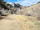
The vision of the Peaks to Plains Trail is a 65-mile trail of statewide significance that will serve the 3 million residents of the Denver metro area. The goal is that the Peaks to Plains Trail will one day connect the South Platte Trail in Denver to the headwaters of Clear Creek at Loveland Pass. Once completed, it will connect four counties and seven cities, with a total elevation gain of more than 1 mile. This legacy trail project will offer visitors a truly quintessential Colorado experience. That is why it was chosen as one of former Governor Hickenloopers 16 highest priority trail projects in the state as part of the Colorado the Beautiful Initiative. The first portions of the Peaks to Plains Trail in Clear Creek Canyon Park opened in 2016 and 2017, offering four miles of 10-foot-wide paved surface right along Clear Creek. The next step will be continuing the trail east to Golden with the Mouth of the Canyon segment. | ||||||||||||||||||||||||||||||||||||||||||||||||||
|
Junction: Continental Divide to Glenwood Springs Route
Summit County above
Clear Creek County above
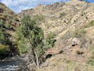
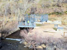
Welch ditch head gate
Proposed bridge to south side of Clear Creek
Other articles:
Locations:
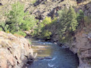
Clear Creek Canyon.
Welch Ditch.
Peaks to Plains Trail to Welch Ditch.
Other articles:
Other articles:
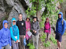
Waiting out a shower. What is actually here are two common trees: Acer glabrum “Rocky Mountain Maple” and A. negundo “Box Elder” growing next to each other for comparison.
Other articles:
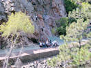
Rock climbing area, often used by classes for young and disabled people.
Other articles:
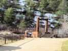
Up a short spur trail to the Tunnel 1 Trailhead. Restrooms at this location.
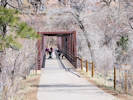
Tough Cuss Bridge
Other articles:
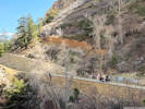
Cliffs on south bank of Tough Cuss Bridge.
Other articles:
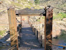
Stairs up to the Welch Ditch.
Other articles:
Headgate of the Church Ditch across Clear Creek.
Other articles:
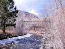
Little flat on west side of Grant Terry Bridge often with a good display of wildflowers.
Other articles:
Junction: Climbing Access Trail, to Welch Ditch Trail.
Other articles:
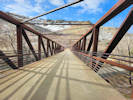
West end of the Grant Terry Bridge.
Other articles:
Cross Clear Creek on Grant Terry Bridge.
Other articles:
East end of Grant Terry Bridge
Other articles:
Junction:
To the east, through the City of Golden, the Peaks to Plains Trail shares the route with the City of Golden Clear Creek Trail
Other articles:
Junction: Shared use with City of Golden Clear Creek Trail
To the east, through the City of Golden, the Peaks to Plains Trail shares the route with the City of Golden Clear Creek Trail
Other articles:
Cross over 44th Avenue, from this point west to US Hwy 6, follow the route of the City of Golden Clear Creek Trail.
Jefferson County above
Junction: South Platte Trail
Date and time this article was prepared:
4/27/2024 3:21:12 PM
|