Eastern Mojave Vegetation
Tom Schweich
|
Eastern Mojave Vegetation
| Death Valley Road |
|
Tom Schweich |

|
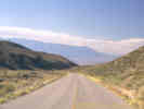
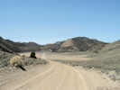
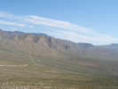
Death Valley Road connects the Owens Valley with the northern portion of Death Valley, by way of the Inyo Mountains, Eureka Valley, and the Last Chance Range. The road is paved for about half of its length, but the northern Death Valley portion is often washed out in the vicinity of Sand Spring. | ||
|
Other articles:
Locations:
Big Pine.
Owens Valley.
|
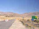
Junction:
This intersection is three miles west of Big Pine in the Owens Valley. California Highway 168 goes east to Deep Springs Valley, and Fish Lake Valley. | ||
|
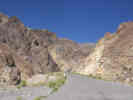
Locations: Devils Gate. |
Devils GateFolded layers of shale form a canyon through which the road runs. | ||
|
Other articles:
|
|||
|
Other articles:
|
Junction: Forest Road 9S15, "Papoose Flat Road" or "Hines Road" | ||
|
Other articles:
|
Junction: Waucoba Saline Road, south through the Saline Valley to California Highway 190. | ||
|
Other articles:
Locations:
Little Cow Horn Valley.
|
Little Cow Horn ValleySmall closed basin. | ||
|
Other articles:
|
|||
|
Other articles:
Locations:
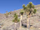
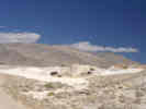
Joshua Flats.
|
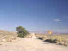
Joshua Flats
| ||
| Road makes a jog east-west down a small side canyon. | |||
| Road crosses a drainage, down and away from the road to the north. | |||
| Quarry on the left (west). | |||
|
Literature Cited:
|
More roads into a little cove on the left. For the next 1.5 miles is the contact zone of the Eureka Valley - Joshua Flats - Beer Creek pluton with the paleozoic rocks of the Lead Gulch and the Bonanza King Formations.
Most literature seems to use "Joshua Flat" in the pluton name. However, the flat just above this location is called "Joshua Flats" with an "s." The location in Inyo County known as "Joshua Flat" without an "s" is about 65 miles to the south, in the northern part of the Coso Range. I don't know who first used the "Joshua Flat" name, or when the "s" got lost from the "Flats." I suppose that could be a research topic in itself. | ||
| Relatively good, new road angles to the left into a mining area over the ridge. | |||
|
Literature Cited:
Other articles:
Locations: Eureka Valley. Last Chance Range. |
| ||
|
Other articles:
Locations: Eureka Valley. |
Junction: Eureka Valley Road, goes north through Cucomongo Canyon. | ||
|
Other articles:
|
Junction: South Eureka Road, south 10 miles to the Eureka Sand Dunes. | ||
|
Other articles:
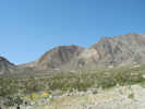
Locations:
Hanging Rock Canyon.
|
Hanging Rock Canyon | ||
|
Other articles:
|
|||
|
Literature Cited:
Other articles:
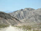
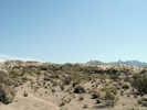
Locations: Crater. Last Chance Mountain. |
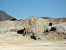
Crater
From Crater, there is a fairly good road that runs north and then through a canyon, giving good access to the south end of Last Chance Mountain. I have collected Frasera albomarginata on the southern portion of Last Chance Mountain. | ||
|
Other articles:
|
|||
|
Other articles:
Locations:
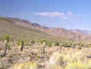
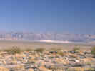
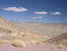
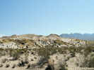
Last Chance Valley.
|
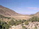
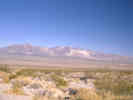
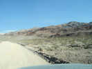
View of Last Chance Valley | ||
|
Other articles:
|
|||
|
Other articles:
|
|||
|
Other articles:
Locations:
Crankshaft Crossing.
Last Chance Canyon.
Last Chance Spring.
|
Crankshaft JunctionRoad to Last Chance Spring and Last Chance Canyon. | ||
|
Other articles:
|
|||
|
Literature Cited:
Other articles:
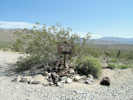
Locations: Sand Spring. |
Sand Spring
| ||
|
Literature Cited:
Other articles:
Locations: Little Sand Spring. |
| ||
|
Other articles:
|
|||
|
Other articles:
|
|||
|
Other articles:
|
Junction:
| ||
| If you have a question or a comment you may write to me at: tomas@schweich.com I sometimes post interesting questions in my FAQ, but I never disclose your full name or address. |
Date and time this article was prepared: 9/22/2024 4:36:35 PM |