 Eastern Mojave Vegetation
Tom Schweich
|
Eastern Mojave Vegetation
| The Vegetation of Lobo Point and North Wild Horse Mesa, Mojave National Preserve, San Bernardino County, California. |
|
Tom Schweich |

Topics in this Article: Introduction Geography Geology Climate Methods Results Discussion Summary Literature Cited |
|
||||||||||||
|
Other articles:
Locations:
Columbia Mountain.
Hole-in-the-Wall.
Lobo Point.
Mid Hills.
|
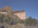
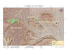
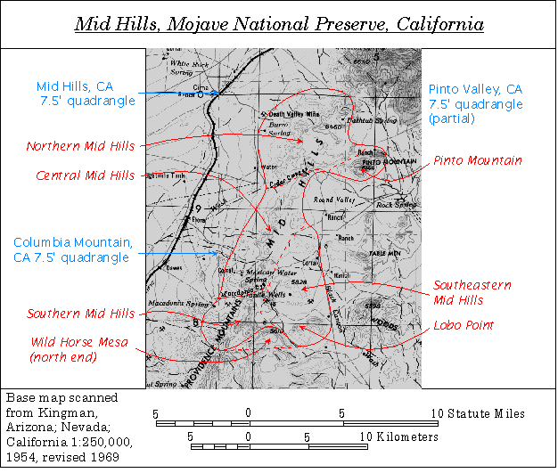
IntroductionA small valley near a prominent point of rocks called Lobo Point by local residents contains a pinyon-juniper woodland of about six hectares. Lobo Point, shown at left, is in the Mid Hills area of Mojave National Preserve, approximately three km northwest of NPS's Hole-in-the-Wall Campground, and is located in the Columbia Mountain, California 7.5 Minute Quadrangle. | ||||||||||||
|
Literature Cited:
Locations:
Wild Horse Mesa.
|
At 1400 m elevation, the site is the lowest pinyon-juniper grove in the Mid Hills. A larger woodland is found in a valley north of Wild Horse Mesa, and about 3 km west of Lobo Point. The purpose of this study is to develop a description of the vegetation at these two sites, and relate it to local and regional vegetation. Botanical nomenclature follows Hickman (1993). | ||||||||||||
|
Locations: Oakland. |
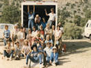
I first visited this valley in 1980, with the Merritt College (Oakland, California) Desert Studies class. Over time, and after repeated return visits with Merritt College, I continued to visit the area, and take an interest in the local vegetation. | ||||||||||||
|
Literature Cited:
|
Major portions of this paper were presented at the 1995 Desert Research Symposium, San Bernardino County Museum, May 20, 1995, and published in symposium proceedings (Schweich, 1995). Those portions are republished in hypertext form on the World Wide Web by permission. | ||||||||||||
|
|
Geography | ||||||||||||
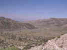
| The triangular area between Barstow and Needles, California and Las Vegas, Nevada is sometimes called the "Lonesome Triangle." This "triangle" can also be defined by highways US Interstate 15, US Interstate 40, and US Highway 95. A large portion of the eastern portion of the area is taken up by the Mojave National Preserve. The Mid Hills are found in the approximate center of Mojave National Preserve. | |||||||||||||
|
Locations: Granite Mountains. McCullough Range. Mid Hills. Muddy Mountains. New York Mountains. Providence Mountains. Virgin Mountains. |
The Mid Hills form a ridge line between the Providence Mountains and the New York Mountains in the eastern Mojave Desert of southeastern California. The Providence and New York Mountains form part of a chain of mountains that stretch from the Granite Mountains to the southwest, through the Providence Mountains, the Mid Hills, and the New York Mountains to the McCullough Range, the Muddy Mountains and the Virgin Mountains in Utah. | ||||||||||||
| Access to the Mid Hills is from US Interstate 15 and US Interstate 40. US Interstate 40 provides access from the south, via Essex Road and Black Canyon Road. US Interstate 15 provides access from the north, using the Valley Wells exit, and Kessler Springs Road through Cima. | |||||||||||||
|
Locations: Baker. Las Vegas. Ludlow. Needles. Valley Wells. |
There is a National Park Service Interpretative Center and Campground at Hole-in-the-Wall, and a campground at Mid Hills. There are no commercial services available anywhere within Mojave National Preserve. The nearest gas stations are at Baker, Ludlow, and Valley Wells (closed in May, 1999). The nearest large markets are in Barstow, Las Vegas, and Needles. A small selection of supplies may be found in Baker. | ||||||||||||
|
|
Geology | ||||||||||||
The rocks of the Mid Hills comprise three major groups:
|