 Eastern Mojave Vegetation
Tom Schweich
|
Eastern Mojave Vegetation
| Lanfair Road - Mojave National Preserve |
|
Tom Schweich |

|
(No Preface) | ||||||
|
Literature Cited:
Other articles:
Locations: Lanfair. |
Lanfair
| ||||||
|
Literature Cited:
Locations: Lanfair. |
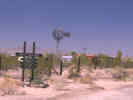
David Thompson (1919) wrote about Lanfair, "During the last two or three years many settlers have taken up homesteads in this valley, most of them near Lanfair, and have been attempting to raise crops by dry farming. In the fall of 1917 more than 130 registered voters were living here. There was a small store at Lanfair, at which groceries, gasoline, and oil could be obtained. " | ||||||
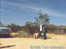
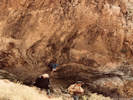
| There is a telephone near this intersection. The new telephone has a telephone number, which unfortunately I don't know. The old telephone number was "Lanfair #1." The old telephone looked like this (38KB,GIF). | |||||||
|
Other articles:
Locations:
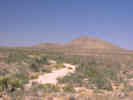
Bobcat Hills.
|
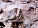
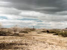
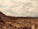
Approximately opposite the Bobcat Hills is a road to the west southwest. This road leads across the north side of Hackberry Mountain, also forming the north boundary of the Mojave Wilderness. The 1982 Desert Studies field trip visited this area searching for fossils. Only plant fossils were found. In retrospect, I think we were looking in the lacustrine sediments of the Winkler Formation.
| ||||||
|
Locations:
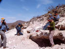
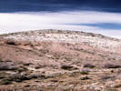
Hackberry Mountain.
|
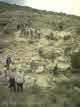
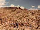
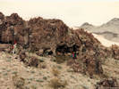
Hackberry MountainHackberry Mountain is one of the three places that the informally named "Winkler Formation" crops out. The other two locations are the north slope of Wild Horse Mesa and Pinto Mountain. The people in the photograph are on a field trip with the Desert Research Symposium, held by the San Bernardino County Museum, May, 1995. | ||||||
|
Other articles:
Locations:
Fenner Valley.
Vontrigger Hills.
Vontrigger Spring.
|
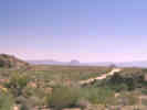
Vontrigger Hills and Spring
| ||||||
|
Other articles:
Locations:
Goffs.
|
GoffsJunctions:
| ||||||
| If you have a question or a comment you may write to me at: tomas@schweich.com I sometimes post interesting questions in my FAQ, but I never disclose your full name or address. |
Date and time this article was prepared: 9/22/2024 4:37:44 PM |