Blue Road
|
Other articles:
• Field Notes:
23-Jan-2015;
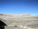
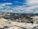
 US I-70 east from Miller Canyon US I-70 east from Miller Canyon
|
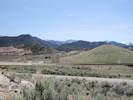
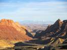
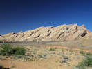
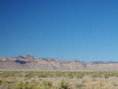
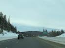
Looking east as I-70 climbs onto the San Rafael Swell.
|
|
Literature Cited:
- Retallack, Gregory J., 2009.
Locations:
South Salt Wash.
|
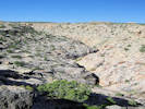
Exit 108: Junction: Emery County Road 923, "Interstate 70 to Willow Springs Wash Road." Near South Salt Wash is a paleosol collection site in the Jurassic Summerville Formation used by Retallack in his 2009 study of greenhouse crises of the past 300 million years. Retallack used stomatal index data for fossil Ginko and related leaves as a proxy for past CO2 spikes and paleosol chemical data as proxies for temperature and humidity changes. These data show that global warming due to CO2 rise is a not a unique event in earth history and that the magnitude of the coming anthropogenic greenhouse pales in comparison with past greenhouse spikes at times of global mass extinctions.
|
|
Other articles:
• Moore Cut Off Road:
at Interstate 70;
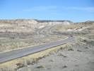
 US Interstate 70 at Exit 116, the "Moore Cut Off Road" US Interstate 70 at Exit 116, the "Moore Cut Off Road"
|
Exit 116: Emery County Road 803 "Moore Cut Off Road"
|
|
Other articles:
• Field Notes:
20030828040;
12 Apr 2017;
Locations:
Eagle Canyon.
San Rafael Swell.
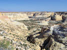 Eagle Canyon from the associated overlook. Eagle Canyon from the associated overlook.
|
San Rafael Swell. |
Eagle Canyon Rest Stop and Overlook
|
|
Other articles:
• Field Notes:
20080606100;
 View north from Ghost Rock Rest Stop View north from Ghost Rock Rest Stop
|
View north from the westbound rest stop.
|
|
Other articles:
• Frasera albomarginata:
at Ghost Rock;
Locations:
Ghost Rock.
|
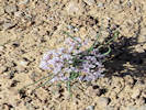
Ghost Rock Rest Stop
Frasera albomarginata has been collected near this Ghost Rock Rest Stop.
|
|
Other articles:
• Field Notes:
6-Jun-08 near Ghost Rock;
• Frasera albomarginata:
at Ghost Rock;
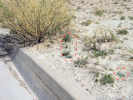 Curbside habitat of Frasera albomarginata at Ghost Rock Rest Stop Curbside habitat of Frasera albomarginata at Ghost Rock Rest Stop
|
Frasera albomarginata at curb side in Ghost Rock Rest Stop.
|
|
Other articles:
• Field Notes:
20080606100;
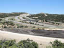
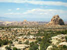
 US Interstate 70 on San Rafael Swell east of Ghost Rock Rest Stop US Interstate 70 on San Rafael Swell east of Ghost Rock Rest Stop
|
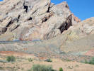
View toward Paige Flat from Ghost Rock.
|
|
Literature Cited:
- Retallack, Gregory J., 2009.
|
Near this location is a paleosol collection site in the Permian Church Rock Frmation used by Retallack in his 2009 study of greenhouse crises of the past 300 million years. Retallack used stomatal index data for fossil Ginko and related leaves as a proxy for past CO2 spikes and paleosol chemical data as proxies for temperature and humidity changes. These data show that global warming due to CO2 rise is a not a unique event in earth history and that the magnitude of the coming anthropogenic greenhouse pales in comparison with past greenhouse spikes at times of global mass extinctions.
|
|
|
|
|
Locations:
Paige Flat.
|
Paige Flat
|
|
|
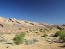
The Big Pond to the south of the highway. The Big Pond sits in Crawford Draw. Crawford Draw is the name given to one of Retallack's (2009) locations. However, the geographic coordinates given are at a road cut about 1 mile west.
|
|
|
Exit 129, "Sinbad Interchange," exit for Buckhorn Draw Road, and Temple Mountain Road. This may be exit 131, depending upon who is doing the correct counting.
|
|
Other articles:
• Field Notes:
12 Apr 2017;
Locations:
Black Dragon Wash.
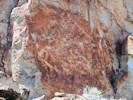
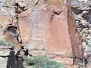
 Black Dragon Canyon on east slope of San Rafael Swell. Black Dragon Canyon on east slope of San Rafael Swell.
|
Black Dragon Canyon Overlook for westbound travelers.
|
|
Other articles:
• Field Notes:
23-Jan-2015;
Locations:
Spotted Wolf Canyon.
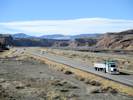
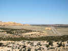
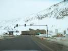
 US I-70 descends through Spotted Wolf Canyon US I-70 descends through Spotted Wolf Canyon
|
View down Spotted Wolf Canyon for eastbound travelers.
|
|
Other articles:
• Field Notes:
12 Apr 2017;
Locations:
The Squeeze.
 Entrance to Spotted Wolf Canyon on Interstate 70 Entrance to Spotted Wolf Canyon on Interstate 70
|
Eastern edge of San Rafael Swell. |
Eastern edge of San Rafael Swell. |
Allium seen at The Squeeze Rest Stop. |
The Squeeze Rest Area at the mouth of Spotted Wolf Canyon.
|
|
Other articles:
• Utah Highway 24:
at US I-70;
|
Junction: Utah Highway 24, southwest around the San Rafael Swell.
|
|
Other articles:
• US Highway 191:
57800;
• U. S. Highway 6:
at US I-70 near Green River;
|
Junction: US Highway 191, north along the Book Cliffs to Price.
|
|
|
Green River, UT
|
|
Other articles:
• Field Notes:
11 Apr 2017;
Locations:
Green River (town).
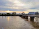 Sunset across the Green River Sunset across the Green River
|
Green River in Green River, UT |
|
|
Other articles:
• US Highway 191:
Crescent Junction;
|
Crescent Junction
Junction: US Highway 191, south to Moab
|
|
Locations:
Book Cliffs.
 Book Cliffs near Crescent Junction. Book Cliffs near Crescent Junction.
|
Book Cliffs to the north.
|
|
Other articles:
• Utah Highway 128:
at US I-70;
|
Junction: Utah Highway 128, south to Colorado River
|
|
Other articles:
• Cisco Road:
at US I-70;
|
Junction: Cisco Road, south to Cisco and Utah Highway 128.
|
|
Other articles:
• Field Notes:
23 Nov 2019;
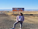 Welcome to Utah Welcome to Utah
|
Grand County, Utah above
Mesa County, Colorado below
|
|
Locations:
Rabbit Valley.
|
Exit 2: Rabbit Valley Road.
There is a collection of Frasera paniculata a little more than a mile south of the highway.
|
|
|
Exit 11: Old US Highway 6, for Mack, Colorado.
|
|
Other articles:
• U. S. Highway 50:
at US I-70 15;
|
West of this exit US Highway 50 shares the route with I-70 all the way to Salina, Utah.
Exit 15: 13 Road, US Highway 50
East of this exit, US Highway 50 diverges to the south from I-70 passing though Pueblo, CO, on its route to Ocean City, MD.
|
|
Other articles:
• CO Hwy 340:
at I-70;
|
Exit 19: S. Cherry St., Colorado Highway 340, for Fruita
|
|
|
Fruita
|
|
|
Exit 37: US I-70 Business West, US Highway 6
|
|
|
Exit 28: 24 Road
|
|
|
Grand Junction, CO
|
|
|
Exit 31: Horizon Drive
|
|
|
Exit 37: US I-70 Business East, US Highway 6
|
|
|
Exit 42: Elberta Avenue, for Palisade.
|
|
|
Palisade
|
|
|
Exit ?: N. River Road, for Palisade east.
|
|
|
Exit 46: ?, for Coal Canyon.
|
|
|
Exit 47: ?, for James M. Robb - Colorado River State Park.
|
|
Other articles:
• CO Hwy 65:
at I-70;
|
Exit 49: Colorado State Highway 65, “Grand Mesa Scenic Byway”
|
|
|
Exit 62: 45 Road, to DeBeque.
|
|
|
Mesa County above
Garfield County below
|
|
|
Exit 72?: Old US Highway 6, west of Parachute.
|
|
|
Parachute
|
|
|
Exit 75: County Road 215, to Parachute and Battlement Mesa.
|
|
|
Exit 87: US Highway 6, west of Rifle.
|
|
|
Exit 81: County Road 323
|
|
Locations:
Rifle.
|
Rifle
|
|
Other articles:
• CO Hwy 13:
at I-70;
|
Exit 90: Colorado Highway 13, for Rifle. State Highway 13 in the U.S. state of Colorado is a mountain route that travels from the Wyoming border near Baggs, Wyoming down through the Rocky Mountains to Rifle. Colorado Highway 13 crosses US Highway 40 at Craig.
|
|
|
Exit 94: County Road 315, Mamm Creek Road
|
|
|
Silt
|
|
|
Exit 97: 9th Street, for Silt
|
|
|
New Castle
|
|
|
Exit 105: Castle Valley Road, for New Castle.
|
|
|
Exit 109: US Highway 6, to the west, Chacra(?), Canyon Creek(?).
|
|
|
Exit 111: County Road 134, to South Canyon Creek.
|
|
|
Exit 114: County Road 133
|
|
Other articles:
• CO-82:
at I-70;
|
Exit 116: Colorado State Highway 82, to Glenwood Springs.
|
|
|
Glenwood Springs, CO
|
|
Other articles:
• Field Notes:
Saturday, June 20th;
Locations:
No Name.
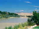
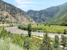 Colorado River at No Name Colorado River at No Name
|
No Name
Exit 119: County Road 129. Rest Stop.
|
|
|
Exit 121: ?, to Grizzly Creek.
|
|
|
Exit 125: ?, for Cinnamon Creek.
|
|
|
Exit 129:
, rest stop?
|
|
|
Garfield County above
Eagle County below
|
|
|
Cross Colorado River
|
|
Locations:
Dotsero.
|
Dotsero
|
|
|
Cross Union Pacific railroad tracks.
|
|
|
Exit 133: US Highway 6, to Dotsero
|
|
|
Exit 140: US Highway 6, to Gypsum.
|
|
|
Gypsum
|
|
Locations:
Eagle.
|
Eagle
|
|
|
Exit 147: Eby Creek Road, to Eagle.
|
|
Other articles:
• CO Hwy 131:
at I-70;
|
Exit 157: Colorado State Highway 131, Bellyache Ridge Road
|
|
|
Exit 163: Edwards Access Road
|
|
|
Exit 167: Avon Road
|
|
|
Exit 168: Post Blvd
|
|
|
Exit 169: US Highway 6, exit westbound only.
|
|
Other articles:
• US Highway 24:
at I-70;
Locations:
Idaho Springs.
|
Exit 171: US Highway 24, south.
|
|
|
Exit 173: Chamonix Road
|
|
|
Exit 176: Vail Road
|
|
Other articles:
• Field Notes:
24-Jan-2015;
Locations:
Vail.
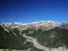
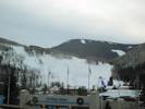 Vail ski areas from I-70. Vail ski areas from I-70.
|
Vail
|
|
|
Exit 180: Big Horn Road, for Pitkin Creek.
|
|
|
Exit ?: Vail Pass - Ten Mile, westbound exit only.
|
|
Other articles:
• Field Notes:
24-Jan-2015;
Locations:
Vail Pass.
 Vail Pass, 10,603 ft. Vail Pass, 10,603 ft.
|
Eagle County above
Exit 190:
Summit County below
|
|
Other articles:
• CO Highway 91:
at I70;
|
Exit 195: Colorado Highway 91, at Wheeler Junction, highway through Climax to Leadville.
Since the development of the Copper Mountain ski resort area, Wheeler Junction is more commonly referred to as Copper Mountain.
|
|
|
Exit 198: Officer's Gulch
|
|
|
Exit 201: W. Main St., to Frisco.
|
|
|
Frisco
|
|
Other articles:
• CO Highway 9:
at I-70W;
|
Exit 203: Colorado Highway 9, south, to Breckenridge and Fairplay.
|
|
Other articles:
• Colorado Trans-Basin Water Transfer:
Roberts Tunnel;
• US Highway 285:
at Roberts Tunnel;
Locations:
Dillon Reservoir.
Harold D. Roberts Tunnel.
|
Dillon Reservoir
Water dammed here is transported through the Harold D. Roberts tunnel, under the continental divide, to the South Platte River Basin.
|
|
Other articles:
• CO Highway 9:
at I-70E;
• U. S. Highway 6:
near Silverthorne;
|
Silverthorne
Exit 205:
- Colorado Highway 9, north, to Kremmling.
- US Highway 6, diverges to the south from I-70, and traverses Loveland Pass before rejoining I-70 near the Loveland Ski Area.
|
|
Other articles:
• Colorado Trans-Basin Water Transfer:
Overview;
Locations:
Straight Creek.
|
Exit immediately outside the tunnel for the Coon Hill Trailhead.
|
|
Other articles:
• Field Notes:
24-Jan-2015;
 West Portal West Portal
|
Summit County above
|
|
Locations:
Eisenhower Memorial Tunnel.
|
EisenhowerJohnson Memorial Tunnel. The westbound bore is named after Dwight D. Eisenhower, the U.S. President for whom the Interstate system is also named. The eastbound bore is named for Edwin C. Johnson, a governor and U.S. Senator who lobbied for an Interstate Highway to be built across Colorado.
|
 East portal of the Eisenhower-Johnson Tunnels. East portal of the Eisenhower-Johnson Tunnels.
|
Clear Creek County below
|
|
Other articles:
• U. S. Highway 6:
near Loveland;
|
Exit 216: US Highway 6, westbound for Loveland Ski Area, and Loveland Pass.
|
|
|
Exit 218: ?
|
|
Other articles:
• County Route 321:
at US I-70;
|
Exit 221: Bakerville Road, for Graymont, and County Road 321 “Stevens Gulch Road.” This is the access for Grays Peak and Torreys Peak to the south. Engelmann Peak is to the north, and probably better accessed from US Highway 40.
|
|
|
Silver Plume
Exit 226: Woodward Street
|
|
Other articles:
• Field Notes:
4 Aug 2011;
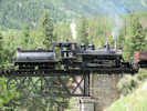 Georgetown Loop locomotive at Lebanon Silver Mine Georgetown Loop locomotive at Lebanon Silver Mine
|
(No Freeway Access) The Lebanon Silver Mine is a stop on the Georgetown Loop Railroad for an optional mine tour.
|
|
Locations:
Georgetown.
|
Georgetown
|
|
Other articles:
• 15th Street:
at I-70;
|
Exit 228: 15th Street, for Georgetown and Guanella Pass Road.
|
|
Other articles:
• Golden Checklist Flora:
Physaria vitulifera, Parry, 1861;
Locations:
Clear Creek Canyon.
Clear Creek Headwaters.
|
Clear Creek Canyon
“Headwaters of Clear Creek”
|
|
Other articles:
• US Hwy 40:
at US I-70;
|
Exit 232: US Highway 40, north over Berthoud Pass, to Interstate 80 just east of Salt Lake City.
|
|
|
Exit 234: County Road 308, Downieville, Dumont.
|
|
|
Exit 238: Fall River Road, Fall River.
|
|
|
Exit 235: County Road 312, Downieville, Dumont.
|
|
|
Exit 238: County Road 275, at east end of Downieville.- Exit westbound only.
- Entrance eastbound only.
|
|
Other articles:
• Colorado Boulevard:
at I-70 W Exit 239;
|
Exit 239: Stanley Road
|
|
Other articles:
• 13th Avenue:
at I-70 & CO 103;
• CO Hwy 103:
at US I-70;
|
Exit 240: Colorado State Highway 103 “Chicago Creek Road”, 13th Avenue, to Mount Evans.
|
|
Other articles:
• Golden Checklist Flora:
Physaria vitulifera, Rydberg, 1895;
Locations:
Idaho Springs.
|
Idaho Springs
|
|
Other articles:
• Colorado Boulevard:
Traffic Circle;
|
Exit 241: Colorado Blvd.
|
|
|
Exit 243: Central City Parkway
|
|
Other articles:
• U. S. Highway 6:
at I70;
|
Exit 244: US Highway 6, east to Golden.
|
|
|
Exit 247: Homestead Road, to US Highway 40.- Exit eastbound.
- Entrance westbound.
|
|
|
Clear Creek County above
Jefferson County below
|
|
|
Exit 248: County Road 65, to US Highway 40.- Exit westbound.
- Entrance eastbound.
|
|
|
Exit 251: US Highway 40, to Bergen Park and Evergreen.- Exit eastbound.
- Entrance westbound.
|
|
Other articles:
• State Highway 74:
at I-70;
|
Exit 252: Colorado Highway 74, to Evergreen.
|
|
|
Exit 253: Genesee Drive
|
|
Locations:
Genesee Park.
|
Genesee Park
Genesee Park is a park in Jefferson County, Colorado. It is the largest park in the Denver Mountain Parks system, with a total of 2,413 acres. Interstate 70 traverses the park between exits 252 and 254 along the Lariat Loop Scenic & Historic Byway.
|
|
Other articles:
• US Hwy 40:
at Genesee Trail;
|
Exit 254: US 40, Genesee Trail Road
|
|
Other articles:
• US Hwy 40:
at Genesee Ridge;
|
Exit 256: US 40, Genesee Ridge Road, S. Grapevine Road
|
|
Locations:
Mount Vernon Canyon.
|
Mouth of Mount Vernon Canyon
|
|
Other articles:
• Cty Rd 93:
at I-70;
|
Exit 259: Jefferson County Road 93, Hogback Road, to Morrison, US Highway 40, and West Colfax Avenue.
|
|
Other articles:
• Golden Checklist Flora:
Tin Cup Ridge;
|
US I-70 cuts through Dinosaur Ridge. To the north, the local name of “Tin Cup Ridge” is applied. To the south, simply “Tin Cup Ridge.”
|
|
Other articles:
• C-470:
usi70;
|
Exit 260: Colorado State Highway 470
|
|
|
Golden below
|
|
Other articles:
• Golden Checklist Flora:
Golden s. l., south;
Locations:
Golden.
|
Golden
|
|
Other articles:
• U. S. Highway 6:
at I70;
|
Exit 261: US Highway 6, eastbound only. If you wanted to go west, you should have taken C-470.
|
|
|
Golden above
|
|
Other articles:
• US Hwy 40:
at US I-70;
|
Exit 262: US Highway 40, Colfax Avenue
|
|
Other articles:
• Denver West Marriot Boulevard:
at I-70;
|
Exit 263: Denver West Colorado Mills Parkway, Denver West Marriott Blvd.
|
|
Other articles:
• 32th Avenue:
at Youngfield;
|
Exit 264: 32nd Avenue, Youngfield Street
|
|
Other articles:
• CO Hwy 58:
at IS I-70;
|
Exit 265: State Highway 58, to Golden. Sometimes referred to as the “Beer-muda Triangle”, in honor of the large number of trucks carrying Coors beer that have gone over the rail here.
|
|
Other articles:
• Colorado Highway 72:
at US I-70;
|
Exit 266: State Highway 72, Ward Road
|
|
Other articles:
• Kipling:
at I-70;
|
Exit 267: Kipling Street, to the south, and Kipling Parkway, to the north.
|
|
Other articles:
• Wadsworth:
at I-70;
|
Junction: State Highway 121, Wadsworth
|
|
Other articles:
• US I-76:
at I-70;
|
Junction: US Interstate 76, northeast in the direction of Nebraska.
|
|
Other articles:
• Sheridan Blvd:
at I-70;
|
Jefferson County above
Exit 271: Sheridan Blvd., State Highway 95
Denver County below
|
|
Other articles:
• US Highway 287:
at US I-70;
|
Junction:- Federal Blvd
- US Highway 287
- To the North, US Highway 287 follows Federal Blvd to W. 120th near Broomfield.
- To the South, US Highway 287 follows Federal Blvd to US Hwy 6 at Colfax, it then joins I-70 east to Limon Colorado when it turns south.
|
|
Other articles:
• US Interstate 25:
at US I-70;
|
Junction: US Interstate 25
|
|
|
Denver, CO
|
|
Other articles:
• C-470:
Exit 20;
|
Junction: Colorado Highway 470, toll road.
|
|
Other articles:
• Interstate 70 Business:
at Exit 359;
|
Exit 359, Business I-70, US Highway 24 west, to CO State Highway 71
|
|
Locations:
Limon.
|
Limon
|
|
Other articles:
• Interstate 70 Business:
at Exit 359;
|
Exit 361, Business I-70, US Highway 24 east, US Highway 40 east, to Colorado State Highway 71.
|
|
Other articles:
• US Highway 287:
near Limon;
• US Hwy 40:
at US I-70;
• Interstate 70 Business:
Exit 363;
|
Exit 363: US Highway 287, south.
|
|
|
Colorado above
Kansas below
|
|
Other articles:
• US Hwy 83:
at US I70;
|
Junction: US Highway 83
|
|
|
Colorado above
Kansas below
|
|
|
Salina, Kansas
|
|
|
Kansas City, MO
|
|
|
St Louis, MO
|
|
|
E. St. Louis, IL
|
|
|
Indianapolis, IN
|
|
|
Columbus, OH
|
|
|
New Stanton, PA
|
|
|
Breezewood, PA
|
|
|
Baltimore, MD
|
|
If you have a question or a comment you may write to me at:
tas4@schweich.com
I sometimes post interesting questions in my FAQ, but I never disclose your full name or address.
|
[Home Page] [Site Map]
Date and time this article was prepared:
4/27/2024 3:31:37 PM
|
 U. S. Interstate Highways