
|
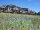
Detailed Area Plant List for Trout Creek Pass, Chaffee County, United States.
Edited by Tom Schweich
This list is assembled from personal collections, herbarium vouchers, and published lists. For California, much of the data is provided by the participants of the Consortium of California Herbaria as indicated by a single dagger “†.” Their web site is at: (http://ucjeps.berkeley.edu/consortium/). For Colorado, much of the data is provided by the Southwest Environmental Information Network as indicated by a double dagger “‡,” which web site is found at (http://swbiodiversity.org). See their respective websites for copyright information and recommended citation formats.
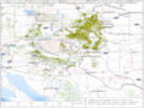
For a complete list of Locations included in this Area List, see the Locations Included section, below.
For a check list, please see: Check List for Trout Creek Pass, Chaffee County, United States.
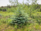
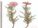
Pinaceae
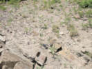
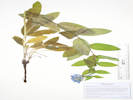
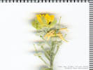
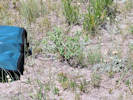
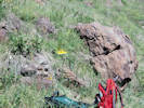
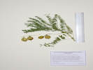
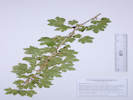
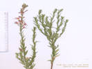
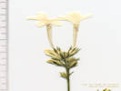
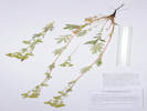
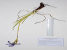
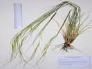
Picea pungens Engelm. Colorado Blue Spruce. CalPhotos. Jepson eFlora. SEINet Taxon.
- Salt Creek,
determination tentative
Tom Schweich 3812.
7/22/2024.
.
Apiaceae
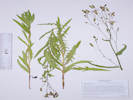
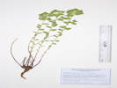
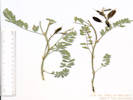
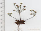
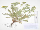
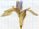
Cymopterus lemmonii (J. M. Coult. & Rose) Dorn. (Syn: Pseudocymopterus montanus (A. Gray) J. M. Coult. & Rose ) Alpine False Springparsley. CalPhotos. Jepson eFlora. SEINet Taxon.
Perennial herb, to 15 cm., glabrous throughout, except very slightly scabrous at top of peduncle and on ribs of some rays; Pseudoscape, absent; Leaves, basal and cauline, 40 mm. × 25 mm. wide, obovate, compound, leaflets, #7, ultimate divisions narrowly lanceolate; Inflorescence, compound umbel; Involucre, bracts, 1.7 mm., linear (but not pinnafitid); Rays, ascending-spreading, ±equal; Involucel, bractlets green, inconspicuous, 1 mm.; Corolla, petals, #5, 1 mm. × 0.6 mm. wide, yellow; Stamens, #5; Filaments, recurved; Ovary, glabrous; Stylopodium, absent (?); Fruit, unknown. (Described from Coll. No. 1469, 29 June 2016)
- Salt Creek,
Edges of aspen grove, near what appears to be a former beaver pond, with Ribes inerme, Dasiphora fruticosa, Rosa woodsii, and Carex sp.
Right bank of Salt Creek, just west of the place it is first crossed by FR 435 “Salt Creek Road,” 3.0 miles generally west of US Highway 285, 111 km. southwest of Golden.
Tom Schweich 3313.
22 Jul 2024.
(
Undist.
)
.
.


0 records found in tblPhotographs for photo: WeberWAW2012
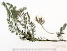
Pseudocymopterus montanus (A. Gray) J. M. Coult. & Rose. (=Cymopterus lemmonii (J. M. Coult. & Rose) Dorn) Alpine False Springparsley. CalPhotos. Jepson eFlora. SEINet Taxon.
- Salt Creek, Tom Schweich 3351. 7/17/2023. .
Asclepiadaceae
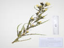
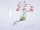
Asclepias hallii A. Gray. Hall's Milkweed. CalPhotos. Jepson eFlora. SEINet Taxon.
- Salt Creek,
Road cut in fractured shale, below lodgepole pines.
Along Pike-San Isabel Forest Road 435, 3.6 miles generally west of US highway 285, 112 km. southwest of Golden.
Tom Schweich 3319.
22 Jul 2024.
(
Undist.
)
.

Asteraceae
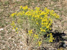
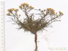
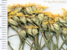
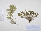
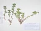
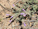
Artemisia frigida Willd. Prairie Sagewort. CalPhotos. Jepson eFlora. SEINet Taxon.
Perennial herb, to 30 cm., woody at base; Stems many; Leaves alternate, 9 mm., pinnately dissected into 7 parts, silvery hairy; Inflorescence raceme-like, indeterminate, heads 1-3 in axils; Heads have only disk flowers, all alike; Involucre of hairy phyllaries; Phyllaries in 2 series, hairy, not gummy or with tips recurved; Receptacle hairy, not chaffy or bristly; Flowers fertile; Pappus absent; (Described from Coll. No. 1067, 8 Oct 2014).
- Salt Creek,
Small valley between two ridges, just north of Salt Creek and Pike-San Isabel National Forest Road 435 "Salt Creek Road," 3.1 mi. by road west of US Highway 285, 145 km. southwest of the GNIS location of Golden
Tom Schweich 2695.
16 Aug 2021.
(
KHD00075276‡
OBI183397‡
)
Tom Schweich 2925.
7/18/2022.
Tom Schweich 2930.
7/18/2022.
.
.

Artemisia ludoviciana Nutt. ssp. incompta (Nutt.) D. D. Keck. White Sagebrush. CalPhotos. Jepson eFlora. SEINet Taxon.
- Salt Creek,
Open hillside with ponderosa pines, collected nearby: Hymenoxys richardsonii var. floribunda, and Muhlenbergia montana.
South-facing hillside along Salt Creek and Pike-San Isabel National Forest Road 435 "Salt Creek Road," 3.2 mi. by road west of US Highway 285, 145 km. southwest of the GNIS location of Golden.
Tom Schweich 2688.
16 Aug 2021.
(
KHD00075274‡
OBI183402‡
)
.
.

Artemisia ludoviciana Nutt. ssp. ludoviciana. (Syn: A. britonii Rydb. ) White Sagebrush. CalPhotos. Jepson eFlora. SEINet Taxon.
Perennial herb, to 40 cm, unarmed, spreading by rhizomes; Leaf tomentose abaxially, sparse tomentose adaxially, proximal wedge-shaped, 40 mm × 15 mm wide, 3+-toothed, ≤⅓ leaf-width, distal lanceolate, entire (Described from Coll. No. 898, 24 August 2012, Frequency and depth of leaf lobing distinguishes between ssp. ludoviciana and ssp. incompta. These leaves are neither 2°-divided, nor deeper than ⅓-width, nor divided nearly to the mid-rib. Therefore, ssp. ludoviciana is applied rather than ssp. incompta).
- Salt Creek,
Open hillside with ponderosa pines; collected nearby: Erigeron subtrinervis, Solidago missouriensis, Lithospermum multiflorum, and Elymus elymoides.
Compare with Coll. No. 2688, determined var. incompta, collected about 195 m. south and down the slope.
South-facing hillside along Salt Creek and Pike-San Isabel National Forest Road 435 "Salt Creek Road," 3.2 mi. by road west of US Highway 285, 145 km. southwest of the GNIS location of Golden.
Tom Schweich 2694.
16 Aug 2021.
(
COLO2691848‡
KHD00075275‡
OBI183398‡
)
.
.

Artemisia tridentata Nutt. Big Sagebrush. CalPhotos. Jepson eFlora. SEINet Taxon.
- Salt Creek, Tom Schweich 2922. 7/18/2022. Tom Schweich 2929. 7/18/2022. . .
Chaenactis douglasii (Hook.) Hook. & Arn. var. douglasii. Douglas' Dustymaiden. CalPhotos. Jepson eFlora. SEINet Taxon. Also collected in the Mono Lake Basin.
Annual to Perennial, becoming woody at base, to 40 cm., not thistle-like, not scapose, proximal hairs cobwebby, white, becoming glandular distally, some reddish-purple color on stems, leaves, and phyllaries; Leaves basal and cauline, deeply lobed, margins rolled (i.e., leaf blade not flat); Inflorescence, flowers of 1 kind, rayless, discoid; Heads 20+, solitary on peduncles (1.5)4-6 cm. at flowering; Receptacle not chaffy, epaleate; Phyllaries in 2+ series, 5-9 mm x 2 mm wide, outer < inner, tips appressed; Flowers yellow, no ray flowers; Pappus a well-developed crown of scales, 1.0-5.0 mm., not alternating with awns or bristles; Achenes 6 mm, hairy (Described from Coll. No. 764.1, 20 Jan 2012, and Coll. No. 829, 26 Jan 2013, Mono County, California, and Coll. No. 2562, 12 July 2021, Park County, Colorado).
- Salt Creek,
Open hillside with pines, also collected here: Oreocarya thyrsiflora, Penstemon barbatus, Gutierrezia sarothrae, and Muhlenbergia montana.
South-facing hillside along Salt Creek and Pike-San Isabel National Forest Road 435 "Salt Creek Road," 3.2 mi. by road west of US Highway 285, 145 km. southwest of the GNIS location of Golden.
Tom Schweich 2562.
12 Jul 2021.
(
COLO2706406‡
KHD00075518‡
OBI183412‡
)
.
.
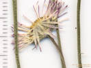
Cirsium scariosum Nutt. Meadow Thistle. CalPhotos. Jepson eFlora. SEINet Taxon.
- Salt Creek,
Tom Schweich 2926.
7/18/2022.
Determination per Ackerfield (2015) retained.
Tom Schweich 3811.
7/22/2024.
.
.

Ericameria parryi (A. Gray) G. I. Nesom & G. I. Baird var. parryi. Parry's Rabbitbrush. CalPhotos. Jepson eFlora. SEINet Taxon.
- Salt Creek,
Open prairie just above the creek, not as dry as the slope above where most collections were made at this location.
Just north of Salt Creek, between it and Pike-San Isabel National Forest Road 435 "Salt Creek Road," 3.1 mi. by road west of US Highway 285, 145 km. southwest of the GNIS location of Golden
Tom Schweich 2698.
16 Aug 2021.
(
COLO2691921‡
KHD00075279‡
OBI183395‡
)
.
.
Erigeron flagellaris A. Gray. Trailing Fleabane. CalPhotos. Jepson eFlora. SEINet Taxon.
Perennial, to 5-6 cm., with scapose inflorescence to 9 cm., spreading by leafy stoloniferous branches; Leaves, basal and cauline, entire, basal, linear-oblanceolate, 35 mm. × 2.5 mm., cauline, linear, 13 mm. × 1.5 mm.; Inflorescence, single heads on scape to 8 cm.; Receptacle epaleate; Phyllaries, 2+series, ±equal, 4 mm., hairy abaxially, ascending multicellular hairs with clear crosswalls, glandular between hairs; Flowers of 2 kinds; Pappus of bristles, 2 mm., + short scales, that of ray and disc flowers alike; Rays, #±80, corolla white, fading lilac, 8 mm. × 0.5 mm.; Disc flowers, corolla yellow, lobes triangular; Achene, short hairy. (Described from Coll. No. 1116, 28 May 2015).
- Salt Creek,
Open hillside with pines, also collected here: Oenothera coronopifolia, Lithospermum multiflorum, Penstemon barbatus var. torreyi, Gutierrezia sarothrae, and Muhlenbergia montana.
South-facing hillside along Salt Creek and Pike-San Isabel National Forest Road 435 "Salt Creek Road," 3.2 mi. by road west of US Highway 285, 145 km. southwest of the GNIS location of Golden.
Tom Schweich 2569.
12 Jul 2021.
(
Golden
)
.
.
Erigeron subtrinervis Rydb. ex Porter & Britton. Threenerve Daisy. CalPhotos. Jepson eFlora. SEINet Taxon.
- Salt Creek,
Open hillside with pines, also collected here: Oenothera coronopifolia, Lithospermum multiflorum, Penstemon barbatus var. torreyi, Gutierrezia sarothrae, and Muhlenbergia montana.
South-facing hillside along Salt Creek and Pike-San Isabel National Forest Road 435 "Salt Creek Road," 3.2 mi. by road west of US Highway 285, 145 km. southwest of the GNIS location of Golden.
Tom Schweich 2571.
12 Jul 2021.
(
COLO2706455‡
Golden
)
Open hillside with ponderosa pines, collected nearby: Hymenoxys richardsonii var. floribunda, and Muhlenbergia montana.
South-facing hillside along Salt Creek and Pike-San Isabel National Forest Road 435 "Salt Creek Road," 3.2 mi. by road west of US Highway 285, 145 km. southwest of the GNIS location of Golden.
Tom Schweich 2689.
16 Aug 2021.
(
COLO2691939‡
Golden
)
.
.
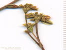
Gutierrezia sarothrae (Pursh) Britton & Rusby. (Syn: G. linearifolia Lag. ) Broom Snakeweed. CalPhotos. Jepson eFlora. SEINet Taxon.
Perennial, tap-rooted, to 9 cm.; Leaves, alternate, linear, 20 mm. × 1 mm. mm. wide, dotted with embedded oil glands, very few short hairs; Peduncle, 0.5-1.5 mm.; Inflorescence, some flowers with strap-shaped corollas, flowers of two kinds in same heads, Involucre, 3.5 mm. × 2.5-3.0 mm. wide, obconic, not gummy; Phyllary, 2-3 unequal series, inner folded around ovary of ray flowers, dotted with embedded oil glands, tips appressed; Receptacle, epaleate; Rays, #5, yellow; Disk, #4; Pappus, a well-developed crown of scales on both ray and disk flowers; (Described from Coll. No. 144, 3 Oct 1997: keys easily to Gutierrezia sarothrae. However, inner phyllaries are folded around ovary of ray flowers, a character not mentioned in keys or description.)
- Salt Creek,
Open hillside with pines, collected nearby: Hymenoxys richardsonii var. floribunda, and Muhlenbergia montana.
Not in bloom when this site was visited on 12 July 2021 like the Hymenoxys was.
South-facing hillside along Salt Creek and Pike-San Isabel National Forest Road 435 "Salt Creek Road," 3.2 mi. by road west of US Highway 285, 145 km. southwest of the GNIS location of Golden.
Tom Schweich 2687.
16 Aug 2021.
(
COLO2691962‡
OBI183403‡
)
.
.
Hymenopappus filifolius Hook. var. cinereus (Rydb.) I. M. Johnst. Fine Leaved Wooly White. CalPhotos. Jepson eFlora. SEINet Taxon.
- Salt Creek,
In stiff, dry soil that appears subject to sheet flow, with: Penstemon teucroides and Packera fendleri.
Along the fence line, about 636 m. northeast of the crossing of Salt Creek by Forest Road 435 “Salt Creek Road,” 3.0 mi. by road west of US Highway 285, 111 km. southwest of Golden.
Tom Schweich 3095.
17 Jul 2023.
(
KHD ‡
)
.
.

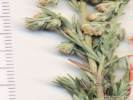
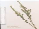
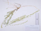
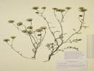
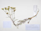
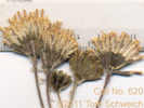
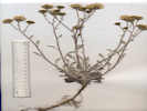
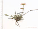
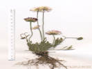
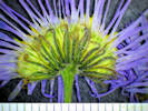
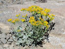
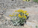
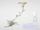
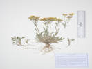
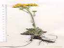
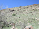
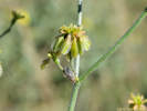
Hymenoxys richardsonii (Hook.) Cockerell var. floribunda (A. Gray) Parker. (Syn: Picradenia richardsonii Hooker var. floribunda (A. Gray) Weber ) Colorado Rubberweed. CalPhotos. Jepson eFlora. SEINet Taxon.
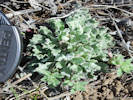
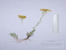
Perennial, sub-shrub, 20 cm., caudex, branched, woody; Stem, clusters of tomentum, glandular; Leaves, basal and cauline, 25-60 mm. × 15-15 mm. wide, reduced distally, pinnately lobed into 3 linear segments, 0.8-1.8 mm. wide, glandular punctate, little bits of tomentum here and there, margins, entire; Inflorescence, head enclosed by an involucre, 1 per stem, showy, flat-topped, not overtopped by leaves; Peduncles, 40 mm., inconspicuously glandular; Involucre, 5 mm. × 10 mm. wide, hemispheric, glandular, scattered tomentose; Phyllaries, 2 series, series 1, 4.5 mm. × 2 mm. wide, fused ½, lanceolate, series 2, 4 mm. × 1.5 mm. wide, widest above middle; Receptacle, conic, epaleate; Flowers, 2 kinds; Ray flowers, #8-10, tube 1.9 mm. + blade 5.5 mm. × 4.8 mm. wide, obovate, yellow, fertile; Disk flowers, many, tube 3.5 mm. + lobes 0.4 mm., throat expanding, yellow; Pappus, few, well-developed scales, 1.8 mm., ±equal; Fruit (cypsela), 2.5 mm., hairy (Described from Coll. No. 2189, 5 August 2019).
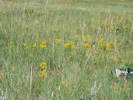
- Trout Creek Pass, Along Chaffee County Road 311, about 0.8 mi. west of its intersection with US Highway 285 at Trout Creek Pass, 149 km. southwest of the GNIS location of Golden. Tom Schweich 2189. 5 Aug 2019. ( CAS KHD00070555‡ OBI186020‡ REGIS UCR ) .
- Salt Creek,
Open hillside with pines, also collected here: Oreocarya thyrsiflora, Penstemon barbatus, Chaenactis douglasii, Gutierrezia sarothrae, and Muhlenbergia montana.
South-facing hillside along Salt Creek and Pike-San Isabel National Forest Road 435 "Salt Creek Road," 3.2 mi. by road west of US Highway 285, 145 km. southwest of the GNIS location of Golden.
Tom Schweich 2564.
12 Jul 2021.
(
COLO2706398‡
KHD00075409‡
OBI183724‡
)
Open hillside with pines, collected nearby: Gutierrezia sarothrae, and Muhlenbergia montana.
Also collected just up the slope in flower on 12 July 2021.
South-facing hillside along Salt Creek and Pike-San Isabel National Forest Road 435 "Salt Creek Road," 3.2 mi. by road west of US Highway 285, 145 km. southwest of the GNIS location of Golden.
Tom Schweich 2686.
16 Aug 2021.
(
COLO2706331‡
KHD00075273‡
)
.
.
Lactuca tatarica (L.) C.A.Mey. var. pulchella (Pursh) Breitung. (=Mulgedium pulchellum (Pursh) G. Don in R. Sweet) Blue Lettuce. CalPhotos. Jepson eFlora. SEINet Taxon.
- Salt Creek,
Open hillside with ponderosa pines, collected nearby: Chaenactis douglasii, Erigeron subtrinervis, Gutierrezia sarothrae, and Hymenoxys richardsonii var. floribunda.
South-facing hillside along Salt Creek and Pike-San Isabel National Forest Road 435 "Salt Creek Road," 3.2 mi. by road west of US Highway 285, 145 km. southwest of the GNIS location of Golden.
Tom Schweich 2691.
16 Aug 2021.
(
KHD00075270‡
OBI183401‡
)
.
.
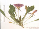
Packera fendleri (A. Gray) W.A. Weber & Á. Löve. (Syn: Senecio fendleri A. Gray ) Fendler’s Ragwort. CalPhotos. Jepson eFlora. SEINet Taxon.
- Salt Creek,
Sparse vegetation on a sheetflow slope below a small hill with junipers and pines. Also collected here: Penstemon teucrioides and Bromus porteri.
Small valley north of Salt Creek, formerly accessed by recently closed Forest Road 435A, 6.85 km. northwest of Antero Junction, 22.3 km. northeast of Buena Vista.
Tom Schweich 2861.
18 Jul 2022.
(
CS201824‡
Undist.
)
.
.


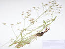
Solidago missouriensis Nutt. Missouri Goldenrod. CalPhotos. Jepson eFlora. SEINet Taxon.
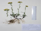
Perennial herb, to 35-40 cm., generally glabrous throughout; Leaves, basal, unknown, cauline, alternate, petiole 10-45 cm. + blade 100 mm. × 21-22 mm. wide, reduced above, oblanceolate, margin, sparsely scabrous proximally, serrate distally, glabrous, prominently 3(5)-nerved; Inflorescence, crowded panicle; Pedicels, 1 mm.; Bracts, #2, 1.8 mm.; Involucre, 3.0-4.5 mm. × 3-5 mm. wide, obconic; Phyllaries, 2+ series, 2.2-3.5 mm. × 1 mm. wide, graduated, green, margin chartaceous, veins 1; Receptacle, epaleate, conic; Flowers, 2 kinds; Rays, #12, fertile, tube 2 mm. + blade 2.2 mm., yellow; Disk flower, #12, tube 2.8 mm. + lobes 0.7 mm. = 3.5 mm., yellow; Pappus, capillary bristles, 3.0 mm.; Cypsela, 0.4-0.6 mm., glabrous-sparsely hairy. Described from Coll. No. 1255, 26 Jul 2015, and Coll. No. 1519, 29 Jul 2016. Distinguished in part by its glabrous characters and presence of 3 prominent nerves on leaves. Jepson eFlora notes that S. missouriensis Nutt. Is misapplied to S. spectabilis (D. C. Eaton) A. Gray. FNANM states that, in the west, it can be similar to smaller plants of S. spectabilis (13 Sep 2014).
- Salt Creek,
Open hillside with ponderosa pines, collected nearby: Chaenactis douglasii, Erigeron subtrinervis, Gutierrezia sarothrae, and Hymenoxys richardsonii var. floribunda.
South-facing hillside along Salt Creek and Pike-San Isabel National Forest Road 435 "Salt Creek Road," 3.2 mi. by road west of US Highway 285, 145 km. southwest of the GNIS location of Golden.
Tom Schweich 2692.
16 Aug 2021.
(
Golden
)
.
.
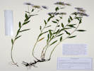
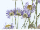
Symphyotrichum spathulatum (Lindl.) G. L. Nesom. (Syn: Aster occidentalis (Nutt.) Torr. & A. Gray , Aster occidentalis (Nutt.) Torr. & A. Gray var. fremontii ) Western Mountain Aster. CalPhotos. Jepson eFlora. SEINet Taxon.
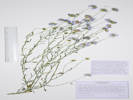
Perennial from fibrous roots, generally ≤ 40 cm tall (obs: 37-40 cm); Stem, becoming hairy distally, but never strigose; Leaves, basal and cauline, alternate, reduced above, lanceolate, lower leaf petiole 80 mm. + blade 70 mm. × 6 mm. wide, length > 7 × longer than wide (obs: 11.5-13 × longer), glabrous, margins minutely dentate, without spinulose tip, basal present at flowering; Inflorescence, 3-13 heads (3,4,8,13 observed); Heads, flowers of two kinds; Peduncles 2-8 cm, hairy, eglandular; Involucre 15 mm, non-glandular; Phyllaries in 2+ series, slightly overlapping, graduated, outer < inner, ±herbaceous, not paper-like (chartaceous), lower margin scarious, elongate green tip 3x width, tip acute to obtuse; Receptacle epaleate; Flowers both ray and disc; Pappus of bristles, single series, #25-30, cylindric, short plumose; Rays conspicuous, 13 mm., much exceeding disc flowers, blue/lavender; Disc flower, style present; Style branches minutely glandular, not tufted hairy; Achenes with a pappus of bristles, whitish (Described from Coll. No. 498, 2 Aug 2007, and Coll. No. 708, 16 Nov 2011). Taylor (2010) refers all collections of Symphyotrichum spathulatum made in the central Sierra Nevada (cSN) to var. yosemitanum based upon the character of linear leaves. However, so far, my collections (498, 708, 715, & 724) of the taxon in the Mono Lake basin have had lanceolate to narrowly elliptic leaves, which would lead one to var. spathulatum.
- Salt Creek,
Dry, lightly shaded, terrace above the creek. Also collected here: Lappula occidentalis, Astragalus hallii, and seen: Dodecatheon pulchellum, and Iris missouriensis.
Variety spathulatum, if infraspecific names are to be applied.
Terrace above Salt Creek, just off Forest Road 435 “Salt Creek Road,” 2.8 mi. by road west of US Highway 285, 111 km. southwest of Golden.
Tom Schweich 3089.
17 Jul 2023.
(
KHD ‡
)
.
.

Tetradymia canescens DC. Spineless Horsebush. CalPhotos. Jepson eFlora. SEINet Taxon.
Perennial shrub, to 1 m., woody below, unarmed; Stems some sharp-pointed, 2nd+ year stems pubesence interrupted by linear glabrescent streaks (Sect. Tetradymia, incl. stenolepis, canescens, and glabrata); Leaves distal only, lanceolate, 15 mm. × 2 mm. wide, entire, gray tomentose (not green glabrous), not forming spines; Heads, with only disc flowers (discoid); Involucre cylindric; Phyllaries 4, in one equal series or 2-ranked (which doesn't really matter when keying), 9 mm., wooly, carinate (keeled), not scarious or transparent, tips not black; Receptacle epaleate; Disc flowers, 4; Corolla, 5-lobed, yellow; Pappus of many well-developed bristles. Achenes glabrous (Described from Coll. No. 706, 15 Nov 2011, and Coll. No. 1029, 24 Jul 2013).
- Trout Creek Pass,
Collected with Hymenoxys richardsonii var. floribunda.
A Western Cordilleran plant, also collected at Mono Lake, California.
Along Chaffee County Road 311, about 0.8 mi. west of its intersection with US Highway 285 at Trout Creek Pass, 149 km. southwest of the GNIS location of Golden.
Tom Schweich 2190.
5 Aug 2019.
(
CAS
KHD00070553‡
OBI149557‡
REGIS
UCR
)
.
Boraginaceae
Cryptantha fendleri (A. Gray) Greene. Sand Dune Cat's-Eye. CalPhotos. Jepson eFlora. SEINet Taxon.
- Salt Creek,
Open grassland with a few down trees; also collected here: Artemisia frigida, Astragalus hallii, and Hesperostipa comata.
Small valley between two ridges, just north of Salt Creek and Pike-San Isabel National Forest Road 435 "Salt Creek Road," 3.1 mi. by road west of US Highway 285, 145 km. southwest of the GNIS location of Golden
Tom Schweich 2697.
16 Aug 2021.
(
COLO2691855‡
KHD00075278‡
OBI183396‡
)
.
.
Lappula occidentalis (S. Watson) Greene var. occidentalis. (Syn: Lappula redowskii (Hornem.) Greene var. redowskii ) Stickseed. CalPhotos. Jepson eFlora. SEINet Taxon.
- Salt Creek, Dry soil at break in slope above creek. Also collected here: Symphyotrichum spathulatum, Astragalus hallii, and seen: Dodecatheon pulchellum, and Iris missouriensis. Terrace above Salt Creek, 100 m. northeast on the right bank of the creek, along Forest Road 435 “Salt Creek Road,” 2.8 mi. by road west of US Highway 285, 111 km. southwest of Golden. Tom Schweich 3090. 17 Jul 2023. ( Undist. ) . .
Lithospermum multiflorum Torrey ex A. Gray. Many Flowered Stoneseed. CalPhotos. Jepson eFlora. SEINet Taxon.
Perennial … cleistogamous flowers absent. Flowers heterostyled and dimorphic.
- Salt Creek,
Open hillside with pines, also collected here: Oenothera coronopifolia, Ipomopsis aggregata var. candida, Penstemon barbatus var. torreyi, Gutierrezia sarothrae, and Muhlenbergia montana.
South-facing hillside along Salt Creek and Pike-San Isabel National Forest Road 435 "Salt Creek Road," 3.2 mi. by road west of US Highway 285, 145 km. southwest of the GNIS location of Golden.
Tom Schweich 2568.
12 Jul 2021.
(
KHD00075331‡
)
.
.
Mertensia ciliata (Torr.) G. Don. Tall Fringed Bluebells. CalPhotos. Jepson eFlora. SEINet Taxon.
- Trout Creek Pass,
Collected with Hymenoxys richardsonii var. floribunda, Tetradymia canescens, Geranium caespitosum, Penstemon barbatus, Galium boreale, and Achnatherum hymenoides.
Along Chaffee County Road 311, about 0.8 mi. west of its intersection with US Highway 285 at Trout Creek Pass, 149 km. southwest of the GNIS location of Golden.
Tom Schweich 2194.1
5 Aug 2019.
(
KHD00070565‡
)
.
.
Oreocarya thyrsiflora Greene. (Syn: Cryptantha thyrsiflora (Greene) Payson ) Limestone Cat's-Eye. CalPhotos. Jepson eFlora. SEINet Taxon.
- Salt Creek,
Open hillside with pines, also collected here: Penstemon barbatus, Chaenactis douglasii, Gutierrezia sarothrae, and Muhlenbergia montana.
South-facing hillside along Salt Creek and Pike-San Isabel National Forest Road 435 "Salt Creek Road," 3.2 mi. by road west of US Highway 285, 145 km. southwest of the GNIS location of Golden.
Tom Schweich 2563.
12 Jul 2021.
(
COLO2706646‡
KHD00075410‡
OBI183725‡
)
.
Brassicaceae
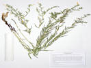
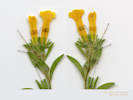
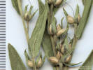
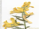
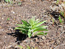
Physaria vitulifera Rydb. Bull. Torrey Bot. Club 28: 278. 1901. (Syn: P. vitulifera × bellii ) Roundtip Twinpod. CalPhotos. Jepson eFlora. SEINet Taxon.
Perennial, terrestrial herb, caespitose, stellate hairy throughout, flowering branches to 15 cm.; Roots, tap; Stem, scapose, hairs as above; Leaves, basal and cauline, basal, petiole 10-35 mm. + blade 22-24 mm. × 8-14 mm. wide, elliptic, weakly pinnately lobed, to few basal leaves with a single pair of teeth, otherwise entire, tip barely acuminate, cauline, alternate, nearly sessile, 13-22 mm. × 4-4.5 mm. wide, oblancelate, margin entire; Pedicel, 5 mm., ascending, becoming s-shaped in fruit; Sepals, #4, 5-7 mm. × 1.5 mm. wide, lanceolate, green, hairy as above; Flowers, Petals, #4, 10 mm. × 2-2.5 mm. wide, obovate, margin entire, color yellow; Stamens, #6 (4 long, 2 short), 6-8 mm.; Filaments, 4.5-6 mm., pair of short filaments slightly winged proximal ½; Anthers, 1.5 mm., saggitate (?); Ovary, 2 mm. × 1.8 mm. wide; Style, #1, 4-6.4 mm., persistent, not elongating in fruit; Fruit, pedicels, 18-20 mm, longest sigmoid, hairs as above, mature fruit, didymous, 3-4.5 mm. × 4 mm. wide, round, apical sinus well-developed, basal sinus much less so, hairy as above; Ovules, 4 per ovary (Described from Coll. No. 1345, 12 May 2016 and Coll. No. 1828, 16 May 2018). Some will key to P. bellii in Ackerfield (2015) at couplet 17 per the shape of the basal leaves, which can be entire to very shallowly once dentate. However, FNANM sends this in the direction of P. vitulifera at couplet 12 based on the relative development of the basal and apical sinuses of the fruit.
- Salt Creek,
Along the recently closed Forest Road 435A, about 150 m. east of it's junction with Forest Road 435 “Salt Creek Road,” 6.80 km. northwest of Antero Junction, 21.7 km. northeast of Buena Vista.
Tom Schweich 2869.
18 Jul 2022.
(
KHD00079841‡
OBI183822‡
)
.
.


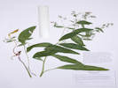
Turritis glabra L. (Syn: Arabis glabra (L.) Bernhardi ) Tower Rockcress. CalPhotos. Jepson eFlora. SEINet Taxon.
Short-lived (?) perennial, terrestrial, herb, 45 cm. to 90 cm. tall; Roots, tap. Stem, erect, #1, (1 of 4 specimens has 2 stems), leafy, proximal, simple and forked hairs, distal, glabrous; Leaves, basal and cauline, basal simple, petiole, 6 mm., blade, 60 mm. × 15 mm. wide, oblanceolate, hairs, simple and forked, margin, dentate, tip, obtuse; cauline, #20, sessile, lobed, 2.5 mm., 40 mm. × 10 mm. wide, lanceolate, reduced above, margin, entire, becoming glabrous distally; Inflorescence, raceme, 70 mm. × 11 mm. wide, not bracted, not one-sided; Pedicels (at anthesis), 3-4 mm., glabrous; Sepals, #4, 2.5 mm. × 1.1 mm. wide, ovate, green, margin chartaceous; Petals, 4.5 mm. × 0.7 mm. wide, spatulate, margin entire, color, pinkish, fading lavender; Fruit, (24-) 80-85 mm. × 0.9 mm. wide, ascending-appressed, glabrous, flattened, parallel to replum, style, base 0.4-0.5 mm. wide, stigma, 0.8-0.9 mm. wide; Ovules, biseriate, many, 0.7 mm. × 0.3 mm. wide, tan, translucent, wing not apparent. (Described from Coll. No. 1887, 28 May 2018).
- Salt Creek,
Tom Schweich 2933.
7/18/2022.
.
Campanulaceae
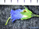
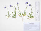
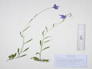
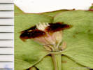
Campanula parryi A. Gray. Parry's Bellflower. CalPhotos. Jepson eFlora. SEINet Taxon.
- Salt Creek,
On the floor of an aspen glade just north of Salt Creek.
Along the recently closed Forest Road 435A, about 280 m. east of it's junction with Forest Road 435 “Salt Creek Road,” 6.72 km. northwest of Antero Junction, 21.8 km. northeast of Buena Vista.
Tom Schweich 2867.
19 Jul 2022.
(
COLO2706026‡
CS201816‡
KHD00079840‡
)
Shaded edge of former beaver pond now a meadow, with: Carex utriculata.
Right bank of Salt Creek, just west of the place it is first crossed by FR 435 “Salt Creek Road,” 3.0 miles generally west of US Highway 285, 111 km. southwest of Golden.
Tom Schweich 3315.
22 Jul 2024.
(
Undist.
)
.
Caryophyllaceae
Eremogone fendleri (A. Gray) Ikonnikov. (Syn: Arenaria fendleri A. Gray ) Fendler's Sandwort. CalPhotos. Jepson eFlora. SEINet Taxon.
Perennial herb, tufted, to 30 cm.; Stem, proximal glabrous, distal short glandular hairy “peg-like hairs”; Leaves, mostly basal, cauline, stipules absent, opposite, 50 mm. × 0.5 mm. wide, linear to needle-like, erect to appressed, margin finely scabrous, tip small spinulose; Inflorescence, open cyme; Pedicels, 3-8 mm.; Sepals, #5 distinct, 4.5-5.0 mm. × 1 mm. wide, glandular hairy (or stipitate glandular); Petals, white, 5 mm., entire; Stamens, #10; Anthers, purple; Styles, #3. Described from Coll. No. 1270, 1374, and 2372.
- Salt Creek,
Open ground at edge of ponderosa pine forest.
Base of hills, about 240 m. northeast of the crossing of Salt Creek by Forest Road 435 “Salt Creek Road,” 3.0 mi. by road west of US Highway 285, 111 km. southwest of Golden.
Tom Schweich 3100.
17 Jul 2023.
(
Undist.
)
.
Euphorbiaceae
Euphorbia brachycera Engelm. (Syn: Tithymalus brachyceras (Engelm.) Small ) Horned Spurge. CalPhotos. Jepson eFlora. SEINet Taxon.
Perennial, to 25-30 cm., glabrous throughout; Stem, erect, herbaceous; Leaves, alternate, sessile, lanceolate, 16 mm. × 8 mm. wide, margin entire, tip acute, green throughout; Flowers, arranged in a cyathium, glands entire with “horns” on either side. (Described from Coll. No. 2485, 2 June 2021.)
- Salt Creek,
Open mud-cracked flat, with Dasiphora fruticosa, Koeleria macrantha, Antennaria sp., and Gutierrezia sarothrae.
Along the fence line, about 630 m. east of the crossing of Salt Creek by Forest Road 435 “Salt Creek Road,” 3.0 mi. by road west of US Highway 285, 111 km. southwest of Golden.
Tom Schweich 3093.
17 Jul 2023.
(
Undist.
)
.


Fabaceae
Astragalus . Milkvetch. CalPhotos. Jepson eFlora. SEINet Taxon.
- Salt Creek,
Valley bottom, around a small grove of aspens, also collected here: Oxytropis sericea, Oenothera coronopifolia, and Artemisia frigida.
Small valley between two ridges, just north of Salt Creek and Pike-San Isabel National Forest Road 435 "Salt Creek Road," 3.1 mi. by road west of US Highway 285, 145 km. southwest of the GNIS location of Golden.
Tom Schweich 2574.
12 Jul 2021.
(
Deferred
)
.
.
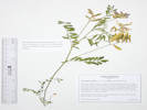
Astragalus crassicarpus Nutt. Groundplum Milkvetch. CalPhotos. Jepson eFlora. SEINet Taxon.
Perennial herb, to 15 cm., Leaves, compound, stipules free, petiole, 15 mm., blade, 85 mm. × 22 mm. wide, leaflets, #23, 11 mm. × 3.5 mm. wide, terminal leaflet, not a tendril, hairs, simple, appressed, straight, Calyx, tube 8 mm. + lobes 3 mm., hairs, simple, some light and some dark, Flower, zygomorphic, white to blue, banner, 24 mm., glabrous, wings, claw, 10 mm., blade, 10 mm., keel, 20 mm., tip, obtuse; Style, persistent, 8 mm.; Fruit, 17 mm. × 7.3 mm. wide, oblong, glabrous (Described from Coll. No. 1851, 18 May 2018).
- Salt Creek,
Tom Schweich 2920.
7/18/2022.
.
.

Astragalus hallii A. Gray var. hallii. Hall's Milkvetch. CalPhotos. Jepson eFlora. SEINet Taxon.
- Salt Creek,
Open grassland with a few down trees; also collected here: Artemisia frigida.
Small valley between two ridges, just north of Salt Creek and Pike-San Isabel National Forest Road 435 "Salt Creek Road," 3.1 mi. by road west of US Highway 285, 145 km. southwest of the GNIS location of Golden
Tom Schweich 2696.
16 Aug 2021.
(
COLO2691806‡
KHD00075277‡
OBI183697‡
)
Also collected here: Symphyotrichum spathulatum, Lappula occidentalis, and seen: Dodecatheon pulchellum, and Iris missouriensis.
Terrace above Salt Creek, 135 m. northeast on the right bank of the creek, along Forest Road 435 “Salt Creek Road,” 2.8 mi. by road west of US Highway 285, 111 km. southwest of Golden.
Tom Schweich 3091.
17 Jul 2023.
(
Undist.
)
.
.
Astragalus miser Douglas ex. Hook. var. oblongifolius (Rydb.) Cronquist. Timber Milkvetch. CalPhotos. Jepson eFlora. SEINet Taxon.
- Salt Creek,
Open hillside with pines, also collected here: Oenothera coronopifolia, Lithospermum multiflorum, Penstemon barbatus var. torreyi, Gutierrezia sarothrae, and Muhlenbergia montana.
South-facing hillside along Salt Creek and Pike-San Isabel National Forest Road 435 "Salt Creek Road," 3.2 mi. by road west of US Highway 285, 145 km. southwest of the GNIS location of Golden.
Tom Schweich 2570.
12 Jul 2021.
(
KHD00075394‡
)
.
.
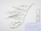
Astragalus tenellus Pursh. Looseflower Milkvetch. CalPhotos. Jepson eFlora. SEINet Taxon.
- Salt Creek, Valley bottom, around a small grove of aspens, also collected here: Oxytropis sericea, Oenothera coronopifolia, Penstemon virgatus var. asa-grayi and Artemisia frigida. Described by Pursh (1814, v. 2, p. 473) as an M. Lewis collection on the banks of the Missouri, but not appearing in Moulton's (1999) herbarium list. Small valley between two ridges, just north of Salt Creek and Pike-San Isabel National Forest Road 435 "Salt Creek Road," 3.1 mi. by road west of US Highway 285, 145 km. southwest of the GNIS location of Golden. Tom Schweich 2577. 12 Jul 2021. ( KHD00075395‡ OBI183711‡ ) . .
Oxytropis deflexa (Pall.) DC. var. sericea Torr. & A. Gray. Nodding Locoweed. CalPhotos. Jepson eFlora. SEINet Taxon.
- Salt Creek,
Edge of aspen and spruce filling in meadow that appears to be a former beaver pond.
Right bank of Salt Creek, just west of the place it is first crossed by FR 435 “Salt Creek Road,” 3.0 miles generally west of US Highway 285, 111 km. southwest of Golden.
Tom Schweich 3316.
22 Jul 2024.
(
Undist.
)
.
.


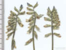
Oxytropis sericea Nutt. ex Torr. & A. Gray var. sericea. White Locoweed. CalPhotos. Jepson eFlora. SEINet Taxon.
Perennial, to 35 cm., hairs soft, often wavy, not wart-like; Leaves, basal, compound, 170 mm. × 36 mm. wide; Leaflets, #17±, 29 mm. × 7 mm. wide, hairy both sides; Bracts, 11 mm., lanceolate; Calyx, tube 10 mm. + lobes 4 mm., hairs white, wavy; Flowers, ascending, 20-24 mm., banner, 19 mm., white with purple guides, wings, 19 mm. (unable to see distinctive flexure of wings in dried specimens), keel, 17 mm., purple distally, trip porrect; Fruit, last year's persistent, 20 mm. × 7 mm. wide, ascending (Described from Coll. No. 3242, 14 May 2024).
- Salt Creek,
Valley bottom, around a small grove of aspens, also collected here: Oenothera coronopifolia, Penstemon virgatus var. asa-grayi and Artemisia frigida.
Variety sericea if infraspecific names are to be applied.
Small valley between two ridges, just north of Salt Creek and Pike-San Isabel National Forest Road 435 "Salt Creek Road," 3.1 mi. by road west of US Highway 285, 145 km. southwest of the GNIS location of Golden.
Tom Schweich 2576.
12 Jul 2021.
(
KHD00075400‡
OBI183718‡
)
.
.
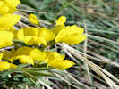
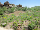
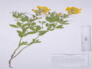
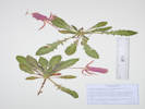
Thermopsis rhombifolia (Nutt. ex Pursh) Nutt. ex Richardson var. divaricarpa (A. Nelson) Isely. (Syn: Thermopsis divaricarpa A. Nelson ) Spreadfruit Goldenbanner. CalPhotos. Jepson eFlora. SEINet Taxon.
- Salt Creek,
Tom Schweich 2932.
7/18/2022.
.
Fumariaceae
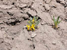
Corydalis aurea Willd. Scrambled Eggs. CalPhotos. Jepson eFlora. SEINet Taxon.
- Salt Creek,
tiny plants on north slope of arroyo
Combined with Coll. No. 3097.
Tom Schweich 3096.
17 Jul 2023.
(
Undist.
)
Larger plants on the south side of the arroyo, smaller plants on the north side.
Banks of an arroyo, about 520 m. northeast of the crossing of Salt Creek by Forest Road 435 “Salt Creek Road,” 3.0 mi. by road west of US Highway 285, 111 km. southwest of Golden.
Tom Schweich 3097.
17 Jul 2023.
(
KHD ‡
)
.

Gentianaceae
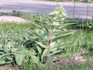
Frasera speciosa Griseb. (Syn: Swertia radiata (Kellogg) Kuntze ) Elkweed. CalPhotos. Jepson eFlora. SEINet Taxon.
- Salt Creek,
out in middle of valley, two plants in bloom, few rosettes seen
Tom Schweich 3350.
7/17/2023.
.
Geraniaceae
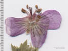
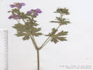
Geranium caespitosum James. Pineywoods Geranium. CalPhotos. Jepson eFlora. SEINet Taxon.
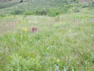
- Trout Creek Pass,
Collected with Hymenoxys richardsonii var. floribunda, Tetradymia canescens, and Achnatherum hymenoides.
Along Chaffee County Road 311, about 0.8 mi. west of its intersection with US Highway 285 at Trout Creek Pass, 149 km. southwest of the GNIS location of Golden.
Tom Schweich 2192.
5 Aug 2019.
(
CAS
KHD00070550‡
OBI186018‡
UCR
)
.

Grossulariaceae
Ribes inerme Rydb. White Stem Gooseberry. CalPhotos. Jepson eFlora. SEINet Taxon.
- Salt Creek,
Edges of aspen grove, near what appears to be a former beaver pond, with Pseudocymopterus montanus, Dasiphora fruticosa, Rosa woodsii, and Carex sp.
Right bank of Salt Creek, just west of the place it is first crossed by FR 435 “Salt Creek Road,” 3.0 miles generally west of US Highway 285, 111 km. southwest of Golden.
Tom Schweich 3312.
22 Jul 2024.
(
Undist.
)
.

Loasaceae
Mentzelia speciosa Osterh. (Syn: Nuttallia speciosa (Osterh.) Greene ) Plains Blazing Star. CalPhotos. Jepson eFlora. SEINet Taxon.
- Salt Creek,
Junction of two small washes, with various sagebrushes, Thermopsis rhombifolia, Allium cernuum, and Oenothera suffrutescens sp.
Small valley north of Salt Creek, formerly accessed by recently closed Forest Road 435A, 6.64 km. northwest of Antero Junction, 22.2 km. northeast of Buena Vista.
Tom Schweich 2866.
19 Jul 2022.
(
KHD00079839‡
)
.
Onagraceae
Oenothera cespitosa Nutt. ssp. macroglottis (Rydb.) W.L. Wagner. Tufted Evening Primrose. CalPhotos. Jepson eFlora. SEINet Taxon.
- Salt Creek,
Along the recently closed Forest Road 435A, about 150 m. east of it's junction with Forest Road 435 “Salt Creek Road,” 6.80 km. northwest of Antero Junction, 21.7 km. northeast of Buena Vista.
Tom Schweich 2868.
18 Jul 2022.
(
KHD00078700‡
)
.
.
Oenothera coronopifolia Torr. & A. Gray. Crownleaf Evening Primrose. Hierba de San Juan.. CalPhotos. Jepson eFlora. SEINet Taxon.
- Salt Creek,
Open hillside with pines, also collected here: Ipomopsis aggregata var. candida, Oreocarya thyrsiflora, Penstemon barbatus, Gutierrezia sarothrae, Hymenoxys richardsonii var. floribunda, and Muhlenbergia montana.
South-facing hillside along Salt Creek and Pike-San Isabel National Forest Road 435 "Salt Creek Road," 3.2 mi. by road west of US Highway 285, 145 km. southwest of the GNIS location of Golden.
Tom Schweich 2566.
12 Jul 2021.
(
KHD00075333‡
)
Scattered ponderosa pines and aspens, also collected here: Oxytropis sericea, Artemisia frigida, and Hesperostipa comata.
Small valley between two ridges, just north of Salt Creek and Pike-San Isabel National Forest Road 435 "Salt Creek Road," 3.1 mi. by road west of US Highway 285, 145 km. southwest of the GNIS location of Golden.
Tom Schweich 2572.
12 Jul 2021.
(
OBI183721‡
)
.
.
Oenothera suffrutescens (Ser.) W. L. Wagner & Hoch. (Syn: Gaura coccinea Pursh , Gaura glabra Lehm. ) Linda Tarde. CalPhotos. Jepson eFlora. SEINet Taxon.
Herbaceous perennial, to 60 cm.; Stipules absent; Leaves alternate, 25 mm. x 5 mm., lanceolate, few toothed; Inflorescence straight, open; Bracts 2-3 mm.; Buds erect; Sepals fused to tip in bud, all coming free, reflexed, 6 mm., not persistent after flowering; Hypanthium 6 mm.; Petals entire; Stamens 8, < stigma; Anthers maturing in unison with stigma; Ovary at flowering > distal internode (ergo infl. "open"); Stigma 4-lobed; Fruit 7 mm., stalk-like base 0, erect, fusiform, gradually wider at middle, puberulent, indehiscent; Seeds few, 2 mm., glabrous, not winged (Decribed from Coll. No. 317, keyed 15 Dec 2012).
- Salt Creek,
Junction of two small washes, with various sagebrushes, Thermopsis rhombifolia, Allium cernuum, and Mentzelia sp.
Small valley north of Salt Creek, formerly accessed by recently closed Forest Road 435A, 6.64 km. northwest of Antero Junction, 22.2 km. northeast of Buena Vista.
Tom Schweich 2865.
18 Jul 2022.
(
Undist.
)
.
Plantaginaceae
Penstemon barbatus (Cav.) Roth. Beard-Lip Beardtongue. CalPhotos. Jepson eFlora. SEINet Taxon.
- Trout Creek Pass,
Collected with Hymenoxys richardsonii var. floribunda, Tetradymia canescens, Geranium caespitosum, and Achnatherum hymenoides.
Along Chaffee County Road 311, about 0.8 mi. west of its intersection with US Highway 285 at Trout Creek Pass, 149 km. southwest of the GNIS location of Golden.
Tom Schweich 2193.
5 Aug 2019.
(
CAS
KHD00070567‡
OBI183225‡
UCR
)
.
.
Penstemon barbatus (Cav.) Roth var. torreyi (Benth.) A. Gray. Beardlip Penstemon. CalPhotos. Jepson eFlora. SEINet Taxon.
- Salt Creek, Open hillside with pines, also collected here: Oenothera coronopifolia, Ipomopsis aggregata var. candida, Gutierrezia sarothrae, Hymenoxys richardsonii var. floribunda, and Muhlenbergia montana. South-facing hillside along Salt Creek and Pike-San Isabel National Forest Road 435 "Salt Creek Road," 3.2 mi. by road west of US Highway 285, 145 km. southwest of the GNIS location of Golden. Tom Schweich 2567. 12 Jul 2021. ( COLO2706570‡ Golden ) . .
Penstemon teucrioides Greene. Germander Beardtongue. CalPhotos. Jepson eFlora. SEINet Taxon.
- Salt Creek,
In an old road, 4 plants, more up the road. Also here: Astragalus crassicarpus.
Also Coll. No. 2862, 377 m. northeast.
Along the recently closed Forest Road 435A about 435 m. east of its junction with Forest Road 435 “Salt Creek Road,” 6.76 km, northwest of Antero Junction, 22.0 km. northeast of Buena Vista.
Tom Schweich 2859.
18 Jul 2022.
(
KHD00079836‡
OBI183823‡
)
On a sparsely vegetated outwash slope.
Also Coll. No. 2859, 377 m. southwest.
Small valley north of Salt Creek, 6.86 km. northwest of Antero Junction, 22.4 km. northeast of Buena Vista.
Tom Schweich 2862.
18 Jul 2022.
(
Undist.
)
.
.
Penstemon virgatus A. Gray var. asa-grayi (Crosswh.) Dorn. Upright Blue Beardtongue. CalPhotos. Jepson eFlora. SEINet Taxon.
- Salt Creek,
Valley bottom, around a small grove of aspens, also collected here: Oxytropis sericea, Oenothera coronopifolia, and Artemisia frigida.
Small valley between two ridges, just north of Salt Creek and Pike-San Isabel National Forest Road 435 "Salt Creek Road," 3.1 mi. by road west of US Highway 285, 145 km. southwest of the GNIS location of Golden.
Tom Schweich 2575.
7 Jul 2021.
(
KHD00075527‡
OBI183720‡
)
.
Polemoniaceae
Ipomopsis aggregata (Pursh) V.E. Grant ssp. candida (Rydb.) V.E. Grant & A.D. Grant. Scarlet Gilia. CalPhotos. Jepson eFlora. SEINet Taxon.
- Salt Creek,
Open hillside with pines, also collected here: Oreocarya thyrsiflora, Penstemon barbatus, Chaenactis douglasii, Gutierrezia sarothrae, Hymenoxys richardsonii var. floribunda, and Muhlenbergia montana.
South-facing hillside along Salt Creek and Pike-San Isabel National Forest Road 435 "Salt Creek Road," 3.2 mi. by road west of US Highway 285, 145 km. southwest of the GNIS location of Golden.
Tom Schweich 2565.
12 Jul 2021.
(
COLO2706653‡
KHD00075408‡
OBI183722‡
)
.
Polygonaceae
Eriogonum alatum Torrey in L. Sitgreaves, Rep. Exped. Zuni Colorado Rivers. 168, plate 8. 1853. (Syn: Pterogonum alatum (Torr.) Gross ) Winged Buckwheat. CalPhotos. Jepson eFlora. SEINet Taxon.
- Salt Creek,
Edge of ponderosa pine forest, with Artemisia tridentata and Thermopsis rhombifolia.
Base of hills, about 260 m. northeast of the crossing of Salt Creek by Forest Road 435 “Salt Creek Road,” 3.0 mi. by road west of US Highway 285, 111 km. southwest of Golden.
Tom Schweich 3099.
17 Jul 2023.
(
Undist.
)
.
.


Rumex triangulivalvis (Danser) Rech. f. (Syn: R. salicifolius Weinm. var. triangulivalvis (Danser) J. C. Hickman ) Triangular-Valved Dock. CalPhotos. Jepson eFlora. SEINet Taxon.
Perennial, to 15 cm., growing beside distributary of Mill Creek; Main stem, herbaceous (not clearly woody), decumbent; Leaves, cauline, lance-linear arcuate, 80 mm. × 10 mm. wide, 8 × longer than wide, margins wavy, adaxial surface sparsely short-hairy, esp. mid-rib, abaxial sparsely cobwebby, esp. mid-rib, petiole, 45 mm., not jointed; Inflorescence, monoecious, axillary, dense, interrupted; Flower, inner perianth lobes 3, 3 mm. × 1.8 mm. wide, triangular, notched bear base, tip acute, tubercule (callosity) 1 × 3 inner lobes = 3, ± equal, width 0.3 mm., 1/6 lobe, minute warty, outer perianth lobes mostly deteriorated and easily overlooked; Stamens, 6, yellow; Styles, 3, fringed; Seed, 3-angled, 1.4 mm × 0.7 mm. wide, brown (Described from Coll. No. 1009, 22 July 2013).
- Salt Creek,
South slope of a developing arroyo.
Banks of an arroyo, about 520 m. northeast of the crossing of Salt Creek by Forest Road 435 “Salt Creek Road,” 3.0 mi. by road west of US Highway 285, 111 km. southwest of Golden.
Tom Schweich 3097.1
17 Jul 2023.
(
Undist.
)
.

Primulaceae
Androsace septentrionalis L. (Syn: Androsace septentrionalis L. ssp. subumbellata (A. Nelson) G. T. Robbins ) Pygmyflower Rockjasmine. CalPhotos. Jepson eFlora. SEINet Taxon.
- Salt Creek,
Growing at the base of grasses and forbs.
In a small valley, north of Salt Creek and Pike-San Isabel National Forest Road 435 "Salt Creek Road," 3.2 mi. by road west of US Highway 285, 145 km. southwest of the GNIS location of Golden
Tom Schweich 2870.
18 Jul 2022.
(
Undist.
)
.
.
Dodecatheon pulchellum (Raf.) Merr. (=Primula pauciflora (Durand) A. R. Mast & Reveal var. pauciflora ) Beautiful Shootingstar. CalPhotos. Jepson eFlora. SEINet Taxon.
- Salt Creek,
in grasses and rushes beside creek.
Tom Schweich 3348.
7/17/2023.
.
.

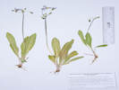

Primula pauciflora (Durand) A. R. Mast & Reveal var. pauciflora. (Syn: Dodecatheon pulchellum (Raf.) Merr. ) Darkthroat Shooting Star. CalPhotos. Jepson eFlora. SEINet Taxon.
- Salt Creek, Floor of aspen and lodgepole forest. Coordinates estimated from other nearby collections. Right bank of Salt Creek, just west of the place it is first crossed by FR 435 “Salt Creek Road,” 3.0 miles generally west of US Highway 285, 111 km. southwest of Golden. Tom Schweich 3318. 22 Jul 2024. ( Undist. ) .
Ranunculaceae
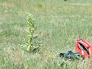
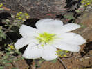
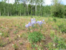
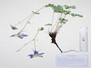
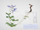
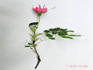
Aquilegia coerulea E. James. Colorado Blue Columbine. CalPhotos. Jepson eFlora. SEINet Taxon.
Collected by E. James, 1820, described 1823, holotype: NY.
- Salt Creek,
Tom Schweich 3813.
7/22/2024.
.
Rosaceae
Argentina anserina (L.) Rydb. (Syn: Potentilla anserina L. ) Silver Weed Cinquefoil. CalPhotos. Jepson eFlora. SEINet Taxon.
- Salt Creek,
Dry bank of small spring-fed creek, with Antennaria sp., and Artemisia frigida.
Along the fence line, about 636 m. northeast of the crossing of Salt Creek by Forest Road 435 “Salt Creek Road,” 3.0 mi. by road west of US Highway 285, 111 km. southwest of Golden.
Tom Schweich 3094.
17 Jul 2023.
(
KHD ‡
)
.
.

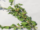
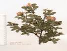
Dasiphora fruticosa (L.) Rydb. (Syn: Potentilla fruticosa L. ) Shrubby Cinquefoil, Golden Hardtack. CalPhotos. Jepson eFlora. SEINet Taxon.
- Salt Creek,
Tom Schweich 2921.
7/18/2022.
Edges of aspen grove, near what appears to be a former beaver pond, with Pseudocymopterus montanus, Ribes inerme, Rosa woodsii, and Carex sp.
Right bank of Salt Creek, just west of the place it is first crossed by FR 435 “Salt Creek Road,” 3.0 miles generally west of US Highway 285, 111 km. southwest of Golden.
Tom Schweich 3311.
22 Jul 2024.
(
Undist.
)
.
.
Potentilla hippiana Lehm. var. hippiana. Wooly Cinquefoil. CalPhotos. Jepson eFlora. SEINet Taxon.
Perennial herb, to 35 cm., woody caudex; Stem, unbranched, pilose; Leaves, basal and cauline, basal, 70 mm. × 24 mm. wide, pinnately compound, sericeous adaxially, tomentose and sericeous abaxially, distinctly bicolored or not, leaflets, #9, toothed along full length, cauline, reduced, stipules, 11 mm. × 3 mm. wide, lanceolate, entire, leaflets, #5, 24 mm. × 6 mm. wide, without decurrent bases, toothed along length; Inflorescence, cyme; Bractlets, ±same color as sepals; Petals, 5 mm. × 4.5 mm. wide, yellow; Styles, 2.7 mm., tapered from base, smooth (Described from Coll. No. 2182, 2902).
- Salt Creek,
Drying flat away from creek, with Oenothera coronopifolia, Artemisia frigida, Gutierrezia sarothrae, Juncus articus, and a sedge, probably Carex inops var. heliophila.
About 590 m. east of the crossing of Salt Creek by Forest Road 435 “Salt Creek Road,” 3.0 mi. by road west of US Highway 285, 111 km. southwest of Golden.
Tom Schweich 3092.
17 Jul 2023.
(
KHD ‡
)
.
.
Potentilla pensylvanica L. Prairie Cinquefoil. CalPhotos. Jepson eFlora. SEINet Taxon.
Perennial herb, to 40 cm., erect; Leaves, basal and cauline, basal, 130 mm. × 25 mm. wide, compound, pinnate, leaflets, #11, margins, revolute; cauline, #7-10 per stem, alternate, reduced in size, compound, pinnately-lobed, stipules, large, to 25 mm., deeply cleft, petiole, 25 mm., blade, 70 mm. × 32 mm. wide, leaflets, #10, 30 mm. × 11 mm. wide, lobed ≥½, margin, revolute; Inflorescence, clusters of #5-7 flowers; Pedicels, 2-10 mm.; Sepals, #5, 5 mm., green, hairy, glands, abundant, epicalyx bractlets, 4.5 mm. × 1.8 mm. wide; Petals, #5, 5.3 mm. × 4.5 mm. wide, yellow; Receptacle, hairy, 3 mm.; Stamens, ±16; Anthers, 0.7 mm. × 0.6 mm. wide; Ovary, many; Styles, 1 per ovary, thickest near base, tapered throughout; Achenes, 1.3 mm. × 0.8 mm. wide, attachment, lateral, rugose. Described from Coll. No. 2136, 11 July 2019.
- Salt Creek,
On open ground with Artemisia tridentata, A. frigida, Koeleria macrantha, and Nassella viridula.
Small valley north of Salt Creek, formerly accessed by recently closed Forest Road 435A, 6.70 km. northwest of Antero Junction, 22.3 km. northeast of Buena Vista.
Tom Schweich 2864.
18 Jul 2022.
(
KHD00079838‡
)
.
.
Rosa woodsii Lindl. Mountain Rose. CalPhotos. Jepson eFlora. SEINet Taxon.
Prickles absent on new growth, leaflets 5-9, flowers 1-10(25).
- Salt Creek,
In aspen at edge of what appears to be a former beaver pond, with Pseudocymopterus montanus, Ribes inerme, Dasiphora fruticosa, and Carex sp.
Right bank of Salt Creek, just west of the place it is first crossed by FR 435 “Salt Creek Road,” 3.0 miles generally west of US Highway 285, 111 km. southwest of Golden.
Tom Schweich 3310.
22 Jul 2024.
(
Undist.
)
.
Rubiaceae
Galium boreale L. (Syn: Galium septentrionale Roem. & Schult. ) Bedstraw. CalPhotos. Jepson eFlora. SEINet Taxon.
Perennial, to 40 cm.; Stems, ascending; Leaves, in whorls of 4, tips rounded, 3-nerved; Flowers, cream-colored; Fruit, short-hairy (Described from Coll. No. 2374, 23 June 2020).
- Trout Creek Pass,
Collected with Hymenoxys richardsonii var. floribunda, Tetradymia canescens, Geranium caespitosum, Penstemon barbatus, and Achnatherum hymenoides.
Along Chaffee County Road 311, about 0.8 mi. west of its intersection with US Highway 285 at Trout Creek Pass, 149 km. southwest of the GNIS location of Golden.
Tom Schweich 2194.
5 Aug 2019.
(
KHD00070566‡
OBI183160‡
)
.
Alliaceae
Allium cernuum Roth. Nodding Onion. CalPhotos. Jepson eFlora. SEINet Taxon.
- Salt Creek,
Tom Schweich 2931.
7/18/2022.
Drier soil in the meadow with spruce, aspen, Cirsium arvense and Dasiphora fruticosa.
Right bank of Salt Creek, just west of the place it is first crossed by FR 435 “Salt Creek Road,” 3.0 miles generally west of US Highway 285, 111 km. southwest of Golden.
Tom Schweich 3317.
22 Jul 2024.
(
Undist.
)
.

Cyperaceae
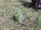
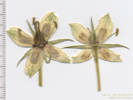
Carex utriculata Boott. Beaked Sedge. CalPhotos. Jepson eFlora. SEINet Taxon.
Perennial, sedge, to 60 cm., rhizomatous; Leaves, with cross-walls, not pubescent, sheath, smooth; Inflorescence, 200 mm. × 9 mm. wide, 5-6 spikes; Spikes, differentiated, basal, absent, terminal, staminate, 26 mm. × 2.5 mm. wide, lateral, pistillate, erect, 30 mm. × 8 mm. wide, ±cylindric; Bracts, proximal, 280 mm., >inflorescence; Scales, pistillate, 3-3.5 mm., <perigynia; Perigynia, 3.5 mm., glabrous, yellowish, beak, distinct; Stigma, #3; Anthers, 2.3 mm. (Described from Coll. No. 3314, 22 July 2024.)
- Salt Creek,
Channels in meadow that looks to be a former beaver pond, with Campanula parryi.
Right bank of Salt Creek, just west of the place it is first crossed by FR 435 “Salt Creek Road,” 3.0 miles generally west of US Highway 285, 111 km. southwest of Golden.
Tom Schweich 3314.
22 Jul 2024.
(
Undist.
)
.

Iridaceae
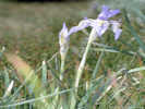
Iris missouriensis Nutt. Western Blue Flag. CalPhotos. Jepson eFlora. SEINet Taxon.
- Salt Creek,
Tom Schweich 3349.
7/17/2023.
.
Orchidaceae
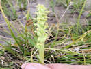
Platanthera huronensis (Nutt.) Lindl. Huron Green Orchid. CalPhotos. Jepson eFlora. SEINet Taxon.
- Salt Creek,
Bank of small spring-fed creek, at least 8 plants here, widely spaced along creek.
Small valley north of Salt Creek, formerly accessed by recently closed Forest Road 435A, 6.74 km. northwest of Antero Junction, 22.4 km. northeast of Buena Vista.
Tom Schweich 2863.
18 Jul 2022.
(
KHD00079837‡
)
.
Poaceae
Bromus porteri (J.M. Coult.) Nash. Nodding Brome. CalPhotos. Jepson eFlora. SEINet Taxon.
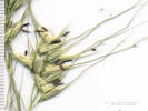
Perennial grass, 45 cm., caespitose; Leaves, sheath, 130 mm., open about ½-way; collar minutely hairy, ligule, 2 mm., blade, 130 mm. × 4 mm. wide, flat, scabrous; Inflorescence, nodding, 1 per culm, panicle; Rachis, ascending hairy, not quite appressed; Spikelets, many, 23 mm. × 2.8 mm. wide, similar, pedicels, 44 mm.; Compression, unremarkable; Glumes, soft spreading hairy, lower, 7.5 mm., veins, 3, upper 8.5 mm., < lowest floret, veins, 3, converging, awns, 0, but mid-vein goes strongly right to the tip; Florets, 8 per spikelet; Callus, few short hairs; Lemma, 10.5 mm., > glumes, rolled, hairy. veins, 5, convergent, awns, 1, 1 mm., subterminal, straight; Palea, 9.5 mm., < lemma, membranous, ciliate, tip rounded; Stamens, 3; Anthers, 2.2 mm. (Described from Coll. No. 2860, 18 July 2022.)
- Salt Creek,
Growing in and next to a small wash. Also here: Artemisia frigida.
Small valley just north of Salt Creek, near recently closed Forest Road 435A, 6.87 km. northwest of Antero Junction, 22.2 km. northeast of Buena Vista.
Tom Schweich 2860.
18 Jul 2022.
(
KHD00078682‡
)
.
.
Danthonia californica Bol. California Oatgrass. CalPhotos. Jepson eFlora. SEINet Taxon.
- Salt Creek,
Valley bottom, around a small grove of aspens, also collected here: Astragalus tenellus, Oxytropis sericea, Oenothera coronopifolia, Penstemon virgatus var. asa-grayi and Artemisia frigida.
Small valley between two ridges, just north of Salt Creek and Pike-San Isabel National Forest Road 435 "Salt Creek Road," 3.1 mi. by road west of US Highway 285, 145 km. southwest of the GNIS location of Golden.
Tom Schweich 2578.
12 Jul 2021.
(
KHD00075402‡
)
.
.
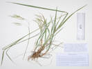
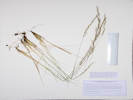
Elymus elymoides (Raf.) Swezey. (Syn: E. longifolius (J. G. Sm.) Gould , Sitanion hystrix (Nutt.) J. G. Sm. ) Squirreltail Grass. CalPhotos. Jepson eFlora. SEINet Taxon.
Perennial grass to 50 cm., clumped; Inflorescence, bilateral spike; Rachis, internodes, 6.4 mm., breaking apart when mature; Spikelets, 2 per node; Glumes, #2, subulate, 62-65 mm.; Florets, #3, lowest 2 fertile, upper sterile; Lemma, 10 mm. + awn 50 mm., veins, #5, converging; Palea, 9 mm., 1 of 2 veins slightly extended as bristle. Variety brevifolius if infraspecific names are to be applied. Described from Coll. No. 1717, 28 July 2017.
- Salt Creek,
Open hillside with ponderosa pines, collected nearby: Artemisia ludoviciana, Erigeron subtrinervis, Solidago missouriensis, and Lithospermum multiflorum.
Probably var. brevifolius if infraspecific names are to be applied, currently treated as E. longifolius by some, neither name being accepted by Colorado authors.
South-facing hillside along Salt Creek and Pike-San Isabel National Forest Road 435 "Salt Creek Road," 3.2 mi. by road west of US Highway 285, 145 km. southwest of the GNIS location of Golden.
Tom Schweich 2693.
16 Aug 2021.
(
COLO2691913‡
OBI183400‡
)
Open hillside with ponderosa pines, collected nearby: Artemisia ludoviciana, Erigeron subtrinervis, Solidago missouriensis, and Lithospermum multiflorum.
Collected with Coll. No. 2693, also determined Elymus elymoides, but this one is quite glaucus.
South-facing hillside along Salt Creek and Pike-San Isabel National Forest Road 435 "Salt Creek Road," 3.2 mi. by road west of US Highway 285, 145 km. southwest of the GNIS location of Golden.
Tom Schweich 2693.1
16 Aug 2021.
(
OBI183399‡
)
.
.
Eriocoma hymenoides (Roem. & Schult.) Rydb. (Syn: Achnatherum hymenoides (Roem. & Schult.) Barkworth , Oryzopsis hymenoides (Roem. & Schult.) Ricker , Stipa hymenoides Roem. & Schult. ) Indian Rice Grass. CalPhotos. Jepson eFlora. SEINet Taxon.
- Trout Creek Pass,
Collected with Hymenoxys richardsonii var. floribunda and Tetradymia canescens.
Along Chaffee County Road 311, about 0.8 mi. west of its intersection with US Highway 285 at Trout Creek Pass, 149 km. southwest of the GNIS location of Golden.
Tom Schweich 2191.
5 Aug 2019.
(
CAS
KHD00070777‡
OBI186021‡
REGIS
UCR
)
.
.
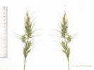
Hesperostipa comata (Trin. & Rupr.) Barkworth. (Syn: Stipa comata Trin. & Rupr. ) Needle and Thread. CalPhotos. Jepson eFlora. SEINet Taxon.
Perennial, 50 cm., clumped, nonrhizomatous; Roots, fibrous; Stem, herbaceous; Leaves, blade and sheath differentiated; Sheath, 100-120 mm., open ≥½, glabrous; Ligule, membranous, length 3.7 mm., lacerate into 2 equal parts, auricles 0; Blade, 60 mm., involute, glabrous; Inflorescence, 1 per culm, >leaves, panicle, 200 mm. × 30 mm. wide; Rachis, not extended, somewhat scabrous throughout; Spikelets, many, similar, borne singly; Compression, unremarkable; Disarticulation, above the glumes; Glumes, lower, 23-34 mm., veins #3, upper, 23-29 mm., veins #5, awl-shaped, rounded, membranous, ±equal, tip, very narrow, not awned; Florets, 1 per spikelet; Callus, 4.5-50 mm., sharp, straight hairs 1.0-1.5 mm., color tan; Lemma, 9.5-10.0 mm., rolled, indurate, straight hairy 0.5 mm., color white-tan, veins #3(?), awns, #1, 125-160 mm., twisted and short straight hairy proximal 45 mm., bent, scabrous distally; Palea, 9 mm., ±lemma, few white hairs on mid-vein; Stamens, #3; Anthers, 6.5 mm. (Described from Coll. No. 1890, 28 May 2018).
- Salt Creek,
Valley bottom, around a small grove of aspens, also collected here: Oxytropis sericea, Oenothera coronopifolia, and Artemisia frigida.
Small valley between two ridges, just north of Salt Creek and Pike-San Isabel National Forest Road 435 "Salt Creek Road," 3.1 mi. by road west of US Highway 285, 145 km. southwest of the GNIS location of Golden.
Tom Schweich 2573.
12 Jul 2021.
(
COLO2718484‡
OBI183723‡
)
Tom Schweich 2924.
7/18/2022.
.
.
Koeleria macrantha (Ledeb.) Schult. Prairie Junegrass. CalPhotos. Jepson eFlora. SEINet Taxon.
Perennial bunch grass, to 45-55 cm., non-rhizomatous; Leaves, mostly basal or lowest cauline, cauline, sheath, 90 mm., open, ligule, <1-1.5 mm., membraneous, auricles, 0, blade, 40 mm., tip prow-shaped or merely constricted; Inflorescence, panicle, 60 mm. × 9 mm., shiny in anthesis due to exposure of translucent palae, short branches, branches short soft hairy; Spikelets, 5 mm., 1 per node on 1°-3° or indistinct panicle branches; Glumes, lower, 3 mm., veins 1, upper, 4 mm., veins 3; Florets, 3, #1 and #2 pistillate, #3 staminate, or variously mixed bisexual and pistillate, open, i.e., palea separated from lemma; Disarticulation, between florets; Rachilla hairy, extends nearly 1 mm. above upper floret (or not); extension undecorated; Lemma, 4.5 mm., veins 5, short hairy throughout, awn, 0-0.5 mm., short, soft; Palea, =lemma, translucent or colorless, exposed, i.e., outside lemma.; Stamens, 3, 1.8 mm. Described from Coll. No. 1131, 9 June 2015, and Coll. No. 1144, 15 Jun 2015.
- Salt Creek,
Tom Schweich 2923.
7/18/2022.
Tom Schweich 2928.
7/18/2022.
.
.


Muhlenbergia montana (Nutt.) Hitchc. Mountain Muhly. CalPhotos. Jepson eFlora. SEINet Taxon.
Perennial grass, to 50 cm., caespitose; Leaves, sheath, open, ligule, membraneous, 4.5 mm., auricles, 0, blade, 110 mm. × 1 mm. wide; Inflorescence, rather sparse contracted panicle, 120 mm.; Florets per spikelet, #1; Glumes, #2, papery, toothed, lower, 1.5 mm., upper, 2 mm., teeth 3; Lemma, 3 mm. + awn 13 mm., flexuous, tuft of hairs at base; Palea, 2.8 mm. Described from Coll. No. 1282, 28 Aug 2015.
- Salt Creek,
Open hillside with ponderosa pines, collected nearby: Chaenactis douglasii, Erigeron subtrinervis, Gutierrezia sarothrae, and Hymenoxys richardsonii var. floribunda.
South-facing hillside along Salt Creek and Pike-San Isabel National Forest Road 435 "Salt Creek Road," 3.2 mi. by road west of US Highway 285, 145 km. southwest of the GNIS location of Golden.
Tom Schweich 2690.
16 Aug 2021.
(
COLO2718302‡
OBI183705‡
)
.
.
Nassella viridula (Trin.) Barkworth. (Syn: Stipa viridula Trin. ) Green Needlegrass. CalPhotos. Jepson eFlora. SEINet Taxon.
Perennial grass, 70-100 cm., clumped, non-rhizomatous; Stem, herbaceous; Leaves, cauline, sheath, 17 mm., ligule, 3 mm., membraneous, collar with few hairs at sides, blade, to 30 cm., convolute; Inflorescence, 1 per culm, panicle, 20-25 cm.; Rachis, lightly scabrous, not extended beyond upper spikelet; Compression, unremarkable; Spikelets, 1 per node; Florets, 1 per spikelet, bisexual; Glumes, 2, 8-9 mm., ±equal, rounded, membraneous, colorless, exc. 3 green veins, tip, short (2 mm.) hair-like awn; Disarticulation, above the glumes, Florets, 1 per spikelet; Callus, short; Lemma, 5-6 mm. × 1.2 mm. wide, <glumes, green, hairy, <1 mm., indurate, enclosing grain, awns, #1, 20-25 mm., twisted, bent, short hairy (±0.2 mm.); Palea, 1.5-2.0 mm., <lemma, membraneous, glabrous; Stamens, #3. Described from Colls. No. 1146, 1652, and 1698.
- Salt Creek,
Tom Schweich 2927.
7/18/2022.
.
.

Pascopyrum smithii (Rydb.) Á. Löve. (Syn: Agropyron smithii Rydb. ) Western Wheatgrass. CalPhotos. Jepson eFlora. SEINet Taxon.
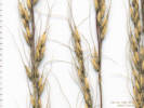
Perennial grass, to 75 cm., rhizomes, not seen; Leaves, ligule, short membraneous, auricles, 0, blade revolute; Inflorescence, bilateral spike; Rachis, internodes 6 mm.; Spikelets, 17 mm. × 10 mm. wide × 2 mm., not in capitate clusters, 1 per node, not oriented edgewise to rachis; Glumes, < lowest floret, narrowly lanceolate, slightly asymmetric, lower, 9.5 mm., upper, 10.6 mm.; Florets, #6±; Lemma, 11 mm., awns, 0; Palea, 9 mm.; Anthers, 4.5 mm. Described from Coll. No. 1691, 28 Jun 2017.
- Salt Creek, Occasional at base of hills, stiff soil, edge of Ponderosa pine forest, also out on the plain. Base of hills, about 255 m. northeast of the crossing of Salt Creek by Forest Road 435 “Salt Creek Road,” 3.0 mi. by road west of US Highway 285, 111 km. southwest of Golden. Tom Schweich 3098. 17 Jul 2023. ( KHD ‡ ) .
| Total number of taxa: | 77 |
| Native Taxa: (serif, italic, bold) | 74 |
| Exotic Taxa: (sans-serif, italic) | 0 |
| Nativity Undetermined: (default font, italic) | 3 |
| Listed Weeds: Identified as Weed | 0 |
Notes:
† -- Data provided by the participants of the Consortium of California Herbaria (ucjeps.berkeley.edu/consortium/).
‡ -- Southwest Environmental Information Network, SEINet. 2009-2014. http//:swbiodiversity.org/seinet/index.php. Accessed from July 2009 to September 2014.
Locations Included in This Area
If you have a question or a comment you may write to me at: . I sometimes post interesting questions in my FAQ, but I never disclose your full name or address.
[Home Page] [Site Map]
Date and time this article was prepared: 4/21/2025 8:38:27 PM.
